Map Measure
3
to
46
704
270
336
328
188
178
149
141
94
85
72
64
50
49
43
40
25
22
22
21
20
19
17
15
15
15
14
14
12
12
11
10
10
9
8
8
8
7
7
6
5
5
5
4
3
3
2
2
2
2
2
1
1
1
1
1
1
1
1
82
52
45
28
25
Sort By
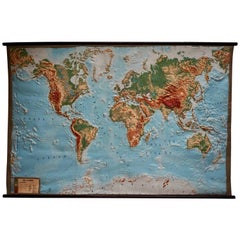
World Relief Map
Located in Antwerp, BE
Large world relief map.
Measures: Width 232 cm.
Height 158 cm.
Category
Mid-20th Century German Mid-Century Modern Maps
Materials
Acrylic
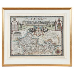
17th Century John Speed Map of the Barkshire Described, c.1616
By John Speed
Located in Royal Tunbridge Wells, Kent
Described, J. Sud and Georg Humble, publication (1616 or later), hand-coloured engraved map, map measuring
Category
Antique 17th Century British Maps
Materials
Paper
Free Shipping
H 22.05 in W 26.38 in D 1.19 in
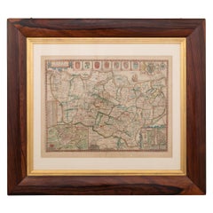
17th Century John Speed Map of Kent with Her Cities & Earles Described, C.1676
By John Speed
Located in Royal Tunbridge Wells, Kent
-coloured engraved map, map measuring 380mm x 505mm, English text on reverse, mounted in gilt and solid wood
Category
Antique 17th Century British Maps
Materials
Paper
Free Shipping
H 25.99 in W 34.65 in D 0.79 in
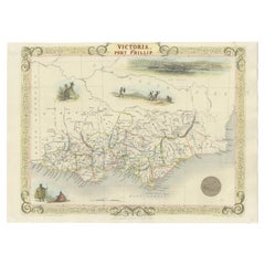
Antique Map of Victoria, or Port Phillip in Australia, ca. 1850
Located in Langweer, NL
This antique map, measuring approximately 12.7 x 10.0 inches, showcases Victoria, specifically
Category
Antique Mid-19th Century European Maps
Materials
Paper
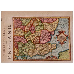
17th Century Hand-Colored Map of Southeastern England by Mercator and Hondius
By Gerard Mercator
Located in Alamo, CA
mat measuring 14' wide x 12" high and the map measures 11.25" wide x 7" high. There is English text on
Category
Antique Mid-17th Century Dutch Maps
Materials
Paper
H 12 in W 14 in D 0.13 in
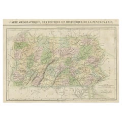
French Geographical, Statistical and Historical Map of Pensylvania, 1825
Located in Langweer, NL
others. This map measures 26.5" X 19 3/4 and will good excellent once framed and displayed.
Category
Antique 1820s Maps
Materials
Paper
H 20.08 in W 25.99 in D 0 in
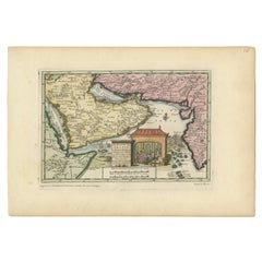
Wonderful Small Map of the Coasts of Arabia, Persia and Western India, ca. 1710
Located in Langweer, NL
. Enhanced with hand-coloring, the map measures approximately 8.9 x 5.9 inches (22.6 x 15 cm).
This
Category
Antique Early 18th Century European Maps
Materials
Paper
H 5.9 in W 8.9 in D 0.002 in
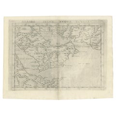
16th Century Map of Saudi Arabia, the Persian Gulf and Red Sea, ca. 1574
Located in Langweer, NL
year 1574. Rendered in black and white, the map measures approximately 9.8 x 7.1 inches (24.9 x 18 cm
Category
Antique 16th Century Maps
Materials
Paper
No Reserve
H 7.1 in W 9.8 in D 0.002 in
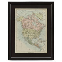
1875 "North America" Map by J. Bartholomew
Located in Colorado Springs, CO
measures 14 10/16” x 10 1/2”.
Map has been artfully framed to archival standards, with acid-free mats
Category
Antique 1870s Scottish Maps
Materials
Paper
1837 Mitchell's "Tourist's Pocket Map of the State of Virginia" by J.H. Young
Located in Colorado Springs, CO
repaired on both recto and verso with archival tape. Map measures 12 3/8" H x 15"W.
Map has been
Category
Antique 1830s American Maps
Materials
Paper
H 24.25 in W 25.75 in D 1.75 in
17th Century Hand-Colored Map of West Africa by Mercator/Hondius
Located in Alamo, CA
in an archival heather green colored mat. The mat measures 14" wide x 12" high and the map measures
Category
Antique Mid-17th Century Dutch Maps
Materials
Paper
1948 "A Hysterical Map of Yellowstone National Park" by Jolly Lindgren, 2nd Ed.
Located in Colorado Springs, CO
; light spotting in margin. Linen backed. B+/B. Map measures 16 x 16”. Map has been expertly framed, to
Category
Vintage 1940s American Maps
Materials
Paper
H 20 in W 20 in D 0.75 in
1842 Wall Map of the United States by J. H. Young, Published by S. A. Mitchell
Located in Colorado Springs, CO
since been stabilized and backed with new archival linen. Map measures 45" H x 38" W.
Category
Antique 1840s American Maps
Materials
Paper
H 45 in W 38 in D 1 in
1889 "The Pacific States and Territories"
Located in Colorado Springs, CO
lower left corner. Colored map. Title printed in cartouche at lower left. Map measures 11 1/4" H x 9 3/4
Category
Antique 1880s American Maps
Materials
Paper
Map Bedfordshire General Framed
Located in BUNGAY, SUFFOLK
A general map of Bedfordshire with its hundreds
A scale of 5 miles
in the original green mount
Category
Antique 18th Century English Georgian Maps
Materials
Paper
Original 1891 Walker Map
Located in Norwell, MA
Original 1891 map of Massachusetts by Walker. Towns include Cambridge, Boston, Dedham, Ashland
Category
Antique 19th Century Maps
Map Bedfordshire No 3 General Framed
Located in BUNGAY, SUFFOLK
A general map of Bedfordshire with its hundreds. Measure: 37cm 14 1/2" high
A scale of 5 miles
Category
Antique 18th Century English Georgian Maps
Materials
Paper
1891 Map of Norfolk County Massachusetts
Located in Norwell, MA
1891 map of Norfolk county Massachusetts including the towns of Wrentham, Franklin, Medfield
Category
Antique 19th Century Maps
Huge Europe and Asia Vintage Wall Map
Located in San Diego, CA
A huge Europe and Asia vintage wall map, circa 1950s. The map is in fair vintage condition and
Category
Mid-20th Century American Maps
Materials
Paper
Map Huntingdonshire R Scott Archibald Fullarton & Co Glasgow
Located in BUNGAY, SUFFOLK
Folding Map of Huntingdonshire by R Scott with distances from London and reference to the hundreds
Category
Antique 19th Century English Victorian Maps
Materials
Paper
Antique Map of Italy by Andriveau-Goujon, 1843
By Andriveau-Goujon
Located in New York, NY
Antique Map of Italy by Andriveau-Goujon, 1843. Map of Italy in two parts by Andriveau-Goujon for
Category
Antique 1840s French Maps
Materials
Linen, Paper
Road Map, John Ogilby, No 54, London, Yarmouth, Britannia
By John Ogilby
Located in BUNGAY, SUFFOLK
Norwich & No 75 Kings Lyn to Harwich. All in the original black and gold frames.
Measures: Sheet width
Category
Antique 1670s English Baroque Maps
Materials
Paper
Vintage Map of Nantucket Town by Ruth Haviland Sutton, 1946
Located in Nantucket, MA
Vintage Map of Nantucket Town by Ruth Haviland Sutton, 1946, a classic vintage tourist map of
Category
Vintage 1940s American Other Maps
Materials
Paper
Map Berkshire C&J Greenwood Windsor Castle JDower Polling Hundreds
Located in BUNGAY, SUFFOLK
Map of the County of Berkshire from an Actual Survey made in the Years 1822 & 1823 by C&J Greenwood
Category
Antique 19th Century English Georgian Maps
Materials
Paper
Louisiana: A Framed 19th Century Map by O. W. Gray
By Gray and Co
Located in Alamo, CA
measures 22.63" wide x 20" high x 0.88" deep. The map is somewhat toned, although the appearance appears in
Category
Antique Mid-19th Century American Other Maps
Materials
Paper
America "Amérique Septentrionale": A 19th Century French Map by Delamarche
By Maison Delamarche 1
Located in Alamo, CA
-colored mat. The frame measures 22.63" wide x 20" high x 0.88" deep. There are two other 19th century maps
Category
Antique Mid-19th Century American Other Maps
Materials
Paper
H 20 in W 22.63 in D 0.88 in
Antique 1630 Colored Belgium Map Flandria Gallica Flanders Henricus Hondius
Located in Dayton, OH
"Antique hand colored map of Flanders, Belgium, circa 1630, engraved by Henricus Hondius. “Henricus
Category
Antique Early 17th Century Renaissance Maps
Materials
Paper
H 20 in W 0.625 in D 23.375 in
"Africa Vetus": a 17th Century Hand-Colored Map by Sanson
By Nicolas Sanson
Located in Alamo, CA
This original hand-colored copperplate engraved map of Africa entitled "Africa Vetus, Nicolai
Category
Antique Late 17th Century French Maps
Materials
Paper
Old German Map of Northern America with Attractive Hand Colouring, 1864
Located in Langweer, NL
Interesting German map of Northern America in a handsome coloring.
Genuine antique hand colored map
Category
Antique 1860s Maps
Materials
Paper
1903 Antique National Publishing Road Map of New Jersey Geological Survey
Located in Dayton, OH
.
Measures: map 44.5" x 32".
Category
Antique Early 1900s Victorian Maps
Materials
Paper
Antique Map of the Eastside of Coiba Island 'Quibo', Panama, 1749
Located in Langweer, NL
Antique map titled 'Plan de la partie orientale de l'Isle de Quibo'. Map of the eastside of Coiba
Category
Antique 18th Century Maps
Materials
Paper
Greece, "Graeciae Antiquae"" A 17th Century Hand-colored Map by Sanson
By Nicolas Sanson
Located in Alamo, CA
This is an original 17th century hand colored copperplate engraved map of Greece entitled "Graeciae
Category
Antique Mid-17th Century French Maps
Materials
Paper
H 24.75 in W 29.75 in D 0.13 in
18th Century Hand Colored Map of Spain and Portugal by Visscher
By Nicolaes Visscher II
Located in Alamo, CA
This is an early 18th century map of Spain and Portugal, with attractive original hand-coloring
Category
Antique Early 18th Century Dutch Maps
Materials
Paper
Antique Map of the Sunda Islands Including Sumatra, Java, and Borneo, 1705
Located in Langweer, NL
Title: “Antique Map of the Sunda Islands Including Sumatra, Java, and Borneo”
This print is a
Category
Antique Early 1700s Maps
Materials
Paper
Free Shipping
H 8.67 in W 11.89 in D 0 in
Antique Map of the War Situation in Europe and Asia, 1944
Located in Langweer, NL
, measuring nearly 4 feet by 3 feet, includes five inset maps of the war situation in both Europe and Asia
Category
20th Century Maps
Materials
Paper
Massive Vintage Wall Map of the Soviet Union 'Sowjetunion' by Karl Wenschow
By Denoyer-Geppert
Located in San Diego, CA
, Germany, circa 1950s. The map was distributed by Denoyer-Geppert and measures 96" x 68"; it is presented
Category
Mid-20th Century American Maps
Materials
Wood, Paper
Road Map, John Ogilby, London, Barwick, York, Chester, Darlington, Durham Framed
By John Ogilby
Located in BUNGAY, SUFFOLK
gilded frame.
Measures: Sheet width 45cm., 17 ¾”, height 32cm., 12 ½”
Frame width 58.5cm., 23
Category
Antique 1670s English Baroque Maps
Materials
Paper
H 18.12 in W 23.04 in D 0.6 in
Mid-18th Century Hand Drawn English Farm Map on Vellum, circa 1740s
Located in San Francisco, CA
Mid-18th century hand drawn English farm map on Vellum circa 1740s
Henry Maxted & Isaac Terry
Category
Antique Mid-18th Century English Maps
Materials
Lambskin
"Nova Barbariae Descriptio", a 17th Century Hand-Colored Map of North Africa
By Johannes Janssonius
Located in Alamo, CA
mat measures 29" x 22.38" and the map sheet measures 23.75" x 20.25". There is a central fold, as
Category
Antique Mid-17th Century Dutch Maps
Materials
Paper
H 22.38 in W 29 in D 0.13 in
California, Alaska and Mexico: 18th Century Hand-Colored Map by de Vaugondy
By Didier Robert de Vaugondy
Located in Alamo, CA
This an 18th century hand-colored map of the western portions of North America entitled "Carte de
Category
Antique 1770s French Maps
Materials
Paper
H 13.75 in W 16.63 in D 0.13 in
North & South America: A 17th Century Hand-colored Map by Jansson & Goos
By Johannes Janssonius
Located in Alamo, CA
A 17th century hand-colored map of North & South America entitled "Americae Descriptio" by the
Category
Antique 1620s Dutch Maps
Materials
Paper
Southeastern Ireland: A 17th Century Hand Colored Map by Mercator and Hondius
By Gerard Mercator
Located in Alamo, CA
. It is presented in an archival cream colored mat measuring 14' wide x 12" high and the map sheet
Category
Antique Mid-17th Century Dutch Maps
Materials
Paper
H 12 in W 14 in D 0.13 in
1630 Pierre Petit map "Description du Gouvernement de la Capelle" Ric0010
Located in Norton, MA
1630 Pierre Petit map entitled
"Description du Gouvernement de la Capelle,"
Ric0010
Pierre
Category
Antique 17th Century Dutch Maps
Materials
Paper
H 18.9 in W 22.45 in D 0.4 in
Extremely Large Hand-Drawn Manuscript Map of Surinam, 1830, History of Slavery
Located in Amsterdam, NL
A unique large hand-drawn map of Surinam by Albrecht Helmut Hiemcke (German, 1760-1839
Category
Antique Mid-19th Century Surinamer Maps
Materials
Paper
Free Shipping
H 34.85 in W 97.05 in D 0.08 in
Portugal: A Large 17th Century Hand-colored Map by Sanson and Jaillot
By Nicolas Sanson
Located in Alamo, CA
This large hand-colored map entitled "Le Royaume de Portugal et des Algarves Divisee en see
Category
Antique 1690s French Maps
Materials
Paper
Italy, Sicily, Sardinia, Corsica and Dalmatian Coast: A 17th Century Dutch Map
By Theodorus Danckerts
Located in Alamo, CA
This hand colored 17th century Dutch map entitled "Novissima et Accuratissima totius Italiae
Category
Antique Late 17th Century Dutch Maps
Materials
Paper
H 18.13 in W 31.25 in D 1.38 in
Map Road John Ogilby Britannia No 74 Ipswich to Norwich Cromer Framed
By John Ogilby
Located in BUNGAY, SUFFOLK
Kings Lyn to Harwich & No 54 London to Yarmouth. All in the original black and gold frames.
Measures
Category
Antique 1670s English Baroque Maps
Materials
Paper
"Africae Accurata", a Hand-Colored 17th Century Map of Africa by Visscher
By Nicolaes Visscher II
Located in Alamo, CA
An 18th century hand-colored map of Africa entitled "Africae Accurata Tabula ex officina" by
Category
Antique Late 17th Century Dutch Maps
Materials
Paper
H 23.75 in W 28.13 in D 0.13 in
Map Road Strip Britannia Sheet 2 John Ogilby London Aberistwith Islip Bramyard
By John Ogilby
Located in BUNGAY, SUFFOLK
of England and Wales.
Strip map Islip to Bramyard, on a scale of approximately one inch to the mile
Category
Antique 17th Century English Baroque Maps
Materials
Paper
H 14.38 in W 19.3 in D 0.79 in
Road Map John Ogilby No 75 Kings Lyn Harwich, Britannia Framed Wallhanging
By John Ogilby
Located in BUNGAY, SUFFOLK
, as a publisher of maps and geographical accounts.
Ogilby was born outside Dundee, in 1600, the
Category
Antique 1670s European Baroque Maps
Materials
Paper
H 15.75 in W 19.69 in D 0.6 in
Africa: A Large 17th Century Hand-Colored Map by Sanson and Jaillot
By Nicolas Sanson
Located in Alamo, CA
This large original hand-colored copperplate engraved map of Africa entitled "L'Afrique divisee
Category
Antique 1690s French Maps
Materials
Paper
Captain Cook's Exploration of Tahiti 18th C. Hand-Colored Map by Bellin
By Jacques-Nicolas Bellin
Located in Alamo, CA
This beautiful 18th century hand-colored copper plate engraved map is entitled "Carte de l'Isle de
Category
Antique Mid-18th Century French Maps
Materials
Paper
H 11.38 in W 17.5 in D 0.13 in
Persia, Armenia & Adjacent Regions: A 17th Century Hand-colored Map by De Wit
By Frederick de Wit
Located in Alamo, CA
, has a mylar window and the map is secured in the mat by mylar corners. It measures 24" x 26.5" and the
Category
Antique Late 17th Century Dutch Maps
Materials
Paper
H 23.5 in W 27 in D 1.325 in
17th Century Map of Cumberland County in Northwest England Printed by John Speed
By John Speed
Located in Middleburg, VA
Rare extremely early map of the county of Cumberland in the Northwest of England. Printed by John
Category
Antique Early 17th Century English Maps
Materials
Paper
H 23 in W 27 in D 1 in
17th Century Hand-Colored Map of a Region in West Germany by Janssonius
By Johannes Janssonius
Located in Alamo, CA
This attractive highly detailed 17th century original hand-colored map is entitled
Category
Antique Mid-17th Century Dutch Maps
Materials
Paper
17th Century Hand-Colored Map of Valencia and Murcia, Spain by Mercator/Hondius
By Gerard Mercator
Located in Alamo, CA
an archival cream colored mat measuring 16" wide x 12" high and the map sheet measures 11.25" wide x
Category
Antique Mid-17th Century Dutch Maps
Materials
Paper
H 12 in W 16 in D 0.13 in
17th Century Hand Colored Map of the Liege Region in Belgium by Visscher
By Nicolaes Visscher II
Located in Alamo, CA
, Trier and Dinant.
This attractive map is presented in a cream-colored mat measuring 30" wide x 27.5
Category
Antique Late 17th Century Dutch Maps
Materials
Paper
Vienna, Austria: A Large 17th Century Hand-Colored Map by Sanson and Jaillot
By Nicolas Sanson
Located in Alamo, CA
This large 17th century hand-colored map of Vienna, Austria and the surrounding countryside and
Category
Antique 1690s French Maps
Materials
Paper
H 20 in W 24.88 in D 0.13 in
Prussia, Poland, N. Germany, Etc: A Hand-colored 17th Century Map by Janssonius
By Johannes Janssonius
Located in Alamo, CA
This is an attractive hand-colored copperplate engraved 17th century map of Prussia entitled
Category
Antique Mid-17th Century Dutch Maps
Materials
Paper
H 21.25 in W 24.63 in D 0.07 in
Southern & Eastern Europe: A Large 17th C. Hand-colored Map by Sanson & Jaillot
By Nicolas Sanson
Located in Alamo, CA
This large hand-colored map entitled "Estats de L'Empire des Turqs en Europe, ou sont les
Category
Antique 1690s French Maps
Materials
Paper
H 24.88 in W 38 in D 0.13 in
- 1
- ...
Get Updated with New Arrivals
Save "Map Measure", and we’ll notify you when there are new listings in this category.
