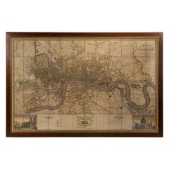
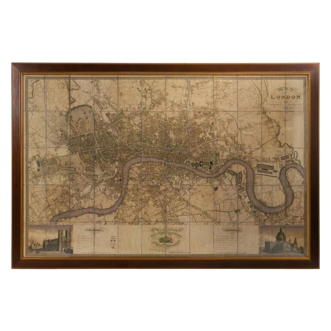
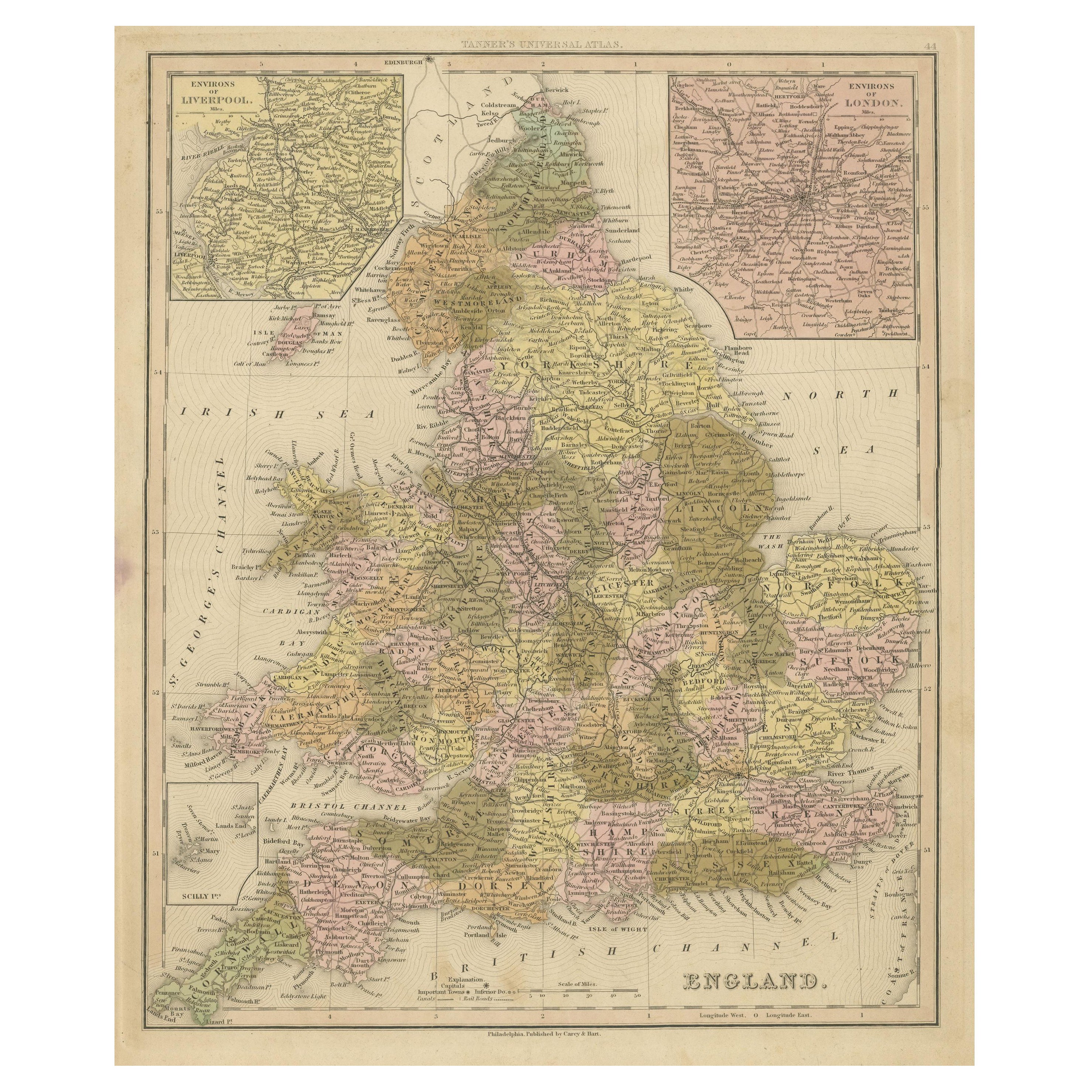
Illustrated Map of London from Exhibtion
View Similar Items


1 of 4
Illustrated Map of London from Exhibtion
About the Item
- Dimensions:Height: 35.44 in (90 cm)Width: 42.92 in (109 cm)Depth: 1.19 in (3 cm)
- Materials and Techniques:
- Period:
- Date of Manufacture:1851
- Condition:Wear consistent with age and use. All Kingham Decorative items: the very bare minimum of restoration work may have been carried out. This is to ensure we retain the age and history of each piece, preserving the essence of originality and integrity.
- Seller Location:Alton, GB
- Reference Number:Seller: 001841stDibs: LU6819229727912
Authenticity Guarantee
In the unlikely event there’s an issue with an item’s authenticity, contact us within 1 year for a full refund. DetailsMoney-Back Guarantee
If your item is not as described, is damaged in transit, or does not arrive, contact us within 7 days for a full refund. Details24-Hour Cancellation
You have a 24-hour grace period in which to reconsider your purchase, with no questions asked.Vetted Professional Sellers
Our world-class sellers must adhere to strict standards for service and quality, maintaining the integrity of our listings.Price-Match Guarantee
If you find that a seller listed the same item for a lower price elsewhere, we’ll match it.Trusted Global Delivery
Our best-in-class carrier network provides specialized shipping options worldwide, including custom delivery.You May Also Like
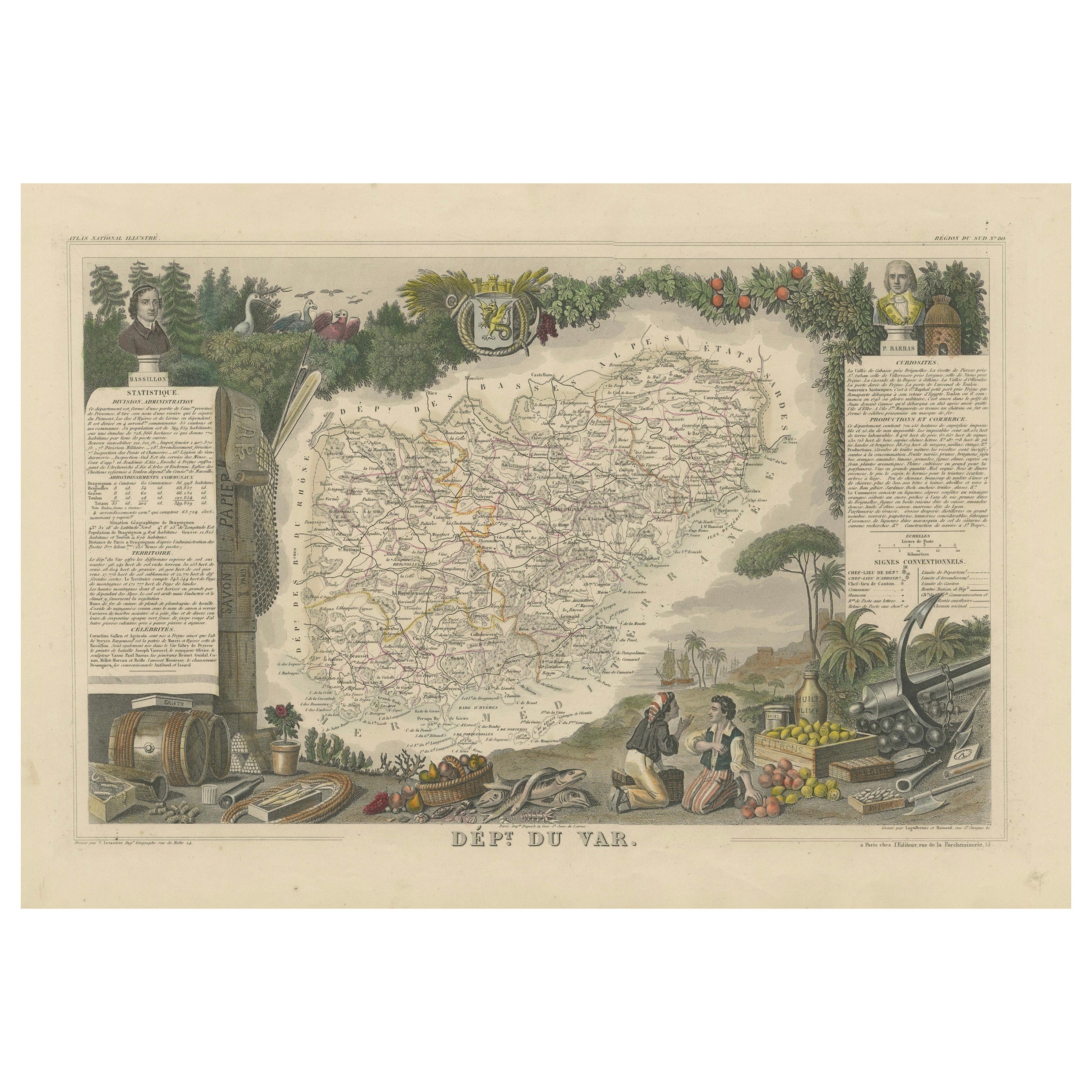
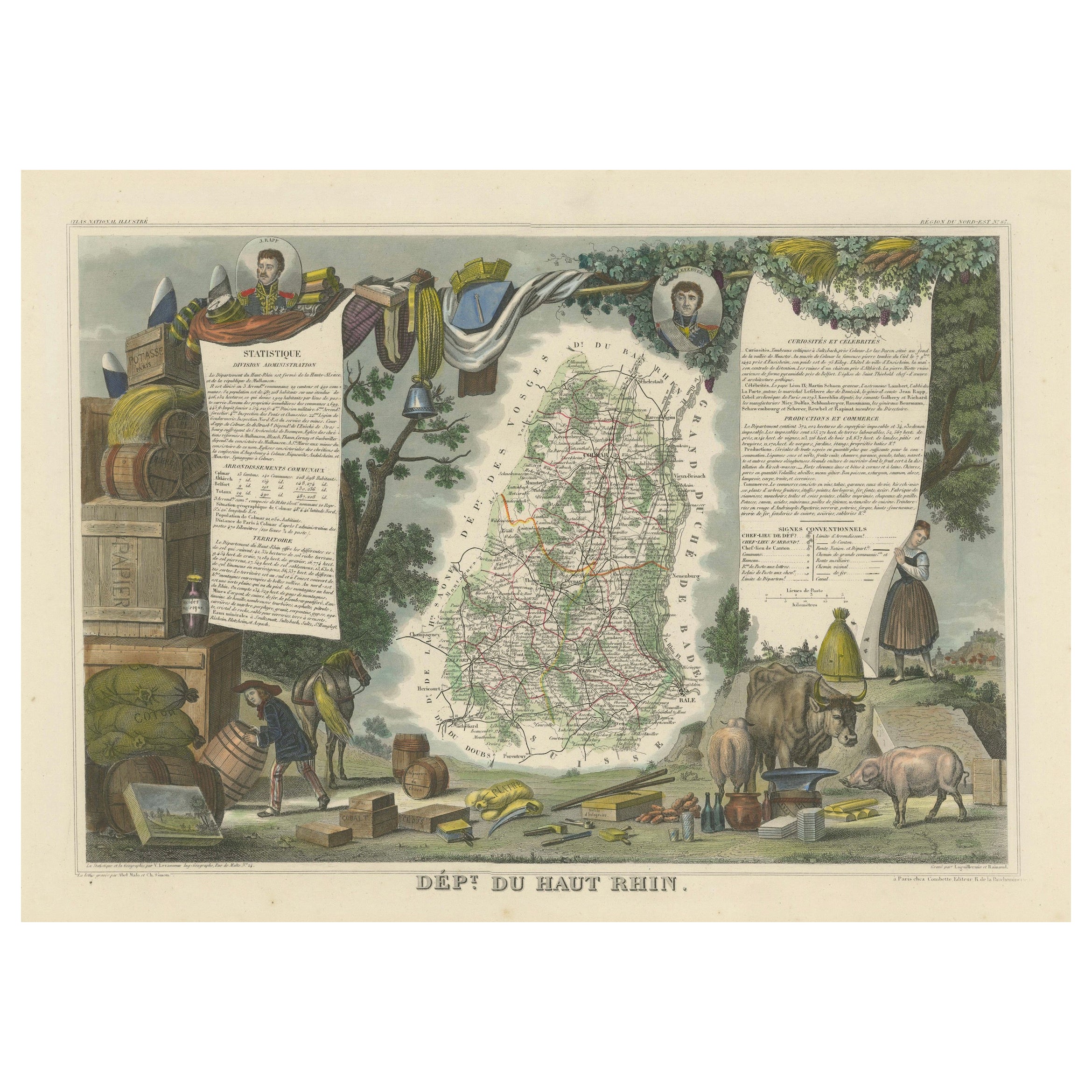
The Illustrated Map of the Var Department from the Atlas National Illustré, 1856
Located in Langweer, NL
This original hand-colored map is from the "Atlas National Illustré," a work by Victor Levasseur, a French geographer and cartographer known for his richly illustrated maps.
The map...
Category
Antique 1850s Maps
Materials
Paper
$316 Sale Price
20% Off
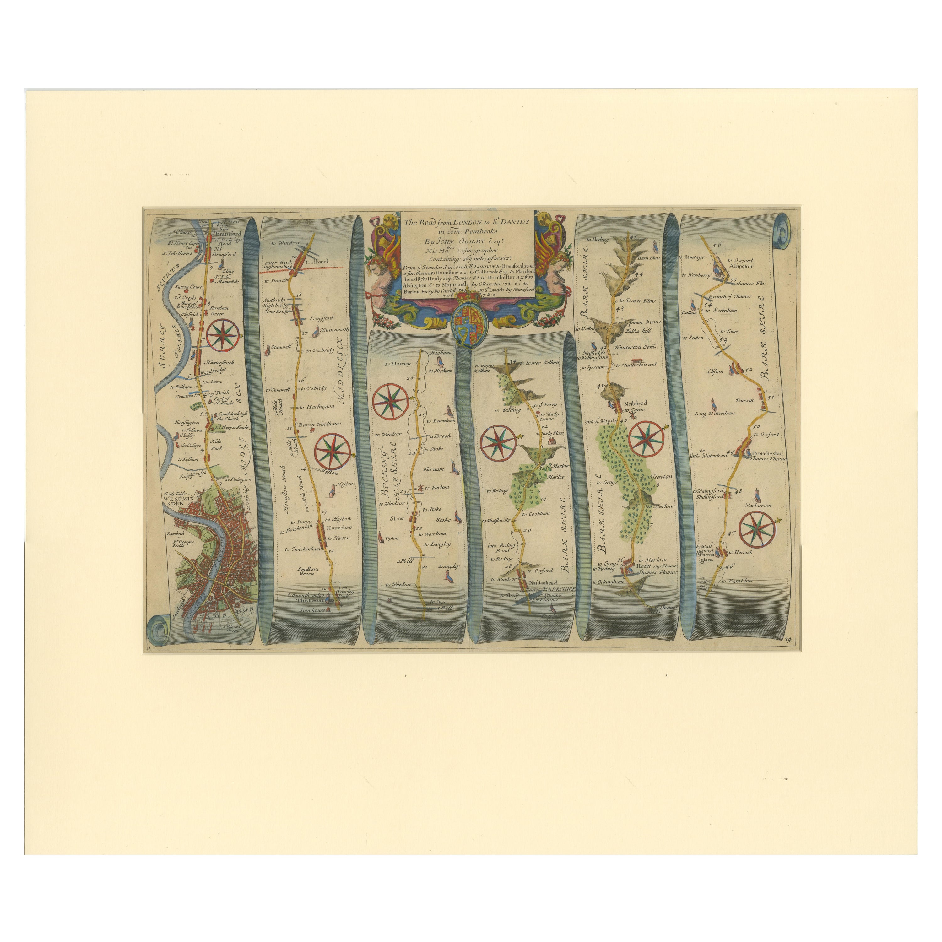
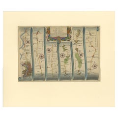
Original Antique Map of the Road from London to Bensington
Located in Langweer, NL
Antique map titled 'The Road from London to St. Davids in com: Pembroke (..)'. A strip map of the road from London to Bensington. The map is ornamented with numerous compass roses, a...
Category
Antique Late 17th Century Maps
Materials
Paper
$503 Sale Price
20% Off
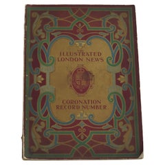
Coronation Record of King George V by The Illustrated London News , London 1911
Located in Lincoln, Lincolnshire
This is an original 1911 edition of the Illustrated London News Coronation Record celebrating the coronation of King George V and Queen Mary.
This Royal Memorabilia magazine publica...
Category
Early 20th Century British Edwardian Historical Memorabilia
Materials
Paper
Antique Map of London by Tirion '1754'
Located in Langweer, NL
Antique map titled 'Kaart van Londen enz. en van het naby gelegen land ruim een Uur gaans rondsom dezelve Stad; getrokken uit de groote gemeeten Kaart van Hr. John Rocque'. In the se...
Category
Antique Mid-18th Century Maps
Materials
Paper

$741 Sale Price
20% Off
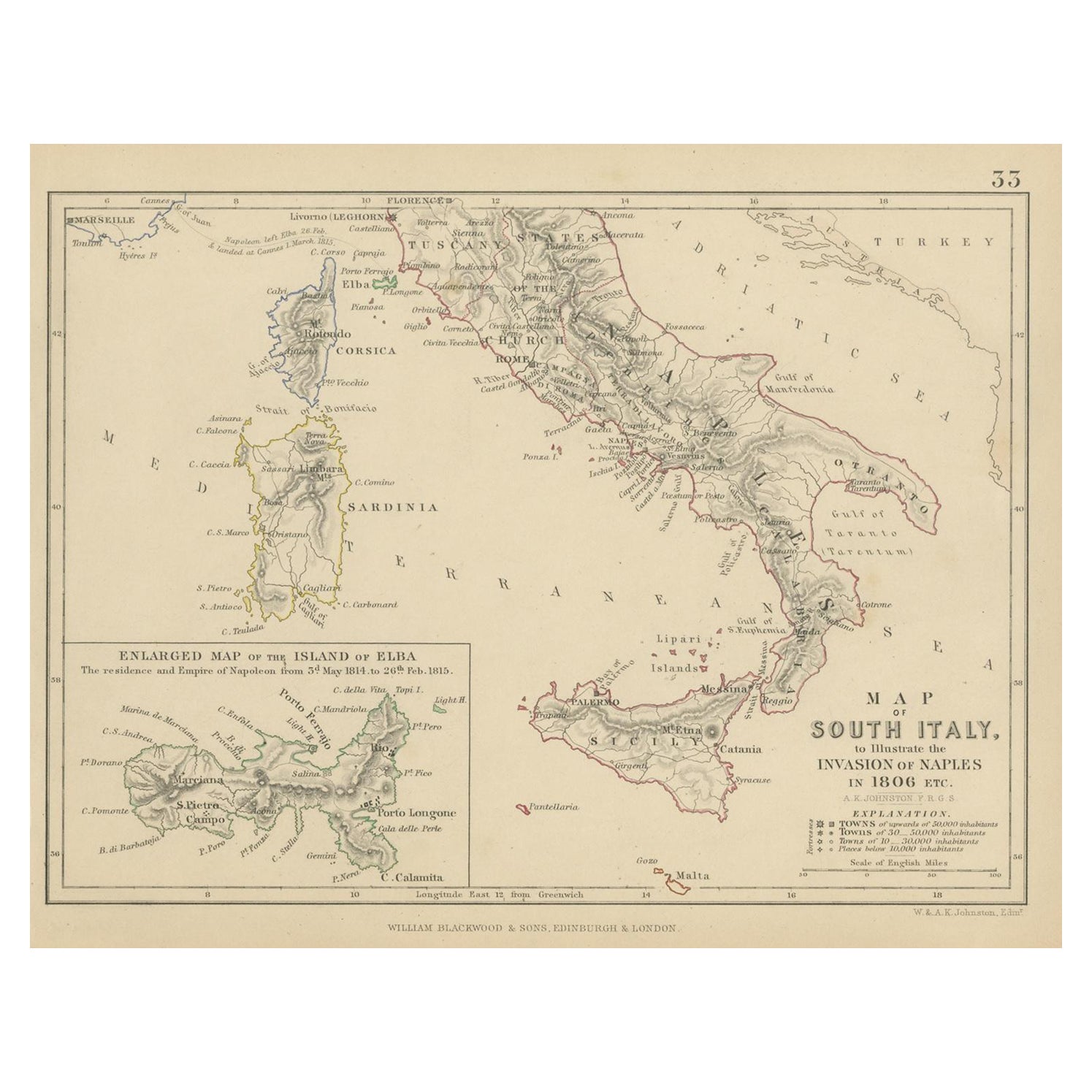
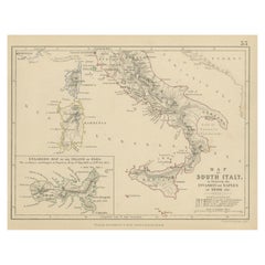
Antique Map of South Italy, illustrating the Invasion of Naples in, 1806
Located in Langweer, NL
Antique battle map titled 'Map of South Italy, to illustrate the invasion of Naples in 1806 etc'. Map of South Italy illustrating the invasion of Naples. Wi...
Category
Antique Mid-19th Century Maps
Materials
Paper
$177 Sale Price
20% Off
Large Scale Map of the London Metropolis
Located in Dallas, TX
The product is a large scale map of the London Metropolis, specifically focusing on the city in intricate detail. It would be a valuable collectible for those interested in maps and ...
Category
Mid-20th Century English Maps
Materials
Paper