Items Similar to Large Framed Map of the Mediterranean


Want more images or videos?
Request additional images or videos from the seller
1 of 7
Large Framed Map of the Mediterranean
$4,500
£3,393.45
€3,924.68
CA$6,313.48
A$7,017.82
CHF 3,678.59
MX$85,704.57
NOK 45,925.09
SEK 43,206.94
DKK 29,292.70
About the Item
Large map/chart chart of The Mediterranean and the Grecian Archipelago showing Italy, Sardinia, Corsica, part of France, etc. in a black frame.
- Dimensions:Height: 36 in (91.44 cm)Width: 67 in (170.18 cm)Depth: 0.75 in (1.91 cm)
- Style:Mid-Century Modern (Of the Period)
- Place of Origin:
- Period:
- Date of Manufacture:20th Century
- Condition:Wear consistent with age and use.
- Seller Location:Queens, NY
- Reference Number:Seller: 623481stDibs: LU977924962672
About the Seller
4.9
Recognized Seller
These prestigious sellers are industry leaders and represent the highest echelon for item quality and design.
Platinum Seller
Premium sellers with a 4.7+ rating and 24-hour response times
Established in 1939
1stDibs seller since 2013
1,000 sales on 1stDibs
Typical response time: <1 hour
- ShippingRetrieving quote...Shipping from: Long Island City, NY
- Return Policy
Authenticity Guarantee
In the unlikely event there’s an issue with an item’s authenticity, contact us within 1 year for a full refund. DetailsMoney-Back Guarantee
If your item is not as described, is damaged in transit, or does not arrive, contact us within 7 days for a full refund. Details24-Hour Cancellation
You have a 24-hour grace period in which to reconsider your purchase, with no questions asked.Vetted Professional Sellers
Our world-class sellers must adhere to strict standards for service and quality, maintaining the integrity of our listings.Price-Match Guarantee
If you find that a seller listed the same item for a lower price elsewhere, we’ll match it.Trusted Global Delivery
Our best-in-class carrier network provides specialized shipping options worldwide, including custom delivery.More From This Seller
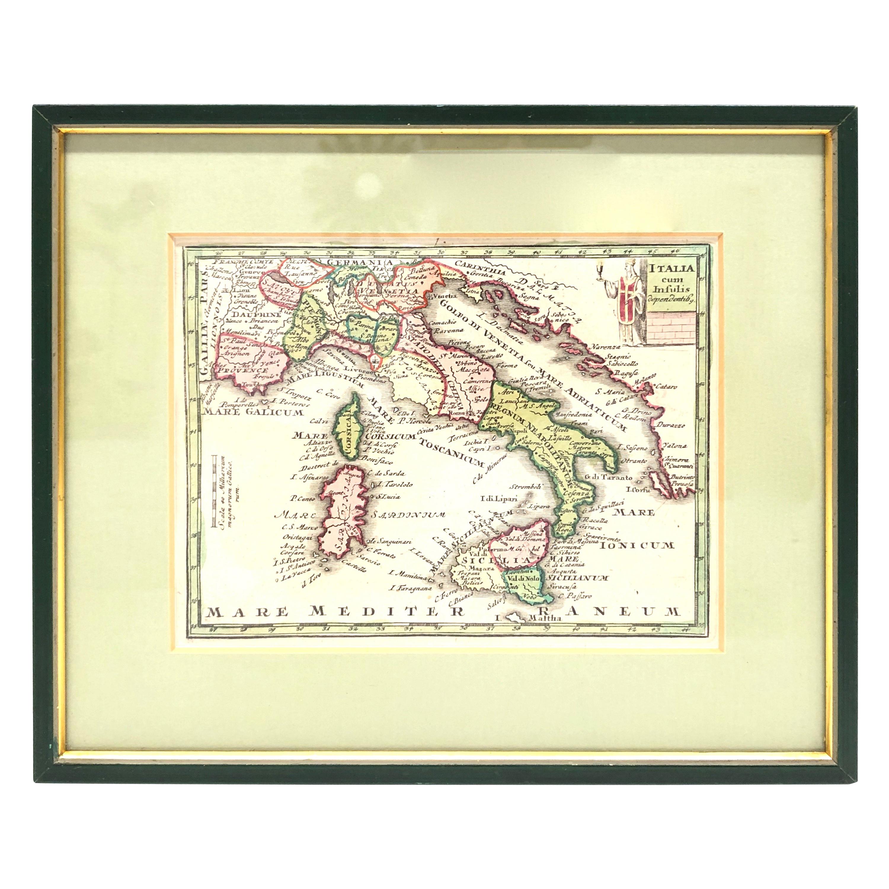
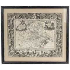
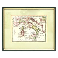
View AllItalian Neo-Classic Map of Italy
Located in Queens, NY
Italian Neo-classic style framed print of map of Italy
Category
20th Century Italian Neoclassical Paintings
Materials
Paper
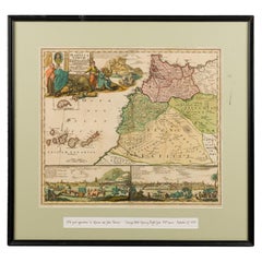
Framed Print of an Antique German Map of Morocco
Located in Queens, NY
Antique German map (print) of Morocco (circa 1728) featuring a central map above two city views depicted below and an upper scenic cartouche featur...
Category
Mid-20th Century German Biedermeier Paintings
Materials
Wood
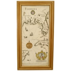
Mid-Century Modern Florida Gulf Coast Map
Located in Queens, NY
Mid-Century Modern (Italian) map print depicting 19th century Gulf Coast areas of Florida with crests and medallions in gold frames. (Companion piece: GRS118A)
Condition: Good; Wear...
Category
20th Century Italian Mid-Century Modern Paintings
Materials
Paper
Vintage Framed United States Map
Located in Queens, NY
Vintage aged paper map of the United States mounted on particle board and framed in a simple wooden frame.
Category
20th Century American Mid-Century Modern Maps
Materials
Wood, Paper

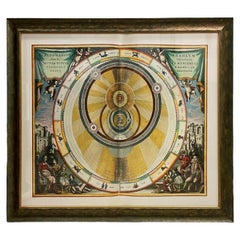
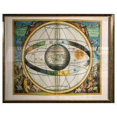
Italian Renaissance Style Framed Print Of A Celestial Map "Tychonic Planisphere"
Located in Queens, NY
Italian Renaissance style framed print of a celestial map depicting the beliefs of the Earth is stationary at the center of the planetary system with the Sun and Moon revolving the E...
Category
20th Century Italian Renaissance Paintings
Materials
Brass
Italian Renaissance Style Framed Print Of A Celestial Map
Located in Queens, NY
Italian Renaissance style framed print of a celestial map depicting the beliefs of the Earth is the center of the universe with the Sun and planet rotating around
Category
20th Century Renaissance Paintings
Materials
Ceramic
You May Also Like
1970s Framed Antique Map of Italy 1746 Original
Located in Nuernberg, DE
An extraordinary original antique map, framed in the 1970s by Brehm Nuremberg, Germany, showing Italy. Map is dated 1746 and approx. 7 ¼" wide and 5 ¾" high in viewable size. Framed ...
Category
Vintage 1970s Decorative Art
Materials
Glass, Wood
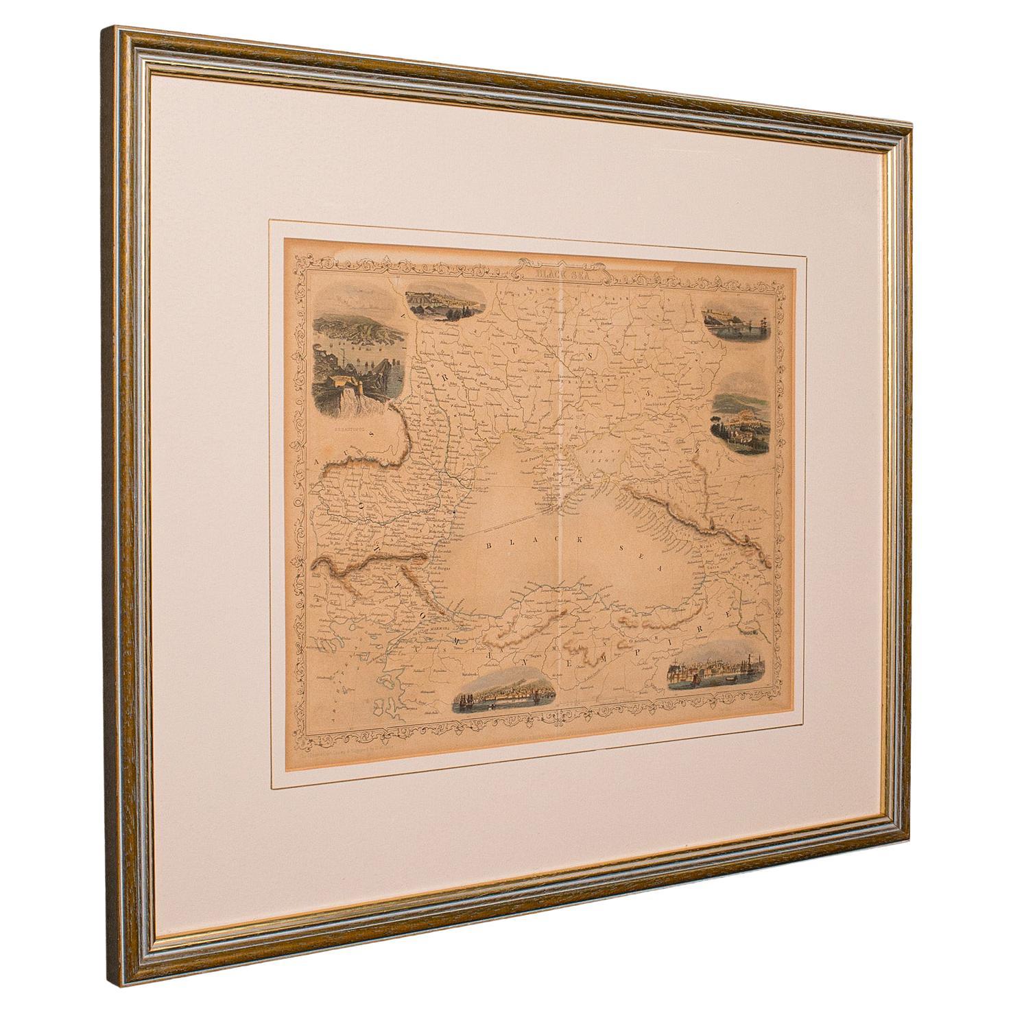
Antique Lithography Map, Black Sea, English, Framed, Cartography, Victorian
Located in Hele, Devon, GB
This is an antique lithography map of the Black Sea region. An English, framed atlas engraving of cartographic interest by John Rapkin, dating to the early Victorian period and later...
Category
Antique Mid-19th Century British Early Victorian Maps
Materials
Wood

Antique Lithography Map, West Africa, English, Framed, Cartography, Victorian
Located in Hele, Devon, GB
This is an antique lithography map of Western Africa. An English, framed atlas engraving of cartographic interest by John Rapkin, dating to the early Victorian period and later, circ...
Category
Antique Mid-19th Century British Early Victorian Maps
Materials
Wood

Vintage Reproduction 17th Century Map of Europe, American, Cartography, Blaeuw
Located in Hele, Devon, GB
This is a vintage reproduction map of Europe. An American, paper stock cartography print in frame after the work by Blaeuw, dating to the late 20t...
Category
Late 20th Century Central American Mid-Century Modern Maps
Materials
Glass, Wood, Paper

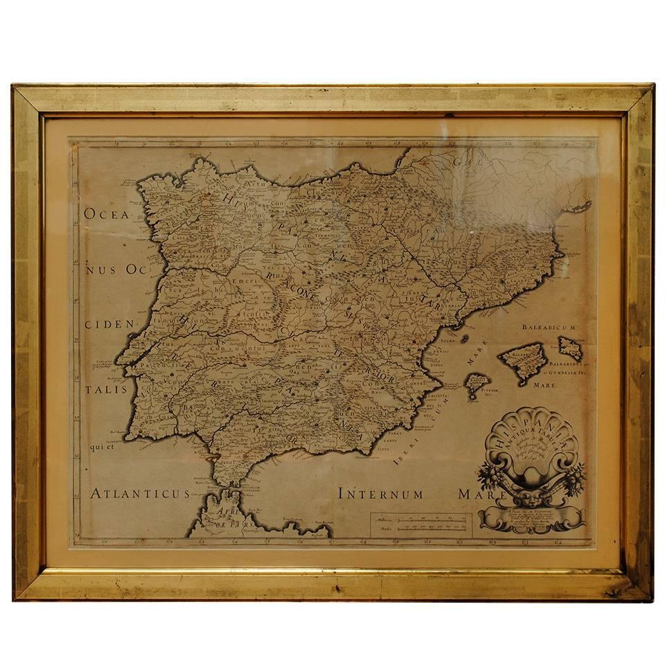
17th Century Lithograph Framed Map of Spain
Located in Atlanta, GA
In giltwood frame, dated 1652.
Category
Antique 18th Century and Earlier Spanish Baroque Prints
Materials
Ink, Paper

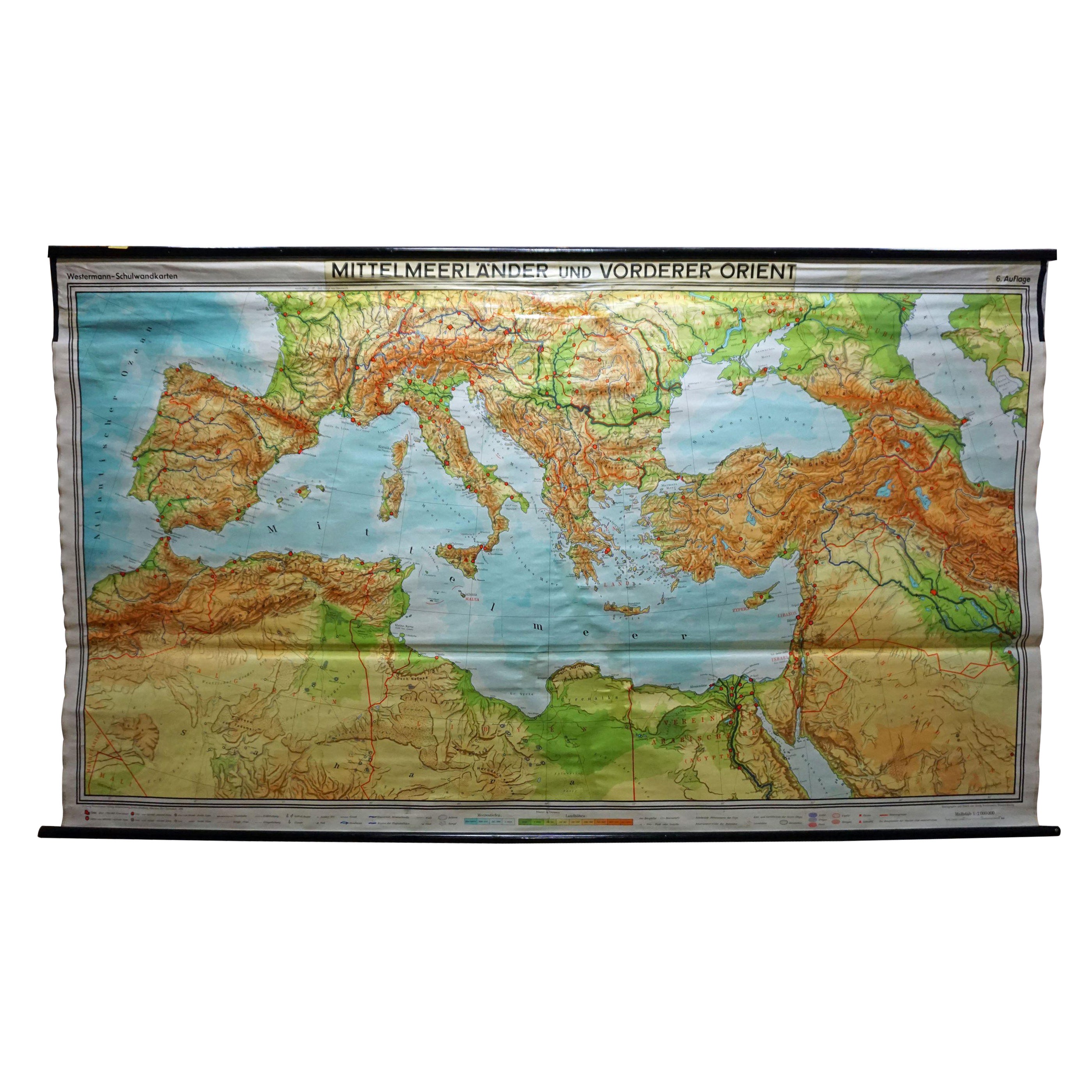
Vintage Mural Map Mediterranean Sea Near East Countries Rollable Wall Chart
Located in Berghuelen, DE
A large countrycore pull-down map showing the countries surrounding the Mediterranean Sea, published by Westermann. Colorful print on paper reinforced with canvas.
Measurements:
Width 269 cm (105.91 inch)
Height 149 cm (58.66 inch)
The measurements shown refer just to the canvas and do not include the poles.
Background information on the history of school wall charts:
The idea to upgrade every day school life by using pictures...
Category
Vintage 1970s German Country Prints
Materials
Canvas, Wood, Paper

More Ways To Browse
Mid Century Mediterranean
The Vintage Map
Large Vintage Map
Large Map Of Italy
Sardinia Map
Map New Holland
Treasure Map
Caribbean Antiques
19th Century Map Of Africa
Antique Malaysia
Antique Map Of Ireland
Ships Log
Map Of Egypt
Nautical Maps
Antique Maps Of Long Island
James Cook Map
Antique Doctors Office Furniture
Pirate Furniture