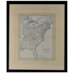
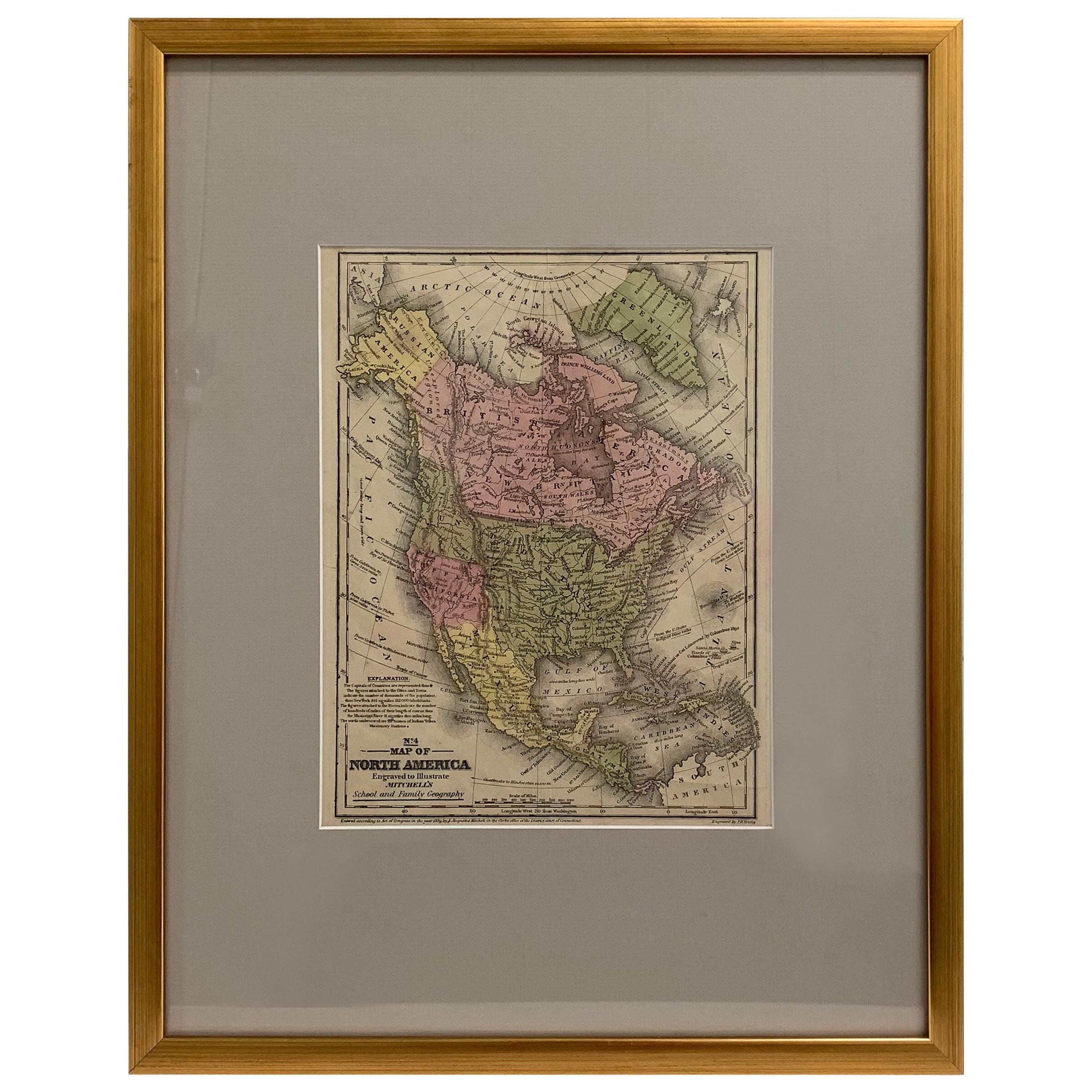
Map of the Original 13 Colonies
View Similar Items

1 of 3
Map of the Original 13 Colonies
About the Item
- Dimensions:Height: 37 in (93.98 cm)Width: 34 in (86.36 cm)Depth: 1 in (2.54 cm)
- Style:American Classical (Of the Period)
- Materials and Techniques:
- Place of Origin:
- Period:
- Date of Manufacture:1876
- Condition:
- Seller Location:Acworth, GA
- Reference Number:Seller: 112861stDibs: LU140525491163
You May Also Like
- Antique Map of Algeria and the French Colonies, 1875Located in Langweer, NLAntique map titled 'Algérie et Colonies Francaises'. Large map of Algeria and the French Colonies. This map originates from 'Atlas de Géographie Moderne Physique et Politique' by A. ...Category
Antique Late 19th Century Maps
MaterialsPaper
 $218 Sale Price50% Off
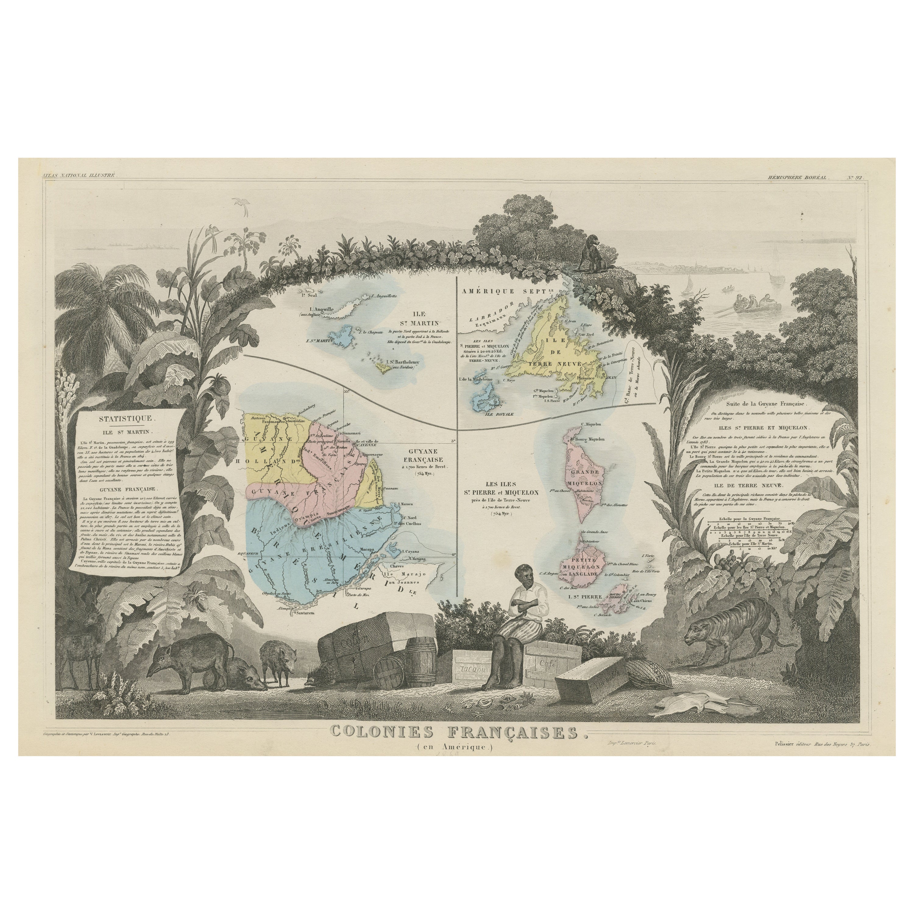
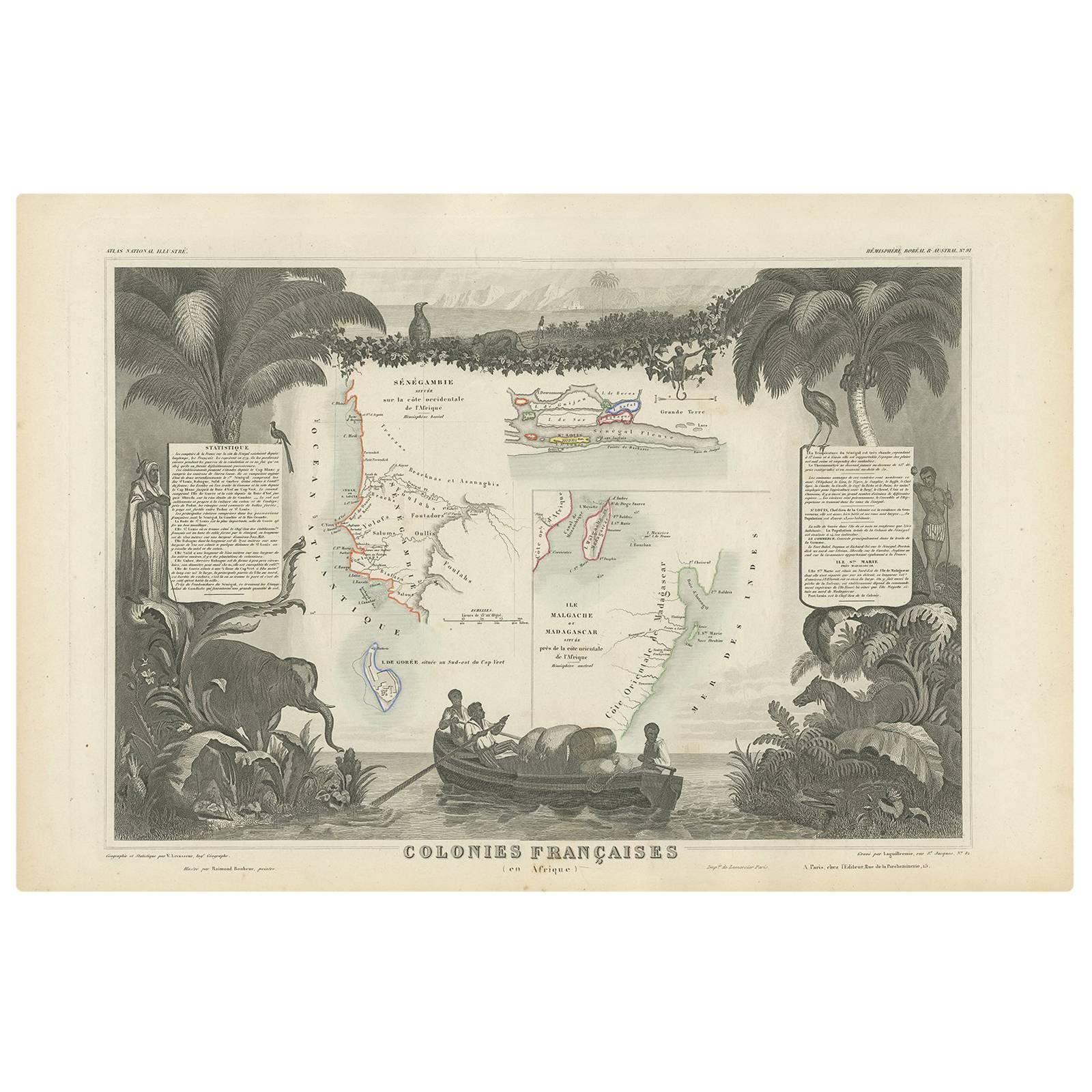
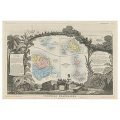
 - Original Steel Engraved Map of French Colonies in America, 1854Located in Langweer, NLAntique map titled 'Colonies Francaises (en Amerique)'. Detailed map bordered by vignettes showing local animals, produce and activities of the various French Colonies in America. Th...Category
Antique Mid-19th Century Maps
MaterialsPaper
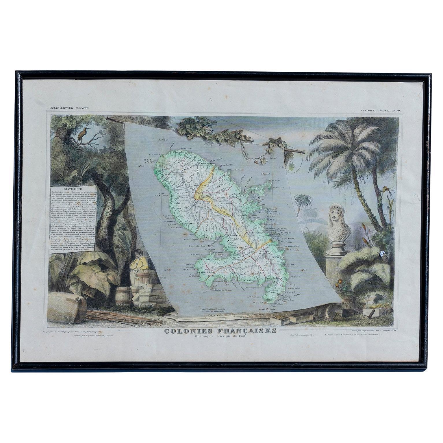
- Map Colonies Francaises Martinique, 1845Located in BUNGAY, SUFFOLKColonies Francaises, Martinique, Amerique DU SUD Geographie et Statistique par V.Levasseur. Ing'r Geographe. Illustre par Raymond Bonheur, peintre. Grave par Laguihermie, Rue St...Category
Antique 19th Century French Maps
MaterialsPaper
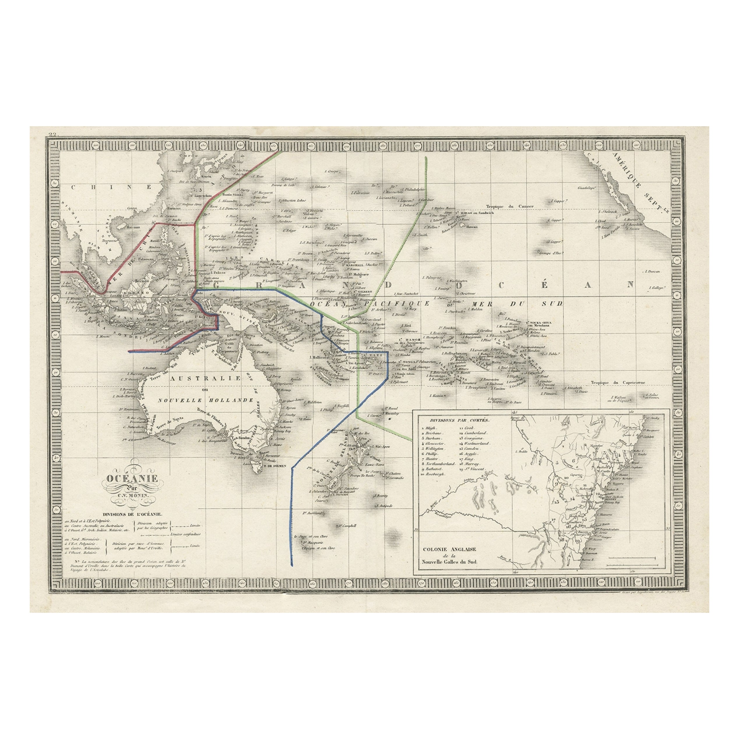
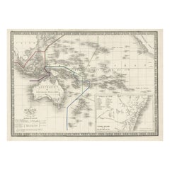
- French Antique Map of Oceania with Details of the Australian Colonies, c.1840Located in Langweer, NLAntique map Oceania titled 'Océanie par C.V. Monin'. Old map of Oceania with an inset of New South Wales. Originates from 'Atlas Classique de la Géographie Ancienne (..)'. Artists ...Category
Antique 19th Century Maps
MaterialsPaper
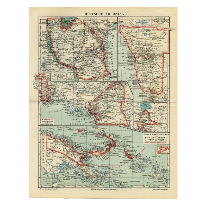
- Antique Map of German Colonies by Meyer, 1895Located in Langweer, NLAntique map titled 'Deutsche Kolonien.' Lithographed map of the German Colonies. German East-Africa, German Southeast-Africa, Cameroon, Marshall-Islands, German Colonies in the Pacif...Category
Antique 19th Century Maps
MaterialsPaper
 $96 Sale Price20% Off
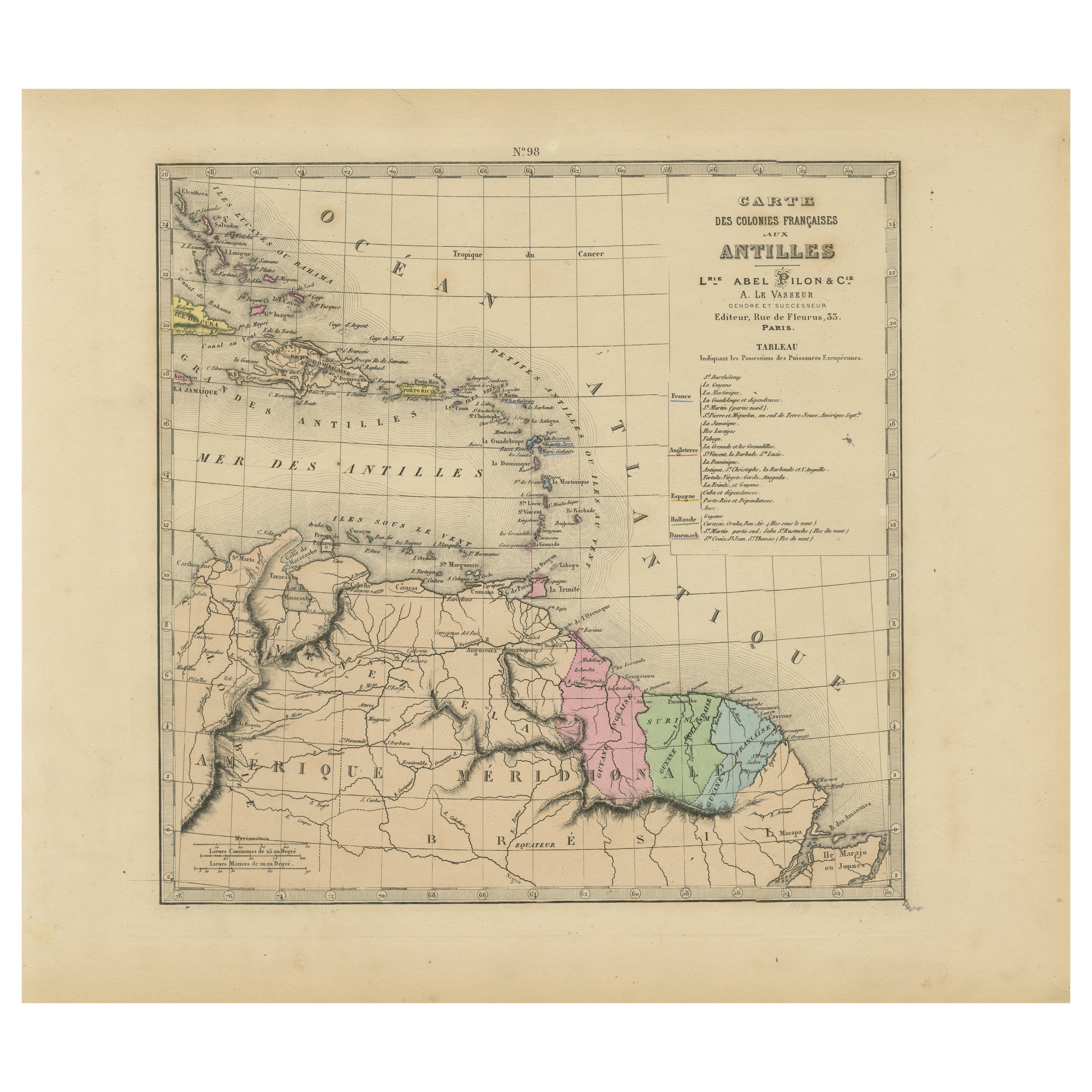
 - Authentique Map by Pilon of The French Colonies in The West Indies, 1876Located in Langweer, NLThe 1876 map titled "Carte des Colonies Françaises aux Antilles" represents a significant contribution to cartography within the "Grand Atlas Départemental de la France de L'Algérie ...Category
Antique Late 19th Century Maps
MaterialsPaper
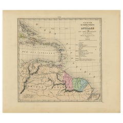 $210 Sale Price20% Off

Recently Viewed
View AllMore Ways To Browse
Colonies Map
Atlas China
Antique Maps Wales
Antique Map Wales
Antique Furniture South East London
Antique Map Of Wales
Antique Maps Of Wales
Antique Island Caribbean
Atlas Stand
Teak Sphere
17th Century Italian Map
17th Century Italy Map
Map Of Virginia
Antique Battle Maps
Us Map Antique
Reclaimed Lumber
Antique Us Maps
Antique Us Map