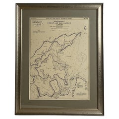
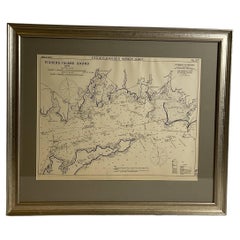
Mariners Chart of Greenport, and Sag Harbor by George Eldridge 1901
View Similar Items


Want more images or videos?
Request additional images or videos from the seller
1 of 13
Mariners Chart of Greenport, and Sag Harbor by George Eldridge 1901
About the Item
- Dimensions:Height: 27 in (68.58 cm)Width: 21 in (53.34 cm)Depth: 1 in (2.54 cm)
- Materials and Techniques:
- Place of Origin:
- Period:1900-1909
- Date of Manufacture:1901
- Condition:
- Seller Location:Norwell, MA
- Reference Number:Seller: 85801stDibs: LU1741238280242
About the Seller
5.0
Vetted Seller
These experienced sellers undergo a comprehensive evaluation by our team of in-house experts.
Established in 1967
1stDibs seller since 2015
347 sales on 1stDibs
Typical response time: 2 hours
More From This SellerView All
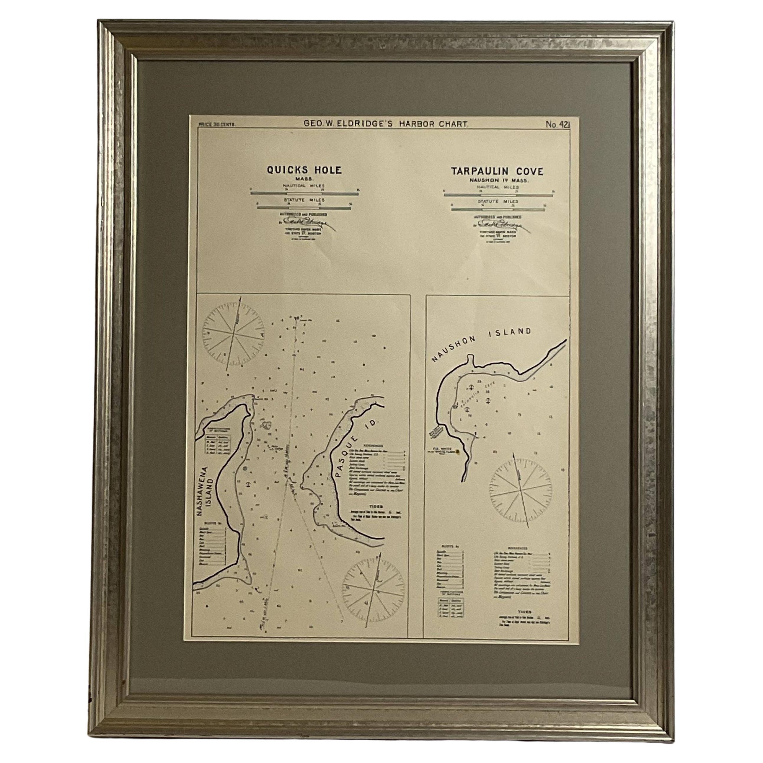
- Mariners Chart of Quicks Hole and Tarpaulin Cove by George Eldridge 1901Located in Norwell, MANautical chart showing the harbor and local waters of Naushon Island Quick Holes. The chart display depths buoys, lightness, etc., The chart shows the cove in Naushon with ships stor...Category
Antique Early 1900s North American Maps
MaterialsPaper
- Mariners Chart of Marion Massachussets by George Eldridge 1901Located in Norwell, MANautical chart showing the harbor and local waters of Marion Harbor., The chart displays depth, buoys, lighthouses, etc., Shown are Planting Island, Ram Island, Sippican Neck, Little...Category
Antique Early 1900s North American Prints
MaterialsPaper
- Mariners charts of Massachusett Long Island by George Eldridge 1901Located in Norwell, MANautical Chart showing the harbor and local waters of the Little Neck Bay, Manhasset and Hempstead Harbors. The chart displays depths, buoys, lighthouses, etc., Shown is Manhasset Ne...Category
Antique Early 1900s North American Prints
MaterialsPaper
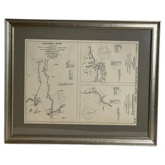
- Mariners Chart of Fishers Island Sound by George Eldridge 1901Located in Norwell, MANautical Chart showing the harbor and local waters of fishers island sound. The chart displays depths, buoys, lighthouses, etc., Shown is Watch Hill Point, Stonington, Mason Island, ...Category
Antique Early 1900s North American Prints
MaterialsPaper
- Mariners Chart of Westport Mass and Narraganset Pier by George Eldridge 1901Located in Norwell, MAOriginal Nautical chart showing the harbor and local waters of Westport Mass, Narraganset Pier R.I. The chart displays depths, the Narraganset Pier, Little Neck Westport Harbor, Hors...Category
Antique Early 1900s North American Prints
MaterialsPaper
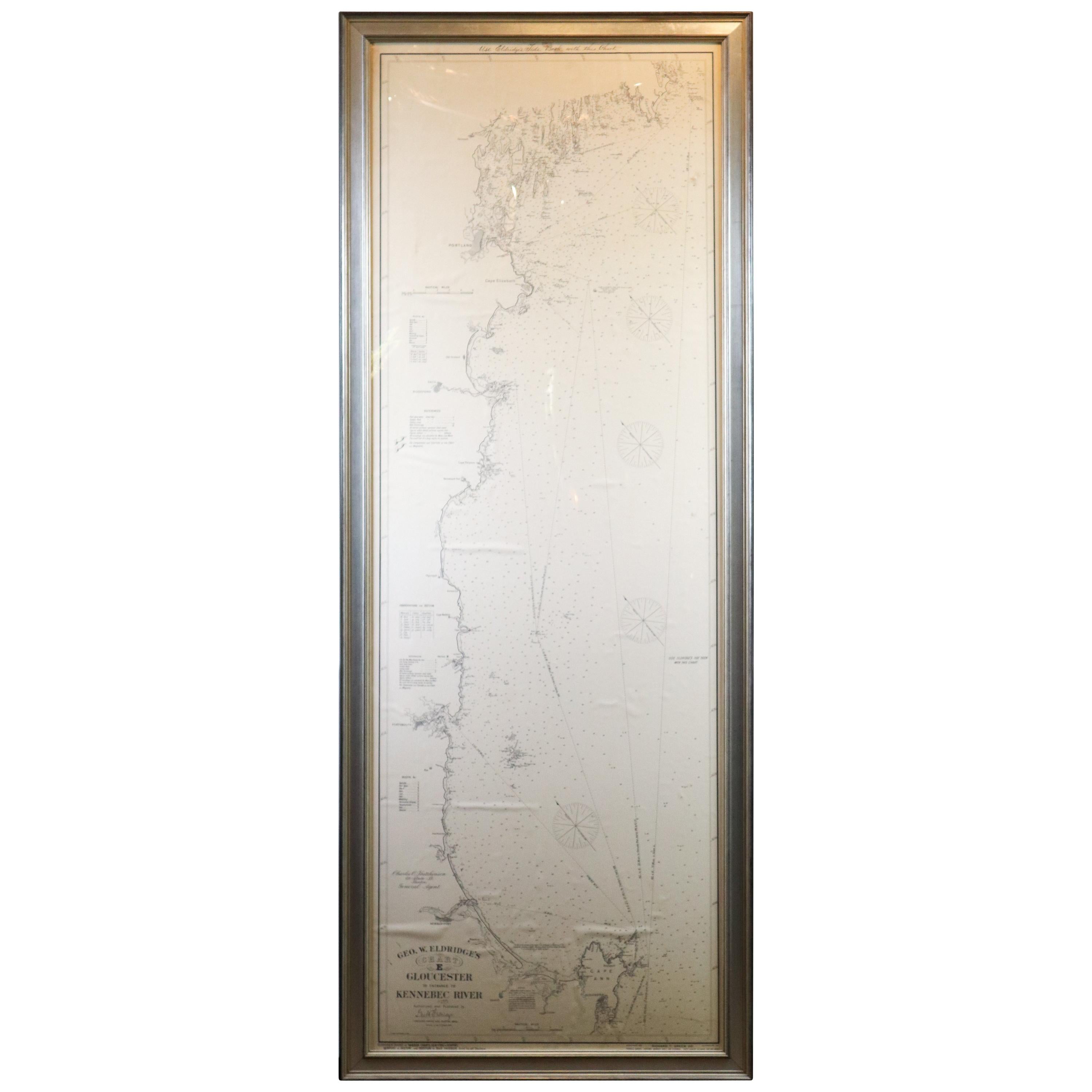
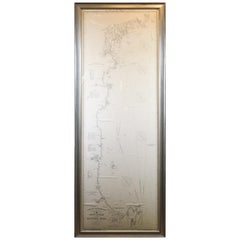
- Original 1910 George Eldridge ChartLocated in Norwell, MAOriginal framed 1910 George Eldridge chart "E" showing Gloucester to the Kennebec river. Showing the coast of Maine in great detail. Towns include Bath, Camden, Portland, the Coastal...Category
20th Century Unknown Maps


You May Also Like
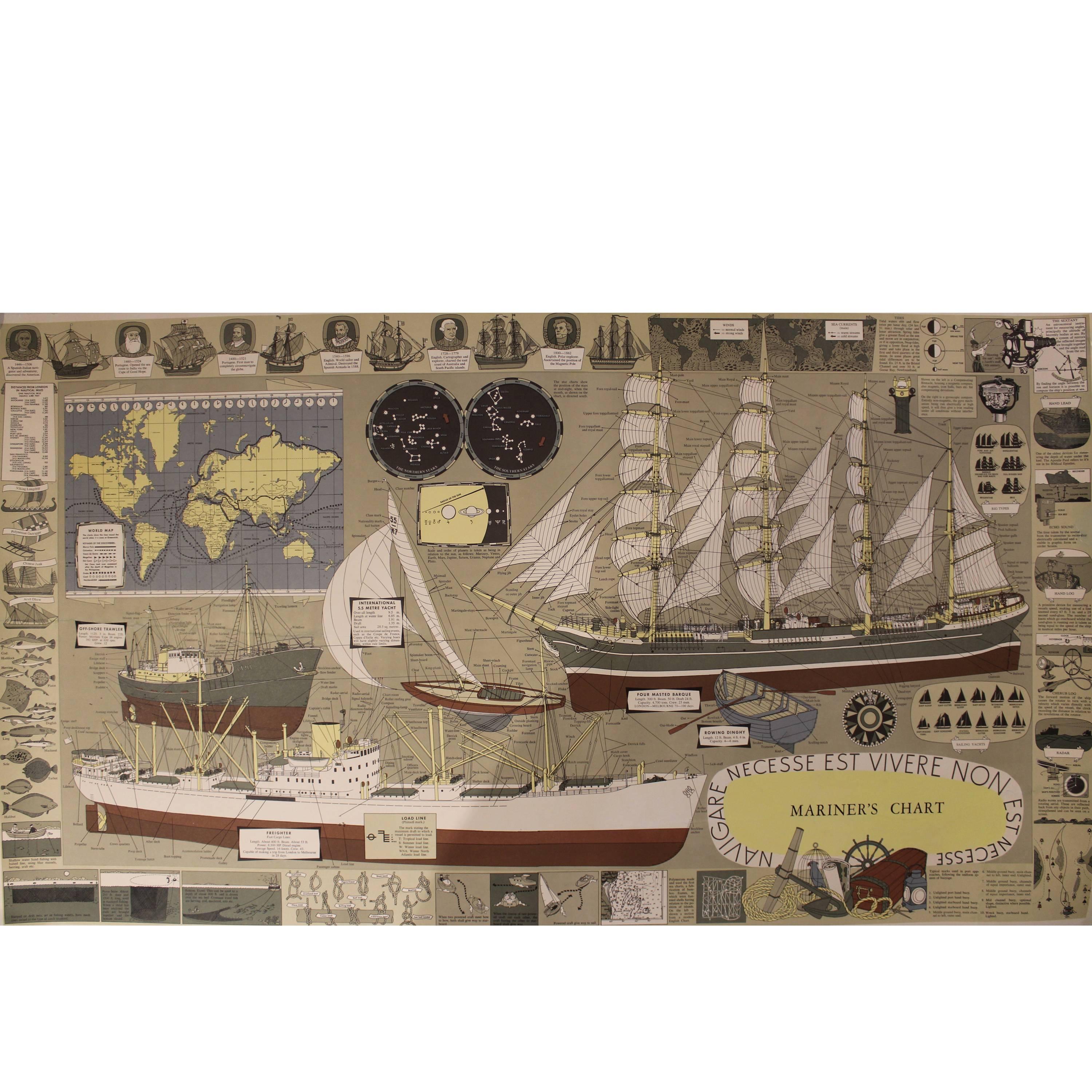
- Mariner's Chart PosterLocated in Hamilton, OntarioMariner's chart poster (nautical).Category
20th Century Posters
 $1,795 Sale Price20% Off
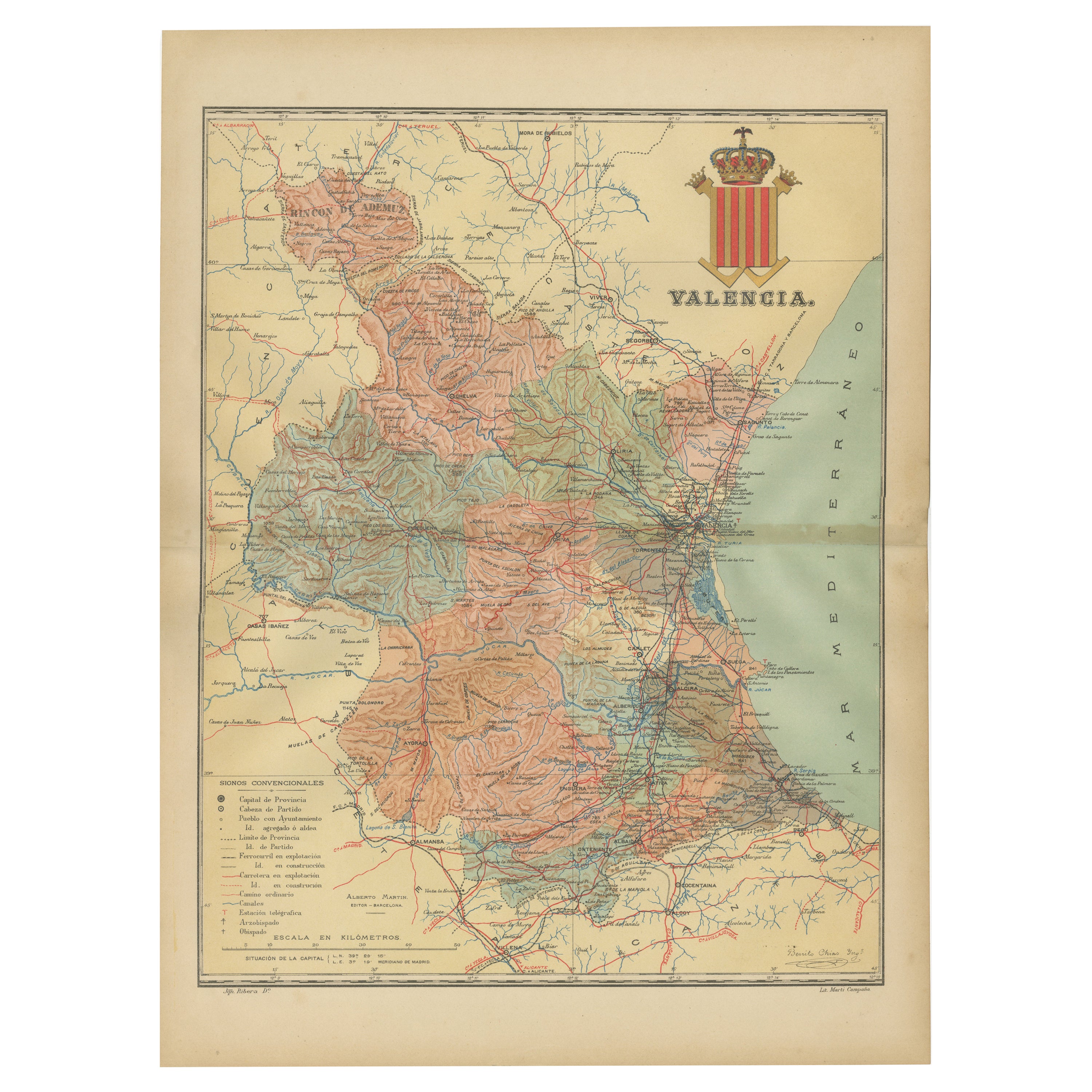
 - Topographical and Infrastructure Map of the Province of Valencia, 1901Located in Langweer, NLA historical map of the province of Valencia, dated 1901. The map includes intricate details such as topographical features, with mountain ranges and river systems prominently marked...Category
Antique Early 1900s Maps
MaterialsPaper
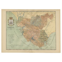
- Cádiz 1901: Nautical Crossroads of the Atlantic and MediterraneanLocated in Langweer, NLThe map illustrates the province of Cádiz, located in the autonomous community of Andalusia, Spain, from the year 1901. It displays various geographic and man-made features: The map...Category
Antique Early 1900s Maps
MaterialsPaper
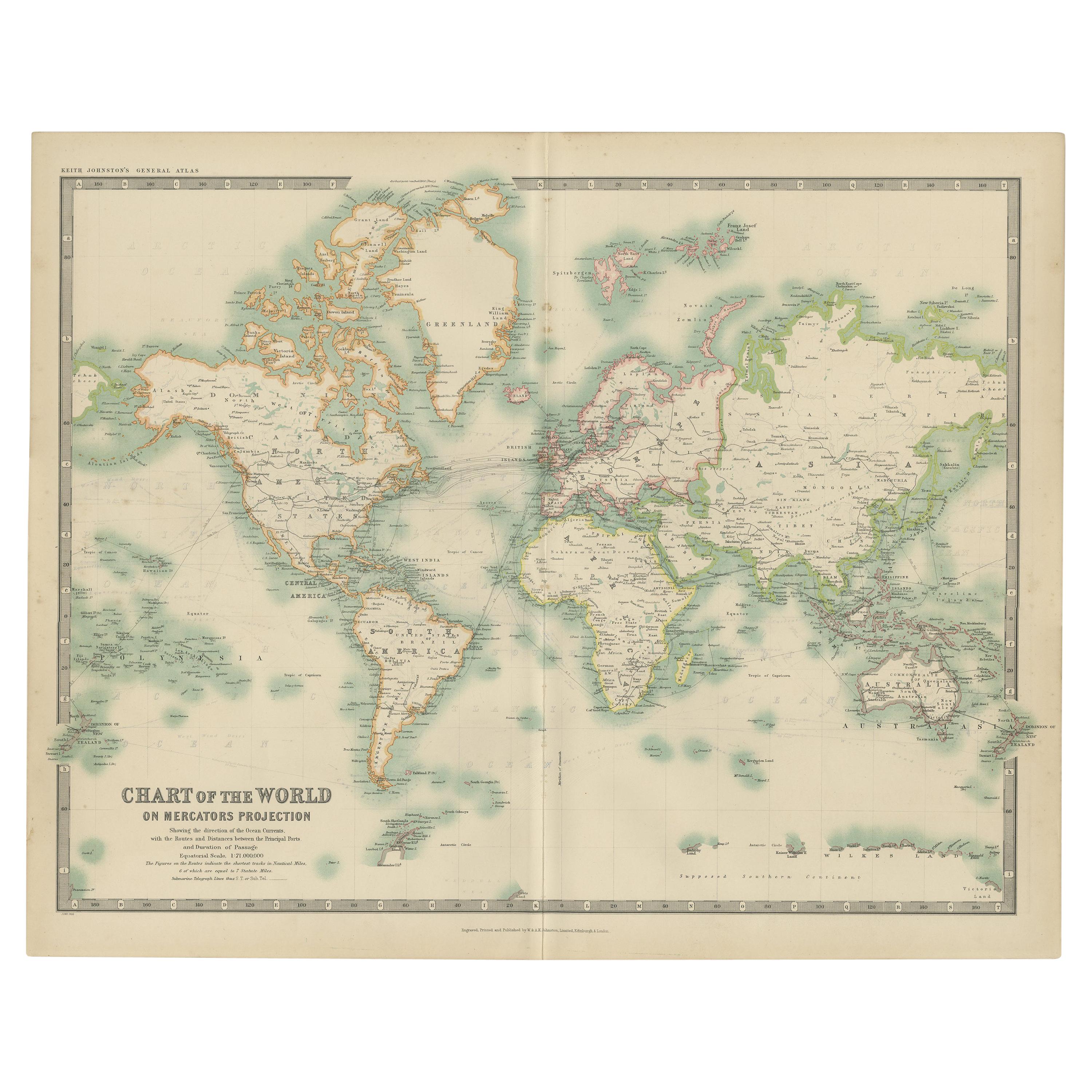
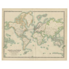
- Antique Chart of the World by Johnston '1909'Located in Langweer, NLAntique map titled 'Chart of the World on Mercator's Projection Showing the directions of the Oceans Currents with the Routes and Distances Between Principal Ports'. Detailed map of ...Category
Early 20th Century Maps
MaterialsPaper
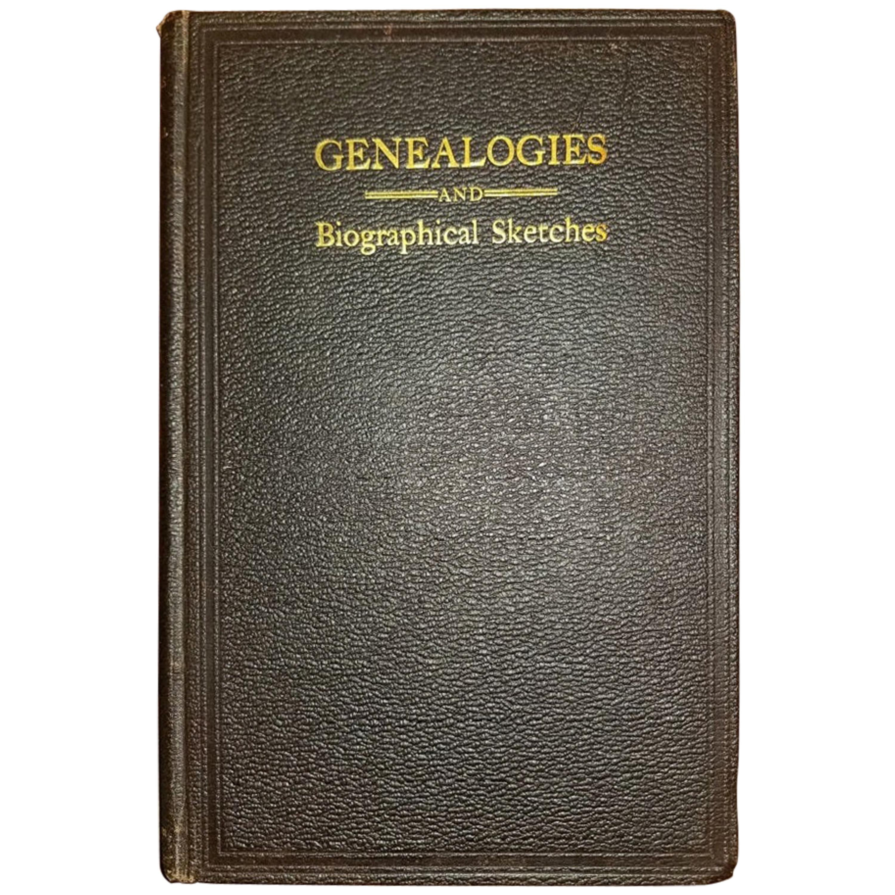
- Genealogies and Sketches of Some Old Families of VA and KY by BF Van Meter 1901Located in Dallas, TXPresenting an extremely rare first edition hardback copy of Genealogies and Sketches of Some Old Families Who have taken Prominent Part in the Development o...Category
Early 20th Century American American Colonial Books
MaterialsPaper
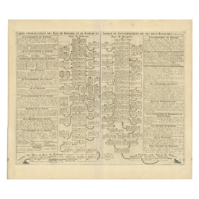
- Antique Genealogy Chart of the Kings of Hungary and Bohemia by Chatelain, 1732Located in Langweer, NLAntique print titled 'Carte Genealogique des Rois de Hongrie (..)'. Genealogical chart of the kings of Hungary and Bohemia. This print orginates from 'Atlas H...Category
Antique 18th Century Prints
MaterialsPaper


Recently Viewed
View AllMore Ways To Browse
Galicia Map
Santa Cruz Solomon Islands
Antique Maps Sumatra
Original Antique Map Of World
Georg Barque
F V Hayden
Dirk Hartog
Serbia Map
Antique Maps Of Tennessee
Covens & Mortier On Sale
Wyoming Map
Giovanni Maria Cassini On Sale
Arkansas Indian Map
Denver Map
Map Of Denver
Palliser Furniture
Rand Mcnally Map Of Kansas
Sumba Map