Acrylic Maps
to
1
1
2
1
2
1
7,447
5,713
126
63
34
1
1
1
1
2
2
2
Material: Acrylic
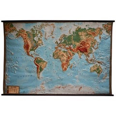
World Relief Map
Located in Antwerp, BE
Large world relief map.
Measures: Width 232 cm.
Height 158 cm.
Category
Mid-20th Century German Mid-Century Modern Acrylic Maps
Materials
Acrylic
$2,152
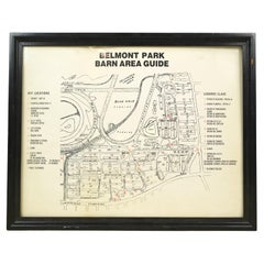
Framed Belmont Park Racetrack Barn Area Guide Map
Located in New York, NY
This piece was acquired from the Belmont Park racetrack in Elmont, New York. It displays an itemized map of the barn area at Belmont Park. It is made of acrylic with a black wood fra...
Category
20th Century American Acrylic Maps
Materials
Acrylic, Wood
Related Items
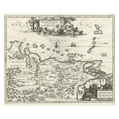
Antique Map of Venezuela by Montanus, 1671
Located in Langweer, NL
Antique map titled 'Venezuela cum parte Australi Novae Andalusiae'. The map extends from Coquibocoa to the Orinoque River, centered on Bariquicemento and Cape de Curiacao. Large cart...
Category
Mid-17th Century English Antique Acrylic Maps
Materials
Paper
Flower Color Guide
Located in New York, NY
The ultimate color-by-color flower reference guide - from New York's pre-eminent floral designers, Putnam and Putnam Planning a wedding, a dinner, a birthday party, a romantic evenin...
Category
21st Century and Contemporary European Acrylic Maps
Materials
Paper
Original Antique Map of The London Underground. 1911
Located in St Annes, Lancashire
Superb map of The London Underground
Published by Ward Lock, 1911
Folding map. Printed on paper
Unframed.
Good condition/ Minor repair to an edge tear on right edge ( shown in ...
Category
1910s English Vintage Acrylic Maps
Materials
Canvas, Paper
1830 Mexico and United States Framed Map
Located in Stamford, CT
Map of North America published circa 1830. Map shows United States into Canada. Mexico extending into the upper California territory. Texas appears in name but prior to the period of...
Category
1830s American American Classical Antique Acrylic Maps
Materials
Glass, Wood, Paper
Framed 1838 Mexico & Gulf of Mexico Map
Located in Stamford, CT
Framed 1838 Mexico & Gulf of Mexico map. Printed by Fisher, Son & Co. of London in 1838. As found framed condition. Map has not been examined outside of th...
Category
1830s English American Classical Antique Acrylic Maps
Materials
Glass, Wood, Paper
Very Decorative Original Antique Map of the World, Published in France in c.1780
Located in Langweer, NL
Antique map titled 'L'Ancien Monde Et Le Nouveau en Deux Hemispheres' - Double hemisphere map of the World, showing the contemporary geographical...
Category
18th Century Antique Acrylic Maps
Materials
Paper
$733 Sale Price
20% Off
H 10.24 in W 17.6 in D 0 in
1834 Mexico & Guatemala Framed Map by H.S. Tanner
Located in Stamford, CT
1834 Mexico & Guatemala map of published by H.S. Tanner, Philadelphia, Pennsylvania. Engraved by J. Knight.
As found high end custom framing with carved wood frame, custom matting a...
Category
1830s American American Classical Antique Acrylic Maps
Materials
Glass, Wood, Paper
Framed 1838 North America & Recent Discoveries Map
Located in Stamford, CT
1838 map of North America & recent discoveries. Engraved color map by J. Wyld, London, England. This map shows Texas as a Republic without its panhandle.
Framed in brown carved wood...
Category
1830s American American Classical Antique Acrylic Maps
Materials
Glass, Wood, Paper
Small Antique Baedeker's South Eastern France Guide Book, Provence, Travel Maps
Located in Hele, Devon, GB
This is a delightful antique edition of Baedeker's South Eastern France guide book, complete with superb fold-out maps, centre-fold maps and informative text. A bound and intact late...
Category
Early 20th Century British Late Victorian Acrylic Maps
Materials
Paper
$552
H 6.3 in W 4.34 in D 0.99 in
Large Original Antique Map of Ireland. C.1900
Located in St Annes, Lancashire
Fabulous map of Ireland
Original color.
Engraved and printed by the George F. Cram Company, Indianapolis.
Published, C.1900.
Unframed.
Free shipping.
Category
1890s American Antique Acrylic Maps
Materials
Paper
Seminal guide to the East and West Indies, with 42 coloured maps and plates
Located in ZWIJNDRECHT, NL
Seminal guide to the East and West Indies, with 42 double-page and folding plates, including 6 maps, all engravings beautifully coloured by a contemporary hand
LINSCHOTEN, Jan Huygh...
Category
Early 17th Century Dutch Dutch Colonial Antique Acrylic Maps
Materials
Paper
$267,858 Sale Price
25% Off
H 12.6 in W 8.27 in D 1.58 in
1705 Golfe de Mexico and Florida Framed Map
Located in Stamford, CT
Framed map of Mexico & Florida circa 1705, Paris. Small map with Mexico and the Gulf Coast. Inset text indicating Panama, Acapulco, Mexico City and the Mississippi. Extends North to ...
Category
Early 1700s French Spanish Colonial Antique Acrylic Maps
Materials
Glass, Wood, Paper
Recently Viewed
View AllMore Ways To Browse
Kentucky Antiques
Japanese Kite
Irish Antiques 16th Century
Carstens Floor Vase
Carstens Uffrecht
Carved Ancestor Figure
Carved Crow
Carved Ibex
Carved Ivory Sculpture
Carved Nativity
Carved Pipes
Casket Plate
Cast Aluminum Planter
Cast Iron Rooster
Cast Iron Settee
Cat Ring Holder
Cathrineholm Enamel
Cedar Hope Chest


