Canvas Maps
to
2
5
1
6
1
1
5
3
2
2
1
81,855
5,715
126
63
34
4
2
2
1
1
6
6
6
1
Material: Canvas
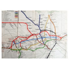
Original Antique Map of The London Underground. 1911
Located in St Annes, Lancashire
Superb map of The London Underground
Published by Ward Lock, 1911
Folding map. Printed on paper
Unframed.
Good condition/ Minor repair to an edge tear on right edge ( shown in ...
Category
1910s English Vintage Canvas Maps
Materials
Canvas, Paper
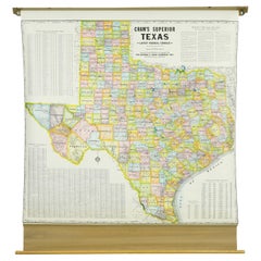
1850-1960 Cram's Superior Latest Federal Census Texas Map
By G. F. Cram Company
Located in New York, NY
The 1850-1960 Cram's Superior Latest Federal Census Texas Map, crafted from pine wood, steel, and canvas, is a valuable historical cartographic piece. Publi...
Category
1910s American Vintage Canvas Maps
Materials
Canvas
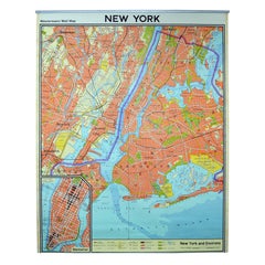
Vintage Wall Chart New York City Urban Map, USA 1950s
Located in Stockholm, SE
A classical wall chart showing a map of the city of New York. published by Westermann and with English text. Used as teaching material in Swedish schools. colorful print on paper rei...
Category
1950s German Vintage Canvas Maps
Materials
Metal
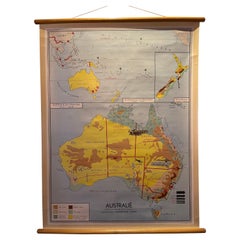
Decorative Vintage Print, Dutch Chart of Australia, 1st Edition, 1952
Located in Langweer, NL
The vintage school chart of Australia titled "Australië," created by W. Bakker & H. Rush and published in 1952:
**Title**: Australië
**Creators**: W. Bakker & H. Rush
**Publication ...
Category
Mid-20th Century European Canvas Maps
Materials
Canvas
$333 Sale Price
20% Off
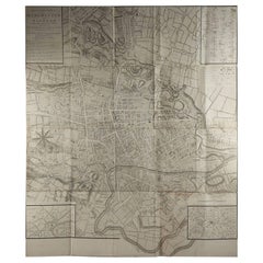
Large Original Antique Folding Map of Manchester, England, Dated 1793
Located in St Annes, Lancashire
Superb map of Manchester and Salford
Folding map. Printed on paper laid on to the original canvas
Unframed.
Published by C. Laurent, 1793.
Free shippi...
Category
1790s English Georgian Antique Canvas Maps
Materials
Canvas, Paper
Antique Map of the East Indies by Brouwer, 1917
Located in Langweer, NL
Antique map titled 'Geotektonische Schetskaart van het Oostelijk Gedeelte van den Oost-Indischen Archipel':
**Title**: Geotektonische Schetskaart van het Oostelijk Gedeelte van den ...
Category
Early 20th Century Canvas Maps
Materials
Canvas, Paper
$1,142 Sale Price
20% Off
Related Items
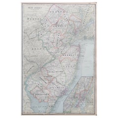
Large Original Antique Map of New Jersey, USA, circa 1900
Located in St Annes, Lancashire
Fabulous map of New Jersey
Original color
Engraved and printed by the George F. Cram Company, Indianapolis.
Published, circa 1900
Unframed
Repairs to minor edge tears
Category
1890s American Antique Canvas Maps
Materials
Paper
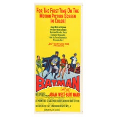
'Batman' Original Vintage Australian Daybill Movie Poster, 1966
Located in Devon, GB
"For the first time on the motion picture screen in color!" Printed in stunning stone lithography, this fabulously kitsch and colourful Australian Daybill...
Category
1960s Australian Mid-Century Modern Vintage Canvas Maps
Materials
Paper, Linen
James Bond 'You Only Live Twice' Original Vintage Movie Poster, Australian, 1967
Located in Devon, GB
The fifth film in EON Productions' James Bond series and the last of Sean Connery's first stint starring as the suave secret agent, it was announced during filming of 'You Only Live ...
Category
1960s Australian Mid-Century Modern Vintage Canvas Maps
Materials
Paper, Linen
$4,803
H 39.88 in W 27.13 in D 0.01 in
Large Antique Map of the State of Texas, 1861
Located in Langweer, NL
Antique map titled 'Johnson's New Map of the State of Texas' Large map of Texas, shows railroads, wagon roads, the U.S. Mail Route, rivers, ports, ...
Category
Mid-19th Century American Antique Canvas Maps
Materials
Paper
Antique Map of Venezuela by Montanus, 1671
Located in Langweer, NL
Antique map titled 'Venezuela cum parte Australi Novae Andalusiae'. The map extends from Coquibocoa to the Orinoque River, centered on Bariquicemento and Cape de Curiacao. Large cart...
Category
Mid-17th Century English Antique Canvas Maps
Materials
Paper
Antique Map of Principality of Monaco
Located in Alessandria, Piemonte
ST/619 - "Old Geographical Atlas of Italy - Topographic map of ex-Principality of Monaco" -
ediz Vallardi - Milano -
A somewhat special edition ---
Category
Late 19th Century Italian Other Antique Canvas Maps
Materials
Paper
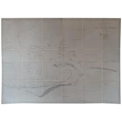
Mariner's Chart Poster
Located in Hamilton, Ontario
Mariner's chart poster (nautical).
Category
20th Century Canvas Maps
The Decisive Moment 1st Edition 1952 Henri Cartier Bresson Cover Henri Matisse
Located in Red Lion, PA
Henri Cartier-Bresson – The Decisive Moment – 1st Edition, 1952 – Cover by Henri Matisse – Published by Simon & Schuster
A true cornerstone of 20th-century photography, this is an extremely rare and collectible first edition of The Decisive Moment (Images à la Sauvette...
Category
1950s French Mid-Century Modern Vintage Canvas Maps
Materials
Paper
$960 Sale Price
20% Off
H 14.5 in W 10.75 in D 1 in
'Scarface' Original Vintage Australian One Sheet Movie Poster, 1984
Located in Devon, GB
Considered to be one of the best gangster films ever made, 'Scarface' follows the rise and fall of Cuban refugee Tony Montana (Al Pacino) as he becomes the biggest drug lord in 1980s Miami. Directed by Brian De Palma and written by Oliver Stone, the cast also featured Michelle Pfeiffer in her breakthrough role as coke-addict mob wife Elvira Hancock. The film's excessive violence, profanity and scenes of graphic drug usage were met with a negative critical response on initial release, but subsequent reappraisal has established 'Scarface' as a cult classic. A loose remake of the 1932 film of the same name, De Palma dedicated his version to Howards Hawks and Ben Hecht...
Category
1980s Australian Post-Modern Vintage Canvas Maps
Materials
Paper, Linen
$1,646
H 39.88 in W 27.5 in D 0.01 in
Antique Map of Flintshire in Wales, United Kingdom, c.1850
Located in Langweer, NL
Antique map titled 'Flintshire'. Antique map of Flintshire with a inlay plan of Flintshire town. Flintshire is a principal area of Wales, known as a county, United Kingdom. Drawn and...
Category
19th Century Antique Canvas Maps
Materials
Paper
$133 Sale Price
20% Off
H 9.65 in W 12.6 in D 0 in
Original Antique Map of Ancient Greece, Achaia, Corinth, 1786
Located in St Annes, Lancashire
Great map of Ancient Greece. Showing the region of Thessaly, including Mount Olympus
Drawn by J.D. Barbie Du Bocage
Copper plate engraving by P.F Tardieu
Original hand color...
Category
1780s French Other Antique Canvas Maps
Materials
Paper
'The Wicker Man' Original Vintage Movie Poster, Australian, 1974
Located in Devon, GB
Bearing the tagline 'An island lost to unspeakable terrors of pagan rituals!' this scarce Australian one sheet displays by far the best poster artwork produced for the 1970 cult Brit...
Category
1970s Australian Post-Modern Vintage Canvas Maps
Materials
Linen, Paper
Previously Available Items
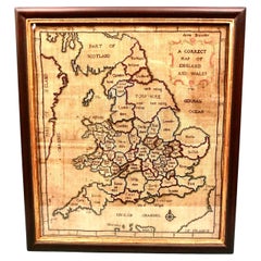
Silk Needlework Map of England and Wales Signed Anna Brewster Dated 1783
Located in San Francisco, CA
A charming silk needlework depiction of England and Wales executed in 1783 by Anna Brewster. This Georgian map sampler is signed and dated in the upper lef...
Category
Late 18th Century English Georgian Antique Canvas Maps
Materials
Canvas, Silk
H 24.5 in W 21.5 in D 1.5 in
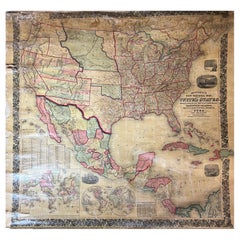
Large Antique 1859 Map of North America
Located in Sag Harbor, NY
This Map was made by Augustus Mitchell in 1859 It is in amazing condition for being 163 years old. This price is for the rolled up easy to ship version of this piece. I will be Frami...
Category
Mid-19th Century American Antique Canvas Maps
Materials
Canvas, Paper
Extra Large Midcentury School Map of Mexico by Haack Painke Kooyman
Located in Mexico City, CDMX
We offer this extra large midcentury school map of Mexico by Haack Painke Kooyman, circa 1960. This vintage item remains fully functional, but it shows si...
Category
1960s German Mid-Century Modern Vintage Canvas Maps
Materials
Canvas
W&A K Johnston’s Charts of Physical Maps by G W Bacon
Located in Godshill, Isle of Wight
Large university chart “Physical Map of Scotland” by Bacon
W&A K Johnston’s charts of physical maps by G W Bacon,
This is colorful Physical map of Scotland, it is large lithogr...
Category
Early 20th Century Beaux Arts Canvas Maps
Materials
Canvas
Vintage Botanical West German Biology Print Chart by Hagemann, Germany, 1960s
Located in Antwerp, BE
1960s canvas wall school chart, Pull down chart with beautiful illustration of a flower. It shows the details of the flower Taraxacum on a bla...
Category
Mid-20th Century German Hollywood Regency Canvas Maps
Materials
Canvas, Paper
H 45.28 in W 33.47 in D 0.4 in
1920s Double Sided Cartocraft Slated School Map, U.S.A. & World Denoyer Geppert
Located in Buffalo, NY
1920s Double Sided Cartocraft Slated School Map, One side depecting the United States, other side depecting the World, Made by Denoyer Geppert ,Pull down retractable, Slated material...
Category
1920s American Industrial Vintage Canvas Maps
Materials
Canvas, Wood
H 62 in W 68 in D 1 in
Wall-School Chart "Sonnenblume" from Jung-Koch-Quentell, 1965
Located in Almelo, NL
Wall chart of the Sonneblume by Jung Koch Quentell
- Canvas backed
- On it's original wooden hangers
- German, circa 1965.
- Measures: 37 x 45 inch.
Jung Koch Quentell
Th...
Category
1960s German Other Vintage Canvas Maps
Materials
Canvas
Wall-School Chart "Ohrenqualie" from Jung-Koch-Quentell, 1960s
Located in Almelo, NL
Wall chart of the Ohrenqualie by Jung Koch Quentell
- Canvas backed
- On it's original hangers
- German, 1960s.
- Measures: 37 x 45 inch.
Jung Koch Quentell
The name Jung...
Category
1960s German Other Vintage Canvas Maps
Materials
Canvas
Wall-School Chart "Lobster" from Jung-Koch-Quentell, 1968
Located in Almelo, NL
Wall chart of the Lobster by Jung Koch Quentell
- Canvas backed
- On it's original hangers
- German, 1968
- Measures: 37 x 45 inch
Jung Koch Quentell
The name Jung Koch ...
Category
1960s German Other Vintage Canvas Maps
Materials
Canvas
German Butterfly School Chart or Science Poster "Tagschmetterling" By M. Richter
Located in Almelo, NL
This German school chart contains beautiful pictures from flowers and butterflies. The school chart is made by the famous illustrator M. Richter.
Category
Mid-20th Century German Canvas Maps
Materials
Canvas
H 29 in W 39 in D 2 in
18th Century Map of the Bourgogne Region
Located in Vosselaar, BE
This large map of the French Bourgogne region was printed and mounted in the late 18th century. Since the governemental centralisation by the Sun King (Louis XIV) the succesing monar...
Category
Late 18th Century French Neoclassical Antique Canvas Maps
Materials
Canvas
Three Dimensional Wall Map
Located in Sagaponack, NY
An amazing and graphic Swiss-made three dimensional wall map of the United States rendered in molded and colored rubber attached to canvas and walnut ...
Category
1950s Swiss Mid-Century Modern Vintage Canvas Maps
Materials
Rubber, Canvas, Walnut
Recently Viewed
View AllMore Ways To Browse
Kentucky Antiques
Japanese Kite
Irish Antiques 16th Century
Carstens Floor Vase
Carstens Uffrecht
Carved Ancestor Figure
Carved Crow
Carved Ibex
Carved Ivory Sculpture
Carved Nativity
Carved Pipes
Casket Plate
Cast Aluminum Planter
Cast Iron Rooster
Cast Iron Settee
Cat Ring Holder
Cathrineholm Enamel
Cedar Hope Chest
