Copper Maps
to
1
1
1
2
2
9,427
5,710
126
63
34
2
1
1
1
1
2
2
2
Material: Copper
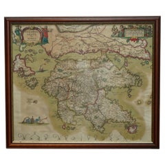
Greece 1660 Jan Jansson Watercolour Map Peloponesus Sive Morea I Laurenbergio
Located in West Sussex, Pulborough
We are delighted to offer for sale this Jan Jansson Date: 1660 (published) Amsterdam map of Greece.
This is an authentic antique map of Peloponnese or...
Category
1660s Danish Dutch Colonial Antique Copper Maps
Materials
Copper
$723 Sale Price
30% Off
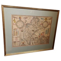
Framed 17th Century Map of Cumberland, England by John Speed, 1610
By John Speed
Located in Middleburg, VA
A fascinating and richly detailed antique map of Cumberland County in northwest England, drawn and published by the celebrated English cartographer John Spe...
Category
Early 17th Century English British Colonial Antique Copper Maps
Materials
Copper, Gold Leaf
Related Items
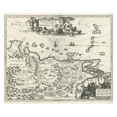
Antique Map of Venezuela by Montanus, 1671
Located in Langweer, NL
Antique map titled 'Venezuela cum parte Australi Novae Andalusiae'. The map extends from Coquibocoa to the Orinoque River, centered on Bariquicemento and Cape de Curiacao. Large cart...
Category
Mid-17th Century English Antique Copper Maps
Materials
Paper
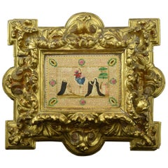
Frame with Vellum Painting, 17th Century
Located in Madrid, ES
Carved and gilded frame with painting on vellum, "Virgin of the Rosary with Santo Domingo de Guzmán and Santa Catalina of Siena", 17th century. Registration in the back zone (Mr. Jos...
Category
17th Century European Baroque Antique Copper Maps
Materials
Leather, Wood, Paint
Original Antique Map of The London Underground. 1911
Located in St Annes, Lancashire
Superb map of The London Underground
Published by Ward Lock, 1911
Folding map. Printed on paper
Unframed.
Good condition/ Minor repair to an edge tear on right edge ( shown in ...
Category
1910s English Vintage Copper Maps
Materials
Canvas, Paper
Large Original Antique Map of Ireland. C.1900
Located in St Annes, Lancashire
Fabulous map of Ireland
Original color.
Engraved and printed by the George F. Cram Company, Indianapolis.
Published, C.1900.
Unframed.
Free shipping.
Category
1890s American Antique Copper Maps
Materials
Paper
Early 19th Century Original Framed Land Indenture, England, 1810
Located in Lambertville, NJ
A large hand written land indenture document England, 1810, framed. The beautifully hand written document mounted on board with a red velvet border and ...
Category
1810s English Regency Antique Copper Maps
Materials
Glass, Giltwood, Parchment Paper
Ciro Ferri Drawing Offering Scene Italie 17th Century
Located in Beuzevillette, FR
Italian lead pencil drawing, entourage of Ciro Ferri, depicting an offering scene in front of a temple, in the manner of the antiquity.
Measurements: 7.8/5.9 inches
...
Category
17th Century Italian Antique Copper Maps
Materials
Paper
Vintage Reproduction 17th Century Map of Europe, American, Cartography, Blaeuw
Located in Hele, Devon, GB
This is a vintage reproduction map of Europe. An American, paper stock cartography print in frame after the work by Blaeuw, dating to the late 20t...
Category
Late 20th Century Central American Mid-Century Modern Copper Maps
Materials
Glass, Wood, Paper
$1,259
H 30.32 in W 38.39 in D 1.38 in
Large Original Vintage Map of Israel, circa 1920
Located in St Annes, Lancashire
Great map of Israel
Original color.
Good condition
Published by Alexander Gross
Unframed.
Category
1920s English Edwardian Vintage Copper Maps
Materials
Paper
Extremely Large Hand-Drawn Manuscript Map of Surinam, 1830, History of Slavery
Located in Amsterdam, NL
A unique large hand-drawn map of Surinam by Albrecht Helmut Hiemcke (German, 1760-1839)
?
'Colonie Surinaame', 1830
A large hand-drawn and coloured map of the colony of Suri...
Category
Mid-19th Century Surinamer Antique Copper Maps
Materials
Paper
$45,413
H 34.85 in W 97.05 in D 0.08 in
Original 17th-Century Antique Map of Nanjing Province, China – by Blaeu
Located in Langweer, NL
Title: 17th-Century Antique Map of Nanjing Province, China – "Nanking sive Kiangnan" by Blaeu, with Decorative Details
Description: This captivating 17th-century map of Nanjing Pr...
Category
1650s Antique Copper Maps
Materials
Paper
$1,601
H 18.9 in W 23.04 in D 0.01 in
World Relief Map
Located in Antwerp, BE
Large world relief map.
Measures: Width 232 cm.
Height 158 cm.
Category
Mid-20th Century German Mid-Century Modern Copper Maps
Materials
Acrylic
Large Original Antique Map of Africa. C.1900
Located in St Annes, Lancashire
Fabulous map of Africa
Original color.
Engraved and printed by the George F. Cram Company, Indianapolis.
Published, C.1900.
Unframed.
Free shipping.
Category
1890s American Antique Copper Maps
Materials
Paper
Previously Available Items
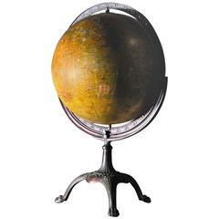
1930s Weber Costello Globe with Cast Copper Mount
Located in Surrey, BC
Beautiful example of a classic globe from the 1930s and made by Weber Costello. The mounting mechanism is cast from copper.
The roots of what would bec...
Category
1930s American Victorian Vintage Copper Maps
Materials
Copper
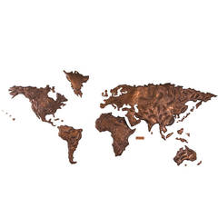
Copper World Map from Sabena Airlines, JFK Airport, New York, 1972
Located in Wilton, CT
Commissioned by Sabena Airlines Belgium. This unique copper repousse world map was the backdrop for Sabena's check in counter at JFK Airport, New York, in ...
Category
1970s Chilean Mid-Century Modern Vintage Copper Maps
Materials
Copper
Repoussé Map from JFK Airline Terminal by Patricio Caces, 1972
By Patricio Caces
Located in New York, NY
This is an extraordinary and unique map of the world salvaged from the Sabena airlines terminal check in counter at JFK airport. It was created by Chilean artist Patricio Caces in 1972.
Category
1970s American Vintage Copper Maps
Materials
Copper
Recently Viewed
View AllMore Ways To Browse
Kentucky Antiques
Japanese Kite
Irish Antiques 16th Century
Carstens Floor Vase
Carstens Uffrecht
Carved Ancestor Figure
Carved Crow
Carved Ibex
Carved Ivory Sculpture
Carved Nativity
Carved Pipes
Casket Plate
Cast Aluminum Planter
Cast Iron Rooster
Cast Iron Settee
Cat Ring Holder
Cathrineholm Enamel
Cedar Hope Chest
