American Maps
Color: Gray
Place of Origin: American
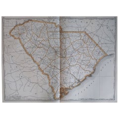
Large Original Antique Map of South Carolina, USA, 1894
By Rand McNally & Co.
Located in St Annes, Lancashire
Fabulous map of South Carolina
Original color
By Rand, McNally & Co.
Published, 1894
Unframed
Free shipping.
Category
1890s Antique American Maps
Materials
Paper
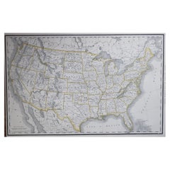
Large Original Antique Map of the United States of America. 1891
By Rand McNally & Co.
Located in St Annes, Lancashire
Fabulous map of The United States
Original color
By Rand, McNally & Co.
Dated 1891
Unframed
Free shipping.
Category
1890s Antique American Maps
Materials
Paper
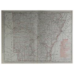
Large Original Antique Map of Arkansas by Rand McNally, circa 1900
By Rand McNally & Co.
Located in St Annes, Lancashire
Fabulous monochrome map with red outline color
Original color
By Rand, McNally & Co.
Published, circa 1900
Unframed
Minor edge tears.
Category
Early 1900s Edwardian Antique American Maps
Materials
Paper
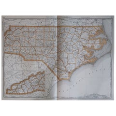
Large Original Antique Map of North Carolina, USA, 1894
By Rand McNally & Co.
Located in St Annes, Lancashire
Fabulous map of North Carolina
Original color
By Rand, McNally & Co.
Published, 1894
Unframed
Free shipping.
Category
1890s Antique American Maps
Materials
Paper
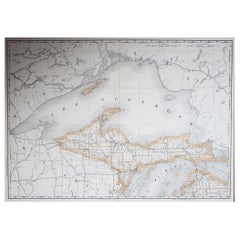
Large Original Antique Map of Michigan 'North', USA, 1894
By Rand McNally & Co.
Located in St Annes, Lancashire
Fabulous map of Michigan North.
Original color.
By Rand, McNally & Co.
Published, 1894.
Unframed.
Free shipping.
Category
1890s Antique American Maps
Materials
Paper
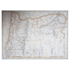
Large Original Antique Map of Oregon, USA, 1894
By Rand McNally & Co.
Located in St Annes, Lancashire
Fabulous map of Oregon.
Original color.
By Rand, McNally & Co.
Published, 1894.
Unframed.
Free shipping.
Category
1890s Antique American Maps
Materials
Paper
Large Original Antique Map of Indiana, USA, 1894
By Rand McNally & Co.
Located in St Annes, Lancashire
Fabulous map of Indiana.
Original color.
By Rand, McNally & Co.
Published, 1894.
Unframed.
Free shipping.
Category
1890s Antique American Maps
Materials
Paper
"San Francisco, Upper California” 1851 Antique Map of San Francisco
Located in Colorado Springs, CO
This is a pictorial lettersheet view of the city and harbor of San Francisco. This lithograph was printed on grey wove paper, across a double sheet, by famed lithographers Britton & ...
Category
1850s Antique American Maps
Materials
Paper
Large Original Antique City Plan of Baltimore, USA, 1894
By Rand McNally & Co.
Located in St Annes, Lancashire
Fabulous colorful map of Baltimore
Original color
By Rand, McNally & Co.
Published, 1894
Unframed
Free shipping.
Category
1890s Antique American Maps
Materials
Paper
Large Original Antique Map of Washington, 'State', USA, 1894
By Rand McNally & Co.
Located in St Annes, Lancashire
Fabulous map of Washington.
Original color.
By Rand, McNally & Co.
Published, 1894.
Unframed.
Free shipping.
Category
1890s Antique American Maps
Materials
Paper
Large Original Antique Map of New York, USA, 1894
By Rand McNally & Co.
Located in St Annes, Lancashire
Fabulous map of New York.
Original color.
By Rand, McNally & Co.
Published, 1894
Unframed
Free shipping.
Category
1890s Antique American Maps
Materials
Paper
Large Original Antique Map of Utah, USA, 1894
By Rand McNally & Co.
Located in St Annes, Lancashire
Fabulous map of Utah
Original color
By Rand, McNally & Co.
Published, 1894
Unframed
Free shipping.
Category
1890s Antique American Maps
Materials
Paper
Large Original Antique Map of New Hampshire, USA, 1894
By Rand McNally & Co.
Located in St Annes, Lancashire
Fabulous map of New Hampshire
Original color
By Rand, McNally & Co.
Published, 1894
Unframed
Free shipping.
Category
1890s Antique American Maps
Materials
Paper
Large Original Antique Map of Iowa, USA, 1894
By Rand McNally & Co.
Located in St Annes, Lancashire
Fabulous map of Iowa.
Original color.
By Rand, McNally & Co.
Published, 1894.
Unframed.
Free shipping.
Category
1890s Antique American Maps
Materials
Paper
Large Original Antique City Plan of San Francisco, USA, 1894
By Rand McNally & Co.
Located in St Annes, Lancashire
Fabulous colorful map of San Francisco
Original color
By Rand, McNally & Co.
Published, 1894
Unframed
Free shipping.
Category
1890s Antique American Maps
Materials
Paper
Original Antique City Plan of Kansas City, USA. 1894
By Rand McNally & Co.
Located in St Annes, Lancashire
Fabulous colorful map of Kansas City
Original color
By Rand, McNally & Co.
Published, 1894
Unframed
Slightly reduced bottom margin.
Free shipping.
Category
1890s Antique American Maps
Materials
Paper
Large Original Antique Map of Ohio by Rand McNally, circa 1900
By Rand McNally & Co.
Located in St Annes, Lancashire
Fabulous monochrome map with red outline color
Original color
By Rand, McNally & Co.
Published, circa 1900
Unframed
Repairs to minor edge tears.
Category
Early 1900s Edwardian Antique American Maps
Materials
Paper
Original Antique City Plan of Milwaukee, USA, 1894
By Rand McNally & Co.
Located in St Annes, Lancashire
Fabulous colorful map of Milwaukee
Original color
By Rand, McNally & Co.
Published, 1894
Unframed
Free shipping.
Category
1890s Antique American Maps
Materials
Paper
Large Original Antique Map of Connecticut, USA, 1894
By Rand McNally & Co.
Located in St Annes, Lancashire
Fabulous map of Connecticut and Rhode Island
Original color
By Rand, McNally & Co.
Published, 1894
Unframed
Free shipping.
Category
1890s Antique American Maps
Materials
Paper
Large Original Antique City Plan of Detroit, USA, 1894
By Rand McNally & Co.
Located in St Annes, Lancashire
Fabulous colorful map of Detroit
Original color
By Rand, McNally & Co.
Published, 1894
Unframed
Free shipping.
Category
1890s Antique American Maps
Materials
Paper
Original Antique City Plan of St Joseph, Missouri, USA, 1894
By Rand McNally & Co.
Located in St Annes, Lancashire
Fabulous colorful map of St Joseph
Original color
By Rand, McNally & Co.
Published, 1894
Unframed
Free shipping.
Category
1890s Antique American Maps
Materials
Paper
Set of 6 Original Vintage Maps of American States, circa 1900
Located in St Annes, Lancashire
Wonderful set of 6 vintage maps.
Random American states including Maine, Utah, New Hampshire, Nevada, Vermont and New Mexico.
Monochrome with red color outline.
Published by Rand,...
Category
Early 1900s Edwardian Antique American Maps
Materials
Paper
Large Original Antique City Plan of Minneapolis and St Paul, USA, circa 1900
By Rand McNally & Co.
Located in St Annes, Lancashire
Fabulous colorful map of Minneapolis and St Paul, Minnesota.
Original color
By Rand, McNally & Co.
Published, circa 1900
Unframed
Free shipping.
Category
Early 1900s Antique American Maps
Materials
Paper
Large Original Antique City Plan of Philadelphia, USA, circa 1900
By Rand McNally & Co.
Located in St Annes, Lancashire
Fabulous colorful map of Philadelphia
Original color
By Rand, McNally & Co.
Published, circa 1900.
Unframed
Free shipping.
Category
Early 1900s Antique American Maps
Materials
Paper
Original Antique Map of South Dakota by Rand McNally, circa 1900
By Rand McNally & Co.
Located in St Annes, Lancashire
Fabulous monochrome map with red outline color
Original color
By Rand, McNally & Co.
Published, circa 1900
Unframed
Minor edge tears.
Category
Early 1900s Edwardian Antique American Maps
Materials
Paper
Large Original Antique City Plan of Cincinnati, USA, circa 1900
By Rand McNally & Co.
Located in St Annes, Lancashire
Fabulous colorful map of Cincinnati, Ohio.
Original color
By Rand, McNally & Co.
Published, circa 1900
Unframed
Free shipping.
Category
Early 1900s Antique American Maps
Materials
Paper
Large Original Antique City Plan of Montreal, Canada, circa 1900
By Rand McNally & Co.
Located in St Annes, Lancashire
Fabulous colorful map of Montreal
Original color
By Rand, McNally & Co.
Published, circa 1900
Unframed
Free shipping.
Category
Early 1900s Antique American Maps
Materials
Paper
America "Amérique Septentrionale": A 19th Century French Map by Delamarche
By Maison Delamarche 1
Located in Alamo, CA
This framed mid 19th century map of North America entitled "Amérique Septentrionale" by Felix Delamarche was published in Paris in 1854 by Quay de l'Horloge du Palais, avec les Carte...
Category
Mid-19th Century Other Antique American Maps
Materials
Paper
Plan for the City of Washington by Andrew Ellicott, Antique Print, 19th Century
Located in Colorado Springs, CO
By Andrew Ellicott (1754-1820) and Pierre Charles L'Enfant (1754-1825). Plan of the City of Washington. Published by Thackara & Vallance, Philadelphia, 1792. Later impression printed on 19th century wove paper.
This is a fine 19th century printing of the "official" plan of Washington, D.C. First printed in 1792 by the original publishers, Thackara & Vallance in Philadelphia, this is a later 19th century printing of the fifth recorded engraving of the L’Enfant / Ellicott city plan. The first three issues of this city plan were in published in periodicals, making the fifth edition only the second separately-issued engraving of the plan. In full, the title reads, “Plan of the City of Washington in the Territory of Columbia, ceded by the States of Virginia and Maryland to the United States of America and by them established as the Seat of their Government after the year 1800.”
The national capital city is laid out according to a plan originally proposed by Pierre Charles L'Enfant and modified by Andrew Ellicott. L'Enfant was born in Paris, where he trained to be an architect. He came to America in 1777, and served under George Washington as an engineer during the Revolutionary War. In 1791, Washington asked L'Enfant to design the new capital city in the District of Columbia. However, trouble arose between the city and L'Enfant. The City Commissioner needed a finished, printed copy of the plan in order to sell building lots but L'Enfant worked slowly and released only incomplete plans, and proved to be quite obstinate. On instruction from President Washington...
Category
Late 19th Century Antique American Maps
Materials
Paper
Related Items
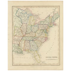
Original Antique Hand-colored Map of the United States, circa 1845
Located in Langweer, NL
Antique map titled 'United States'. Old map of the United States, includes the last part of the North West Territory (present day Wisconsin and part of Minnesota). It also marks Ft. Crawford at the confluence of the Mississippi River and the Ouisconsin River (present day Wisconsin River). Published by Orr & Company; Amen Corner...
Category
Mid-19th Century Antique American Maps
Materials
Paper
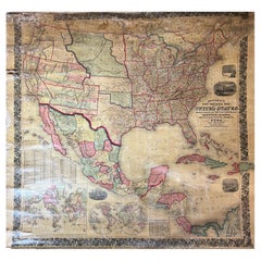
Large Antique 1859 Map of North America
Located in Sag Harbor, NY
This Map was made by Augustus Mitchell in 1859 It is in amazing condition for being 163 years old. This price is for the rolled up easy to ship version of this piece. I will be Frami...
Category
Mid-19th Century Antique American Maps
Materials
Canvas, Paper
Antique St Andrews Golf Etching by W.L. Wyllie, circa 1900
Located in Oxfordshire, GB
A very charming etching of two children playing golf on the beach at St Andrews, in the background is the town of St Andrews with the Castle & Cathedral prominent in the sky line. Fr...
Category
Early 1900s Sporting Art Antique American Maps
Materials
Wood, Paper
Antique Map of the United States by Titus '1871'
Located in Langweer, NL
Antique map titled 'The United States of America'. Original antique map of the United States. This map originates from 'Atlas of Prebl...
Category
Late 19th Century Antique American Maps
Materials
Paper
Antique Hand-Colored Map of France by J.B. Elwe, 1792
Located in Langweer, NL
Antique map titled 'Carte Nouvelle du Royaume de France'. Beautiful antique map of France, including the Southern part of England. Decorated with cartouche and 12 coats of arms.
Category
Late 18th Century Antique American Maps
Materials
Paper
Antique Map of North America by Dufour 'circa 1834'
Located in Langweer, NL
Antique map titled 'Amérique Septentrionale'. Uncommon map of North America. Published by or after A.H. Dufour, circa 1834. Source unknown, to be determined.
Category
Mid-19th Century Antique American Maps
Materials
Paper
Antique Map of the East Indies by Moll '1745'
Located in Langweer, NL
Antique map titled 'A Chart of ye East-Indies. With the Coast of Persia, China also the Philipina, Moluca and Sunda Islands'. Detailed map of the Indian Ocean, Southeast Asia, China,...
Category
Mid-18th Century Antique American Maps
Materials
Paper
Antique Map with Hand Coloring of the United States and the Caribbean
Located in Langweer, NL
Antique map titled 'Verein-Staaten von Nord-America, Mexico, Yucatan u.a.'. Very detailed map of the United States of America showing the Caribbean. With an inset map of the surround...
Category
Late 19th Century Antique American Maps
Materials
Paper
H 15.08 in W 18.71 in D 0.02 in
Original Engraved Antique Map of the World, Colorful and Decorative, C.1780
By Pierre François Tardieu
Located in Langweer, NL
Antique map titled 'Mappemonde en Deux Hemispheres ou l'on a Indique les Nouvelles Decouvertes' - This handsome double hemisphere map presents a ...
Category
18th Century Antique American Maps
Materials
Paper
H 15.6 in W 20.32 in D 0 in
Antique Map of North America, 1821
Located in Langweer, NL
Antique map of America titled 'Carte de l'Amerique septentrionale'. Scarce map of North America, shortly after the Louisiana Purchase and the first ...
Category
19th Century Antique American Maps
Materials
Paper
Antique Map of Oregon
Located in Langweer, NL
Antique map titled 'Oregon'. Original antique map of Oregon, United States. This print originates from 'Encyclopaedia Britannica', Ninth Edition. Publish...
Category
Late 19th Century Antique American Maps
Materials
Paper
Antique Map of North East Borneo and North Sulawesi by P.M.G. Vandermaelen
Located in Langweer, NL
Contemporary colored lithographed map. Relief shown pictorially and by hachures. Covers North Eastern Borneo and part of Northern Sulawesi.
Category
Early 19th Century Antique American Maps
Materials
Paper
H 20.99 in W 27.41 in D 0.02 in
Previously Available Items
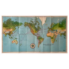
Pan American Airways 1952 World Route Map
By Pan American Airways
Located in New York, NY
World Route Map published in 1952 by Pan American World Airways and printed by Jeppesen and Company, showing the worldwide destinations on six continents ser...
Category
1950s Mid-Century Modern Vintage American Maps
Materials
Paper
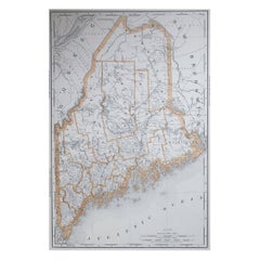
Large Original Antique Map of Maine, USA, 1894
By Rand McNally & Co.
Located in St Annes, Lancashire
Fabulous map of Maine
Original color
By Rand, McNally & Co.
Published, 1894
Unframed
Free shipping.
Category
1890s Antique American Maps
Materials
Paper
Large Original Antique City Plan of Indianapolis, USA, circa 1900
By Rand McNally & Co.
Located in St Annes, Lancashire
Fabulous colorful map of Indianapolis
Original color
By Rand, McNally & Co.
Published, circa 1900
Unframed
Free shipping.
Category
Early 1900s Antique American Maps
Materials
Paper
Free Shipping
H 27.5 in W 20.5 in D 0.07 in
Large Original Antique Map of Oklahoma by Rand McNally, circa 1900
By Rand McNally & Co.
Located in St Annes, Lancashire
Fabulous monochrome map with red outline color
Original color
By Rand, McNally & Co.
Published, circa 1900
Unframed
Repairs to minor edge tears.
Category
Early 1900s Edwardian Antique American Maps
Materials
Paper
Free Shipping
H 20.5 in W 27.5 in D 0.07 in
1970s United Airlines Airport / Travel Agent Thermo-Plastic Sign, 3-Dimensional
By united airlines
Located in Buffalo, NY
1970s United Airlines Airport / Travel Agent Thermo-plastic sign (BLOW MOLD). Amazing 3-dimensional graphics depicting popular tourist travel destinati...
Category
1970s Mid-Century Modern Vintage American Maps
Materials
Plastic
H 29 in W 42 in D 2 in
Large Original Antique Map of North Carolina by Rand McNally, circa 1900
By Rand McNally & Co.
Located in St Annes, Lancashire
Fabulous monochrome map with red outline color
Original color
By Rand, McNally & Co.
Published, circa 1900
Unframed
Repairs to minor edge tears.
Category
Early 1900s Edwardian Antique American Maps
Materials
Paper
Free Shipping
H 20.5 in W 27.5 in D 0.07 in
Original Antique City Plan of Omaha, Nebraska, USA, circa 1900
By Rand McNally & Co.
Located in St Annes, Lancashire
Fabulous colorful map of Omaha, Nebraska
Original color
By Rand, McNally & Co.
Published circa 1900
Unframed
Free shipping.
Category
Early 1900s Antique American Maps
Materials
Paper
Free Shipping
H 20.5 in W 14 in D 0.07 in
Original Antique Map of Connecticut & Rhode Island by Rand McNally, circa 1900
By Rand McNally & Co.
Located in St Annes, Lancashire
Fabulous monochrome map with red outline color
Original color
By Rand, McNally & Co.
Published, circa 1900
Unframed.
Category
Early 1900s Edwardian Antique American Maps
Materials
Paper
Free Shipping
H 14 in W 20.5 in D 0.07 in
Framed 19th Century Colton Map of Mexico, Texas, California and US Territories
By J.H. Colton
Located in Alamo, CA
This framed 19th century map of the southern portions of North America by J. H. Colton, published in New York in 1855 in his General Atlas of the World on page No. 54 in volume 1. Th...
Category
Mid-19th Century Other Antique American Maps
Materials
Paper
H 20 in W 22.63 in D 0.88 in
Large Original Antique City Plan of St Louis, USA, circa 1900
By Rand McNally & Co.
Located in St Annes, Lancashire
Fabulous colorful map of St Louis, Missouri
Original color
By Rand, McNally & Co.
Published, circa 1900
Unframed
Free shipping.
Category
Early 1900s Antique American Maps
Materials
Paper
Free Shipping
H 27.5 in W 20.5 in D 0.07 in
19th Century Hand-Colored Map of Africa by Henry Tanner
By Henry Schenck Tanner
Located in Alamo, CA
An early to mid-19th century hand-colored map of Africa by Henry Schenk Tanner, published in Tanner's Universal Atlas by Matthew Carey & Son in Philadelphia in 1834. At the time this map was published, Africa was largely unexplored. The "Mountains of Kong" and the "Mountains of the Moon...
Category
Mid-19th Century Antique American Maps
Materials
Paper
Original Antique City Plan of New Orleans, USA, circa 1900
By Rand McNally & Co.
Located in St Annes, Lancashire
Fabulous colorful map of New Orleans
Original color
By Rand, McNally & Co.
Published, circa 1900
Unframed
Free shipping.
Category
Early 1900s Antique American Maps
Materials
Paper
Recently Viewed
View AllMore Ways To Browse
Greek Asia Minor
Antique Maps Canada
Antique Map Canada
Canada Antique Map
West Indies Map
Antique Portuguese Plates
Map Huge
Antique Maps Of Canada
Bali Map
Antique Map South Africa
Antique Map Of South Africa
South Africa Antique Map
Map Of West Indies
Belgium Army
Sweden Antique Map
Belgian Army
Cornelius Company
Antique Nautical Maps
