American Maps
7
19
to
10
9
19
19
19
2
2
1
80
29
1
19
7
2
10
4
3
1
2
1
18
3
2
1
1
64
52
32
23
19
8
1
1
1
1
Period: Early 20th Century
Place of Origin: American
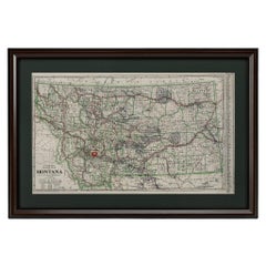
"Clason's Guide Map of Montana" by The Clason Map Company, Circa 1920s
Located in Colorado Springs, CO
Presented is “Clason's Guide Map of Montana,” published in the early 1920s by the Clason Map Company. Issued as a folding map, this map identifies county boundaries, county seats, Na...
Category
1920s Art Deco Vintage American Maps
Materials
Paper
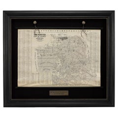
1915 "San Francisco City and County" Hanging Map by W. Bashford Smith
Located in Colorado Springs, CO
Presented is a rare wall map of San Francisco by W. Bashford Smith. Published in San Francisco in 1915, this map indicates streets and city districts, and, most notably, shows the si...
Category
1910s Art Deco Vintage American Maps
Materials
Wood, Paper
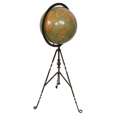
Antique Webber Costello Globe on Metal Tripod Base c 1900 / 1920's
Located in New York, NY
Rare floor model globe made by Weber Costello, circa 1900. The 12" globe rests on a folding metal base. This example is in very good, original condition, showing only light wear, nor...
Category
Early 20th Century Industrial American Maps
Materials
Metal
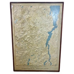
Rare and Early Plaster Relief Map of Adirondack Mountains by F J H Merrill
By P.F. Howells, E. W. Merrill
Located in Buffalo, NY
Rare and Early Monumental Plaster Relief Map of Adirondack Mountains by The University of the State of New York, New York State Museum..F J H Merrill director,,,modeled by Howell's ...
Category
1910s Industrial Vintage American Maps
Materials
Plaster, Wood
1908 "Map of Texas" by The Kenyon Company
Located in Colorado Springs, CO
Presented is an antique map of the state of Texas, printed as a pocket map in 1908 by The Kenyon Company. The state map is brightly colored by county, with principal cities and towns listed. The congressional districts are numbered and boldly outlined in red. Rivers, roads, and railroads all appear prominently on this fantastic map...
Category
Early 1900s Antique American Maps
Materials
Paper
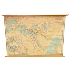
Antique Rand McNally & Company Schoolmap. Ancient Oriental Empires. Historical
By Rand McNally & Co.
Located in ROTTERDAM, ZH
This is a real unique map made by the famous Rand McNally Company. This rare schoolmap is probably made in the late 1920's. The map of all the ...
Category
1920s American Classical Vintage American Maps
Materials
Fabric, Paper
1912 "Panoramic View of New York City and Vicinity" by Jacob Ruppert
Located in Colorado Springs, CO
This is an attractive and very scarce map of New York, published by the Yorkville brewer Jacob Ruppert in 1912. The map shows an expansive view of the region reaching from Sandy Hook in the south and Yonkers to the north, to Hicksville in the east and past Newark to the west. This beautifully colored birds eye view shows waterways with all shipping traffic, boroughs, and clearly labeled railroad routes. It is presented on period dowels and backed on its original linen.
Jacob Ruppert was born in New York City in 1842 to Bavarian immigrants. His father owned a brewery in Manhattan where young Jacob learned the business of brewing. In 1862, Jacob established the Jacob...
Category
1910s Vintage American Maps
Materials
Paper
1918 American Frohse Anatomical Chart, A. J. Nystrom, Max Brodel Illustrator
By A.J. Nystrom & Co, Max Brödel
Located in Buffalo, NY
Antique American Frohse Anatomical pull down chart, by A. J. Nystrom, ,revised and augmented by Max Brodel illustrator... Amazing color, patina, age appropriate wear. dated 1918..
Max (Paul Heinrich) Brödel
1870-1941
Brödel, an illustrator and the first director of the Art as Applied to Medicine program at Johns Hopkins...
Category
1910s Steampunk Vintage American Maps
Materials
Wood, Paper
Large Original Antique Map of Ohio by Rand McNally, circa 1900
By Rand McNally & Co.
Located in St Annes, Lancashire
Fabulous monochrome map with red outline color
Original color
By Rand, McNally & Co.
Published, circa 1900
Unframed
Repairs to minor edge tears.
Category
Early 1900s Edwardian Antique American Maps
Materials
Paper
Set of 6 Original Vintage Maps of American States, circa 1900
Located in St Annes, Lancashire
Wonderful set of 6 vintage maps.
Random American states including Maine, Utah, New Hampshire, Nevada, Vermont and New Mexico.
Monochrome with red color outline.
Published by Rand,...
Category
Early 1900s Edwardian Antique American Maps
Materials
Paper
Antique American "Rand Menally Co." Chicago Table-Top Globe on Stand, Circa 1900
Located in New Orleans, LA
Antique American "Rand Menally Co.," Chicago table-top globe on stand with map made By "G.W. Bacon & Co." of London, England, Circa 1900.
Some normal wear and tear: per the last 2 ...
Category
Early 20th Century American Maps
Materials
Metal
Large Original Antique City Plan of Minneapolis and St Paul, USA, circa 1900
By Rand McNally & Co.
Located in St Annes, Lancashire
Fabulous colorful map of Minneapolis and St Paul, Minnesota.
Original color
By Rand, McNally & Co.
Published, circa 1900
Unframed
Free shipping.
Category
Early 1900s Antique American Maps
Materials
Paper
Large Original Antique City Plan of Philadelphia, USA, circa 1900
By Rand McNally & Co.
Located in St Annes, Lancashire
Fabulous colorful map of Philadelphia
Original color
By Rand, McNally & Co.
Published, circa 1900.
Unframed
Free shipping.
Category
Early 1900s Antique American Maps
Materials
Paper
Original Antique Map of South Dakota by Rand McNally, circa 1900
By Rand McNally & Co.
Located in St Annes, Lancashire
Fabulous monochrome map with red outline color
Original color
By Rand, McNally & Co.
Published, circa 1900
Unframed
Minor edge tears.
Category
Early 1900s Edwardian Antique American Maps
Materials
Paper
Large Original Antique City Plan of Montreal, Canada, circa 1900
By Rand McNally & Co.
Located in St Annes, Lancashire
Fabulous colorful map of Montreal
Original color
By Rand, McNally & Co.
Published, circa 1900
Unframed
Free shipping.
Category
Early 1900s Antique American Maps
Materials
Paper
Original Antique City Plan of Buffalo, New York, USA, circa 1900
By Rand McNally & Co.
Located in St Annes, Lancashire
Fabulous colorful map of Buffalo
Original color
By Rand, McNally & Co.
Published, circa 1900.
Unframed
Free shipping.
Category
Early 1900s Antique American Maps
Materials
Paper
Large Original Antique City Plan of Cincinnati, USA, circa 1900
By Rand McNally & Co.
Located in St Annes, Lancashire
Fabulous colorful map of Cincinnati, Ohio.
Original color
By Rand, McNally & Co.
Published, circa 1900
Unframed
Free shipping.
Category
Early 1900s Antique American Maps
Materials
Paper
1907 Map of Colorado, Antique Topographical Map, by Louis Nell
Located in Colorado Springs, CO
This highly detailed pocket map is a topographical map of the state of Colorado by Louis Nell from 1907. The map "has been complied from all availabl...
Category
Early 1900s Antique American Maps
Materials
Paper
Pictorial Map of Chicago, circa 1926
Located in Colorado Springs, CO
This is a colorful folding pocket map of the city of Chicago, published by The Clason Map Co., circa 1926.
This highly decorative, double sided map features "Pictorial Map of Chicago...
Category
1920s Vintage American Maps
Materials
Paper
Related Items
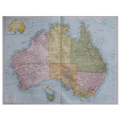
Large Original Vintage Map of Australia, circa 1920
Located in St Annes, Lancashire
Great map of Australia
Original color. Good condition
Published by Alexander Gross
Unframed.
Category
1920s Vintage American Maps
Materials
Paper
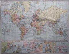
Large Original Vintage Map of The World, circa 1920
Located in St Annes, Lancashire
Great map of The World
Original color.
Good condition / minor foxing
Published by Alexander Gross
Unframed.
Category
1920s Vintage American Maps
Materials
Paper
Large Original Vintage Map of Greece, circa 1920
Located in St Annes, Lancashire
Great map of Greece
Original color.
Good condition
Published by Alexander Gross
Unframed.
Category
1920s Vintage American Maps
Materials
Paper
Large Original Vintage Map of Persia / Iran, circa 1920
Located in St Annes, Lancashire
Great maps of Persia.
Unframed.
Original color.
By John Bartholomew and Co. Edinburgh Geographical Institute.
Published, circa 1920.
Free shipping.
Category
1920s Vintage American Maps
Materials
Paper
Antique Rand McNally Terrestrial Globe, Glass, Light Up, Unusual Bronze Base
By Rand McNally & Co.
Located in Buffalo, NY
Antique Rand McNally terrestrial globe, glass, light up, unusual bronze decorative base. Glass world globe in great original condition, stylized neoc...
Category
1930s Neoclassical Revival Vintage American Maps
Materials
Bronze
Large Antique Map of the State of Texas, 1861
Located in Langweer, NL
Antique map titled 'Johnson's New Map of the State of Texas' Large map of Texas, shows railroads, wagon roads, the U.S. Mail Route, rivers, ports, ...
Category
Mid-19th Century Antique American Maps
Materials
Paper
Antique Ophthalmometer Eye Machine by General Optical Company
Located in Norwalk, CT
This Antique Universal Ophthalmometer Eye Exam Machine by General Optical Company is stamped “Pat Oct 24th 1911”. This is an optical optometrist device to mea...
Category
Early 20th Century American Maps
Vintage Remington Rand Typewriter, 1947
By Remington Rand
Located in Colorado Springs, CO
Presented is a vintage Remington Rand typewriter from 1947. The typewriter is the portable De Luxe Model 5, issued in a sleek carrying case. Still functional, this classic design features a black crinkle finish, and a QWERTY keyboard. Included in the set of metal rimmed black keys are fun features like a shift key, shift lock key, self-starter key, marginal release, and a back space key.
A touch regulator is also included in this De Luxe model. The touch regulator is an adjustment mechanism that permits the keyboard tension to be set at any one of five positions, as indicated by the number in the center of the touch regulator slot. This enables the operator to easily set the key action to suit light, medium, or heavy touch, ensuring maximum typing comfort and speed.
The first commercially successful typewriter was designed by Christopher Sholes and Carlos Glidden and manufactured by gunmakers E. Remington and Sons in 1868. In 1886, E. Remington and Sons sold the entirety of their typewriter interests to Wyckoff, Seamans & Benedict. Wyckoff, Seamans & Benedict manufactured their typewriters under the Remington Standard Typewriter Company name beginning in 1892. The company became the Remington Typewriter Company in 1902, before merging with the Rand Kardex Company in 1927 to become Remington Rand. Remington Rand continued to sell typewriters until around 1955, when it was acquired by the Sperry Corporation.
Among the early famous typewriter users was Mark Twain. Twain said in a letter to Remington, “Please do not use my name in any way. Please do not even divulge the fact that I own a machine. … I don’t like to write letters, and so I don’t want people to know I own this curiosity-breeding little joker,” talking about his 1875 Remington model. Twain was the first author ever to have a manuscript typed. Other famous users include Agatha Christie, Rudyard Kipling, who made good use of the Remington Noiseless...
Category
1940s Mid-Century Modern Vintage American Maps
Materials
Metal
2 Large Vols Antique Reference Book, Egypt - Historical and Picturesque, English
Located in Hele, Devon, GB
This is 2 large volumes of the antique reference book 'Egypt - Descriptive, Historical and Picturesque by G. Ebers. An English translation by Clara Bell, wi...
Category
Late 19th Century Victorian Antique American Maps
Materials
Textile, Paper
H 14.97 in W 12.01 in D 1.38 in
Antique Map of the Ancient Greek Colonization
Located in Langweer, NL
Antique map titled 'Map I containing the Western Division of the Grecian Colonies & Conquests'. Original antique map of the ancient Greek colonization. Frontispiece map of 'The Histo...
Category
Late 18th Century Antique American Maps
Materials
Paper
Large Original Vintage Map of Israel, circa 1920
Located in St Annes, Lancashire
Great map of Israel
Original color.
Good condition
Published by Alexander Gross
Unframed.
Category
1920s Edwardian Vintage American Maps
Materials
Paper
Circa 1920s-30s Pair of Bookends by the Pompeian Bronze Company
Located in Chapel Hill, NC
Circa 1920s-30s pair of bookends by the Pompeian Bronze Company. Copyright 1921. A thin veneer of patinated bronze is molded over a heavy casting. Art Deco motifs with the arts in ba...
Category
Early 20th Century Art Deco American Maps
Materials
Bronze
Previously Available Items
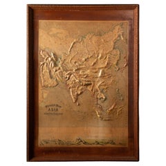
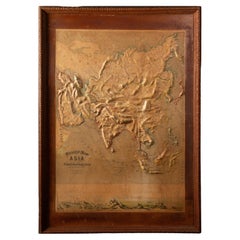
Early 20th C. Relief Maps: Asia Wood and Leather Frames
Located in New York, NY
This early 20th-century set of three relief maps offers a captivating glimpse into the geographical features of Asia. The maps, meticulously crafted, are elevated by their presentat...
Category
Early 20th Century Victorian American Maps
Materials
Leather, Wood, Paper
Early 20th C. Relief Maps: Asia Wood and Leather Frames
Located in New York, NY
This early 20th-century set of three relief maps offers a captivating glimpse into the geographical features of South America, Asia, and Africa. The maps, meticulously crafted, are e...
Category
Early 20th Century Victorian American Maps
Materials
Leather, Wood, Paper
1917 "Map of the City of Denver, Colorado" by L. L. Poates Eng, Co.
Located in Colorado Springs, CO
This is a detailed antique map of Denver, Colorado. The map was printed in the 1917 “New Encyclopedic Atlas and Gazetteer of the World” and first engrave...
Category
1910s Vintage American Maps
Materials
Paper
"Pike's Peak by Rail: Cog Wheel Route" by C.W. Sells, 1903
Located in Colorado Springs, CO
Presented is a 1903 bird’s eye view of Pike’s Peak Cog Railway, published by C. W. Sells. Issued in a folding brochure advertisement for the Colorado-based railway, this colorful bir...
Category
Early 1900s Antique American Maps
Materials
Paper
1903 Chicago Street Map by J.M. Matthews Co.
Located in Colorado Springs, CO
Presented is an original 1903 map of the city of Chicago, Illinois. The map was issued in the 1903 edition of The Universal Atlas, published by Dodd, M...
Category
Early 1900s Antique American Maps
Materials
Paper
1906 "Tourists Guide to Colorado Springs, Manitou, Colorado City..." Map
Located in Colorado Springs, CO
Presented is "Clason's Guide Map to Colorado Springs, Manitou, Colorado City and Pike's Peak Region," published in Denver in 1906 by the Clason Map Company. Issued as a tourist map of the city, the map identifies roads, rivers, and lakes, offers topographical and elevation data, and marks all railroad routes, some of which are further outlined in dark red. In town, a key identifies tourist spots like hotels, sanitariums, hospitals, and churches, marking them with triangles, circled crosses, crosses, and arrows. The legend further differentiates between roads, street car tracks, railroads, wagon roads, and trails, for easy navigation.
The border panels around the map are printed with advertisements for the local businesses. Viewers of the map could peruse fine food and beverage offerings like Manitou Table Water and Ginger Champagne, Vincent’s Beet Sugar Syrup, and Kuner’s Pickles, find saddle horses for ladies at the Club Stables, or even consider a real estate purchase through Wills, Spackmen, and Kent.
This is a very scarce map of Colorado...
Category
Early 1900s Antique American Maps
Materials
Paper
Map of Nantucket by Austin Strong '1881-1952', circa 1925
Located in Nantucket, MA
Map of Nantucket by Austin Strong (1881 - 1952), circa 1925, an original print on paper whimsical map of Nantucket Island by Robert Louis Stevenson's...
Category
1920s Folk Art Vintage American Maps
Materials
Paper
Antique Art Deco Period 12-Inch Library Globe by Replogle
By Replogle Globes
Located in Philadelphia, PA
A fine antique Art Deco 12-inch library globe.
By Replogle.
Date to the 1930S.
With sepia toning to the gores and crazing throughout.
Simply a great globe from a bygone e...
Category
Early 20th Century Art Deco American Maps
Materials
Paper
Antique Whimsical Map of San Diego, California by Jo Mora for Marston Stores
By Jo Mora, A. Marston & Co.
Located in San Diego, CA
Antique whimsical map of San Diego, California by Jo Mora for Marston Stores, circa 1928. The rare map itself measures 22" x 27" and is presented in its original thin wood frame measuring 25.25" x 30.5". The map and frame are in fair to poor condition with a number of stains, blotches folds and wrinkles (please see pictures). The frame also has some damage to it. It is a very, very rare map with only 2,000 copies ever made. #1968
Jo Mora’s spectacular pictorial map of San Diego; an historical account of the city of San Diego, created by the brilliant and incomparable Jo Mora in 1928. George Marston, owner of the Marston Department Store, commissioned Mora to create one of his signature cartes, with San Diego as the subject matter, for the 50th ‘Golden’ Anniversary of The Marston Company. As a prominent philanthropist and benefactor of the city, George W. Marston eventually earned the unofficial title of “San Diego’s First Citizen”. It has been suggested that Mora and Marston probably met at the Bohemian Grove...
Category
Early 20th Century American Maps
Materials
Paper
H 30.5 in W 25.25 in D 0.5 in
Large Original Antique City Plan of Indianapolis, USA, circa 1900
By Rand McNally & Co.
Located in St Annes, Lancashire
Fabulous colorful map of Indianapolis
Original color
By Rand, McNally & Co.
Published, circa 1900
Unframed
Free shipping.
Category
Early 1900s Antique American Maps
Materials
Paper
Free Shipping
H 27.5 in W 20.5 in D 0.07 in
Large Original Antique Map of Oklahoma by Rand McNally, circa 1900
By Rand McNally & Co.
Located in St Annes, Lancashire
Fabulous monochrome map with red outline color
Original color
By Rand, McNally & Co.
Published, circa 1900
Unframed
Repairs to minor edge tears.
Category
Early 1900s Edwardian Antique American Maps
Materials
Paper
Free Shipping
H 20.5 in W 27.5 in D 0.07 in
1904 Map of the Denver and Rio Grande & Rio Grande Western System, Rand McNally
Located in Colorado Springs, CO
1904 Map of the Denver and Rio Grande and the Rio Grande Western System by Rand McNally & Co.
This map details the Denver & Rio Grande Western Railroad. First published in 1885, t...
Category
Early 1900s Antique American Maps
Materials
Paper
H 10.25 in W 28 in D 1 in
Recently Viewed
View AllMore Ways To Browse
Greek Asia Minor
Antique Maps Canada
Antique Map Canada
Canada Antique Map
West Indies Map
Antique Portuguese Plates
Map Huge
Antique Maps Of Canada
Bali Map
Antique Map South Africa
Antique Map Of South Africa
South Africa Antique Map
Map Of West Indies
Belgium Army
Sweden Antique Map
Belgian Army
Cornelius Company
Antique Nautical Maps
