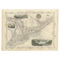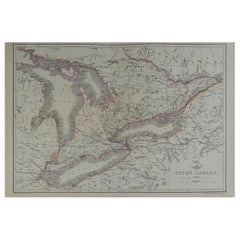
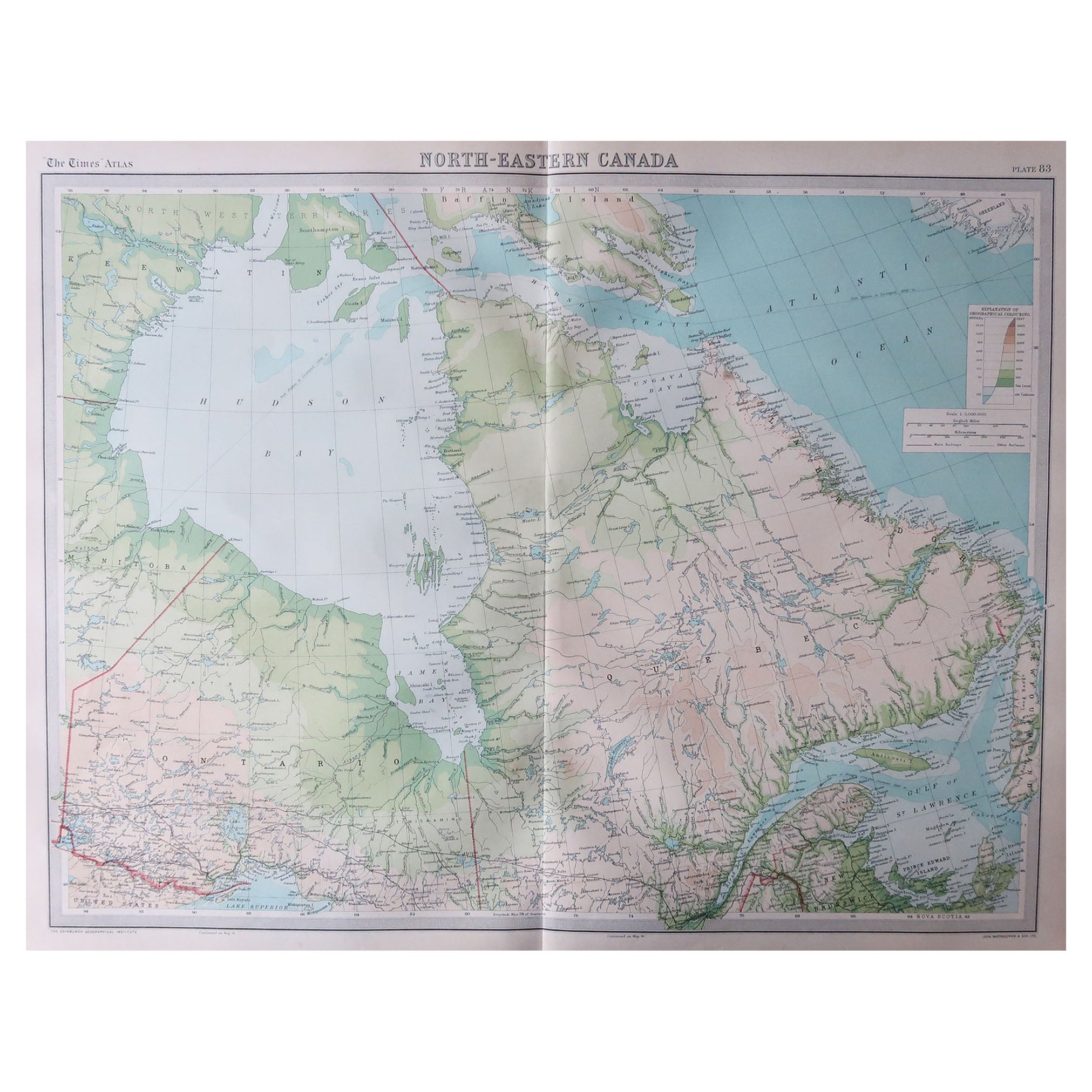
Original Antique Map of the Great Lakes, Canada by T. Ettling, 1861
View Similar Items


Want more images or videos?
Request additional images or videos from the seller
1 of 5
Original Antique Map of the Great Lakes, Canada by T. Ettling, 1861
About the Item
- Dimensions:Height: 19 in (48.26 cm)Width: 13 in (33.02 cm)Depth: 0.07 in (1.78 mm)
- Style:Other (In the Style Of)
- Materials and Techniques:Paper,Other
- Place of Origin:
- Period:
- Date of Manufacture:1861
- Condition:Wear consistent with age and use.
- Seller Location:St Annes, GB
- Reference Number:1stDibs: LU1836322436322
About the Seller
4.9
Platinum Seller
These expertly vetted sellers are 1stDibs' most experienced sellers and are rated highest by our customers.
1stDibs seller since 2016
2,539 sales on 1stDibs
Associations
International Confederation of Art and Antique Dealers' Associations
More From This SellerView All
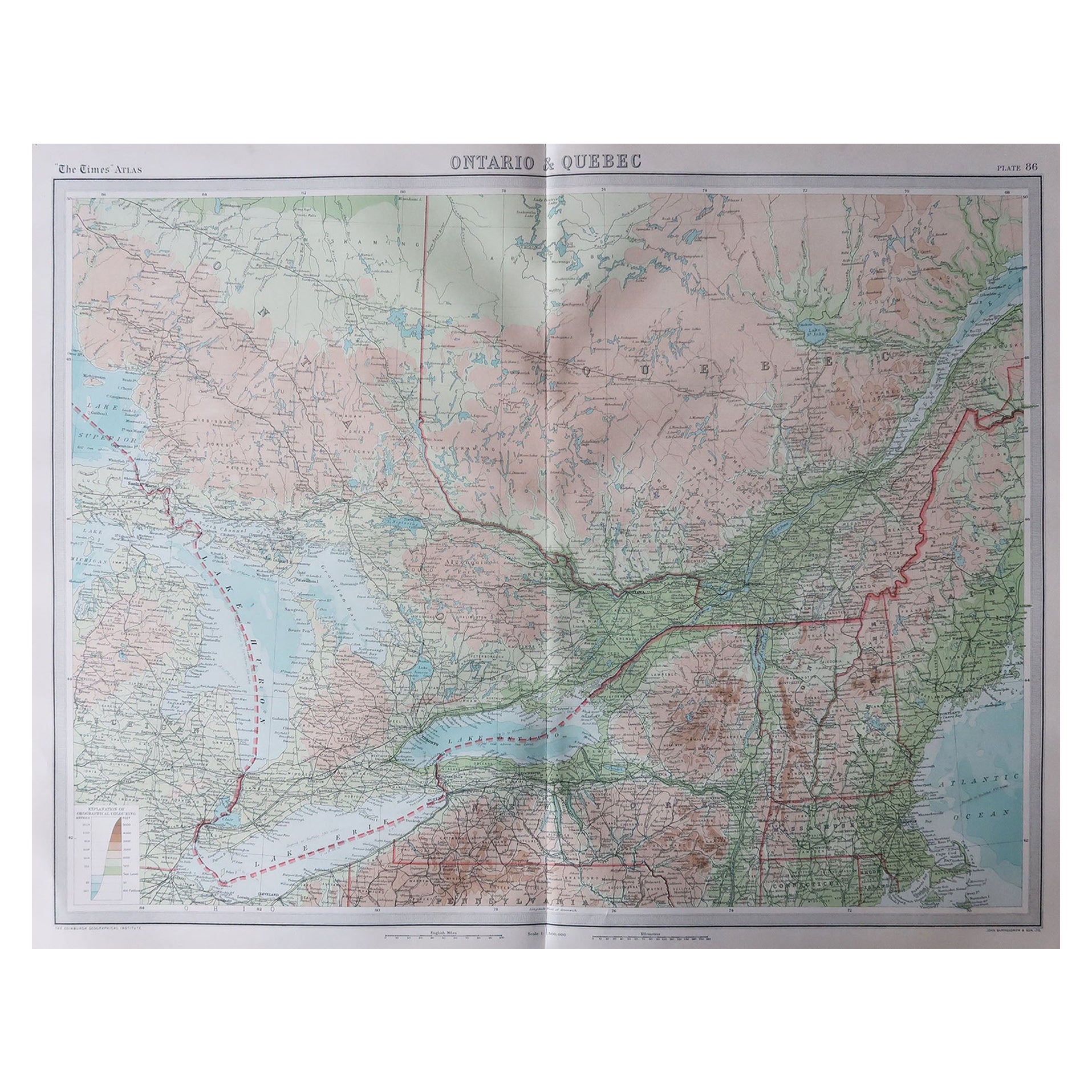
- Large Original Vintage Map of the Great Lakes, Canada, circa 1920Located in St Annes, LancashireGreat map of The Great Lakes. Unframed. Original color. By John Bartholomew and Co. Edinburgh Geographical Institute Published, circa 1920 ...Category
Vintage 1920s British Maps
MaterialsPaper
- Original Antique Map of Indonesia, 1861Located in St Annes, LancashireGreat map of Indonesia Drawn and engraved by Edward Weller Original color Published in The Weekly Dispatch Atlas, 1861 Repairs to minor e...Category
Antique 1860s English Victorian Maps
MaterialsPaper

- Original Large Antique Map of Paris, France by John Dower, 1861Located in St Annes, LancashireFabulous monochrome map of Paris. Vignettes of St Germain En Laye, Saint Cloud, Versailles and Fontainbleau. Unframed. Drawn by J.Dower. Lithography by Weller. 4 sheets j...Category
Antique 1860s English Victorian Maps
MaterialsPaper
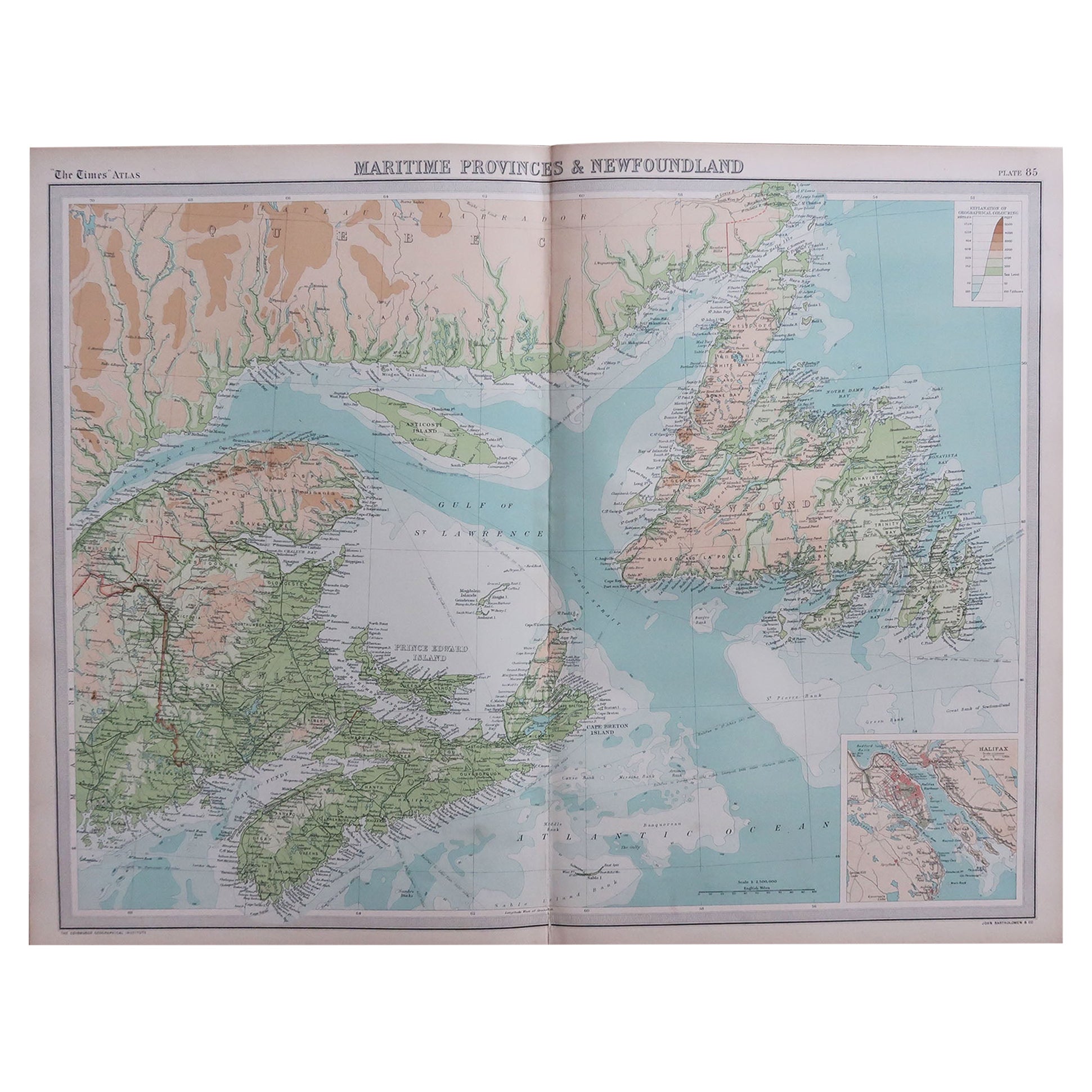
- Large Original Vintage Map of the Maritimes, Canada, circa 1920Located in St Annes, LancashireGreat map of The Maritime provinces Unframed Original color By John Bartholomew and Co. Edinburgh Geographical Institute Published, circa 1920 Free shipping.Category
Vintage 1920s British Maps
MaterialsPaper
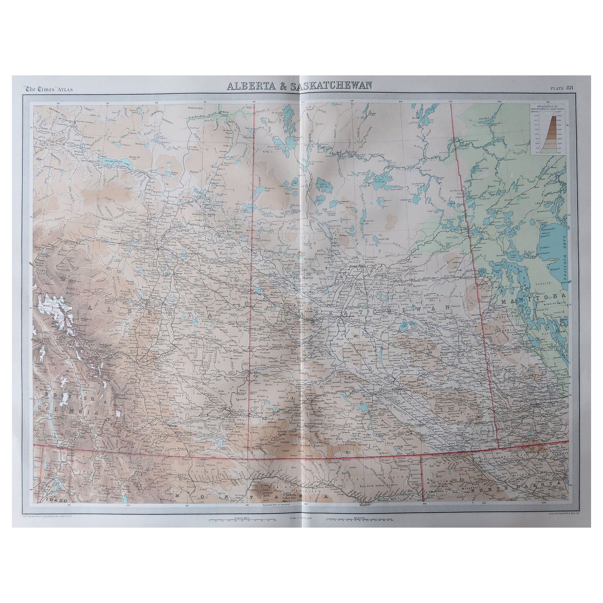
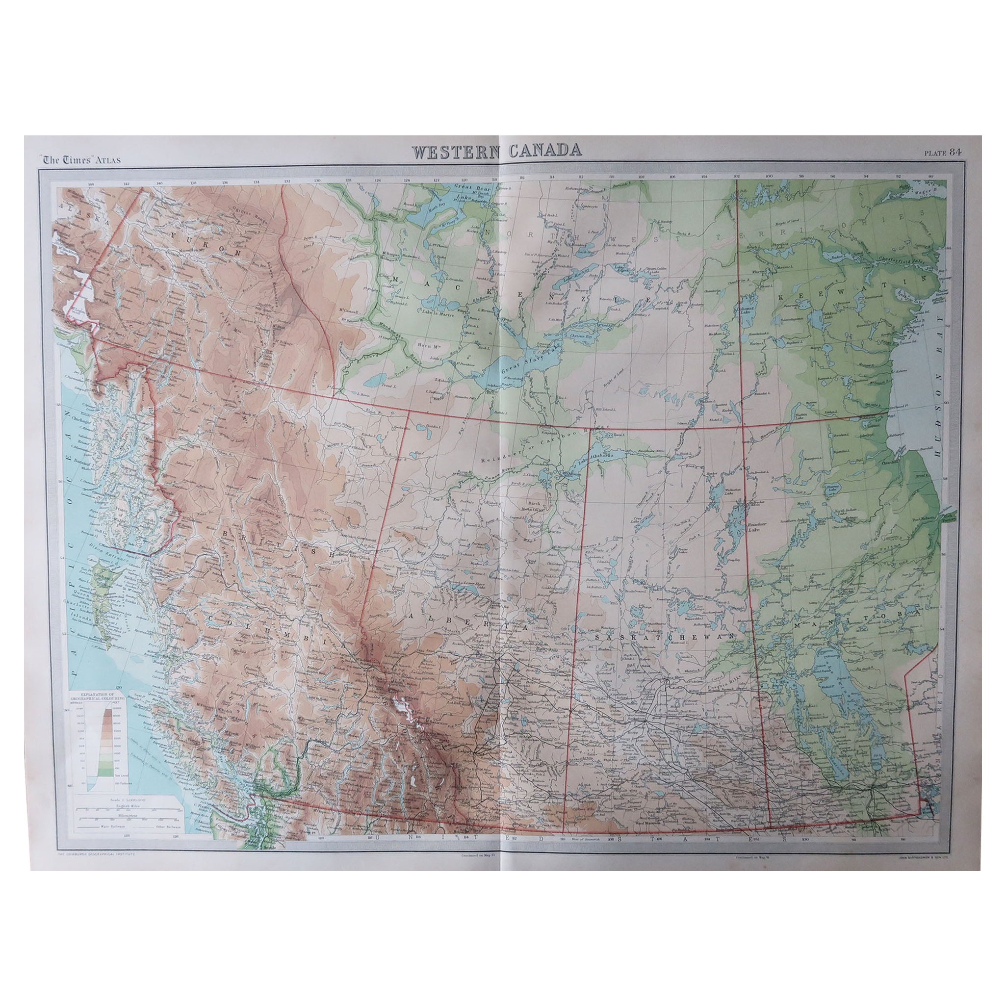
- Large Original Vintage Map of Western Canada, circa 1920Located in St Annes, LancashireGreat map of Western Canada Unframed Original color By John Bartholomew and Co. Edinburgh Geographical Institute Published, circa 1920 Fr...Category
Vintage 1920s British Maps
MaterialsPaper
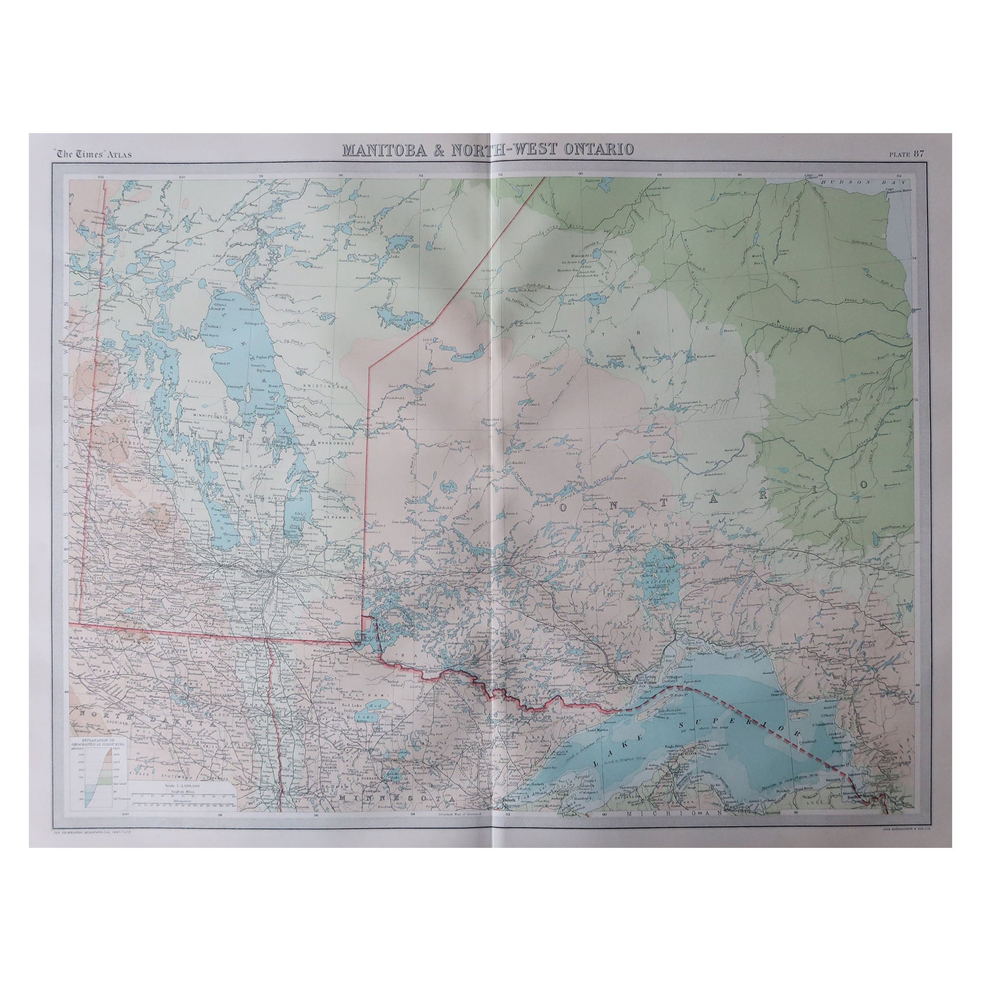
- Large Original Vintage Map of Manitoba, Canada, circa 1920Located in St Annes, LancashireGreat map of Manitoba and part of Ontario Unframed Original color By John Bartholomew and Co. Edinburgh Geographical Institute Published, circa 1920 Free shipping.Category
Vintage 1920s British Maps
MaterialsPaper


You May Also Like
- Beautiful Decorative Hand-Colored Antique Map of West Canada, 1851Located in Langweer, NLDescription: Antique map of Canada titled 'West Canada'. With decorative vignettes titled Kingston and Falls of Niagara. Originates from 'The Illustrated Atlas, And Modern History Of The World Geographical, Political, Commercial & Statistical, Edited By R. Montgomery Martin'. Published; John Tallis London, New York, Edinburgh & Dublin. 1851. Drawn and Engraved by J. Rapkin. Artists and Engravers: John Tallis (1817-1876) was a British map...Category
Antique 1850s Maps
MaterialsPaper
- Original Engraved Antique Map of the World, Colorful and Decorative, C.1780By Pierre François TardieuLocated in Langweer, NLAntique map titled 'Mappemonde en Deux Hemispheres ou l'on a Indique les Nouvelles Decouvertes' - This handsome double hemisphere map presents a ...Category
Antique 18th Century Maps
MaterialsPaper
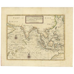
- Antique Map of the East Indies by Moll '1745'Located in Langweer, NLAntique map titled 'A Chart of ye East-Indies. With the Coast of Persia, China also the Philipina, Moluca and Sunda Islands'. Detailed map of the Indian Ocean, Southeast Asia, China,...Category
Antique Mid-18th Century Maps
MaterialsPaper
 $639 Sale Price35% Off
 - Antique Map of the Eastern Hemisphere by Wyld, 1842Located in Langweer, NLAntique map titled 'Eastern Hemisphere'. Large map depicting the continents Europe, Asia, Afrika and Australia. Artists and Engravers: James Wyld (1812–1887) was a British geograph...Category
Antique 19th Century Maps
MaterialsPaper
 $962 Sale Price20% Off
 - Antique Map of the Course of the Rhine River by Blaeu, circa 1640Located in Langweer, NLAntique map titled 'Rhenus Fluviorum Europae celeberrimus, cum Mosa, Mosella, et reliquis, in illum se exonerantibus, fluminibus'. Beautiful map of the course of the Rhine River...Category
Antique Mid-17th Century Maps
MaterialsPaper
 $1,230 Sale Price25% Off
 - Antique Map of the Island of Borneo by Janssonius, circa 1650Located in Langweer, NLAntique map titled 'Insula Borneo et Occidentalis pars Celebis cum adjacentibus Insulis'. Rare sea chart of the island of Borneo. Published by J. Janssonius, circa 1650.Category
Antique Mid-17th Century Maps
MaterialsPaper
 $1,613 Sale Price24% Off