1740s Maps
to
58
68
68
1
2,936
2,181
476
3
289
34
10
127
7
35
9
2
5
4
4
2
68
2
1
1
1
68
68
68
Period: 1740s
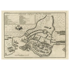
Old Copper Engraving of the Siege of Syracuse, Sicily, Italy, Published, ca.1740
Located in Langweer, NL
Antique print titled 'Syracuse, Assiégée par les Atheniens'.
Old print of the siege of Syracuse, Sicily, Italy. Source unknown, to be determined.
The siege of Syracuse by the...
Category
Antique 1740s Maps
Materials
Paper
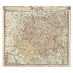
Antique Map of the Region of Elbogen & Eger, Czech Republic & Hungary, 1742
Located in Langweer, NL
Antique map titled 'Repraesentatio Geographica Circuli Egerani, nec non Elnbogensis : in quo simul viae Egeranae in Thermas Carolinas distincta delineatio conspicitur (..)'.
Orig...
Category
Antique 1740s Maps
Materials
Paper
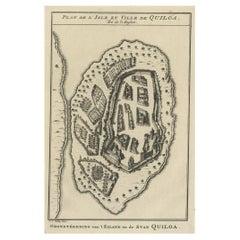
Antique Print of East African Island of Quiloa or Kilwa Kisiwani, Tanzania, 1749
Located in Langweer, NL
Antique print titled 'Plan de l'Isle et Ville de Quiloa, Grondtékening van 't Eiland en de Stad Quiloa'.
This bird's-eye view show the East African island of Quiloa, now known as...
Category
Antique 1740s Maps
Materials
Paper
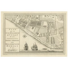
Original Antique Plan of the Dutch Settlement at Chinsura-Hooghly, India, 1746
Located in Langweer, NL
Antique print, titled: 'Plan de la Loge Hollandoise d'Ougly'.
A plan of the Dutch settlement at Chinsura-Hooghly, India. This print originates from Prevost's 'Histoire Generale d...
Category
Antique 1740s Maps
Materials
Paper
Navigational Chart of Mexico's Coast, with Acapulco and Port Marquis, 1748
Located in Langweer, NL
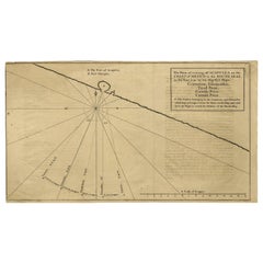
Antique map titled 'The Form of cruising off Acapulca on the Coast of Mexico in the South Seas in the Year 1742. by His Majesty's Ships, Centurion, Gloucester, Tryall Prize, Carmila ...
Category
Antique 1740s Maps
Materials
Paper
Antique Map of Hangzhou, Capital of the Province of Zheijang, China, 1748
Located in Langweer, NL
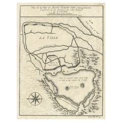
Antique map titled 'Plan de la ville de Hang-Tcheou-Fou ou Hang-Chew-Fu Capitale de la Province de Che-Kiang’.
This original print shows a map of the city of Hangzhou, capital of...
Category
Antique 1740s Maps
Materials
Paper
Old Print of Fort James on Kunta Kinteh Island on the Gambia River, Africa, 1746
Located in Langweer, NL
Antique print titled 'Plan de l’lle James sur la Gambra en 1732, Vue de Fort James du côte du Nord-Est, Vue de Fort James du côte de N.N. Ouest'.
Old print of Kunta Kinteh Island on the Gambia...
Category
Antique 1740s Maps
Materials
Paper
Uncommon and Rare Map of the Caspian Sea by Order of the Czar, 1742
Located in Langweer, NL
Antique map, titled: 'Kaert van de Kaspische Zee volgens bevel van den Czaer (…).'
Uncommon map of Caspian Sea. Source unknown, to be determined.
Ar...
Category
Antique 1740s Maps
Materials
Paper
Old Town View of the Fula Tribe and Its Cotton Plantations, Gambia, Africa, 1748
Located in Langweer, NL
Antique print titled 'Vue d'une Ville des Foulis et de ses Plantations - Gezigt van eene Stad der Fuli, en derzelver Planteryen'. View of a town of the Fula people and its cotton pla...
Category
Antique 1740s Maps
Materials
Paper
Rare Map of St. Louis on the Island of Hispaniola 'Santa Domingo', 1748
Located in Langweer, NL
Description: Antique map titled 'A New & Exact Planof the Harbour of Port Louis (..)'.
Scarce early plan of the Harbor of St. Louis on the Island of Hispaniola (Santa Domingo), showing the the harbor at the time it was taken by Admiral Knowles in March 1748. Charles Knowles (1704 – 1777) was an officer of the Royal Navy, who saw service during the War of Jenkins' Ear, the War of the Austrian Succession, and the Seven Years War. He also briefly served with the Imperial Russian Navy...
Category
Antique 1740s Maps
Materials
Paper
