Rare Near & Middle East Map by G.W. Bacon & Co. LTD, London, circa 1880
View Similar Items


Want more images or videos?
Request additional images or videos from the seller
1 of 9
Rare Near & Middle East Map by G.W. Bacon & Co. LTD, London, circa 1880
About the Item
- Dimensions:Height: 30.75 in (78.11 cm)Width: 40.75 in (103.51 cm)Depth: 0.2 in (5.08 mm)
- Materials and Techniques:
- Place of Origin:
- Period:
- Date of Manufacture:circa 1880
- Condition:Wear consistent with age and use. Folded dimensions 8" x 10".
- Seller Location:San Francisco, CA
- Reference Number:1stDibs: LU5199219585232
About the Seller
5.0
Gold Seller
These expertly vetted sellers are highly rated and consistently exceed customer expectations.
Established in 1985
1stDibs seller since 2020
317 sales on 1stDibs
Typical response time: 10 hours
More From This SellerView All
- Mid-18th Century Hand Drawn English Farm Map on Vellum, circa 1740sLocated in San Francisco, CAMid-18th century hand drawn English farm map on Vellum circa 1740s Henry Maxted & Isaac Terry, Surveyors. A Map of a Farm in the Parish of Blean in the County of KENT: Belonging to Mrs Elizabeth Hodgson circa 1743. A beautiful hand drawn map...Category
Antique Mid-18th Century English Maps
MaterialsLambskin
- 1868 Map of the Upper Part of the Island of Manhattan Above 86th StreetBy Wm. Rogers Mfg. Co.Located in San Francisco, CAThis wonderful piece of New York City history is over 150 years old. It depicts 86th street and above. It was lithographed by WC Rogers and company. It was made to show what was the Battle of Harlem during the Revolutionary war...Category
Antique 1860s American American Colonial Maps
MaterialsPaper
- Mid-19th Century Cast Iron Match Holder by Zimmerman of Hanau Germany circa 1850Located in San Francisco, CARare mid-19th century cast iron match holder by Zimmerman of Hanau, Germany, circa 1850 This woman in her night clothes lights her way holdi...Category
Antique Mid-19th Century German Tobacco Accessories
MaterialsIron
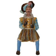
- Vintage Christmas Holiday Musketeer Doll, circa 1940s-1950sLocated in San Francisco, CAVintage Christmas Holiday Musketeer Doll, circa 1940s-1950s Hand painted. Handmade clothing. Very nice vintage doll. Unsure if it's wood or papier...Category
Mid-20th Century American Toys and Dolls
MaterialsMachiche
- Vintage Large Scale "Kodak Film" Advertisement, circa 1950Located in San Francisco, CAVintage large scale "Kodak Film" advertisement, circa 1950 A young couple below a sky of clouds - A great vintage photo by Kodak Dimensions: 29.25" wi...Category
Mid-20th Century American Decorative Art
MaterialsPaper
- 19th Century Shakespeare 10 Volumes, circa 1894Located in San Francisco, CA19th century Shakespeare 10 volumes, circa 1894 Edited by William Aldis Wright Macmillan and Co., London and New York Each volume measures 7" wide x 10.5" high Offered as...Category
Antique Late 19th Century American Books
MaterialsPaper
 $1,650 / set


You May Also Like
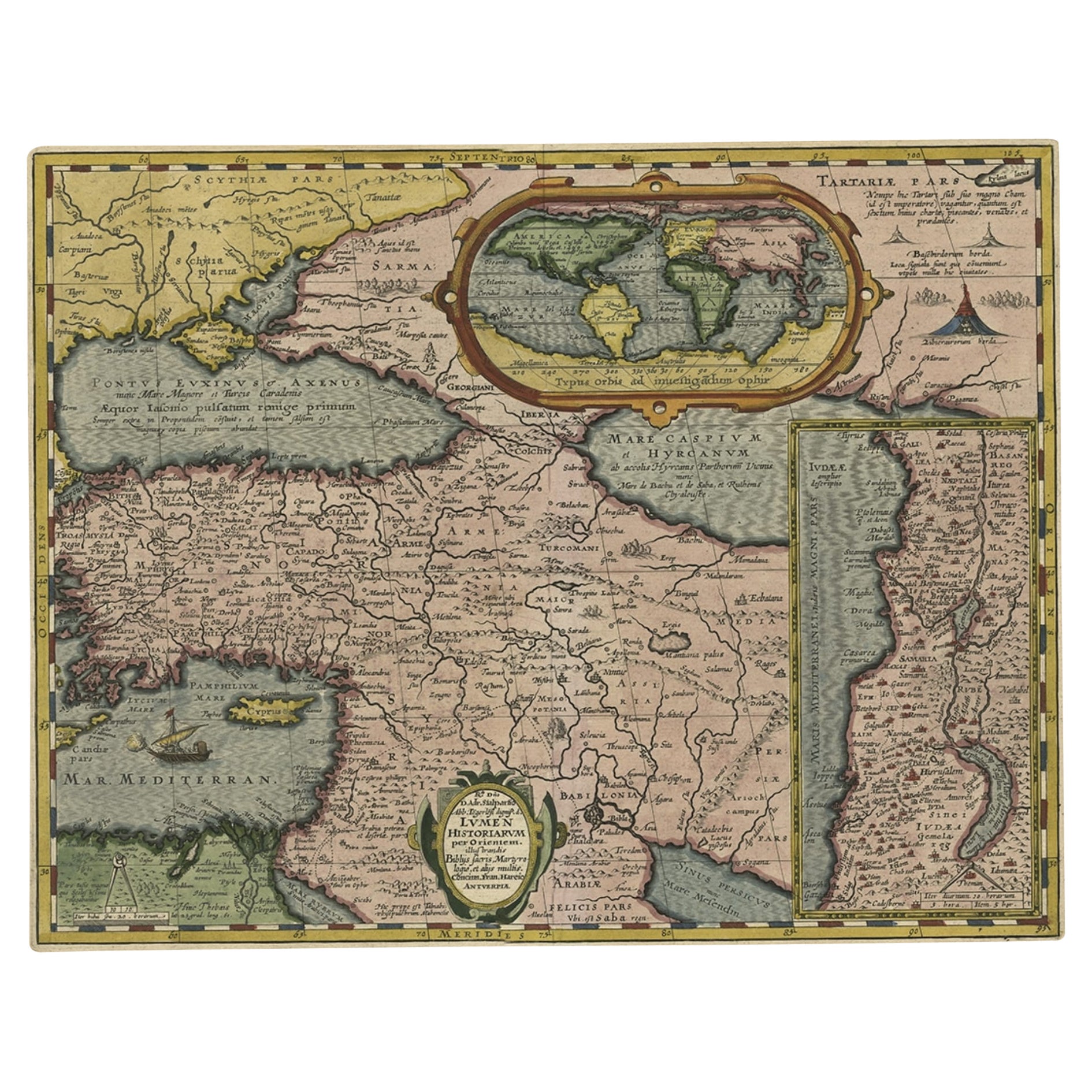
- Rare Antique Map of the Middle East, ca.1690Located in Langweer, NLDescription: Antique print, untitled. Two decorative maps on one sheet of the middle east in biblical times. Source unknown, to be determined. Artists and Engravers: Anonymous...Category
Antique 1690s Prints
MaterialsPaper
- Antique Map of the Middle East by Perthes, 1848Located in Langweer, NLAntique map titled 'Terra inter Euphratem et Indum Antiqua'. Old map of the Middle East originating from 'Orbis Terrarum Antiquus in usum Schola...Category
Antique 19th Century Maps
MaterialsPaper
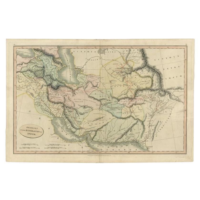
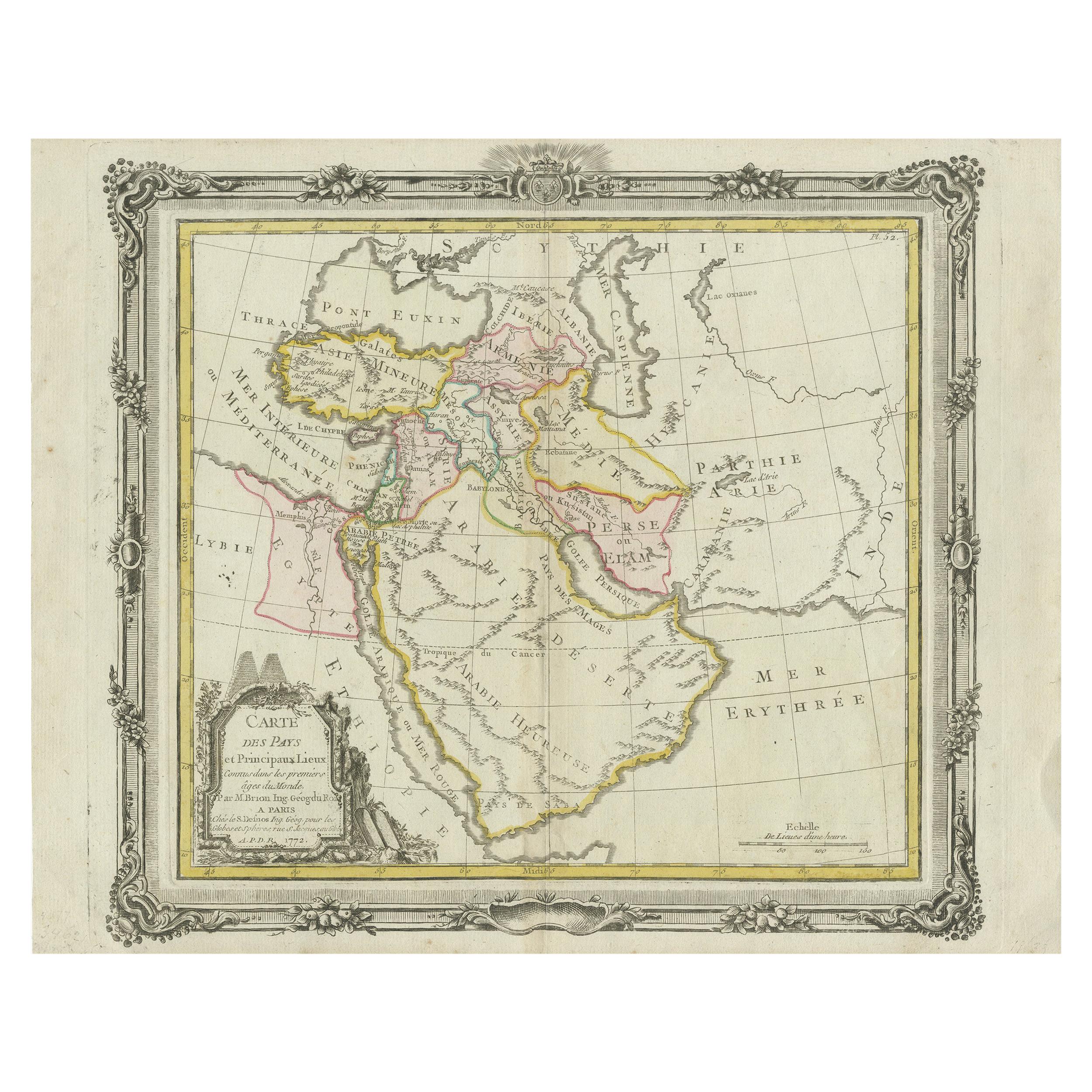
- Antique Map of the Middle East by Smith, 1809Located in Langweer, NLAntique map titled 'Regiones inter Euphraten et Indum'. Old map of the Middle East showing the region between the Euphrates and Indus river. Ori...Category
Antique 19th Century Maps
MaterialsPaper
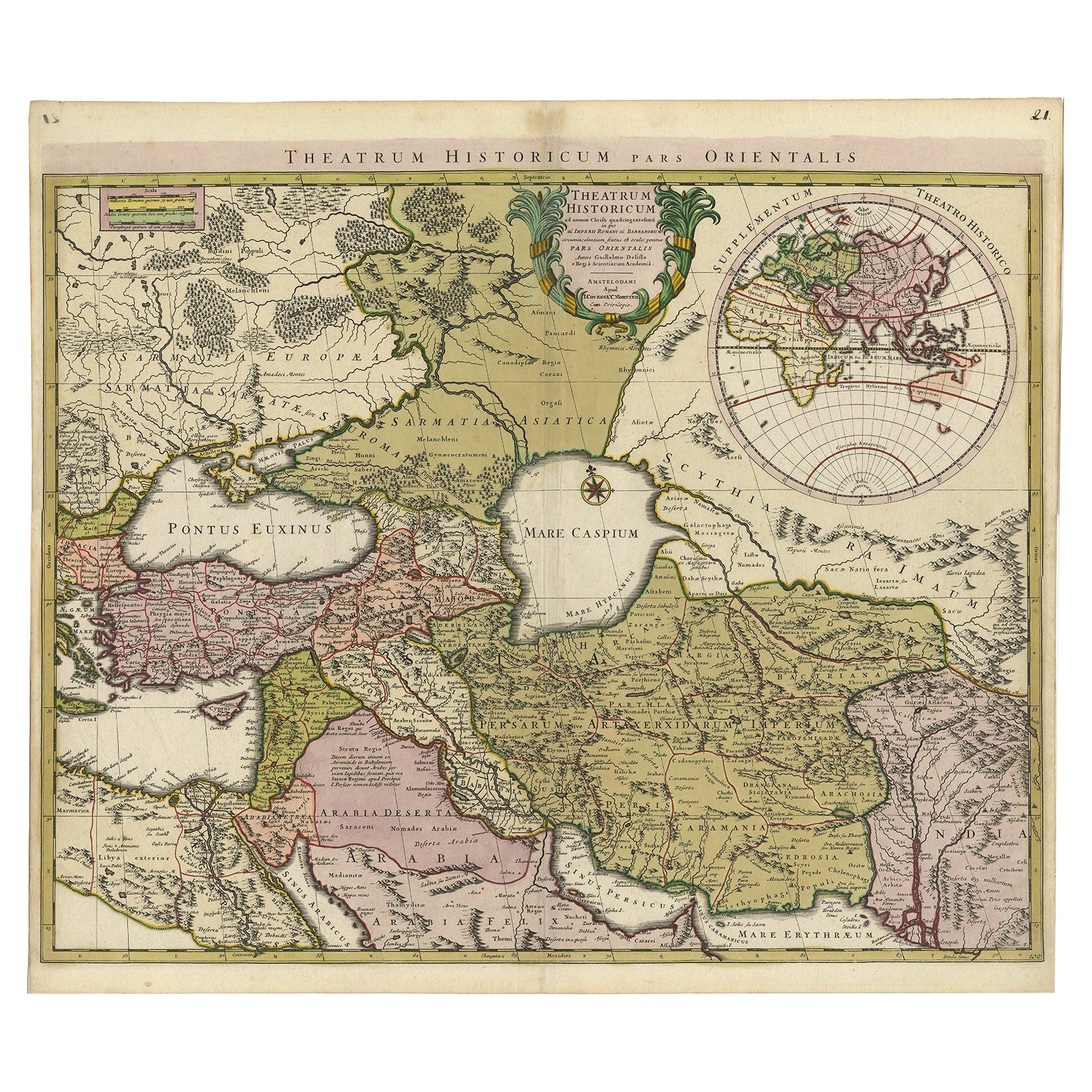
- Antique Map of the Middle East by Mortier, 1700Located in Langweer, NLAntique map titled 'Carte de la Situation du Paradis Terrestre (..)'. Detailed map of the Holy Land and the Middle East, centered on the Garden of Eden and including a large Cyprus. ...Category
Antique 18th Century Maps
MaterialsPaper
 $210 Sale Price20% Off
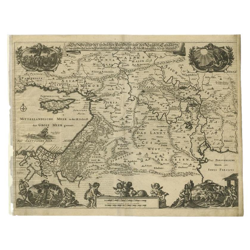
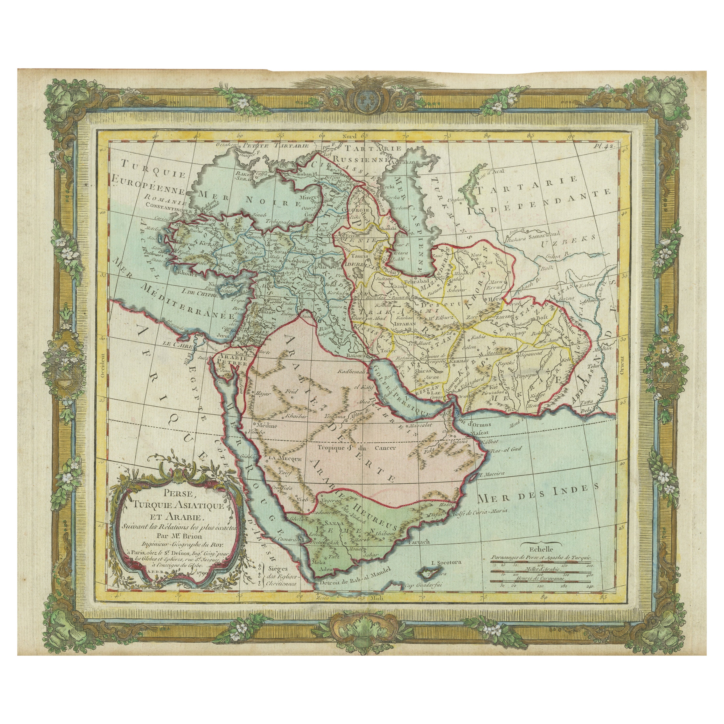
 - Antique Map of the Middle East by Von Sandrart, 1708Located in Langweer, NLAntique map titled 'Die Gegend des Irdlisches Paradieses und des Landes Kanaan.' Map of the Middle East with a prominent Cyprus. The map shows t...Category
Antique 18th Century Maps
MaterialsPaper
- Antique Bible Map of the Middle East by A. Schut, 1743Located in Langweer, NLAntique map titled 'De Gelegentheyt van 't Paradys en 't Landt Canaan'. Dutch Bible map covering the region between the Mediterranean and the Persian Gulf, ...Category
Antique Mid-18th Century Maps
MaterialsPaper
 $453 Sale Price24% Off