Hand-Crafted Maps
to
1
14
7
21
5
3
2
2
2
1
1
5
9
7
1
2
1
1
1
14
9
6
5
2
19
11
11
4
3
21
21
21
1
1
1
1
1
Technique: Hand-Crafted
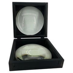
Large European 1930's Nautical Map Reader Magnifying Glass
Located in Haddonfield, NJ
This European set of two nautical magnifying glass map-readers are quite unusual and rarely found. It is fully encased in it's heavy wooden and metal enforced box. Hailing from betwe...
Category
1930s German Industrial Vintage Hand-Crafted Maps
Materials
Metal
$2,000 Sale Price
20% Off
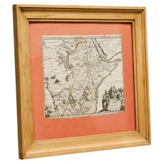
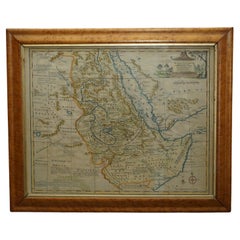
Willem Janszoon Blaeu Rare Original 17th Century Map of Ethiopia in a Pine Frame
By Willem Blaeu
Located in Meer, VAN
Willem Janszoon Blaeu Rare Original 17th Century Map of Ethiopia in a Pine Frame
Rare early 17th century map of Ethiopia by Willem Janszoon Blaeu. The Netherlands.
A so called ‘'A...
Category
17th Century Antique Hand-Crafted Maps
Materials
Pine, Paper
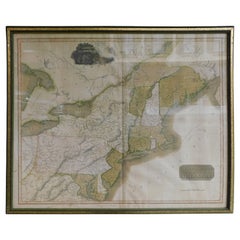
English Engraved Hand Colored Map of the North Eastern United States, circa 1817
Located in Charleston, SC
English copper engraved hand colored map of the North Eastern United States matted under glass in a gilt frame, Early 19th Century. Drawn and Engraved for Thomson's New General Atlas...
Category
1810s English George III Antique Hand-Crafted Maps
Materials
Glass, Giltwood, Paint, Paper
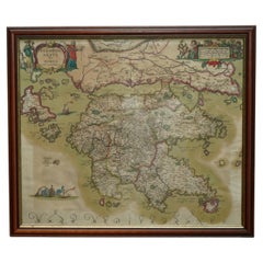
Greece 1660 Jan Jansson Watercolour Map Peloponesus Sive Morea I Laurenbergio
Located in West Sussex, Pulborough
We are delighted to offer for sale this Jan Jansson Date: 1660 (published) Amsterdam map of Greece.
This is an authentic antique map of Peloponnese or...
Category
1660s Danish Dutch Colonial Antique Hand-Crafted Maps
Materials
Copper
London 1744 Published Watercolour Antique Map of East Africa by Eman Bowen
Located in West Sussex, Pulborough
We are delighted to offer for sale this New and Accurate Map of Nubia & Abissinia, together with all the Kingdoms Tributary Thereto, and bordering upon them published in 1744 by Emanuel Bowen
This is a decorative antique engraved map of East Africa...
Category
1740s English George III Antique Hand-Crafted Maps
Materials
Paper
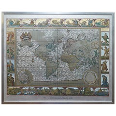
Silver Leaf Foil Wall World Map Engraving Based on the Original Moses Pitt, 1681
Located in West Sussex, Pulborough
We are delighted to offer for sale this lovely antique style pictorial silver leaf foil world map taken from and original engraving my Moses Pitt, 1681
This is a very interesting ...
Category
20th Century English Modern Hand-Crafted Maps
Materials
Silver Leaf
18th Century Map of French Pyrenees Region of France
Located in Haddonfield, NJ
An antique map titled "Principatus Benearnia, La Principaute De Bearn" created by the renowned Dutch cartographer Willem Janszoon Blaeu.
It depicts the Principality of Bearn, a histo...
Category
1880s Danish Baroque Antique Hand-Crafted Maps
Materials
Wood, Paper
19th Century Reprint of 16th Century Harbor Map of Copenhagen
Located in Haddonfield, NJ
This reprint of 1587 antique map of Copenhagen, Denmark retains its original mid-century mat and has been recently reframed in classic wood frame. The muted sepia colored map is a wo...
Category
1880s Danish Baroque Antique Hand-Crafted Maps
Materials
Wood, Paper
Gold Leaf Foil Pictorial Plan Map of the West Country of England Antique Style
Located in West Sussex, Pulborough
We are delighted to offer for sale this lovely Antique style pictorial plan map of the West Country of England etched in gold leaf foil
This is a very interesting and decorative p...
Category
20th Century English Adam Style Hand-Crafted Maps
Materials
Gold Leaf
Vintage World Map Mirror Based on the Original by Johnson 1882 Military Campaign
Located in West Sussex, Pulborough
We are delighted to offer for sale this lovely Antique style pictorial plan map of the globe based on the original by Johnson in 1882
This is a very interesting and decorative pie...
Category
20th Century English Campaign Hand-Crafted Maps
Materials
Mirror
Large 1950's Philips' Hanging Globe
By Philips
Located in Hastings, GB
A superb decorators' interior design piece, this very large hanging globe made by the Philips' company in the 1950's hangs from a brass chain, the ...
Category
1950s English Mid-Century Modern Vintage Hand-Crafted Maps
Materials
Brass
Framed 17th Century Map of Cumberland, England by John Speed, 1610
By John Speed
Located in Middleburg, VA
A fascinating and richly detailed antique map of Cumberland County in northwest England, drawn and published by the celebrated English cartographer John Spe...
Category
Early 17th Century English British Colonial Antique Hand-Crafted Maps
Materials
Copper, Gold Leaf
French Framed Copper Engraved Hand Colored Map of Carolina & Georgia, Circa 1757
Located in Charleston, SC
French copper engraved hand colored map of Carolina & Georgia matted under glass with a painted frame, mid-18th century
Category
1750s French Louis XV Antique Hand-Crafted Maps
Materials
Glass, Wood, Paint, Paper
Rare and Early Plaster Relief Map of Adirondack Mountains by F J H Merrill
By E. W. Merrill, P.F. Howells
Located in Buffalo, NY
Rare and Early Monumental Plaster Relief Map of Adirondack Mountains by The University of the State of New York, New York State Museum..F J H Merrill director,,,modeled by Howell's ...
Category
1910s American Industrial Vintage Hand-Crafted Maps
Materials
Plaster, Wood
Beautiful Colour French Antique 1856 Hand Watercolour Map of Dept Des La Corse
Located in West Sussex, Pulborough
We are delighted to offer for sale this stunning 1856 hand watercolour map of the Austrian Alps titled Dept Des La Course taken from the Atlas National ...
Category
1850s French Early Victorian Antique Hand-Crafted Maps
Materials
Paper
Fine Antique 1856 Hand Watercolour Map of Dept Des Hautes Alpes by Levasseur's
Located in West Sussex, Pulborough
We are delighted to offer for sale this stunning 1856 hand watercolour map of the Austrian Alps titled Dept Des Hautes Alpes taken from the Atlas National...
Category
1850s French Early Victorian Antique Hand-Crafted Maps
Materials
Paper
Fine French Antique 1856 Hand Watercolour Map of Dept Des Hautes Pyrenees
Located in West Sussex, Pulborough
We are delighted to offer for sale this stunning 1856 hand watercolour map of the Austrian Alps titled Dept Des Hautes Pyrenees taken from the Atlas Nat...
Category
1850s French Early Victorian Antique Hand-Crafted Maps
Materials
Paper
Staffordshire 1645 Hand Colored Antique Print Staffordiensis Comitatvs Map
Located in West Sussex, Pulborough
We are delighted to offer for sale this lovely antique Atlas page map of Staffordshire printed in 1645 Amsterdam Staffordiensis Comitatvs Vulgo
This o...
Category
Early 1800s English Georgian Antique Hand-Crafted Maps
Materials
Paper
Double Sided and Glazed Cheshire 1645 Hand Colored Antique Print Map Rare Find
Located in West Sussex, Pulborough
We are delighted to offer for sale this lovely antique Atlas page map of Cheshire printed in 1645 Amsterdam Staffordiensis Comitatvs Vulgo
I have thre...
Category
Early 1800s English Georgian Antique Hand-Crafted Maps
Materials
Paper
Double Sided Northamptonshire 1645 Hand Colored Antique Print Map Rare Find
Located in West Sussex, Pulborough
We are delighted to this lovely antique Atlas page map of Northamptonshire printed in 1645 Amsterdam Staffordiensis Comitatvs Vulgo
I have three of th...
Category
Early 1800s English Georgian Antique Hand-Crafted Maps
Materials
Paper
FRAME DRIVING SCHOOL 70 S 20th Century
Located in Madrid, ES
Large Globe 50S
THE GLOBE IS IN PLASTIC AND THE FOOT IN WOOD. 1950s. IT HAS LIGHT. GOOD CONDITION WITH CENTURIES OF USE. MEASUREMENTS: 110 CM IN HEIGHT AND 60 CM IN DIAMETER
good con...
Category
20th Century English Modern Hand-Crafted Maps
Materials
Plastic, Wood
Related Items
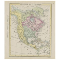
Small Map of the United States, circa 1870
Located in Langweer, NL
Antique map titled 'Amérique septe. Physique'. Small map of the United States. lithographed by C. Callewaert brothers in Brussels circa 1870.
Category
Mid-19th Century Belgian Antique Hand-Crafted Maps
Materials
Paper
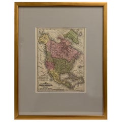
Framed 1839 Hand Colored Map of the United States
Located in Stamford, CT
Framed hand colored map of the United States of America from 1839. Newly framed in a giltwood frame.
Category
1830s American American Classical Antique Hand-Crafted Maps
Materials
Giltwood, Paper, Glass
American Nautical Brass Yacht Binnacle Mounted in Mahogany Case, Circa 1890
Located in Charleston, SC
American nautical mahogany yacht binnacle with a hinged locking oval glass viewing port, original removable brass side light burner with font, brass carrying handle, and fitted with ...
Category
1890s American American Empire Antique Hand-Crafted Maps
Materials
Brass
$6,500
H 10 in W 10.5 in D 8 in
Antique Map of Venezuela by Montanus, 1671
Located in Langweer, NL
Antique map titled 'Venezuela cum parte Australi Novae Andalusiae'. The map extends from Coquibocoa to the Orinoque River, centered on Bariquicemento and Cape de Curiacao. Large cart...
Category
Mid-17th Century English Antique Hand-Crafted Maps
Materials
Paper
Large Danish Maple and Mahogany Pond Yacht Ship Model
Located in Kastrup, DK
Large elegant wooden pond yacht ship model in maple and mahogany.
High quality, hand-built. Deck fitted with small screws.
Denmark 1920-1930....
Category
Early 20th Century Danish Other Hand-Crafted Maps
Materials
Brass
One of the most influential maps of America ever made, 17th Century Willem Blaeu
By Willem Blaeu
Located in ZWIJNDRECHT, NL
A rare and important 17th Century Italian Engraving of Willem Blaeu's Great Wall Map of America, "America quarta pars orbis quam plerunq, nuvum orbem apellitant primo detecta est ann...
Category
17th Century Dutch Dutch Colonial Antique Hand-Crafted Maps
Materials
Paper, Linen
$88,953
H 33.9 in W 43.3 in D 0.1 in
End 19th century Large Nautical Mahogany Rudder with Eight Spokes Bronze Hub UK
Located in Milan, IT
Large mahogany rudder with eight spokes with bronze hub. English manufacture of the end of the 19th century. Diameter 130 cm - inches 51.2, depth 15 cm - inches 5.9.
There are evidences showing that already in the third millennium BC, in ancient Egypt, people used wooden oars...
Category
Late 19th Century British Antique Hand-Crafted Maps
Materials
Wood
$2,965
H 5.9 in Dm 51.2 in
Folk Art Scratch Built Boat, Early 20th C
Located in London, GB
Scandinavian folk art boat of 2 rigged masts - completely scratch built from pine and teak wood. Original paint finish. Handmade and dating from the earl...
Category
Early 20th Century Scandinavian Folk Art Hand-Crafted Maps
Materials
Steel
Antique Map of The United States of North America, Pacific States, 1882
Located in Langweer, NL
The map is from the same 1882 Blackie Atlas and focuses on the Pacific States of the United States of America during that period. Here are some details and historical context about t...
Category
1880s Antique Hand-Crafted Maps
Materials
Paper
$237 Sale Price
20% Off
H 14.97 in W 11.03 in D 0 in
Vintage Large Nautical Maritime Brass Glass Ship's Hourglass Display Model Timer
Located in San Diego, CA
Very unique large maritime/nautical brass and glass hourglass. Wonderful dorm and design. Brass has a wonderful patina and can be polished if desired. H...
Category
Mid-20th Century American Hand-Crafted Maps
Materials
Bronze
$1,440 Sale Price
20% Off
H 19.5 in W 7.25 in D 7.25 in
Scale Nautical Vintage Model of an English Motorboat, 1950s
Located in Milan, IT
Scale model of an English motorboat (antique motor yacht) from the 1950s, wooden planking hull. Measures: Length 57 cm, 23.44 inches, width 13.5 cm, 5.3 ...
Category
1950s British Vintage Hand-Crafted Maps
Materials
Wood
Early 20th Century Folk Art Boat Model Collection
Located in London, GB
Early 20th century Folk Art Boat Model Collection
Every now and again something truly amazing comes along, this is true in this amazing collection of...
Category
1920s British Folk Art Vintage Hand-Crafted Maps
Materials
Brass, Copper
Previously Available Items
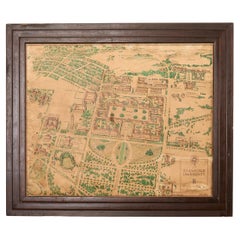
Stanford University Weathered Hand-Colored Map 1943
Located in Rio Vista, CA
Finely detailed hand-colored pictorial framed map of Stanford University, California circa 1943. The print has a faded, weathered patina adding to its character and aged aesthetic. T...
Category
20th Century American Folk Art Hand-Crafted Maps
Materials
Wood, Paper
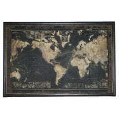
EXTRA LARGE 1.2 X 1.8 METER WORLD MAP ATLAS SHOWiNG VICTORIAN SHIPPING LANES ETC
Located in West Sussex, Pulborough
Royal House Antiques
Royal House Antiques is delighted to offer for sale this lovely antique style Atlas World Map which is extra large and shows old shipping lanes and currents
P...
Category
20th Century Victorian Hand-Crafted Maps
Materials
Wood
H 47.25 in W 70.87 in D 1.58 in
ANTiQUE CIR 1880 J LEBEGUE & CIE PARIS TERRESTRIAL LITHOGRAPH GLOBE CAST IRON
By J. Lebegue & Cie
Located in West Sussex, Pulborough
Royal House Antiques
Royal House Antiques is delighted to offer for sale this absolutely exquisite original Circa 1860-1880 Globe Terrestre by J Lebegue & Cie on an ornately cast sw...
Category
1880s European Victorian Antique Hand-Crafted Maps
Materials
Iron
1650 JOHANNES BLAEU WATERCOLOUR MAP OF GLOUCESTERSHIRE WiTH GOLD GILTWOOD FRAME
Located in West Sussex, Pulborough
Royal House Antiques
Royal House Antiques is delighted to offer for sale this lovely antique Atlas page map of Gloucestershire by Johannes Blaeu circa...
Category
1650s English Charles II Antique Hand-Crafted Maps
Materials
Giltwood, Paper
H 20.08 in W 23.63 in D 0.79 in
Large early 20th century globe on stand by Jordglob
Located in Debenham, Suffolk
Large early 20th century globe on stand by jordglob circa 1909.
Beautiful Swedish globe of generous proportions. A 1909 globe in good condition suspended on a brass arm, which sits...
Category
Early 20th Century Swedish Edwardian Hand-Crafted Maps
Materials
Metal
20th Century Lapis Lazuli Earth Globe, Marquetry in Precious Stones
Located in Valladolid, ES
Amazing Large handmade earth globe with lapis lazuli background and marquetry with semi-precious stones, they are applied following the jewelry technique called "Pietre dure", carefu...
Category
1980s French Mid-Century Modern Vintage Hand-Crafted Maps
Materials
Bronze
Mid-Century Illuminated Replogle World Floor Globe in Wood and Glass, Chicago
Located in Haddonfield, NJ
American 1950's back light green painted floor globe by Replogle, Mid-Century Modern.
Remarkable and charming Chicago made world globe featur...
Category
Mid-20th Century American Mid-Century Modern Hand-Crafted Maps
Materials
Steel
John Cary Travel Celestial Globe in Box Marked Cary & Co London, No. 21540
By John Cary
Located in West Sussex, Pulborough
We are delighted to offer for sale this lovely John Cary Travel Celestial Globe in Box marked Cary & Co London, No. 21540
This globe I believe is classed as a 14 inch which is the...
Category
19th Century English Victorian Antique Hand-Crafted Maps
Materials
Brass
H 8.47 in W 8.08 in D 8.08 in
Spanish Armillary Sphere of Polychrome Wood, Paper and Iron, Early 20th Century
Located in Madrid, ES
Spanish armillary sphere of polychrome wood, paper and iron,
Early 20th century
Measures: 35 x 26cm
Good condition.
Category
20th Century Spanish Modern Hand-Crafted Maps
Materials
Iron
H 13.78 in Dm 10.24 in
World Globe Made of Precious Gemstones with Brass Stand, 7kg
Located in West Sussex, Pulborough
We are so excited to offer for sale this beautiful world globe.
It has a stunning solid brass stand which has been polished.
As mentioned in the title the globe is made of prec...
Category
20th Century British Hand-Crafted Maps
Materials
Multi-gemstone
English Map of West Indies with a Gilt Wood Frame Under Glass, Late 19th Cent
Located in Charleston, SC
English hand colored accurate map of the West Indies with a foliage gilt wood and gesso frame under glass, Late 19th century. Long West from London.
Category
Late 19th Century English Victorian Antique Hand-Crafted Maps
Materials
Gesso, Glass, Giltwood, Paint, Paper
H 13.75 in W 16.75 in D 0.75 in
Framed Britannia Map Hand Tinted and Colored, Signed Matthaus Seutter, C. 1725
Located in Charleston, SC
Framed and Matted Britannia Map hand tinted and colored with gilt frame.
Signed Matthaus Seutter, 1725
Seutter was one of the most important and prolific German map publishers of t...
Category
1720s German George II Antique Hand-Crafted Maps
Materials
Glass, Giltwood, Paper
H 33 in W 28.75 in D 1.25 in
Recently Viewed
View AllMore Ways To Browse
Vintage Figurines Made In Italy
Vintage Gazelle Glasses
Vintage Goodwood
Vintage Hand Carved Wooden Birds
Vintage Hermes Saddle
Vintage Jade Stone
Vintage Ken Edwards Pottery
Vintage Magazine Table
Vintage Metal Calendar
Vintage Minature
Vintage Pink Rose China
Vintage Radio Case
Vintage Rattan Cabinet
Vintage Sailfish
Vintage Swan Mirror
Vintage Wet Bar
Vintage Wooden Puzzles
Vinyl Audio Cabinet
