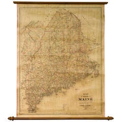
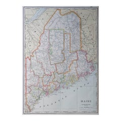
1887 Maine Wall Map with Original Hanging Hardware
View Similar Items


Want more images or videos?
Request additional images or videos from the seller
1 of 3
1887 Maine Wall Map with Original Hanging Hardware
About the Item
- Dimensions:Height: 34 in (86.36 cm)Width: 26.5 in (67.31 cm)Depth: 1 in (2.54 cm)
- Place of Origin:
- Period:
- Date of Manufacture:1887
- Condition:Wear consistent with age and use.
- Seller Location:Colorado Springs, CO
- Reference Number:Seller: M1081stDibs: LU9097961022
About the Seller
4.9
Platinum Seller
These expertly vetted sellers are 1stDibs' most experienced sellers and are rated highest by our customers.
Established in 2010
1stDibs seller since 2011
400 sales on 1stDibs
More From This SellerView All
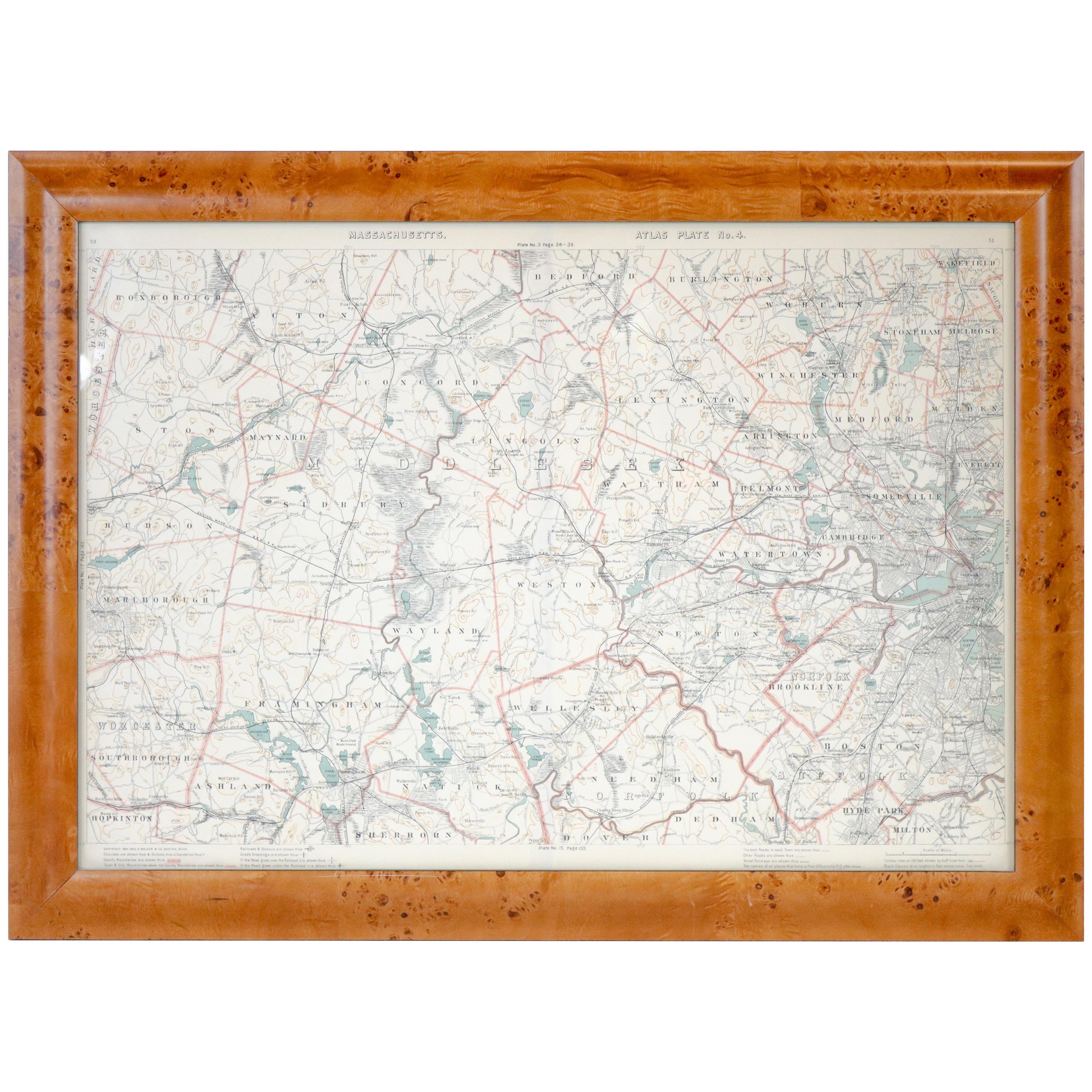
- 1854 Map of Massachusetts, Connecticut and Rhode Island, Antique Wall MapLocated in Colorado Springs, COThis striking wall map was published in 1854 by Ensign, Bridgman & Fanning and has both full original hand-coloring and original hardware. This impression is both informative and highly decorative. The states are divided into counties, outlined in red, green, and black, and subdivided into towns. Roads, canals, and railroad lines are prominently depicted, although they are not all labeled. The mapmakers also marked lighthouses, banks, churches, and prominent buildings, with a key at right. The map is an informative and comprehensive overview of the infrastructural development of New England prior to the Civil War. Physical geographies depicted include elevation, conveyed with hachure marks, rivers and lakes. The impression features an inset map of Boston...Category
Antique 19th Century American Maps
MaterialsPaper
- 1915 "San Francisco City and County" Hanging Map by W. Bashford SmithLocated in Colorado Springs, COPresented is a rare wall map of San Francisco by W. Bashford Smith. Published in San Francisco in 1915, this map indicates streets and city districts, and, most notably, shows the si...Category
Vintage 1910s American Art Deco Maps
MaterialsWood, Paper
- "The United States from the Latest Authorities" Antique Wall Map, 1835Located in Colorado Springs, COThis is a 1835 map of “The United States from the Latest Authorities” by Ezra Strong. A hand-colored engraved wall map of the eastern half of the United States, this map has a large inset of the "Oregon District" and several engraved city views and two portraits. The primary map extends to Mexico Texas and the Missouri Territory, showing the course of the Missouri River to Ft. Mandan and Old Ft. Mandan, and noting many forts along the river. The territories to the east of Missouri Territory are separately delineated as Sioux District and Huron District. The western details of the map are very good for a map of this time period, with many Native American settlements, villages, forts and other details noted. The map is bordered with vignettes of Boston, New York, Philadelphia, Hartford, Cincinnati, and Baltimore. Each vignette notes the date settled, primary settler, and the population as of 1830. Two portraits of LaFayette and George Washington are presented in full length with related biographical information. A large inset map at lower right shows the Oregon District, centered on the Columbia River and extending to the Rocky Mountains. This is one of the earliest commercial appearances of a separate map of Oregon...Category
Antique 1830s American Maps
MaterialsPaper
- 1842 Wall Map of the United States by J. H. Young, Published by S. A. MitchellLocated in Colorado Springs, COPresented is an 1842 hanging “Map of the United States,” engraved by J. H. Young and published by Samuel Augustus Mitchell, Philadelphia. This is a beautiful example of the rare 1842...Category
Antique 1840s American Maps
MaterialsPaper
- McClellan's Own Story by George B. McClellan, First Edition, 1887Located in Colorado Springs, COMcClellan, George B. McClellan’s Own Story: The war for the Union, the soldiers who fought it, the civilians who directed it, and his relations to it and them. New York: Charles Webster, 1887. First edition. Illustrated with steel plate engravings and maps. Rebound in quarter navy leather and cloth boards, with raised bands, gilt tooling, and titles to the spine, new marbled endpapers, and a new archival cloth slipcase. Presented is the first edition of George B. McClellan Civil War memoir, McClellan’s Own Story: The War for the Union. The memoir was published posthumously in 1887 by Charles Webster, in New York. It is presented rebound in stunning quarter navy leather and cloth boards, with raised bands, gilt tooling, and titles to the spine, and new marbled endpapers. The book comes with a new archival cloth slipcase, with an inset image of McClellan on the front. General George B. McClellan is one of the most controversial figures of the American Civil War. His chief contribution to the Union cause was his brilliant ability to organize and train troops. Yet he proved to be an overly cautious and indecisive General. Despite early wins in West Virginia, McClellan began to fear the Confederate Army’s growing size and strength. He grew increasingly hesitant to engage without more men or resources and disagreed with many of Lincoln’s war decisions. As a result, McClellan was removed as General-in-Chief in the spring of 1862, though he retained command of the Army of the Potomac. After the Battle of Seven Pines, a hasty retreat to Washington after the Seven Days Battles, and the epic contest at Antietam, McClellan was removed from all command in November of that same year. He went on to become the unsuccessful Democratic Party nominee in the 1864 presidential election against the Republican Lincoln. Criticized after the Civil War, McClellan never publicly defended his actions as commander of the Union army. In this book, however, his memoir provides his answers to the many critics. Using a combination of military documents...Category
Antique 1880s American Books
MaterialsLeather, Paper
- 1847 “World at One View” Antique Hand-Colored Wall Map of the WorldLocated in Colorado Springs, COThis is a highly desirable hanging wall map of the "World at One View", published in 1847 by Ensign and Thayer, New York. This pictorial map was printed as a broadside and features...Category
Antique 19th Century American Maps
MaterialsPaper


You May Also Like
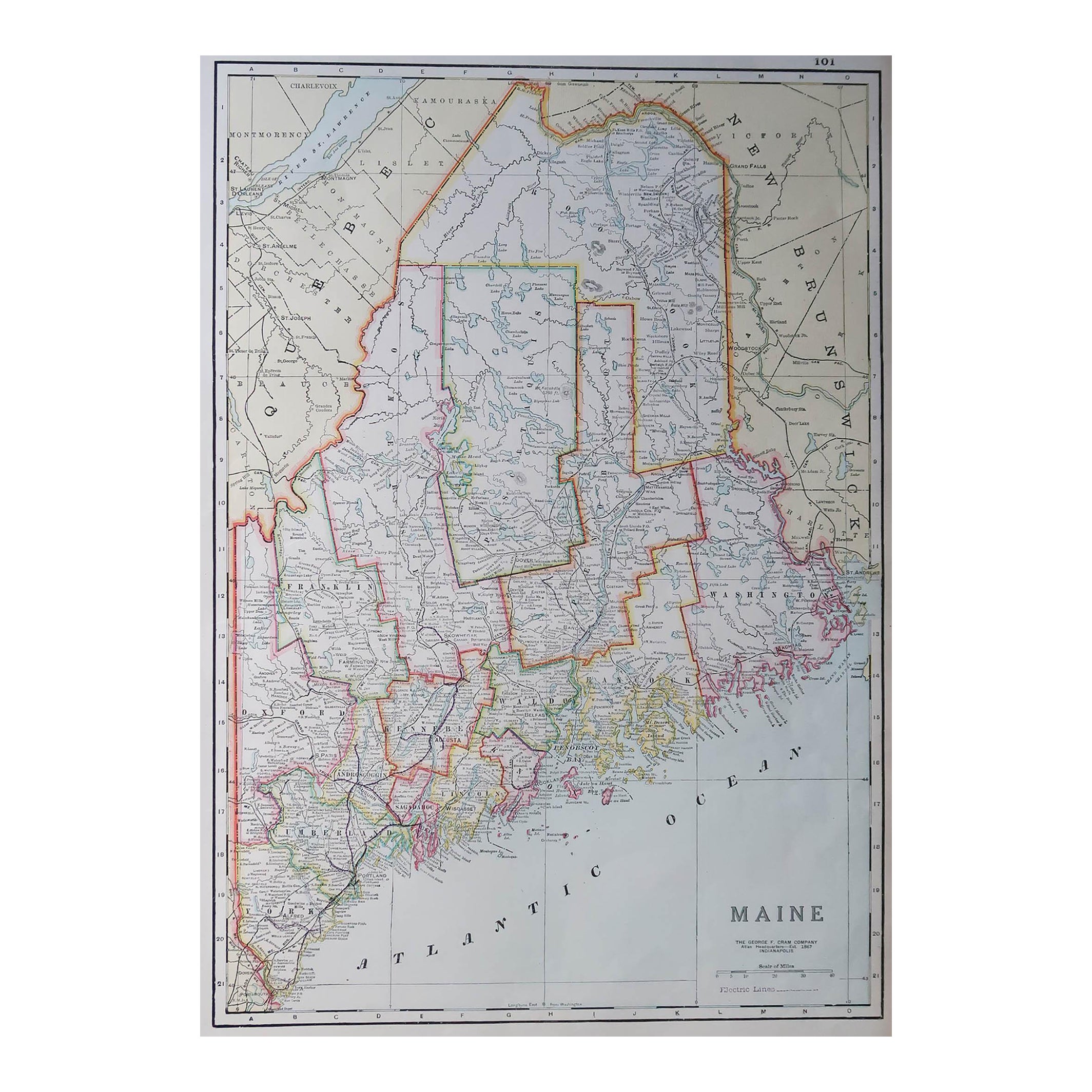
- Large Original Antique Map of Maine, USA, C.1900Located in St Annes, LancashireFabulous map of Maine Original color Engraved and printed by the George F. Cram Company, Indianapolis. Published, C.1900 Unframed Free shipping.Category
Antique 1890s American Maps
MaterialsPaper
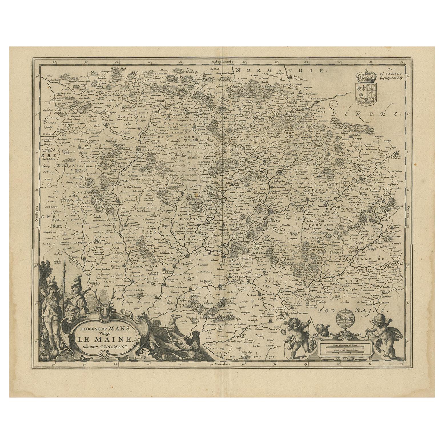
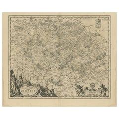
- Antique Map of the Maine Region by Janssonius, 1657By Johannes JanssoniusLocated in Langweer, NLAntique map of France titled 'Diocese du Mans vulgo le Mains'. Decorative map of the region of Maine, France. This map originates from 'Atlas Novus, Sive Theatrum Orbis Orbis Terraru...Category
Antique 17th Century Maps
MaterialsPaper
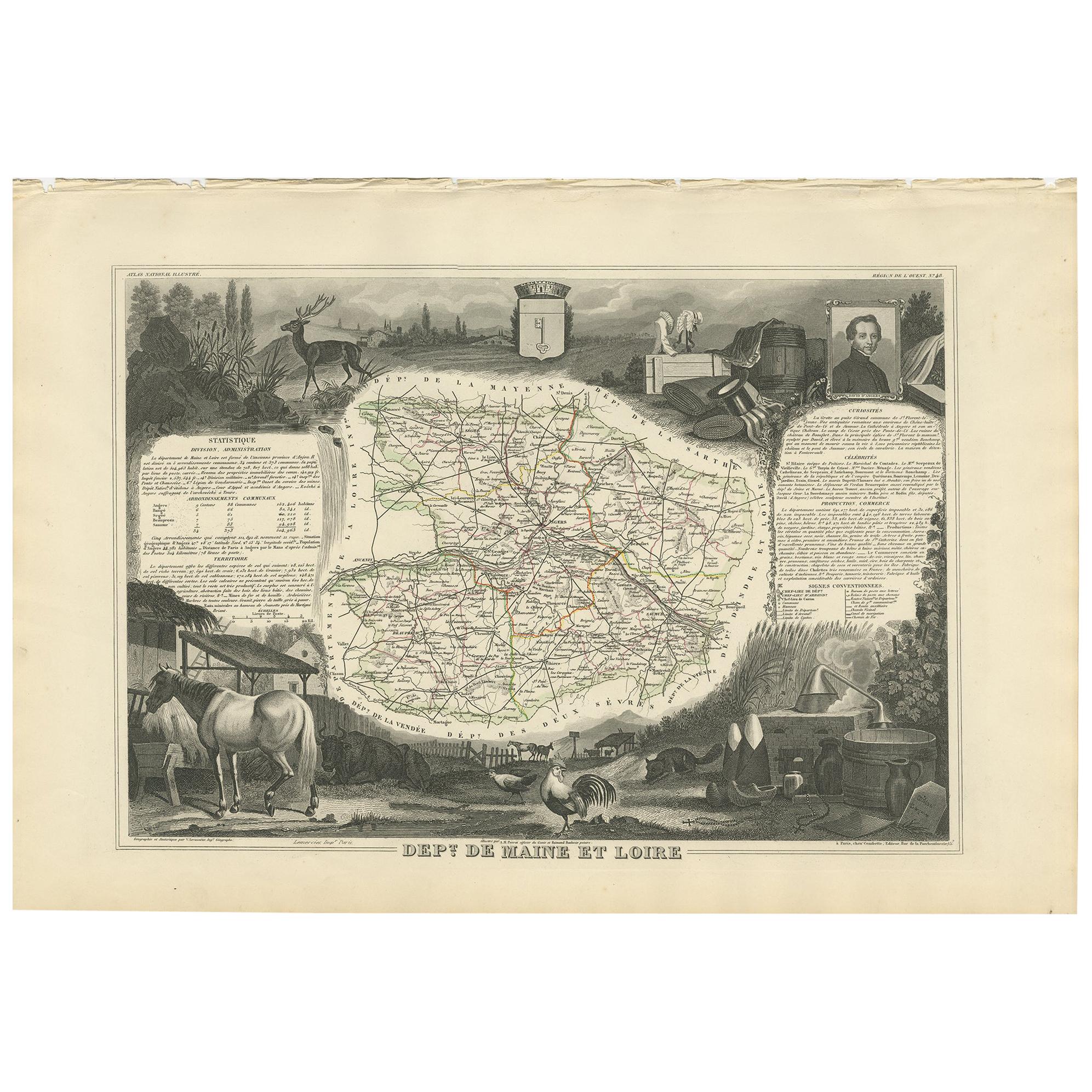
- Antique Map of Maine et Loire ‘France’ by V. Levasseur, 1854Located in Langweer, NLAntique map titled 'Dépt. de Maine et Loire'. Map of the French department of Maine et Loire, France. This area of France is part of the Loire Valley wine region, where nearly every ...Category
Antique Mid-19th Century Maps
MaterialsPaper
 $158 Sale Price20% Off
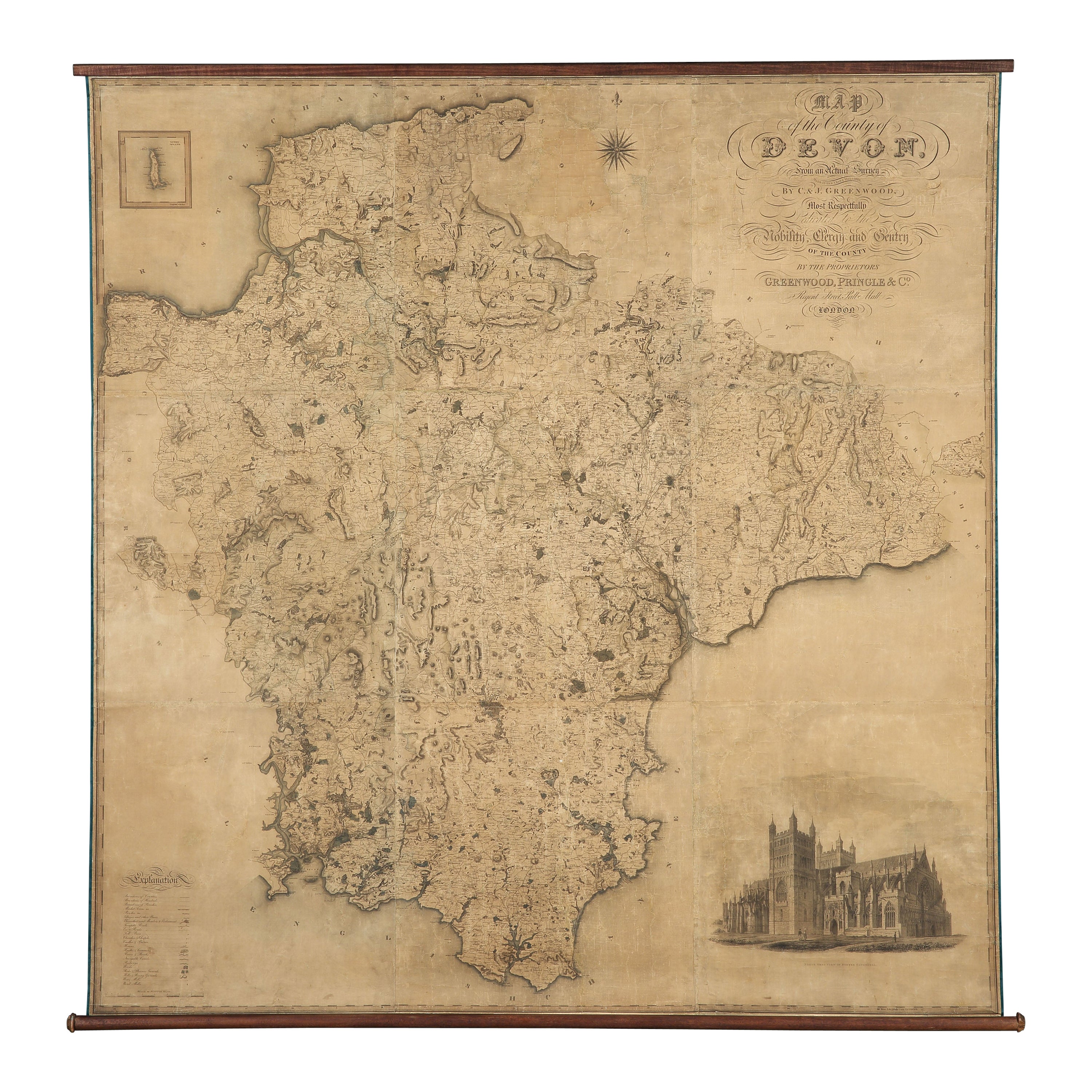
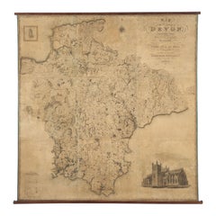
 - Map Hanging Wall County of Devon C&J Greenwood 1827 Exeter Cathedral Lundy IsleLocated in BUNGAY, SUFFOLKC & J GREENWOOD MAP OF THE COUNTY OF DEVON, FROM AN ORIGINAL SURVEY, PUBLISHED 1827, WITH ENGRAVING OF EXETER CATHEDRAL AND MAP OF LUNDY INSET, 6ft 2 ...Category
Antique 1820s English Early Victorian Maps
MaterialsPaper
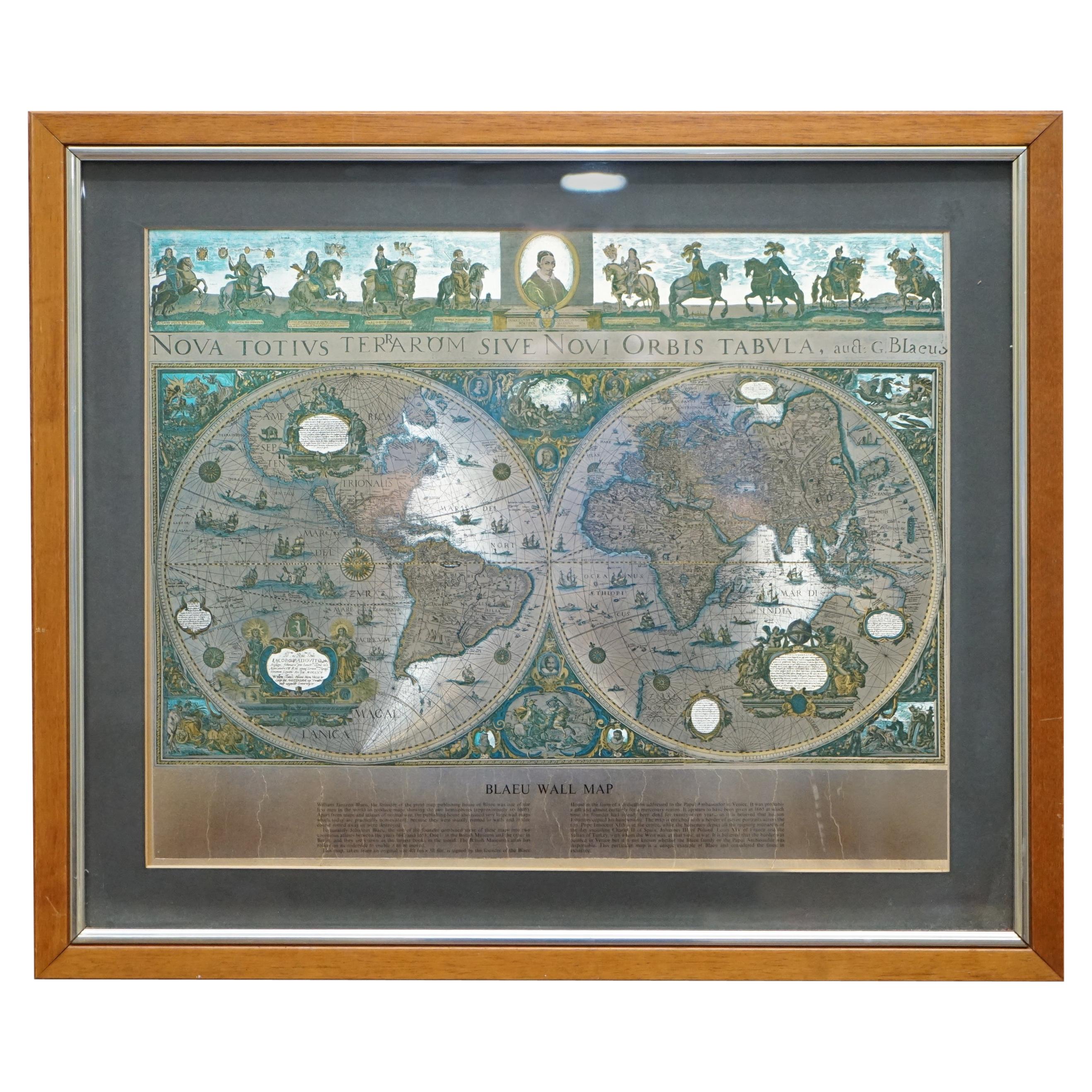
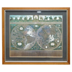
- World Map Silver Leaf Print Based on Original Willem Blaeu Wall Map 1571-1638Located in GBWe are delighted to offer for sale this lovely Antique style pictorial plan map of the globe based on the original Willem Blaeu 1571-1638 engraved in silver leaf foil This is a v...Category
20th Century English Campaign Maps
MaterialsSilver Leaf
- Antique Map of the Region of Maine by Janssonius, circa 1650By Johannes JanssoniusLocated in Langweer, NLAntique map of France titled 'Diocese du Mans vulgo le Mains'. Decorative map of the region of Maine, France. Published by J. Janssonius.Category
Antique Mid-17th Century Maps
MaterialsPaper

Recently Viewed
View AllMore Ways To Browse
Antique Railroad Maps
Map Railroad
Maine Map
Maps Of Maine
Antique Maine Maps
Antique Maine Map
Antique Map Maine
Antique Maps Of Maine
Antique Map Of Maine
Colbys Antique Furniture
George Fleet
Antique Railroad Maps
Map Of New Zealand
Antique Map Art Collectibles
Antique Maps Art Collectibles
James Cook Map
Old Antique Compass
Nautical Charts