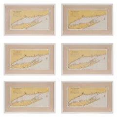
1960s Set of Six Long Island Tidal Current Charts or Maps
View Similar Items


1 of 10
1960s Set of Six Long Island Tidal Current Charts or Maps
About the Item
- Dimensions:Height: 14 in (35.56 cm)Width: 22.5 in (57.15 cm)Depth: 0.75 in (1.91 cm)
- Sold As:Set of 6
- Style:Mid-Century Modern (Of the Period)
- Materials and Techniques:
- Place of Origin:
- Period:
- Date of Manufacture:circa 1960s
- Condition:Wear consistent with age and use. these maps/charts are in good vintage condition with some discoloration of paper consistent with their age. They have been newly matted and framed with high quality materials.
- Seller Location:Culver City, CA
- Reference Number:Seller: B0610018z552zz231stDibs: LU79891475382
You May Also Like
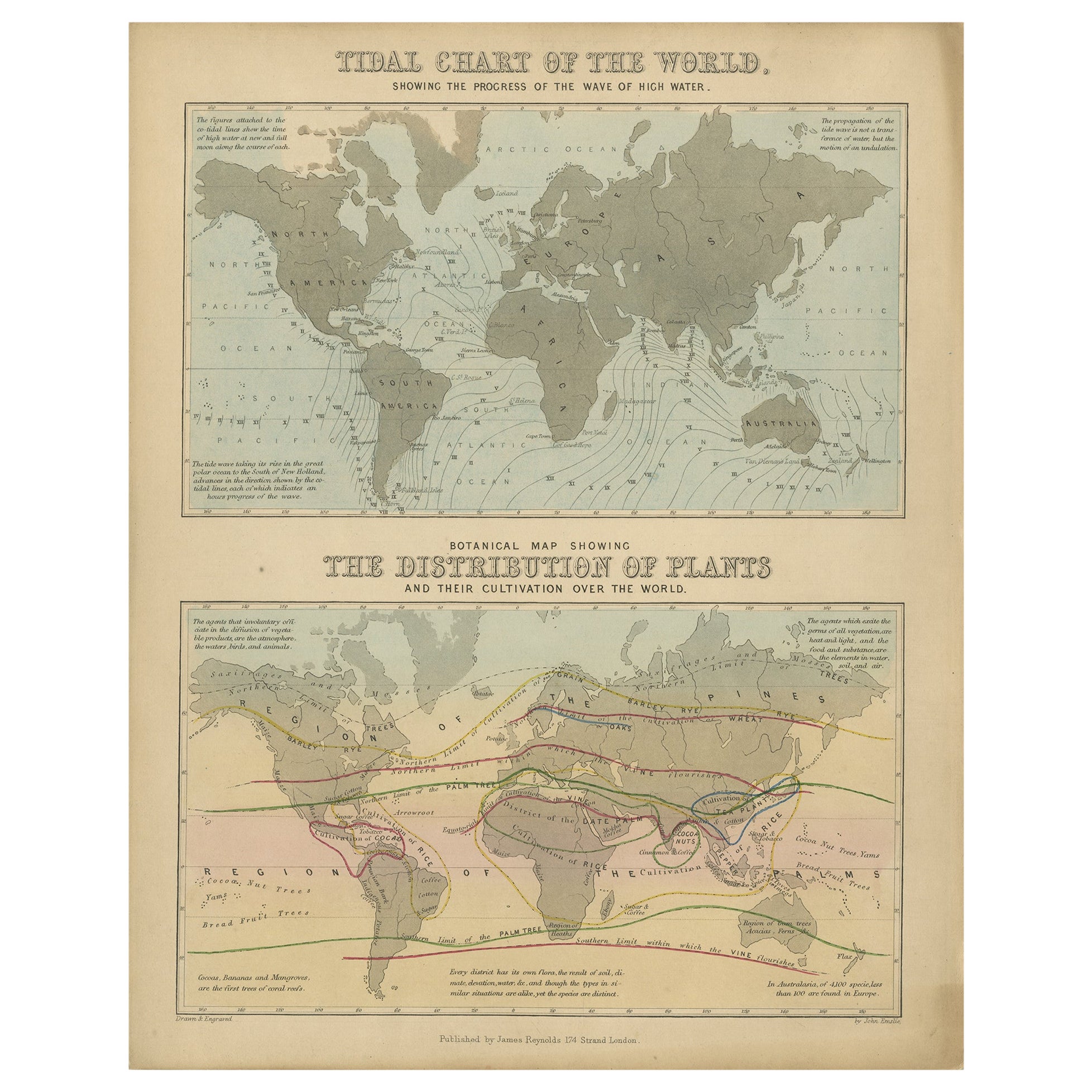
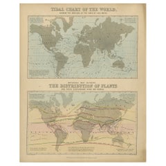
- Antique Tidal Chart and Botanical Map, 1843Located in Langweer, NLTwo antique world maps on one sheet. The upper map is a tidal chart of the world and shows the progress of the wave of high water. The lower botanical map shows the distribution of p...Category
Antique 19th Century Maps
MaterialsPaper
 $192 Sale Price20% Off
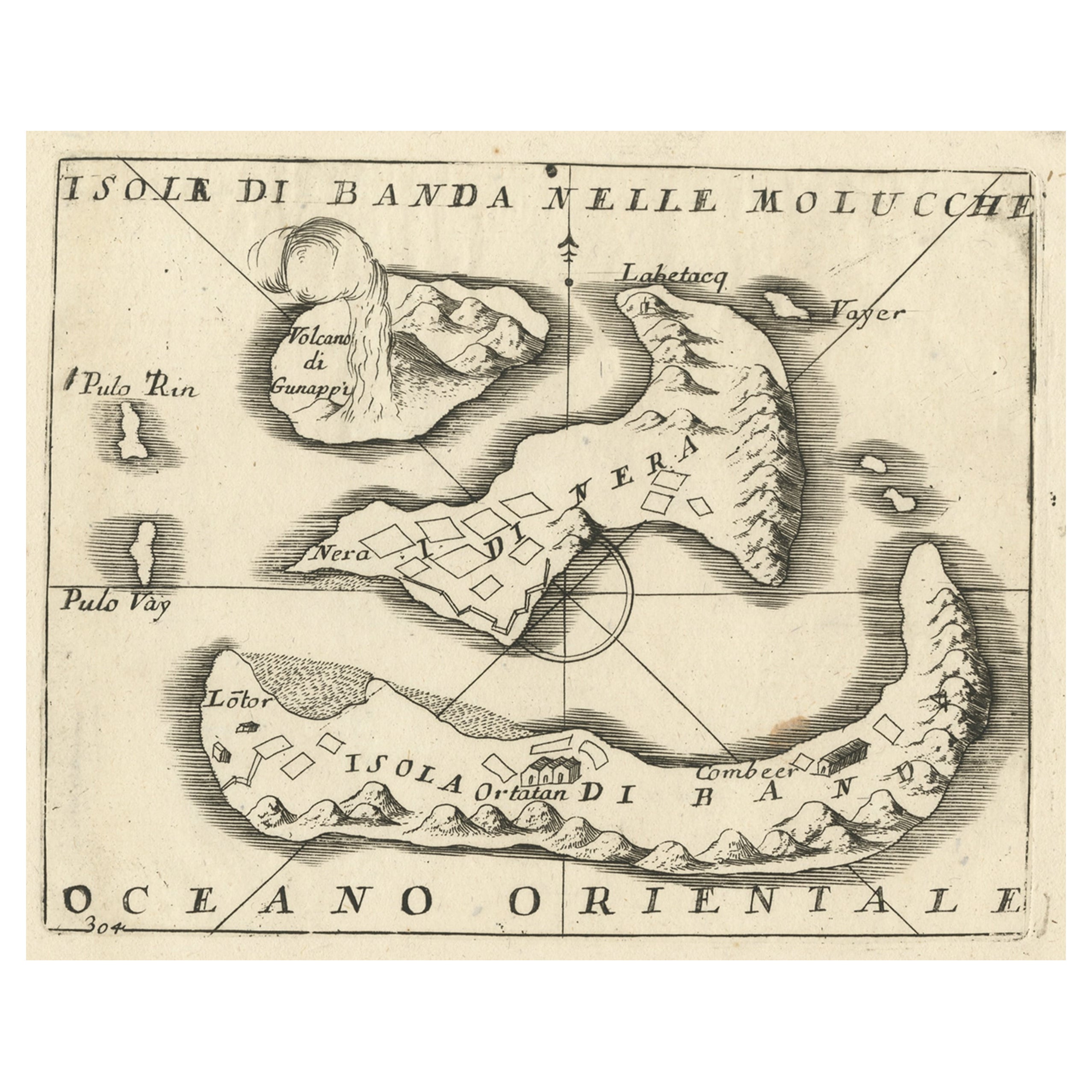
 - Antique Chart of the Banda Islands or The Spice Islands, Indonesia, 1726Located in Langweer, NLAntique map titled 'Nieuwe Caart der Eylanden van Banda'. Beautiful chart of the Banda Islands including Banda Api, Banda Neira, Banda Besar, Pulau Hatta (Rosengain), Pulau Ai an...Category
Antique 1720s Maps
MaterialsPaper
 $605 Sale Price20% Off
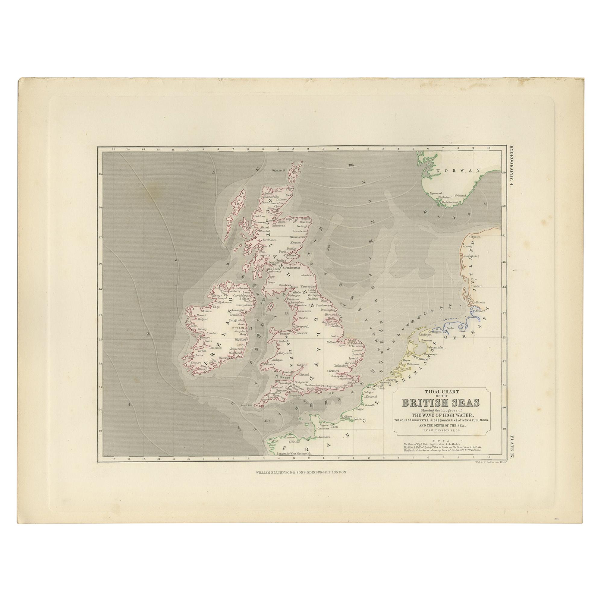
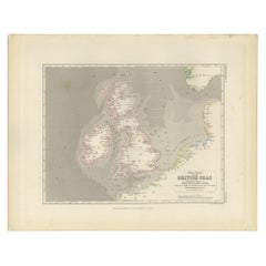
 - Antique Tidal Chart of the British Seas by Johnston, '1850'Located in Langweer, NLAntique map titled 'Tidal Chart of the British Seas showing the progress of the wave of high water'. Original antique tidal chart of the British Seas. This map originates from 'The P...Category
Antique Mid-19th Century Maps
MaterialsPaper
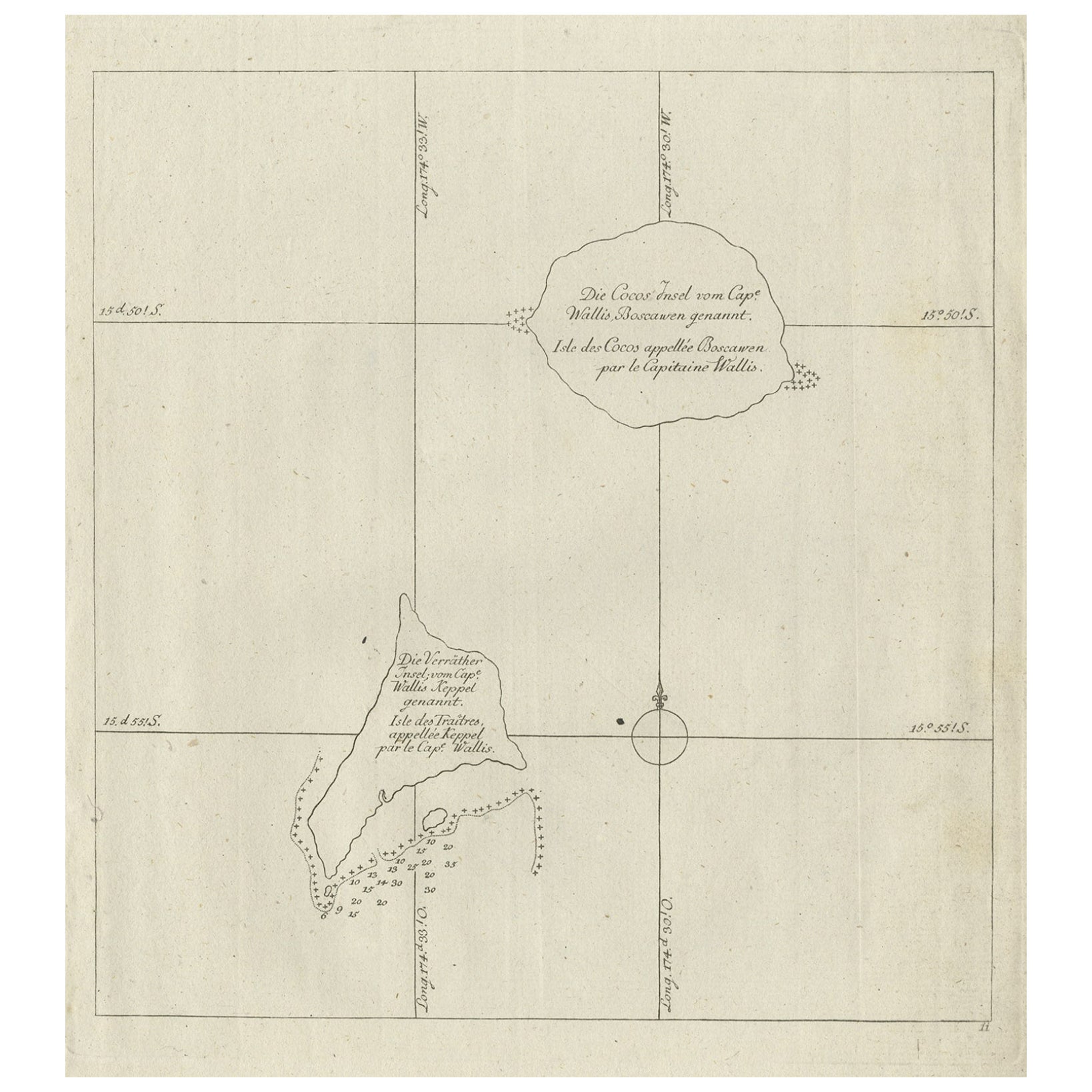
- Antique Map of the Cocos or Keeling Islands, 1778Located in Langweer, NLAntique map titled 'Die Cocos Insel vom Capt. Wallis Bosawren. Die Verrather Islel von Capt. Wallis Keppel Genannt'. Also with French subtitles. Old map of the Cocos or Keeling Islan...Category
Antique 18th Century Maps
MaterialsPaper
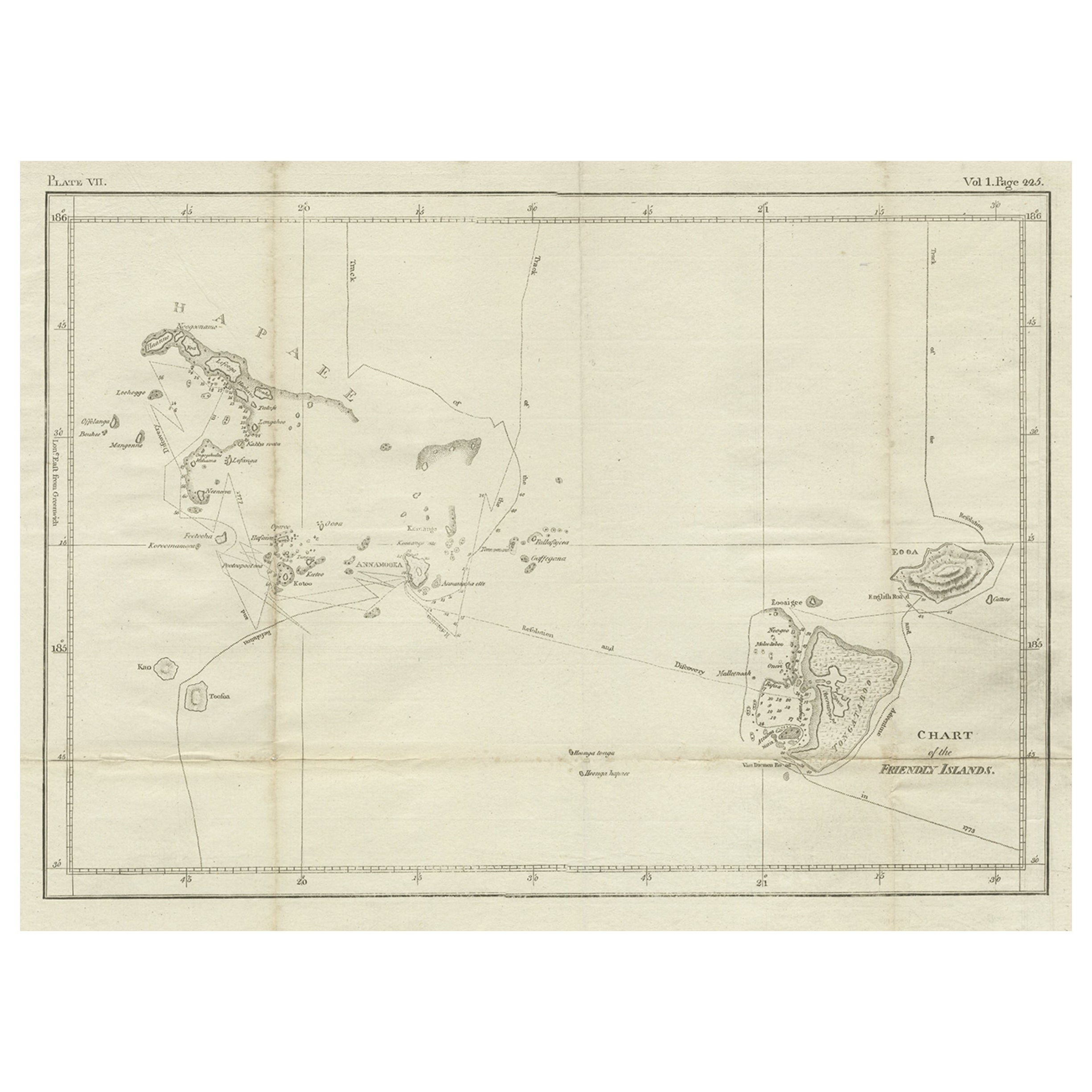
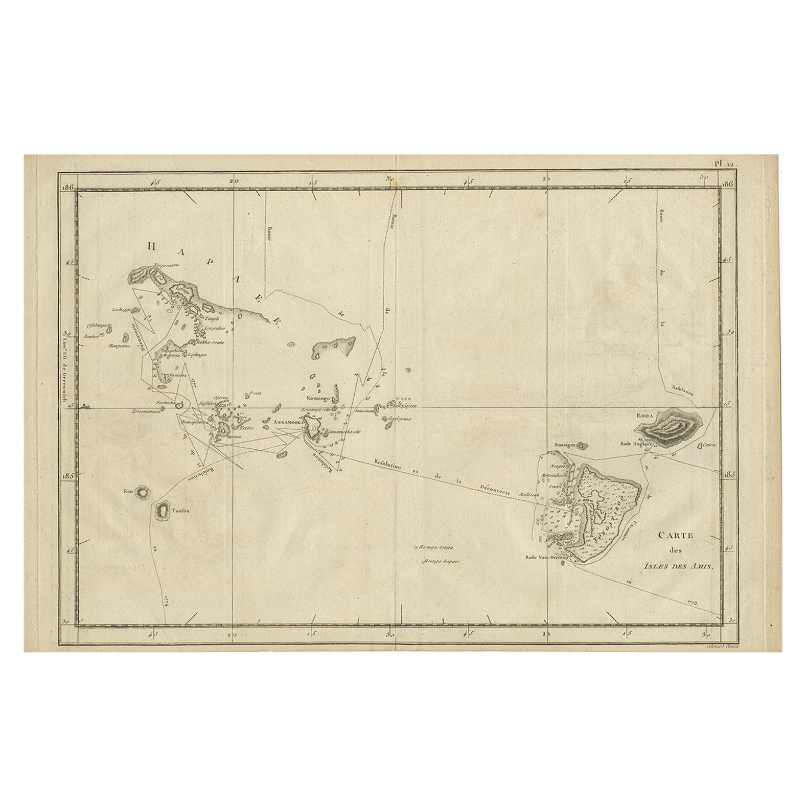
- Antique Chart of the Friendly Islands or Nowadays Tonga, by Cook, 1784By James CookLocated in Langweer, NLAntique print titled 'Chart of the Friendly Islands'. Antique map of the Friendly Islands depicting Rotterdam or Anamocka, Middelburg or Eaoowe and Amsterdam or Tongatabu. Originates...Category
Antique 18th Century Prints
MaterialsPaper
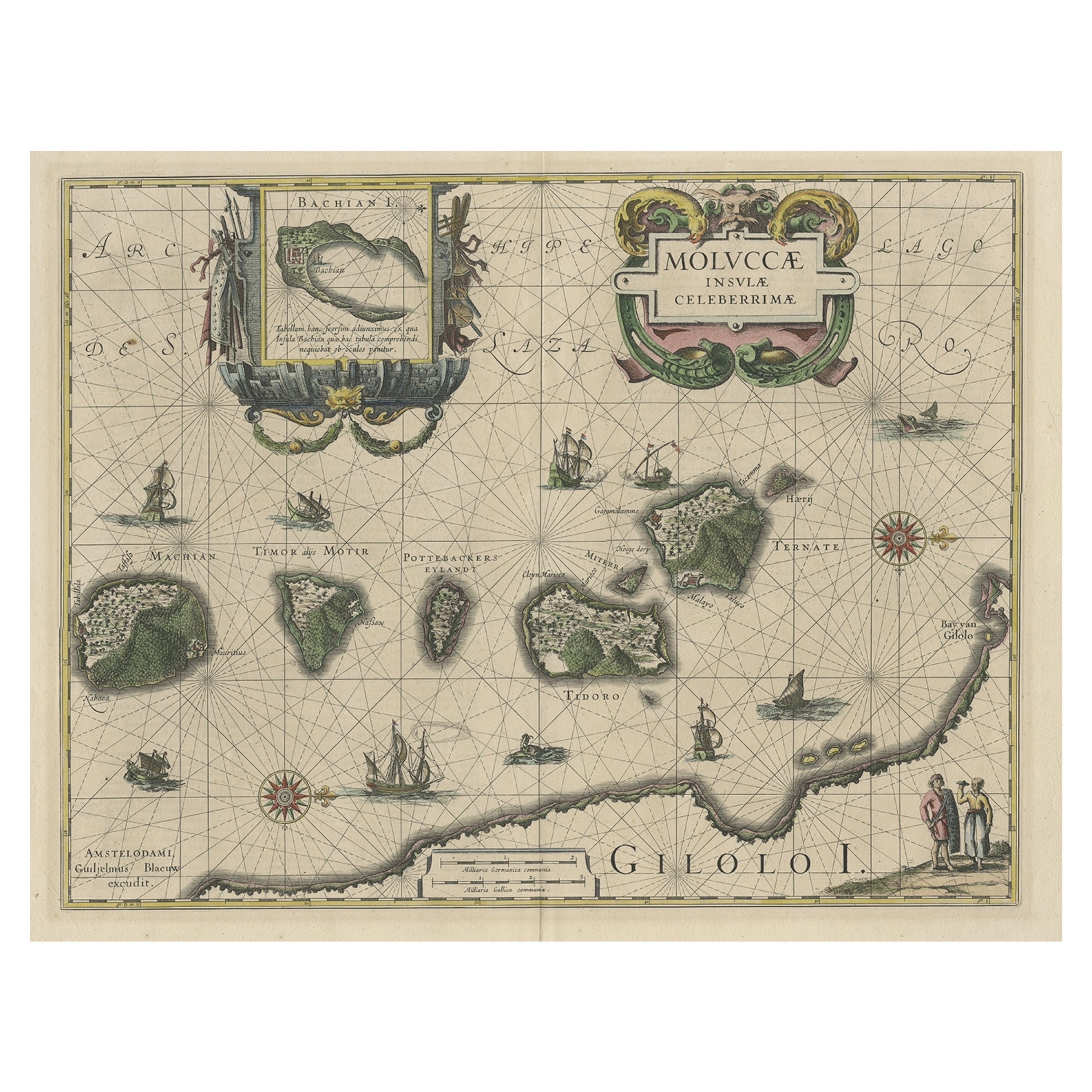
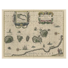
- Decorative Map of the Maluku or Moluccas or Spice Islands, Indonesia, Ca.1640Located in Langweer, NLAntique map titled 'Moluccae Insulae Celeberrimae'. Decorative map of the Maluku Islands, also known as the Moluccas or the Spice Islands. Inset of the island of Bachian (Batjan) in an elaborate frame as well as a Moluccan couple in the lower right corner in Europeanized native dress. Artists and Engravers: Willem Janszoon Blaeu (1571-1638) was a prominent Dutch geographer and publisher. Born the son of a herring merchant, Blaeu chose not fish but mathematics and astronomy for his focus. He studied with the famous Danish astronomer Tycho Brahe...Category
Antique 1640s Maps
MaterialsPaper
Recently Viewed
View AllMore Ways To Browse
Retro United States Map
Retro Maps Of The United States
Framed Chart
Vintage Chart Map
Nautical Chart Nautical Chart
Used Nautical Charts
Nautical Map
Nautical Maps
Nautical Block
Nautical Charts
Vintage Long Island Maps
Vintage Map Of Long Island
Vintage Long Island Map
Speed Map
Vintage Wooden Secretary
Map Nautical Chart
Aesthetic Secretary
Nautical Map Vintage