Items Similar to Hand-Colored Lithograph of an Armed Knight under the Reign of Louis XI, ca.1860
Want more images or videos?
Request additional images or videos from the seller
1 of 5
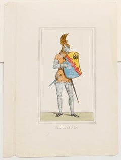
Hand-Colored Lithograph of an Armed Knight under the Reign of Louis XI, ca.1860
$115.60
$144.5020% Off
£85.53
£106.9120% Off
€96
€12020% Off
CA$159.84
CA$199.8020% Off
A$175.48
A$219.3620% Off
CHF 91.55
CHF 114.4420% Off
MX$2,123.61
MX$2,654.5120% Off
NOK 1,147.45
NOK 1,434.3120% Off
SEK 1,081.20
SEK 1,351.4920% Off
DKK 730.95
DKK 913.6820% Off
About the Item
Antique print titled 'Chevalier armé sous Louis XI'. Lithograph of an armed knight under the reign of Louis XI. Source unknown, to be determined.
Artists and Engravers: Anonymous.
Condition: Good, general age-related toning. Partly mounted to grey paper. Blank verso, please study image carefully.
About the Seller
5.0
Recognized Seller
These prestigious sellers are industry leaders and represent the highest echelon for item quality and design.
Platinum Seller
Premium sellers with a 4.7+ rating and 24-hour response times
Established in 2009
1stDibs seller since 2017
2,636 sales on 1stDibs
Typical response time: <1 hour
- ShippingRetrieving quote...Shipping from: Langweer, Netherlands
- Return Policy
Authenticity Guarantee
In the unlikely event there’s an issue with an item’s authenticity, contact us within 1 year for a full refund. DetailsMoney-Back Guarantee
If your item is not as described, is damaged in transit, or does not arrive, contact us within 7 days for a full refund. Details24-Hour Cancellation
You have a 24-hour grace period in which to reconsider your purchase, with no questions asked.Vetted Professional Sellers
Our world-class sellers must adhere to strict standards for service and quality, maintaining the integrity of our listings.Price-Match Guarantee
If you find that a seller listed the same item for a lower price elsewhere, we’ll match it.Trusted Global Delivery
Our best-in-class carrier network provides specialized shipping options worldwide, including custom delivery.More From This Seller
View AllGenuine Antique Print of a Knight Armed with A Martel in Old Hand-Coloring, 1842
Located in Langweer, NL
Antique print titled 'A Knight armed with a Martel'. Old print of a knight wearing a chainmail hauberk, hood, chausses, and carries a buckler and martel de fer (war hammer...
Category
Antique 19th Century Prints
Materials
Paper
$231 Sale Price
20% Off
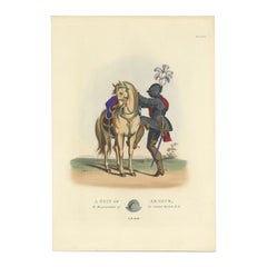
Hand-Coloured Lithograph of Armoured Knight and Horse in Tournament Dress, 1842
Located in Langweer, NL
Title: Hand-Coloured Lithograph of Armoured Knight and Horse in Tournament Dress
Description: This exquisite hand-coloured lithograph presents a fully armoured knight mounted on a similarly armoured horse, highlighting the grandeur of medieval tournament culture. Drawn from *Der Rittersaal: Eine Geschichte des Ritterthums* (1842) by Friedrich Martin von Reibisch and Dr. Franz Kottenkamp, the plate exemplifies the craftsmanship of tournament armor and equestrian regalia.
The knight is clad in articulated plate armor, intricately engraved and polished to perfection, reflecting the martial prowess and status of a noble warrior. He holds a ceremonial poleaxe, often seen in jousts or tournaments as both a practical weapon and a symbol of chivalry. His plumed helmet, adorned with vibrant red and yellow feathers, adds an element of spectacle befitting a medieval tournament.
The horse is draped in a richly patterned caparison, a cloth covering adorned with intricate geometric designs, likely symbolizing the knight's heraldic identity. The ornate horse armor...
Category
Antique 1840s Prints
Materials
Paper

$712 Sale Price
20% Off
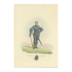
Antique Handcolored Print of Thomas Peyton in Full Armor Gear, 1842
Located in Langweer, NL
Antique print titled 'Sir Thomas Peyton'. Old print of Thomas Peyton, sheriff of Cambridgeshire and Huntingdonshire. This print originates from 'A critical inquiry into antient armou...
Category
Antique 19th Century Prints
Materials
Paper
$211 Sale Price
20% Off
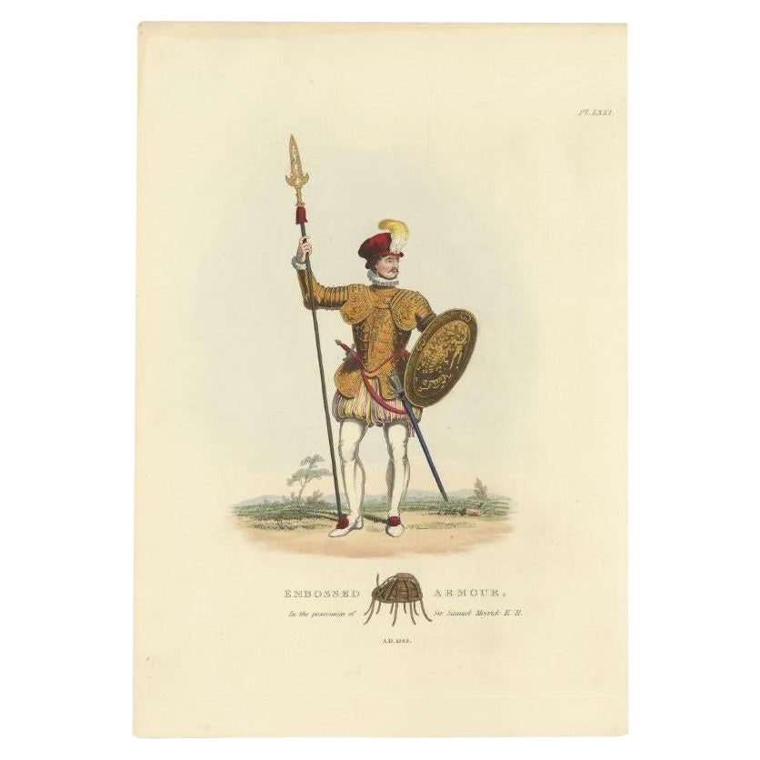
Antique Hand-Colored Print of a Knight in Embossed Armour, (1842)
Located in Langweer, NL
Antique print titled 'Embossed Armour, in the possession of Sir Samuel Meyrick K.H.'. Old print of embossed armour. This print originates from 'A criti...
Category
Antique 19th Century Prints
Materials
Paper
$221 Sale Price
20% Off
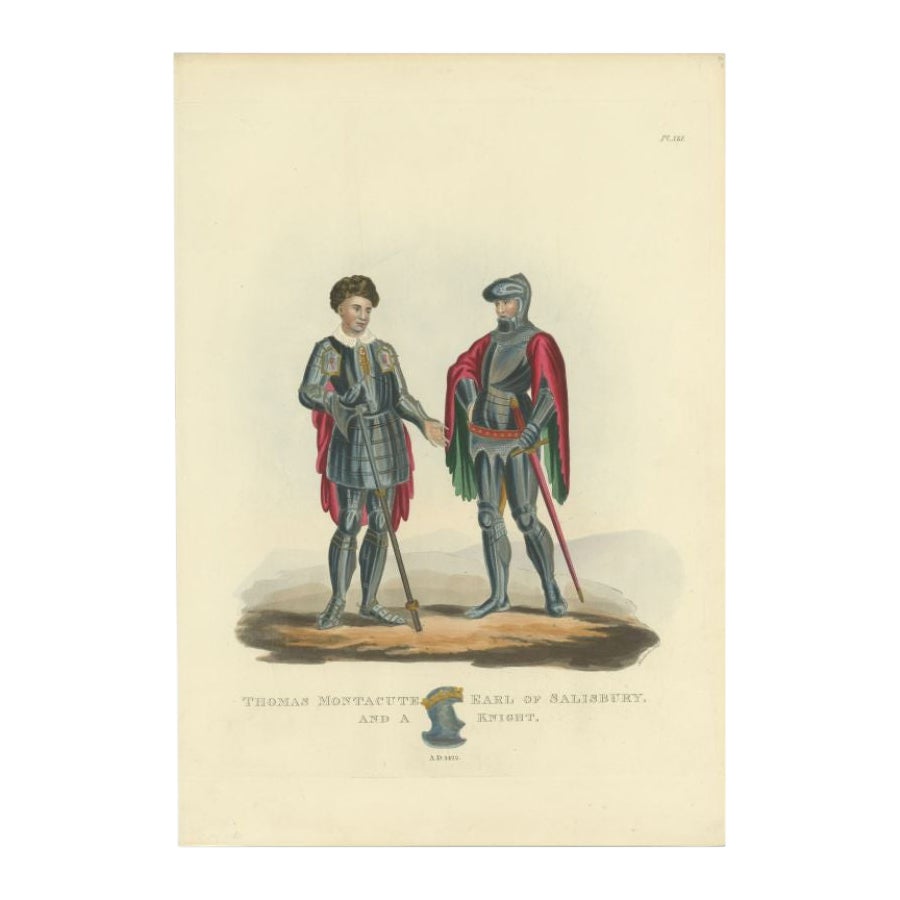
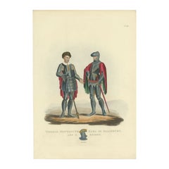
Antique Handcolored Print of Thomas Montacute of Salisbury and a Knight, 1842
Located in Langweer, NL
Antique print titled 'Thomas Montacute Earl of Salisbury and a Knight'. Old print of Thomas Montacute, Earl of Salisbury. This print originates from 'A critical inquiry into antient ...
Category
Antique 19th Century Prints
Materials
Paper
$221 Sale Price
20% Off
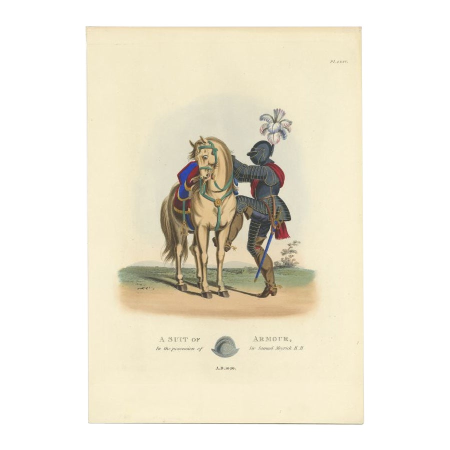
Original Handcolored Antique Print of a Suit of Armour, '1842'
Located in Langweer, NL
Antique print titled 'A Suit of Armour, in the posession of Sir Samuel Meyrick K.H.'. Old print of a suit of armour. This print originates from 'A critical inquiry into antient armou...
Category
Antique 19th Century Prints
Materials
Paper
$250 Sale Price
20% Off
You May Also Like
Cavalier - Hand-Colored Lithograph - 19th Century
Located in Roma, IT
Cavalier is an original hand-colored lithograph on paper realized by an Anonymous artist of the XIX century, it represents a cavalier in his particular costume with shield through ha...
Category
19th Century Modern Portrait Prints
Materials
Lithograph
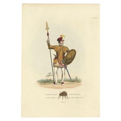
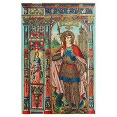
Original Antique Illuminated Print of St George. C.1880
Located in St Annes, Lancashire
Wonderful print of St George
Illuminated Chromolithograph
Published circa 1880
Unframed.
Free shipping
The measurement is the paper size
Category
Antique 1880s English Gothic Prints
Materials
Paper
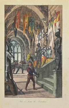
Knights' Weapons - Lithograph - 1862
Located in Roma, IT
Knights' Weapons is a lithograph on paper realized in 1862.
The artwork belongs to the Suite Uses and customs of all the peoples of the universe: " History of the government, of the...
Category
1860s Modern Figurative Prints
Materials
Lithograph
Antique Copper Engraving of an Officer of Pikeman by Francis Grose
By Francis Grose
Located in New York, NY
Francis Grose entered the army early in life and served in the cavalry, infantry, and militia.He had a profound knowledge of antiquities and spent the greater part of his life collec...
Category
Antique 19th Century English Renaissance Revival Prints
Materials
Paper
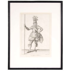
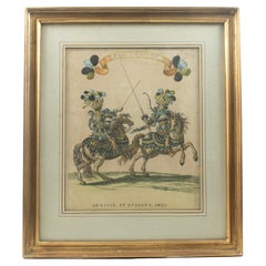
"Armiger et Ephebus Indi" — Hand-Coloured Engraving - Grand Carrousel 1662
Located in TEYJAT, FR
"Armiger et Ephebus Indi" — Hand-Coloured Engraving from the Grand Carrousel of 1662
An exceptional hand-coloured copperplate engraving from the celebrated Grand Carrousel held at t...
Category
Antique Early 19th Century French Baroque Prints
Materials
Giltwood, Paint, Paper
$1,541 Sale Price
20% Off
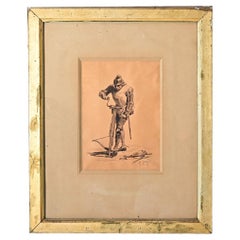
French Framed Drawing of a Knight by Eugene Giraud
Located in Baton Rouge, LA
A fantastic 19th century framed drawing of a knight by notable artist Eugene Giraud, signed in the lower right corner. The subject of the work is an armored knight dressed in chainma...
Category
Antique 19th Century French Medieval Drawings
Materials
Gold