Items Similar to Map of Beijing (Peking) with Tartar and Chinese Divisions and Jesuit Missions
Want more images or videos?
Request additional images or videos from the seller
1 of 6
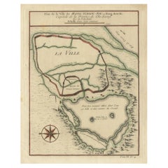
Map of Beijing (Peking) with Tartar and Chinese Divisions and Jesuit Missions
$229.86
$287.3220% Off
£169.56
£211.9420% Off
€192
€24020% Off
CA$318.48
CA$398.1020% Off
A$345.60
A$43220% Off
CHF 183.14
CHF 228.9220% Off
MX$4,238.60
MX$5,298.2420% Off
NOK 2,266.30
NOK 2,832.8820% Off
SEK 2,141.54
SEK 2,676.9220% Off
DKK 1,462.04
DKK 1,827.5520% Off
About the Item
An antique map by Jacques Nicolas Bellin titled "Plan de la Ville de Peking Capitale de l'Empire de la Chine," published in Paris in 1754.
This finely engraved plan shows the detailed layout of the city of Peking (now known as Beijing), the capital of China. The map distinctly divides the city into the "Ville Tartare" (Tartar City) and "Ville Chinoise" (Chinese City), indicating the segregated living areas during that period. Notable features on the map include the Emperor's Palace and the French Jesuit and Portuguese Jesuit missions located in the Tartar City, as well as the Temples of the Earth and Sky marked in the Chinese City.
This kind of map is a valuable historical document, offering insight into the urban planning and social geography of Beijing in the mid-18th century. It reflects the European interest in the far reaches of the world during the age of exploration and the importance of Jesuit missions in cultural exchanges between the West and China. The presence of religious missions on the map underscores the role of European powers in the spread of Christianity in China at the time.
- Dimensions:Height: 9.45 in (24 cm)Width: 7.56 in (19.2 cm)Depth: 0 in (0.02 mm)
- Materials and Techniques:Paper,Engraved
- Period:1750-1759
- Date of Manufacture:1754
- Condition:Good. General age-related toning and/or occasional minor defects from handling. Please study scan carefully.
- Seller Location:Langweer, NL
- Reference Number:Seller: BG-13600-481stDibs: LU3054338424852
About the Seller
5.0
Recognized Seller
These prestigious sellers are industry leaders and represent the highest echelon for item quality and design.
Platinum Seller
Premium sellers with a 4.7+ rating and 24-hour response times
Established in 2009
1stDibs seller since 2017
2,622 sales on 1stDibs
Typical response time: <1 hour
- ShippingRetrieving quote...Shipping from: Langweer, Netherlands
- Return Policy
Authenticity Guarantee
In the unlikely event there’s an issue with an item’s authenticity, contact us within 1 year for a full refund. DetailsMoney-Back Guarantee
If your item is not as described, is damaged in transit, or does not arrive, contact us within 7 days for a full refund. Details24-Hour Cancellation
You have a 24-hour grace period in which to reconsider your purchase, with no questions asked.Vetted Professional Sellers
Our world-class sellers must adhere to strict standards for service and quality, maintaining the integrity of our listings.Price-Match Guarantee
If you find that a seller listed the same item for a lower price elsewhere, we’ll match it.Trusted Global Delivery
Our best-in-class carrier network provides specialized shipping options worldwide, including custom delivery.More From This Seller
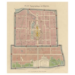
View AllOriginal Antique Street Plan of Peking, Beijing, China
Located in Langweer, NL
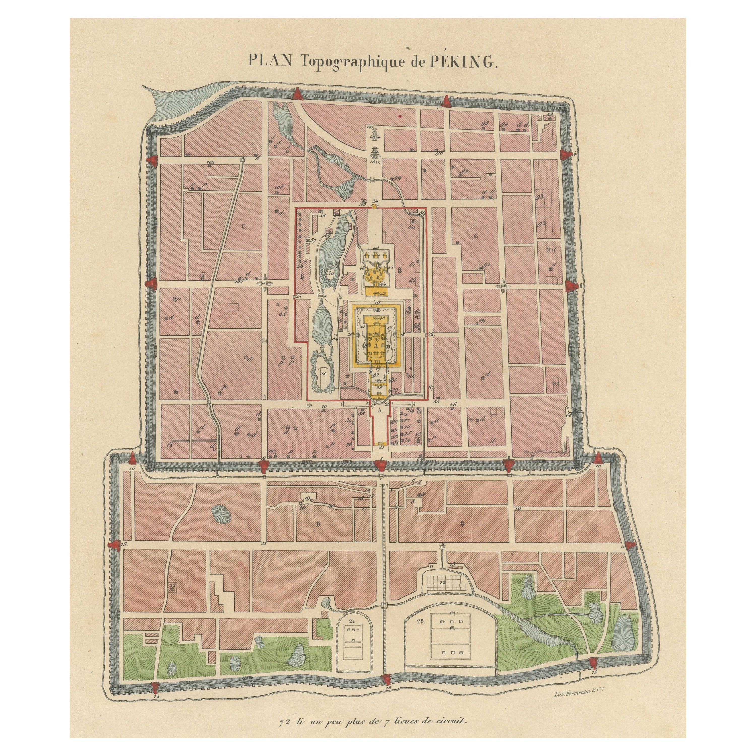
Antique print titled 'Plan topographique de Péking'. Plan of the city of Beijing, Peking, China. Published by Formentin & Cie, circa 1830.
Category
Antique Mid-19th Century Prints
Materials
Paper
$555 Sale Price
20% Off
Antique Map of Three Chinese Cities in Chensi and Koei Tcheou, c.1758
Located in Langweer, NL
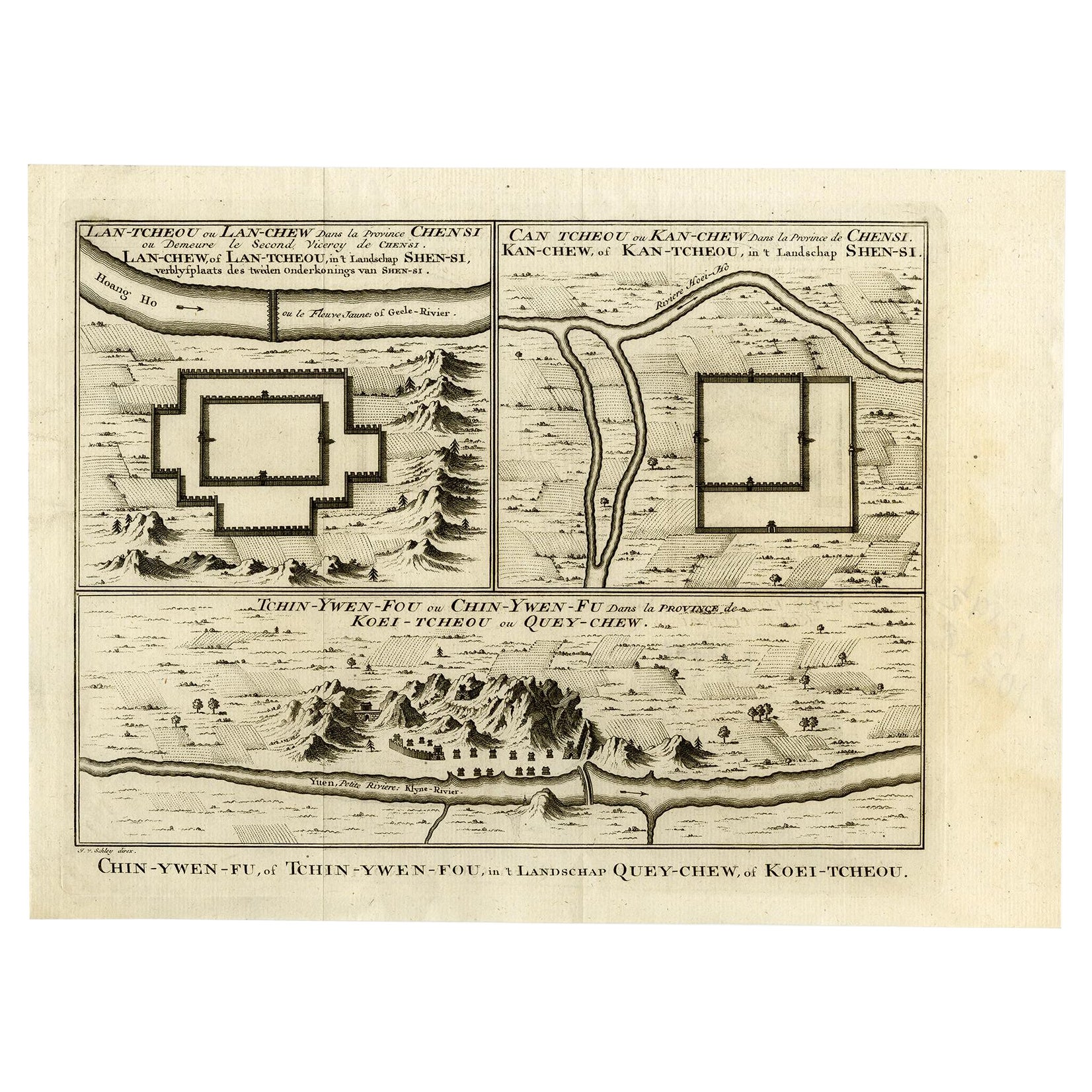
Antique map titled 'Lan-Tcheou ou Lan-Chew dan la province Chensi; Can Tcheou ou Kan-Chew dan la province de Chensi; Tchin-Ywe-Fou ou Chin-Ywen-Fu dans la province de Koei-Tcheou ou Quey-chew.' Three plans of old Chinese cities...
Category
Antique 18th Century Maps
Materials
Paper

$268 Sale Price
20% Off
1749 Jacques Nicolas Bellin Map of the Great Wall of China Near Kiang-nan fu
Located in Langweer, NL
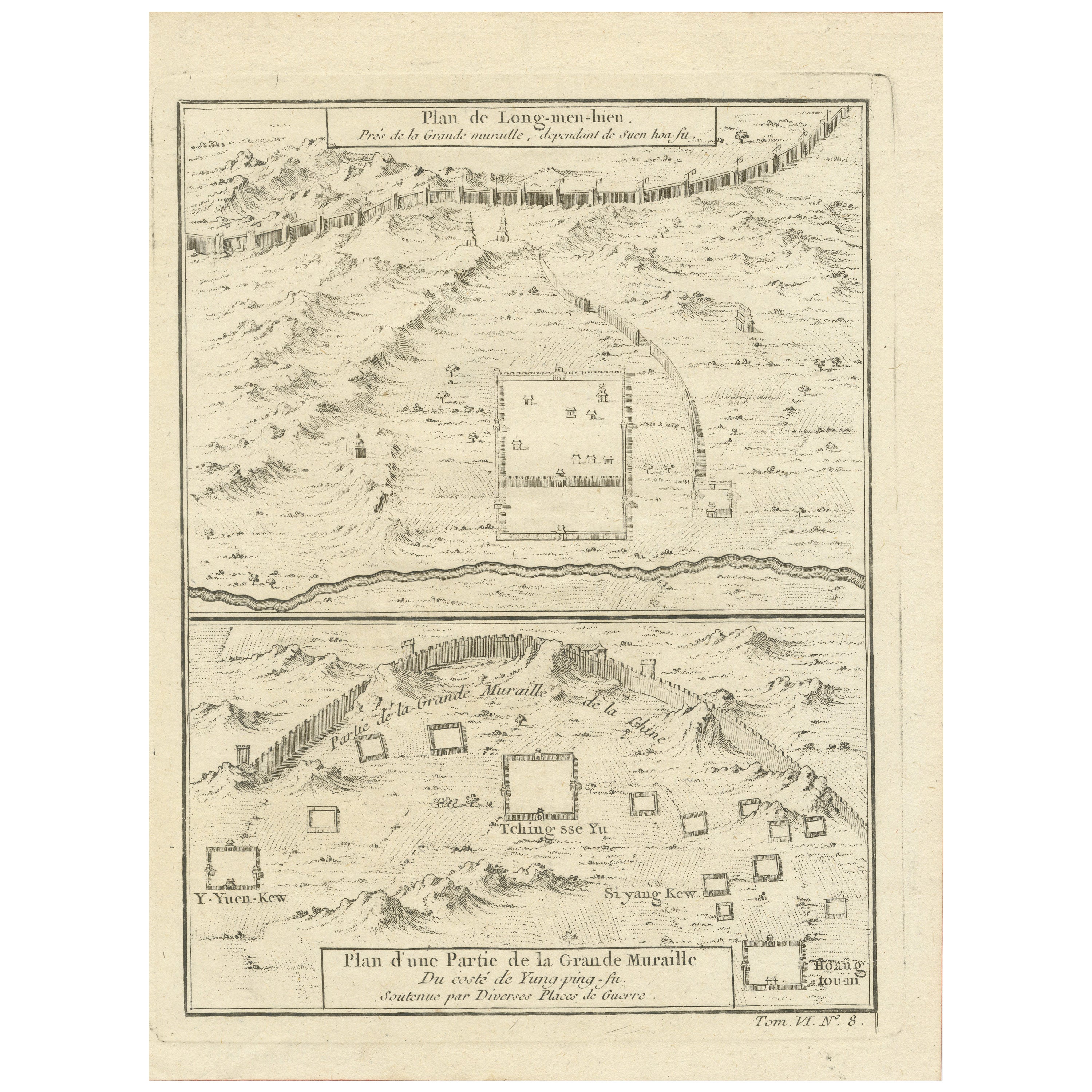
This original antique image is an historical map by Jacques Nicolas Bellin, depicting the Great Wall of China as it was understood in the mid-18th century.
The map includes French ...
Category
Antique 1750s Prints
Materials
Paper

$143 Sale Price
20% Off
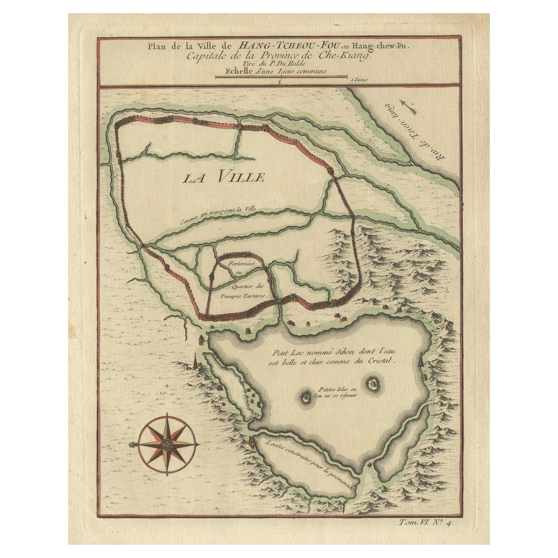
Antique Map of Hangzhou, Capital of the Province of Zheijang, China, 1748
Located in Langweer, NL
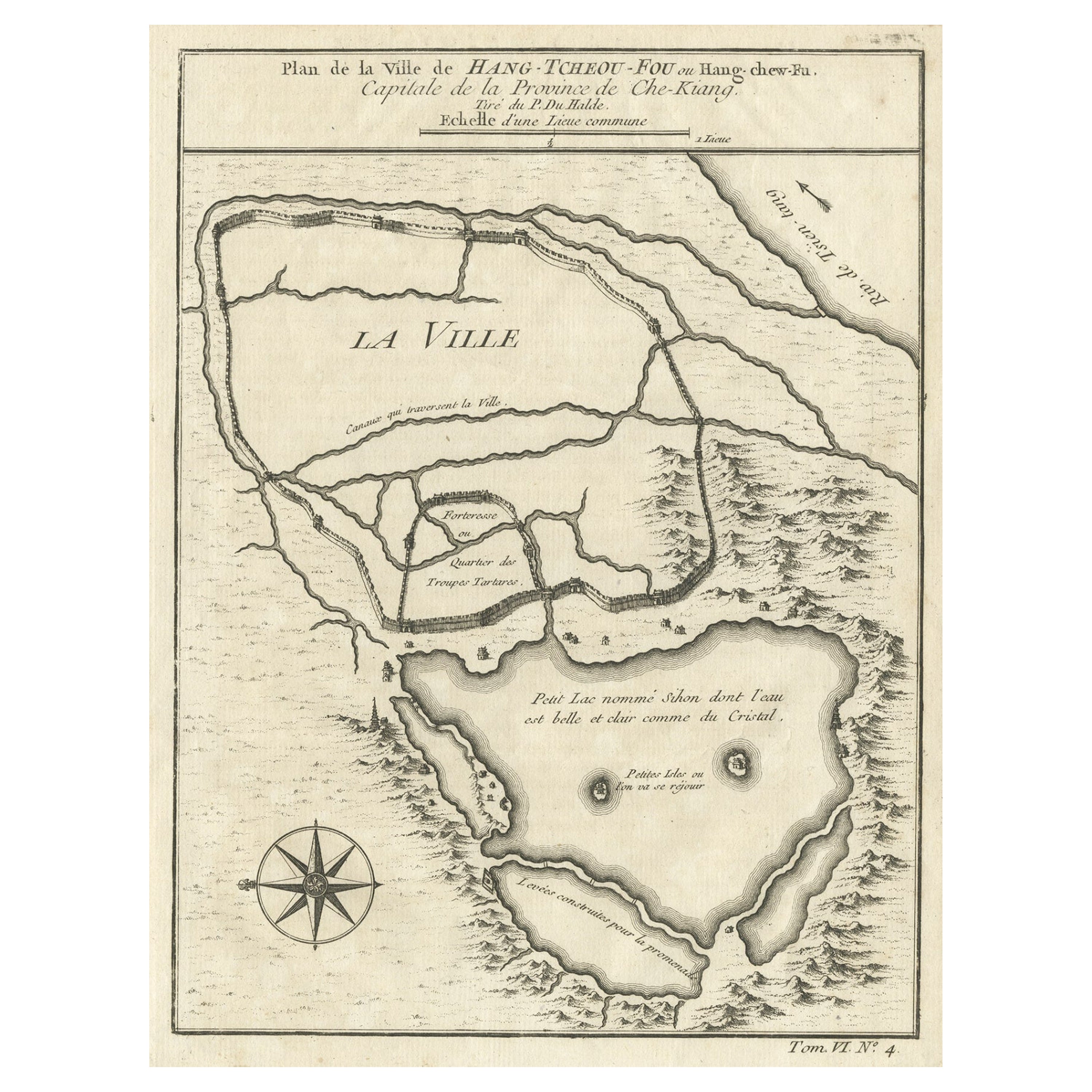
Antique map titled 'Plan de la ville de Hang-Tcheou-Fou ou Hang-Chew-Fu Capitale de la Province de Che-Kiang’.
This original print shows a map of the city of Hangzhou, capital of t...
Category
Antique 1740s Maps
Materials
Paper
$325 Sale Price
20% Off
Antique Map of Hangzhou, Capital of the Province of Zheijang, China, c.1750
Located in Langweer, NL
Antique map titled ‘Plan de la ville de Hang-Tcheou-Fou ou Hang-Chew-Fu Capitale de la Province de Che-Kiang’. This original print shows a map of the city of Hangzhou, capital of the...
Category
Antique 1750s Maps
Materials
Paper
$325 Sale Price
20% Off
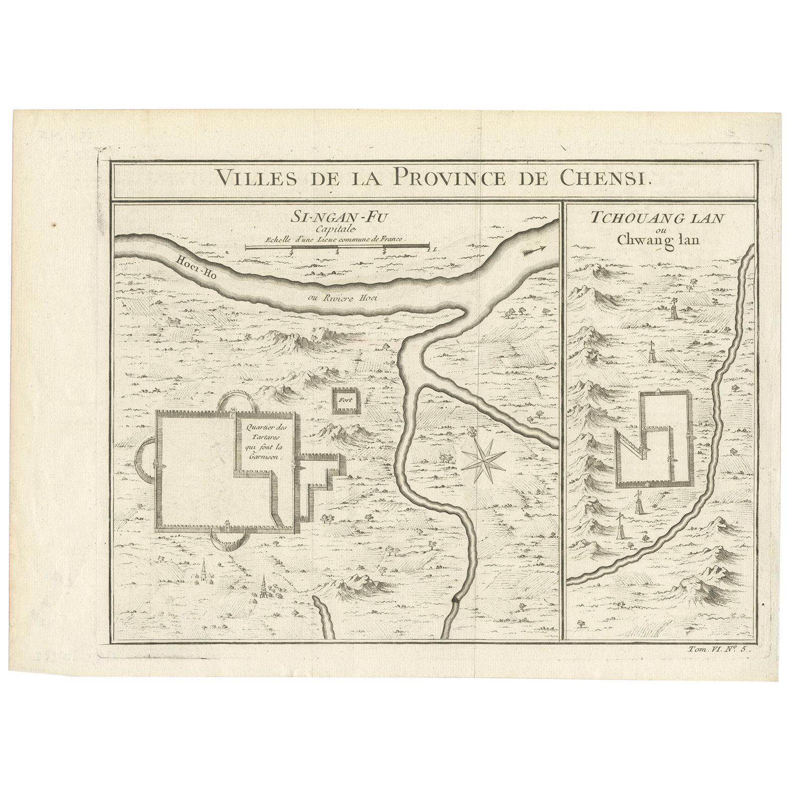
Antique Map of Si-Ngan-fu and Tchang Lan 'China' by Bellin '1748'
By Jacques-Nicolas Bellin
Located in Langweer, NL
Antique map China titled ‘Villes de la Province de Chensi’. Interesting set of two local town plans of "Si-Ngan-Fu: Capitale, Hoofdstad." and "Tchang...
Category
Antique Mid-18th Century Maps
Materials
Paper
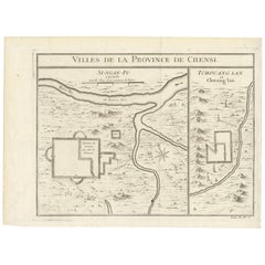
$143 Sale Price
20% Off
You May Also Like
Super Rare Antique French Map of Chine and the Chinese Empire, 1780
Located in Amsterdam, Noord Holland
Super Rare Antique French Map of Chine and the Chinese Empire, 1780
Very nice map of Asia. 1780 Made by Bonne.
Additional information:
Type: Map
...
Category
Antique 18th Century European Maps
Materials
Paper

$584 Sale Price
33% Off
Framed Map of China
Located in Greenwich, CT
Map of China, 19th century. European print map of China
Conservation frame with walnut frame
Overall dimension : 28 1/2" wide 31" high 2" depth with fra...
Category
Antique 19th Century European Qing Prints
Materials
Paper

$3,800
"Map and History of Peking" 1936, China Beijing Chromolithograph of City Temples
Located in Austin, TX
A Map and History of Peiping; formerly known as Peking; capital of provinces, princedoms, and kingdoms since 1121 B.C.; in 1264 A.D. the capital of the Mongol Empire of Kublai Khan; ...
Category
1930s Figurative Prints
Materials
Paper, Lithograph
Framed Early 19th Century Drawn and Engraved Map of China
By John Knighton Thomson
Located in San Francisco, CA
Hand drawn and tinted engraved map of China dated 1815
Created for Thomson's New General Atlas
Edinburgh
Beautifully framed with a linen covered mat.
Category
Antique Early 19th Century European Prints
Materials
Paper
China: An Original 18th Century Hand-colored Map by E. Bowen
Located in Alamo, CA
This is an original 18th century hand-colored map entitled "A New & Accurate Map of China, Drawn from Surveys made by the Jesuit Missionaries, by order of the Emperor. The whole bein...
Category
Mid-18th Century Old Masters Landscape Prints
Materials
Engraving

Large Original Vintage Map of China, circa 1920
Located in St Annes, Lancashire
Great map of China.
Original color. Good condition.
Published by Alexander Gross
Unframed.
Category
Vintage 1920s English Edwardian Maps
Materials
Paper

More Ways To Browse
Antique Smoking Set
Antique Solingen
Antique Stable Door
Antique Staffordshire Cows
Antique Teapoy
Antique Wedgwood Dishes
Antique Wood Beams
Arabia Finland Kaj Franck
Arabic Plates
Art Deco Automobile
Art Deco Lizard
Art Nouveau Horn
Arte Vetraria Muranese (AVEM) On Sale
Ashford Marble
Ashley Wood
Asian Coins
Astronomical Clock
Austrian Pug