Early 17th Century Prints
to
82
85
5
91
Height
to
Width
to
1
5,101
9,482
5,505
892
1,196
1,710
1,666
195
81
211
248
256
309
415
691
374
228
91
1
1
1
1
8
4
2
2
1
91
91
91
2
2
2
2
1
Period: Early 17th Century
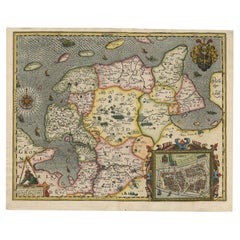
Stunning Decorative Antique Map of East Frisia with an Inset of Emden, c.1610
Located in Langweer, NL
Description: Antique map titled 'Typus Frisie Orientalis a Dullarto (..)'. One of the most decorative maps of East Frisia and its important shipping center of Emden and the Watten Is...
Category
Antique Early 17th Century Prints
Materials
Paper
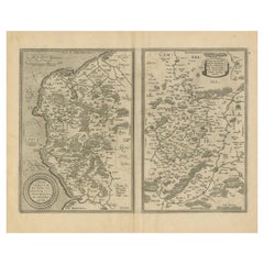
Antique Map of the Coastline Between Calais and Estaples and Northern France
Located in Langweer, NL
Antique map titled 'Caletensium et Bononiensium Ditionis Accurata Delinatio [on sheet with] Veromanduorum Eorumque Confinium Exactissima Discriptio'. Two maps on a folio sheet. Calentensium covers the coastline between Calais and Estaples based in part on a four-sheet map by Nicolas de Nicolay...
Category
Antique Early 17th Century Prints
Materials
Paper
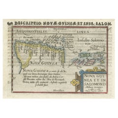
Rare Original Miniature Map of Papua New Guinea and the Salomon Islands, 1600
Located in Langweer, NL
Very handsome original old coloured copper engraving of Papua and the Solomon Island. Title of the map 'Descriptio Novae Guneae et Inss. Salom.
On the reverse text in Latin.
Ve...
Category
Antique Early 17th Century Prints
Materials
Paper
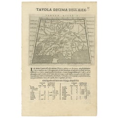
Two Maps of Asia on One Sheet, India, Bangladesh and Malaysia & Burma etc., 1617
Located in Langweer, NL
Antique map titled 'Tabula Asiae'.
Two maps of Asia on one sheet, recto and verso. The recto features an interesting map of India, Bangladesh and the Ganges River. On the verso, ...
Category
Antique Early 17th Century Prints
Materials
Paper
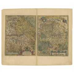
Map of the Region of Basel and Northern Switzerland by Ortelius, circa 1603
Located in Langweer, NL
Two original antique maps on one sheet titled 'Basiliensis Territorii Descriptio Nova [with] Circulus sive Liga Sueviae'. The first centers on Basel, Switzerland, located on the Rhine River...
Category
Antique Early 17th Century Prints
Materials
Paper
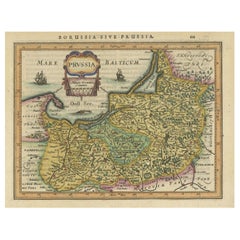
Original Decorative Antique Map of Prussia, 1628
Located in Langweer, NL
Antique map titled 'Prussia'. Original antique map of Prussia, a historically prominent German state that originated in 1525 with a duchy centered on th...
Category
Antique Early 17th Century Prints
Materials
Paper
Original Antique Map of the Region of Picardy, France, ca.1602
Located in Langweer, NL
Antique map titled 'Picardiae Belgicae regionis descriptio'.
Original antique map of the region of Picardy, France. Superb example of the decorative style of Ortelius and filled ...
Category
Antique Early 17th Century Prints
Materials
Paper
Original Antique Map of the Rhine, South and North of Strasbourg, Germany, 1608
Located in Langweer, NL
Antique map titled 'Argentoratensis agri descriptio'.
Original antique map of the Rhine, both south and north of Strasbourg, based on Daniel Specklin's three-sheet map of the Elz...
Category
Antique Early 17th Century Prints
Materials
Paper
Rare Engravings of Council of War in Bantam and Javanese Local Traders, 1614
Located in Langweer, NL
One leaf with an engraving on each site and text in old Dutch. One side shows the War Council of the locals in Bantam and the other side show some vegetables traders of Bantam.
B...
Category
Antique Early 17th Century Prints
Materials
Paper
Rare Map of Kildin Island in Russia Plus Engraving of Seal Hunting, 1614
Located in Langweer, NL
Insula Kilduyn. Orig. copper-engraving after details from J. H. van Linschoten's map taken from his account of the three expeditions undertaken by Willem Barents in 1594, in an attem...
Category
Antique Early 17th Century Prints
Materials
Paper
Small Map of Bantam with Dutch Ships and an Engraving of Portugese, 1614
Located in Langweer, NL
Two rare old miniature copper-engravings one one leaf. One showing the first arrival of the first Dutch in Indonesia, the so-called 'Houtman expedition' and on the reverse Portugese welcoming them with gifts.
The First Dutch Expedition to Indonesia was an expedition that took place from 1595 to 1597. It was instrumental in the opening up of the Indonesian spice trade...
Category
Antique Early 17th Century Prints
Materials
Paper
Catching Doves in Renaissance Europe: Stradanus & Galle's 1615 Hunting Print
Located in Langweer, NL
The antique print titled 'Retibus aut iaculis capitar sic sepe Palumbe' is a fascinating piece from the early 17th century, part of the renowned 104-print series "Venationes Ferarum, Avium, Piscium" designed by Joannes Stradanus and engraved by Philip Galle around 1615. This series is celebrated for its detailed depiction of various hunting scenes.
**Key Aspects of the Print:**
1. **Scene Depiction**: The print vividly portrays the practice of catching wild doves. It features a hunter selling doves from a basket on the side of his donkey, capturing a moment typical of rural life and hunting practices of the time.
2. **Hunting Technique**: The method of catching doves using large nets in the trees is illustrated, showcasing a historical hunting technique. This detail provides insight into the methods and tools used in bird hunting in the early 17th century.
3. **Artistic Style**: The print reflects the artistic style of Joannes Stradanus, a Flemish artist known for his dynamic and detailed illustrations. Stradanus's work often depicted scenes of hunting, agriculture, and daily life, capturing the spirit of the Renaissance.
4. **Engraving by Philip Galle**: Philip Galle, a renowned engraver, was known for his skillful execution and contribution to the spread of Renaissance art through printed media. His collaboration with Stradanus resulted in high-quality and artistically significant prints.
5. **Cultural and Historical Significance**: This print is valuable for its portrayal of hunting practices and rural life in the early 17th century. It serves as a window into the societal norms, livelihoods, and traditions of the time.
6. **Part of a Larger Series**: Being part of "Venationes Ferarum, Avium, Piscium," this print is a piece of a larger collection that aimed to document various forms of hunting, fishing, and bird catching. The series is significant for its comprehensive portrayal of these activities.
7. **Educational Value**: For historians and art enthusiasts, this print offers educational insights into the techniques of Renaissance printmaking, as well as the socio-cultural aspects of hunting and trade in early modern Europe.
The 'Retibus aut iaculis capitar sic sepe Palumbe' print is not only an antique hunting print...
Category
Antique Early 17th Century Prints
Materials
Paper
Antique Miniature Map of New Guinea by Bertius, '1618'
Located in Langweer, NL
Antique miniature map titled 'Nova Guinea et Ins. Salomonis'. Rare miniature map of New Guinea (Solomon Islands). This map originates from 'Tabularum Geo...
Category
Antique Early 17th Century Prints
Materials
Paper
Antique Map of the Region of Salzburg by Ortelius 'circa 1606'
Located in Langweer, NL
Antique map titled 'Salisburgensis Iurisdictionis'. Original antique map of the region of Salzburg, Austria. Published by A. Ortelius, circa 1606.
Category
Antique Early 17th Century Prints
Materials
Paper
Antique Miniature Map of Ceylon 'Sri Lanka' and the Maldives by Bertius, 1618
Located in Langweer, NL
Antique map titled 'Descriptio Zeilan, et Maldivarum Inss'. Rare, original antique miniature map of Ceylon/Sri Lanka and the Maldives. This map originate...
Category
Antique Early 17th Century Prints
Materials
Paper
Antique Print of the Town of Duinkerken ‘France’ by L. Guicciardini, 1613
Located in Langweer, NL
Beautiful bird's eye-view plan of the town of Duinkerken. From Ludovico Guicciardini.'s description of the Netherlands 'Beschrijvinghe van alle de Nederlanden anderssins ghenoemt Ned...
Category
Antique Early 17th Century Prints
Materials
Paper
Decorative Early Hand-Colored Map of the Northeast of England, ca.1620
Located in Langweer, NL
Antique map titled 'Eboracum, Lincolnia, Derbia, Staffordia, Notinghamia, Lecestria, Rutlandia et Norfolcia'.
Decorative early map of the northeast of England, comprising the cou...
Category
Antique Early 17th Century Prints
Materials
Paper
Antique Print of Natives of Southern Asia by Linschoten, circa 1605
Located in Langweer, NL
Antique print titled 'Provincie Pegu incola (..) - Incola ex Insulis Moluco (..) - Penequais familiae (..)'. Old print showing various figures including a man from Pegu, a man from the Moluccan islands, Penequais Indians and inhabitants of S. Thomas. Illustration from an edition of Linschoten's Itinerario. This work informed Europeans of the 16th century Portuguese trade and navigation in southern Asia.
Category
Antique Early 17th Century Prints
Materials
Paper
Map of Warwickshire, England, Incl insets of Warwick and Coventry, c.1614
Located in Langweer, NL
Antique map titled 'The Counti of Warwick the Shire Towne and Citie of Coventre described'. Map of Warwickshire, England. Includes inset town plans of Warwick and Coventry. This map ...
Category
Antique Early 17th Century Prints
Materials
Paper
Early, Rare and Small Hand-Coloured Copper Engraving of Greece, ca. 1602
Located in Langweer, NL
Attractive minature map of Greece or 'Graecia"
Maker/Publisher: A. Ortelius/A. en F. Arsenius / M Coignet / J. van Keerbergen - 1601-1620
With a si...
Category
Antique Early 17th Century Prints
Materials
Paper
Pair 17th Century Medical Anatomy Engravings by Francesco Valesio, 1627
Located in Rochester, NY
Two anatomical copper engravings by Francesco Valesio. From De humani corporis fabrica libri decem
Evangelista Deuchino, Venice: 1627. Laid paper.
Category
European Antique Early 17th Century Prints
Materials
Paper
17th-Century Botanical Engravings of Mosses and Ferns By John Parkinson
By John Parkinson
Located in Downingtown, PA
John Parkinson was the last of the great English herbalists and one of the first of the great English botanists. Here the pair of prints show mosses and lichen and the other of ferns.
From: Paradisi in sole Paradisus Terrestris: or a garden of all sorts of pleasant flowers...
Category
English Jacobean Antique Early 17th Century Prints
Materials
Paper
17th Century Jan Van De Velde Print "January" from the Months, 1618
Located in Cagliari, IT
Beautiful burin from the rare suite "The Months" performed by the artist and engraved by Claens Jansz Visscher (1587-19 June 1652).
Very fresh and well contrasted, laid paper with w...
Category
Dutch Antique Early 17th Century Prints
Materials
Paper
Spices of the Tropics: Cinnamon and Cassia in De Bry's 1601 Illustration
Located in Langweer, NL
Title: "Spices of the Tropics: Cinnamon and Cassia in De Bry's 1601 Illustration"
Description: This 1601 engraving by Theodore de Bry offers a detailed look at the spice-bearing tre...
Category
Antique Early 17th Century Prints
Materials
Paper
Hampshire County, Britain/England: A Map from Camden's" Britannia" in 1607
By John Norden
Located in Alamo, CA
An early hand-colored map of Britain's Hampshire county, published in the 1607 edition of William Camden's great historical description of the British Isles, "Britannia". This map was drawn by cartographer John Norden (c. 1547-1625) and engraved by William Hole (active 1607-1624) and William Kip...
Category
English Antique Early 17th Century Prints
Materials
Paper
Antique Map of the Region of Pavia, Lodi, Novara, Tortona & Alessandria, Italy
Located in Langweer, NL
Antique map titled 'Territorio di Pavia, Lodi, Novarra, Tortona, Alessandria e altri vicini dello Stato di Milano'. Original old map of the region of Pavia, Lodi, Novara, Tortona and...
Category
Antique Early 17th Century Prints
Materials
Paper
The Spanish Grand Duke of Alba or Iron Duke in the Netherlands, 1618
Located in Langweer, NL
Antique portrait titled 'Ferdinando Alvares a Toledo (..)'.
Old portrait of Fernando Alvarez de Toledo y Pimentel or Ferdinandus Toletanus Dux Albanus (1507 - 1582), known as the Grand Duke of Alba...
Category
Antique Early 17th Century Prints
Materials
Paper
Early Antique Map of the Dutch Provinces of Friesland and Groningen, 1604
Located in Langweer, NL
Antique map titled 'Frisiae Occidentalis.'
This attractive map shows the Dutch Provinces of Friesland and Groningen. Embellished with strapwork tit...
Category
Antique Early 17th Century Prints
Materials
Paper
17th Century Jan Van De Velde Print "October" from the Months, 1618
Located in Cagliari, IT
Beautiful burin from the rare suite "The Months" performed by the artist and engraved by Claens Jansz Visscher (1587-19 June 1652).
Very fresh and well contrasted, laid paper with w...
Category
Dutch Antique Early 17th Century Prints
Materials
Paper
Antique Map of the Moluccas by Porcacchi, 'circa 1620'
Located in Langweer, NL
Antique map titled 'Isole Molucche'. The map depicts the East Indies and Indochina, including modern-day Indonesia and the Philippines. The area covered stretches from the Bay of Bengal...
Category
Antique Early 17th Century Prints
Materials
Paper
Antique Print of the Ruins of the Roman Fortress Brittenburg, The Netherlands
Located in Langweer, NL
The ruins of the Roman fortress Brittenburg near Katwijk, The Netherlands. Made by 'Ludovico Guicciardini' after an anonymous artist. Lodovico Guicciardini (19 August 1521-22 March 1...
Category
Antique Early 17th Century Prints
Materials
Paper
C. 1625 After Antoine de Pluvinel, "Henry IV, Mounted", Hand Colored Engraving
Located in Morristown, NJ
Early 17th century, French hand colored equestrian engraving. After Antoine de Pluvinel (French, 1552-1620), "Henry IV, Mounted", figure 42 from "L'Instruction du Roy en l'Exercice de Monter a Cheval", c. 1625, matted and framed under UF-3 plexiglass (blocks approx. 97% of UV) , gallery label verso. Figures from this publication have sold at Christie's. Those were not hand colored.
A highly detailed engraving with the French King Henry 1V the central figure. Mounted on horseback, Le Roy (the King) is watched by no less than 10 courtiers some of whom are mounted on horseback, all of which are named in the engraving.
Antoine de Pluvinel (1552, Crest, Dauphine - 24 August 1620) was the first of the French riding masters, and has had great influence on modern dressage. He wrote L’Instruction du Roy en L'exercice de Monter à Cheval ("instruction of the King in the art of riding"), was tutor to King Louis XIII, and is credited with the invention of using two pillars, as well as using shoulder-in to increase suppleness.
In 1594, Pluvinel founded the "Academie d'Equitation" near what is now Place des Pyramides. There, the French nobility was trained not only in horsemanship, but also in all the accomplishments (dancing, fashionable dressing, etc.) It can be said that Pluvinel's influence on the aristocracy lasted from the late 16th century to the 17th century. Richelieu, the future Prime Minister of King Louis XIII attended the Academie; so did William, Duke of Cavendish.
Pluvinel's book was published posthumously by the Flemish engraver Crispijn van de Passe II and the royal valet de chambre...
Category
French Baroque Antique Early 17th Century Prints
Materials
Plexiglass, Boxwood, Paint, Paper
Antique Portrait of Philip of Hohenlohe-Neuenstein by Van Meteren, 1618
Located in Chonburi, TH
This antique portrait engraving of Philip of Hohenlohe-Neuenstein, created by the renowned engraver Emanuel van Meteren in 1618, is a remarkable piece of historical artwork. Van Mete...
Category
Dutch Antique Early 17th Century Prints
Materials
Paper
