Collectibles and Curiosities on Sale

746
to
560
163
746
746
746
35
22
17
11
5
5
5
4
3
3
2
1
1
1
1
1
778
947
119
273
359
153
35
24
29
43
31
77
78
63
35
16
457
152
134
38
32
198
59
48
44
43
21
17
5
2
2
Sale Items
Period: 19th Century
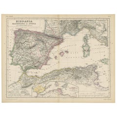
Antique Map of Spain, Mauritia and Africa by H. Kiepert, circa 1870
By Heinrich Kiepert
Located in Langweer, NL
Antique map titled 'Hispania, Mauretania et Africa'. This map originates from 'Atlas Antiquus. Zwölf Karten zur Alten Geschichte' by H. Kiepert. Published in Berlin, circa 1870.
Category

Antique Late 19th Century Maps

Materials

Paper

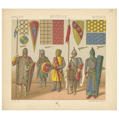
Antique Print of Knights with Middle Ages Armament, circa 1880
Located in Langweer, NL
Antique print titled 'Middle Ages - Moyen Age - Mittelalter'. Chromolithograph of Middle Ages Armament'. This print originates from 'Le Costume Historique' by M.A. Racinet. Published...
Category

Antique Late 19th Century Prints

Materials

Paper

Antique Map of Oceania by Levasseur, circa 1860
Located in Langweer, NL
Antique map titled 'Carte générale de l'Océanie'. Large map of Oceania including New Zealand, Australia, Polynesia, Micronesia and the East Indies. This map originates from 'Atlas Un...
Category

Antique Mid-19th Century Maps

Materials

Paper

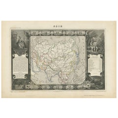
Antique Map of Asia by V. Levasseur, 1854
By Victor Levasseur
Located in Langweer, NL
Antique map titled 'Asie'. Map of the main Asian continent. The decorated border shows various images, as well as two blocks of statistical text on the continent, including populatio...
Category

Antique Mid-19th Century Maps

Materials

Paper

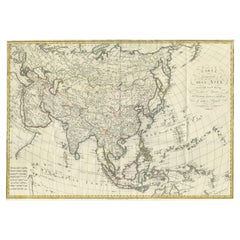
Antique Map of Asia by Ferrario '1815'
Located in Langweer, NL
Antique map titled 'Carta generale dell' Asia (..)'. Original antique map of Asia. This map originates from ' Le Costume Ancien et Moderne' by Jule...
Category

Antique Early 19th Century Maps

Materials

Paper

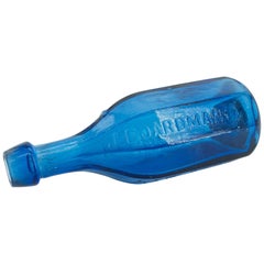
1840s American Octagonal J Boardman New York Mineral Waters Soda Bottle New York
By John Boardman
Located in Hyattsville, MD
J. Boardman & Company New York Mineral Waters, this bottle is never sold. Soda water bottle, America, 1845-1860. Octagonal, bright, medium sapphire b...
Category

Antique 1840s American Federal Historical Memorabilia

Materials

Blown Glass

Antique Map of the State of Ohio by Titus '1871'
Located in Langweer, NL
Antique map titled 'Railroad & Township Map of the State of Ohio'. Original antique map of the State of Ohio. This map originates from 'Atlas of Preble County Ohio' by C.O. Titus. Pu...
Category

Antique Late 19th Century Maps

Materials

Paper

Antique Map of Africa by Levasseur 'c.1840'
Located in Langweer, NL
Antique map titled 'Afrique'. Original antique map of Africa. Decorative map of the continent surrounded by allegorical vignettes. Engraved by Raimond Bonheur, father of the famous F...
Category

Antique Mid-19th Century Maps

Materials

Paper

Early 19th Century Hand Colored Map of the United States and Caribbean Islands
Located in Hamilton, Ontario
Hand coloured early 19th century map by Giraldon of France titled "Etats Unis et Grandes Antilles" (United States and Greater Antilles).
Category

Antique Early 19th Century French Maps

Materials

Paper

Antique Map of South Africa by Wyld '1845'
Located in Langweer, NL
Antique map titled 'South Africa'. Original antique map of South Africa. This decorative original old map originates from 'An Atlas of th...
Category

Antique Mid-19th Century Maps

Materials

Paper

Old Nautical Map of Corsica
Located in Alessandria, Piemonte
ST/556/1 - Old map of Corsica isle, surveyed by Captain Hell, of the French Royal Navy in 1824, engraved and published on 1874, with additions and corre...
Category

Antique Early 19th Century English Other Prints

Materials

Paper

Antique Woodblock Print Map of Japan 'circa 1860'
Located in Langweer, NL
Original Japanese woodblock print map of Japan. Very large and fascinating map, rebacking with Japanese paper. Published circa 1860.
Category

Antique Late 19th Century Maps

Materials

Paper

19th Century Chinese Apothecary Balance Scale Stand
Located in Rio Vista, CA
Large Chinese carved wood apothecary balance scale with stand and storage drawer cabinet. It features beautiful carved fretwork on the top and sides...
Category

Antique 19th Century Chinese Ming Scientific Instruments

Materials

Brass

Antique Map of the World by Johnson, '1872'
Located in Langweer, NL
Antique map titled 'Johnson's World. Original world map. This map originates from 'Johnson's New Illustrated Family Atlas of the World' by A.J. John...
Category

Antique Late 19th Century Maps

Materials

Paper

Victorian Child's Shoe on Mannequin Form
Located in Houston, TX
The leg of a wooden mannequin with a child's high-top shoe and black ribbed sock from the Victorian Era mounted on a metal base. The seven button shoe is ...
Category

Antique Late 19th Century French Victorian Historical Memorabilia

Materials

Steel

Antique Map of North America by Wyld '1845'
Located in Langweer, NL
Antique map titled 'North America'. Original antique map of North America. This map originates from 'An Atlas of the World, Comprehending ...
Category

Antique Mid-19th Century Maps

Materials

Paper

Old Horizontal Map of England
By Tasso
Located in Alessandria, Piemonte
ST/520 - Old rare Italian map of England, dated 1826-1827 - by Girolamo Tasso, editor in Venise, for the atlas of M.r Le-Sage.
Category

Antique Early 19th Century Italian Other Prints

Materials

Paper

Antique Map of Maine et Loire ‘France’ by V. Levasseur, 1854
Located in Langweer, NL
Antique map titled 'Dépt. de Maine et Loire'. Map of the French department of Maine et Loire, France. This area of France is part of the Loire Valley wine region, where nearly every ...
Category

Antique Mid-19th Century Maps

Materials

Paper

Antique Map of Asia Minor by J. Tallis, circa 1851
Located in Langweer, NL
A highly decorative mid-19th century map of 'Asia Minor' (modern day Turkey) which was drawn and engraved by J. Rapkin and published in John Tallis's Illust...
Category

Antique Mid-19th Century Maps

Materials

Paper

Antique Map of the World by Ferrario '1831'
Located in Langweer, NL
Original antique map of the world. This print originates from 'Costume Antico e Moderno: Palestine, China, India, Oceania' by Ferrario. Publis...
Category

Antique Mid-19th Century Prints

Materials

Paper

Antique Religious Print 'No. 3' Visitation of the Blessed Virgin Mary circa 1840
Located in Langweer, NL
Antique print titled ‘Histoire Sainte, Nouveau Testament, Visitation de la Sainte Vierge.’ This plate shows a scene from the New Testament; The Visitation of the Blessed Virgin Mary...
Category

Antique Mid-19th Century Prints

Materials

Paper

19th Century German Porcelain Carriage, Liechtenstein Coat of Arms
Located in Vero Beach, FL
This highly decorative porcelain is pristine and functions with ease. The wheels of the cart move it back and forth securely. The rear of the carriage features the Royal Coat of Arms...
Category

Antique 19th Century Liechtenstein Victorian Porcelain

Materials

Porcelain

Antique Map of the Burmese Empire by Wyld, '1845'
Located in Langweer, NL
Antique map titled 'Map of Burman Empire, Siam, Cochin China and Ton-King'. Original antique map of the Burmese Empire. This map originates from 'An Atlas of the World, Comprehending...
Category

Antique Mid-19th Century Maps

Materials

Paper

Antique Physical Chart of the Indian Ocean by Johnston '1850'
Located in Langweer, NL
Antique map titled 'Physical Chart of the Indian Ocean showing the temperature of the water'. Original antique chart of the Indian Ocean. This map originates from 'The Physical Atlas...
Category

Antique Mid-19th Century Maps

Materials

Paper

Very Rare 19th Century Italian Trompe L'oeil Panels
Located in London, GB
19th century Italian trompe l'oeil panels We are proud to offer a spectacular pair of highly decorative 19th century Italian trompe l'oeil panels, each depicting an architectural b...
Category

Antique 1850s Italian Early Victorian Sculptures and Carvings

Materials

Wrought Iron

Antique Map of England & Wales by Wyld '1845'
Located in Langweer, NL
Antique map titled 'England & Wales'. Original antique map of England & Wales. This map originates from 'An Atlas of the World, Comprehending Se...
Category

Antique Mid-19th Century Maps

Materials

Paper

Antique Map of Vosges ‘France’ by V. Levasseur, 1854
By Victor Levasseur
Located in Langweer, NL
Antique map titled 'Dépt. des Vosges'. Map of the Vosges region in France, centred on Epinal. This map originates from ‘Atlas National de la France Illustré’. Published by A. Combett...
Category

Antique Mid-19th Century Maps

Materials

Paper

Antique Map of Arabia by Tardieu '1843'
Located in Langweer, NL
Antique map titled 'Arabie'. Attractive small map of Arabia. This map originates from 'Dictionnaire Universel de Geographie Moderne' 4th Edition, by A.Pe...
Category

Antique Mid-19th Century Maps

Materials

Paper

Antique Map of Egypt and Palestina by H. Kiepert 'circa 1870'
By Heinrich Kiepert
Located in Langweer, NL
Antique map titled 'Aegyptus, Phoenice et Palestina'. With inset maps of Tyrus, Alexandria and Hierosolyma. This map originates from 'Atlas Antiquus. Zwölf Karten zur Alten Geschicht...
Category

Antique Late 19th Century Maps

Materials

Paper

Antique Map of the East Indies by Wyld '1845'
Located in Langweer, NL
Antique map titled 'Archipelago of the Indian Ocean'. Original antique map of the East Indies. This map originates from 'An Atlas of the World, Comprehending Separate Maps of its Var...
Category

Antique Mid-19th Century Maps

Materials

Paper

Antique Map of the United States of North America by Wyld '1845'
Located in Langweer, NL
Antique map titled 'Map of The United States of North America'. Original antique map of the United States of North America. This map originates from 'An Atlas of the World, Comprehen...
Category

Antique Mid-19th Century Maps

Materials

Paper

Miniature Example Mahogany Bureau Bookcase
Located in New York, NY
Cabinet makers sample.
Category

Antique 19th Century American Federal Models and Miniatures

Materials

Mahogany

Negretti and Zambra Aneroid Barometer, 19th Century
Located in Hamilton, Ontario
19th century Negretti & Zambra aneroid barometer. Large English oak, Gothic style barometer. Free shipping within the United States and Canada.
Category

Antique 19th Century Great Britain (UK) Gothic Scientific Instruments

Antique Map of Scotland 'South' by A.K. Johnston, 1865
Located in Langweer, NL
Antique map titled 'Scotland (Southern Sheet)'. This map originates from the ‘Royal Atlas of Modern Geography’ by Alexander Keith Johnston. Published by William Blackwood and Sons, E...
Category

Antique Mid-19th Century Maps

Materials

Paper

19th Century "Globe De Marié" in Great Condition
Located in Sofia, BG
19th century "Globe de Marié" that was used for a demonstration of an intension to propose marriage to your beloved. The bottom part is made of hand painted wood and the decoration i...
Category

Antique Mid-19th Century French Models and Miniatures

Materials

Glass

De Indische Archipel by C.W. Mieling, 1865-1876
Located in Langweer, NL
'De Indische Archipel: Tafereelen uit de natuur en het volksleven in Indië' by C.W. Mieling. This is a very rare first edition (only 1 copy in Nederlandse Centrale Catalogus – NCC and only 1 copy in JAP, sold in 1974) of a sumptuous work originally published in 12 instalments (started in 1865 by C.W. Mieling and completed in 1876 by J.M. van ‘t Haaff, both in The Hague). It was in January 1862 that a Prospectus was issued by C. W. Mieling, The Hague, announcing the publication of what is the most spectacular of the plate works of Indonesia, De Indische Archipel, which commenced publication in The Hague in 1865. The work contains 24 large chromolithograph plates which are among the largest published on Indonesia. From both a topographical and artistic point of view the plates are of considerable interest as they present a comprehensive series of views in the archipelago, ranging through Java. Borneo, Sumatra and Minahasa, after drawings by virtually all the prominent mid-19th century artists of Indonesia: Raden Saleh...
Category

Antique Mid-19th Century Books

Materials

Paper

Old Tibetan Bronze Bell or Cymbal
Located in Alessandria, Piemonte
Part of an antique Bronze bell or Cymbal, hand hammered - Tibet - half XIX century - can be hung from the ceiling. CYMBAL is a percussion instrument. Now it is used in many ensembles...
Category

Antique 1850s Tibetan Tibetan Metalwork

Materials

Bronze

Antique Map of the Chinese Empire and Japan, '1875'
Located in Langweer, NL
Antique map titled 'Carte générale de l'Empire Chinois et du Japon'. Large map of the Chinese Empire and Japan. This map originates from 'Atlas de Géographie Moderne Physique et Poli...
Category

Antique Late 19th Century Maps

Materials

Paper

19th Century Carved Indian Carnival God Figure, Polychrome Paint on Stand
Located in Los Angeles, CA
Interesting 19th century carved figure with polychrome decoration. Unique coloration and dance position with arm raised. Considerable losses consistent with age, but flaking seems ...
Category

Antique 19th Century Indian Primitive Religious Items

Materials

Wood, Paint

Antique Map of France, Spain and Portugal by Johnson, 1872
Located in Langweer, NL
Antique map titled 'Johnson's France (..)'. Original map showing France, Spain and Portugal. With inset maps of Corsica and Gibraltar Rock. This map ori...
Category

Antique Late 19th Century Maps

Materials

Paper

Antique Map of Northern Africa by Levasseur, '1875'
Located in Langweer, NL
Antique map titled 'Carte de l'Afrique Septentrionale'. Large map of Northern Africa. This map originates from 'Atlas de Géographie Moderne Physique et...
Category

Antique Late 19th Century Maps

Materials

Paper

Antique Map of Washington County 'Ohio' by Titus, 1871
Located in Langweer, NL
Antique map titled 'Washington'. Original antique map of Washington, Ohio. This map originates from 'Atlas of Preble County Ohio' by C.O. Titus. Published, 1871.
Category

Antique Late 19th Century Maps

Materials

Paper

Pair Antique Tripod Bronze Stands Chimera and Marble Balls Painted Ivy
Located in Mimizan, FR
Pair of 19th century neoclassical bronze decorative tripod stands with chimera supporting a decorative ball painted with trailing Ivy Stands have lion paw feet with dragon heads Very...
Category

Antique 1870s British Neoclassical Revival Models and Miniatures

Materials

Marble, Bronze

Antique Map of Meurthe ‘France’ by V. Levasseur, 1854
Located in Langweer, NL
Antique map titled 'Dépt. de la Meurthe'. Map of the French department of Meurthe, France. Part of Lorraine and the Alsace-Lorraine wine region. This map originates from ‘Atlas Natio...
Category

Antique Mid-19th Century Maps

Materials

Paper

Original Antique Map of Peru in South America, 1875
Located in Langweer, NL
Antique map titled 'Carte générale du Pérou'. Large map of Peru. This map originates from 'Atlas de Géographie Moderne Physique et Politique' by A. Levasse...
Category

Antique Late 19th Century Maps

Materials

Paper

Antique Map of North and South America by Schneider and Weigel, 1818
Located in Langweer, NL
Antique map titled 'America nach Arrowsmiths Weltcharte und dessen Globular Projection (..)'. Map of North and South America. Published by Schneider and Weigel, 1818.
Category

Antique Early 19th Century Maps

Materials

Paper

Antique Map of Seram, Boero and the Banda Islands by Van den Bosch '1818'
Located in Langweer, NL
Antique map titled 'Kaart der Ambonsche Eilanden'. Rare and attractive map of the islands of Seram, Boero and the Banda Islands. Includes a nice view of the Island of Seram. One of 1...
Category

Antique Early 19th Century Maps

Materials

Paper

Antique Religious Print 'No. 11' The Temptation of Jesus, circa 1840
Located in Langweer, NL
Antique print titled ‘Histoire Sainte, Nouveau Testament,Tentation.’ This plate shows a scene from the New Testament; The Temptation of Jesus.’ This print originates from a rare s...
Category

Antique Mid-19th Century Prints

Materials

Paper

Antique Map of Southern Italy by J. Tallis, circa 1851
Located in Langweer, NL
Decorative and detailed mid-19th century map of Southern Italy which was drawn and engraved by John Rapkin (vignettes by A. H. Wray and J. Rogers...
Category

Antique Mid-19th Century Maps

Materials

Paper

Antique Map of the Netherlands and Belgium by Hérisson, 1829
Located in Langweer, NL
For your online catalogue, here is a detailed description of the antique map titled 'Carte Routière du Royaume des Pays-Bas comprenant la Hollande et la Belgique,' published by Eustache Hérisson in 1829: **Title**: 'Carte Routière du Royaume des Pays-Bas comprenant la Hollande et la Belgique' **Publisher**: Eustache Hérisson **Publication Year**: 1829 This original antique map is a detailed depiction of the Netherlands and Belgium, dating back to 1829. As a 'Carte Routière', it focuses on the road networks of the region, providing valuable historical insights into the transportation and geographical understanding of the early 19th century. The map's delineation of the Kingdom of the Netherlands, including both Holland and Belgium, is particularly noteworthy as it represents the political geography of the period shortly before Belgium's independence in 1830. The map is sectionalised and laid on linen, a common practice in the 19th century for preserving and reinforcing maps, making them more durable and portable. This method of mounting also suggests that the map was intended for practical use, possibly by travelers or for educational purposes. **Artist and Publisher**: Eustache Hérisson, the publisher of this map, was a known figure in the cartographic and publishing world of the early 19th century. His work is characterized by attention to detail and accuracy, making this map not only a beautiful piece of art but also a reliable historical document. This map is a valuable historical artifact, offering insights into the geographical and political landscape of the Netherlands...
Category

Antique Mid-19th Century Maps

Materials

Paper

German Late 19th Century Crocodile And Silver Vanity Suitcase Case
Located in Copenhagen, K
Beautiful old crocodile vanity and necessaire case, with eight jars in facetted glass and silver lids, one box in silver, several brushes and combs in silver, inkwell in silver, perfume container in silver and glass, travel clock, lipstick container...
Category

Antique Late 19th Century German Trunks and Luggage

Materials

Silver

Antique Map of China and Japan by A.K. Johnston, 1865
Located in Langweer, NL
Antique map titled 'China and Japan'. Depicting Eastern China, the Islands of Japan and more. This map originates from the ‘Royal Atlas of Modern Geography’ by Alexander Keith Johnst...
Category

Antique Mid-19th Century Maps

Materials

Paper

Elephant Head Walking Stick / Promenade Stick Bone, circa 1890
Located in Berlin, DE
Solid wood stick with fine bone engraving as an elephant head. Germany around 19th century Very fine carved handwork. Carved elephant sculpture as a handle. Very high quality workma...
Category

Antique 1890s Sports Equipment and Memorabilia

Materials

Bone

Antique Map of the Northern Hemisphere by Lowry, '1852'
Located in Langweer, NL
Antique map titled 'Perspective Projection of the World on the horizon of London'. Original map of the northern hemisphere. This map originates fro...
Category

Antique Mid-19th Century Maps

Materials

Paper

Antique Map of Part of the Roman Empire by H. Kiepert, circa 1870
By Heinrich Kiepert
Located in Langweer, NL
Antique map titled 'Imperia Persarum et Macedonum'. Depicts part of the Roman Empire, from Greece to Eastern India. This map originates from 'Atlas Antiqus. Zwölf Karten zur Alten Ge...
Category

Antique Late 19th Century Maps

Materials

Paper

19th century English Fishing Framed Aquatint Prints by R G Reeves
By Richard G. Reeve
Located in Savannah, GA
Pair of sportsman prints titled; Live-bait fishing for Jack and Fly-fishing for Trout.; Aquatints with original hand color. Done after James Pollard, by R G Reeve...
Category

Antique 1860s English Victorian Drawings

Materials

Glass, Wood, Paper

Antique Map of Australia and surrounding Islands by F. von Stülpnagel, 1850
Located in Langweer, NL
Antique map titled 'Festland von Asutralien und benachbarte Inseln'. Map showing Australia, New Zealand, Southern New-Guinea and surrounding islands. This map originates from Stieler...
Category

Antique Mid-19th Century Maps

Materials

Paper

Ropes and Tackle for 19th Century Waling Vessel
Located in New York, NY
Tools ropes and tackle for 19th century waling vessel.
Category

Antique 19th Century American American Classical Nautical Objects

Materials

Rope, Maple

Read More

Pamela Shamshiri Shares the Secrets behind Her First-Ever Book and Its Effortlessly Cool Interiors

The sought-after designer worked with the team at Hoffman Creative to produce a monograph that beautifully showcases some of Studio Shamshiri's most inspiring projects.

Moroccan Artworks and Objects Take Center Stage in an Extraordinary Villa in Tangier

Italian writer and collector Umberto Pasti opens the doors to his remarkable cave of wonders in North Africa.

Montecito Has Drawn Royalty and Celebrities, and These Homes Are Proof of Its Allure

Hollywood A-listers, ex-pat aristocrats and art collectors and style setters of all stripes appreciate the allure of the coastal California hamlet — much on our minds after recent winter floods.

Whaam! Blam! Pow! — a New Book on Pop Art Packs a Punch

Publishing house Assouline and writer Julie Belcove have teamed up to trace the history of the genre, from Roy Lichtenstein, Andy Warhol and Yayoi Kusama to Mickalene Thomas and Jeff Koons.

The Sparkling Legacy of Tiffany & Co. Explained, One Jewel at a Time

A gorgeous new book celebrates — and memorializes — the iconic jeweler’s rich heritage.

What Makes a Gem-Encrusted Chess Set Worth $4 Million?

The world’s most opulent chess set, weighing in at 513 carats, is literally fit for a king and queen.

Tauba Auerbach’s Geometric Pop-Up Book Is Mighty Rare, Thanks to a Hurricane

This sculptural art book has an epic backstory of its own.

Step inside the Storied Mansions of Palm Beach’s Most Effervescent Architect

From Spanish-style courtyards to fanciful fountains, these acclaimed structures abound in surprising and elegant details.
Recently Viewed

View All