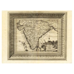
Items Similar to Penisola dell'India... - Etching by Giacomo Cantelli da Vignola - 1683
Want more images or videos?
Request additional images or videos from the seller
1 of 5
Giacomo Cantelli da VignolaPenisola dell'India... - Etching by Giacomo Cantelli da Vignola - 16831683
1683
$1,419.79
£1,073.40
€1,200
CA$1,985.22
A$2,169.61
CHF 1,141.72
MX$25,986.56
NOK 14,369.67
SEK 13,420.71
DKK 9,142.16
About the Item
Etching realized by Giacomo Cantelli da Vignola, and published by Giacomo dé Rossi in 1683.
It is part of the Series "Mercurio Geografico or Geographical Guide to All Parts of the World...", collection of maps published in Rome by de Rossi between 1660 and 1730.
Suggestive map of India, Ceylon, the Maldives and neighbouring regions with the title at the bottom right within a large and imaginative cartouche with natives and animals.
Intact sheet with margins as original. Horizontal binding fold in the center.
- Creator:Giacomo Cantelli da Vignola
- Creation Year:1683
- Dimensions:Height: 24.18 in (61.4 cm)Width: 18.71 in (47.5 cm)Depth: 0.04 in (1 mm)
- Medium:
- Movement & Style:
- Period:1680-1689
- Framing:Framing Options Available
- Condition:Insurance may be requested by customers as additional service, contact us for more information.
- Gallery Location:Roma, IT
- Reference Number:Seller: T-1532401stDibs: LU650315864002
About the Seller
4.9
Platinum Seller
Premium sellers with a 4.7+ rating and 24-hour response times
1stDibs seller since 2017
7,833 sales on 1stDibs
Typical response time: 1 hour
- ShippingRetrieving quote...Shipping from: Grasse, France
- Return Policy
More From This Seller
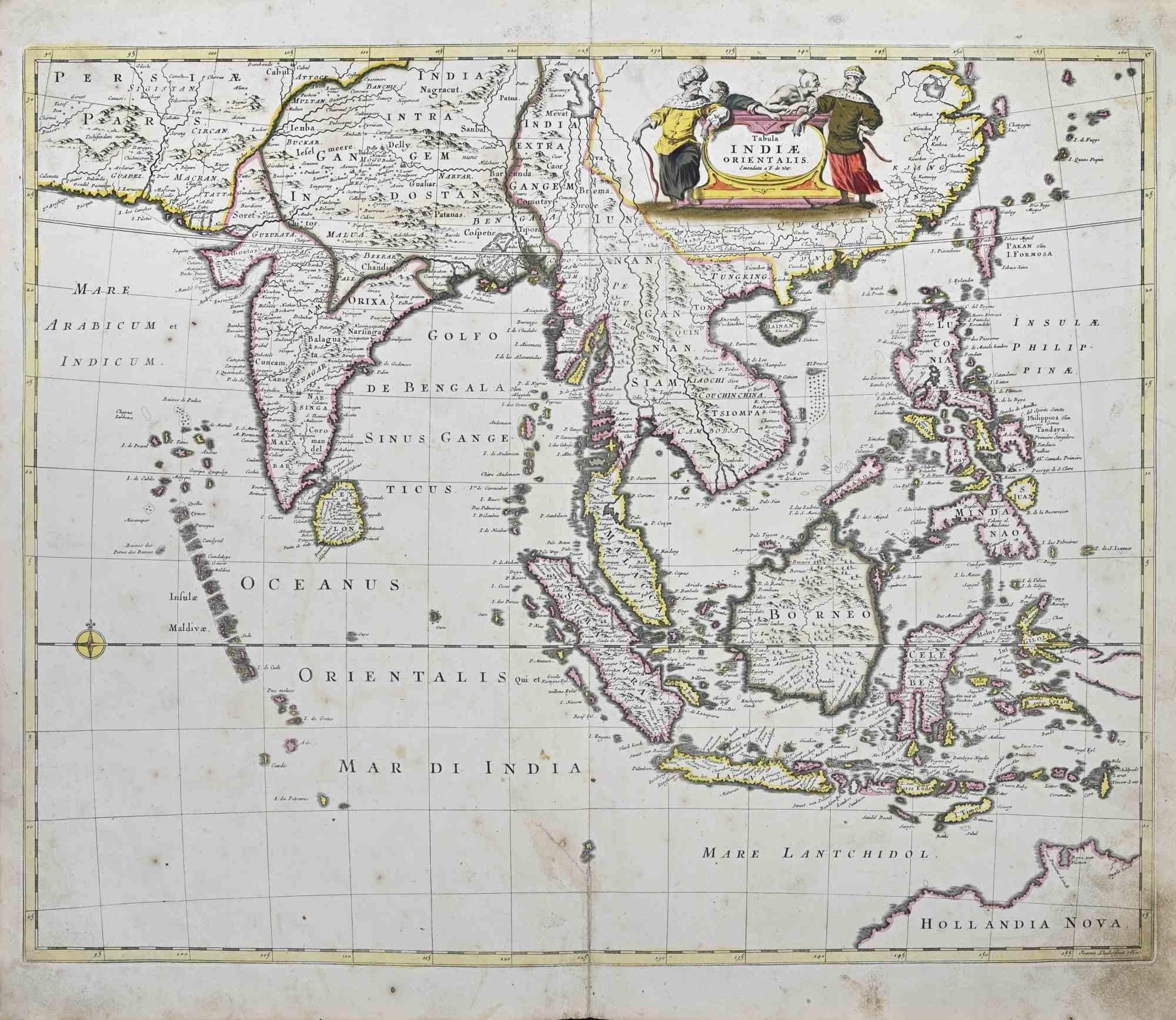
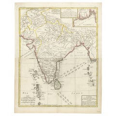
View AllTabula Indiae Orientalis - Etching by Frederick de Wit - 1680ca
By Frederick de Wit
Located in Roma, IT
This double-page etching with contemporary coloring, entitled Tabula Indiae orientalis, was realized by the cartographer Frederick de Wit for the famous Atlas published in Amsterdam ...
Category
1680s Modern Figurative Prints
Materials
Etching

$1,325 Sale Price
20% Off
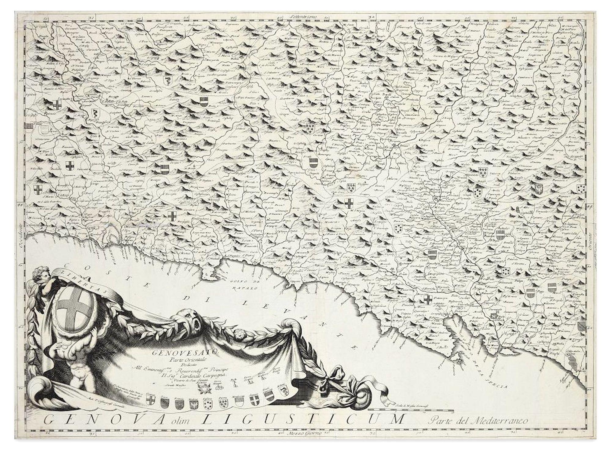
Genova Olim Ligusticum - Etching by V. Coronelli - 1684 ca.
By Vincenzo Maria Coronelli
Located in Roma, IT
Genova olim Ligusticum is a charming antique map etched on paper, representing the "Genovesato Parte Orientale" or the Genoa area and devoted to the prince and cardinal Carpegna, rea...
Category
1680s Figurative Prints
Materials
Etching

Novissima et Accuratissima XVII ... - Etching by Frederick de Wit - 1680ca
By Frederick de Wit
Located in Roma, IT
This double-page etching with contemporary coloring, entitled Novissima et accuratissima XVII Provinciarum Germaniae Inferior Tabula, was realized by the cartographer Frederick de Wi...
Category
1680s Modern Figurative Prints
Materials
Etching

Valsavia Superiore e Inferiore - Etching by V. M. Coronelli - Late 17th century
By Vincenzo Maria Coronelli
Located in Roma, IT
Valsavia Superiore e Inferiore is a beautiful historical etching on ivory-colored paper, realized by Vincenzo Maria Coronelli (1650-1718) in the late 17th century.
This interesting ...
Category
Late 17th Century Figurative Prints
Materials
Paper, Etching
Accuratissima Totius Asiae Tabula - Etching by Frederick de Wit - 1680 ca
By Frederick de Wit
Located in Roma, IT
This double-page etching with contemporary coloring, entitled Accuratissima totius Asiae Tabula, was realized by the cartographer Frederick de Wit for the famous Atlas published in A...
Category
1680s Modern Figurative Prints
Materials
Etching

Novissima et Accuratissima Totius.. - Etching by Frederick de Wit - 1680ca
By Frederick de Wit
Located in Roma, IT
This double-page etching with contemporary coloring, entitled Novissima et Accuratissima totius Italiae, Corsicae et Sardiniae, was realized by the cartographer Frederick de Wit for ...
Category
1680s Modern Figurative Prints
Materials
Etching
You May Also Like
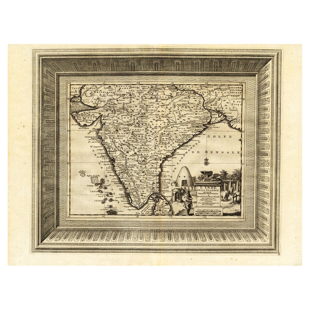
Rare Engraved Antique Map of India with Elephants in the Cartouche, c.1725
Located in Langweer, NL
Antique map titled 'L'Inde de ca le Gange suivant les nouvelles observations (..)'.
Detailed map of India, with part of Sri Lanka. Compass rose and decorative cartouche lower rig...
Category
Antique 18th Century Maps
Materials
Paper
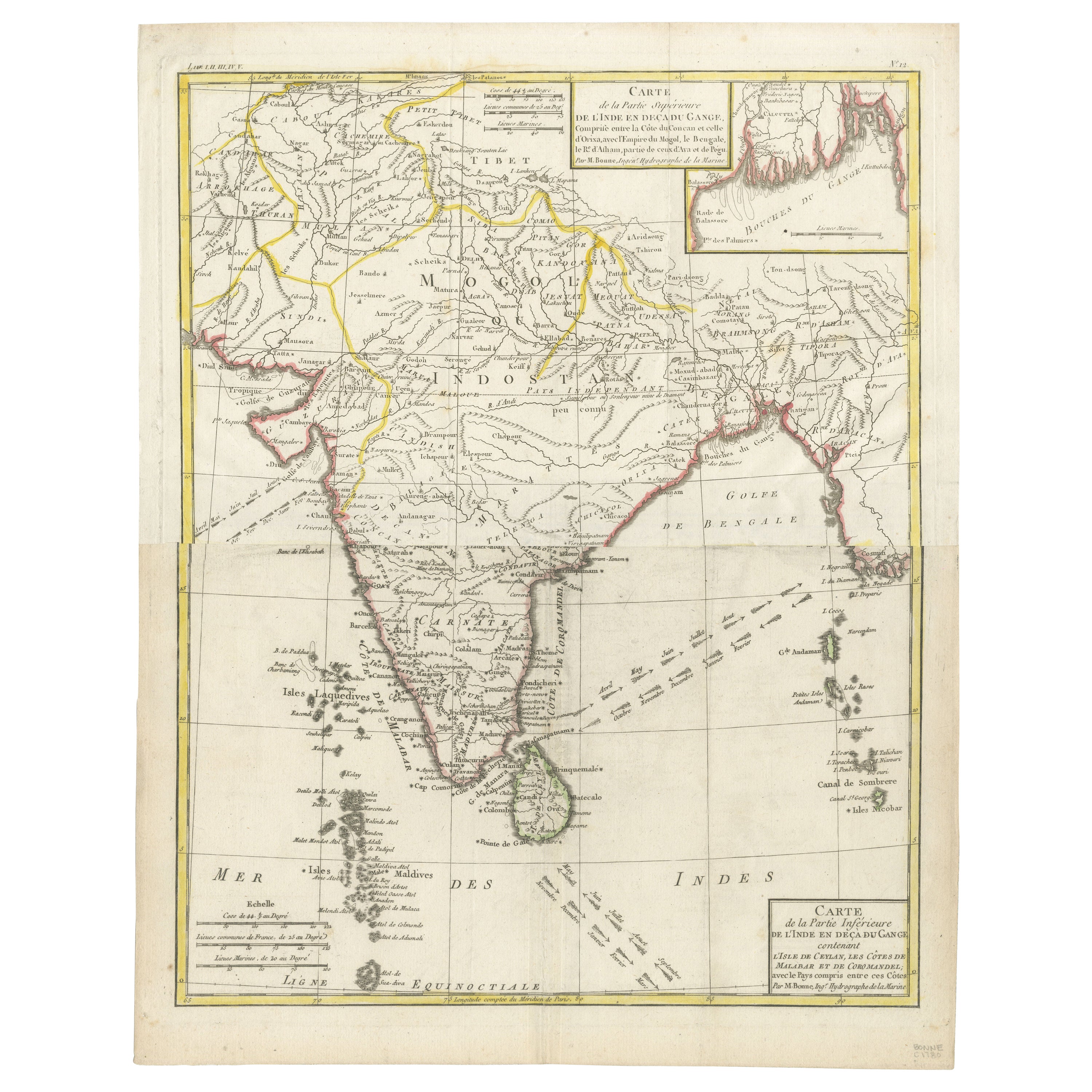
Map of India and Ceylon with Inset of Calcutta and the Ganges, by Bonne, 1780
Located in Langweer, NL
The map on offer is an antique copperplate engraving of India and Ceylon (Sri Lanka), created by Rigobert Bonne (1727-1794), a prominent French cartographer. Here is a breakdown of t...
Category
Antique 1780s Maps
Materials
Paper
$321 Sale Price
20% Off
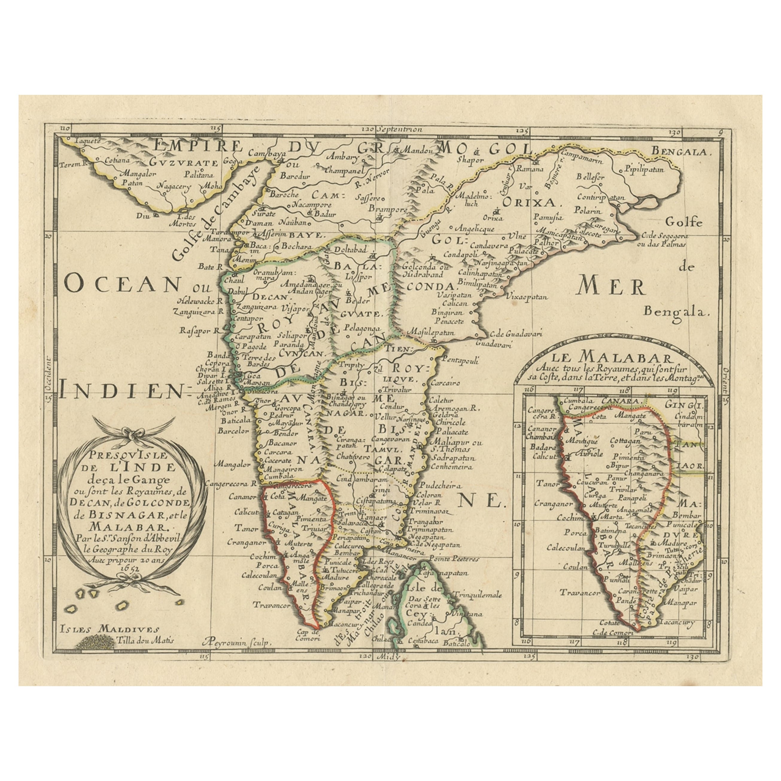
Original Antique Map showing Southern India, Northern Sri Lanka & Malabar, 1652
Located in Langweer, NL
Antique map titled 'Presqu'Isle de l'Inde deca le Gange (..)'.
Old map showing the southern part of India, including the northern part of Sri Lanka. With inset map of Southern India (Malabar). This map covers the subcontinent from the Bay of Bengal and the Gulf of Cambay to Ceylon. The Mogul Empire can be found in the north. Further south...
Category
Antique 1650s Maps
Materials
Paper

$624 Sale Price
20% Off
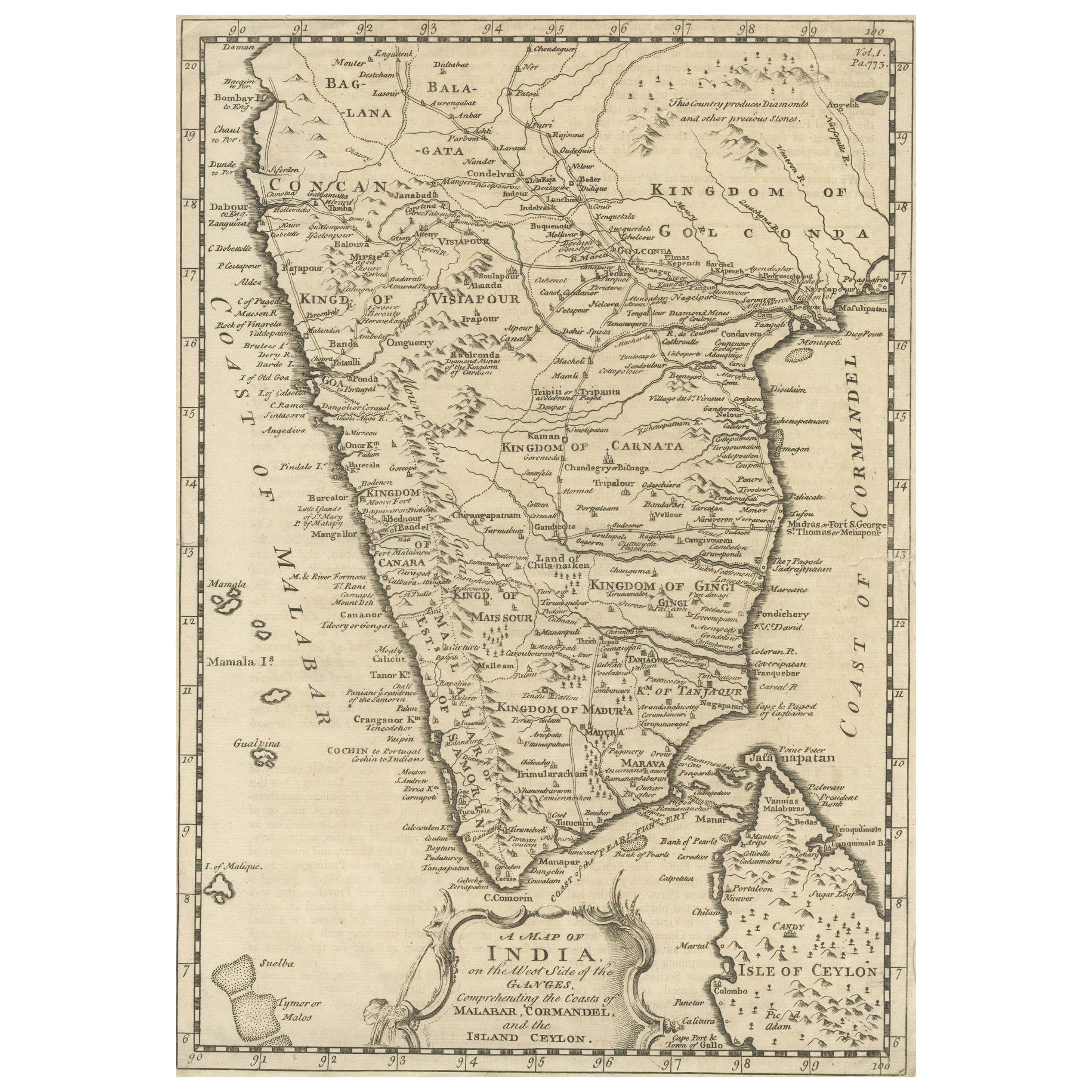
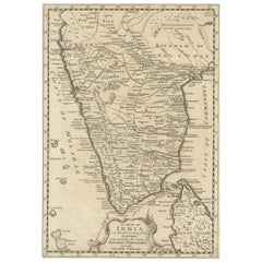
Original Detailed Antique Map of Southern India and Most of Ceylon, 1744
Located in Langweer, NL
Antique map titled 'A Map of India on the west Side of the Ganges, comprehending the coasts of Malabar, Coromandel and the Island Ceylon'.
Map of Southern India and most of Ceylo...
Category
Antique 1740s Maps
Materials
Paper
$416 Sale Price
20% Off
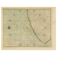
Antique Map of the Gulf of Bengal by J.N. Bellin, circa 1760
Located in Langweer, NL
Beautiful chart of the Gulf of Bengal. The map extends from Malabar to Sumatra and today Phuket area in Thailand. Including Pegu, Ceylon, and the Andaman and Nicobar Islands. Numerou...
Category
Antique Mid-18th Century Maps
Materials
Paper

Antique Print of the Malabar Coast of India showing the VOC establishments, 1726
Located in Langweer, NL
Dutch print with the title: Platte Grond van t'Fort Tricoen male met de daar aangelegen Pagoods-Berg (Trincomalee, Sri Lanka)
The map is taken from: 'Oud en Nieuw Oost-Indiën' van François Valentyn.
1) Ottens, Frederik (engraver / etcher)
2) Braam, J. van (publisher)
3) Linden, Gerard onder de (publisher)
MALABAR COAST...
Category
Antique 1720s Maps
Materials
Paper
$265 Sale Price
20% Off
More Ways To Browse
Picasso Picador Et Taureau
Picasso Satyr
Pierre Bonnard Signed
Pkz Posters
Rare Vintage Original Skate Decks
Rembrandt Etching Amsterdam
Renoir Hand Signed
Roger Jourdain
Rouault Passion
Roy Lichtenstein Composition
Roz Chast
Sally Michael
Salvador Dali Cerberus
Salvador Dali Ea
Salvador Dali Heart
Salvador Dali Moses
Sandu Liberman Lithograph
Scott Jacobs