Items Similar to Oceanus - Etching by Johannes Janssonius - 1650s

Want more images or videos?
Request additional images or videos from the seller
1 of 5
Johannes JanssoniusOceanus - Etching by Johannes Janssonius - 1650s1650s
1650s
$2,612.44
£1,987.48
€2,200
CA$3,664.87
A$3,999.04
CHF 2,068.97
MX$47,840.50
NOK 26,136.10
SEK 24,541.39
DKK 16,758.69
About the Item
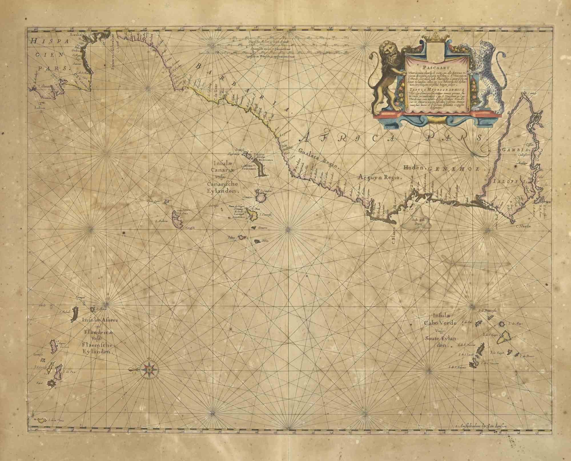
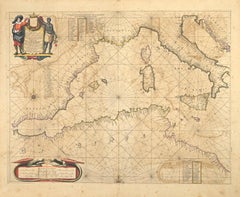
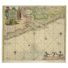
Antique Map - Oceanus is an antique map realized in 1650 by Johannes Janssonius (1588-1664).
The Map is Hand-colored etching, with coeval watercoloring.
Good conditions with slight foxing.
From Atlantis majoris quinta pars, Orbem maritimum [Novus Atlas, volume V: carte marittime]. Amsterdam: Janssonius, 1650. First edition of this famous work by Janssonius also known as the "Waterwereld"; is the first "maritime atlas (in the true sense of the word) printed in the Netherlands" (Koeman) and was published as the fifth volume of the Atlas Novus.
- Creator:Johannes Janssonius (1588 - 1664, Dutch)
- Creation Year:1650s
- Dimensions:Height: 19.3 in (49 cm)Width: 23.23 in (59 cm)Depth: 0.04 in (1 mm)
- Medium:
- Movement & Style:
- Period:1650-1659
- Framing:Framing Options Available
- Condition:Insurance may be requested by customers as additional service, contact us for more information.a.
- Gallery Location:Roma, IT
- Reference Number:Seller: T-1414951stDibs: LU650312857582
About the Seller
4.9
Platinum Seller
Premium sellers with a 4.7+ rating and 24-hour response times
1stDibs seller since 2017
7,798 sales on 1stDibs
Typical response time: 1 hour
- ShippingRetrieving quote...Shipping from: Grasse, France
- Return Policy
More From This Seller
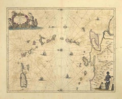
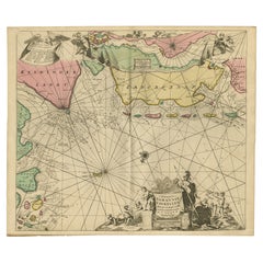
View AllMare Atlanticum - Etching by Johannes Janssonius - 1650s
By Johannes Janssonius
Located in Roma, IT
Mare Atlanticum is an ancient map realized in 1650 by Johannes Janssonius (1588-1664).
Good conditions.
From Atlantis majoris quinta pars, Orbem maritimum [Novus Atlas, volume V: c...
Category
1650s Modern Figurative Prints
Materials
Etching
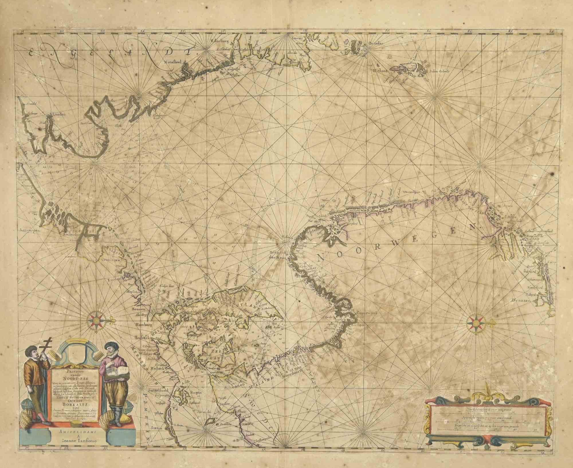
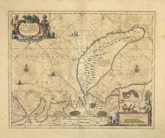
Oceani Borealis - Etching by Johannes Janssonius - 1660s
By Johannes Janssonius
Located in Roma, IT
Oceani Borealis is an ancient map realized in 1650 by Johannes Janssonius (1588-1664).
Good conditions.
From Atlantis majoris quinta pars, Orbem maritimum [Novus Atlas, volume V: c...
Category
1660s Modern Figurative Prints
Materials
Etching
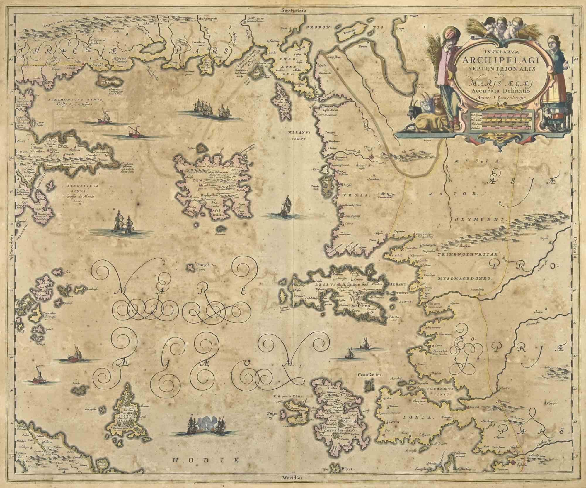
Archipelagus Septentrionalis - Etching by Johannes Janssonius - 1650s
By Johannes Janssonius
Located in Roma, IT
Archipelagus Septentrionalis is an ancient map realized in 1650 by Johannes Janssonius (1588-1664).
Good conditions.
From Atlantis majoris quinta pars, Orbem maritimum [Novus Atlas...
Category
1650s Modern Figurative Prints
Materials
Etching
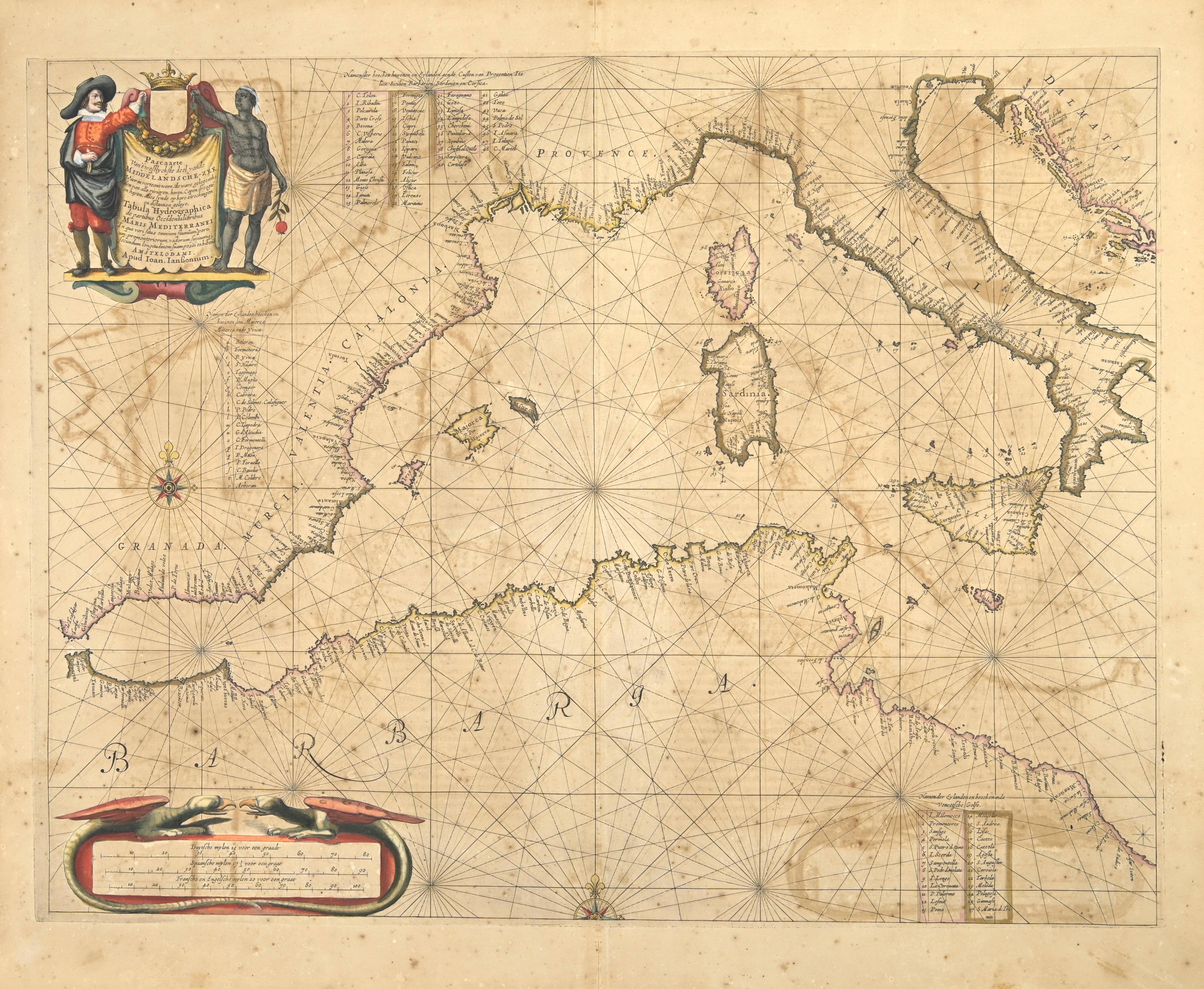
Barbarga - Etching by Johannes Janssonius - 1650s
By Johannes Janssonius
Located in Roma, IT
Barbarga is an ancient map realized in 1650 by Johannes Janssonius (1588-1664).
Good conditions.
From Atlantis majoris quinta pars, Orbem maritimum [Novus Atlas, volume V: carte ma...
Category
1650s Modern Figurative Prints
Materials
Etching
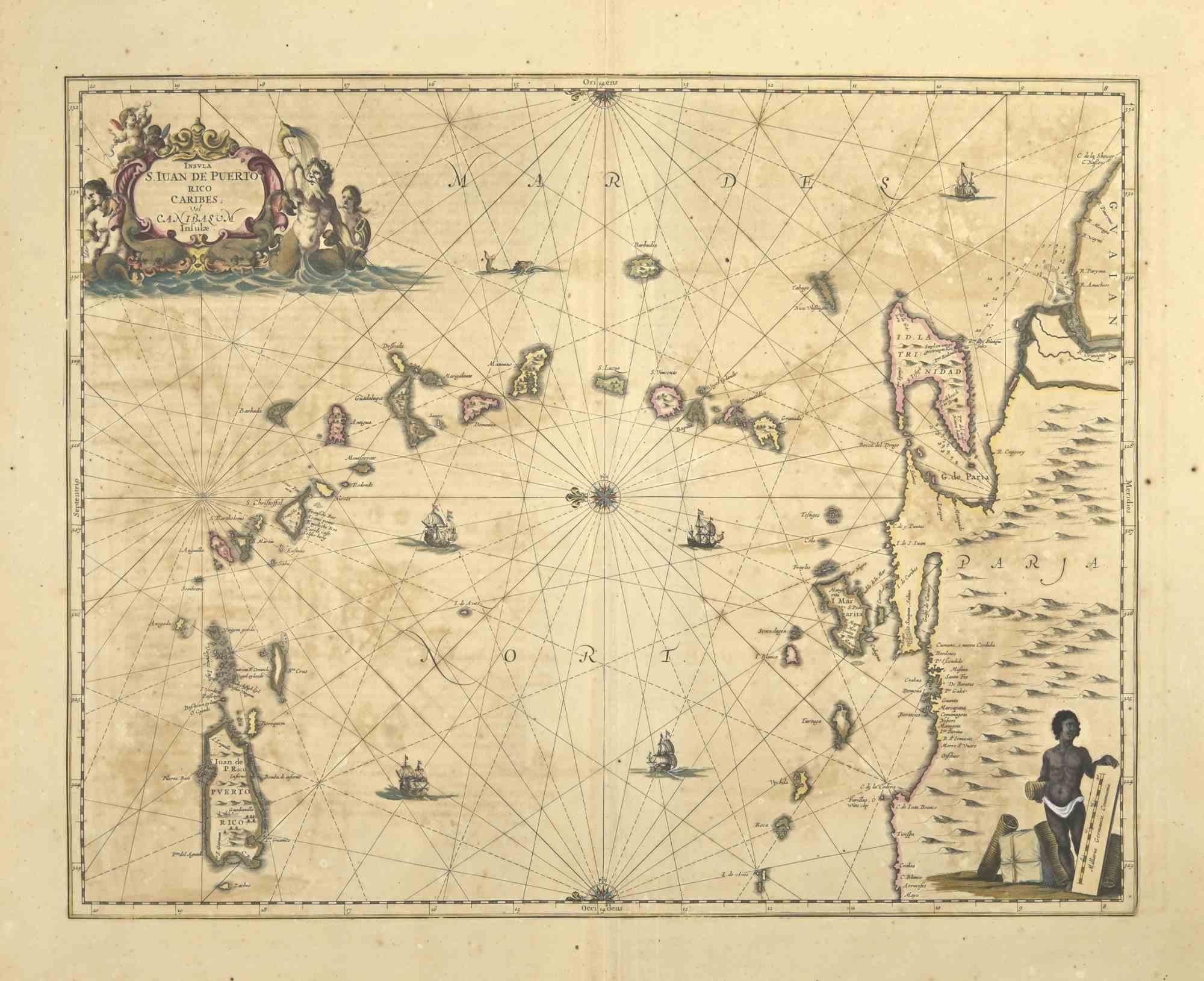
S.Juan de Puerto Rico - Etching by Johannes Janssonius - 1650s
By Johannes Janssonius
Located in Roma, IT
S.Juan de Puerto Rico is an ancient map realized in 1650 by Johannes Janssonius (1588-1664).
Good conditions.
From Atlantis majoris quinta pars, Orbem maritimum [Novus Atlas, volum...
Category
1650s Modern Figurative Prints
Materials
Etching
Nova Zemla - Etching by Johannes Janssonius - 1650s
By Johannes Janssonius
Located in Roma, IT
Nova Zemla is an ancient map realized in 1650 by Johannes Janssonius (1588-1664).
Good conditions.
From Atlantis majoris quinta pars, Orbem maritimum [Novus Atlas, volume V: carte ...
Category
1650s Modern Figurative Prints
Materials
Etching
You May Also Like
1717 Johannes Van Keulen Sea Chart of the Eastern Atlantic - Amsterdam to Gambia
Located in Langweer, NL
1717 Johannes Van Keulen Sea Chart of the Eastern Atlantic - Amsterdam to Gambia
This 1717 sea chart by Johannes Van Keulen, titled "Nieuwe Paskaert vande ...
Category
Antique 1710s Dutch Maps
Materials
Paper
$2,003 Sale Price
25% Off
Rugen Island, Germany: An Early 17th Century Map by Mercator and Hondius
By Gerard Mercator
Located in Alamo, CA
This is an early 17th century map entitled "Nova Famigerabilis Insulae Ac Ducatus Rugiae Desciptio" (Map of Rugen Island, Germany) by Gerard Mercator and Henricus and Joducus Hondiu...
Category
Early 17th Century Old Masters Landscape Prints
Materials
Engraving

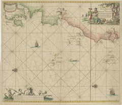
Original Antique Engraving of a Sea Chart of the Western Mediterranean, ca.1650
Located in Langweer, NL
Antique map titled 'Pascaerte van 't westlyckste deel vande Middelandsche-Zee (..)'.
Sea chart of the Western Mediterranean. The map extends from the Straits of Gibralter to Italy ...
Category
Antique 1650s Maps
Materials
Paper

Old Decorative & Highly Detailed Sea Chart of the North Dutch-German Coast, 1681
Located in Langweer, NL
Antique map titled 'Paskaart van een gedeelte van Vriesland, Groeninger, en Emderland. Met zyn onderhoorige Eylanden; Strekkende van't Eylant der Schelling'.
Decorative and highly ...
Category
Antique 1680s Dutch Maps
Materials
Paper
$1,371 Sale Price
30% Off
Rare Sea Chart of the East Frisian Islands or Watten and the North Sea, c.1700
Located in Langweer, NL
Description: Antique map titled 'Paskaarte van de rievier de Elve streckende van Oldenbroek tot Hamburgh.'
Rare and interesting chart of the East Frisian Islands (or Watten) and th...
Category
Antique Early 1700s Dutch Maps
Materials
Paper
$1,537 Sale Price
30% Off
Antique Map of Nova Zembla by Janssonius, c.1650
Located in Langweer, NL
Antique map titled 'Nova Zemla, waygats fretum Nassovi cum et terra Samoiedum singula omnium emendatissime descripta'. This map depicts Nova Zembla and the northern continental coast...
Category
Antique 17th Century Maps
Materials
Paper

$377 Sale Price
20% Off
More Ways To Browse
Dali Mythology
David Hammons
Diego Rivera Lithograph
Divina Commedia
Dorothy Iannone
Eigenthum D Verleger
Engraving Flemish
Ensor Etching
Eugene Hawkins
Eugenio Granell
Femme Nue Couchee
Frank Benson Etchings
Georges Braque Greek
Henri Privat Livemont
Henry Moore 1949
Henryk Tomaszewski
Hockney Ipad Drawings
Invader Rubik