Items Similar to Carte Pour Servir a l'Histoire Philosophique.. - Etching by Rigobert Bonne- 1780


Want more images or videos?
Request additional images or videos from the seller
1 of 6
Rigobert BonneCarte Pour Servir a l'Histoire Philosophique.. - Etching by Rigobert Bonne- 17801780
1780
$897.53
£666.71
€750
CA$1,238.20
A$1,361.12
CHF 715.34
MX$16,529
NOK 8,923.74
SEK 8,454.62
DKK 5,709.39
About the Item
Etching on paper.
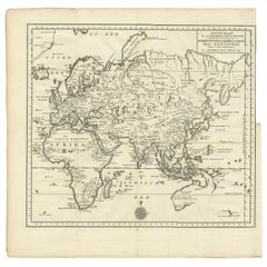
From Guillaume-Thomas Raynal, Histoire philosophique et politique des établissemens et du commerce des Européens dans les deux Indes, Geneva 1780.
This interesting world map covers nearly all the landmasses of Africa, Europe, Asia, and Australia. Interior detail is relatively sparse apart from rivers, occasional place names, pictorial topography, and a few notable points of interest such as the Great Wall of China and various trade routes.
Inland seas feature trade winds and currents (including seasonal variations), along with some navigational hazards such as coral reefs or shoals.
Incomplete coastlines along New Guinea and northern Japan reflect ongoing exploration patterns, and an inset map at bottom center provides additional detail of the southern tip of India and Ceylon.
Large margins beyond the copperplate at right and bottom, small to thin at top and left. Traces of editorial creases from insertion in volume.
- Creator:Rigobert Bonne
- Creation Year:1780
- Dimensions:Height: 14.69 in (37.3 cm)Width: 19.77 in (50.2 cm)Depth: 0.04 in (1 mm)
- Medium:
- Movement & Style:
- Period:1780-1789
- Framing:Framing Options Available
- Condition:Insurance may be requested by customers as additional service, contact us for more information.
- Gallery Location:Roma, IT
- Reference Number:Seller: T-1532391stDibs: LU650315863992
About the Seller
4.9
Platinum Seller
Premium sellers with a 4.7+ rating and 24-hour response times
1stDibs seller since 2017
7,709 sales on 1stDibs
Typical response time: 2 hours
- ShippingRetrieving quote...Shipping from: Grasse, France
- Return Policy
Authenticity Guarantee
In the unlikely event there’s an issue with an item’s authenticity, contact us within 1 year for a full refund. DetailsMoney-Back Guarantee
If your item is not as described, is damaged in transit, or does not arrive, contact us within 7 days for a full refund. Details24-Hour Cancellation
You have a 24-hour grace period in which to reconsider your purchase, with no questions asked.Vetted Professional Sellers
Our world-class sellers must adhere to strict standards for service and quality, maintaining the integrity of our listings.Price-Match Guarantee
If you find that a seller listed the same item for a lower price elsewhere, we’ll match it.Trusted Global Delivery
Our best-in-class carrier network provides specialized shipping options worldwide, including custom delivery.More From This Seller
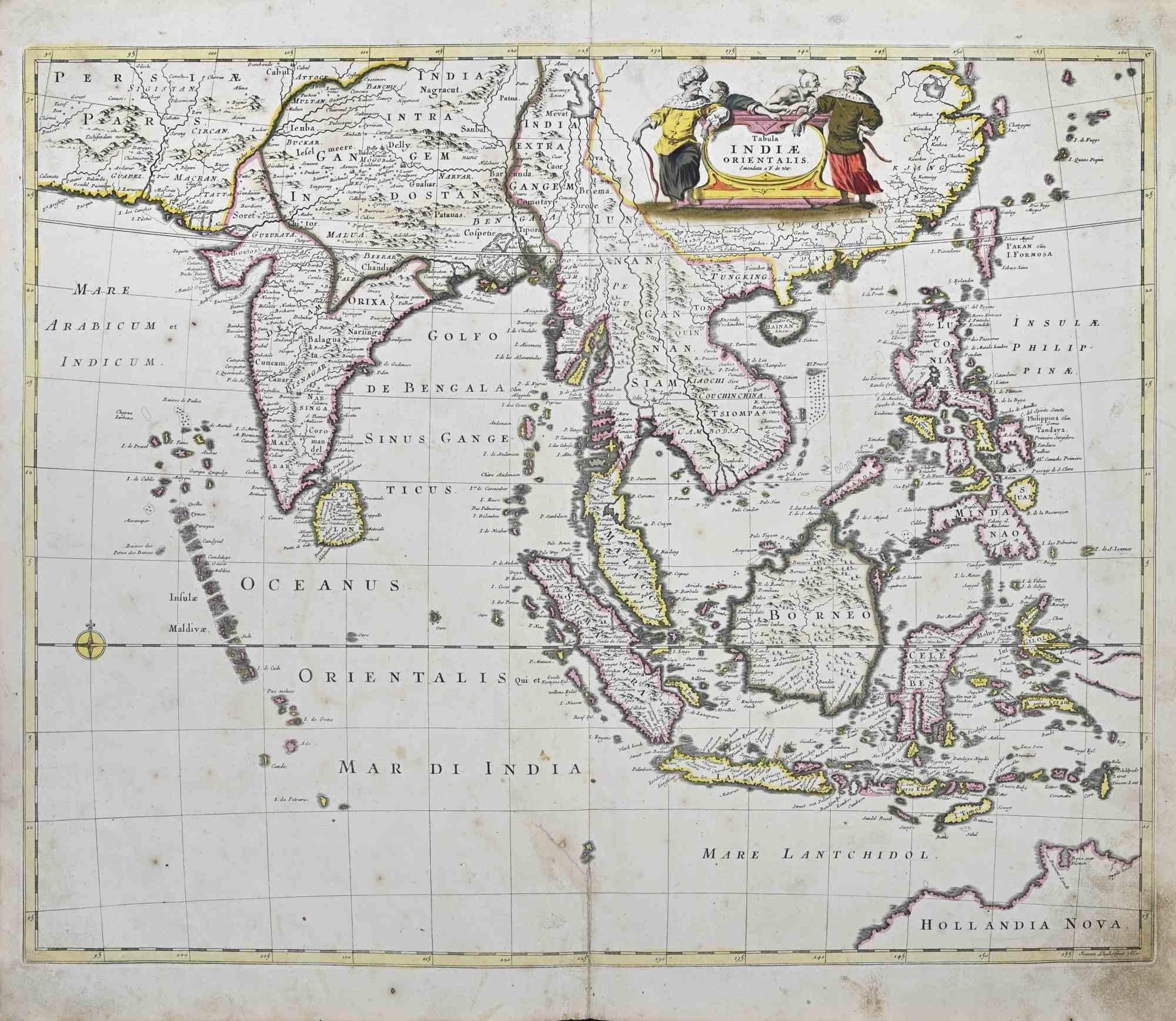
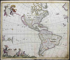
View AllTabula Indiae Orientalis - Etching by Frederick de Wit - 1680ca
By Frederick de Wit
Located in Roma, IT
This double-page etching with contemporary coloring, entitled Tabula Indiae orientalis, was realized by the cartographer Frederick de Wit for the famous Atlas published in Amsterdam ...
Category
1680s Modern Figurative Prints
Materials
Etching

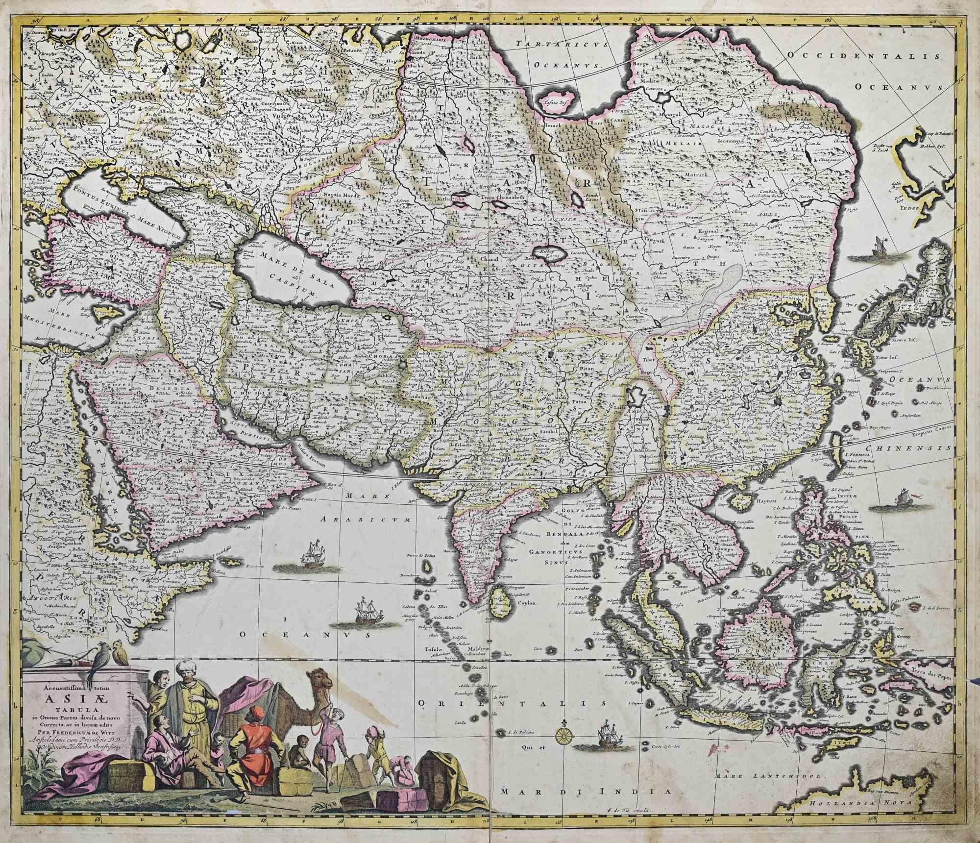
Accuratissima Totius Asiae Tabula - Etching by Frederick de Wit - 1680 ca
By Frederick de Wit
Located in Roma, IT
This double-page etching with contemporary coloring, entitled Accuratissima totius Asiae Tabula, was realized by the cartographer Frederick de Wit for the famous Atlas published in A...
Category
1680s Modern Figurative Prints
Materials
Etching

Novissima et Accuratissima... - Etching by Frederick de Wit - 1680 ca
By Frederick de Wit
Located in Roma, IT
This double-page etching with contemporary coloring, entitled Novissima et Accuratissima Septentrionalis ac Meridionalis Americae, was realized by the cartographer Frederick de Wit f...
Category
1680s Modern Figurative Prints
Materials
Etching
Map of the World - Original Etching - 1820
Located in Roma, IT
Map of the World is an Original Etching realized by an unknown artist of 19th century in 1820.
Very good condition on two sheets of white paper joine...
Category
1820s Modern Figurative Prints
Materials
Etching

Map of Campaign of 1814 - Etching by Pierre François Tardieu - 1837
Located in Roma, IT
Map of Campaign of 1814 is an Etching realized by Pierre François Tardieu in 1837.
Good conditions.
The artwork is realized in a well-balanced composition. the artwork and belongs ...
Category
1830s Modern Figurative Prints
Materials
Lithograph

Map of Mar Del Nort - Etching by Johannes Janssonius - 1650s
By Johannes Janssonius
Located in Roma, IT
Antique Map -Mar Del Nort is an antique map realized in 1650 by Johannes Janssonius (1588-1664).
The Map is Hand-colored etching, with coeval watercolorang.
Good conditions with sl...
Category
1650s Modern Figurative Prints
Materials
Etching

You May Also Like
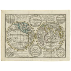
Very Decorative Original Antique Map of the World, Published in France in c.1780
By Rigobert Bonne
Located in Langweer, NL
Antique map titled 'L'Ancien Monde Et Le Nouveau en Deux Hemispheres' - Double hemisphere map of the World, showing the contemporary geographical...
Category
Antique 18th Century Maps
Materials
Paper

$737 Sale Price
20% Off
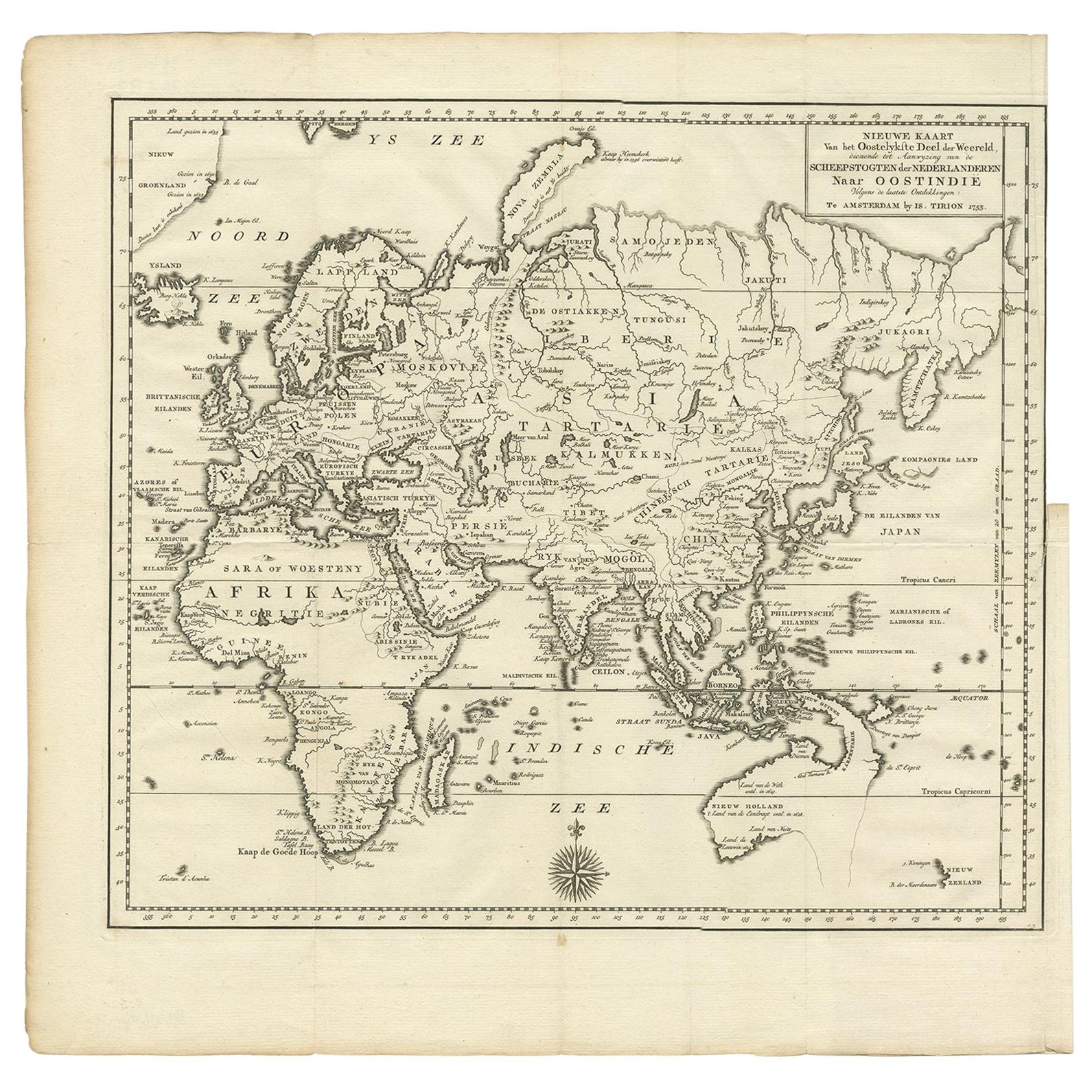
Antique Map of the Eastern Part of the World by Tirion, 1755
By Isaak Tirion
Located in Langweer, NL
Antique map titled 'Nieuwe Kaart van het Oostelykste Deel der Weereld, dienende tot Aanwyzing van de Scheepstogten der Nederlanderen naar Oostindië'. Australia (Nieuw Holland) shown ...
Category
Antique Mid-18th Century Dutch Maps
Materials
Paper
Original Engraved Antique Map of the World, Colorful and Decorative, C.1780
By Pierre François Tardieu
Located in Langweer, NL
Antique map titled 'Mappemonde en Deux Hemispheres ou l'on a Indique les Nouvelles Decouvertes' - This handsome double hemisphere map presents a ...
Category
Antique 18th Century Maps
Materials
Paper

$449 Sale Price
20% Off
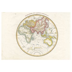
Antique Map of the Eastern Hemisphere by Lapie, France, circa 1830
Located in Langweer, NL
Antique Map of the Eastern Hemisphere by Lapie, France, circa 1830
This finely engraved and hand-colored antique map, titled Hémisphère de l'ancien continent (Eastern Hemisphere), w...
Category
Antique 1830s Maps
Materials
Paper
Interesting Antique Engraving of the World in Hemispheres with 6 Diagrams, 1788
Located in Langweer, NL
Antique map titled 'De Nieuwe en Ouden oppervlakke en doorzigtkundige Aardrykes Bollen (..)'. Twin hemispheres surrounded by six diagrams showing various divisions of the globe. Cali...
Category
Antique Late 18th Century Maps
Materials
Paper
$478 Sale Price
20% Off
Antique Map of Europe by R. Bonne, 1780
Located in Langweer, NL
A fine example of Rigobert Bonne and Guilleme Raynal’s 1780 map of Europe. Drawn by R. Bonne for G. Raynal’s Atlas de Toutes les Parties Connues du Globe Terrestre, Dressé pour l'His...
Category
Antique Late 18th Century French Maps
Materials
Paper

$150 Sale Price
30% Off
More Ways To Browse
Antique Navigation
World Map Of Trade Routes
Great Wall China
Picasso Picador Et Taureau
Picasso Satyr
Pierre Bonnard Signed
Pkz Posters
Rare Vintage Original Skate Decks
Rembrandt Etching Amsterdam
Renoir Hand Signed
Roger Jourdain
Rouault Passion
Roy Lichtenstein Composition
Roz Chast
Sally Michael
Salvador Dali Cerberus
Salvador Dali Ea
Salvador Dali Heart