Atlas Art

to
13
110
100
50
18
15
Overall Width
to
Overall Height
to
103
107
72
11
1
1
9
30
18
4
4
24
138
14
6
2
1
1
215
77
1
293
151,978
79,476
50,382
42,314
36,010
34,270
29,582
26,591
25,707
24,912
20,315
18,184
15,907
14,674
13,541
13,100
10,905
10,323
10,187
108
105
71
53
12
28
26
11
4
3
16
169
213
47
Art Subject: Atlas
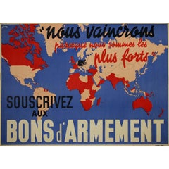
1939 Powerful WWII french poster - Subscribe to Armament Bonds
Located in PARIS, FR
Designed by J. Kap in 1939, this powerful poster titled "Souscrivez aux Bons d’Armement" (Subscribe to Armament Bonds) was a key piece of French wartime propaganda at the dawn of Wor...
Category

1930s Prints and Multiples

Materials

Lithograph, Paper

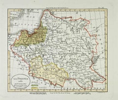
Map of Poland - Etching - Early 20th Century
Located in Roma, IT
Map of Poland is an etching map realized in the early 20th century. Good conditions.
Category

Early 20th Century Modern Figurative Prints

Materials

Etching

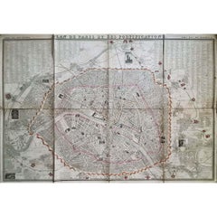
1848 Original map by Maillard - Plan de Paris et ses Fortifications
Located in PARIS, FR
In the realm of cartography, maps serve as both practical tools and artistic representations, encapsulating the essence of a place at a specific moment in time. The 1848 vintage map,...
Category

1840s Prints and Multiples

Materials

Paper, Linen, Lithograph

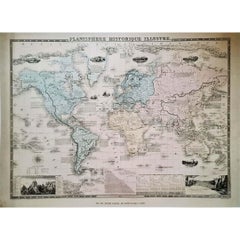
1864 Original illustrated planisphere - World Map - Geography
Located in PARIS, FR
Immerse yourself in the epic journey of the past with the Illustrated Historical Planisphere of 1864 by Charpentier! 🗺️ This cartographic treasure transports you through the intrica...
Category

1860s Prints and Multiples

Materials

Linen, Lithograph, Paper

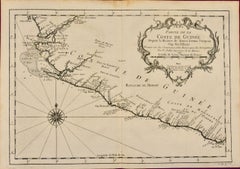
West Coast of Africa; Guinea & Sierra Leone: Bellin 18th Century Map
Located in Alamo, CA
This is a Jacques Bellin copper-plate map entitled "Partie de la Coste de Guinee Dupuis la Riviere de Sierra Leona Jusquau Cap das Palmas", depicting the coast of Guinea and Sierra L...
Category

1740s Old Masters Landscape Prints

Materials

Engraving

Map of the War -Vesfaglia and Lower Saxony - Etching - 19th Century
Located in Roma, IT
Map of the War -Vestaglia and Lower Saxony is an etching realized during the 19th century. Good condition.
Category

Early 19th Century Modern Figurative Prints

Materials

Etching

1947 original map "Les eaux-de-vie de France - Le Cognac" by Larmat
Located in PARIS, FR
The 1947 original map Atlas de la France vinicole - Les eaux-de-vie de France - Le Cognac, created by Louis Larmat and printed by Dorel in Paris, is a fascinating and detailed cartog...
Category

1940s Prints and Multiples

Materials

Lithograph, Paper

Circa 1950 original illustrated map for "Carte France autour de Bordeaux"
Located in PARIS, FR
The circa 1950 original illustrated map for "Carte France autour de Bordeaux" is an excellent representation of mid-20th century cartography, focusing on the area surrounding Bordeau...
Category

1950s Prints and Multiples

Materials

Paper, Linen

West Africa: 18th Century Hand-colored Homann Map Entitled "Guinea Propria"
Located in Alamo, CA
This is a scarce richly hand colored copper plate engraved map of Africa entitled "Guinea Propria, nec non Nigritiae vel Terrae Nigrorum Maxima Pars" by Johann Baptist Homann (1664-1...
Category

1740s Other Art Style Prints and Multiples

Materials

Engraving

Price - Map of Seine - Original Etching - 19th Century
Located in Roma, IT
Map of Seine is an original etching realized by an anonymous engraver of the 19th Century. Printed in series of "France Pittoresque" at the top center. The state of preservation of...
Category

19th Century Figurative Prints

Materials

Etching

1948 original map titled La Vallée de la Dordogne de Bordeaux à la Bourboule
Located in PARIS, FR
The 1948 original map titled La Vallée de la Dordogne de Bordeaux à la Bourboule was created by the French artist and cartographer Jean Moles. This map serves as both a geographical ...
Category

1940s Prints and Multiples

Materials

Lithograph, Paper

1938 original map titled "Carte du réseau aérien français" Air France
Located in PARIS, FR
The 1938 original map titled "Carte du réseau aérien français" by A. Collinet offers a captivating snapshot of Air France's global aviation network durin...
Category

1930s Prints and Multiples

Materials

Linen, Paper, Lithograph

Circa 1950 original map poster of Calvados, designed by André Lesot - Normandy
Located in PARIS, FR
This circa 1950 original map poster of Calvados, designed by André Lesot, is a beautifully detailed representation of this historic region in Normandy, France. Produced by Éditions G...
Category

1950s Prints and Multiples

Materials

Lithograph, Paper, Linen

Map of Campaign of 1814 - Etching by Pierre François Tardieu - 1837
Located in Roma, IT
Map of Campaign of 1814 is an Etching realized by Pierre François Tardieu in 1837. Good conditions. The artwork is realized in a well-balanced composition. the artwork and belongs ...
Category

1830s Modern Figurative Prints

Materials

Lithograph

Map of Scotland - Etching by Johannes Blaeu - 1650s
Located in Roma, IT
Map of Scotland is an geographic map realized by Johannes Blaeu. Etching, printed in 1660 ca. Copper engraving, colored (coeval coloring), on paper, with center fold; Latin text. ...
Category

1650s Modern Figurative Prints

Materials

Etching

1943 original map " Les vins des Côtes du Rhône - Groupe Septentrional"
Located in PARIS, FR
The 1943 original map by L. Larmat from the "Atlas de la France Vinicole" series, titled "Les vins des Côtes du Rhône - Groupe Septentrional", is a beautiful and historically signifi...
Category

1940s Prints and Multiples

Materials

Lithograph, Paper

Map of Greece - Etching on Paper 19th Century
Located in Roma, IT
Image dimensions: 22.2 x 27.8 cm. Grecia is an interesting hand-colored etching on paper, realized by an anonymous artist in the first half of the XIX century. With the inscriptions in Italian, this original print describes the geography of Greece with the great charisma of the antique maps. In very good conditions, except for a usual yellowing of the paper at the edges and minor defects and signs of the time, and some light yellow strips...
Category

19th Century Modern Figurative Prints

Materials

Etching

17th Century Dutch Map of Italy, Sicily, Sardinia, Corsica and Dalmatian Coast
By Theodorus Danckerts
Located in Alamo, CA
This hand colored 17th century Dutch map entitled "Novissima et Accuratissima totius Italiae Corsicae et Sardiniae Descriptio" by Theodore Danckerts depicts the Italian Peninsula in ...
Category

1690s Prints and Multiples

Materials

Engraving

Peloponnesvs (Greece) - Etching by Johannes Janssonius - 1650s
Located in Roma, IT
Peloponnesvs is an antique map realized in 1650 by Johannes Janssonius (1588-1664). The Map is Hand-colored etching, with coeval watercoloring. Good conditions with slight foxing. ...
Category

1650s Modern Figurative Prints

Materials

Etching

1941 original map "Les vins de Bordeaux - Entre-deux-mers, Graves... " by Larmat
Located in PARIS, FR
In 1941, French cartographer L. Larmat created a remarkable map titled Atlas de la France Vinicole: Les Vins de Bordeaux - Entre-Deux-Mers, Graves de Vayres, Sainte-Foy Bordeaux, whi...
Category

1940s Prints and Multiples

Materials

Lithograph, Paper

Sweden and Adjacent Portions of Scandinavia: A Hand-colored 18th C. Homann Map
Located in Alamo, CA
This hand-colored copper-plate map of Sweden and adjacent portions of Scandinavia entitled "Regni Sueciae in Omnes suas Subjacentes Provincias accurate divisi Tabula Generalis" was c...
Category

Early 18th Century Old Masters Landscape Prints

Materials

Engraving

"The World" Published by Cummings & Hilliard, No. 1, Cornhill, Boston
Located in Soquel, CA
"The World" Published by Cummings & Hilliard, No. 1, Cornhill, Boston Early 19th century engraved double hemisphere Atlas Map, titled "The World." Hand colored original outlines. Pu...
Category

1820s American Realist Landscape Prints

Materials

Paper, Printer's Ink, Etching

Carta delle Aspirazioni Nazionali - Vintage Offset - 20th century
Located in Roma, IT
Carta delle Aspirazioni Nazionali is an original offset, realized by an anonymous artist in the mid-20th Century. Fair conditions with riping and cutaways. The artwork is depicted ...
Category

Mid-20th Century Modern Figurative Prints

Materials

Offset

A Hand Colored 17th Century Janssonius Map of Prussia: Poland, N. Germany, etc.
Located in Alamo, CA
An attractive hand-colored copperplate engraved 17th century map of Prussia entitled "Prussia Accurate Descripta a Gasparo Henneberg Erlichensi", published in Amsterdam by Joannes Janssonius in 1664. This very detailed map from the golden age of Dutch cartography includes present-day Poland, Latvia, Lithuania, Estonia and portions of Germany. This highly detailed map is embellished by three ornate pink, red, mint green and gold...
Category

Mid-17th Century Old Masters Landscape Prints

Materials

Engraving

1946 original map "Les vins des côteaux de la Loire - Bourgueil" by Larmat
Located in PARIS, FR
The 1946 original map Atlas de la France Vinicole - Les Vins des Côteaux de la Loire: Bourgueil, St Nicolas-de-Bourgueil, Chinon, Montlouis, Jasnières, created by Louis Larmat and pr...
Category

1940s Prints and Multiples

Materials

Lithograph, Paper

Circa 1950 poster Air Algérie regular line network
Located in PARIS, FR
The circa 1950 poster Air Algérie, réseau des lignes régulières by C. Rivière is a vibrant and captivating piece of mid-century commercial art that illustrates the network of regular...
Category

1950s Prints and Multiples

Materials

Lithograph, Paper, Linen

1947 original map Gouvernement Généraux du Poitou, du Pays d'Aunis
Located in PARIS, FR
The 1947 original map Gouvernement Généraux du Poitou, du Pays d'Aunis et de Saintonge Angoumois, created by Louis Larmat and printed by Dorel in Paris, is a beautifully detailed cartographic representation of a historically significant region in western France. This map, part of Larmat’s extensive body of work, is known for its artistic craftsmanship and geographical precision, offering a comprehensive view of the historical administrative regions of Poitou, Aunis, Saintonge, and Angoumois, which played key roles in the political and cultural history of France. Louis Larmat is celebrated for his contributions to cartography, particularly for his ability to merge historical context, topographical detail, and aesthetic elegance in his maps. His works, especially those focusing on the vinicultural regions of France, are highly respected for their accuracy and artistry. This particular map, although focusing on a more political and historical aspect rather than the wine regions he is most famous for, continues his tradition of detailed regional documentation. Larmat’s cartographic works often transcended the realm of simple geographical depiction, becoming historical documents that encapsulate the cultural essence of the regions they portray. This map illustrates the general governments (administrative divisions) of the provinces of Poitou, Aunis, Saintonge, and Angoumois, regions that are steeped in history. These areas, situated along France’s western coastline, have been integral to the country’s political, economic, and cultural development over centuries. The region of Poitou, for example, is historically known as the birthplace of Eleanor of Aquitaine...
Category

1940s Prints and Multiples

Materials

Lithograph, Paper

1946 original map "Les vins des côteaux de la Loire - Vouvray " by Larmat
Located in PARIS, FR
The 1946 map titled Atlas de la France Vinicole - Les Vins des Côteaux de la Loire: Vouvray by Louis Larmat, printed by Dorel in Paris, presents an intimate exploration of one of the...
Category

1940s Prints and Multiples

Materials

Lithograph, Paper

Campagne de Russie - Etching by Pierre François Tardieu - 1837
Located in Roma, IT
Campagne de Russie is an Etching realized by Pierre François Tardieu in 1837. Good conditions. The artwork is realized in a well-balanced composition. the artwork and belongs to th...
Category

1830s Modern Figurative Prints

Materials

Lithograph

1941 original map "Les vins de Bordeaux - Loupiac, ..." by Larmat
Located in PARIS, FR
In 1941, L. Larmat crafted an exquisite map titled Atlas de la France Vinicole: Les Vins de Bordeaux - Loupiac, Sainte-Croix-du-Mont, Ières Côtes de Bordeaux, Côtes de Bordeaux St. M...
Category

1940s Prints and Multiples

Materials

Lithograph, Paper

A Hand Colored 18th Century Framed Map of South America by Thomas Jefferys
Located in Alamo, CA
This detailed hand colored map of South America by Thomas Jefferys was published in London in 1750. The map shows countries, early colonial possessions, towns, rivers, mountains, and...
Category

Mid-18th Century Other Art Style Landscape Prints

Materials

Engraving

Map of Vienne - Original Etching - 19th Century
Located in Roma, IT
Map of Vienne is an original etching realized by an anonymous engraver of the 19th Century. Belongs to the Series of "France Pittoresque" at the top center. The state of preservati...
Category

19th Century Figurative Prints

Materials

Etching

Map of Battle of Waterloo - Etching by Pierre François Tardieu - 1837
Located in Roma, IT
Map of Battle of Waterloo is an Etching realized by Pierre François Tardieu in 1837. Good conditions. The artwork is realized in a well-balanced composition. the artwork and belong...
Category

1830s Modern Figurative Prints

Materials

Etching

Circa 1950 original illustrated map by André Lesot for "Carte de la Manche"
Located in PARIS, FR
The circa 1950 original illustrated map by André Lesot for "Carte de la Manche" is a significant piece that highlights both artistic design and geographic representation. Created dur...
Category

1950s Prints and Multiples

Materials

Lithograph, Linen, Paper

Map of Germany - Original Etching - 1820
Located in Roma, IT
Map of Germany is an Original Etching realized by an unknown artist of 19th century in 1820. Very good condition on two sheets of white paper joined at...
Category

1820s Modern Figurative Prints

Materials

Etching

Original poster made in the 1950's of the Greater Portland Maine
Located in PARIS, FR
Original cartographic poster made in the 1950's that shows us all the monuments and different places of historical importance in the city of Portland. Portland, also known as Portla...
Category

1950s Prints and Multiples

Materials

Paper, Linen, Lithograph

Map of Chatham, Cape Cod
Located in New York, NY
Original map of Chatham, Cape Cod, with recent hand-coloring, 1938. Light toning to edges; has original holes punched in left edge. From "Massachusetts Cit...
Category

1930s Prints and Multiples

Materials

Paper

Map of Mar Del Nort - Etching by Johannes Janssonius - 1650s
Located in Roma, IT
Antique Map -Mar Del Nort is an antique map realized in 1650 by Johannes Janssonius (1588-1664). The Map is Hand-colored etching, with coeval watercolorang. Good conditions with sl...
Category

1650s Modern Figurative Prints

Materials

Etching

Map of Russia - Original Etching - Late 19th Century
Located in Roma, IT
This Map of Russia is an etching realized by an anonymous artist. The state of preservation of the artwork is good with some small diffused stains. Sheet dimension:27.5 x 44 At t...
Category

Late 19th Century Modern Figurative Prints

Materials

Etching

Map of Vallombrosa - Florence 1926
Located in Roma, IT
This Map of Vallombrosa is a vintage offset print realized by an anonymous author in 1926. The state of preservation of the artwork is aged with some small diffused stains and the a...
Category

1920s Modern Figurative Prints

Materials

Color

The Americas - Vintage Map - 18th century
Located in Roma, IT
The Americas is a very beautiful vintage map realized in the 18th century by an Italian cartographer. Very good conditions, on the right side the inscript...
Category

18th Century Figurative Prints

Materials

Paper, Etching

An original poster featuring an illustrated map of Tenerife - La Lucha
Located in PARIS, FR
A beautiful poster featuring an illustrated map of Tenerife or Tenerife, an island in Spain that forms part of the Canary Islands archipelago in the Atlantic Ocean. It is not only t...
Category

1950s Prints and Multiples

Materials

Lithograph, Paper

1937 original poster designed as a board game - automobile race across Belgium
Located in PARIS, FR
The 1937 original map poster titled "Une course d'automobiles à travers la Belgique" is a fascinating artifact that combines cartography, graphic design, and the cultural enthusiasm ...
Category

1930s Prints and Multiples

Materials

Lithograph, Linen, Paper

Circa 1825 original engraving of the map of Syria by Giraldon Bovinet
Located in PARIS, FR
The circa 1825 original engraving of "Syrie" by Giraldon Bovinet, based on the work of L. Vivien, is a historically significant map that reflects early 19th-century cartographic tech...
Category

1820s Prints and Multiples

Materials

Engraving, Paper

Map of Battle of Aboukir - Etching by Pierre François Tardieu - 1837
Located in Roma, IT
Map of Battle of Aboukir is an Etching realized by Pierre François Tardieu in 1837. Good conditions. The artwork is realized in a well-balanced composition.  and belongs to the sui...
Category

1830s Modern Figurative Prints

Materials

Etching

1943 original map "Les vins des Côtes du Rhône - Groupe Meridional"
Located in PARIS, FR
The 1943 original map by L. Larmat from the "Atlas de la France Vinicole" series, titled "Les vins des Côtes du Rhône - Groupe Méridional", is a significant cartographic depiction of...
Category

1940s Prints and Multiples

Materials

Lithograph, Paper

1941 original map "Les vins de Bordeaux - Saint-Émilion, Pomerol..." by Larmat
Located in PARIS, FR
The 1941 original map by L. Larmat, titled "Atlas de la France vinicole – Les vins de Bordeaux: Saint-Émilion, Pomerol, Néac, Côtes de Fronsac, Côtes Canon-Fronsac", offers a detaile...
Category

1940s Prints and Multiples

Materials

Lithograph, Paper

Map Of Martinique - Etching - 19th Century
Located in Roma, IT
Map Of Martinique is an etching realized by an anonymous engraver of the 19th Century. Printed within the series "France Pittoresque" at the top center. The state of preservation o...
Category

19th Century Modern Figurative Prints

Materials

Etching

1947 original map "Les eaux-de-vie de France - Le Cognac Bons Bois" by Larmat
Located in PARIS, FR
The 1947 original map Atlas de la France Vinicole - Les Eaux-de-vie de France - Le Cognac Bons Bois, created by Louis Larmat and printed by Dorel in Paris, is a beautifully crafted c...
Category

1940s Prints and Multiples

Materials

Lithograph, Paper

Southerlandia Map - Etching by Johannes Janssonius - 1650
Located in Roma, IT
Southerlandia Map is an ancient map realized in 1650 by Johannes Janssonius (1588-1664). The Map is Hand-colored etching, with coeval watercoloring. Good conditions. From Atlantis...
Category

1650s Modern Figurative Prints

Materials

Etching

1946 original map "Les vins des côteaux de la Loire - Pouilly-sur-Loire" Larmat
Located in PARIS, FR
The 1946 original map Atlas de la France Vinicole - Les Vins des Côteaux de la Loire: Pouilly-sur-Loire, Sancerre, Quincy, Reuilly, created by Louis Larmat and printed by Dorel in Pa...
Category

1940s Prints and Multiples

Materials

Lithograph, Paper

1947 original map "Les eaux-de-vie de France - Le Cognac" by Larmat
Located in PARIS, FR
The 1947 original map Atlas de la France vinicole - Les eaux-de-vie de France - Le Cognac, created by Louis Larmat and printed by Dorel in Paris, is a fascinating and detailed cartog...
Category

1940s Prints and Multiples

Materials

Lithograph, Paper

1947 original map "Le Cognac Bois ordinaires & Bois communs" by Larmat
Located in PARIS, FR
The 1947 original map Atlas de la France Vinicole - Les Eaux-de-vie de France - Le Cognac Bois Ordinaires & Bois Communs dits à Terroir, created by Louis Larmat and printed by Dorel ...
Category

1940s Prints and Multiples

Materials

Lithograph, Paper

1947 original map "Les eaux-de-vie de France - Le Cognac fins bois" by Larmat
Located in PARIS, FR
The 1947 original map Atlas de la France Vinicole - Les Eaux-de-vie de France - Le Cognac Fins Bois, created by Louis Larmat and printed by Dorel in Paris, is an exquisite piece that...
Category

1940s Prints and Multiples

Materials

Lithograph, Paper

Golf of Benngala - Etching by Johannes Janssonius - 1650s
Located in Roma, IT
Golfo De Benngala is an antique map realized in 1650 by Johannes Janssonius (1588-1664). The Map is Hand-colored etching, with coeval watercoloring. Good conditions with slight fox...
Category

1650s Modern Figurative Prints

Materials

Etching

1941 original map "Les vins de Bordeaux - Blayais, Côtes de Blaye" by Larmat
Located in PARIS, FR
In 1941, L. Larmat created an impressive map titled Atlas de la France Vinicole: Les Vins de Bordeaux - Blayais, Côtes de Blaye, Bourgeais, Côtes de Bourg, printed by Dorel in Paris....
Category

1940s Prints and Multiples

Materials

Lithograph, Paper

1943 original map "Les vins des Côtes du Rhône - Chateauneuf du Pape " by Larmat
Located in PARIS, FR
The 1943 original map by L. Larmat, titled "Les vins des Côtes du Rhône - Châteauneuf-du-Pape - Tavel", is an exquisite part of the "Atlas de la France Vinicole" series. Printed by D...
Category

1940s Prints and Multiples

Materials

Lithograph, Paper

Regnum Hungariae - Etching by Frederick de Wit - 1680ca
Located in Roma, IT
This double-page etching with contemporary coloring, entitled Regnum Hungariae, was realized by the cartographer Frederick de Wit for the famous Atlas published in Amsterdam in ca. 1...
Category

1680s Modern Figurative Prints

Materials

Etching

Regni Hungariae et Regionum - Etching by Frederick de Wit - 1680ca
Located in Roma, IT
This triple-page etching with contemporary coloring, entitled Regni Hungariae et Regionum, was realized by the cartographer Frederick de Wit for the famous Atlas published in Amsterd...
Category

1680s Modern Figurative Prints

Materials

Etching

Map of Northumberland by Joan Blaeu
Located in London, GB
To see our other original maps, scroll down to "More from this Seller" and below it click on "See all from this Seller" - or send us a message if you cannot find the poster you want....
Category

1660s Landscape Prints

Materials

Engraving

Recently Viewed

View All