Atlas Art
to
13
110
100
50
18
15
Overall Width
to
Overall Height
to
103
107
72
11
1
1
9
30
18
4
4
24
138
14
6
2
1
1
215
77
1
293
152,879
80,070
50,627
42,495
36,138
34,335
29,694
26,674
25,735
25,073
20,373
18,293
16,008
14,756
13,604
13,137
10,946
10,353
10,193
108
105
71
53
12
28
26
11
4
3
16
169
213
47
Art Subject: Atlas
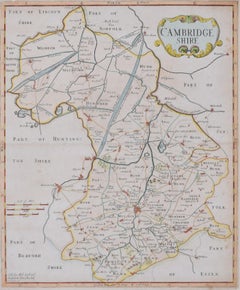
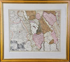
Map of Cambridge 18th century engraving by Sutton Nichols
Located in London, GB
To see more, scroll down to "More from this Seller" and below it click on "See all from this Seller."
Sutton Nichols (1668 - 1729)
Map of Cambridgeshire
Engraving
43 x 36 cm
Signed in plate lower left.
A beautifully coloured 18th century map engraving of Cambridgeshire. The map was produced by Robert Morden for publication in Edward Gibson's 1695 translation of William Camden's Britannia, a topographical and historical survey of Great Britain and Ireland produced to "restore antiquity to Britaine, and Britain to his antiquity" - a most noble aim.
William Camden (1551 - 1623) was an English antiquarian, historian, topographer, and herald, best known as the author of Britannia, the first chorographical survey of the islands of Great Britain and Ireland, and the Annales, the first detailed historical account of the Queen...
Category
18th Century Landscape Prints
Materials
Engraving
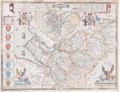
John Speede Map The Countye Palatine of Chester with that most ancient citie
By John Speed
Located in London, GB
To see our other views and maps of England - including London, Oxford and Cambridge, scroll down to "More from this Seller" and below it click on "See all from this Seller" - or send...
Category
17th Century Realist Landscape Prints
Materials
Engraving
New Revised North America Map with Mythical Figures and Animals
Located in Houston, TX
Copperplate engraving hand colored map of Northern America. The figures of the mythical figure along the right side and the animals were added in later after the original printing. T...
Category
Early 1700s Naturalistic Landscape Prints
Materials
Engraving
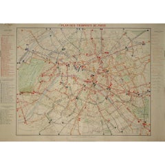
1899 "Plan des Tramways de Paris" by Wuhrer - Paris's public transportation
Located in PARIS, FR
The 1899 "Plan des Tramways de Paris" by Wuhrer is a fascinating snapshot of Paris's public transportation landscape at the dawn of the 20th century. This meticulously crafted map delineates the extensive network of tramway lines that crisscrossed the city, each route marked in detail to aid both residents and visitors in navigating the bustling metropolis.
The Belle Époque, during which this map was produced, was a period of significant growth and modernization in Paris. The city's population was expanding rapidly, and with it came the need for a more efficient means of urban transport. Tramways emerged as a vital solution, connecting neighborhoods and making the city's many attractions more accessible. These electric trams were a symbol of technological progress, replacing the horse-drawn carriages of earlier years and setting the stage for the future of public transit...
Category
1890s Prints and Multiples
Materials
Lithograph, Paper
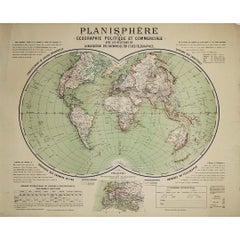
Circa 1900 original poster Planisphère de géographie politique et commercial
Located in PARIS, FR
This circa 1900 original poster, "Planisphère de Géographie Politique et Commerciale," is a fascinating artifact of early 20th-century cartography, created by H. Bouthillier de Beaum...
Category
Early 1900s Prints and Multiples
Materials
Lithograph, Paper
Southern Holland: An Original 17th C. Hand-colored Visscher Map "Hollandiae"
Located in Alamo, CA
This a beautiful framed hand colored 17th century map of the southern portions of Holland by Nicolaus (Nicolas) Visscher II entitled "Hollandiae pars Meridionalis, vulgo Zuyd-Holland", published in Amsterdam in 1678. The map shows the region between Breda, Heusden, Gornichem, Gouda, Dordrecht, and Willemstad. It includes a decorative cartouche in the lower left corner.
The map is presented in an attractive maple colored wood frame with gold trim and a fabric mat. There is a central vertical fold, as issued. There are small areas of discoloration consistent with age. The map is otherwise in very good condition.
The Visscher family were one of the great cartographic families of the 17th century. Begun by Claes Jansz Visscher...
Category
Late 17th Century Other Art Style Landscape Prints
Materials
Engraving
Wiltshire, original vintage map by Donald McCullough
Located in London, GB
David McCullough
Wiltshire
Lithograph
57 x 43 cm
The Countryman County Map of Wiltshire was part of the Countryman magazine’s series of illustrated county maps, designed to celebr...
Category
1940s Realist Figurative Prints
Materials
Lithograph
Battle of Bautzen - Etching by Pierre François Tardieu - 1837
Located in Roma, IT
Battle of Bautzen is an Etching realized by Pierre François Tardieu in 1837.
Good conditions.
The artwork is realized in a well-balanced composition. the artwork and belongs to the...
Category
1830s Modern Figurative Prints
Materials
Lithograph
Campagne d'Egypte - Etching by Pierre François Tardieu - 1837
Located in Roma, IT
Campagne d'Egypte is an Etching realized by Pierre François Tardieu in 1837.
Good conditions.
The artwork is realized in a well-balanced composition. the artwork and belongs to the...
Category
1830s Modern Figurative Prints
Materials
Lithograph
German Campaign - Etching by Pierre François Tardieu - 1837
Located in Roma, IT
German campaign is an Etching realized by Pierre François Tardieu in 1837.
Good conditions.
The artwork is realized in a well-balanced composition. the artwork and belongs to the s...
Category
1830s Modern Figurative Prints
Materials
Lithograph
Siege of Toulon - Etching by Pierre François Tardieu - 1837
Located in Roma, IT
Siege of Toulon is an Etching realized by Pierre François Tardieu in 1837.
Good conditions.
The artwork is realized in a well-balanced composition. the artwork and belongs to the s...
Category
1830s Modern Figurative Prints
Materials
Lithograph
Map of Battle of Rivoli - Etching by Pierre François Tardieu - 1837
Located in Roma, IT
Map of Battle of Rivoli is an Etching realized by Pierre François Tardieu in 1837.
Good conditions.
The artwork is realized in a well-balanced composition. the artwork and belongs ...
Category
1830s Modern Figurative Prints
Materials
Lithograph
Blue Map - map, north pole, blue, geometrical, mathematical
By Marco Araldi
Located in London, GB
Marco’s background is in engineering and architecture, making him familiar with mathematical design and the awareness of geometry.
When he decided to create art, he was naturally dra...
Category
2010s Contemporary Landscape Paintings
Materials
Ink, Acrylic
$3,863 Sale Price
20% Off
Thesssalia Map - Etching by Johannes Janssonius - 1650s
Located in Roma, IT
Thessalia Map is an ancient map realized in 1650 by Johannes Janssonius (1588-1664).
The Map is Hand-colored etching, with coeval watercoloring.
Good conditions.
From Atlantis maj...
Category
1650s Modern Figurative Prints
Materials
Etching
Map of Haute Vienne - Original Lithograph - 19th Century
Located in Roma, IT
Map of Haute Vienne is an original lithograph artwork realized by an Anonymous engraver of the 19th century.
Printed in the series of "France Pittoresque".
Titled "France Pittore...
Category
19th Century Modern Figurative Prints
Materials
Lithograph
Map Of India - Original Lithograph - 19th Century
Located in Roma, IT
Map of India is an original lithograph artwork realized by an Anonymous engraver of the 19th Century.
Printed in the series of "France Pittoresque".
Titled "France Pittoresque".
...
Category
19th Century Modern Figurative Prints
Materials
Lithograph
Seine et Marne - Original Lithograph - 19th Century
Located in Roma, IT
Seine et Marne Map is an original lithograph realized by an Anonymous engraver of the 19th Century.
Printed in series of "France Pittoresque" at the top cen...
Category
19th Century Modern Figurative Prints
Materials
Paper, Lithograph
Map of Tarn - Original Lithograph - 19th Century
Located in Roma, IT
Map of Tarn is an original lithograph realized by an Anonymous artist of the 19th Century.
Printed in series of "France Pittoresque" at the top center.
The state of preservation of...
Category
19th Century Modern Figurative Prints
Materials
Paper, Lithograph
Map of Var - Original Lithograph- 19th Century
Located in Roma, IT
Map of Var is an original lithograph realized by an Anonymous artist of the 19th century.
Printed in series of "France Pittoresque", as indicated on the top center.
The state of pr...
Category
19th Century Modern Figurative Prints
Materials
Paper, Lithograph
Les Vosges - Original Lithograph - 19th Century
Located in Roma, IT
Les Vosges Map is an original Lithograph map realized by an Anonymous engraver of the 19th Century.
Printed in series of "France Pittoresque" at the top center.
The state of preservation of the artwork is good with yellowish stain.
An interesting piece of art in this geographical map...
Category
19th Century Modern Figurative Prints
Materials
Paper, Lithograph
Yonne Map - Original Lithograph - 19th Century
Located in Roma, IT
Yonne Map is an original lithograph map realized by an Anonymous engraver of the 19th Century.
Printed in series of "France Pittoresque" at the top center.
The state of preservation of the artwork is good with some foxing.
An interesting piece of art in this geographical map...
Category
19th Century Modern Figurative Prints
Materials
Paper, Lithograph
Salon et Loire Map - Original Lithograph - 19th Century
Located in Roma, IT
Salon et Loire Map is an original lithograph map realized by an Anonymous artist of the 19th Century.
Printed in series of "France Pittoresque" at the top center.
The state of preservation of the artwork is good.
An interesting piece of art in this geographical map...
Category
19th Century Modern Figurative Prints
Materials
Paper, Lithograph
Hautes-Pyrénées Map - Original Lithograph - 19th Century
Located in Roma, IT
Hautes-Pyrénées Map is an original lithograph realized by an Anonymous engraver of the 19th Century.
Printed in series of "France Pittoresque" at the top center.
The state of prese...
Category
19th Century Modern Figurative Prints
Materials
Paper, Lithograph
Map of Africa - Original Etching by C. Brue - 1820
Located in Roma, IT
Map of Africa is an original etching realized by C.Brue in 1820.
The print comes from the Series "Atlas Universal" PL. 31.
The state of preservation of the artwork is good except f...
Category
1820s Modern Figurative Prints
Materials
Etching
Basses-Pyrénées - Etching - 19th Century
Located in Roma, IT
Basses-Pyrénées is an etching realized by an Anonymous engraver of the 19th Century.
Printed in series of "France Pittoresque" at the top center.
The state of preservation of the a...
Category
19th Century Modern Figurative Prints
Materials
Lithograph
Map of Seine - Original Etching - 19th Century
Located in Roma, IT
Map of Seine is an original etching realized by an anonymous engraver of the 19th Century.
Printed in series of "France Pittoresque" at the top center.
The state of preservation of...
Category
19th Century Figurative Prints
Materials
Etching
Map of Pyrénées - Original Etching - 19th Century
Located in Roma, IT
Map of Pyrénées is an original antique etching realized by an anonymous engraver of the XIX century.
Printed in series of "France Pittoresque" at the top center.
The state of prese...
Category
19th Century Modern Figurative Prints
Materials
Etching
Map of Rhône - Original Etching - 19th Century
Located in Roma, IT
Map of Rhône is an original antique etching realized by an anonymous engraver of the 19th Century.
Printed in series of "France Pittoresque" at the top center.
The state of preserv...
Category
19th Century Modern Figurative Prints
Materials
Etching
Map of Haute-Saône - Original Etching - 19th Century
Located in Roma, IT
Map of Haute-Saône is an original antique etching realized by an anonymous engraver of the 19th Century.
Printed in series of "France Pittoresque" at the top center.
The state of p...
Category
19th Century Modern Figurative Prints
Materials
Etching
Map of Somme - Etching - 19th Century
Located in Roma, IT
Map of Somme is an etching realized by an anonymous engraver of the 19th Century.
Printed in series of "France Pittoresque" at the top center.
The state of preservation of the artw...
Category
19th Century Modern Figurative Prints
Materials
Etching
Map of Vendée - Etching - 19th Century
Located in Roma, IT
Map of Vendée is an etching realized by an anonymous engraver of the 19t century.
Printed in series of "France Pittoresque" at the top center.
The state of preservation of the artw...
Category
19th Century Modern Figurative Prints
Materials
Etching
Map of Vaucluse - Etching - 19th Century
Located in Roma, IT
Map of Vaucluse is an original antique etching realized by an anonymous engraver of the XIX century.
Printed in series of "France Pittoresque" at the top center.
The state of prese...
Category
19th Century Modern Figurative Prints
Materials
Etching
Map of Eastern Roman Empire -Vintage Offset Print - Early 20th Century
Located in Roma, IT
This map of Eastern Roman Empire is a vintage offset print realized in the early 20th Century.
The state of preservation of the artwork is aged with dif...
Category
Early 20th Century Figurative Prints
Materials
Offset
Map of Lymosin-Perigord-Quercye - Original Etching by Antonio Zatta - 1776
Located in Roma, IT
This Map of Lymosin-Perigord-Quercy is an etching realized by Antonio Zatta in Venice in 1776.
The state of preservation of the artwork is good except for the worn paper and the pap...
Category
1770s Figurative Prints
Materials
Etching
Map of Nubia and Abissinia - Original Etching by Antonio Zatta - 1784
Located in Roma, IT
This Map of Nubia and Abissinia is an etching realized by Antonio Zatta in Venice in 1784.
The state of preservation of the artwork is good expect for the worn paper with some littl...
Category
1770s Landscape Prints
Materials
Etching
The Death of Print - Etching by Sergio Barletta - 1970s
Located in Roma, IT
The Death of Print is an original etching, realized by Sergio Barletta.
Hand-signed in pencil on the lower right. Titled on the lower left in Italian" Morta di Stampa".
In very go...
Category
1970s Contemporary Figurative Prints
Materials
Etching
Map of Spain and Portugal - Original Etching - Late 19th Century
Located in Roma, IT
This Map of Spain and Portugal is an etching realized by an anonymous artist.
The state of preservation of the artwork is good with some small diffused stains.
Sheet dimension: 28...
Category
Late 19th Century Modern Figurative Prints
Materials
Etching
Carte de l'Ocean Atlantique - by F. A. de Varnhagen - 1865
Located in Roma, IT
Bermuda Islands is an original black and white print realized in 1865.
Good conditions except for some light folds along the margin.
Original title "Carte de l'Océan Atlantique ave...
Category
1860s Figurative Prints
Materials
Etching
Leyden, Map from "Civitates Orbis Terrarum" - by F. Hogenberg - 1575
Located in Roma, IT
Braun G., Hogenberg F., Leyden, from the collection Civitates Orbis Terrarum, Cologne, T. Graminaeus, 1572-1617.
The “Civitates Orbis Terrarum” (Atlas of Cities of the World) was th...
Category
16th Century Figurative Prints
Materials
Etching, Aquatint
Jacques Liozu's 1951 illustrated map of the region of Pays d'Ouest
Located in PARIS, FR
Jacques Liozu's 1951 illustrated map of the Pays d'Ouest is a remarkable cartographic work that skilfully combines art and geography. Jacques Liozu, the famous French artist-cartogra...
Category
1950s Prints and Multiples
Materials
Lithograph, Paper
Map of Oxfordshire coloured 18th century engraving by Thomas Kitchin
Located in London, GB
To see our other original maps, scroll down to "More from this Seller" and below it click on "See all from this Seller" - or send us a message if you cannot find the poster you want....
Category
1760s Landscape Prints
Materials
Engraving
1953 Coronation Map for London Transport
Located in London, GB
To see more, scroll down to "More from this Seller" and below it click on "See all from this Seller."
Coronation Arrangements – Map of London (1...
Category
1950s Landscape Prints
Materials
Lithograph
Christophe Stouvenel "US Army" 2019
Located in Saint Ouen, FR
US ARMY
2020
Stencil on 1881 military geography atlas maps
(military map of the United States - eastern part)
45x57 cms
(note that on the borders there ma...
Category
2010s Figurative Drawings and Watercolors
Materials
Glue, Ink, Mixed Media
Territory Of The Potomac Hunt
Located in Bristol, CT
Classic map compiled by: C.W. Owen, Jr 1948 of the 'Territory of the Potomac Hunt' Kennels: Travilah, MD
Map Sz: 17"H x 18"W
Frame Sz: 22"H x 23"W
The Potomac Hunt is one of Maryl...
Category
1940s Prints and Multiples
Materials
Lithograph
Clouds - 24 kt Gold Leaf & Acrylic, Painting, Acrylic on Other
Located in Yardley, PA
Nature. Imagination. Clouds. An endless play of gold acrylic with splashes of 24 kt gold leaf comes to life. Emotion comes to light. :: Painting :: Contemporary :: This piece comes ...
Category
2010s Contemporary Paintings
Materials
Acrylic
"Britannia"
Located in Bristol, CT
Drawn and engraved by Edw. Weller for Dr William Smith's 'Ancient Atlas' plate No. 10
Map Sz: 22 1/2"H x 17 3/8"W
Frame Sz: 27 1/8"H x 22"W
Category
1870s Prints and Multiples
Materials
Paper
Le Coste Nord Ovest Dell' America E Nord Est Dell' Asia Delineate Sulle Ultime O
Located in Bristol, CT
Map Sz: 14 1/2"H x 19 7/8"W
Frame Sz: 21"H x 26 3/8"W
A fine example of Cassini's 1798 map of Alaska, the Bering Strait, and Siberia. Cassini issued this map in his 1798 atlas to illustrate the discoveries made by James Cook. Cook was the first to accurately chart the Alaskan coastline and provide a detailed mapping of the Aleutian Islands. Cook's zigzagging route is shown as he skirts the Aleutian Islands, passes through the Bering Strait into the Arctic Ocean, and then turns back to sail south along the Siberian Coast. Here the Aleutians are collectively identified as Isole Alessiane, though many of the original islands...
Category
1790s Prints and Multiples
Materials
Paper
Molly: Oakland to Los Angeles, CA (Positive)
By Nikki Rosato
Located in New Orleans, LA
medium: silver gouache on paper
The artist says of the inspiration in her latest work . . .
Moving to Washington, DC in 2016 changed me. The unraveling of this country's leadershi...
Category
21st Century and Contemporary Contemporary Portrait Paintings
Materials
Gouache
Civilization & Its Discontents
Located in New York, NY
Print of an accomplished artist Jerry Meyer.
Category
2010s Modern Prints and Multiples
Materials
Digital
Motherland Revisited
By Jeffrey Pitt
Located in New Orleans, LA
Jeffrey Pitt’s intricate paintings evolved out of the artist’s desire to interpret culture based on artistic and ceremonial expression. With a B.A. in Anthropology, Pitt has a great ...
Category
21st Century and Contemporary Abstract Paintings
Materials
Acrylic, Canvas, Oil
Carte de l'Europe by Paulémile Pissarro, 1972 - Graphite on paper
Located in London, GB
THIS WORK IS SOLD UNFRAMED
Carte de l'Europe by Paulémile Pissarro (1884 - 1972)
Graphite on paper
12.9 x 20 cm (5 ¹/₈ x 7 ⁷/₈ inches)
Provenance
Estate of the Artist
Yvonne Pissa...
Category
1970s Post-Impressionist Landscape Drawings and Watercolors
Materials
Paper
HOMANN, Johann Baptist (1663-1724) Nova Anglia. Septentrionali Americæ implantat
Located in Bristol, CT
Map Sz: 18 3/4"H x 22 5/8"W
Frame Sz: 27 1/2"H x 31"W
Nuremberg: Homann Heirs, [circa 1740]. Copper-engraved map, with full original colour.
A highly fascinating and attractive ma...
Category
1740s Prints and Multiples
Materials
Paper
Civilization & Its Discontents
Located in New York, NY
Print of an accomplished artist Jerry Meyer. Framed and signed.
Category
2010s Prints and Multiples
Materials
Digital
Recently Viewed
View AllMore Ways To Browse
Miracle On Ice
Murray Dessner
Native American Oklahoma
New England Barn
New Orleans Jazz Poster
Niagara Falls Oil
Oil Painting By Alice
Oil Painting Willow Tree
Oil Paintings New Zealand
Opera Nude
Orca Whale Art
Original Vintage Travel Posters Monte Carlo
Otto Lindberg
Painting Bird Hunting
Painting Bouvard Antoine Painting
Painting Signed Scott
Paintings Landscapes Signed Jacobs
Paris In The Rain
