Atlas Art
to
13
110
100
50
18
15
Overall Width
to
Overall Height
to
103
107
72
11
1
1
9
30
18
4
4
24
138
14
6
2
1
1
215
77
1
293
152,113
79,541
50,433
42,342
36,057
34,363
29,620
26,612
25,726
24,915
20,354
18,190
15,912
14,675
13,559
13,105
10,942
10,337
10,202
108
105
71
53
12
28
26
11
4
3
16
169
213
47
Art Subject: Atlas
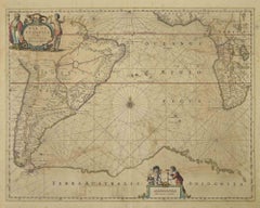
Antique Map - Mar Di Athiopia - Etching by Johannes Janssonius - 1650s
Located in Roma, IT
Antique Map - Mar Di Athiopia is an antique map realized in 1650 by Johannes Janssonius (1588-1664).
The Map is Hand-colored etching, with coeval watercolorang.
Good conditions wit...
Category
1650s Modern Figurative Prints
Materials
Etching
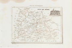
Map of Puy De Dome - Original Etching - 19th Century
Located in Roma, IT
Map of Puy De Dome is an original etching realized by an anonymous engraver of the XIX century.
Printed in series of "France Pittoresque" at the top cente...
Category
19th Century Figurative Prints
Materials
Etching
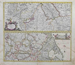
Totius fluminis Rheni Novissima Descriptio- Etching by Frederick de Wit - 1680ca
Located in Roma, IT
This double-page etching with contemporary coloring, entitled Totius fluminis Rheni novissima descriptio, was realized by the cartographer Frederick de Wit for the famous Atlas publi...
Category
1680s Modern Figurative Prints
Materials
Etching
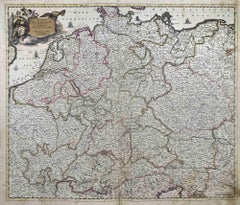
Accuratissima Germaniae Tabula - Etching by Frederick de Wit - 1680ca
Located in Roma, IT
This double-page etching with contemporary coloring, entitled Accuratissima Germaniae Tabula [...], was realized by the cartographer Frederick de Wit for the famous Atlas published i...
Category
1680s Modern Figurative Prints
Materials
Etching
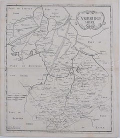
Map of Cambridgeshire, 18th century engraving by Sutton Nicholls
Located in London, GB
To see more, scroll down to "More from this Seller" and below it click on "See all from this Seller."
Sutton Nichols (1668 - 1729)
Map of Cambridgeshire
Engraving
43 x 36 cm
Signe...
Category
18th Century Landscape Prints
Materials
Engraving
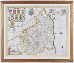
Map of Northumberland by Joan Blaeu
Located in London, GB
To see our other original maps, scroll down to "More from this Seller" and below it click on "See all from this Seller" - or send us a message if you cannot find the poster you want....
Category
1660s Landscape Prints
Materials
Engraving
Dalmatia with the Adjacent Islands - Etching by Giovanni Cassini - 1792
Located in Roma, IT
Dalmatia with the Adjacent Islands - Plate 42 is an original old master artwork realized by Giovanni Cassini in 1792
Handcolored etching.
Includes frame
Category
Late 18th Century Old Masters Figurative Prints
Materials
Etching
Map of Russia - Etching by Marco Di Pietro - 19th Century
Located in Roma, IT
This map of Russia is an etching realized by the Italian engraver Marco Di Pietro in 19th century.
The state of preservation of the artwork is excellent. The signature is engraved o...
Category
19th Century Old Masters Figurative Prints
Materials
Etching
1935 original map French exploration in North America
Located in PARIS, FR
In 1935, a remarkable map titled "Les Français au Cœur de l'Amérique" was produced, highlighting the rich history of French exploration and influence in North America. This map is a ...
Category
1930s Prints and Multiples
Materials
Lithograph, Paper
Map of France - Etching - 1820
Located in Roma, IT
Map of France is an Original Etching realized by an unknown artist of 19th century in 1820.
Very good condition on two sheets of white paper joined at t...
Category
1820s Modern Figurative Prints
Materials
Etching
1800 'Map of London, Southwark, and parts adjacent' by Darton and Harvey
Located in London, GB
Darton and Harvey (publisher)
Map of London, Southwark, and parts adjacent (1800)
Engraving
42 x 56 cm
Original price "1 shilling".
Category
Early 1800s Prints and Multiples
Materials
Paper, Engraving
Map of Seine - Original Etching - 19th Century
Located in Roma, IT
Map of Seine is an original etching realized by an anonymous engraver of the XIX century.
Printed in series of "France Pittoresque" at the top center.
The state of preservation of ...
Category
19th Century Figurative Prints
Materials
Etching
Map of Terre Neuve - Original Etching - 19th Century
Located in Roma, IT
Map of Terre Neuve is an original etching realized by an anonymous engraver of the XIX century.
Printed in series of "France Pittoresque" at the top center.
The state of preservati...
Category
19th Century Figurative Prints
Materials
Etching
The Atlantic Ocean - Original Etching by A. Stieler - 1857
Located in Roma, IT
The Atlantic Ocean is an original colored print realized in 1857.
Hand-colored engraving made in Gotha (Germany) by Adolf Stieler.
Good conditions except for some light yellowing t...
Category
1950s Figurative Prints
Materials
Etching
Ancient Map of Senegal - Original Etching - 19th Century
Located in Roma, IT
Map of Senegal is an original etching realized by an anonymous engraver of the 19th Century.
Printed in series of "France Pittoresque" at the top center.
The state of preservation ...
Category
19th Century Figurative Prints
Materials
Etching
Map of Greece - Original Etching by Antonio Zatta - 18th Century
Located in Roma, IT
This Map of Greece is an etching realized by Antonio Zatta, Cartographer, publisher and typographer.
The state of preservation of the artwork is good except for the worn paper and t...
Category
1780s Figurative Prints
Materials
Etching
Map of Switzerland - Etching - 19th Century
Located in Roma, IT
This map of Netherlands is an etching realized in 19th century.
The state of preservation of the artwork is excellent. The signature "F.B." is engraved on the lower right. At the to...
Category
19th Century Figurative Prints
Materials
Etching
Map of Deux Sèvres - Original Etching - 19th Century
Located in Roma, IT
Map of Deux Sèvres is an original antique etching realized by an anonymous engraver of the 19th Century.
Printed in series of "France Pittoresque" at the top center.
The state of p...
Category
19th Century Modern Figurative Prints
Materials
Etching
Map of China - Etching - 19th Century
Located in Roma, IT
This map of China is an etching realized in 19th century.
The state of preservation of the artwork is excellent. At the top of the paper, the inscription...
Category
19th Century Figurative Prints
Materials
Etching
Valsavia Superiore e Inferiore - Etching by V. M. Coronelli - Late 17th century
By Vincenzo Maria Coronelli
Located in Roma, IT
Valsavia Superiore e Inferiore is a beautiful historical etching on ivory-colored paper, realized by Vincenzo Maria Coronelli (1650-1718) in the late 17th century.
This interesting ...
Category
Late 17th Century Figurative Prints
Materials
Paper, Etching
Ancient Map of Denmark and Sweden - Original Etching - 19th Century
Located in Roma, IT
This Map of Denmark and Sweden is an etching realized by an anonymous artist.
The state of preservation of the artwork is good with some small diffused stains.
Sheet dimension: 27x...
Category
Late 19th Century Modern Figurative Prints
Materials
Etching
View of Leiden - Etching by G. Braun and F. Hogenberg - Late 1500
Located in Roma, IT
This map of Leida is an original etching realized by George Braun and Franz Hogenberg as part of the famous Series "Civitates Orbis Terrarum".
The “Civitates Orbis Terrarum” (Atlas...
Category
16th Century Figurative Prints
Materials
Etching
Battle of Wissembourg - Lithograph - 1872
Located in Roma, IT
Battle of Wissembourg is an artwork realized by R. Walker.
Lithograph, printed in 1872 by Milliam Mackenzie, London.
Good condition.
Category
1870s Modern Figurative Prints
Materials
Lithograph
Battle of Forbach - Lithograph - 1872
Located in Roma, IT
Battle of Forbach is an artwork realized by R. Walker.
Lithograph, printed in 1872 by Milliam Mackenzie, London.
Good condition.
Category
1870s Modern Figurative Prints
Materials
Lithograph
Battle of Vionville - Lithograph - 1872
Located in Roma, IT
Battle of Vionville is an artwork realized by R. Walker.
Lithograph, printed in 1872 by Milliam Mackenzie, London.
Good condition.
Category
1870s Modern Figurative Prints
Materials
Lithograph
Battle of Beaumont - Lithograph - 1872
Located in Roma, IT
Battle of Beaumont is an artwork realized by R. Walker.
Lithograph, printed in 1872 by Milliam Mackenzie, London.
Good condition.
Category
1870s Modern Figurative Prints
Materials
Lithograph
Battle of Saarbruck - Lithograph - 1872
Located in Roma, IT
Battle of Saarbruck is an artwork realized by R. Walker.
Lithograph, printed in 1872 by Milliam Mackenzie, London.
Good condition.
Category
1870s Modern Figurative Prints
Materials
Lithograph
Li Governi di Borgogna - Ancient Map - 1777
Located in Roma, IT
Li Governi di Borgogna is an original black and white etching on paper, printed by Antonio Zatta in Venice, 1777.
Original Title: Li Governi di Borgogna della Franca Contea e del Ly...
Category
1770s Modern Landscape Prints
Materials
Etching
Original poster Concentration Camps in the Soviet Union Never in France S.F.I.O.
Located in PARIS, FR
The original poster titled "Les camps de concentration en Union soviétique - jamais ça en France" ("Concentration Camps in the Soviet Union - Never in France") serves as a stark poli...
Category
1940s Prints and Multiples
Materials
Lithograph, Paper, Linen
Hemisphere Of The New Continent - Ancient Map by J.G. Heck - 1834.
Located in Roma, IT
Hemisphere Of The New Continent - West is an artwork realized in 1834 by Johann Georg Heck
Original colored print.
Good conditions except for yellowing of the paper and very littl...
Category
1830s Modern Figurative Prints
Materials
Etching
Prussia (after the war of 1866) - Lithograph - 1872
Located in Roma, IT
Prussia (after the war of 1866) is a map realized by an artist during the 19th century.
Lithograph, printed in 1872 by Milliam Mackenzie, London.
Good condition.
Category
1870s Modern Figurative Prints
Materials
Lithograph
Battle of Vionville - Lithograph by R. Walker - 1872
Located in Roma, IT
Battle of Vionville is a map realized by R. Walker.
Lithograph, printed in 1872 by Milliam Mackenzie, London.
Good condition.
Category
1870s Modern Figurative Prints
Materials
Lithograph
Battle of Beaumont - Lithograph by R. Walker - 1872
Located in Roma, IT
Battle of Beaumont is a map realized by R. Walker.
Lithograph, printed in 1872 by Milliam Mackenzie, London.
Good condition.
Category
1870s Modern Figurative Prints
Materials
Lithograph
Battle of Wissembourg - Lithograph by R. Walker - 1872
Located in Roma, IT
Battle of Wissembourg is a map realized by R. Walker.
Lithograph, printed in 1872 by Milliam Mackenzie, London.
Good condition.
Category
1870s Modern Figurative Prints
Materials
Lithograph
Battle of Saarbruck - Lithograph by R. Walker - 1872
Located in Roma, IT
Battle of Saarbruck is an map realized by R. Walker.
Lithograph, printed in 1872 by Milliam Mackenzie, London.
Good condition.
Category
1870s Modern Figurative Prints
Materials
Lithograph
South Germany - Lithograph - 1872
Located in Roma, IT
South Germany is a map realized by an artist during the 19th century.
Lithograph, printed in 1872 by Milliam Mackenzie, London.
Good condition.
Category
1870s Modern Figurative Prints
Materials
Lithograph
1963 original poster Le Vignoble d'Alsace, la Route des Vins d'Alsace
Located in PARIS, FR
P. Barbier's 1963 original poster promoting "Le Vignoble d'Alsace, la Route des Vins d'Alsace" (The Vineyards of Alsace, the Alsace Wine Route) stands as a picturesque invitation to explore the rich winemaking heritage and scenic beauty of this renowned French region. This poster, created to promote the Alsace Wine Route, not only serves as promotional material but also encapsulates the essence of tradition, culture, and the joy of wine exploration.
The Alsace Wine Route, or "Route des Vins d'Alsace," winds through the picturesque vineyards and charming villages of the Alsace region in northeastern France. This route is known for its exceptional wines, centuries-old winemaking traditions, and stunning landscapes...
Category
1960s Prints and Multiples
Materials
Lithograph, Paper
Jacques Liozu's 1951 illustrated map of the region of Franche-Comté
Located in PARIS, FR
Jacques Liozu's 1951 illustrated map of Franche-Comté is a cartographic work of great beauty and precision. Jacques Liozu, a renowned French artist and cartographer, created this map...
Category
1950s Prints and Multiples
Materials
Lithograph, Paper
Cambridgeshire map 17th century engraving by John Speed
By John Speed
Located in London, GB
To see more, scroll down to "More from this Seller" and below it click on "See all from this Seller."
John Speed (1551 or 1552 - 1629)
Map of Cambridgeshire
Engraving with later hand colouring
39 x 53 cm
A beautifully coloured map of Cambridgeshire, with an antique description...
Category
1610s Landscape Prints
Materials
Engraving
Old advertising poster made by Willy Fisher in the 1950s - Le Vignoble d'Alsace
Located in PARIS, FR
Old advertising poster made by Willy Fisher in the 1950s, Le Vignoble d'Alsace - Vins d'Alsace.
Alcohol - Tourism - Wine
The grape varieties of Alsace wines
Category
1950s Prints and Multiples
Materials
Paper, Lithograph
17th Century map of Cumberland, UK by Robert Morden
Located in Petworth, West Sussex
Robert Morden (British, circa 1650 – 1703)
A map of Cumberland with hand colouring
An engraving
14.1/4 x 16.5/8 in. (36.5 x 42.5 cm.)
Category
17th Century Academic Landscape Prints
Materials
Engraving
Isle of Man original vintage poster by Gordon Davey
By Gordon Davey
Located in London, GB
To see our other original vintage posters, scroll down to "More from this Seller" and below it click on "See all from this Seller" - or send us a message if you cannot find the poste...
Category
1950s Prints and Multiples
Materials
Lithograph
John Speede Map The Countye of Monmouth
By John Speed
Located in London, GB
To see our other views and maps of England - including London, Oxford and Cambridge, scroll down to "More from this Seller" and below it click on "See all from this Seller" - or send...
Category
17th Century Realist Landscape Prints
Materials
Engraving
A Map of the Colne Valley Cloth District, West Yorkshire by Max Gill
Located in London, GB
To see our other original maps, scroll down to "More from this Seller" and below it click on "See all from this Seller" - or send us a message if you cannot find the poster you want....
Category
1940s Prints and Multiples
Materials
Lithograph
Map of Northumberland by Joannem Janssonium 17th century
Located in London, GB
To see our other original maps, scroll down to "More from this Seller" and below it click on "See all from this Seller" - or send us a message if you cannot find the poster you want....
Category
1640s Landscape Prints
Materials
Engraving
Cambridgeshire map 17th century engraving by Kip after Saxton
Located in London, GB
To see more, scroll down to "More from this Seller" and below it click on "See all from this Seller."
William Kip (active 1598 - 1610) after Christopher Saxton (1540 - 1610).
Map o...
Category
1630s Landscape Prints
Materials
Engraving
Colombia Comercio Triangular, Pop Art Screenprint by Ana Mercedes Hoyos
Located in Long Island City, NY
Artist: Ana Mercedes Hoyos, Colombian (b. 1942)
Title: Colombia Comercio Triangular
Year: 2005
Edition: 75
Medium: Screenprint, signed and numbered in pencil
Size: 22 x 30 in. (55.8...
Category
Early 2000s Contemporary Figurative Prints
Materials
Screen
Westmoreland, English County Antique map, 1847
By Isaac Slater
Located in Melbourne, Victoria
Steel-engraved map with original outline colouring by Isaac Slater. A detailed engraved map of the English county with title, scale, and key. Decorated with an uncoloured engraved v...
Category
19th Century Naturalistic Landscape Prints
Materials
Engraving
Berkshire, English County Antique map, 1847
By Isaac Slater
Located in Melbourne, Victoria
Steel-engraved map with original outline colouring by Isaac Slater. A detailed engraved map of the English county with title, scale, and key. Decorated with an uncoloured engraved v...
Category
19th Century Naturalistic Landscape Prints
Materials
Engraving
Monmouthshire, English County Antique map, 1847
By Isaac Slater
Located in Melbourne, Victoria
Steel-engraved map with original outline colouring by Isaac Slater. A detailed engraved map of the English county with title, scale, and key. Decorated with an uncoloured engraved vi...
Category
19th Century Naturalistic Landscape Prints
Materials
Engraving
Nottinghamshire, English County Antique map, 1847
By Isaac Slater
Located in Melbourne, Victoria
Steel-engraved map with original outline colouring by Isaac Slater. A detailed engraved map of the English county with title, scale, and key. Decorated with an uncoloured engraved vi...
Category
19th Century Naturalistic Landscape Prints
Materials
Engraving
Huntingdonshire, English County Antique map, 1847
By Isaac Slater
Located in Melbourne, Victoria
Steel-engraved map with original outline colouring by Isaac Slater. A detailed engraved map of the English county with title, scale, and key. Decorated with an uncoloured engraved vi...
Category
19th Century Naturalistic Landscape Prints
Materials
Engraving
Derbyshire, English County Antique map, 1847
By Isaac Slater
Located in Melbourne, Victoria
Steel-engraved map with original outline colouring by Isaac Slater. A detailed engraved map of the English county with title, scale, and key. Decorated with an uncoloured engraved vi...
Category
19th Century Naturalistic Landscape Prints
Materials
Engraving
Hautes Alpes, France. Antique map of a French department, 1856
Located in Melbourne, Victoria
'Dept. des Hautes Alpes', steel engraving with original outline hand-colouring., 1856, from Levasseur's 'Atlas National Illustre'.
This area of France i...
Category
19th Century Naturalistic Landscape Prints
Materials
Engraving
Map of the North of Scotland 17th century hand-coloured map by Gerardus Mercator
Located in London, GB
Gerardus Mercator (1512 - 1594)
Map of the North of Scotland (1683)
Engraving with later hand colouring
35 x 45 cm
A fantastically characterful and detailed map engraving of the North of Scotland from 1683. The highly detailed and beautifully coloured map is inscribed to the reverse with a description of the parts of Scotland illustrated, called the 'Troisieme Table d'Escosse'. The map comes from the 1683 French edition of Gerardus Mercator's Atlas Major, which was first published in 1585.
Gerardus Mercator was the Flemish father of mapmaking. He was a skilled geographer, cosmographer and cartographer and is most renowned for creating the 1569 world map based on a new projection which represented sailing courses of constant bearing (rhumb lines) as straight lines - an innovation that is still employed in today's nautical charts.
Mercator was a highly influential pioneer in the history of cartography and is generally considered one of the founders of the Netherlandish school of cartography and geography. He is also widely considered the most notable figure of the school. In his own day, he was a notable maker of globes and scientific instruments. In addition, he had interests in theology, philosophy, history, mathematics and geomagnetism. He was also an accomplished engraver and calligrapher. Unlike other great scholars of the age, he travelled little and his knowledge of geography came from his library of over a thousand books and maps, from his visitors and from his vast correspondence (in six languages) with other scholars, statesmen, travellers, merchants and seamen. Mercator's early maps were in large formats suitable for wall mounting but in the second half of his life, he produced over 100 new regional maps in a smaller format suitable for binding into his Atlas of 1595. This was the first appearance of the word Atlas in reference to a book of maps...
Category
1680s Prints and Multiples
Materials
Engraving
Australia Original Vintage Propaganda Poster post WW2 MacDonald Max Gill
Located in London, GB
To see our other original vintage travel and propaganda posters, scroll down to "More from this Seller" and below it click on "See all from this Seller" - or send us a message if you...
Category
1940s Modern Landscape Prints
Materials
Lithograph
Berkshire 19th century map engraved by John Dower
Located in London, GB
To see more, scroll down to "More from this Seller" and below it click on "See all from this Seller."
John Dower (1825 - 1901)
Map of Berkshire from an actual survey made in the ye...
Category
1820s Prints and Multiples
Materials
Engraving
"Tar Wells", 1978, Lithograph by Dennis Oppenheim
Located in Long Island City, NY
Artist: Dennis Oppenheim, American (1938 - 2011)
Title: Tar Wells
Year: 1978
Medium: Lithograph, signed and numbered in pencil
Edition: 100
Size: 39 x 27 in. (99.06 x 68.58 cm)
Category
1970s Land Landscape Prints
Materials
Lithograph
Original Air France Planishere Map by Lucien Boucher circa 1950
Located in Boca Raton, FL
Created in the 1950's by the artist Lucien Boucher, this is one of a series of posters commissioned by Air France to show their routes around the world. The artist uses small local s...
Category
1950s Prints and Multiples
Materials
Lithograph
Map of the War between Hungary and Prussia - Etching - 19th Century
Located in Roma, IT
Map of the War between Hungary and Prussia is an etching realized during the 19th century.
Good condition.
Category
Early 19th Century Modern Figurative Prints
Materials
Etching
Recently Viewed
View AllMore Ways To Browse
Miracle On Ice
Murray Dessner
Native American Oklahoma
New England Barn
New Orleans Jazz Poster
Niagara Falls Oil
Oil Painting By Alice
Oil Painting Willow Tree
Oil Paintings New Zealand
Opera Nude
Orca Whale Art
Original Vintage Travel Posters Monte Carlo
Otto Lindberg
Painting Bird Hunting
Painting Bouvard Antoine Painting
Painting Signed Scott
Paintings Landscapes Signed Jacobs
Paris In The Rain
