
Antique Map Table

4
to
27
202
104
181
105
100
55
30
30
24
23
19
16
14
13
13
10
7
7
7
6
6
5
4
4
4
4
4
3
3
3
3
3
3
3
2
2
2
2
2
2
1
1
1
1
1
16
6
2
2
2
Sort By
Victorian Campaign Mahogany Map Table
Located in Essex, MA
Rectangular top when opened. Folds up for transport.
Category

Mid-19th Century English Campaign Antique Map Table

Materials

Mahogany

Antique Victorian Campaign Mahogany Map Table
Victorian Campaign Mahogany Map Table
H 27.5 in W 36.13 in D 19.75 in
1837 Mitchell's "Tourist's Pocket Map of the State of Virginia" by J.H. Young
Located in Colorado Springs, CO
on the inset map. Tables showing steam boat routes and stage routes through Virginia are presented
Category

1830s American Antique Map Table

Materials

Paper

Antique Map Made After a Roman Papyrus Travel Map, Known as Peutinger Map, 1773
Located in Langweer, NL
as Peutinger's Tabula or Peutinger Table, is an illustrated itinerarium (ancient Roman road map
Category

18th Century Antique Map Table

Materials

Paper

Antique Map of France with Inset Map of the Island of Corsica, 1820
Located in Langweer, NL
Antique map titled 'France in Departments'. Old map of France, with small inset map of the island
Category

19th Century Antique Map Table

Materials

Paper

Antique Map of Eastern Persia, 1852
Located in Langweer, NL
Antique map titled 'Eastern Persia'. Original map of Eastern Persia. This map originates from
Category

Mid-19th Century Antique Map Table

Materials

Paper

Antique Map of Eastern Persia, 1852
H 12.21 in W 9.45 in D 0.02 in
Antique Map of France with an Inset Map of the Island of Corsica, c.1820
Located in Langweer, NL
'. Beautiful map of France with an inset map of the island of Corsica. Includes a table with reference to the
Category

19th Century Antique Map Table

Materials

Paper

Antique Map of Austria by Lowry, 1852
Located in Langweer, NL
Antique map titled 'Austria'. Original map of Austria. This map originates from 'Lowry's Table
Category

Mid-19th Century Antique Map Table

Materials

Paper

Antique Map of Austria by Lowry, 1852
H 9.65 in W 12.21 in D 0.02 in
Antique Map of Denmark by Lowry, 1852
Located in Langweer, NL
Antique map titled 'Denmark'. Original map of Denmark. This map originates from 'Lowry's Table
Category

Mid-19th Century Antique Map Table

Materials

Paper

Antique Map of Denmark by Lowry, 1852
H 12.21 in W 9.65 in D 0.02 in
Antique Map of Australasia by Lowry, 1852
Located in Langweer, NL
Antique map titled 'Australasia'. Original map of Australasia. This map originates from 'Lowry's
Category

Mid-19th Century Antique Map Table

Materials

Paper

Antique Map of Australasia by Lowry, 1852
H 9.65 in W 12.21 in D 0.02 in
Antique Map of Europe by Lowry, 1852
Located in Langweer, NL
Antique map titled 'Europe'. Original map of Europe. This map originates from 'Lowry's Table Atlas
Category

Mid-19th Century Antique Map Table

Materials

Paper

Antique Map of Europe by Lowry, 1852
H 9.65 in W 12.21 in D 0.02 in
Antique Map of France by Lowry, '1852'
Located in Langweer, NL
Antique map titled 'France in Provinces'. Original map of France. This map originates from 'Lowry's
Category

Mid-19th Century Antique Map Table

Materials

Paper

Antique Map of France by Lowry, '1852'
H 12.21 in W 9.65 in D 0.02 in
Antique Map of Australia by Lowry, 1852
Located in Langweer, NL
Antique map titled 'Australia'. Two individual sheets of Australia. This map originates from
Category

Mid-19th Century Antique Map Table

Materials

Paper

Antique Map of Australia by Lowry, 1852
H 12.21 in W 9.65 in D 0.02 in
Antique Map of London by Tirion '1754'
Located in Langweer, NL
of 1744, the map's title, imprint and key appears in a table at top left. The scale bars are in a
Category

Mid-18th Century Antique Map Table

Materials

Paper

Antique Map of London by Tirion '1754'
H 12.8 in W 18.31 in D 0.02 in
Antique Map of South America by Lowry, 1852
Located in Langweer, NL
Antique map titled 'South America'. Original map of South America. This map originates from
Category

Mid-19th Century Antique Map Table

Materials

Paper

Antique Map of South America by Lowry, 1852
H 12.21 in W 9.65 in D 0.02 in
Antique Map of North America by Lowry '1852'
Located in Langweer, NL
Antique map titled 'North America'. Original map of North America. This map originates from
Category

Mid-19th Century Antique Map Table

Materials

Paper

Antique Map of North America by Lowry '1852'
H 12.21 in W 9.65 in D 0.02 in
Antique Map of Northern Asia by Lowry, 1852
Located in Langweer, NL
Antique map titled 'North Asia'. Original map of Northern Asia. This map originates from 'Lowry's
Category

Mid-19th Century Antique Map Table

Materials

Paper

Antique Map of Northern Asia by Lowry, 1852
H 9.65 in W 12.21 in D 0.02 in
Antique Map of the Bosporus and Dardanelles, 1852
Located in Langweer, NL
. This map originates from 'Lowry's Table Atlas constructed and engraved from the most recent Authorities
Category

Mid-19th Century Antique Map Table

Materials

Paper

Antique Map of the Bosporus and Dardanelles, 1852
No Reserve
H 12.21 in W 9.65 in D 0.02 in
Antique Map of West Africa by Lowry, 1852
Located in Langweer, NL
Antique map titled 'West Africa'. Three individual sheets of West Africa. This map originates from
Category

Mid-19th Century Antique Map Table

Materials

Paper

Antique Map of West Africa by Lowry, 1852
H 12.21 in W 9.65 in D 0.02 in
Antique Map of South Africa by Lowry, 1852
Located in Langweer, NL
Antique map titled 'South Africa'. Two individual sheets of South Africa. This map originates from
Category

Mid-19th Century Antique Map Table

Materials

Paper

Antique Map of South Africa by Lowry, 1852
H 12.21 in W 9.65 in D 0.02 in
Antique Map of North Africa by Lowry '1852'
Located in Langweer, NL
. This map originates from 'Lowry's Table Atlas constructed and engraved from the most recent Authorities
Category

Mid-19th Century Antique Map Table

Materials

Paper

Antique Map of North Africa by Lowry '1852'
H 12.21 in W 9.65 in D 0.02 in
Antique Map of the Nassau Region in Western Germany
Located in Langweer, NL
corner's table of explanations suggests a high level of detail and care taken in the map's creation
Category

Early 18th Century Antique Map Table

Materials

Paper

Antique Map of the Nassau Region in Western Germany
No Reserve
H 20.67 in W 24.1 in D 0.02 in
Antique Map of the Arctic Regions by Lowry '1852'
Located in Langweer, NL
Antique map titled 'Arctic Regions'. Original map of the Arctic Regions. This map originates from
Category

Mid-19th Century Antique Map Table

Materials

Paper

Antique Map of Spain and Portugal by Lowry, '1852'
Located in Langweer, NL
Antique map titled 'Spain and Portugal'. Original map of Spain and Portugal. This map originates
Category

Mid-19th Century Antique Map Table

Materials

Paper

Antique Map of British North America by Lowry, '1852'
Located in Langweer, NL
Antique map titled 'British North America'. Original map of British North America. This map
Category

Mid-19th Century Antique Map Table

Materials

Paper

Antique Map of Persia and Tartary by Lowry, '1852'
Located in Langweer, NL
Antique map titled 'Persia and Tartary'. Original map of Persia and Tartary. This map originates
Category

Mid-19th Century Antique Map Table

Materials

Paper

Antique Map of Russia in Europe by Lowry, 1852
Located in Langweer, NL
Antique map titled 'Russia in Europe'. Original map of Russia in Europe. This map originates from
Category

Mid-19th Century Antique Map Table

Materials

Paper

Antique Map of Holland and Belgium by Lowry, '1852'
Located in Langweer, NL
Antique map titled 'Holland and Belgium'. Original map of the Netherlands and Belgium. This map
Category

Mid-19th Century Antique Map Table

Materials

Paper

Antique Map of New South Wales by Lowry, '1852'
Located in Langweer, NL
Antique map titled 'New South Wales north'. Original map of New South Wales, Australia. This map
Category

Mid-19th Century Antique Map Table

Materials

Paper

Antique Map of the Southern Hemipshere by Lowry '1852'
Located in Langweer, NL
the southern hemisphere. This map originates from 'Lowry's Table Atlas constructed and engraved from
Category

Mid-19th Century Antique Map Table

Materials

Paper

Antique Map of the Northern Hemisphere by Lowry, '1852'
Located in Langweer, NL
the northern hemisphere. This map originates from 'Lowry's Table Atlas constructed and engraved from
Category

Mid-19th Century Antique Map Table

Materials

Paper

Antique Map of the United States by Lowry, '1852'
Located in Langweer, NL
Antique map titled 'United States'. Four individual sheets of the United States. This map
Category

Mid-19th Century Antique Map Table

Materials

Paper

Antique Map of Germany and Switzerland by Lowry, '1852'
Located in Langweer, NL
. This map originates from 'Lowry's Table Atlas constructed and engraved from the most recent Authorities
Category

Mid-19th Century Antique Map Table

Materials

Paper

Antique Map of Nubia and Abyssina by Lowry, 1852
Located in Langweer, NL
Antique map titled 'Nubia and Abyssina'. Two individual sheets of Nubia and Abyssina. This map
Category

Mid-19th Century Antique Map Table

Materials

Paper

Antique Map of Sweden and Norway by Lowry, '1852'
Located in Langweer, NL
Antique map titled 'Sweden and Norway'. Two individual sheets of Sweden and Norway. This map
Category

Mid-19th Century Antique Map Table

Materials

Paper

Antique Map of the World in two sheets, 1852
Located in Langweer, NL
map originates from 'Lowry's table Atlas constructed and engraved from the most recent authorities' by
Category

Mid-19th Century Antique Map Table

Materials

Paper

Antique Map of the World in two sheets, 1852
H 12.21 in W 9.65 in D 0.02 in
Antique Map of Turkey in Asia by Lowry '1852'
Located in Langweer, NL
Asia. This map originates from 'Lowry's Table Atlas constructed and engraved from the most recent
Category

Mid-19th Century Antique Map Table

Materials

Paper

Antique Map of Turkey in Asia by Lowry '1852'
H 12.21 in W 9.65 in D 0.02 in
Antique Map of France by Van Baarsel (c.1820)
Located in Langweer, NL
with an inset map of the island of Corsica. Includes a table with reference to the departments
Category

Early 19th Century Antique Map Table

Materials

Paper

Antique Map of France by Van Baarsel (c.1820)
H 9.73 in W 12.13 in D 0.02 in
French Geographical, Statistical and Historical Map of Pensylvania, 1825
Located in Langweer, NL
. Carez in Paris. (1825) Hand colored engraved map. Relief shown by hachures. Text and tables at sides
Category

1820s Antique Map Table

Materials

Paper

Antique Map of New South Wales by Lowry, 1852
Located in Langweer, NL
and part of Victoria. This map originates from 'Lowry's Table Atlas constructed and engraved from the
Category

Mid-19th Century Antique Map Table

Materials

Paper

Antique Map of New South Wales by Lowry, 1852
H 9.65 in W 12.21 in D 0.02 in
Antique Geographical, Historical and Statistical Map of Massachusetts, 1822
Located in Langweer, NL
This attractive map of Massachusetts presents a finely detailed overview of the state in the first
Category

1820s Antique Map Table

Materials

Paper

Antique Map of South America by Wyld, circa 1850
By J. Wyld
Located in Langweer, NL
Beautiful folding map of South America titled 'Colombia Prima or South America Drawn from the Large
Category

Mid-19th Century British Antique Map Table

Materials

Paper

Original Antique Map of England and Wales with Large Cartouche
Located in Langweer, NL
of England and Wales by J.B. Nolin after Coronelli. With decorative cartouche, table and inset map of
Category

Late 17th Century Antique Map Table

Materials

Paper

Antique Map of Egypt and Arabia Petraea by Lowry, '1852'
Located in Langweer, NL
Antique map titled 'Egypt and Arabia Petrea'. Original map of Egypt and Arabia Petraea. This map
Category

Mid-19th Century Antique Map Table

Materials

Paper

Antique Map of European Turkey and Greece by Lowry '1852'
Located in Langweer, NL
Turkey and Greece. This map originates from 'Lowry's table Atlas constructed and engraved from the most
Category

Mid-19th Century Antique Map Table

Materials

Paper

Antique Map of Asia with Additional Country Information, c. 1749
Located in Langweer, NL
Antique map titled 'L'Asie divisée en ses principaux Empires et Royaumes'. Detailed map of Asia
Category

18th Century Antique Map Table

Materials

Paper

Antique Map of Syria and Arabia Petraea by Lowry '1852'
Located in Langweer, NL
. This map originates from 'Lowry's Table Atlas constructed and engraved from the most recent Authorities
Category

Mid-19th Century Antique Map Table

Materials

Paper

Framed Mid-19th Century Wall Map of Long Island, the Hamptons
Located in Sag Harbor, NY
A Framed museum quality find. This large wall map dates to the mid-1800s. Detailed inset maps of
Category

Mid-19th Century American Antique Map Table

Materials

Linen, Paper

Plan of Paris, France, by A. Vuillemin, Antique Map, 1845
Located in Colorado Springs, CO
This large and detailed plan of Paris was published by Alexandre Vuillemin in 1845. The map conveys
Category

1840s American Antique Map Table

Materials

Paper

Antique Map of China and the East Indies by Lowry, 1852
Located in Langweer, NL
. This map originates from 'Lowry's table Atlas constructed and engraved from the most recent authorities
Category

Mid-19th Century Antique Map Table

Materials

Paper

Antique Map of India, Afghanistan, Balochistan and surroundings by Lowry, '1852'
Located in Langweer, NL
, Afghanistan, Baluchistan and surroundings. This map originates from 'Lowry's Table Atlas constructed and
Category

Mid-19th Century Antique Map Table

Materials

Paper

Antique Map of the Kanton Luzerne 'Switzerland' by Homann Heirs, 1763
Located in Langweer, NL
Antique map titled 'Canton Lucern (..)'. Fine decorative copper plate engraved antique map of the
Category

Mid-18th Century Antique Map Table

Materials

Paper

"The United States from the Latest Authorities" Antique Wall Map, 1835
Located in Colorado Springs, CO
a separate map of Oregon Territory in any publication. A smaller inset shows South Florida. A table
Category

1830s American Antique Map Table

Materials

Paper

Antique Map of Islands in the Mediterranean by Bowen, 'c.1760'
Located in Langweer, NL
Antique map titled 'Particular Draughts of some of the chief African Islands (..)'. Eight small
Category

Mid-18th Century Antique Map Table

Materials

Paper

Colourful Antique Map of England and Wales Divided in Counties, 1854
Located in Langweer, NL
Antique map titled 'A Map Shewing the Places in England & Wales Sending Members to Parliament with
Category

19th Century Antique Map Table

Materials

Paper

1847 Ornamental Map of the United States & Mexico by H. Phelps
Located in Colorado Springs, CO
Offered is an original 1847 ornamental map of the U.S. entitled "Ornamental Map of the United
Category

1840s American Antique Map Table

Materials

Paper

Antique Double Hemisphere World Map with California as an Island, 1710
Located in Langweer, NL
Description: Antique map titled 'De Werelt Caart'. First state (out of three) antique double
Category

1710s Antique Map Table

Materials

Paper

Old 18th Century Composite Map of Key Caribbean Islands with Descriptive Texts
Located in Langweer, NL
settlements. A prominent feature of this map is the extensive textual descriptions and tables accompanying
Category

1740s Antique Map Table

Materials

Paper

Detailed German Map of Australia Including Statistics of 1841, Published in 1854
Located in Langweer, NL
feature of this map is the inclusion of a statistical table that gives a snapshot of the population
Category

1850s Antique Map Table

Materials

Paper

Antique Map of the West Indies and Central America by Lowry '1852'
Located in Langweer, NL
America. This map originates from 'Lowry's Table Atlas constructed and engraved from the most recent
Category

Mid-19th Century Antique Map Table

Materials

Paper

Antique Map of Canada, New Brunswick and Nova Scotia by Lowry, 1852
Located in Langweer, NL
Brunswick and Nova Scotia. This map originates from 'Lowry's table Atlas constructed and engraved from the
Category

Mid-19th Century Antique Map Table

Materials

Paper

  • 1
Get Updated with New Arrivals
Save "Antique Map Table", and we’ll notify you when there are new listings in this category.

Antique Map Table For Sale on 1stDibs

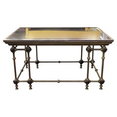
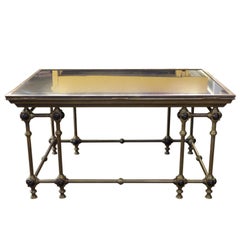
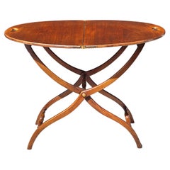
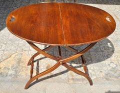
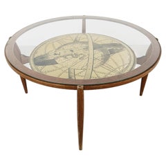
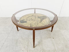
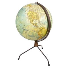
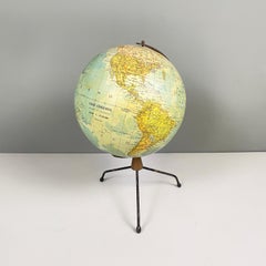
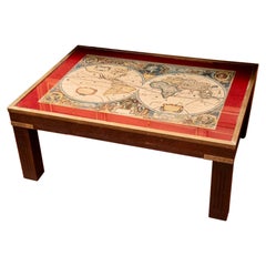
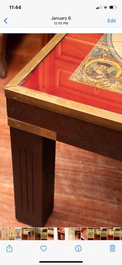
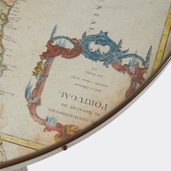
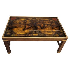
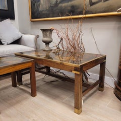
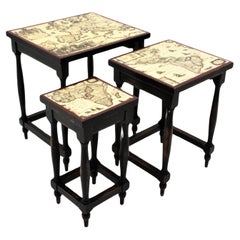
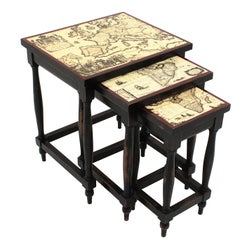
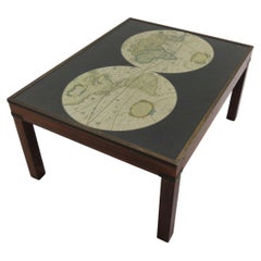
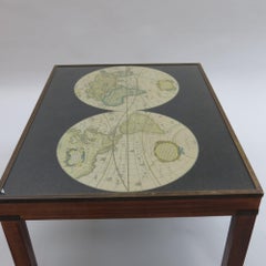
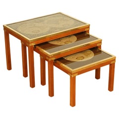
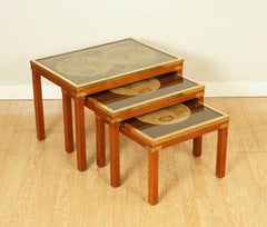
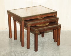
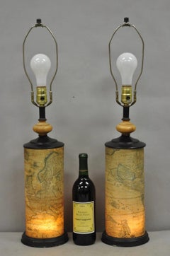
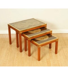
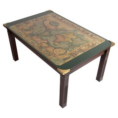
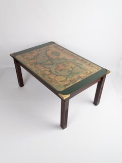
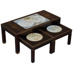
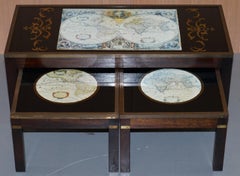
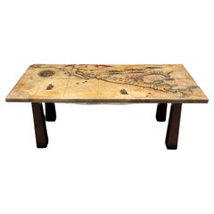
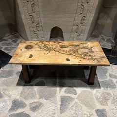
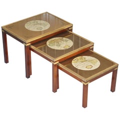
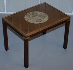
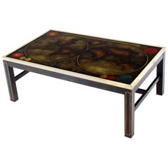
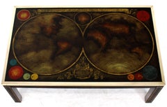
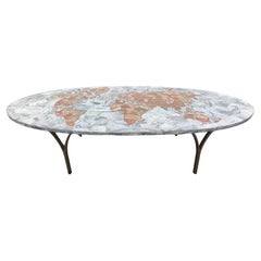
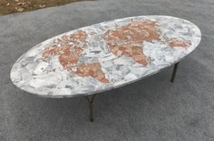
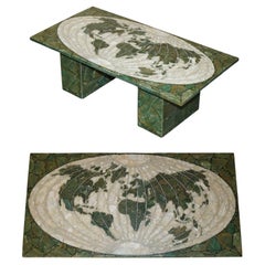
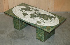
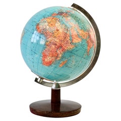
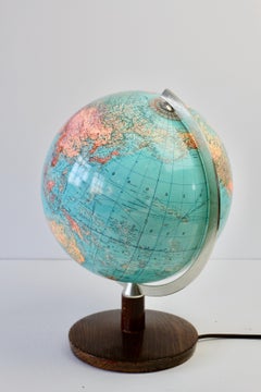
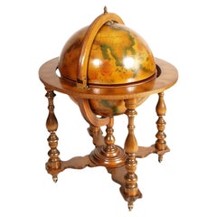
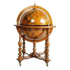
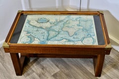
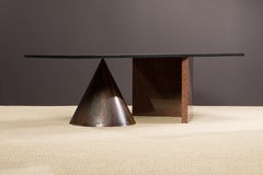
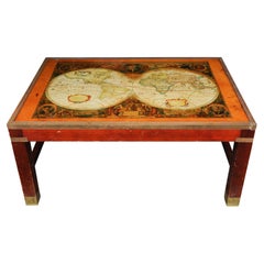
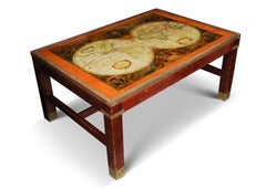
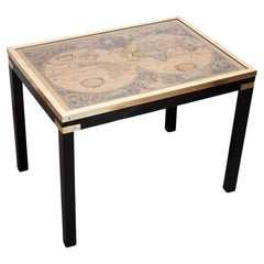
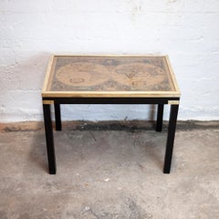
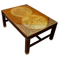
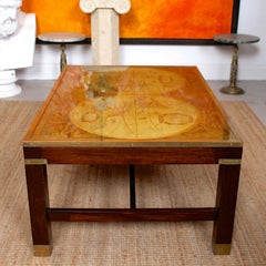
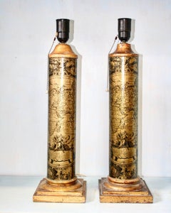
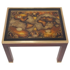
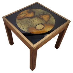
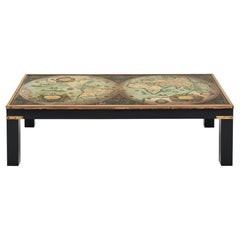
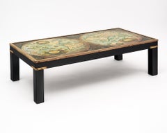
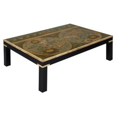
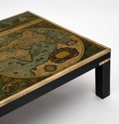
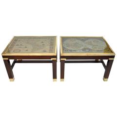
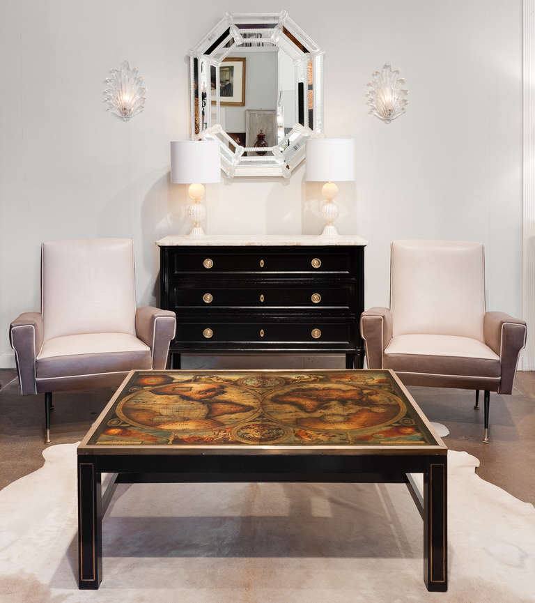
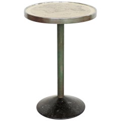
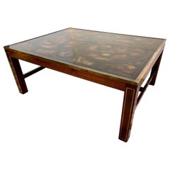
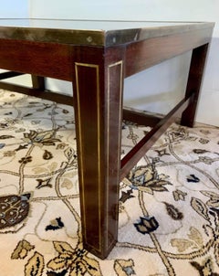
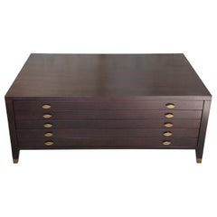
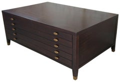
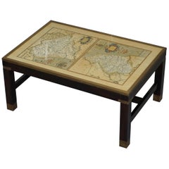
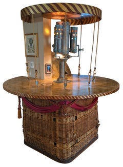
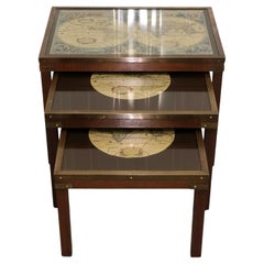
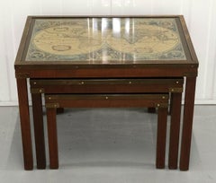
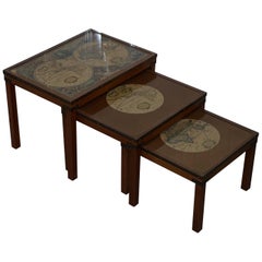
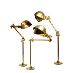
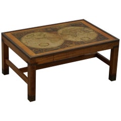
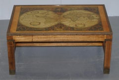
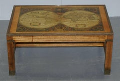
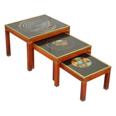
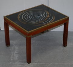
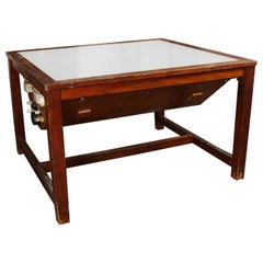
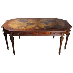
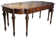
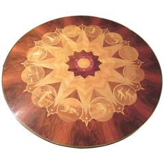
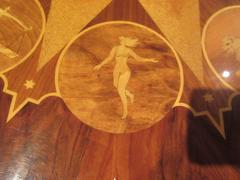
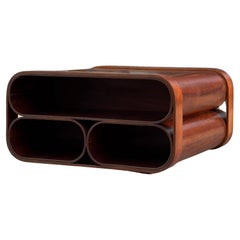
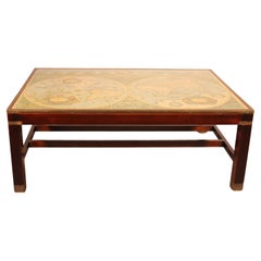
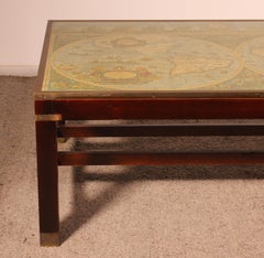
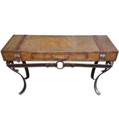
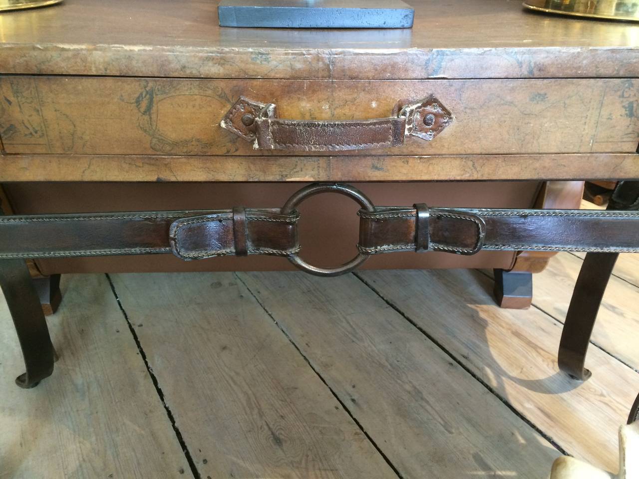
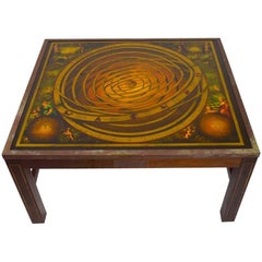
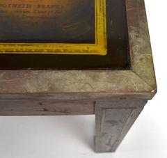
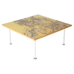
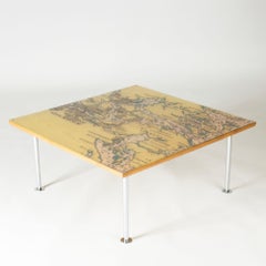
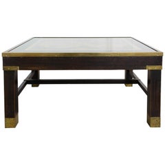
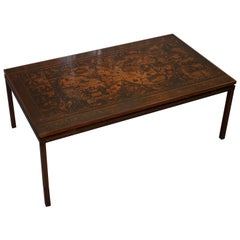
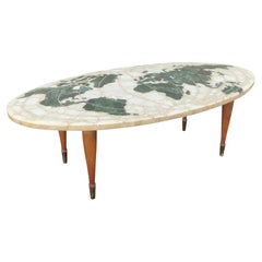
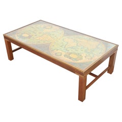
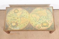
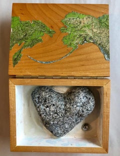
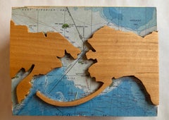
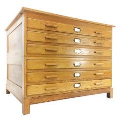
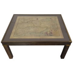
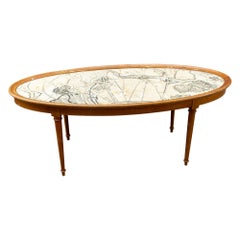
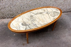
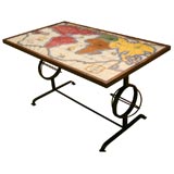
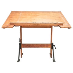
At 1stDibs, there are many versions of the ideal antique map table for your home. Each antique map table for sale was constructed with extraordinary care, often using wood, mahogany and metal. You’ve searched high and low for the perfect antique map table — we have versions that date back to the 18th Century alongside those produced as recently as the 20th Century are available. An antique map table is a generally popular piece of furniture, but those created in Victorian, Georgian and Industrial styles are sought with frequency. You’ll likely find more than one antique map table that is appealing in its simplicity, but Donald & Sons and Jas Shoolbred & Co. produced versions that are worth a look.

How Much is a Antique Map Table?

Prices for an antique map table start at $212 and top out at $72,939 with the average selling for $4,800.
Questions About Antique Map Table
  • 1stDibs ExpertFebruary 22, 2021
    You can identify an antique table in a number of ways. The first clue that a table is antique is the joinery. If a piece of furniture is dovetailed by hand, it only has a couple of dovetails, which are uneven. Also, antique tables are not defined by perfect symmetry. Lastly, antique tables were typically made of oak, mahogany, and walnut.
    In addition to the joinery you can check the bottoms of the drawers and the backs of the cabinets. If they were made prior to 1850 then the wood will most likely be dimensioned by hand. It will be uneven to the touch. The secondary wood that receives the veneer will have been scraped smooth but drawer bottoms, backs and bottoms are often left less finished.
  • 1stDibs ExpertApril 5, 2022
    An antique rent table is a piece of furniture that landlords and tenants used to exchange rent. The rent money would be placed in one drawer, the table would rotate for the landlord to receive. It was considered polite and gentlemanly to pay rent this way. Shop a collection of antique rent tables from some of the world’s top sellers on 1stDibs.
    1stDibs ExpertApril 5, 2022
    A rent table is a small circular or polygonal table with drawers. Rent tables frequently had drawers labeled for the days of the week, and English landlords in the 18th century often used them to collect rent. On 1stDibs, shop antique rent tables from some of the world’s top sellers.
  • 1stDibs ExpertApril 5, 2022
    To identify your antique dining table, first check to see if there is a maker’s mark on the underside. If there are no identifying marks or stamps, a furniture appraiser can check the style and the hardwood used to identify your piece. Shop a collection of antique furniture from some of the world’s top sellers on 1stDibs.
  • 1stDibs ExpertMay 5, 2023
    To determine whether a side table is an antique, closely examine its details. Older pieces will typically have telltale features like wood pegs, hand-cut dovetails with some slight imperfections and mortise-and-tenon construction. Tables that are a consistent color throughout or have machine-cut moldings or carvings are unlikely to be antiques. A certified appraiser or knowledgeable antiques dealer can be a helpful resource when dating tables. Shop a collection of antique, vintage and modern side tables on 1stDibs.
  • 1stDibs ExpertFebruary 13, 2023
    While you can look for markings and other details to try and determine the maker, the best way to identify an antique drop leaf table is to work with a certified appraiser. Trusted online venues and search engines can be helpful when conducting research on a specific collectible, piece of jewelry, art work or other item about which you may have questions, but qualified professionals, such as an antiques dealer or an appraiser at an auction house, have the knowledge and experience needed to make more accurate identifications. Shop a selection of antique, vintage and modern tables on 1stDibs.