Arab Map
to
8
119
27
98
84
26
26
18
15
14
12
10
10
9
7
5
5
5
4
3
3
3
3
2
2
2
2
1
1
1
1
1
1
1
1
1
42
42
10
4
2
Sort By
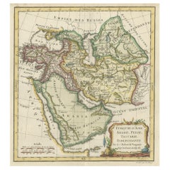
Old Map Depicting Turkey, Persia, Arab and Black Sea Etc, 1778
Located in Langweer, NL
Antique map titled 'Turquie d'Asie, Arabie, Perse, Tartarie Independante'.
Old map of Turkey in
Category
Antique 1770s Maps
Materials
Paper
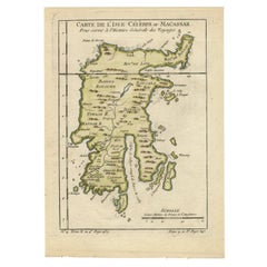
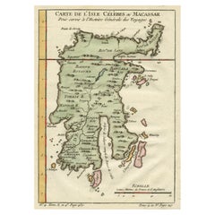
Antique Map of Celebes 'Sulawesi', Island in Indonesia, 1754
By Jacques-Nicolas Bellin
Located in Langweer, NL
Antique map titled 'Carte De L'Isle Celebes ou Macassar'. Detailed copper engraved map of Celebes
Category
Antique 18th Century Maps
Materials
Paper
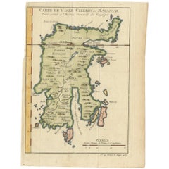
Antique Map of Celebes 'Sulawesi, Indonesia' by Bellin, ciarca 1755
By Jacques-Nicolas Bellin
Located in Langweer, NL
Antique map titled 'Carte de l'Isle Celebes ou Macassar'. Map of Celebes (Sulawesi, Indonesia
Category
Antique Mid-18th Century European Maps
Materials
Paper
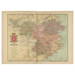
Girona 1902: Geographic and Infrastructural Map of Catalonia’s Northern Province
Located in Langweer, NL
The map provided is of the province of Girona (in Catalan, Girona), located in the northeast of
Category
Antique Early 1900s Maps
Materials
Paper
Free Shipping
H 14.77 in W 20.08 in D 0 in
Antique Map of Celebes 'Sulawesi', Island in Indonesia, c.1750
By Jacques-Nicolas Bellin
Located in Langweer, NL
Antique map titled 'Carte De L'Isle Celebes ou Macassar'. Detailed copper engraved map of Celebes
Category
Antique 18th Century Maps
Materials
Paper
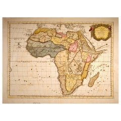
"Africa Vetus": a 17th Century Hand-Colored Map by Sanson
By Nicolas Sanson
Located in Alamo, CA
This original hand-colored copperplate engraved map of Africa entitled "Africa Vetus, Nicolai
Category
Antique Late 17th Century French Maps
Materials
Paper
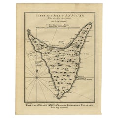
Antique Map of Anjouan or Ndzuani Island, Part of The Comoros, 1749
Located in Langweer, NL
Antique map titled ‘Carte de L’Isle D’Anjouan - Kaart van 't Eiland Anjouan’. Original antique map
Category
Antique 18th Century Maps
Materials
Paper
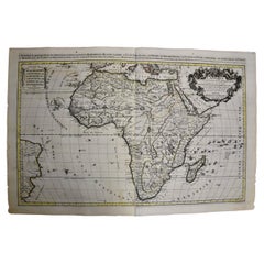
Africa: A Large 17th Century Hand-Colored Map by Sanson and Jaillot
By Nicolas Sanson
Located in Alamo, CA
This large original hand-colored copperplate engraved map of Africa entitled "L'Afrique divisee
Category
Antique 1690s French Maps
Materials
Paper
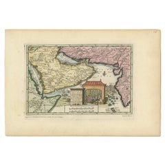
Wonderful Small Map of the Coasts of Arabia, Persia and Western India, ca. 1710
Located in Langweer, NL
Wonderful small map covering the coasts of Arabia, Persia and western India. It illustrates the
Category
Antique Early 18th Century European Maps
Materials
Paper
H 5.9 in W 8.9 in D 0.002 in
Córdoba 1901: A Cartographic Journey Through Andalusia’s Heartland in Spain
Located in Langweer, NL
The map provided is of the province of Córdoba, part of the autonomous community of Andalusia in
Category
Antique Early 1900s Maps
Materials
Paper
Free Shipping
H 20.08 in W 14.77 in D 0 in
Antique Print of East African Island of Quiloa or Kilwa Kisiwani, Tanzania, 1749
Located in Langweer, NL
Tanzania. The map shows the fort, settlements, and gardens of the island. It dates to a few decades before
Category
Antique 1740s Maps
Materials
Paper
H 9.85 in W 7.68 in D 0 in
Colonial Crossroads: Angola and Mozambique in 1903
Located in Langweer, NL
The image for sale is an original historical map from 1903 that shows the Portuguese colonies of
Category
Antique Early 1900s Maps
Materials
Paper
"Africa Vetus": A 17th Century Hand-colored Map By Sanson
By Nicholas Sanson d'Abbeville
Located in Alamo, CA
This original hand-colored copperplate engraved map of Africa entitled "Africa Vetus, Nicolai
Category
1690s Landscape Prints
Materials
Engraving
Persia, Armenia & Adjacent Regions: A Hand-colored 17th Century Map by De Wit
By Frederick de Wit
Located in Alamo, CA
This colorful and detailed 17th century copperplate map by Frederick De Wit was published in
Category
Late 17th Century Old Masters More Prints
Materials
Engraving
Frederick de WitPersia, Armenia & Adjacent Regions: A Hand-colored 17th Century Map by De Wit , 1680
H 23.5 in W 27 in D 1.325 in
Africa: A Large 17th Century Hand-colored Map By Sanson and Jaillot
By Nicholas Sanson d'Abbeville
Located in Alamo, CA
This large original hand-colored copperplate engraved map of Africa entitled "L'Afrique divisee
Category
1690s Landscape Prints
Materials
Engraving
T. E. LAWRENCE - Seven Pillars Of Wisdom - 1935 - FIRST TRADE EDITION
Located in Hillsborough, NJ
photogravure portrait frontispiece of Lawrence from the plaster bust, 47 plates, 4 folding maps, and several in
Category
Vintage 1930s British Books
Materials
Leather
1935 Seven Pillars of Wisdom
By T. E. Lawrence
Located in Bath, GB
folding maps, and in-text illustrations.
Collated, complete.
Thomas Lawrence became famous in his
Category
Vintage 1930s British Books
Materials
Paper
Antique Print of Quiloa 'Africa' by J.N. Bellin, circa 1750
Located in Langweer, NL
Tanzania. Printed circa 1750, the map shows the fort, settlements, and gardens of the island. It dates to a
Category
Antique Mid-18th Century Prints
Materials
Paper
Egypt: Land and Lives of the Pharaohs Revealed Hardcover Book by Cheryl Perry
Located in North Hollywood, CA
, lithographs, sculptures, artifacts, maps and illustrations.
Publisher ? : ? Global Book
Language
Category
21st Century and Contemporary Egyptian Egyptian Books
Materials
Paper
H 12.25 in W 9.75 in D 2 in
Cabin in September - Minimalist Figurative Landscape Painting
By Mike Gough
Located in Los Angeles, CA
create a patchwork map of memories as a guide back to the authenticity of human feeling.
REPRESENTATION
Category
21st Century and Contemporary Contemporary Landscape Paintings
Materials
Mixed Media, Acrylic, Wood Panel
The Way Home - Original Minimalist Scenic Warm Earth Tones Landscape Painting
By Mike Gough
Located in Los Angeles, CA
work is to create a patchwork map of memories as a guide back to the authenticity of human feeling
Category
21st Century and Contemporary Minimalist Landscape Paintings
Materials
Mixed Media, Acrylic, Wood Panel
MIxed Media Conceptual Art Sculpture Drawing Human Rights Welded Iron
By Francoise Schein
Located in Surfside, FL
in New York where she begins a work on cartography territories. Subway map Floating on NY Sidewalk is
Category
Late 20th Century Conceptual Abstract Sculptures
Materials
Iron
Rare Palestine Antique Hebrew Judaica Yahrzeit Synagogue Sign Memorial Plaque
Located in Surfside, FL
produced Jewish-themed color postcards, greeting cards, Jewish National Fund stamps, and maps documenting
Category
Early 20th Century Aesthetic Movement More Art
Materials
Lithograph
Summer Story - Minimalist Figurative Landscape Painting
By Mike Gough
Located in Los Angeles, CA
create a patchwork map of memories as a guide back to the authenticity of human feeling.
REPRESENTATION
Category
21st Century and Contemporary Contemporary Landscape Paintings
Materials
Mixed Media, Acrylic, Wood Panel
At The Lake - Minimalist Figurative Landscape Painting
By Mike Gough
Located in Los Angeles, CA
create a patchwork map of memories as a guide back to the authenticity of human feeling.
REPRESENTATION
Category
21st Century and Contemporary Contemporary Landscape Paintings
Materials
Mixed Media, Acrylic, Wood Panel
Preservation - Minimalist Scenic Landscape Painting
By Mike Gough
Located in Los Angeles, CA
work is to create a patchwork map of memories as a guide back to the authenticity of human feeling
Category
21st Century and Contemporary Minimalist Landscape Paintings
Materials
Mixed Media, Acrylic, Wood Panel
Between - Minimalist Scenic Landscape Painting Boat on Water
By Mike Gough
Located in Los Angeles, CA
create a patchwork map of memories as a guide back to the authenticity of human feeling.
REPRESENTATION
Category
21st Century and Contemporary Contemporary Landscape Paintings
Materials
Mixed Media, Acrylic, Wood Panel
Around The Bay - Minimalist Scenic Landscape Painting
By Mike Gough
Located in Los Angeles, CA
work is to create a patchwork map of memories as a guide back to the authenticity of human feeling
Category
21st Century and Contemporary Minimalist Landscape Paintings
Materials
Mixed Media, Acrylic, Wood Panel
Into The Dark - Minimalist Scenic Nighttime Landscape Painting
By Mike Gough
Located in Los Angeles, CA
create a patchwork map of memories as a guide back to the authenticity of human feeling.
REPRESENTATION
Category
21st Century and Contemporary Contemporary Landscape Paintings
Materials
Mixed Media, Acrylic, Wood Panel
Husain by Maqbul Fida Husain, Richard Bartholomew, Shiv S. Kapur, H. N. Abrams
By Maqbool Fida Husain
Located in North Hollywood, CA
across a map of India with the names of Indian States on various of her body. The exhibition was
Category
Late 20th Century Indian Expressionist Books
Materials
Paper
H 11 in W 12 in D 1.5 in
Ayutthaya Lacquered And Gilt Bronze Buddha Head 15th Century
Located in Dallas, TX
size and the splendor of its architecture.
Well-known from contemporary sources and maps, Ayutthaya
Category
Antique 15th Century and Earlier Thai Ming Figurative Sculptures
Materials
Bronze
Lithograph - Flowers
By (after) Henri Matisse
Located in Collonge Bellerive, Geneve, CH
ways unchanged since Roman times. The coming of the railway had put Bohain on the industrial map, but
Category
1940s Modern Still-life Prints
Materials
Lithograph
Henri Matisse (After) - Lithograph - Pumpkin and Flowers
By (after) Henri Matisse
Located in Collonge Bellerive, Geneve, CH
ways unchanged since Roman times. The coming of the railway had put Bohain on the industrial map, but
Category
1940s Modern Still-life Prints
Materials
Lithograph
H 9.45 in W 12.6 in D 0.04 in
Henri Matisse (After) - Lithograph - Flowers
By (after) Henri Matisse
Located in Collonge Bellerive, Geneve, CH
ways unchanged since Roman times. The coming of the railway had put Bohain on the industrial map, but
Category
1940s Modern Still-life Prints
Materials
Lithograph
H 9.45 in W 12.6 in D 0.04 in
Henri Matisse (After) - Lithograph - Pumpkin and Flowers
By (after) Henri Matisse
Located in Collonge Bellerive, Geneve, CH
ways unchanged since Roman times. The coming of the railway had put Bohain on the industrial map, but
Category
1940s Modern Figurative Prints
Materials
Lithograph
H 12.6 in W 9.45 in D 0.04 in
Henri Matisse (After) - Lithograph - Flowers
By (after) Henri Matisse
Located in Collonge Bellerive, Geneve, CH
railway had put Bohain on the industrial map, but people still traveled everywhere on foot or horseback
Category
1940s Modern Figurative Prints
Materials
Lithograph
H 12.6 in W 9.45 in D 0.04 in
Henri Matisse (After) - Lithograph - Woman with Flowers in Her Hair
By (after) Henri Matisse
Located in Collonge Bellerive, Geneve, CH
railway had put Bohain on the industrial map, but people still traveled everywhere on foot or horseback
Category
1940s Modern Portrait Prints
Materials
Lithograph
H 12.6 in W 9.45 in D 0.04 in
Original Lithograph - Henri Matisse - Apollinaire
By Henri Matisse
Located in Collonge Bellerive, Geneve, CH
Roman times. The coming of the railway had put Bohain on the industrial map, but people still traveled
Category
1930s Modern Portrait Prints
Materials
Linocut
Guillaume Apollinaire
By Henri Matisse
Located in Collonge Bellerive, Geneve, CH
Roman times. The coming of the railway had put Bohain on the industrial map, but people still traveled
Category
1930s Modern Portrait Prints
Materials
Lithograph
Original Lithograph - Henri Matisse - Apollinaire
By Henri Matisse
Located in Collonge Bellerive, Geneve, CH
Roman times. The coming of the railway had put Bohain on the industrial map, but people still traveled
Category
1930s Modern Portrait Prints
Materials
Linocut
Original Lithograph - Henri Matisse - Apollinaire
By Henri Matisse
Located in Collonge Bellerive, Geneve, CH
Roman times. The coming of the railway had put Bohain on the industrial map, but people still traveled
Category
1930s Modern Portrait Prints
Materials
Linocut
Creole Dancer
By (after) Henri Matisse
Located in Collonge Bellerive, Geneve, CH
railway had put Bohain on the industrial map, but people still traveled everywhere on foot or horseback
Category
Mid-20th Century Modern Still-life Prints
Materials
Lithograph
Left: Naute Arabes [...] - Arabischer scheepluyden [...].
By Jan Huygen van Linschoten
Located in Zeeland, Noord-Brabant
the work of Bernard Paludanus (1550-1633), and others. Linschoten's maps are among the earliest maps
Category
1630s Figurative Prints
Materials
Engraving
Very Old Engraving of Casablanca (Anfa), Azemmour (Azamor) and Diu, 1574
Located in Langweer, NL
the Portuguese against a combined fleet of Egyptian, Arab and Indian forces. The Portuguese conquered
Category
Antique 16th Century Maps
Materials
Paper
Important giant Map of Asia, for the King of France, 1696
By Nicolas de Fer
Located in Amsterdam, NL
le Quay de l’Horloge, à la Sphere Royal. Avec le Privilege du Roy, 1696
(See also his Giant Map of
Category
Late 17th Century Old Masters More Prints
Materials
Watercolor, Engraving
Framed Hand Colored Map of Asia by Nicolas de Fer for Le Dauphine
Located in Amsterdam, NL
in relief printing, later hand coloring, 109.5 x 163 cm
Note:
The map is surrounded by richly
Category
Antique Late 17th Century French Decorative Art
Materials
Other
1870s Brass Clisigonimeter F. Miller Innsbruck Surveyor Measurement Instrumemt
Located in Milan, IT
represented on copper plates. Arabs used topography to realize maps and to measure agrarian surfaces and lands
Category
Antique 1870s Scientific Instruments
Materials
Brass
H 2.8 in W 7.5 in D 8.2 in
Choke: Hormuz – Land (left) Water (right)
By Gregor Turk
Located in Atlanta, GA
Gregor Turk’s new series titled “CONFLUX” features wall-mounted box-like maps of global choke
Category
21st Century and Contemporary Contemporary Mixed Media
Materials
Rubber, Wood
1870s Brass Cathetometer Signed G. Coradi Zurich Antique Scientific Instrument
Located in Milan, IT
part of the Earth surface on a map, indicating its details like streets, rivers, buildings
Category
Antique 1780s Scientific Instruments
Materials
Brass
H 13 in W 16.5 in D 5.1 in
Early 1900s Telescope Diopter Praetorian Tablet Secretan Paris Antique Surveyor
Located in Milan, IT
trace medium and small scale maps, as it allows you to draw in detail and with contour lines in view of
Category
Antique Early 1900s Scientific Instruments
Materials
Brass
H 5.9 in W 4 in D 8.15 in
1870s Small Brass Theodolite Kelvin & James White Antique Surveyor's Instrument
Located in Milan, IT
represented on copper plates. Arabs used topography to realize maps and to measure agrarian surfaces and lands
Category
Antique 1870s Scientific Instruments
Materials
Brass
H 9.8 in W 4.4 in D 10.15 in
1870s Italian Theodolite Antique Earth Scientific Instrument of Measurement
Located in Milan, IT
represented on copper plates. Arabs used topography to realize maps and to measure agrarian surfaces and lands
Category
Antique 1870s Scientific Instruments
Materials
Brass
H 17.7 in W 9.1 in D 16 in
1870s, Brass Theodolite Ing. Salmoiraghi Milano Antique Scientific Instrument
Located in Milan, IT
, then described and represented on copper plates. Arabs used topography to realize maps and to measure
Category
Antique 1870s Scientific Instruments
Materials
Brass
H 18.5 in W 10.3 in D 10.6 in
1820s Rare Cittelli Milan Brass Wood Praetorian Tablet Antique Surveyor Tool
Located in Milan, IT
conceived it in 1590. Used for tracing medium and small scale maps, it allows you to draw in detail. It was
Category
Antique 1820s Scientific Instruments
Materials
Brass
H 61 in W 17.8 in D 27.5 in
1900s Brass Theodolite Compass And Eccentric Telescope Signed SUSS Budapepest
Located in Milan, IT
.
Among the Arabs, topography was used for the construction of geographical maps and for the measurement
Category
Antique Early 1900s Scientific Instruments
Materials
Brass
1870s Theodolite Troughton & Simms Antique Scientific Instrument of Measurement
Located in Milan, IT
graphically in scale a part of the Earth surface on a map, indicating its details like streets, rivers
Category
Antique 1870s Scientific Instruments
Materials
Brass
H 18.5 in W 13.6 in D 15 in
Early 20th Century Silver Mezuzah by Avraham Moshe Sokolka, Jerusalem
Located in New York, NY
map of Tel Aviv made of silver and gold that the municipality of Tel Aviv presented to Governor
Category
Early 20th Century Israeli Art Deco Religious Items
Materials
Silver
MIxed Media Conceptual Art Sculpture Drawing Human Rights Welded Iron
By Francoise Schein
Located in Surfside, FL
in New York where she begins a work on cartography territories. Subway map Floating on NY Sidewalk is
Category
Late 20th Century Conceptual Abstract Sculptures
Materials
Iron
after Henri Matisse - Fern - Lithograph
By (after) Henri Matisse
Located in Collonge Bellerive, Geneve, CH
coming of the railway had put Bohain on the industrial map, but people still traveled everywhere on foot
Category
1950s Modern Still-life Prints
Materials
Lithograph
Lithograph - Woman
By (after) Henri Matisse
Located in Collonge Bellerive, Geneve, CH
ways unchanged since Roman times. The coming of the railway had put Bohain on the industrial map, but
Category
1940s Modern Figurative Prints
Materials
Lithograph
- 1
Get Updated with New Arrivals
Save "Arab Map", and we’ll notify you when there are new listings in this category.
Arab Map For Sale on 1stDibs
Surely you’ll find the exact arab map you’re seeking on 1stDibs — we’ve got a vast assortment for sale. There are many modern, contemporary and Old Masters versions of these works for sale. You’re likely to find the perfect arab map among the distinctive items we have available, which includes versions made as long ago as the 18th Century as well as those made as recently as the 21st Century. Adding a arab map to a room that is mostly decorated in warm neutral tones can yield a welcome change — find a piece on 1stDibs that incorporates elements of gray, blue, white, beige and more. A arab map from (after) Henri Matisse, Henri Matisse, Mike Gough, Nicholas Sanson d'Abbeville and Francoise Schein — each of whom created distinctive versions of this kind of work — is worth considering. Artworks like these of any era or style can make for thoughtful decor in any space, but a selection from our variety of those made in lithograph, paint and acrylic paint can add an especially memorable touch.
How Much is an Arab Map?
The price for a arab map in our collection starts at $111 and tops out at $49,773 with the average selling for $1,451.
