Astronomy Map
1
to
16
81
56
68
67
52
28
26
18
13
12
7
6
5
4
4
4
4
4
2
2
2
2
1
1
1
1
1
1
1
1
1
1
1
1
1
30
24
12
7
3
Sort By
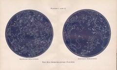
The Old Constellation Figures. Astronomy map of the stars.
Located in Melbourne, Victoria
Colour lithograph, 1890. 285mm by 430mm (sheet). From W Peck's 'A Handbook and Atlas of Astronomy
Category
Late 19th Century Victorian More Prints
Materials
Lithograph
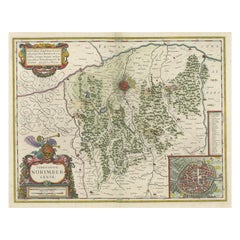
Antique Map centered on Nuremberg, Germany
Located in Langweer, NL
Antique map titled 'Territorium Norimbergense'. Beautiful map centered on Nuremberg, Germany. With
Category
Antique Mid-17th Century Maps
Materials
Paper
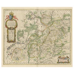
Antique Map of Silesia centered on Glogau
Located in Langweer, NL
Antique map titled 'Ducatus Silesiae Glogani vera delineatio'. This decorative map shows the Odra
Category
Antique Mid-17th Century Maps
Materials
Paper
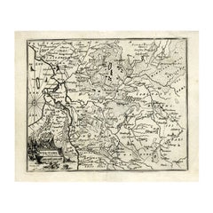
Antique Map of Overijssel by Bachiene, 1758
Located in Langweer, NL
and also Professor in Astronomy and Geography at the 'Illustere School'. This map was engraved by
Category
Antique 18th Century Maps
Materials
Paper
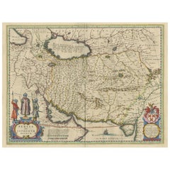
Antique Map of Persia with Dedication Cartouche
Located in Langweer, NL
Antique map titled 'Persia sive Sophorum Regnum'. Original old map of Persia. The map extends from
Category
Antique Mid-17th Century Maps
Materials
Paper
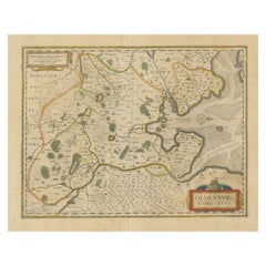
Antique Map of the Region of Oldenburg, Germany
By Willem Blaeu
Located in Langweer, NL
Antique map titled 'Oldenburg Comitatus'. Detailed old map of Oldenburg, Germany. The map also
Category
Antique Mid-17th Century Maps
Materials
Paper
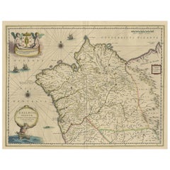
Antique Map of the Northwestern Coast of Spain
Located in Langweer, NL
Antique map titled 'Gallaecia Regnum'. Original old map of the northwestern coast of Spain
Category
Antique Mid-17th Century Maps
Materials
Paper
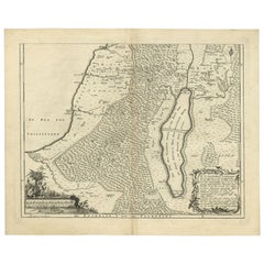
Antique Map of Southern Palestine by Bachiene, 1763
Located in Langweer, NL
"Antique map of the south part of Palestine. This simplified map shows the most important cities of
Category
Antique 18th Century Maps
Materials
Paper
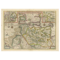
Original Antique Map of the Duchy of Holstein
By Willem Blaeu
Located in Langweer, NL
Antique map titled 'Ducatus Holsatiae Nova Tabula'. Original old map of the Duchy of Holstein, the
Category
Antique Mid-17th Century Maps
Materials
Paper
Antique Map of the Jewish Land by Lindeman, 1761
Located in Langweer, NL
Antique map titled 'De VIde Landkaart Verbeeldende Het Joodsche Land (..).' Map of the Jewish Land
Category
Antique 18th Century Maps
Materials
Paper
Original Hand-Colored Antique Map of Ancient Germany, circa 1630
Located in Langweer, NL
Antique map titled 'Germaniae Veteris typus'. Very attractive map of ancient Germany. Published by
Category
Antique Mid-17th Century Maps
Materials
Paper
No Reserve
H 18.9 in W 21.5 in D 0.02 in
Rare Original Double Hemisphere World Map with Allegorical Figures, 1785
Located in Langweer, NL
Antique map titled 'Nieuwe en Naukeurige Kaart der Gantsche bekende Werreld.'
A double
Category
Antique 1780s Maps
Materials
Paper
H 17.05 in W 23.23 in D 0 in
Antique Map of Ancient Persia, Assyria and surroundings, c.1760
Located in Langweer, NL
Antique map titled 'De XII de Landkaart vertoonende de Landen der Assyrische, Babylonische
Category
Antique 18th Century Maps
Materials
Paper
Antique Map of the Maluku Islands by Blaeu, c.1640
Located in Langweer, NL
Antique map titled 'Moluccae Insulae Celeberrimae'. Decorative map of the Maluku Islands, also
Category
Antique 17th Century Maps
Materials
Paper
Detailed Antique Map of Northern Spanish Region of Aragon, c.1650
Located in Langweer, NL
Antique map titled 'Arragonia Regnum'.
Detailed map of northern Spanish region of Aragon. The
Category
Antique 1650s Maps
Materials
Paper
Antique Map of Delfland, Schieland and Islands of Zuid-Holland, the Netherlands
Located in Langweer, NL
Antique map titled 'Delflandia, Schielandia, et Insulae (..)'. Original antique map of Delfland
Category
Antique Mid-17th Century Maps
Materials
Paper
H 19.49 in W 23.12 in D 0.02 in
Map of Northern India and Pakistan 'Mogol', Showing Kabul, Delhi Etc., 1758
Located in Langweer, NL
Antique map titled 'Mogol'.
Map of Northern India and Pakistan ('Mogol'), showing Kabul, Delhi
Category
Antique 1750s Maps
Materials
Paper
H 6.89 in W 7.49 in D 0 in
Antique Map of Macedonia, Northern Greece and part of Turkey in Europe
Located in Langweer, NL
Antique map titled 'Macedonia Epirus et Achaia'. Original old map of Macedonia, northern Greece
Category
Antique Mid-17th Century Maps
Materials
Paper
H 18.59 in W 23.04 in D 0.02 in
Decorative Map of the Spice Islands in the Mollucas, Indonesia, ca.1640
Located in Langweer, NL
Antique map titled 'Moluccae Insulae Celeberrimae'.
Decorative map of the Spice Islands. Inset
Category
Antique 1640s Maps
Materials
Paper
Antique Map of Biblical Palestine with Inset of Israel's 12 Tribes, 1758
Located in Langweer, NL
Antique map titled 'De IIIde Landkaart 't land Kanaan en Gilead onder de XII stammen Israëls
Category
Antique 18th Century Maps
Materials
Paper
H 15.16 in W 18.51 in D 0 in
Antique Map of the Biblical Kingdom of Israel by Lindeman, c.1758
Located in Langweer, NL
Antique map titled 'De IVde Landkaart vertoonende het Koningryk Israels benevens deszelfs
Category
Antique 18th Century Maps
Materials
Paper
Antique Map of the Biblical Land of Canaan by Lindeman, c.1758
Located in Langweer, NL
Antique map titled 'De IIde Landkaart verbeeldende t'Land Kanaan nog bewoond door deszelfs eerste
Category
Antique 18th Century Maps
Materials
Paper
Exploring Ancient Persia: Ptolemaic Map of Iran and Iraq by Ptolemy and Mercator
Located in Langweer, NL
time, his theories dominated both astronomy and geography for nearly 1500 years. His writings were kept
Category
Antique 1610s Maps
Materials
Paper
H 13.71 in W 18.39 in D 0 in
1630 Pierre Petit map "Description du Gouvernement de la Capelle" Ric0010
Located in Norton, MA
1630 Pierre Petit map entitled
"Description du Gouvernement de la Capelle,"
Ric0010
Pierre
Category
Antique 17th Century Dutch Maps
Materials
Paper
H 18.9 in W 22.45 in D 0.4 in
Antique Map of the Northern Part of Biblical Palestine by Lindeman, c.1763
Located in Langweer, NL
Antique map titled 'De 8ste en 9de Landkaarte Geheel Palestina (..).' Map of the northern part of
Category
Antique 18th Century Maps
Materials
Paper
H 15.16 in W 19.02 in D 0 in
Decorative Map of the Maluku or Moluccas or Spice Islands, Indonesia, Ca.1640
Located in Langweer, NL
Antique map titled 'Moluccae Insulae Celeberrimae'.
Decorative map of the Maluku Islands, also
Category
Antique 1640s Maps
Materials
Paper
H 19.3 in W 22.64 in D 0 in
Old Ptolemaic Map of the Region Between the Persian Gulf and Caspian Sea, 1598
Located in Langweer, NL
learned and influential men of his time, his theories dominated both astronomy and geography for nearly
Category
Antique 16th Century Maps
Materials
Paper
H 7.09 in W 9.81 in D 0 in
Old Color Engraving of Blaeu's first Map of Brazil, North Oriented to the Right
By Willem Blaeu
Located in Langweer, NL
Antique map titled 'Novus Brasiliae Typus'. Fine old color example of Blaeu's first map of Brazil
Category
Antique Mid-17th Century Maps
Materials
Paper
H 19.3 in W 22.84 in D 0.02 in
Antique Map of Asia Minor, showing Turkey, Cyprus and the Islands in the Aegean
Located in Langweer, NL
Antique map titled 'Natolia, quae olim Asia Minor'. Decorative map of Asia Minor, showing Turkey
Category
Antique Mid-17th Century Maps
Materials
Paper
H 20.99 in W 24.81 in D 0.02 in
Rare Antique Map with Timor and Nearby Islands Plus an Inset of Hawaii, 1825
Located in Langweer, NL
Antique map titled 'Essai sur la Geographie de l'Ile Timor.'
A map showing Timor and the
Category
Antique 1820s Maps
Materials
Paper
H 13.39 in W 19.69 in D 0 in
Original Blaeu Map of Southeast Asia from India to Tibet and Japan to New Guinea
Located in Langweer, NL
Antique map titled 'India quae Orientalis dicitur et Insulae Adiacentes'.
Beautiful map of
Category
Antique 1640s Maps
Materials
Paper
H 19.49 in W 23.63 in D 0 in
Lyonnais, Beaujolais, Forez, Mâconnais: A 1644 Depiction of France's Provinces
Located in Langweer, NL
An original antique map from 1644, depicting the French provinces of Lyonnais, Beaujolais, Forez
Category
Antique 1640s Maps
Materials
Paper
Free Shipping
H 20.08 in W 23.82 in D 0 in
The Biblical Kingdom of Israel under the Kings Saul, David and Solomon, Ca.1758
Located in Langweer, NL
Antique map titled 'De IVde Landkaart vertoonende het Koningryk Israels benevens deszelfs
Category
Antique 1750s Maps
Materials
Paper
H 15.16 in W 19.3 in D 0 in
Loudun and Mirebeau: A Cartographic Masterpiece of 17th Century France by Blaeu
Located in Langweer, NL
uploaded is an original antique map titled "Loudonois - Mirebalais," created by Willem Janszoon Blaeu, a
Category
Antique 1650s Maps
Materials
Paper
Free Shipping
H 20.08 in W 23.82 in D 0 in
Bird's-Eye Plan of Jerusalem in Israël, a Rare Original Engraving, 1750
Located in Langweer, NL
Antique map titled 'De VIIde Landkaart Verbeeldende de Stad Jerusalem Beneven de daar Omgelegen
Category
Antique 18th Century Maps
Materials
Paper
1640 Flandriae Partes Duae Quarum Altera Proprietaria, Ric0016
Located in Norton, MA
1640 Willem and Joan Blaeu map entitled
"Flandriae Partes duae quarum altera Proprietaria, altera
Category
Antique 17th Century Dutch Maps
Materials
Paper
Maps for the Southern Hemisphere. Antique Astronomy star constellation print
Located in Melbourne, Victoria
Colour lithograph, 1890. 285mm by 210mm (sheet). From W Peck's 'A Handbook and Atlas of Astronomy
Category
Late 19th Century Victorian More Prints
Materials
Lithograph
Maps for the Northern Hemisphere. Antique Astronomy star constellation print
Located in Melbourne, Victoria
Colour lithograph, 1890. 285mm by 210mm (sheet). From W Peck's 'A Handbook and Atlas of Astronomy
Category
Late 19th Century Victorian More Prints
Materials
Lithograph
Ubersichtskarte Des Mondes (Overview Map of the Moon), antique astronomy print
Located in Melbourne, Victoria
'Ubersichtskarte Des Mondes'
(Overview Map of the Moon)
German chromolithograph, circa 1895
Category
Late 19th Century Naturalistic Still-life Prints
Materials
Lithograph
Celestial Night, dark colors, astronomy, black female nude, stars, maps, collage
By Audrey Anastasi
Located in Brooklyn, NY
These collages were created first in the presence of a model, working quickly, in charcoal and pastel, and again, later, alone, furiously tearing and pasting images from magazines, v...
Category
2010s Surrealist Mixed Media
Materials
Paper, Mixed Media
Blue Map - map, north pole, blue, geometrical, mathematical
By Marco Araldi
Located in London, GB
, applying traditional techniques such as multiple Cartesian coordinates and polar system coordinates to maps
Category
2010s Contemporary Landscape Paintings
Materials
Ink, Acrylic
H 39.38 in W 39.38 in D 1.58 in
1902 Americacentric Map of the World - Painting, Mixed Media, Gilding, Ink, Map
By Marco Araldi
Located in London, GB
, applying traditional techniques such as multiple Cartesian coordinates and polar system coordinates to maps
Category
2010s Contemporary Paintings
Materials
Gold
H 24.02 in W 32.29 in D 2.37 in
Celestial Map of the Heavens - contemporary Astrological Painting on Canvas
By Marco Araldi
Located in London, GB
, applying traditional techniques such as multiple Cartesian coordinates and polar system coordinates to maps
Category
2010s Contemporary Mixed Media
Materials
Canvas, Ink, Acrylic
H 20.08 in W 25.99 in D 1.58 in
Theories of Planetary Orbits: A Framed 18th C. Celestial Map by Doppelmayr
By Johann Gabriel Doppelmayr 1
Located in Alamo, CA
This 18th century hand-colored copperplate celestial map by Johann Doppelmayr entitled "Astronomia
Category
Early 18th Century Landscape Prints
Materials
Engraving
H 31.5 in W 34.94 in D 1 in
Theories of Planetary Motion: An 18th C. Framed Celestial Map by Doppelmayr
By Johann Gabriel Doppelmayr 1
Located in Alamo, CA
This 18th century hand-colored copperplate celestial map by Johann Doppelmayr entitled "Theoria
Category
Early 18th Century Landscape Prints
Materials
Engraving
H 31.25 in W 34.88 in D 1 in
Cadiz Island: A Framed 17th Century Hand-colored Map from Blaeu's Atlas Major
By Joan (Johannes) Blaeu
Located in Alamo, CA
This is a 17th century hand-colored map entitled "Insula Gaditana Isla de Cadiz" from Johannes
Category
Mid-17th Century Old Masters Landscape Prints
Materials
Engraving
H 20 in W 24.88 in D 1.13 in
The Orbits of Venus and Mercury: An 18th C. Framed Celestial Map by Doppelmayr
By Johann Gabriel Doppelmayr 1
Located in Alamo, CA
This 18th century hand-colored copperplate celestial map by Johann Doppelmayr entitled "Phænomena
Category
Early 18th Century Landscape Prints
Materials
Engraving
H 31.13 in W 34.88 in D 1 in
Duke of Denver- geometrical, mathematical, cathedral, building
By Marco Araldi
Located in London, GB
, applying traditional techniques such as multiple Cartesian coordinates and polar system coordinates to maps
Category
2010s Contemporary Landscape Paintings
Materials
Ink, Acrylic
H 20.08 in W 20.08 in D 1.58 in
Night at Drury Lane- geometrical, mathematical, cathedral, building
By Marco Araldi
Located in London, GB
, applying traditional techniques such as multiple Cartesian coordinates and polar system coordinates to maps
Category
2010s Contemporary Landscape Paintings
Materials
Ink, Acrylic
H 36.03 in W 25.6 in D 1.58 in
Isometric Cathedral - geometrical, mathematical, cathedral, st Pauls, London
By Marco Araldi
Located in London, GB
, applying traditional techniques such as multiple Cartesian coordinates and polar system coordinates to maps
Category
2010s Contemporary Landscape Paintings
Materials
Acrylic, Ink
H 41.74 in W 54.34 in D 1.58 in
Yomeimon of Toshogu - geometrical, mathematical, cathedral, building
By Marco Araldi
Located in London, GB
, applying traditional techniques such as multiple Cartesian coordinates and polar system coordinates to maps
Category
2010s Contemporary Landscape Paintings
Materials
Ink, Acrylic
H 32.09 in W 32.09 in D 1.58 in
Ala Alhambra - geometrical, mathematical, cathedral, building
By Marco Araldi
Located in London, GB
, applying traditional techniques such as multiple Cartesian coordinates and polar system coordinates to maps
Category
2010s Contemporary Landscape Paintings
Materials
Ink, Acrylic
H 24.02 in W 24.02 in D 1.58 in
The Abbey - acrylic, painting, canvas, classical, figurative
By Marco Araldi
Located in London, GB
, applying traditional techniques such as multiple Cartesian coordinates and polar system coordinates to maps
Category
2010s Contemporary Figurative Paintings
Materials
Ink, Acrylic
H 24.02 in W 32.09 in D 2.37 in
Untitled, paint and collage on treated paper
By Shane Drinkwater
Located in Toronto, Ontario
and astronomy to produce abstract artworks of mystery and beauty. All of his artworks are Untitled and
Category
21st Century and Contemporary Abstract Abstract Paintings
Materials
Paper, Dye, Acrylic
The Three Graces Temple - Classical Mathematical Realism Geometric Drawing Gold
By Marco Araldi
Located in London, GB
, applying traditional techniques such as multiple Cartesian coordinates and polar system coordinates to maps
Category
2010s Contemporary Figurative Paintings
Materials
Gold Leaf
H 29.93 in W 18.9 in D 1.97 in
USS Enterprise -Contemporary Space Star Wars Geometric Art mixed-media Painting
By Marco Araldi
Located in London, GB
, applying traditional techniques such as multiple Cartesian coordinates and polar system coordinates to maps
Category
2010s Contemporary Paintings
Materials
Gold Leaf
H 25.99 in W 35.83 in D 1.97 in
18th Century Celestial Globe
Located in Mjöhult, SE
and manufacture maps and globes for the service of the public. The foreign maps and globes referred to
Category
Antique Mid-18th Century Swedish Rococo Globes
Materials
Brass
Untitled, paint and collage on treated paper
By Shane Drinkwater
Located in Toronto, Ontario
and astronomy to produce abstract artworks of mystery and beauty. All of his artworks are Untitled and
Category
21st Century and Contemporary Abstract Abstract Paintings
Materials
Paper, Acrylic, Dye
Untitled, paint and collage on treated paper
By Shane Drinkwater
Located in Toronto, Ontario
and astronomy to produce abstract artworks of mystery and beauty. All of his artworks are Untitled and
Category
21st Century and Contemporary Abstract Abstract Paintings
Materials
Paper, Dye, Acrylic
Temple of Ptolemy - Architectural Drawing: Acrylic and Gilding Ink on Canvas
By Marco Araldi
Located in London, GB
, applying traditional techniques such as multiple Cartesian coordinates and polar system coordinates to maps
Category
2010s Contemporary Still-life Paintings
Materials
Ink, Canvas, Acrylic
H 30.12 in W 18.9 in D 1.19 in
- 1
Get Updated with New Arrivals
Save "Astronomy Map", and we’ll notify you when there are new listings in this category.
Astronomy Map For Sale on 1stDibs
Surely you’ll find the exact astronomy map you’re seeking on 1stDibs — we’ve got a vast assortment for sale. There are many contemporary, abstract and Surrealist versions of these works for sale. You’re likely to find the perfect astronomy map among the distinctive items we have available, which includes versions made as long ago as the 18th Century as well as those made as recently as the 21st Century. When looking for the right astronomy map for your space, you can search on 1stDibs by color — popular works were created in bold and neutral palettes with elements of gold, gray, beige and blue. Finding an appealing astronomy map — no matter the origin — is easy, but Marco Araldi, Elise Wagner, Andreas Cellarius, Johann Gabriel Doppelmayr and Audrey Anastasi each produced popular versions that are worth a look. Artworks like these of any era or style can make for thoughtful decor in any space, but a selection from our variety of those made in paint, ink and acrylic paint can add an especially memorable touch.
How Much is a Astronomy Map?
The price for a astronomy map in our collection starts at $120 and tops out at $556,334 with the average selling for $1,100.
