Black World Map
8
to
58
487
421
448
381
239
218
100
89
57
57
52
50
44
30
29
28
27
26
25
21
15
14
11
10
10
9
7
6
6
5
5
5
4
4
3
3
3
2
2
1
1
1
1
1
1
1
1
51
42
42
20
15
Sort By
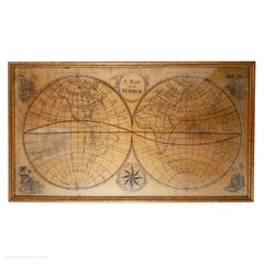
Map Silk Embroidered Western Eastern Hemisphere New Old World Asia America Afri
Located in BUNGAY, SUFFOLK
A rare, late-18th century, silk, embroidered, double hemisphere, world map, blackwork, sampler
Category
Antique 18th Century British Georgian Maps
Materials
Silk
H 0.4 in W 0.4 in D 0.4 in
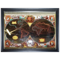
Vintage World Map Mirror Based on the Original by Johnson 1882 Military Campaign
Located in GB
We are delighted to offer for sale this lovely Antique style pictorial plan map of the globe based
Category
20th Century English Campaign Maps
Materials
Mirror
H 18.9 in W 24.02 in D 0.79 in
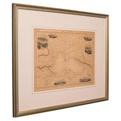
Antique Lithography Map, Black Sea, English, Framed, Cartography, Victorian
Located in Hele, Devon, GB
This is an antique lithography map of the Black Sea region. An English, framed atlas engraving of
Category
Antique Mid-19th Century British Early Victorian Maps
Materials
Wood
H 17.72 in W 20.48 in D 0.79 in
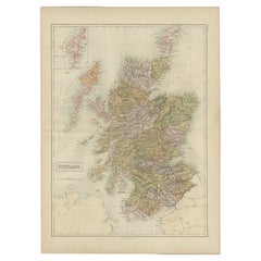
Antique Map of Scotland by A & C. Black, 1870
Located in Langweer, NL
. This map originates from ‘Black's General Atlas of The World’. Published by A & C. Black, 1870.
Category
Antique Late 19th Century Maps
Materials
Paper
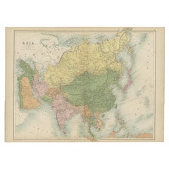
Antique Map of Asia by A & C, Black, 1870
Located in Langweer, NL
Antique map titled 'Asia'. Original antique map of Asia. This map originates from ‘Black's General
Category
Antique Late 19th Century Maps
Materials
Paper
Antique Map of Africa by A & C, Black, 1870
Located in Langweer, NL
Antique map titled 'Africa'. Original antique map of Africa. This map originates from ‘Black
Category
Antique Late 19th Century Maps
Materials
Paper
Antique Map of China by A & C, Black, 1870
Located in Langweer, NL
Antique map titled 'China'. Original antique map of China. This map originates from ‘Black
Category
Antique Late 19th Century Maps
Materials
Paper
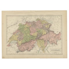
Antique Map of Switzerland by A & C. Black, 1870
Located in Langweer, NL
‘Black's General Atlas of The World’. Published by A & C. Black, 1870.
Category
Antique Late 19th Century Maps
Materials
Paper
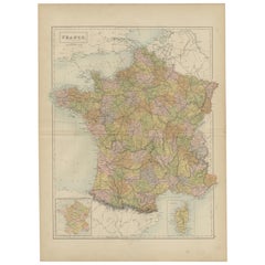
Antique Map of France by A & C. Black, 1870
Located in Langweer, NL
into provinces, before the revolution of 1789 and map of Corsica. This map originates from ‘Black
Category
Antique Late 19th Century Maps
Materials
Paper
Antique Map of South America by A & C. Black, 1870
Located in Langweer, NL
originates from ‘Black's General Atlas of The World’. Published by A & C. Black, 1870.
Category
Antique Late 19th Century Maps
Materials
Paper
Antique Map of North America by A & C. Black, 1870
Located in Langweer, NL
‘Black's General Atlas of The World’. Published by A & C. Black, 1870.
Category
Antique Late 19th Century Maps
Materials
Paper
Antique Map of Austrian Dominions by A & C. Black, 1870
Located in Langweer, NL
originates from ‘Black's General Atlas of The World’. Published by A & C. Black, 1870.
Category
Antique Late 19th Century Maps
Materials
Paper
Antique Map of New Zealand by A & C. Black, 1870
Located in Langweer, NL
, New Zealand and Tasmania. This map originates from ‘Black's General Atlas of The World’. Published by
Category
Antique Late 19th Century Maps
Materials
Paper
Black Sea in Antiquity: Pontus Euxinus Map, Published in 1880
Located in Langweer, NL
This map, titled "PONTUS EUXINUS," depicts the Black Sea region, historically known as the Pontus
Category
Antique 1880s Maps
Materials
Paper
Free Shipping
H 15.56 in W 18.51 in D 0 in
Antique Map of Spain and Portugal by A & C. Black, 1870
Located in Langweer, NL
with inset map of Gibraltar. This map originates from ‘Black's General Atlas of The World’. Published
Category
Antique Late 19th Century Maps
Materials
Paper
Antique Map of Russia in Europe by A & C, Black, 1870
Located in Langweer, NL
originates from ‘Black's General Atlas of The World’. Published by A & C. Black, 1870.
Category
Antique Late 19th Century Maps
Materials
Paper
Antique Map of Turkey in Europe by A & C. Black, 1870
Located in Langweer, NL
the Bosporus and Crete or Candia. This map originates from ‘Black's General Atlas of The World
Category
Antique Late 19th Century Maps
Materials
Paper
Antique Map of Turkey in Asia by A & C. Black, 1870
Located in Langweer, NL
Babylon. This map originates from ‘Black's General Atlas of The World’. Published by A & C. Black, 1870.
Category
Antique Late 19th Century Maps
Materials
Paper
Antique Map of the East Indies by A & C. Black, 1870
Located in Langweer, NL
antique map of Indian Archipelago and Further India. This map originates from ‘Black's General Atlas of
Category
Antique Late 19th Century Maps
Materials
Paper
Antique Map of North Africa and South Africa by Black, 1854
Located in Langweer, NL
Morocco, Algeria and South Africa. This map orginates from 'General Atlas Of The World: Containing Upwards
Category
Antique 19th Century Maps
Materials
Paper
Antique Map of the Northern Part of Scotland by Black '1854'
Located in Langweer, NL
the Orkney Isles. This map originates from 'General Atlas Of The World: Containing Upwards Of Seventy
Category
Antique Mid-19th Century Maps
Materials
Paper
Antique Map of Greece with an Inset Map of Corfu, 1854
Located in Langweer, NL
orginates from 'General Atlas Of The World: Containing Upwards Of Seventy Maps (..)' by Adam & Charles Black
Category
Antique 19th Century Maps
Materials
Paper
Antique Map of The Netherlands and Belgium by A & C, Black, 1870
Located in Langweer, NL
. This map originates from ‘Black's General Atlas of The World’. Published by A & C. Black, 1870.
Category
Antique Late 19th Century Maps
Materials
Paper
Antique Map of Greece and Ionian Islands by A & C. Black, 1870
Located in Langweer, NL
map of Corfu. This map originates from ‘Black's General Atlas of The World’. Published by A & C. Black
Category
Antique Late 19th Century Maps
Materials
Paper
Antique Map of Denmark with Schleswig & Holstein by A & C. Black, 1870
Located in Langweer, NL
Schleswig & Holstein. This map originates from ‘Black's General Atlas of The World’. Published by A & C
Category
Antique Late 19th Century Maps
Materials
Paper
Antique Map of Egypt and Arabia Petraea by A & C. Black, 1870
Located in Langweer, NL
. This map originates from ‘Black's General Atlas of The World’. Published by A & C. Black, 1870.
Category
Antique Late 19th Century Maps
Materials
Paper
Mid 19th Century Map of the Black Sea with Decorative Vignettes, 1851
Located in Langweer, NL
Map of the Black Sea and contingent lands, including Turkey, Russia, Georgia, Azerbaijan, Bulgaria
Category
Antique Mid-19th Century Maps
Materials
Paper
Antique Map Centered on Turkestan, Including the Black and Caspian Seas, 1749
Located in Langweer, NL
Antique map titled 'Carte De Karazm, Turkestan Et Grande Bukarie'.
Original antique map centered
Category
Antique 18th Century Maps
Materials
Paper
H 9.97 in W 14.69 in D 0 in
Antique Map of The United States Southern Section by A & C. Black, 1870
Located in Langweer, NL
States Southern Section. This map originates from ‘Black's General Atlas of The World’. Published by A
Category
Antique Late 19th Century Maps
Materials
Paper
H 17.52 in W 23.63 in D 0.02 in
Antique Map of Brazil, Uruguay, Paraguay and Guyana by A & C. Black, 1870
Located in Langweer, NL
originates from ‘Black's General Atlas of The World’. Published by A & C. Black, 1870.
Category
Antique Late 19th Century Maps
Materials
Paper
H 17.52 in W 13 in D 0.02 in
Antique Map of The United States and Canada by A & C. Black, 1870
Located in Langweer, NL
The United States North Eastern Section and Canada. This map originates from ‘Black's General Atlas of
Category
Antique Late 19th Century Maps
Materials
Paper
Antique Map of Western States, Michigan, Wisconsin, Iowa by A & C. Black, 1870
Located in Langweer, NL
Illinois & Indiana. This map originates from ‘Black's General Atlas of The World’. Published by A & C
Category
Antique Late 19th Century Maps
Materials
Paper
H 13 in W 17.52 in D 0.02 in
Antique Map of Mexico, Central America and West Indies by A & C. Black, 1870
Located in Langweer, NL
, Central America and West Indies with inset map of Panama railway. This map originates from ‘Black
Category
Antique Late 19th Century Maps
Materials
Paper
H 13 in W 17.52 in D 0.02 in
Antique Map of Venezuela, New Granada, Ecuador and Peru by a & C. Black, 1870
Located in Langweer, NL
Venezuela, New Granada, Ecuador and Peru & c. This map originates from ‘Black's General Atlas of The World
Category
Antique Late 19th Century Maps
Materials
Paper
H 17.52 in W 13 in D 0.02 in
Antique Map of the Region Between the Black and Caspian Sea by Cellarius, 1731
Located in Langweer, NL
the world. Our collection includes a wide range of authentic antique maps from the 16th to the 20th
Category
Antique 18th Century Maps
Materials
Paper
H 9.45 in W 14.18 in D 0 in
A Decorative Detailed Map of the Crimea, with an Inset Map of Sebastopol, c 1851
Located in Langweer, NL
from 1849 to 1853, was the last decorative world atlas. 'The Crimea' map was typical of the many fine
Category
Antique 1850s Maps
Materials
Paper
H 10.83 in W 14.18 in D 0 in
Antique Map of Chile, La Plata and Part of Bolivia by A & C. Black, 1870
Located in Langweer, NL
Bolivia. This map originates from ‘Black's General Atlas of The World’. Published by A & C. Black, 1870.
Category
Antique Late 19th Century Maps
Materials
Paper
H 17.52 in W 13 in D 0.02 in
Antique Map of Greece with an Inset Map of the Upper Danube Region, c.1720
Located in Langweer, NL
antique maps to collectors, historians, educators and interior decorators all over the world. Our
Category
Antique 18th Century Maps
Materials
Paper
H 21.07 in W 25.2 in D 0 in
Antique Zoological Chart of the World, 1854
Located in Langweer, NL
Antique map titled 'Zoological Chart of the World'. Total of six maps and insets. Insets of the
Category
Antique 19th Century Maps
Materials
Paper
Antique Map of Asia Minor with Cyprus, Syria and Turkey and the Black Sea, 1747
Located in Langweer, NL
such other provinces of the Turkish Empire (..)'. Beautiful map of Turkey between the Black Sea and
Category
Antique 18th Century Maps
Materials
Paper
H 15.16 in W 18.9 in D 0 in
Antique Map of Northern Asia by Mallet, 1719
Located in Langweer, NL
star maps, maps of the ancient and modern world, and a synopsis of the customs, religion and government
Category
Antique 18th Century Maps
Materials
Paper
Antique Map of Turkmenistan, Uzbekistan, Tajikistan and Kyrgyzstan, 1749
Located in Langweer, NL
-18th century French black and white map of Central Asia including Turkmenistan, Uzbekistan, Tajikistan
Category
Antique 18th Century Maps
Materials
Paper
H 10.32 in W 14.26 in D 0 in
Road Map, John Ogilby, No 54, London, Yarmouth, Britannia
By John Ogilby
Located in BUNGAY, SUFFOLK
Yarmouth.
Hand colored and floated in the original black and gold frame, circa 1961. Some creasing
Category
Antique 1670s English Baroque Maps
Materials
Paper
Antique Map of the Danube River by Homann, c.1720
By Homann Heirs
Located in Langweer, NL
original antique maps to collectors, historians, educators and interior decorators all over the world. Our
Category
Antique 18th Century Maps
Materials
Paper
1948 "A Hysterical Map of Yellowstone National Park" by Jolly Lindgren, 2nd Ed.
Located in Colorado Springs, CO
Presented is a second edition printing of Jolly Lindgren’s “Hysterical Map of Yellowstone National
Category
Vintage 1940s American Maps
Materials
Paper
H 20 in W 20 in D 0.75 in
1915 "San Francisco City and County" Hanging Map by W. Bashford Smith
Located in Colorado Springs, CO
-Pacific International Exposition, with a smaller guide to "Exhibit Palaces." The map is printed in black
Category
Vintage 1910s American Art Deco Maps
Materials
Wood, Paper
Antique Map of Banten Bay on Java Island, Indonesia, c.1720
Located in Langweer, NL
Antique map titled 'La Rade de Bantam'. A small early 18th century black and white map of Banten
Category
Antique 18th Century Maps
Materials
Paper
Antique Map of the Mouth of the Chiang River by Bellin, 1764
By Jacques-Nicolas Bellin
Located in Langweer, NL
Bellin's "Le Petit atlas maritime". Map retains its natural black and white dark impression.
Artists and
Category
Antique 18th Century Maps
Materials
Paper
Map Road John Ogilby Britannia No 74 Ipswich to Norwich Cromer Framed
By John Ogilby
Located in BUNGAY, SUFFOLK
Alesham to Cromer.
Hand colored and floated in the original black and gold frame, circa 1961. Some
Category
Antique 1670s English Baroque Maps
Materials
Paper
Road Map John Ogilby No 75 Kings Lyn Harwich, Britannia Framed Wallhanging
By John Ogilby
Located in BUNGAY, SUFFOLK
floated in the original black and gold frame, c1961. Some creasing commensurate with age. The back of the
Category
Antique 1670s European Baroque Maps
Materials
Paper
H 15.75 in W 19.69 in D 0.6 in
Antique Map of the South Part of Great Britain by Tirion, c.1750
By Isaak Tirion
Located in Langweer, NL
world. Our collection includes a wide range of authentic antique maps from the 16th to the 20th
Category
Antique 18th Century Maps
Materials
Paper
16th Century Map of Saudi Arabia, the Persian Gulf and Red Sea, ca. 1574
Located in Langweer, NL
year 1574. Rendered in black and white, the map measures approximately 9.8 x 7.1 inches (24.9 x 18 cm
Category
Antique 16th Century Maps
Materials
Paper
No Reserve
H 7.1 in W 9.8 in D 0.002 in
Antique Map of Walcheren in the Province of Zeeland, the Netherlands, ca.1910
Located in Langweer, NL
Antique map of Walcheren, part of the province of Zeeland, the Netherlands.
Shows the cities of
Category
Vintage 1910s Maps
Materials
Paper
H 7.49 in W 8.08 in D 0 in
Road Map Britannia No 32 the Road from London to Barnstable John Ogilby Framed
By John Ogilby
Located in BUNGAY, SUFFOLK
collector with no 15 London to St Davids. Framed as a pair.
Measures: Black Linear Border around Map
Category
Antique Late 17th Century English Charles II Maps
Materials
Paper
H 20.48 in W 24.41 in D 0.6 in
Road Map Britannia No 25 London to the Lands End, John Ogilby Brown Gilded Frame
By John Ogilby
Located in BUNGAY, SUFFOLK
, started i
Black Linear Border around Map Length 44cm., 17 1/8" Height 32cm., 12 1/2"
Full Sheet Length
Category
Antique Late 17th Century British Charles II Maps
Materials
Paper
H 22.05 in W 26.19 in D 0.6 in
1877 "Geological and Geographical Atlas of Colorado" by F. V. Hayden
Located in Colorado Springs, CO
black and white lithographic topographical and geological maps.
Bound in original boards and
Category
Antique 1870s American Maps
Materials
Paper
Ancient Crossroads: Albania to Assyria in Antiquity, Published in 1880
Located in Langweer, NL
The map titled "ALBANIA, IBERIA, COLCHIS, ARMENIA, MESOPOTAMIA, BABYLONIA, ASSYRIA" portrays the
Category
Antique 1880s Maps
Materials
Paper
Free Shipping
H 18.51 in W 15.56 in D 0 in
Rue Mouffetard - Triptych. Black and White Portraits. France
By Uwe Ommer
Located in Miami Beach, FL
studio, one assistant, many maps, many guidebooks (but without a phone, a gps system, any spare parts or
Category
1960s Modern Black and White Photography
Materials
Archival Pigment, Black and White
H 17.71 in W 39.37 in D 0.1 in
Rue Mouffetard - Diptych. Black and White. Portraits. Paris
By Uwe Ommer
Located in Miami Beach, FL
Landrover, Rolleiflex camera, portable studio, one assistant, many maps, many guidebooks (but without a
Category
1960s Modern Black and White Photography
Materials
Archival Pigment, Black and White
H 23.62 in W 31.48 in D 0.1 in
Rue Mouffetard. Paris. Portrait, Black and White Photograph.
By Uwe Ommer
Located in Miami Beach, FL
the millennium. With a Landrover, Rolleiflex camera, portable studio, one assistant, many maps, many
Category
1960s Modern Black and White Photography
Materials
Archival Pigment, Black and White
H 23.62 in W 15.74 in D 0.1 in
- 1
- ...
Get Updated with New Arrivals
Save "Black World Map", and we’ll notify you when there are new listings in this category.
Black World Map For Sale on 1stDibs
Find the exact black world map you’re shopping for in the variety available on 1stDibs. You can easily find an example made in the modern style, while we also have 127 modern versions to choose from as well. You’re likely to find the perfect black world map among the distinctive items we have available, which includes versions made as long ago as the 18th Century as well as those made as recently as the 21st Century. When looking for the right black world map for your space, you can search on 1stDibs by color — popular works were created in bold and neutral palettes with elements of black, gray, beige and blue. A black world map from Uwe Ommer, (after) Henri Matisse, Henri Matisse, Don Pollack and David Burdeny — each of whom created distinctive versions of this kind of work — is worth considering. Artworks like these — often created in paint, fabric and canvas — can elevate any room of your home.
How Much is a Black World Map?
The price for an artwork of this kind can differ depending upon size, time period and other attributes — a black world map in our inventory may begin at $1 and can go as high as $1,150,000, while the average can fetch as much as $2,000.
More Ways To Browse
Small Map
De Klyn
Vacheron Constantin Overseas White Dial
Vacheron Constantin Overseas Gold
Vacheron Constantin Overseas World Time
Vacheron Overseas World Time
Vacheron Overseas Black Dial
Blue Vacheron Constantin Overseas
Vacheron Constantin Overseas Blue Dial
Vacheron Overseas Blue Dial
Vacheron Overseas Blue
Vacheron Constantin Overseas Black Dial
Vacheron Constantin Overseas Black
Vacheron Blue Dial Overseas
Vacheron Constantin Blue Dial Overseas
Vacheron Overseas Gold
Running Machine
Mens Gold Vacheron Constantin Watch
