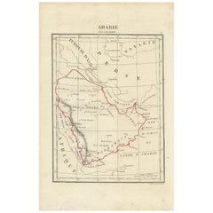

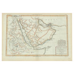
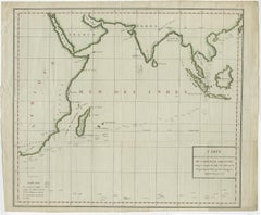
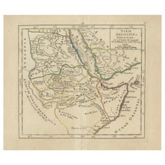
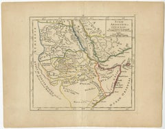
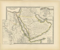
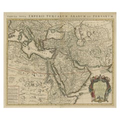
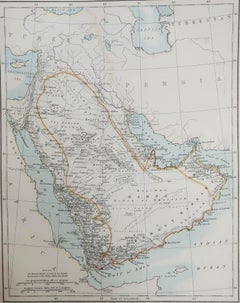
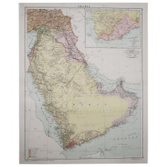
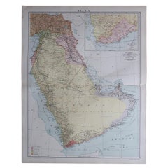
Antique Map of Arabia by Tardieu '1843'
Located in Langweer, NL
Antique map titled 'Arabie'. Attractive small map of Arabia. This map originates from 'Dictionnaire
Category
Antique Mid-19th Century Maps
Materials
Paper
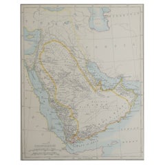
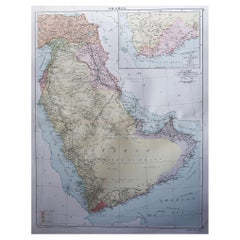
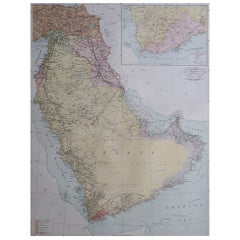
Antique Map of Arabia by Tardieu '1843'
Located in Langweer, NL
Antique map titled 'Arabie'. Attractive small map of Arabia. This map originates from 'Dictionnaire
Paper
$441Sale Price|20% Off
H 9.97 in W 11.15 in D 0.02 in
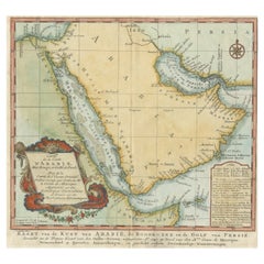
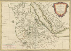
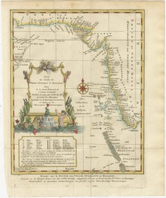
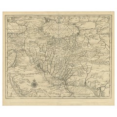
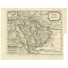
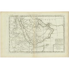
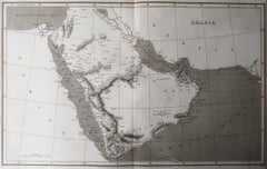
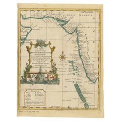
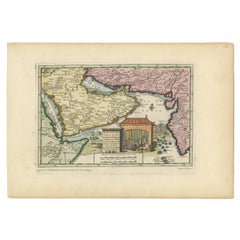
Original Antique Map of Arabia and the Red Sea, circa 1750
Located in Langweer, NL
Dutch version, engraved by J. van Schley, of Bellin's map of Arabia and the Red Sea. The emphasis is the
Paper
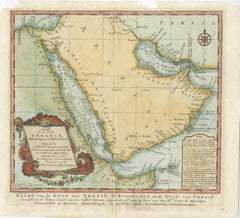
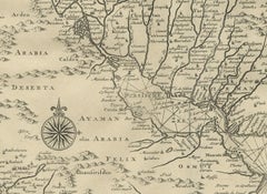
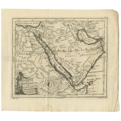
18th Century Map of Arabia – Tirion, Amsterdam c.1730
Located in Langweer, NL
Antique Map of Arabia – Isaak Tirion’s “Nieuwe Kaart van Arabia,” Amsterdam c.1730 This finely
Paper
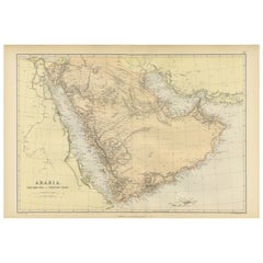

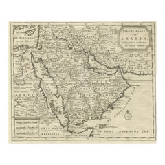
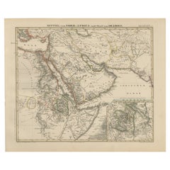
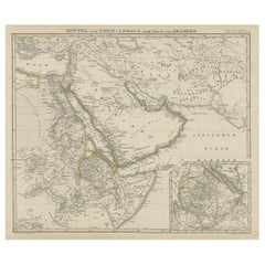
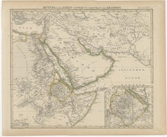
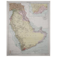
Original 1882 Map of Arabia, Red Sea & Persian Gulf
Located in Langweer, NL
This print is a historically significant map titled "Arabia, the Red Sea, and the Persian Gulf
Paper
$669
H 21.86 in W 16.74 in D 0 in
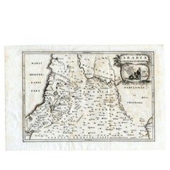
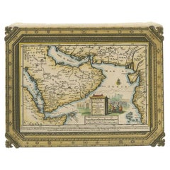
Old Map of Arabian Peninsula and Canaan, Highlighting Biblical Territories, 1750
Located in Langweer, NL
map, which includes the Arabian Peninsula and the biblical lands often referred to as Canaan, appeal
Paper

$422
H 10.24 in W 16.15 in D 0.01 in
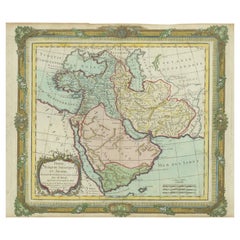
Antique Map of Arabia, Red Sea & Persian Gulf by Rigobert Bonne, 1780
Located in Langweer, NL
Arabia, Red Sea & Persian Gulf – Antique Map, Bonne c1780 Description: This striking map covers
Paper

$807Sale Price|20% Off
H 14.3 in W 20.36 in D 0.02 in
Antique Map of Arabia including Nubia and Abyssinia, also shows the Red Sea
Located in Langweer, NL
Antique map titled 'Nubie et Abissinie'. Original antique map of Nubia, a region along the Nile
Paper
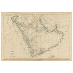
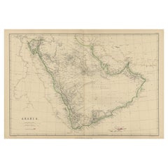
Arabia, Antique Map of the Arabian Peninsula, Blackie Atlas 1860
Located in Langweer, NL
Arabia, Antique Map of the Arabian Peninsula, Blackie Atlas 1860 Description: This original
Paper
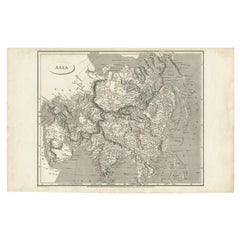
Antique Map of Asia including Arabia, 1806
Located in Langweer, NL
Antique map titled 'Asia'. Original antique map of the Asian continent engraved by E. Jones
Paper
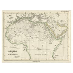
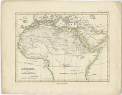
Old Original Map of Africa and Arabia, 1848
Located in Langweer, NL
Antique map titled 'Africa et Arabia'. Old map of Africa and Arabia originating from 'Orbis
Paper


$528Sale Price|40% Off
H 8.08 in W 10.44 in D 0.02 in
Antique Map of the Arabian Peninsula by Franceschini, '1739'
Located in Langweer, NL
Antique map titled 'Conventus et Residentiae'. Rare map of the Arabian Peninsula. This map
Paper

$206Sale Price|20% Off
H 14.18 in W 17.33 in D 0 in
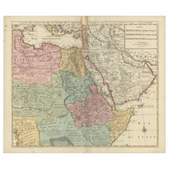
Antique Map of Africa and Arabia with Inset Map of Ethiopia and Eritrea, 1845
Located in Langweer, NL
Central Africa and Arabia with an inset map of Habesch (Ethiopia and Eritrea). Artists and Engravers
Paper
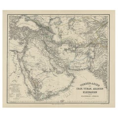
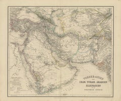
Old German Antique Map of Iran and Arabia, 1866
Located in Langweer, NL
'. Large map centered on Iran. It shows the area from Turkey to Mumbai in India. Includes Arabia, the
Paper

$164Sale Price|20% Off
H 9.45 in W 14.18 in D 0 in
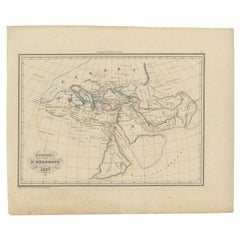
Antique Map of the Arabian Desert by Cellarius, 1731
Located in Langweer, NL
Antique map titled 'Arabia Petraea et Deserta.' Arabian desert with present day Israel, Jordania
Paper
Historic 1857 Map of North-East Africa & Arabia – Fine Engraving
Located in Langweer, NL
North-East Africa and Arabia Map 1857 This detailed antique print shows “Mittel- und Nord-Afrika
Paper

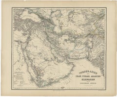
Map of Iran, Arabia, Asia Minor & Caucasus by Perthes, 1858
Located in Langweer, NL
Map of Iran, Arabia, Asia Minor & Caucasus by Perthes, 1858 This is a detailed engraved map titled
Paper

$93Sale Price|20% Off
H 9.65 in W 12.21 in D 0.02 in
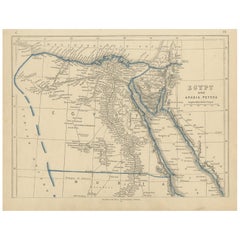
Antique Map of Egypt and Arabia Petraea by Lowry, '1852'
Located in Langweer, NL
Antique map titled 'Egypt and Arabia Petrea'. Original map of Egypt and Arabia Petraea. This map
Paper

$516Sale Price|20% Off
H 9.85 in W 13.59 in D 0.02 in
Antique Map of the Arabian Peninsula by Bonne 'c.1780'
Located in Langweer, NL
antique map of the Arabian Peninsula, including the horn of Africa and part of Southwest Iran. Pictorial
Paper


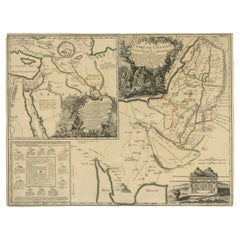
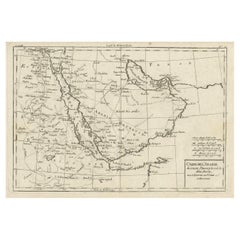
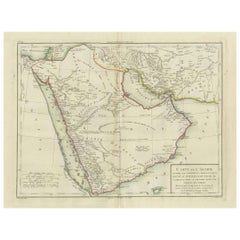
Antique Map of the Arabian Peninsula by Bellin 'c.1740'
Located in Langweer, NL
Antique map titled 'Carte de la Coste d'Arabie, Mer Rouge et Golfe de Perse'. Original antique map
Paper

$1,399Sale Price|20% Off
H 11.03 in W 15.63 in D 0.02 in
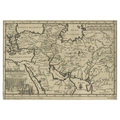
Antique Map of the Middle East with a Large Arabia, 1799
Located in Langweer, NL
Antique map titled 'Perse, Turquie Asiatique et Arabie (..)'. Map of the Middle East with a large
Paper
$225Sale Price|20% Off
H 14.18 in W 17.33 in D 0 in
North & Central Africa & Arabia, Inset Map of Habesch 'Ethiopia & Eritrea', 1845
Located in Langweer, NL
and Central Africa and Arabia with an inset map of Habesch (Ethiopia and Eritrea). Artists and
Paper
$516Sale Price|35% Off
H 9.85 in W 14.89 in D 0 in
Original Antique Map of Canaan, Armenia, Syria, Mesopotamia and Arabia, 1709
Located in Langweer, NL
Antique map titled 'Descriptio Paradisi et Terrae Canaan'. Original antique map of Canaan
Paper
$557
H 15.36 in W 21.66 in D 0.02 in
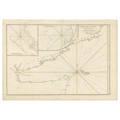
Original Antique Engraved Map of Part of the Red Sea, Arabia, 1775
Located in Langweer, NL
Antique map titled 'Carte de l'Entrée du Golfe de la Mer Rouge'. Uncommon sea chart of the entrance
Paper

$1,197
H 20.87 in W 29.53 in D 0.01 in
Detailed Original Antique Map of the Turkish Empire with Arabia, 1778
Located in Langweer, NL
. . . 1753 Detailed map of the Turkish Empire, extending to the Black Sea, Georgia, the Caspian
Paper
$356Sale Price|20% Off
H 8.59 in W 12.8 in D 0 in
Old Map of the Arabian Peninsula with Parts of Egypt, Sudan, Eritrea & Ethiopia
Located in Langweer, NL
du Globe Terrestre This handsome map of the Arabian Peninsula extends to show parts of Egypt, Sudan
Paper

$432Sale Price|20% Off
H 15.95 in W 19.49 in D 0.02 in
Antique Map of Eastern Turkey, Caucasus, Israel through Iraq and part of Arabia
Located in Langweer, NL
Antique map titled 'Nieuwe Kaart van Irak Arabia, Kurdistan, Diarbek, Turkomannia, Syrie en het
Paper
$399
H 11.23 in W 9.26 in D 0.01 in
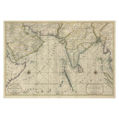
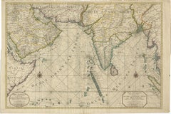
1773 Map of Persia, Gujarat & Malabar Coasts – Arabia to India, Hand-Colored
Located in Langweer, NL
1773 Bellin map of Persia, Gujarat and Malabar coasts with Arabia and Maldives Description: This
Paper
$1,190Sale Price|40% Off
H 30.71 in W 22.64 in D 0.01 in
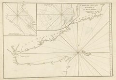
Impressive Decorative Engraved Map of the Red Sea and Arabian Peninsula, 1787
Located in Langweer, NL
antique maps, particularly those focusing on the Arabian Peninsula and maritime navigation in the Red Sea
Paper

$143Sale Price|30% Off
H 17.52 in W 13 in D 0.02 in
Antique Map of Egypt and Arabia Petraea by A & C. Black, 1870
Located in Langweer, NL
Antique map titled 'Egypt and Arabia Petraea'. Original antique map of Egypt and Arabia Petraea
Paper
$619Sale Price|20% Off
H 19.2 in W 22.3 in D 0.002 in
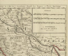
1792 Map of Eastern Africa and the Arabian Peninsula by Delisle/Elwe
Located in Langweer, NL
1792 Map of Eastern Africa and the Arabian Peninsula by Delisle/Elwe This detailed 1792 map
Paper

$220Sale Price|24% Off
H 24.41 in W 19.49 in D 0.02 in
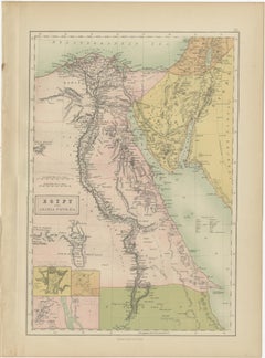
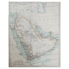
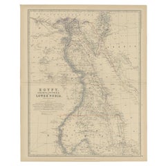
Antique Map of Egypt, Arabia Petraea and Lower Nubia by Johnston '1909'
Located in Langweer, NL
Antique map titled 'Egypt, Arabia Petraea and Lower Nubia'. Original antique map of Egypt, Arabia
Paper
$1,643
H 20.87 in W 25.4 in D 0 in
Old Map of Indian Ocean & Sumatra, Java, Borneo, India, Arabia, Africa, c.1783
Located in Langweer, NL
Antique map titled 'Carte des Declinaisons et Inclinaisons de L'Aiguille Aimantée redigée d'après
Paper

$1,584
H 10.75 in W 15.95 in D 0 in
Antique Map of Continental Asia, with Japan, Arabia, India, Russia, etc c.1702
Located in Langweer, NL
Antique map titled 'Totius Asiae Continens (..).' On this map of continental Asia and the adjacent
Paper
$1,188Sale Price|25% Off
H 15.75 in W 18.51 in D 0.01 in
Scarce Middle East and Arabia Map Showing The Exodus of the Israelites, 1725
Located in Langweer, NL
Antique map titled 'Kaarte van de reize en togten der Israeliten in de woestyne, sedert der zelver
Paper
$1,033Sale Price|20% Off
H 13.39 in W 15.75 in D 0 in
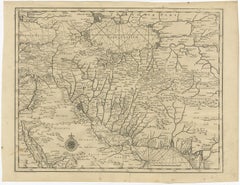
Old Map of Persia, incl the Caspian Sea and Part of the Arabian Peninsula, 1726
Located in Langweer, NL
day western India. This map, centered on Persia, includes the Caspian Sea and part of the Arabian
Paper
$440Sale Price|20% Off
H 7.09 in W 9.81 in D 0 in
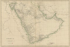
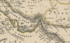
16th Century Map of Saudi Arabia, the Persian Gulf and Red Sea, ca. 1574
Located in Langweer, NL
Ptolemaic map of the Arabian Peninsula based on the 1548 map of Giacomo Gastaldi. It covers nearly
Paper
$410
H 8.67 in W 10.24 in D 0 in
Antique Map of Abyssinia, Sudan and the Red Sea, Arabia and Egypt South, 1749
Located in Langweer, NL
Antique map titled 'Nubie, Abissinie et Cote d'Ajan'. Map of Abyssinia, Sudan and the Red Sea by
Paper
$3,286Sale Price|20% Off
H 24.81 in W 37.01 in D 0 in
Antique Map of Southern Asia with India, the Maldives, Ceylon and Arabia, c.1700
Located in Langweer, NL
Stunning Old Map of Asia. Description: Two-sheet map of Asia, joined. The left part of this
Paper
$997
H 13 in W 16.93 in D 0 in
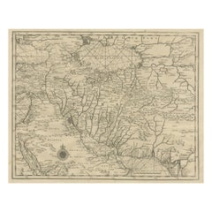
Rare Antique Map of Persia, Incl the Caspian Sea and the Arabian Peninsula, 1726
Located in Langweer, NL
Rare untitled antique map of Persia. It covers from the Gulf of Suez eastward to Ahmedabad
Paper

$446
H 8.67 in W 15.16 in D 0 in
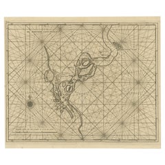
Map of Tapi or Tapti River in Central India and Along the Arabian Sea, 1726
Located in Langweer, NL
Description: Antique map titled 'De Rivier van Suratta'. This chart shows the Tapti or Tapi
Paper
$1,291
H 19.49 in W 22.45 in D 0 in
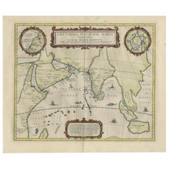
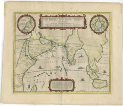
Old Map of Ancient Times covering Egypt Towards Arabia and India to Java, c.1660
Located in Langweer, NL
Description: Antique map titled 'Erythraei Sive Rubri Maris Periplus olim ab arriano descriptus
Paper
$441Sale Price|20% Off
H 15.56 in W 18.51 in D 0 in
Ancient Realms of Northeast Africa: Arabia, Ethiopia, and Egypt, Published 1880
Located in Langweer, NL
This map, titled "ARABIA, AETHIOPIA, AEGYPTUS," illustrates the regions of ancient Arabia, Ethiopia
Paper
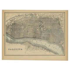

Rare Antique Map of Calcutta 'Kolkata' in India, 1893
Located in Langweer, NL
Antique map titled 'Calcutta (India)'. Old map of Calcutta/Kolkata, India. On verso, a map of Egypt
Paper
$26,300
H 2.5 in W 8.5 in D 3 in
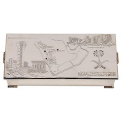
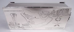
Elizabeth II Sterling Silver and Ruby Humidor Box Made for Saudi Arabia
Located in Long Island City, NY, NY
handles. The top cover is engraved with map of Saudi Arabia; the names of 3 places written out and
Sterling Silver
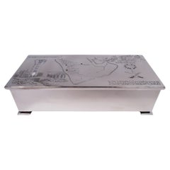
English Modern Sterling Silver Box with Saudi Arabia Association
Located in New York, NY
overhang. Cover top engraved with map of Saudi Arabia; the names of 3 places written out and highlighted
Sterling Silver


Sold
H 11.82 in W 7.68 in D 0 in
Original 1588 Map of Arabia and Persia During the Safavid-Ottoman Conflicts
Located in Langweer, NL
Map of Arabia and the Persian Empire during the Safavid Dynasty by Sebastian Münster (1588) This
Paper
Antique Map of the Red Sea by Van der Aa, 1707
Located in Langweer, NL
Antique map Arabia titled 'De Roode Zee in een Zesde Scheepstogt der Engelze Maatschappie onder H
Paper
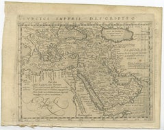
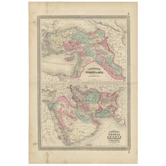
Antique Map of the Turkish Empire, Arabia and Persia
Located in Langweer, NL
l'Arabie et de la Perse (..)'. Original antique map of the Turkish Empire, Arabia and Persia after
Paper
Sold
H 6.11 in W 7.88 in D 0.01 in
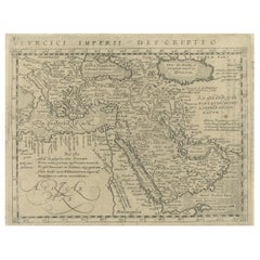
Very Old Detailed Map of the Turkish Empire, Centering on Arabia, 1617
Located in Langweer, NL
Arabia. This map originates from 'Geographiae, tum veteris, tum novae, volumina duo' published by J
Paper

Sold
H 19.49 in W 17.92 in D 0 in
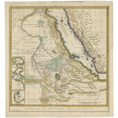
Antique Map of Abyssinia 'Ethiopia' Incl a Part of Arabia & the Red Sea, 1794
Located in Langweer, NL
Antique map titled 'Landkaart van Abyssinie, door James Bruce'. Rare map of Abessinia (Ethiopia
Paper

Antique Map of Arabia by Wyld, '1845'
Located in Langweer, NL
Antique map titled 'Arabia'. Original antique map of Arabia. This map originates from 'An Atlas of
Paper

Antique Map of Arabia by Boulainvilliers, 1745
Located in Langweer, NL
Antique map titled 'Carta nuova dell' Arabia'. Original antique map of Arabia. This map originates
Paper

Antique Map of Arabia by Van Dùren, 1749
Located in Langweer, NL
antique map of Arabia. This map originates from 'Neue Sammlung der merkwürdigsten Reisegeschichten
Paper

Antique Map of Arabia by W. G. Blackie, 1859
Located in Langweer, NL
Antique map titled 'Arabia'. Original antique map of Arabia. This map originates from ‘The Imperial
Paper

Authentic Old Map of Arabia with Original Border Coloring, 1745
Located in Langweer, NL
Lat Creator: Keizer, Jacob, active 1706-1750 Map of Arabia with parts of Persia, Egypt and Abyssinia
Paper

Antique Map of Arabia and Part of Africa, c.1780
Located in Langweer, NL
et l 'Abissinie'. Map of Arabia (Arabian Peninsula) and part of Africa. Covers from the Nile Delta
Paper

Antique Map of Arabia and the Red Sea by Bonne, 1780
Located in Langweer, NL
et l 'Abissinie'. Rare edition of Bonne's map of Arabia (Arabian Peninsula). Covers from the Nile
Paper
Original Antique Map of Saudi Arabia, 1889
Located in St Annes, Lancashire
Great map of Saudi Arabia Drawn and Engraved by W. & A.K. Johnston Published By A & C Black
Paper
Original Antique Map of Saudi Arabia, 1889
Located in St Annes, Lancashire
Great map of Saudi Arabia Drawn and Engraved by W. & A.K. Johnston Published By A & C Black
Paper
Original Antique Map of Saudi Arabia, Arrowsmith, 1820
Located in St Annes, Lancashire
Great map of Saudi Arabia. Drawn under the direction of Arrowsmith. Copper-plate engraving
Paper
Antique Map of the Region of the Arabian Sea
Located in Langweer, NL
Antique map titled 'A Chart of the Coast of Persia, Guzarat & Malabar'. Old map centered on the
Paper

Large Original Vintage Map of Saudi Arabia, circa 1920
Located in St Annes, Lancashire
Great map of Saudi Arabia Original color. Good condition Published by Alexander Gross
Paper

Large Original Vintage Map of Saudi Arabia, circa 1920
Located in St Annes, Lancashire
Great map of Saudi Arabia Original color. Good condition Published by Alexander Gross
Paper

Large Original Vintage Map of Saudi Arabia, circa 1920
Located in St Annes, Lancashire
Great map of Saudi Arabia Original color. Good condition Published by Alexander Gross
Paper

Large Original Vintage Map of Saudi Arabia, circa 1920
Located in St Annes, Lancashire
Great map of Saudi Arabia Original color. Good condition Published by Alexander Gross Unframed.
Paper

Large Original Vintage Map of Saudi Arabia, circa 1920
Located in St Annes, Lancashire
Great map of Saudi Arabia Original color. Good condition Published by Alexander Gross Unframed.
Paper

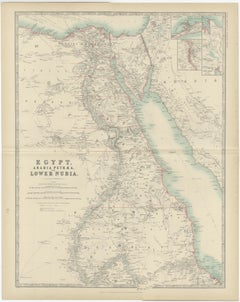
Antique Map of Egypt, Arabia and Lower Nubia, 1882
Located in Langweer, NL
Antique map titled 'Egypt, Arabia Petraea and Lower Nubia'. Old map of Egypt, Arabia and Lower
Paper
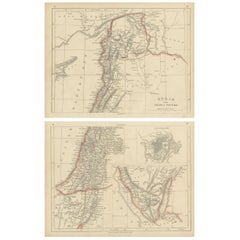

Antique Map of Syria and Arabia Petraea by Lowry '1852'
Located in Langweer, NL
Antique map titled 'Syria and Arabia Petraea'. Two individual sheets of Syria and Arabia Petraea
Paper

Sold
H 26.38 in W 17.92 in D 0.02 in
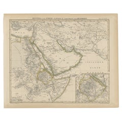
Antique Map of Turkey, Persia, Arabia, Balochistan and Afghanistan, 1872
Located in Langweer, NL
, Persia, Arabia, Balochistan and Afghanistan. This map originates from 'Johnson's New Illustrated Family
Paper


Antique Map of the Arabian Peninsula by Bonne 'c.1780'
Located in Langweer, NL
antique map of the Arabian Peninsula, including the horn of Africa and part of Southwest Iran. Pictorial
Paper

Antique Map of Area Around Arabia in Ancient Greek Times, 1837
Located in Langweer, NL
Antique map titled 'Géographie d'Hérodote'. Antique map of ancient Greece based on the information
Paper

Sold
H 9.97 in W 14.69 in D 0.02 in
Antique Map of the Arabian Peninsula "Egypt, Nubia, Abyssinia" by R. Bonne
Located in Langweer, NL
A finely engraved and attractive late 18th century map of the Arabian peninsula (with Egypt, Nubia
Paper

Sold
H 16.34 in W 22.25 in D 0.01 in
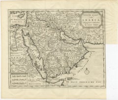
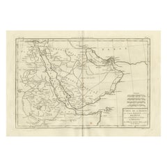
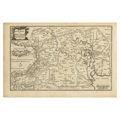
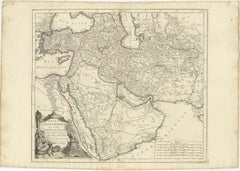
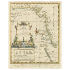
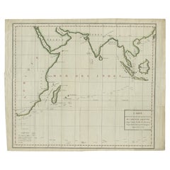
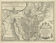
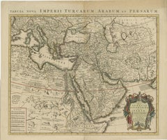
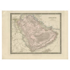
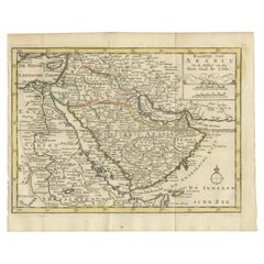
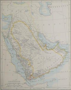
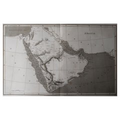
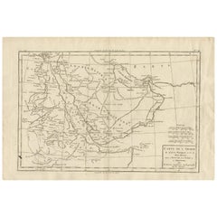
Antique Map of the Arabian Peninsula by Pierre Antoine Tardieu (1784-1869)
Located in Langweer, NL
This is an original antique map titled "Carte de l'Arabie," depicting the Arabian Peninsula and its
Paper

Sold
H 5.9 in W 8.9 in D 0.002 in
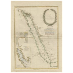
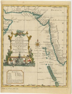
Wonderful Small Map of the Coasts of Arabia, Persia and Western India, ca. 1710
Located in Langweer, NL
Wonderful small map covering the coasts of Arabia, Persia and western India. It illustrates the
Paper

Sold
H 6.7 in W 11.62 in D 0 in
Old Engraved Map of the Middle East, Arabia and Part of Greece 'Cyprus', 1706
Located in Langweer, NL
Title: Antique map titled 'De Zee en Land-Reyse, van Ioh. Mildenhal en Cartwrigt na Persien en
Paper


Sold
H 19.49 in W 17.92 in D 0 in
Rare Old Map of Abessinia 'Ethiopia' Incl. a Part of Arabia & the Red Sea, 1794
Located in Langweer, NL
Antique map titled 'Landkaart van Abyssinie, door James Bruce'. Rare map of Abessinia (Ethiopia
Paper


Sold
H 11.42 in W 14.38 in D 0.02 in
Antique Map of the Arabian Peninsula and Persia by Brion de la Tour '1766'
Located in Langweer, NL
Antique map titled 'Perse, Turquie et Asiatique et Arabie'. Original antique map of the Arabian
Paper
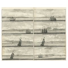
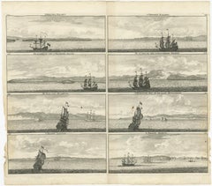
Old Original Engraving with Coastal Views of Arabia, 1711
Located in Langweer, NL
'. Old print with views of Arabia. This print originates from 'Cornelis de Bruins Reizen over Moskovie
Paper
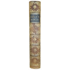

The Koran The Alcoran of Mohammed by George Sale 1844
Located in Dallas, TX
Map of Arabian Peninsula torn. The Book has 3 pull-out maps/illustrations: (1) of the Arabian
Paper
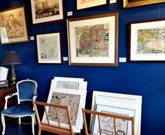
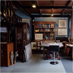
Antique and vintage collectibles and curiosities can bring whimsy and wonder to any interior.
Decorating with old scientific instruments, historical memorabilia and vintage musical instruments, as well as other authentic collectibles and curiosities that can be found on 1stDibs, presents an opportunity to create a unique, natural history museum-like atmosphere in your home that can provoke conversation as often as it pays tribute to how far we’ve come in understanding our world.
And bringing collectibles and curiosities into your space is actually on trend — Wunderkammern, or curiosity cabinets, were all the rage in Europe during the 1500s and continued to have adherents there and in the U.S. in the following centuries. Today, however, they’re experiencing a real surge in popularity and influencing how many interior designers are furnishing and decorating homes — combining contemporary with antique, scientific with tribal, earthly with extraterrestrial, Les Lalanne tables with Flemish tapestries.
The original Wunderkammern were entire rooms filled with objects demonstrating their owners’ worldly knowledge: A proper one included artificiala or preciosa (objets d’art); naturalia (such as skeletons, shells, minerals); exotica (taxidermy or dried plants); and scientifica (scientific instruments), frequently alongside religious relics and ancient artifacts.
Pay tribute to a history of rich and diverse musical traditions that have taken shape all over the world by decorating your home with a collection of antique and vintage musical instruments — with a little help from strong hanging wire or some wall hooks, vintage brass instruments such as a gong, French horn or trumpet can help elevate a home office or complement the efforts you’ve made to ensure a welcoming vibe in your home’s entryway. Bells or antique wind instruments can add provocative metallic contrasts to dark woods as tabletop decorative objects.
Create an intriguing focal point with Georgian scientific instruments, such as stick barometers with mahogany cases or lacquered brass telescopes. These items stem from an era named for the monarchies of the four King Georges, who ruled England in succession starting in 1714 (plus King William’s reign, which lasted until 1837). Just as there was beautiful jewelry produced during the period that today is coveted by collectors, there is much to be found in the collectibles and curiosities realm too.
Wanderlust, nostalgia and a shared love of good design are contributing factors to certain trends in decorating — just as vintage trunks and luggage have reappeared as furniture or home accents in a bedroom or foyer, decorating with globes, maps or nautical objects is similarly rooted in the allure of travel and a penchant for the stylish finishing touch that collectibles bring to our homes.
Find a wide range of antique and vintage collectibles and curiosities on 1stDibs.
Produced in 1843, the well-preserved volume is evidence of the author's exacting specifications.
New or old, the coverlets add old-time charm to any space.
Get into the games! These items celebrate the events, athletes, host countries and sporting spirit.
French trendsetter and serial collector Daniel Rozensztroch tells us about his obsession with objects related to seafaring men.
It's hard to resist the allure of a beautiful pool. So, go ahead and daydream about whiling away your summer in paradise.
The sought-after designer worked with the team at Hoffman Creative to produce a monograph that beautifully showcases some of Studio Shamshiri's most inspiring projects.
Italian writer and collector Umberto Pasti opens the doors to his remarkable cave of wonders in North Africa.
Hollywood A-listers, ex-pat aristocrats and art collectors and style setters of all stripes appreciate the allure of the coastal California hamlet — much on our minds after recent winter floods.