Sicily Map

to
6
29
4
19
12
11
6
5
4
3
3
3
3
2
2
2
2
2
2
1
1
1
1
1
1
1
1
1
1
1
1
1
1
2
2
1
1
1
Sort By
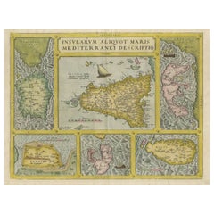
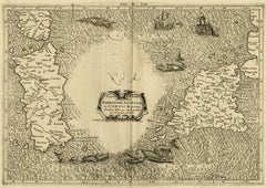
Coloured Antique Map of Sicily, Sardinia, Corfu, Elba, Malta and Zerbi (Jerba)
By Abraham Ortelius
Located in Langweer, NL
Ortelius' map combining, on one page, maps of the islands of Sicily, Sardinia, Corfu, Elba, Malta and Zerbi
Category

Antique 16th Century Maps

Materials

Paper

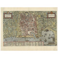
Palermo – 1620 Braun & Hogenberg Bird’s-Eye Map of Palermo, Sicily
Located in Langweer, NL
Palermo – 1620 Braun & Hogenberg Bird’s-Eye Map of Palermo, Sicily This beautifully detailed
Category

Antique 1620s Maps

Materials

Paper

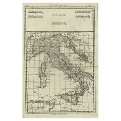
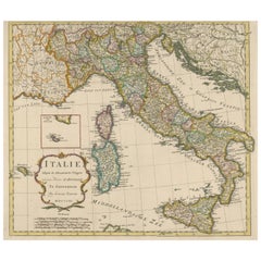
Antique Map of Italy, Corsica, Sardinia and Sicily, ca.1780
Located in Langweer, NL
Description: Antique map titled 'L'Italie.' Map of Italy, Corsica, Sardinia and Sicily. Highly
Category

Antique 1780s Maps

Materials

Paper

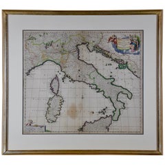
Italy, Sicily, Sardinia, Corsica and Dalmatian Coast: A 17th Century Dutch Map
By Theodorus Danckerts
Located in Alamo, CA
islands of Corsica and Sardinia and part of Sicily are also represented. At the time this map was made
Category

Antique Late 17th Century Dutch Maps

Materials

Paper

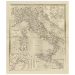
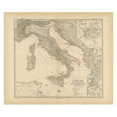
Map of The Italian Peninsula with the islands of Sicily, Sardinia, Corsica, 1880
Located in Langweer, NL
the islands of Sicily, Sardinia, and Corsica. Inset maps offer detailed views of "Roma" with an
Category

Antique 1880s Maps

Materials

Paper

Antique Map of The Regions of Italy and Sicily during the Roman Empire, 1880
Located in Langweer, NL
to "The Regions of Italy and Sicily." This detailed historical map portrays the regions of ancient
Category

Antique 1880s Maps

Materials

Paper

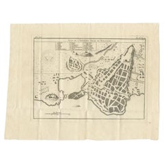
Antique Plan of Ancient Syracuse, Plan of ancient Syracuse, Sicily, Italy
Located in Langweer, NL
Antique print titled 'Plan de l'Ancienne Ville de Syracuse'. Plan of ancient Syracuse, Sicily
Category

Antique 18th Century Maps

Materials

Paper

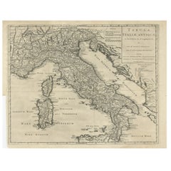
Detailed Antique Map of Italy and surrounding Islands
Located in Langweer, NL
antique map, based on D'Anville's important map of Italy. The map extends to Sicily, Corsica, Sardinia
Category

Antique Mid-18th Century Maps

Materials

Paper

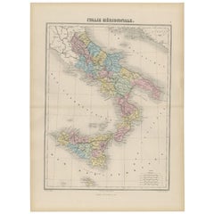
Antique Map of Southern Italy by Migeon, 1880
Located in Langweer, NL
"Antique map titled 'Italie Méridionale'. Old map of southern Italy including Sicily/Sicilia. This
Category

Antique 19th Century Maps

Materials

Paper

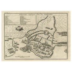
Old Copper Engraving of the Siege of Syracuse, Sicily, Italy, Published, ca.1740
Located in Langweer, NL
, Sicily, Italy. Source unknown, to be determined. The siege of Syracuse by the Roman Republic took
Category

Antique 1740s Maps

Materials

Paper

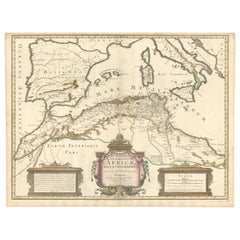
1700 Guillaume Delisle Map: Western Mediterranean & Moorish North Africa
Located in Langweer, NL
Africa map - Moors medieval control - Iberian Peninsula - 18th-century maps - Sicily and Mount Etna
Category

Antique Early 1700s Maps

Materials

Paper

Antique Engraved Map of Italy in Roman Times, ca.1730
Located in Langweer, NL
Minora and part of Majorca and Sicily. Richely printed classical map of ancient kingdoms and city states
Category

Antique 1730s Maps

Materials

Paper

Original Antique Map of Northern Africa by Van Dùren (1749)
Located in Langweer, NL
Libya, and including the southern tip of Spain and Sicily. This map originates from 'Neue Sammlung der
Category

Antique Mid-18th Century Maps

Materials

Paper

Very Large Double Page Detailed Map of Italy and Surrounding Regions, 1794
Located in Langweer, NL
This is a large (two seperate sheets) and detailed map of Italy, including the southern parts of
Category

Antique 1790s Maps

Materials

Paper

Choke II: Strait of Sicily (Tunisia & Sicily) - ceramic - map
By Gregor Turk
Located in Atlanta, GA
This ceramic wall sculpture features a topographic map in black and white. As a self-proclaimed
Category

2010s Abstract Sculptures

Materials

Ceramic

"Choke II: Strait of Messina (Sicily & Italy)" - ceramic - map - Louise Nevelson
By Gregor Turk
Located in Atlanta, GA
This ceramic wall sculpture features a topographic map in black and white. Gregor is inspired by
Category

2010s Abstract Sculptures

Materials

Ceramic

17th Century Dutch Map of Italy, Sicily, Sardinia, Corsica and Dalmatian Coast
By Theodorus Danckerts
Located in Alamo, CA
islands of Corsica and Sardinia and part of Sicily are also represented. At the time this map was made
Category

1690s Prints and Multiples

Materials

Engraving

18th Century Map Engraving - Plan of the Works of the City of Messina, Sicily
Located in Corsham, GB
A map of Messina, a harbour city in northeast Sicily. Inscribed with the title in plate to the
Category

18th Century More Prints

Materials

Engraving

Italy, Central and Southern Part. Century Atlas antique map
Located in Melbourne, Victoria
Sicily and Naples. Central fold as issued. Map name and number printed on the reverse corners. Sheet
Category

Early 20th Century Victorian More Prints

Materials

Lithograph

Map of Sardinia, Sicily and part of Corsica by Mercator - Engraving - 17th c.
By Gerard Mercator
Located in Zeeland, Noord-Brabant
(…)' - Very decorative map of Sardinia, Sicily and part of Corsica. With two war ships, and sea monsters in
Category

1690s Old Masters More Prints

Materials

Engraving

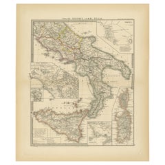
Antique Map of Italy, Sicily and Sardinia Based on Ancient Sources, 1848
Located in Langweer, NL
Antique map titled 'Italia Inferior, Sicilia et Sardinia'. Old map of Italy, Sicily and Sardinia
Category

Antique 19th Century Maps

Materials

Paper

Detailed Antique Map of the Island Sicily, Italy with Nice Coat of Arms, 1747
Located in Langweer, NL
island Sicily, Italy, published by Homann Heirs in 1747. The map is decorated with a wonderful cartouche
Category

Antique 1740s Maps

Materials

Paper

Decorative Map of Sicily, Malta and a Bit of Naples and Sardinia 'Italy', c.1680
Located in Langweer, NL
Antique map titled 'Regnum Siciliae cum circumjacentribus Regnis et Insulis'. Decorative map of
Category

Antique 1680s Maps

Materials

Paper

Big 1960s Detailed 3D Map of Sicily, Italy
By De Agostini
Located in Weesp, NL
Sicily like Filicudi. Map is in great vintage condition. A real eye-catcher. Measurements ; W.105 x
Category

Vintage 1960s Italian Globes

Big 1960s Detailed 3D Map of Sicily, Italy
H 30.71 in W 41.34 in D 1.58 in
Original Antique Map of Sicily, Italy, 1889
Located in St Annes, Lancashire
Great map of Sicily Drawn and Engraved by W. & A.K. Johnston Published By A & C Black
Category

Antique 1880s Scottish Victorian Maps

Materials

Paper

Original Antique Map of Sicily by Thomas Clerk, 1817
Located in St Annes, Lancashire
Great map of Sicily Copper-plate engraving Drawn and engraved by Thomas Clerk, Edinburgh
Category

Antique 1810s English Maps

Materials

Paper

Large Original Antique Map of Sicily, Italy. John Dower, 1861
Located in St Annes, Lancashire
Great map of Sicily Lithograph engraving by John Dower Original colour Published, 1861 Unframed
Category

Antique 1860s English Victorian Maps

Materials

Paper

Antique Map of Italy Depicting Sardinia, Sicily and Corse, c.1873
Located in Langweer, NL
Antique map titled 'Italië'. Old map depicting Italy and the islands of Sardinia, Sicily and Corse
Category

Antique 19th Century Maps

Materials

Paper

Large Antique Map of Italy with Corsica, Sardinia, Sicily & Malta, 1854
Located in Langweer, NL
Antique map titled 'The States of Italy, with their islands, Corsica, Sardinia, Sicily & Malta
Category

Antique 19th Century Maps

Materials

Paper

Antique Map of the Kingdom of Naples and Sicily by Keizer & de Lat, 1788
Located in Langweer, NL
Kingdom of Naples and Sicily, Italy. This map originates from 'Nieuwe Natuur- Geschied- en Handelkundige
Category

Antique Late 18th Century Maps

Materials

Paper

Antique Map of the Region Around Italy, Sicily and Greece by H. Heirs, 1766
Located in Langweer, NL
Gorgeous full color example of Homann's map of the region bounded by the Danube in the North, Italy
Category

Antique Mid-18th Century Maps

Materials

Paper

Antique Map of North Africa by Ortelius 'circa 1580'
Located in Langweer, NL
nearby Mediterranean including Sicily and Malta.This map is oriented northward and shows the northern
Category

Antique 16th Century Maps

Materials

Paper

Antique Map of Italy, South Part, by W. G. Blackie, 1859
Located in Langweer, NL
Malta and Island west of Sicily. This map originates from ‘The Imperial Atlas of Modern Geography
Category

Antique Mid-19th Century Maps

Materials

Paper

Ancient Italy and Sicily. Antique map, 1830
Located in Melbourne, Victoria
. Antique English map showng Sicily and a small part of Italy. 280mm by 380mm (image) The map is loose and
Category

19th Century Naturalistic Landscape Prints

Materials

Engraving

Dolce & Gabbana Sicily Map Print Dress M 44
By Dolce & Gabbana
Located in London, GB
Dolce & Gabbana dress made from silk and printed with the Sicily Map. - Crew neck - Knee length
Category

21st Century and Contemporary Blouses

Get Updated with New Arrivals
Save "Sicily Map", and we’ll notify you when there are new listings in this category.

Sicily Map For Sale on 1stDibs

Find many varieties of an authentic sicily map available at 1stDibs. Frequently made of paper, every sicily map was constructed with great care. You’ve searched high and low for the perfect sicily map — we have versions that date back to the 18th Century alongside those produced as recently as the 20th Century are available. A sicily map is a generally popular piece of furniture, but those created in Victorian styles are sought with frequency. A well-made sicily map has long been a part of the offerings for many furniture designers and manufacturers, but those produced by De Agostini and Theodorus Danckerts are consistently popular.

How Much is a Sicily Map?

A sicily map can differ in price owing to various characteristics — the average selling price 1stDibs is $979, while the lowest priced sells for $36 and the highest can go for as much as $2,536.