Set Of Framed Maps
to
18
173
149
158
121
63
57
53
34
33
28
26
26
24
19
16
15
11
11
8
7
6
6
5
5
5
4
4
4
3
3
3
3
2
2
2
2
1
1
1
1
1
1
1
1
1
42
42
20
7
4
Sort By
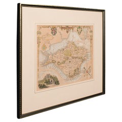
Antique Lithography Map, Isle of Wight, English, Framed, Engraving, Cartography
Located in Hele, Devon, GB
This is an antique lithography map of the Isle of Wight. An English, framed atlas engraving of
Category
Antique Early 19th Century British Regency Maps
Materials
Wood
H 13.59 in W 15.56 in D 0.6 in
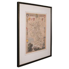
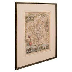
Antique Lithography Map, Buckinghamshire, English, Framed Cartography, Victorian
Located in Hele, Devon, GB
This is an antique lithography map of Buckinghamshire. An English, framed atlas engraving of
Category
Antique Mid-19th Century British Victorian Maps
Materials
Wood, Paper
H 16.15 in W 13.19 in D 0.6 in
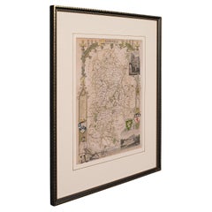
Antique Lithography Map, Bedfordshire, English, Framed Engraving, Cartography
Located in Hele, Devon, GB
This is an antique lithography map of Bedfordshire. An English, framed atlas engraving of
Category
Antique Mid-19th Century British Victorian Maps
Materials
Wood
H 15.75 in W 13.19 in D 0.6 in
Antique Lithography Map, Hertfordshire, English, Framed Engraving, Cartography
Located in Hele, Devon, GB
This is an antique lithography map of Hertfordshire. An English, framed atlas engraving of
Category
Antique Mid-19th Century British Victorian Maps
Materials
Wood
H 13.59 in W 15.75 in D 16.34 in
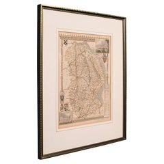
Antique Lithography Map, Lincolnshire, English, Framed, Engraving, Cartography
Located in Hele, Devon, GB
This is an antique lithography map of Lincolnshire. An English, framed atlas engraving of
Category
Antique Mid-19th Century British Victorian Maps
Materials
Wood
H 15.95 in W 13.39 in D 0.6 in
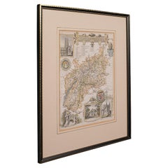
Antique Lithography Map, Gloucestershire, English, Framed Engraving, Cartography
Located in Hele, Devon, GB
This is an antique lithography map of Gloucestershire. An English, framed atlas engraving of
Category
Antique Mid-19th Century British Victorian Maps
Materials
Wood
H 15.75 in W 13 in D 0.6 in
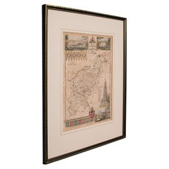
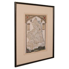
Antique Lithography Map, Northumberland, English, Framed, Engraving, Cartography
Located in Hele, Devon, GB
This is an antique lithography map of Northumberland. An English, framed atlas engraving of
Category
Antique Mid-19th Century British Victorian Maps
Materials
Wood
H 16.74 in W 13.98 in D 0.6 in
Antique Lithography Map, Worcestershire, English, Framed Engraving, Cartography
Located in Hele, Devon, GB
This is an antique lithography map of Worcestershire. An English, framed atlas engraving of
Category
Antique Early 19th Century British Regency Maps
Materials
Wood
H 15.95 in W 13.19 in D 0.6 in
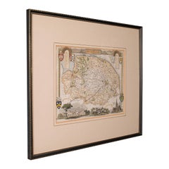
Antique County Map, Norfolk, English, Framed Lithography, Cartography, Victorian
Located in Hele, Devon, GB
This is an antique lithography map of Norfolk. An English, framed atlas engraving of cartographic
Category
Antique Mid-19th Century British Victorian Maps
Materials
Glass, Wood
H 14.57 in W 16.93 in D 0.6 in
Antique County Map, Rutlandshire, English, Framed, Cartography, Victorian, 1860
Located in Hele, Devon, GB
This is an antique lithography map of Rutlandshire. An English, framed atlas engraving of
Category
Antique Mid-19th Century British Victorian Maps
Materials
Wood
H 15.75 in W 13.19 in D 0.6 in
Antique Lithography Map, County Durham, English, Framed Cartography, Victorian
Located in Hele, Devon, GB
This is an antique lithography map of County Durham. An English, framed atlas engraving of
Category
Antique Mid-19th Century British Mid-Century Modern Maps
Materials
Wood
H 13.98 in W 16.15 in D 0.6 in
Antique Lithography Map, Northamptonshire, English, Framed Cartography, C.1860
Located in Hele, Devon, GB
This is an antique lithography map of Northamptonshire. An English, framed atlas engraving of
Category
Antique Mid-19th Century British Victorian Maps
Materials
Wood
H 15.95 in W 13.19 in D 0.6 in
Antique Lithography Map, Cumbria, English, Framed Cartography Interest, Georgian
Located in Hele, Devon, GB
This is an antique lithography map of Cumbria. An English, framed engraving of cartographic
Category
Antique Early 18th Century British Georgian Maps
Materials
Wood
H 21.86 in W 25.2 in D 0.79 in
Antique Lithography Map, Durham, English, Framed, Cartography, Early Georgian
Located in Hele, Devon, GB
This is an antique lithography map of Durham. An English, framed engraving of cartographic interest
Category
Antique Early 18th Century British Georgian Maps
Materials
Wood
H 20.28 in W 21.86 in D 0.6 in
Antique Lithography Map, Cornwall, English Framed Engraving, Cartography, C.1850
Located in Hele, Devon, GB
This is an antique lithography map of the Duchy of Cornwall. An English, framed atlas engraving of
Category
Antique Mid-19th Century British Victorian Maps
Materials
Wood
H 13.98 in W 16.34 in D 0.6 in
Antique Coaching Road Map, South Devon, English, Framed, Cartography, Georgian
Located in Hele, Devon, GB
This is an antique coach road map of South Devon. An English, framed lithograph engraving of
Category
Antique Early 18th Century British Georgian Maps
Materials
Wood
H 12.21 in W 9.65 in D 0.4 in
Set of 2 Costume Prints and a Map of Spain and Portugal, circa 1720
Located in Langweer, NL
Set of two costume prints and a map of Spain and Portugal. The costume prints show costumes of
Category
Antique Early 18th Century Maps
Materials
Paper
Antique Coach Road Map, East Devon, English, Framed, Cartography, Georgian, 1720
Located in Hele, Devon, GB
This is an antique coach road map of East Devon. An English, framed lithograph engraving of
Category
Antique Early 18th Century British Georgian Maps
Materials
Wood
H 12.01 in W 9.45 in D 0.4 in
Road Map John Ogilby No 75 Kings Lyn Harwich, Britannia Framed Wallhanging
By John Ogilby
Located in BUNGAY, SUFFOLK
floated in the original black and gold frame, c1961. Some creasing commensurate with age. The back of the
Category
Antique 1670s European Baroque Maps
Materials
Paper
H 15.75 in W 19.69 in D 0.6 in
Map Road John Ogilby Britannia No 74 Ipswich to Norwich Cromer Framed
By John Ogilby
Located in BUNGAY, SUFFOLK
Alesham to Cromer.
Hand colored and floated in the original black and gold frame, circa 1961. Some
Category
Antique 1670s English Baroque Maps
Materials
Paper
Road Map John Ogilby London St David's Britannia No 15 Abingdon Monmouth Framed
By John Ogilby
Located in BUNGAY, SUFFOLK
John Ogilby (British 1600-1676) Cosmographer and Geographick Printer to Charles II. A road map from
Category
Antique 1670s English Baroque Maps
Materials
Paper
H 20.48 in W 24.41 in D 0.6 in
17th Century Nicolas Visscher Map of Southeastern Europe
Located in Hamilton, Ontario
A beautiful, highly detailed map of southeastern Europe by Nicolas Visscher. Includes regions of
Category
Antique 17th Century Dutch Maps
Materials
Paper
Road Map Britannia No 32 the Road from London to Barnstable John Ogilby Framed
By John Ogilby
Located in BUNGAY, SUFFOLK
collector with no 15 London to St Davids. Framed as a pair.
Measures: Black Linear Border around Map
Category
Antique Late 17th Century English Charles II Maps
Materials
Paper
H 20.48 in W 24.41 in D 0.6 in
Road Map Britannia No 15 London to St Davids John Ogilby Brown Gilt Frame
By John Ogilby
Located in BUNGAY, SUFFOLK
Lechlade, to Fairford, to Barnsley to Gloucester showing Monmouth as the destination. A road map from
Category
Antique Late 17th Century British Charles II Maps
Materials
Paper
H 22.05 in W 26.19 in D 0.6 in
Antique Lithography Map, Isle of Thanet, Kent, English, Cartography, Victorian
Located in Hele, Devon, GB
This is an antique lithography map of The Isle of Thanet in Kent. An English, framed atlas
Category
Antique Mid-19th Century British Victorian Maps
Materials
Wood
H 14.57 in W 16.15 in D 0.6 in
Road Map Britannia No 25 London to the Lands End, John Ogilby Brown Gilded Frame
By John Ogilby
Located in BUNGAY, SUFFOLK
Senan in Cornwall. By John Ogilby His Majesties Cosmographer. A road map from Britannia, 1675/6. No 25
Category
Antique Late 17th Century British Charles II Maps
Materials
Paper
H 22.05 in W 26.19 in D 0.6 in
Road Map Britannia 1675/6 No 5 Road London to Barwick, London Stilton Grey Frame
By John Ogilby
Located in BUNGAY, SUFFOLK
John Ogilby (British 1600-1676) cosmographer and geographick printer to Charles II.
A road map from
Category
Antique Late 17th Century British Charles II Maps
Materials
Paper
H 22.84 in W 25.99 in D 0.4 in
Antique Map of the Maluku Islands by Blaeu, c.1640
Located in Langweer, NL
skills. Blaeu set up shop in Amsterdam, where he sold instruments and globes, published maps, and edited
Category
Antique 17th Century Maps
Materials
Paper
Plan of Paris, France, by A. Vuillemin, Antique Map, 1845
Located in Colorado Springs, CO
toning to the paper. The map has been backed onto linen. It is displayed in a custom archival wood frame
Category
Antique 1840s American Maps
Materials
Paper
Decorative Map of the Spice Islands in the Mollucas, Indonesia, ca.1640
Located in Langweer, NL
Antique map titled 'Moluccae Insulae Celeberrimae'.
Decorative map of the Spice Islands. Inset
Category
Antique 1640s Maps
Materials
Paper
1875 "North America" Map by J. Bartholomew
Located in Colorado Springs, CO
the 9th edition there were thousands of quality illustrations and maps set into the text pages, in
Category
Antique 1870s Scottish Maps
Materials
Paper
Decorative Map of the Maluku or Moluccas or Spice Islands, Indonesia, Ca.1640
Located in Langweer, NL
skills. Blaeu set up shop in Amsterdam, where he sold instruments and globes, published maps, and edited
Category
Antique 1640s Maps
Materials
Paper
H 19.3 in W 22.64 in D 0 in
Antique Coaching Road Map, Devon, English, Regional Cartography, Georgian, 1720
Located in Hele, Devon, GB
This is an antique coaching road map of Devon. An English, framed lithograph engraving of regional
Category
Antique Early 18th Century British Georgian Maps
Materials
Wood
H 12.21 in W 9.65 in D 0.6 in
Road Map, John Ogilby, No 54, London, Yarmouth, Britannia
By John Ogilby
Located in BUNGAY, SUFFOLK
Yarmouth.
Hand colored and floated in the original black and gold frame, circa 1961. Some creasing
Category
Antique 1670s English Baroque Maps
Materials
Paper
Map Road Strip Britannia Sheet 2 John Ogilby London Aberistwith Islip Bramyard
By John Ogilby
Located in BUNGAY, SUFFOLK
framer, print seller, Oxford. Annotated.
The second of 100 sheets of strip maps made for John Ogilby
Category
Antique 17th Century English Baroque Maps
Materials
Paper
H 14.38 in W 19.3 in D 0.79 in
Road Map No43 London to Kings Lynn, Royston to Downham, John Ogilby, Britannia
By John Ogilby
Located in BUNGAY, SUFFOLK
John Ogilby (British 1600-1676) Cosmographer and Geographick Printer to Charles II.
A road map
Category
Antique Late 17th Century British Charles II Maps
Materials
Paper
H 20.48 in W 24.41 in D 0.4 in
18th Century Cartographic Depiction of Upper India and Ceylon, 1835
Located in Langweer, NL
An exquisite set of two maps, 'Carte de la Partie Superieure De L'Inde en de Cadu Gange
Category
Antique 1830s Maps
Materials
Paper
Free Shipping
H 10.04 in W 14.57 in D 0 in
Mapping History: The Decorative Cartography of Indre-et-Loire by Levasseur, 1856
Located in Langweer, NL
additional annotations or simply serving to frame the map aesthetically when displayed. Such margins also
Category
Antique 1850s Maps
Materials
Paper
H 20.67 in W 14.34 in D 0 in
Cadiz Island: A Framed 17th Century Hand-colored Map from Blaeu's Atlas Major
By Joan (Johannes) Blaeu
Located in Alamo, CA
fisheries.”
This 17th century hand-colored map is framed in an ornate, partially textured bronze-colored
Category
Mid-17th Century Old Masters Landscape Prints
Materials
Engraving
H 20 in W 24.88 in D 1.13 in
Rare Set of 3 Map Samplers by A Charles. Italy, Spain & France
Located in Chelmsford, Essex
Set of 3 Map Samplers by A Charles. All depict countries, cities, seas and landmarks of the
Category
Antique Early 19th Century English Tapestries
Materials
Linen
Early Folk Art American Two Sided Framed Military Drawing with Map
Located in Savannah, GA
This unusual set of drawings in a double sided frame came out of an old New England Estate in a
Category
Antique Late 18th Century American Folk Art Political and Patriotic Memo...
Materials
Glass, Wood, Paper
Pair of Monumental National Air Map Company Manhattan Aerial Photo Maps, 1955
Located in San Francisco, CA
A monumental and rare circa 1955 framed two-piece aerial photographic map of the borough of
Category
Vintage 1950s American Mid-Century Modern Photography
Materials
Acrylic, Wood, Paper
H 47.75 in W 33.25 in D 1.5 in
French 1930s Map of Paris à Vol d'Oiseau under Glass in Custom Iron Frame
Located in Atlanta, GA
weathered appearance, the map is set inside a new custom iron frame. With its nice age and great proportions
Category
Early 20th Century French Prints
Materials
Iron
H 28.75 in W 40.25 in D 1 in
Original 'Map of the United States as Californians See It' vintage map poster
Located in Spokane, WA
is in very good fine condition, ready to frame.
A humorous satirical pictorial map from 1947 with
Category
1940s American Modern Landscape Prints
Materials
Offset
H 16.5 in W 20.5 in D 0.04 in
A Map of the Colne Valley Cloth District, West Yorkshire by Max Gill
Located in London, GB
To see our other original maps, scroll down to "More from this Seller" and below it click on "See
Category
1940s Prints and Multiples
Materials
Lithograph
Four Reproduction Vintage Panels of Air France World Map
Located in Los Angeles, CA
Reproduction of a beautiful green and blue mid-century Air France world map on four individual
Category
21st Century and Contemporary French Prints
Materials
Wood, Paper
Contemporary Set of 3 Chairs 'Pipe', Tiger Mountain Fauve 02, Black Frame
By Friends & Founders
Located in Paris, FR
Pipe Set Tiger Mountain - 3 chairs
Design: Friends & Founders
Upholstery available in a wide
Category
21st Century and Contemporary Danish Organic Modern Chairs
Materials
Wool
H 31.89 in W 23.23 in D 21.66 in
Four Reproduction Vintage Panels of Air France World Map
Located in Los Angeles, CA
Reproduction of beautiful blue and green mid-century Air France world map on four individual panels
Category
21st Century and Contemporary French Prints
Materials
Paper, Wood
A Set of 12 Contemporary Framed Abstract Paintings Blue White Museum Collection
By Monica Angle
Located in Buffalo, NY
A set of 12 original mixed media monotype and painting mixed media works by American contemporary
Category
2010s Abstract Expressionist Abstract Paintings
Materials
Canvas, Paper, Acrylic, Watercolor
Original Vintage Soviet Propaganda Poster Great Buildings Of Communism Map USSR
Located in London, GB
Soviet Union set within an oak leaf decorated frame around the image. Horizontal. Good condition, folds
Category
Vintage 1950s Russian Posters
Materials
Paper
H 27.96 in W 37.01 in D 0.04 in
Broke - Mixed Media Credit Card Map Original Artwork
By Fabio Coruzzi
Located in Los Angeles, CA
one-of-a-kind original artwork on panel. This colorful 9-inch high by 11-inch wide artwork is framed
Category
21st Century and Contemporary Pop Art Mixed Media
Materials
Mixed Media, Spray Paint, Panel
Broke 2 - Mixed Media Credit Card Map Original Artwork
By Fabio Coruzzi
Located in Los Angeles, CA
one-of-a-kind original artwork on panel. This colorful 9-inch high by 11-inch wide artwork is framed
Category
21st Century and Contemporary Pop Art Mixed Media
Materials
Mixed Media, Spray Paint, Panel
New France and Labrador - Graphite Drawing, Landscape, On Antiqued Map
By Don Pollack
Located in Chicago, IL
Coeur d’Alenes trail in Northern Idaho. It is a place of rugged and stark beauty barely on the old maps
Category
21st Century and Contemporary Contemporary Landscape Paintings
Materials
Canvas, Oil
Antique Map of Italy Drawn & Engraved by R. Scott for Thomsons, Edinburgh 1814
Located in London, GB
is numbered '26'.
The map is very clean and is set in a beautiful ebonised and gilded frame.
Add
Category
Antique 1810s Scottish Prints
Materials
Other
H 30.52 in W 23.63 in D 0.79 in
Geobond - Colorful Authentic Urban Map Currency Painting
By Fabio Coruzzi
Located in Los Angeles, CA
does not require framing. Free local Los Angeles delivery. Affordable U.S. and worldwide shipping
Category
21st Century and Contemporary Pop Art Figurative Paintings
Materials
Canvas, Oil Pastel, Mixed Media, Acrylic, Ink, Graphite
'Go-for Notations' original signed painting on parchment cycling running map
By Reginald K. Gee
Located in Milwaukee, WI
running up a set of stairs, and third as a head with a bicycle wheel. The story is made clearer by the
Category
1990s Neo-Expressionist Figurative Paintings
Materials
Parchment Paper, Acrylic
H 42.88 in W 37.88 in D 1.88 in
Original Vintage Illustrated Map Poster Afrique Equatoriale Francaise Cameroon
Located in London, GB
above set within a decorative frame border. Artwork by Leo Craste (1887-1970). Published by the
Category
Vintage 1950s French Posters
Materials
Paper
H 47.25 in W 30.71 in D 0.04 in
Large Vintage France Map, Continental, Historical Cartography, Late 20th Century
Located in Hele, Devon, GB
Displays a desirable aged patina throughout
Ebonised frame with textured border sets off the map nicely
In
Category
Late 20th Century European Mid-Century Modern Prints
Materials
Glass, Wood, Paper
H 36.62 in W 28.35 in D 1.38 in
Original Vintage Travel Poster Rhodesia Pictorial Map Southern Africa Zimbabwe
Located in London, GB
decorative compass point. A smaller framed map below marking the area and the South Atlantic Ocean and Indian
Category
Vintage 1930s British Posters
Materials
Paper
H 39.38 in W 24.41 in D 0.04 in
Original Vintage Pictorial Map Poster Ceylon Tea And Other Industries Sri Lanka
By "Leslie MacDonald ""Max"" Gill"
Located in London, GB
above, set within a bold red and black frame border. Tea drink advertising poster Published by The Tea
Category
Vintage 1940s British Posters
Materials
Paper
H 29.93 in W 18.9 in D 0.04 in
- 1
Get Updated with New Arrivals
Save "Set Of Framed Maps", and we’ll notify you when there are new listings in this category.
Set Of Framed Maps For Sale on 1stDibs
On 1stDibs, there are several options of set of framed maps available for sale. Finding the perfect modern, contemporary or Pop Art examples of these works for your space is difficult — today, we have a vast range of variations and more on offer. There are many variations of these items available, from those made as long ago as the 18th Century to those made as recently as the 21st Century. You can search the set of framed maps that we have for sale on 1stDibs by color — popular works were created in bold and neutral palettes with elements of gray, beige, blue and brown. Many versions of these artworks are appealing in their rich colors and composition, but (after) Henri Matisse, Henri Matisse, Donise English, John Mix Stanley and Jasper Johns produced especially popular works that are worth a look. Frequently made by artists working in lithograph, paint and paper, all of these available pieces are unique and have attracted attention over the years.
How Much are Set Of Framed Maps?
Prices for art of this kind can differ depending upon size, time period and other attributes — set of framed maps in our inventory begin at $175 and can go as high as $135,000, while the average can fetch as much as $1,675.
