Virginia Map

to
6
28
20
34
15
15
10
9
9
7
5
5
4
3
3
3
2
2
1
1
1
1
1
1
1
1
1
1
1
1
1
1
2
1
1
1
1
Sort By
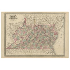
Antique Map of Virginia, Delaware, Maryland & West Virginia by Johnson, 1872
Located in Langweer, NL
Antique map titled 'Johnson's Viriginia (..). Original map of Virginia, Delaware, Maryland and West
Category

Antique Late 19th Century Maps

Materials

Paper

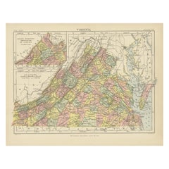
Antique Map of Virginia, with Inset Map of the South Western Continuation
Located in Langweer, NL
Antique map titled 'Virginia'. Original antique map of Virginia, United States. With inset map of
Category

Antique Late 19th Century Maps

Materials

Paper

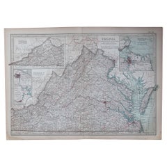
Original Antique Map of the American State of Virginia, 1903
Located in St Annes, Lancashire
Antique map of Virginia Published By A & C Black. 1903 Original colour Good condition Unframed
Category

Antique Early 1900s English Maps

Materials

Paper

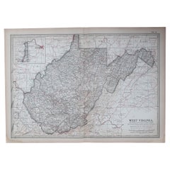
Original Antique Map of the American State of Virginia, 1903
Located in St Annes, Lancashire
Antique map of West Virginia Published By A & C Black. 1903 Original colour Good condition
Category

Antique Early 1900s English Maps

Materials

Paper

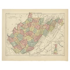
Antique Map of Virginia, with Inset Map of the Northern Part of West Viriginia
Located in Langweer, NL
Antique map titled 'West Virginia'. Original antique map of Virginia, United States. With inset map
Category

Antique Late 19th Century Maps

Materials

Paper

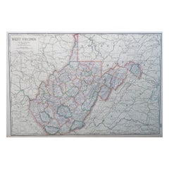
Large Original Antique Map of West Virginia, USA, C.1900
Located in St Annes, Lancashire
Fabulous map of West Virginia Original color Engraved and printed by the George F. Cram Company
Category

Antique 1890s American Maps

Materials

Paper

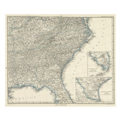
Antique Map of Tennessee, Kentucky, Virginia, Alabama, Georgia and Surroundings
Located in Langweer, NL
, Tennessee, Kentucky, Virginia and part of Florida. With inset maps of the southern part of Florida and the
Category

Antique Mid-19th Century Maps

Materials

Paper

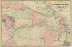
1862 Johnson's Map of the Vicinity of Richmond & Peninsular Campaign, Virginia
Located in Langweer, NL
Title: 1862 Johnson's Map of the Vicinity of Richmond & Peninsular Campaign, Virginia Description
Category

Antique 1860s Maps

Materials

Paper

1864 Johnson's Map of Virginia, Delaware, and Maryland with Fort Monroe Inset
Located in Langweer, NL
Title: 1864 Johnson's Map of Virginia, Delaware, and Maryland with Fort Monroe Inset Description
Category

Antique 1860s Maps

Materials

Paper

Antique Map of South Carolina, North Carolina, and Virginia by Tardieu, 1802
Located in Langweer, NL
) - **Features**: The map includes detailed representations of South Carolina, North Carolina, and Virginia
Category

Antique Early 1800s Maps

Materials

Paper

1837 Mitchell's "Tourist's Pocket Map of the State of Virginia" by J.H. Young
Located in Colorado Springs, CO
This is J. H. Young's pocket map of the Virginia, which shows county development current to 1835
Category

Antique 1830s American Maps

Materials

Paper

Engraving of Idols of Secotam Village in Virginia 'or now North Carolina', 1721
Located in Langweer, NL
image 'Le Dieu des Vents, autre Idole des Virginiens'. The God of Wind. Both idols are key to Virginian
Category

Antique 1720s Maps

Materials

Paper

Virginia. USA. Century Atlas state antique vintage map
Located in Melbourne, Victoria
'The Century Atlas. Virginia' Original antique map, 1903. Central fold as issued. Map name and
Category

Early 20th Century Victorian More Prints

Materials

Lithograph

West Virginia. USA. Century Atlas state antique vintage map
Located in Melbourne, Victoria
'The Century Atlas. West Virginia' Original antique map, 1903. Central fold as issued. Map name
Category

Early 20th Century Victorian More Prints

Materials

Lithograph

"West Virginia" Cream with Red Florals Area Map Scalloped Cotton Handkerchief
Located in New York, NY
Cream with red multi-florals and red scallop-edged "West Virginia" area map handkerchief
Category

1970s American Handkerchiefs

Bermuda: An Early 17th Century Hand-colored Map by Henricus Hondius
By Henricus Hondius
Located in Alamo, CA
. The Bermudas were granted to the Virginia Company, which is referenced on the map. The distance to the
Category

Early 17th Century Old Masters Landscape Prints

Materials

Engraving

Rare Civil War Map of Part of South Eastern Virginia
Located in New York, NY
Rare Civil War Map published in 1862 by H. Lindenkohl & Chs. G. Krebs, shows fortifications used
Category

19th Century Realist Landscape Prints

Materials

Lithograph

Antique Civil War Map of Virginia, "Seat of War in Virginia Sheet 2" 1862
Located in Colorado Springs, CO
This informative map of the Seat of War in Virginia, &c., sheet 2 covers the area in northern
Category

Antique 1860s British Maps

Materials

Paper

Antique Civil War Map of Virginia, "Seat of War in Virginia Sheet 3" 1862
Located in Colorado Springs, CO
This informative map of the Seat of War in Virginia, sheet 3 spans the area from Petersburg and
Category

Antique 1860s British Maps

Materials

Paper

1818 Carey Atlas Correct Hand-Colored Map of Virginia
Located in Colorado Springs, CO
VIRGINIA" Published by M. Carey & Sons, Philadelphia. This original, historic Map of Virginia is found
Category

Antique 1810s North American Maps

Northeastern Virginia and Vicinity of Washington Civil War Map
Located in Colorado Springs, CO
This is an attractive and highly detailed Civil War map of Northern Virginia, which shows the
Category

Antique 1890s American Maps

Rare 17th Century American Map of Virginia and Florida by Jan Janssonius
By Jan Johansson
Located in Wiscasset, ME
dedicated to Italy. 1646 a fourth volume came out with "English County Maps", a year after a similar issue
Category

Antique 18th Century and Earlier Dutch Rococo Maps

Antique Map of Virginia, Showing the Location of Civil War Battle Fields, 1902
Located in Colorado Springs, CO
Presented is an original map from 1902 showing the locations of battlefields across Virginia and
Category

Antique Early 1900s American Maps

Materials

Paper

1862 Pocket Map of Eastern Virginia Representing the Seat of the Civil War
Located in Colorado Springs, CO
This is an 1862 map of Eastern Virginia, compiled by Walter L. Nicholson for the U.S. Coast Survey
Category

Antique 1860s Maps

Florida and Virginia: A 17th Century Hand-colored Map by Hondius after Mercator
By Gerard Mercator
Located in Alamo, CA
This hand-colored early 17th century copper-plate map entitled "Virginia et Florida" was originally
Category

Antique Early 17th Century Dutch Maps

Materials

Paper

Defenses of Washington. Extract of Military Map of N.E. Virginia, Circa 1891
Located in Colorado Springs, CO
This historical and interesting map details the various defenses poised to defend Washington from
Category

Antique 1890s Maps

"Historical Civil War Map" Antique U.S. Pocket Map by Asher and Co., 1862
Located in Colorado Springs, CO
shows all the events of the war, up until August 9th, 1862, in Culpepper, Virginia. This map shows the
Category

Antique 1860s American Maps

Materials

Paper

1865 "Johnson's Kentucky and Tennessee" Map by Johnson and Ward
Located in Colorado Springs, CO
Arkansas, Illinois, Alabama, Georgia, North Carolina, Virginia, Ohio, and Indiana. The map is beautifully
Category

Antique Mid-19th Century Maps

Materials

Paper

1865 "Johnson's California, Utah, Nevada, Colorado, New Mexico, Arizona" Map
Located in Colorado Springs, CO
Virginia” and the “New Military Map of the United States.” Condition: Fine condition overall. Hand Colored
Category

Antique Mid-19th Century Maps

Materials

Paper

1865 "Johnson's Nebraska, Dakota, Colorado, Idaho & Kansas" Map, Johnson & Ward
Located in Colorado Springs, CO
Virginia” and the “New Military Map of the United States.”
Category

Antique Mid-19th Century Maps

Materials

Paper

1865 "Johnson's Missouri and Kansas" Map by Johnson and Ward
Located in Colorado Springs, CO
War-era maps, one of the “Vicinity of Richmond and Peninsular Campaign in Virginia” and the “New
Category

Antique Mid-19th Century Maps

Materials

Paper

Survey for Military Defenses Map of Northeastern Va and Vicinity of Washington
Located in Colorado Springs, CO
"Surveys for military defenses. Map of Northeastern Virginia and Vicinity of Washington. Corrected
Category

Antique 1890s American Maps

Framed New York Central Railway Map Original from 1943 with Railway Label
By Baker, Jones, Hausauer, Inc. 1
Located in Ottawa, Ontario
to Iowa & South to Virginia/Kentucky. The map in frame measures 41"-inches x 26 1/2"
Category

Vintage 1940s American Mid-Century Modern Maps

Materials

Paper

1860 "Johnson's North and South Carolina" by Johnson & Browning
Located in Colorado Springs, CO
but not colored are the neighboring states of Virginia and Georgia. The map is beautifully detailed
Category

Antique 1860s American Victorian Maps

Materials

Paper

Civil War Panorama of the Seat of War by John Bachmann, Antique Print circa 1864
Located in Colorado Springs, CO
theaters of War" (Stephenson & McKee Virginia in Maps p.239). This view, taken from the apparent vantage
Category

Antique 1860s American Maps

Materials

Paper

County Map of Virginia and West Virginia /// American Cartography Geography Art
Located in Saint Augustine, FL
Artist: Samuel Augustus Mitchell (American, 1790-1868) Title: "County Map of Virginia and West
Category

1860s Academic More Prints

Materials

Watercolor, Engraving

William Winterbotham's View of the American United States, First Editions, 1795
Located in Colorado Springs, CO
, Commercial and Philosophical View of the American United States, with all Listed Maps and Plates, Including
Category

Antique 1790s British Books

Materials

Paper

Original Antique Map of Virginia, circa 1890
Located in St Annes, Lancashire
Great map of Virginia Original color. Published, circa 1890 Repairs to minor edge tears
Category

Antique 1890s English Other Maps

Materials

Paper

Original Antique Map of Virginia, circa 1890
H 16.5 in W 11.75 in D 0.07 in
Large Original Antique Map of Virginia, USA, 1894
By Rand McNally & Co.
Located in St Annes, Lancashire
Fabulous map of Virginia Original color By Rand, McNally & Co. Published, 1894 Unframed
Category

Antique 1890s American Maps

Materials

Paper

Original Antique Map of West Virginia, circa 1890
Located in St Annes, Lancashire
Great map of West Virginia Original color. Published, circa 1890 Repairs to a couple of
Category

Antique 1890s English Other Maps

Materials

Paper

1829 Map of Virginia and Maryland by Anthony Finley
Located in Colorado Springs, CO
Maryland and Virginia from 1829. Originally drawn by D.H. Vance and engraved by J.H. Young, this map was
Category

Antique 1820s American Maps

Materials

Paper

Large Original Antique Map of West Virginia, USA, 1894
By Rand McNally & Co.
Located in St Annes, Lancashire
Fabulous map of West Virginia Original color By Rand, McNally & Co. Published, 1894 Unframed
Category

Antique 1890s American Maps

Materials

Paper

Large Original Antique Map of Virginia, USA, circa 1900
Located in St Annes, Lancashire
Fabulous map of Virginia Original color Engraved and printed by the George F. Cram Company
Category

Antique 1890s American Maps

Materials

Paper

Original Antique Map of The American State of Virginia, 1889
Located in St Annes, Lancashire
Great map of Virginia Drawn and Engraved by W. & A.K. Johnston Published By A & C Black
Category

Antique 1880s Scottish Victorian Maps

Materials

Paper

Original Antique Map of The American State of West Virginia, 1889
Located in St Annes, Lancashire
Great map of West Virginia Drawn and Engraved by W. & A.K. Johnston Published By A & C Black
Category

Antique 1880s Scottish Victorian Maps

Materials

Paper

17th Century 1630 Nova Anglia Colored Map Engraving Belgium Virginia Jan Jansson
By J. Jansson
Located in Dayton, OH
17th century 1630 Nova Anglia colored map engraving Belgium Virginia Jan Jansson Nova Anglia by
Category

Antique 17th Century American Colonial Maps

Materials

Paper

Old French Map with Details of New England, Lake Erie, Virginia, Maryland, 1780
Located in Langweer, NL
England. Detailed map of the region bounded by New England, Lake Erie, the Allegehenies, Virginia and
Category

Antique 1780s Maps

Materials

Paper

Antique Map of the vicinity of Richmond by Johnson, 1872
Located in Langweer, NL
Richmond and Peninsular Campaign in Virginia. This map originates from 'Johnson's New Illustrated Family
Category

Antique Late 19th Century Maps

Materials

Paper

Florida and Virginia: A 17th Century Hand-colored Map by Hondius after Mercator
By Gerard Mercator
Located in Alamo, CA
This hand-colored early 17th century copper-plate map entitled "Virginia et Florida" was originally
Category

Early 17th Century Landscape Prints

Materials

Engraving

Virginie (Virginia)
By Alain Manesson Mallet
Located in New York, NY
Original engraving map of Virginia published by French cartographer Alain Mallet, who compiled and
Category

17th Century Realist Landscape Prints

Materials

Engraving

1749 French Map of New England, New York, New Jersey, Pennsylvania and Virginia
Located in New York, NY
Original hand-colored map of the British Colonies in North America, a decade prior to the French
Category

1740s Realist Landscape Prints

Materials

Engraving

Get Updated with New Arrivals
Save "Virginia Map", and we’ll notify you when there are new listings in this category.

Virginia Map For Sale on 1stDibs

Find many varieties of an authentic virginia map available at 1stDibs. Each virginia map for sale was constructed with extraordinary care, often using paper. You’ve searched high and low for the perfect virginia map — we have versions that date back to the 18th Century alongside those produced as recently as the 20th Century are available. A virginia map, designed in the Rococo style, is generally a popular piece of furniture. You’ll likely find more than one virginia map that is appealing in its simplicity, but J. Jansson and Jan Johansson produced versions that are worth a look.

How Much is a Virginia Map?

A virginia map can differ in price owing to various characteristics — the average selling price 1stDibs is $1,563, while the lowest priced sells for $67 and the highest can go for as much as $7,500.