West Indies Map
to
12
52
9
29
21
15
12
11
8
7
6
6
4
4
3
2
2
2
2
2
1
1
1
1
1
1
1
1
1
1
1
1
1
1
1
Sort By
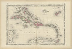
1864 Johnson's Map of the West Indies and Bermuda
Located in Langweer, NL
Title: 1864 Johnson's Map of the West Indies and Bermuda
Description: This is an 1864 map titled
Category
Antique 1860s Maps
Materials
Paper
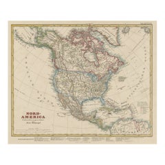
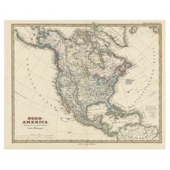
Antique Map of North America Including the West Indies
Located in Langweer, NL
Original antique map titled 'Nord-America'. Old map of North America and the West Indies. Also
Category
Antique Mid-19th Century Maps
Materials
Paper
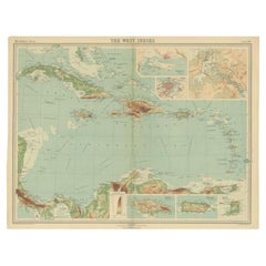
Antique Map of the West Indies in Full Color, 1922
Located in Langweer, NL
Antique map titled 'The West Indies.' A map of the West Indies, the Carribean region. This includes
Category
20th Century Maps
Materials
Paper
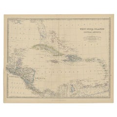
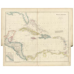
Antique Map of Central America and the West Indies, 1882
Located in Langweer, NL
West Indies. This map originates from 'The Royal Atlas of Modern Geography, Exhibiting, in a Series of
Category
Antique 19th Century Maps
Materials
Paper
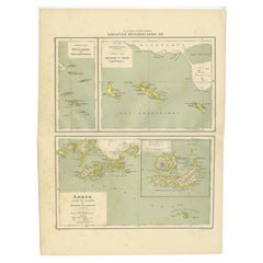
Antique Map of the West Indies and Ambon in Indonesia, 1900
Located in Langweer, NL
-Eilanden en Banda-Eilanden'. Old map of the Dutch West Indies and Ambon Island, Indonesia. This map
Category
20th Century Maps
Materials
Paper
Original Antique Map of the West Indies by J. Arrowsmith, 1842
Located in Langweer, NL
Title: "J. Arrowsmith's 19th Century Map of the West Indies"
This original antique map, crafted by
Category
Antique Early 19th Century Maps
Materials
Paper
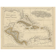
Antique Map of the West Indies and Central America by Lowry '1852'
Located in Langweer, NL
Antique map titled 'West Indies and Central America'. Original map of the West Indies and Central
Category
Antique Mid-19th Century Maps
Materials
Paper
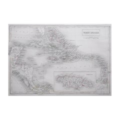
Large Original Antique Map of The West Indies by Sidney Hall, 1847
Located in St Annes, Lancashire
Great map of The West Indies
Drawn and engraved by Sidney Hall
Steel engraving
Original
Category
Antique 1840s Scottish Maps
Materials
Paper
Antique Map with Hand Coloring of North America and the West Indies
Located in Langweer, NL
Original antique map titled 'Nord-America'. Old map of North America and the West Indies.
This
Category
Antique Late 19th Century Maps
Materials
Paper
Antique Map of North America and the West Indies by Stieler, circa 1865
Located in Langweer, NL
Antique map titled 'Nord-America und West-Indien'. Old map of North America and the West Indies
Category
Antique Mid-19th Century Maps
Materials
Paper
H 9.45 in W 12.21 in D 0.02 in
Original Antique Map of the Island of Dominica in the West Indies, 1794
Located in Langweer, NL
MAP OF THE ISLAND OF DOMINICA for the History of the West Indies, by Bryan Edwards. Esq.
Dominica
Category
Antique 1790s Maps
Materials
Paper
Authentique Map by Pilon of The French Colonies in The West Indies, 1876
Located in Langweer, NL
This map is a significant representation of the French colonies in the West Indies during the late 19th
Category
Antique Late 19th Century Maps
Materials
Paper
H 14.38 in W 16.54 in D 0 in
Antique Map of South American, The West Indies & Most of Africa, Ca.1775
Located in Langweer, NL
, but includes most of Africa, the southern part of North America and the West Indies. Arrows in the
Category
Antique 1770s Maps
Materials
Paper
H 15.04 in W 19.77 in D 0 in
1821 Thomson Map of Guadeloupe, Marie-Galante and Antigua in the West Indies
Located in Langweer, NL
This map, published in 1821 by John Thomson, showcases Guadeloupe, Marie-Galante, and Antigua from
Category
Antique 1820s Maps
Materials
Paper
H 21.26 in W 28.94 in D 0 in
Original Antique Map of Martinique Island In The West Indies by Bonne, circa1780
Located in Langweer, NL
Antique map titled 'Carte de l'Isle de la Martinique Colonie Francoise dans les Isles Antilles
Category
Antique 18th Century Maps
Materials
Paper
H 13.59 in W 10.04 in D 0 in
Original Engraved Map of Saint Lucia in the West Indies by Bellin, 1758
Located in Langweer, NL
Hydrographer and engineer of the French Navy, is a remarkable antique map showcasing the intricate details of
Category
Antique 1750s Maps
Materials
Paper
Antique Map of Mexico, Central America and West Indies by A & C. Black, 1870
Located in Langweer, NL
Antique map titled 'Mexico, Central America and West Indies'. Original antique map of Mexico
Category
Antique Late 19th Century Maps
Materials
Paper
H 13 in W 17.52 in D 0.02 in
Antique Map of the West Indies and Central America by W. G. Blackie, 1859
Located in Langweer, NL
Antique map titled 'The West India Island & Central America'. Original antique map of the West
Category
Antique Mid-19th Century Maps
Materials
Paper
H 14.57 in W 21.26 in D 0.02 in
18th Century Original Dutch Map of Martinique in The West Indies by Isaak Tirion
Located in Langweer, NL
This is an 18th-century Dutch map of Martinique, titled *Het Westindisch Eiland Martinique*. The
Category
Antique 1760s Maps
Materials
Paper
H 16.15 in W 19.3 in D 0 in
Antique Map of the Gulf of Mexico and all the islands of the West Indies
Located in Langweer, NL
all the islands of the West Indies. It also includes nice detail of the southern United States
Category
Antique Early 19th Century Maps
Materials
Paper
H 17.41 in W 23.63 in D 0.02 in
Old German Map of the United States, Central America and the West Indies, c.1870
Located in Langweer, NL
, Central America and the West Indies. This map originates from 'H. Kiepert's Kleiner Atlas der Neueren
Category
Antique 19th Century Maps
Materials
Paper
H 13.78 in W 17.68 in D 0 in
Original Engraving of the West Indies, Gulf of Mexico, Antilles, Caribbean, 1780
Located in Langweer, NL
Rigobert Bonne and G. Raynal's 1780 map of the West Indies, Gulf of Mexico, Antilles, and the
Category
Antique Late 18th Century Maps
Materials
Paper
H 9.85 in W 15.16 in D 0 in
Roseaux, St. Lucia Island Map by BELLIN, Handcolored Engraving, 1763
Located in Langweer, NL
intricacies. Its inclusion in the "Maps West Indies St. Lucia" category underscores its significance in
Category
Antique 1760s Maps
Materials
Paper
Copper Engraved Grenada Map by John Thompson Published in 1810
Located in Langweer, NL
coloring, embodies a significant contribution to the category of Maps West Indies Whole.
Crafted with
Category
Antique Early 19th Century Maps
Materials
Paper
Antique Railroad Map of the United States by Rand, McNally & Co, 1900
Located in Langweer, NL
portions of The Dominion of Canada, The Republic of Mexico and the West Indies'. Large railroad map of the
Category
20th Century Maps
Materials
Linen, Paper
Interesting Map of the Atlantic Showing Nelson's and Trade Routes, 1817
By John Thomson
Located in Langweer, NL
Antique map titled 'Chart of the North Atlantic Ocean with Tracks of the Shipping to West Indies
Category
Antique 19th Century Maps
Materials
Paper
Large Antique Map of Guadeloupe and Antigua with Adjacent Isles, 19th Century
Located in Langweer, NL
about the West Indies.
The condition of the map appears to be good, with the paper showing signs of
Category
Antique Early 19th Century Maps
Materials
Paper
H 21.07 in W 29.34 in D 0 in
Antique Map of Cayenne and Cassepouri, French Guinea, South America, c.1730
Located in Langweer, NL
Cayenne and Cassepouri, French Guinea, South America, and Martinique in the West Indies. The map of
Category
Antique 18th Century Maps
Materials
Paper
H 16.54 in W 13.59 in D 0 in
"The Story Map Of The West Indies" 1936
Located in Bristol, CT
Framed colour map of the West Indies published 1936 w/ border design motif adapted from native West
Category
1930s More Prints
Materials
Paper
Original Vintage Poster The Story Map Of The West Indies Native Handicraft Motif
Located in London, GB
Original vintage poster - The Story Map of the West Indies - featuring a colourful illustrated map
Category
Vintage 1930s American Posters
Materials
Paper
H 13.39 in W 16.93 in D 0.04 in
Seminal guide to the East and West Indies, with 42 coloured maps and plates
By Jan Huygen van Linschoten
Located in ZWIJNDRECHT, NL
Seminal guide to the East and West Indies, with 42 double-page and folding plates, including 6 maps
Category
Antique Early 17th Century Dutch Dutch Colonial Books
Materials
Paper
H 12.6 in W 8.27 in D 1.58 in
Original Vintage Poster The Story Map Of The West Indies Native Handicraft Motif
Located in London, GB
Original vintage poster - The Story Map of the West Indies - featuring a colourful illustrated map
Category
1930s More Prints
Materials
Paper
Antique Miniature Map of the West Indies by T. Starling, 1830
Located in Langweer, NL
Miniature steel engraving by Thomas Starling published in his Family Cabinet Atlas by Mr. Bull, London.
Category
Antique Mid-19th Century Maps
Materials
Paper
Antique Map of The Gulf of Mexico and The West Indies, ca.1780
Located in Langweer, NL
Mexico and the West Indies. There is sparse detail mostly confined to Hispaniola and the Windward Islands
Category
Antique 1780s Maps
Materials
Paper
English Map of West Indies with a Gilt Wood Frame Under Glass, Late 19th Cent
Located in Charleston, SC
English hand colored accurate map of the West Indies with a foliage gilt wood and gesso frame under
Category
Antique Late 19th Century English Victorian Maps
Materials
Gesso, Glass, Giltwood, Paint, Paper
H 13.75 in W 16.75 in D 0.75 in
Mitchell's New National Wall Map Exhibiting the United States, circa 1856
Located in Colorado Springs, CO
edition of Mitchell's important 1856 wall map of the United States, Mexico and the West Indies. The map
Category
Antique 1850s American Maps
Original Vintage Poster KLM Air Travel West Indies Caribbean Islands Route Map
Located in London, GB
Original vintage travel poster for KLM Royal Dutch Airlines West Indies Division Caribbean Routes
Category
Vintage 1950s Trinidadian Posters
Materials
Paper
H 20.87 in W 30.71 in D 0.04 in
Charles Lindbergh Signed Oveland and Overseas Flight Path Map, circa 1928
Located in Colorado Springs, CO
San Diego, St. Louis to New York; National Tour; Mexico, Central and South America and the West Indies
Category
Vintage 1920s American Aviation Objects
Antique Map of Grenada, West Indies, 1758
Located in Langweer, NL
"Exquisite 1758 Map: 'CARTE DE L'ISLE DE LA GRENADE'
This alluring map presents a detailed
Category
Antique 1750s Maps
Materials
Paper
Antique Map of the West Indies by Johnson '1872'
Located in Langweer, NL
Antique map titled 'Johnson's West Indies'. Original map of the West Indies, with an inset map of
Category
Antique Late 19th Century Maps
Materials
Paper
Antique Map of the West Indies by Wyld '1845'
Located in Langweer, NL
Antique map titled 'Map of the West India Islands'. Original antique map of the West Indies
Category
Antique Mid-19th Century Maps
Materials
Paper
Antique Map of the West Indies, with Frame Style Border
Located in Langweer, NL
Antique map titled 'Antilles ou Indes Occidentales'. Attractive map of the West Indies. Covers from
Category
Antique Mid-19th Century Maps
Materials
Paper
Antique Map of the West Indies by A & C, Black, 1870
Located in Langweer, NL
Antique map titled 'West India Islands'. Original antique map of the West Indies, Caribbean, with
Category
Antique Late 19th Century Maps
Materials
Paper
Antique Map of the Antilles 'or West Indies' by Levasseur '1875'
Located in Langweer, NL
Antique map titled 'Iles Antilles ou Indes Occidentales'. Large map of the Antilles (or West Indies
Category
Antique Late 19th Century Maps
Materials
Paper
Antique Map of the West Indies with a view of Merchants
Located in Langweer, NL
West Indies, with a portion of Central America and the northern tip of South America. The map features
Category
Antique Early 18th Century Maps
Materials
Paper
Early Map of Islands in the West Indies by Jansonius Van Waesberge, 1676
Located in Langweer, NL
the large and small islands of the West Indies. Crafted through the meticulous technique of copper
Category
Antique Late 17th Century Maps
Materials
Paper
H 8.47 in W 11.03 in D 0.01 in
Antique Map of North America and the West Indies by Homann, circa 1720
Located in Langweer, NL
Antique map titled 'Regni Mexicani seu Nova Hispaniae Ludovicianus, N. Angliae, Carolinae
Category
Antique Early 18th Century Maps
Materials
Paper
H 21.07 in W 24.61 in D 0.02 in
Engraving by Tallis and Rapkin of Map of the West Indies in The Caribbean, 1851
Located in Langweer, NL
John Tallis' 1851 map of the West Indies stands as a striking example of his renowned cartographic
Category
Antique Mid-19th Century Maps
Materials
Paper
H 10.44 in W 14.57 in D 0 in
Engraved Map by Bellin of Saint Lucia or Sainte Lucie in the West Indies, 1764
Located in Langweer, NL
Hydrographer and engineer of the French Navy, is a remarkable antique map showcasing the intricate details of
Category
Antique Late 19th Century Maps
Materials
Paper
H 9.65 in W 14.57 in D 0 in
West-Indies Herman Moll William Paterson Spanish Trade Routes Gold
By Herman Moll
Located in BUNGAY, SUFFOLK
A rare map of the West-Indies or the islands of America in the North Sea with ye adjacent countries
Category
Antique 18th Century Central American Baroque Maps
Materials
Paper
Original Engraving of Tobago, West Indies, Caribbean by John Thomson 1816
Located in Langweer, NL
, created by John Thomson in 1816, unveils a vivid portrayal of Tobago, an island nestled in the West Indies
Category
Antique Early 19th Century Maps
Materials
Paper
H 11.03 in W 13 in D 0.01 in
Map of the West Indies
By Thomas Conder
Located in Saint Augustine, FL
. c. 1768 - 1825), titled "An Accurate Map of the West Indies" published June 2nd, 1794. Engraved by
Category
18th Century and Earlier Other Art Style More Prints
Materials
Copper
Antique Map of North America by A.K. Johnston, 1865
Located in Langweer, NL
Antique map titled 'North America'. Depicting Central America, West Indies, Mexico and more. This
Category
Antique Mid-19th Century Maps
Original Vintage Poster West Indies Pan American Airways Educational Travel Map
Located in London, GB
Original vintage poster featuring a colorful pictorial map of the West Indies showing the different
Category
Vintage 1950s American Posters
Materials
Paper
H 20.87 in W 25.99 in D 0.04 in
English Regency Period Framed Watercolor, Map of the West Indies & Caribbean Sea
Located in Philadelphia, PA
painted as a geography lesson, the subject is a hand drawn and colored map of the West Indies Islands in
Category
Antique Late 18th Century English Regency Paintings
Materials
Fruitwood, Paper
H 2 in W 14 in D 15.25 in
Set of 3 Antique Prints (Capt. James Cook, Miniature Map of West-Indies, Whale)
Located in Langweer, NL
PRINT 1: Engraved head and shoulder portrait of Cook based on the oil portrait by Nathaniel Dance which is considered to be the best likeness of Cook made. Image of Cook surrounded b...
Category
Antique 1770s Prints
Materials
Paper
H 11.03 in W 7.49 in D 0 in
Danckerts Map of Florida, the West Indies and the Caribbean.
Located in Coral Gables, FL
A stunning example of Cornelius Danckerts' important 1696 map of Florida, the West Indies, Central
Category
Antique 18th Century and Earlier Dutch Maps
Nicolas Sanson (1600-1667) Map of West Indies
By Nicolas Sanson
Located in New York, NY
Nicolas Sanson (1600-1667)
Les Antilles &..le Lucayes
Published, Pierre Mariette, Paris, 1656
Engraving with original outline coloring
Sheet size 17 3/8 x 23 1/4"
p.m. 15 1/2 x ...
Category
Antique 18th Century and Earlier Prints
Pierre Mortier (1661-1711) Map of the West Indies
By Pierre Mortier
Located in New York, NY
Pierre Mortier (1661-1711)
Teatre de la Guerre en Amerique...
Published, P. Mortier, Amsterdam, ca. 1700
Engraving with original hand-coloring
Sheet size 24 3/4 x 40 3/4"
p.m. 2...
Category
Antique 18th Century and Earlier Prints
Original Vintage Poster West Indies Pan American Airways Educational Travel Map
Located in London, GB
Original vintage poster featuring a colourful pictorial map of the West Indies showing the
Category
1950s More Prints
Materials
Paper
- 1
Get Updated with New Arrivals
Save "West Indies Map", and we’ll notify you when there are new listings in this category.
West Indies Map For Sale on 1stDibs
Find many varieties of an authentic west indies map available at 1stDibs. A west indies map — often made from paper, fruitwood and hardwood — can elevate any home. Your living room may not be complete without a west indies map — find older editions for sale from the 18th Century and newer versions made as recently as the 20th Century. When you’re browsing for the right west indies map, those designed in Regency styles are of considerable interest. Thomas Condor each produced at least one beautiful west indies map that is worth considering.
How Much is a West Indies Map?
A west indies map can differ in price owing to various characteristics — the average selling price 1stDibs is $433, while the lowest priced sells for $99 and the highest can go for as much as $3,450.
