Isaak Tirion Maps
to
11
11
11
11
11
1
1
11
11
11
18
104
58
28
21
Creator: Isaak Tirion
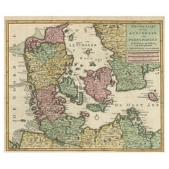
Attractive Antique Map showing Denmark and part of Sweden and Germany c.1750
By Isaak Tirion
Located in Langweer, NL
Antique map titled 'Nieuwe Kaart van het Koninkryk van Deenemarken (..).' Attractive detailed map showing Denmark and a part of Sweden and Germany. Title in block-style cartouche wit...
Category
18th Century Antique Isaak Tirion Maps
Materials
Paper
$527 Sale Price
20% Off
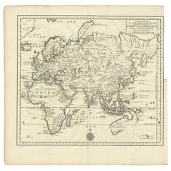
Antique Map of the Eastern Part of the World by Tirion, 1755
By Isaak Tirion
Located in Langweer, NL
Antique map titled 'Nieuwe Kaart van het Oostelykste Deel der Weereld, dienende tot Aanwyzing van de Scheepstogten der Nederlanderen naar Oostindië'. Australia (Nieuw Holland) shown ...
Category
Mid-18th Century Dutch Antique Isaak Tirion Maps
Materials
Paper
$525 Sale Price
26% Off
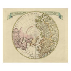
Beautiful Antique Map of the Northern Hemisphere with California as an Island
By Isaak Tirion
Located in Langweer, NL
Antique map titled 'Nieuwe Kaart van de Noord Pool na de alderlaatste ontdekking int licht gebracht tot Amsterdam door Isaak Tirion'. Beautiful map of the Northern Hemisphere and Nor...
Category
Mid-18th Century Antique Isaak Tirion Maps
Materials
Paper
$687 Sale Price
20% Off
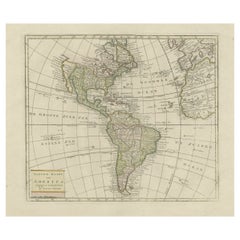
Original Antique Map of North and South America in Attractive Old Coloring
By Isaak Tirion
Located in Langweer, NL
Antique map titled 'Nieuwe Kaart van America'. Beautiful map of America. The fabled Quivira is used to name a large mountain range placed just north of M...
Category
Mid-18th Century Antique Isaak Tirion Maps
Materials
Paper
$945 Sale Price
20% Off
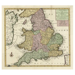
Antique Map of the South Part of Great Britain by Tirion, c.1750
By Isaak Tirion
Located in Langweer, NL
Antique map titled 'Nieuwe Kaart van 'T Zuider Gedeelte van Groot Britannie behelzende Het Koningryk Engeland (..).'
Attractive map showing the south part of Great Britain; the K...
Category
18th Century Antique Isaak Tirion Maps
Materials
Paper
$429 Sale Price
20% Off
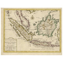
Antique Map of the Sunda Islands Sumatra, Java, Malay Peninsula & Borneo (1739)
By Isaak Tirion
Located in Langweer, NL
Antique map titled 'Nieuwe kaart van de Sundasche Eilanden als Borneo, Sumatra en Groot Iava & c'. Detailed map of the Sunda Islands, Southeast Asia, extending from the tip of Cambod...
Category
Mid-18th Century Antique Isaak Tirion Maps
Materials
Paper
$698 Sale Price
21% Off
Antique Map of Upper Saxony in Germany by Tirion, circa 1740
By Isaak Tirion
Located in Langweer, NL
Antique map titled 'Nieuwe Kaart van de Opper Saxise Kreits (..).' Attractive detailed map showing Upper Saxony, Germany with Meissen, Thuringen, Anhalt, Brandenburg, Pommeren etc. S...
Category
18th Century Antique Isaak Tirion Maps
Materials
Paper
$460 Sale Price
20% Off
Antique Plan of the City of Grave in Holland With Coats of Arms and Compass Rose
By Isaak Tirion
Located in Langweer, NL
Antique map titled 'Grondtekening der Stad Graave'. Plan of Grave, The Netherlands. With coats of arms, compass rose and key. From: Isaak Tirion's 'Hedendaagsche Historie, of Tegenwo...
Category
18th Century Antique Isaak Tirion Maps
Materials
Paper
$211 Sale Price
20% Off
Antique Map of Westergo, Friesland in the the Netherlands, by Tirion, 1744
By Isaak Tirion
Located in Langweer, NL
Antique map titled 'Westergo'. Original antique map of Westergo, part of the province of Friesland, the Netherlands. Published 1744.
Artists and Engravers: Isaak Tirion (1705 in U...
Category
18th Century Antique Isaak Tirion Maps
Materials
Paper
$611 Sale Price
20% Off
Antique Map of the City of Haarlem by Tirion, 1742
By Isaak Tirion
Located in Langweer, NL
Antique map titled 'Grondtekening van Haarlem (..)'. Original antique map of the city of Haarlem, the Netherlands. Published by I. Tirion, 1742.
Artists and Engravers: Isaak Tirio...
Category
18th Century Antique Isaak Tirion Maps
Materials
Paper
$210 Sale Price
20% Off
Antique Map of the Rhineland and Lotharingen by Tirion, c.1740
By Isaak Tirion
Located in Langweer, NL
Antique map titled 'Nieuwe Kaart van de Opper en Neder Rhynse Kreits nevens het Hertogdom Lotharingen.' Attractive detailed map showing the Rheinland (Rhineland) and Lotharingen, Ger...
Category
18th Century Antique Isaak Tirion Maps
Materials
Paper
$262 Sale Price
20% Off
Related Items
Antique Map of Principality of Monaco
By Antonio Vallardi Editore
Located in Alessandria, Piemonte
ST/619 - "Old Geographical Atlas of Italy - Topographic map of ex-Principality of Monaco" -
ediz Vallardi - Milano -
A somewhat special edition ---
Category
Late 19th Century Italian Other Antique Isaak Tirion Maps
Materials
Paper
New Map of North America from the Latest Discoveries, 1763
Located in Philadelphia, PA
A fine antique 18th century map of the North American seaboard.
Entitled "A New Map of North America from the Latest Discoveries 1763".
By the Cartographer/Engraver - John Spil...
Category
Mid-18th Century English Georgian Antique Isaak Tirion Maps
Materials
Paper
Original Antique Map of the American State of Texas ( Eastern Part ), 1903
Located in St Annes, Lancashire
Antique map of Texas ( Eastern part )
Published By A & C Black. 1903
Original colour
Good condition
Unframed.
Free shipping
Category
Early 1900s English Antique Isaak Tirion Maps
Materials
Paper
$49
H 16.25 in W 11.5 in D 0.07 in
Original Antique Map of North America by Dower, circa 1835
Located in St Annes, Lancashire
Nice map of North America
Drawn and engraved by J.Dower
Published by Orr & Smith. C.1835
Unframed.
Free shipping
Category
1830s English Antique Isaak Tirion Maps
Materials
Paper
Antique Map of Virginia & the Chesapeake Bay by Jacques-Nicolas Bellin, c. 1750
By Jacques-Nicolas Bellin
Located in Philadelphia, PA
A fine antique 18th century French map of North America.
By Jacques-Nicolas Bellin.
On laid paper with polychrome highlights.
Depicting Virginia, the Chesapeake Bay, and the nearb...
Category
18th Century French Baroque Antique Isaak Tirion Maps
Materials
Paper
$895
H 15.13 in W 18.63 in D 1.13 in
Original Antique Map of Ancient Greece, Achaia, Corinth, 1786
Located in St Annes, Lancashire
Great map of Ancient Greece. Showing the region of Thessaly, including Mount Olympus
Drawn by J.D. Barbie Du Bocage
Copper plate engraving by P.F Tardieu
Original hand color...
Category
1780s French Other Antique Isaak Tirion Maps
Materials
Paper
Original Antique Map of The World by Dower, circa 1835
Located in St Annes, Lancashire
Nice map of the World
Drawn and engraved by J.Dower
Published by Orr & Smith. C.1835
Unframed.
Free shipping
Category
1830s English Antique Isaak Tirion Maps
Materials
Paper
Original Antique Map of South East Asia by Thomas Clerk, 1817
Located in St Annes, Lancashire
Great map of South East Asia
Copper-plate engraving
Drawn and engraved by Thomas Clerk, Edinburgh.
Published by Mackenzie And Dent, 1817
Unframed.
Category
1810s English Antique Isaak Tirion Maps
Materials
Paper
Antique Map of California as an Island "The 5 Californias" by Robert de Vaugondy
Located in San Diego, CA
A very nice and rare antique map entitled "Carte de la Californie Suivant" (The 5 Californias), by Didier Robert de Vaugondy of Paris, circa 1772. The map itself measures 15.5" x 13...
Category
Mid-19th Century American Antique Isaak Tirion Maps
Materials
Paper
$850
H 22 in W 26 in D 1 in
Original Antique Map of the American State of North Carolina, 1903
Located in St Annes, Lancashire
Antique map of North Carolina
Published By A & C Black. 1903
Original colour
Good condition
Unframed.
Free shipping
Category
Early 1900s English Antique Isaak Tirion Maps
Materials
Paper
Original Antique Map of Sweden, Engraved by Barlow, 1806
Located in St Annes, Lancashire
Great map of Sweden
Copper-plate engraving by Barlow
Published by Brightly & Kinnersly, Bungay, Suffolk. 1806
Unframed.
Category
Early 1800s English Antique Isaak Tirion Maps
Materials
Paper
Vintage "View of the Center of Paris Taken from the Air" Lithograph Map
Located in San Diego, CA
A very stylish "View of the Center of Paris Taken from the Air" lithograph map published by the Paris Ministry of Tourism, circa early 1950s. The piece measures 27" x 43" and shows...
Category
20th Century French Mid-Century Modern Isaak Tirion Maps
Materials
Paper
$680 Sale Price
20% Off
H 43 in W 27 in D 0.25 in
Previously Available Items
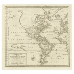
Interesting and Decorative Dutch Antique Map of the Americas
By Isaak Tirion
Located in Langweer, NL
Antique map titled 'Nieuwe Kaart van het Westelykste Deel der Weereld, dienende tot aanwyzing van de Scheepstogten der Nederlanderen naar Westindie'. Excellent map of America, featuring an unusual northwest coast of America, which includes Martin d'Aguilar's strait which provides for a Northwest Passage via the Great Lakes. The rest of the NW coast...
Category
Mid-18th Century Antique Isaak Tirion Maps
Materials
Paper
Antique Map of the Low Countries by Tirion, 1749
By Isaak Tirion
Located in Langweer, NL
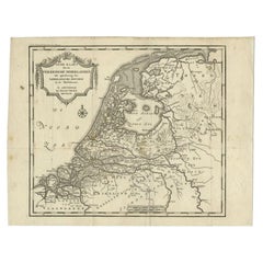
Antique map titled 'Oude Kaart der nu Vereenigde Nederlanden tot opheldering der Vaderlandsche Historie in de Middeleeuwe.' Map of the low countries in medieval times. This map origi...
Category
18th Century Antique Isaak Tirion Maps
Materials
Paper
Antique Map of Great Britain and Ireland by Tirion, circa 1750
By Isaak Tirion
Located in Langweer, NL
Antique map titled 'Nieuwe Kaart van de Eilanden van Groot Brittannien Behelzende de Koningryken Engeland, Schotland en Ierland (…)'. Attractive map showing ...
Category
Mid-18th Century Dutch Antique Isaak Tirion Maps
Materials
Paper
Antique Map Northern Africa by I. Tirion, circa 1770
By Isaak Tirion
Located in Langweer, NL
Antique map Africa titled 'Het Noordelykste deel van Afrika, behelzende Barbarie, Egypte enz. Als mede de geheele Middellandsche Zee. Volgens de nie...
Category
Mid-18th Century Dutch Antique Isaak Tirion Maps
Materials
Paper
Isaak Tirion maps for sale on 1stDibs.
Isaak Tirion maps are available for sale on 1stDibs. These distinctive items are frequently made of paper and are designed with extraordinary care. There are many options to choose from in our collection of Isaak Tirion maps, although beige editions of this piece are particularly popular. If you’re looking for additional options, many customers also consider maps by F. Valentijn, Gerard Mercator, and Willem Blaeu. Prices for Isaak Tirion maps can differ depending upon size, time period and other attributes — on 1stDibs, these items begin at $237 and can go as high as $1,098, while a piece like these, on average, fetch $567.
