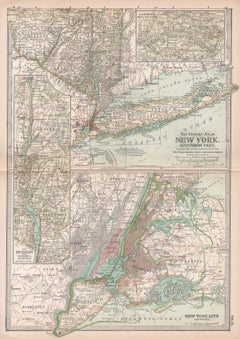
Map Of New York
16
to
103
1,627
329
1,036
641
631
306
295
201
139
106
89
75
59
56
54
47
47
47
39
37
36
34
28
26
22
18
16
14
14
14
13
12
7
5
4
4
3
3
3
3
2
2
2
2
2
2
2
1
1
1
1
1
63
45
42
42
39
Sort By
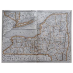
Large Original Antique Map of New York, USA, 1894
By Rand McNally & Co.
Located in St Annes, Lancashire
Fabulous map of New York.
Original color.
By Rand, McNally & Co.
Published, 1894
Unframed
Free
Category
Antique 1890s American Maps
Materials
Paper
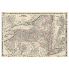
Large Antique Map of New York State with Inset Maps
Located in Langweer, NL
Antique map titled 'Johnson's New York' Large map of New York State. With insets of Albany, Oswego
Category
Antique Mid-19th Century Maps
Materials
Paper
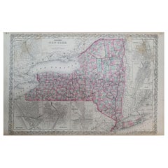
1858 Colton's Map of New York, Ric.B011
Located in Norton, MA
An 1858 Colton's map of New York
Ric.b011
Colton’s New York, 1858 - A large original color
Category
Antique 19th Century Unknown Maps
Materials
Paper
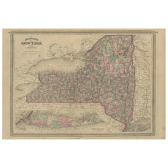
Antique Map of New York by Johnson '1872'
Located in Langweer, NL
Antique map titled 'Johnson's New York'. Original map showing New York, with an inset map of Long
Category
Antique Late 19th Century Maps
Materials
Paper
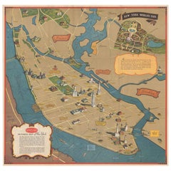
Pictorial Vintage Map of New York City Showing Numerous Landmarks, 1939
Located in Langweer, NL
This pictorial souvenir map focuses on New York City and the site of the 1939 World's Fair. It was
Category
Vintage 1930s Maps
Materials
Paper
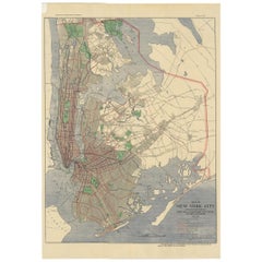
Antique Map of the Passenger Transportation Systems of New York, 1901
Located in Langweer, NL
Antique map titled 'Map of New York City except Richmond Borough showing Passenger Transportation
Category
20th Century Maps
Materials
Paper
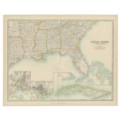
Antique Map of the United States ' South East ' by Johnston '1909'
Located in Langweer, NL
America ( South East Sheet ). With inset maps of New York, Washington and Cuba. This map originates from
Category
Early 20th Century Maps
Materials
Paper
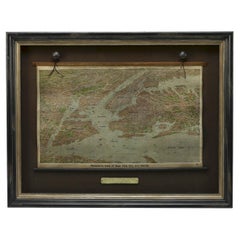
1912 "Panoramic View of New York City and Vicinity" by Jacob Ruppert
Located in Colorado Springs, CO
This is an attractive and very scarce map of New York, published by the Yorkville brewer Jacob
Category
Vintage 1910s American Maps
Materials
Paper
New York. Southern Part. USA. Century Atlas state antique vintage map
Located in Melbourne, Victoria
'The Century Atlas. New York. Southern Part.'
Original antique map, 1903.
Inset maps of 'New York
Category
Early 20th Century Victorian More Prints
Materials
Lithograph
1840 "New Map of the City of New York With Part of Brooklyn & Williamsburg"
Located in Colorado Springs, CO
Presented is a hand-colored, engraved folding map titled "New Map of the City of New York With Part
Category
Antique 1840s American Maps
Materials
Paper
H 30 in W 27.5 in D 3 in
Antique Map of American Cities, Vignette of New York City, circa 1920
Located in St Annes, Lancashire
Great maps of American Cities
Unframed
Original color
By John Bartholomew and Co
Category
Vintage 1920s British Maps
Materials
Paper
No Reserve
H 18 in W 23 in D 0.07 in
1855 "New-York City & County Map" by Charles Magnus
By Charles Magnus
Located in Colorado Springs, CO
This is a beautiful hand-colored map titled “New York City & County Map with Vicinity entire
Category
Antique 1850s American Maps
Materials
Paper
Antique Map of North America with Vignette of the Statue of Liberty, New York
Located in Langweer, NL
railroad system. Vignette of the port of New York featuring the newly erected Statue of Liberty
Category
Antique Late 19th Century Maps
Materials
Paper
Free Shipping
H 15.44 in W 20.4 in D 0.02 in
Vintage Oversized New York City Lower Manhattan 1840s Map Print
Located in Dayton, OH
Vintage late 20th century reproduction print of New York City featuring lower Manhattan in 1840.
Category
Late 20th Century Victorian Maps
Materials
Paper
Antique New York Wall Map by Westermann
By Westermann
Located in Stockbridge, GB
Antique New York Map By Westermann
A rare early school pull down wall map of New York. The map
Category
Mid-20th Century British Schoolhouse Posters
Materials
Canvas, Wood
Old Map of Southern Australia, with an Inset Map of Cape York Peninsula, 1882
Located in Langweer, NL
Antique map titled 'South Australia, New South Wales, Victoria & Queensland'.
Old map of
Category
Antique 1880s Maps
Materials
Paper
H 24.22 in W 19.53 in D 0 in
Antique Map of New South Wales by Johnston, '1909'
Located in Langweer, NL
map of New South Wales. With inset map of Cape York Peninsula. This map originates from the ‘Royal
Category
Early 20th Century Maps
Materials
Paper
1863 "Lloyd's New Map of the United States, the Canadas, and New Brunswick"
Located in Colorado Springs, CO
right margin. This map was published by J. T. Lloyd, in New York, in 1863. According to the publisher’s
Category
Antique 1860s American Maps
Materials
Linen, Wood, Paper
H 37 in W 49.5 in D 1 in
Antique Map of New South Wales by Tallis, circa 1851
Located in Langweer, NL
Antique map titled 'New South Wales'. Decorative and detailed map of New South Wales which was
Category
Antique Mid-19th Century Maps
Materials
Paper
1859 "Colton's New Map of the State of Texas..." by Johnson & Browning
Located in Colorado Springs, CO
Presented is "Colton's New Map of the State of Texas Compiled from De Cordova's Large Map
Category
Antique 1850s American Maps
Materials
Paper
H 27.75 in W 38.5 in D 1.38 in
Antique Map of New England and Part of Canada by Vaugondy 'circa 1755'
Located in Langweer, NL
'. Decorative and highly detailed map of New England and part of Canada, extending east to Newfoundland, with a
Category
Antique Mid-18th Century Maps
Materials
Paper
No Reserve
H 20.08 in W 25.99 in D 0.02 in
Original Antique City Plan of Buffalo, New York, USA, circa 1900
By Rand McNally & Co.
Located in St Annes, Lancashire
Fabulous colorful map of Buffalo
Original color
By Rand, McNally & Co.
Published, circa
Category
Antique Early 1900s American Maps
Materials
Paper
No Reserve
H 20.5 in W 14 in D 0.07 in
1865 "Johnson's California, Utah, Nevada, Colorado, New Mexico, Arizona" Map
Located in Colorado Springs, CO
, New Mexico, and Arizona” map. First published in 1864, this map was issued as pages 66 and 67 in the
Category
Antique Mid-19th Century Maps
Materials
Paper
H 22.5 in W 30.5 in D 0.75 in
Antique Rand McNally & Company Schoolmap. Ancient Oriental Empires. Historical
By Rand McNally & Co.
Located in ROTTERDAM, ZH
Road Map of New York City & Vicinity, in 1904. In 1910,[citation needed] the company acquired the line
Category
Vintage 1920s American American Classical Maps
Materials
Fabric, Paper
H 43.31 in W 64.18 in D 1.19 in
1854 Map of Massachusetts, Connecticut and Rhode Island, Antique Wall Map
Located in Colorado Springs, CO
map and print publisher based in New York during the middle part of the 19th century. Ensign was born
Category
Antique 19th Century American Maps
Materials
Paper
H 38.13 in W 45 in D 3.5 in
A Decorative Detailed Map of the Crimea, with an Inset Map of Sebastopol, c 1851
Located in Langweer, NL
. The London Printing and publishing Company of London and New York bought the rights for many Tallis
Category
Antique 1850s Maps
Materials
Paper
H 10.83 in W 14.18 in D 0 in
1851 Map of "Independent Tartary", Ric. R018
Located in Norton, MA
. (London & New York) between 1838 and 1851. After 1850-51, their maps were published by the London Printing
Category
Antique 19th Century Unknown Maps
Materials
Paper
Antique Map of Holland with Colorful Vignettes, 1851
Located in Langweer, NL
Martin'.
Published; John Tallis London, New York, Edinburgh & Dublin. 1851. Drawn and Engraved by J
Category
Antique 19th Century Maps
Materials
Paper
Antique Map of South Australia by Johnston, 1882
By Thomas Kitchin
Located in Langweer, NL
Antique map titled 'South Australia, New South Wales, Victoria & Queensland'. Old map of Southern
Category
Antique 19th Century Maps
Materials
Paper
Antique Map of South Australia by Tallis, 1851
By Thomas Kitchin
Located in Langweer, NL
, Commercial & Statistical, Edited By R. Montgomery Martin'. Published; John Tallis London, New York, Edinburgh
Category
Antique 19th Century Maps
Materials
Paper
Decorative Map of part of South Australia with Illustrations of Adelaide, 1851
Located in Langweer, NL
London, New York, Edinburgh & Dublin. 1851. Drawn and Engraved by J. Rapkin.
Artists and Engravers
Category
Antique 1850s Maps
Materials
Paper
H 13.71 in W 10.83 in D 0 in
Antique Map of West Canada by Tallis 'c.1850'
Located in Langweer, NL
, London and New York. Published circa 1850.
Category
Antique Mid-19th Century Maps
Materials
Paper
Antique Map of British America by Tallis 'c.1850'
Located in Langweer, NL
Tallis and Company, London and New York. Published circa 1850.
Category
Antique Mid-19th Century Maps
Materials
Paper
Antique Map of Russia in Asia by Tallis, '1851'
Located in Langweer, NL
Martin'.
Published; John Tallis London, New York, Edinburgh & Dublin, 1851. Drawn and Engraved by J
Category
Antique Mid-19th Century Maps
Materials
Paper
French Geographical, Statistical and Historical Map of Pensylvania, 1825
Located in Langweer, NL
Maryland, Delaware, New York and New jersey. Printed on the same page as the map is geographical
Category
Antique 1820s Maps
Materials
Paper
H 20.08 in W 25.99 in D 0 in
Antique Map of Russia in Europe by Tallis, '1851'
Located in Langweer, NL
. Montgomery Martin'. Published; John Tallis London, New York, Edinburgh & Dublin, 1851. Drawn and Engraved by
Category
Antique Mid-19th Century Maps
Materials
Paper
Antique Map of the Islands of the Atlantic by J. Tallis
Located in Langweer, NL
& New York: John Tallis & co, circa 1851).
The Illustrated Atlas, published from 1849-1853, was the
Category
Antique Mid-19th Century Maps
Materials
Paper
Old Engraved Map of Hungary with Decorative Vignettes, 1851
Located in Langweer, NL
'. Published; John Tallis London, New York, Edinburgh & Dublin. 1851.
Drawn and Engraved by J. Rapkin
Category
Antique 19th Century Maps
Materials
Paper
Antique Map of Switzerland by J. Tallis, circa 1851
Located in Langweer, NL
& New York: John Tallis & co, circa 1851).
The Illustrated Atlas, published from 1849 onwards, was the
Category
Antique Mid-19th Century Maps
Materials
Paper
Antique Map of Belgium by J. Tallis, circa 1851
Located in Langweer, NL
(London & New York: John Tallis & co, circa 1851). The Illustrated Atlas, published from 1849-1853, was
Category
Antique Mid-19th Century Maps
Materials
Paper
1859 "Map of the United States of America..." by J. H. Colton
By J.H. Colton
Located in Colorado Springs, CO
,” “Astoria, Oregon,” “Saratoga Lake, New York”, “Valley of the Connecticut,” as well as four monuments, inset
Category
Antique 1850s American Maps
Materials
Paper
Map of Western Australia & Swan River, insets of Perth, Aboriginals, Sheep, 1851
Located in Langweer, NL
& Statistical, Edited By R. Montgomery Martin'. Published; John Tallis London, New York, Edinburgh & Dublin
Category
Antique 1850s Maps
Materials
Paper
H 14.57 in W 10.63 in D 0 in
Antique Map of Victoria ‘Australia’ by J. Tallis, circa 1855
Located in Langweer, NL
in John Tallis & co.'s The Illustrated Atlas (London & New York, circa 1855).
The Illustrated
Category
Antique Mid-19th Century Maps
Materials
Paper
Beautiful Decorative Hand-Colored Antique Map of West Canada, 1851
Located in Langweer, NL
London, New York, Edinburgh & Dublin. 1851.
Drawn and Engraved by J. Rapkin.
Artists and Engravers
Category
Antique 1850s Maps
Materials
Paper
No Reserve
H 10.63 in W 14.38 in D 0 in
Antique Map of England and Wales with Decorative Vignettes, 1851
Located in Langweer, NL
Antique map titled ‘England and Wales’. Includes decorative vignettes titled The grand stand on the
Category
Antique 19th Century Maps
Materials
Paper
1868 Map of the Upper Part of the Island of Manhattan Above 86th Street
By Wm. Rogers Mfg. Co.
Located in San Francisco, CA
This wonderful piece of New York City history is over 150 years old. It depicts 86th street and
Category
Antique 1860s American American Colonial Maps
Materials
Paper
Antique Map of Asia Minor by J. Tallis, circa 1851
Located in Langweer, NL
engraved by J. Rapkin and published in John Tallis's Illustrated Atlas (London & New York: circa 1851
Category
Antique Mid-19th Century Maps
Materials
Paper
Antique Map of Southern Italy by J. Tallis, circa 1851
Located in Langweer, NL
(London & New York, circa 1851). The Illustrated Atlas, published from 1849-1853, was the last decorative
Category
Antique Mid-19th Century Maps
Materials
Paper
Antique Map of Northern Italy by J. Tallis, circa 1851
Located in Langweer, NL
(London & New York: c.1851).
The Illustrated Atlas, published from 1849 to 1853, was the last decorative
Category
Antique Mid-19th Century Maps
Materials
Paper
Antique Map of Russia in Asia by Tallis, c.1851
Located in Langweer, NL
Martin'. Published; John Tallis London, New York, Edinburgh & Dublin. 1851. Drawn and Engraved by J
Category
Antique 19th Century Maps
Materials
Paper
Framed Mid-19th Century Wall Map of Long Island, the Hamptons
Located in Sag Harbor, NY
detailed information about Suffolk County Long Island is staggering. A unique rare New York map
Category
Antique Mid-19th Century American Maps
Materials
Linen, Paper
Antique Map of British Guayana with Insets of Georgetown, Devil's Rock Etc, 1851
Located in Langweer, NL
. Montgomery Martin'. Published; John Tallis London, New York, Edinburgh & Dublin. 1851. Drawn and Engraved by
Category
Antique 19th Century Maps
Materials
Paper
Free Shipping
H 14.18 in W 10.83 in D 0 in
Map of Russia with Vignettes of the Neoskoi Prospect, St. Petersburg, ca.1851
Located in Langweer, NL
. Montgomery Martin'. Published; John Tallis London, New York, Edinburgh & Dublin. 1851. Drawn and Engraved by
Category
Antique 1850s Maps
Materials
Paper
H 14.38 in W 10.63 in D 0 in
Original Antique Map of the Channel Islands, Incl. Decorative Vignettes, 1851
Located in Langweer, NL
By R. Montgomery Martin'. Published; John Tallis London, New York, Edinburgh & Dublin. 1851. Drawn
Category
Antique 1850s Maps
Materials
Paper
H 14.57 in W 10.24 in D 0 in
1847 Ornamental Map of the United States & Mexico by H. Phelps
Located in Colorado Springs, CO
to the rest of the U.S. The map details a potential route for a railroad running from New York City
Category
Antique 1840s American Maps
Materials
Paper
1899 Poole Brothers Antique Railroad Map of the Illinois Central Railroad
Located in Colorado Springs, CO
, with the short rail distances to New York listed above the stop and short rail distances to New Orleans
Category
Antique 1890s American Maps
Materials
Paper
Antique Map of Peru and Bolivia by J. Tallis, circa 1851
Located in Langweer, NL
The Illustrated Atlas (London & New York: circa 1851).
The Illustrated Atlas, published from 1849
Category
Antique Mid-19th Century Maps
Materials
Paper
Antique Map of Turkey in Asia by J. Tallis, circa 1851
Located in Langweer, NL
published in John Tallis & co.'s The Illustrated Atlas (London & New York, circa 1851).
The Illustrated
Category
Antique Mid-19th Century Maps
Materials
Paper
Antique Map of Western Africa with Vignettes of Cape Coast Castle etc, ca.1851
Located in Langweer, NL
; John Tallis London, New York, Edinburgh & Dublin. 1851. Drawn and Engraved by J. Rapkin.
Artists and
Category
Antique 1850s Maps
Materials
Paper
H 10.44 in W 13.98 in D 0 in
Antique Map of the Northern Part of South America by J. Tallis, circa 1851
Located in Langweer, NL
Illustrated Atlas (London & New York: circa 1851).
The Illustrated Atlas, published from 1849 onwards, was
Category
Antique Mid-19th Century Maps
Materials
Paper
H 10.6 in W 14.41 in D 0.02 in
- 1
- ...
Get Updated with New Arrivals
Save "Map Of New York", and we’ll notify you when there are new listings in this category.
Map Of New York For Sale on 1stDibs
With a vast inventory of beautiful furniture at 1stDibs, we’ve got just the map of new york you’re looking for. Frequently made of paper, fabric and linen, every map of new york was constructed with great care. You’ve searched high and low for the perfect map of new york — we have versions that date back to the 19th Century alongside those produced as recently as the 20th Century are available. A map of new york is a generally popular piece of furniture, but those created in styles are sought with frequency. A well-made map of new york has long been a part of the offerings for many furniture designers and manufacturers, but those produced by Beers Atlas Co., Charles Magnus and Rand McNally & Co. are consistently popular.
How Much is a Map Of New York?
Prices for a map of new york start at $67 and top out at $12,000 with the average selling for $800.
Questions About Map Of New York
- Who owns Mazza New York?1 Answer1stDibs ExpertApril 5, 2022Paul Mazza is the owner and designer at Mazza New York. Since founding the brand in the early 2000s, Paul has gained renown in New York and beyond for his jewelry’s craftsmanship. On 1stDibs, shop a collection of Mazza jewelry from some of the world’s top sellers.
- 1stDibs ExpertMarch 31, 2023The artist of the painting called "New York City" is the Dutch painter Piet Mondrian. He was a part of the De Stijl art movement, which emphasized depicting objects, scenes and figures as their basic geometric shapes in simple primary colors. You can see this approach reflected in "New York City," where the architecture of the Big Apple is depicted in simple grid lines in yellow, red and blue. Find a variety of abstract art from some of the world's top galleries on 1stDibs.
- 1stDibs ExpertApril 16, 2024Milton Glaser designed the I Love New York logo. The Bronx-born graphic designer produced the now-iconic image in 1977. Glaser had many other successes during his nearly 70-year career, including creating iconic posters and prints and cofounding the groundbreaking design firm Push Pin Studios. On 1stDibs, shop a diverse assortment of Milton Glaser art.
More Ways To Browse
Dolce Gabbana 1990s
Tiffany Roman
French Colonial Table
Iron Balusters
Used Iron Balusters
Photo Tripod
Vintage 2000S Clothing
Vintage Hollywood Themes
Vintage Hollywood Theme
C Wood Ring
Small Antique Barrel
Early 1800s American
Used Doors Nyc
Antique Wooden Beads
Small Wooden Birds
Leather Wall Hanging
American British Colonial
Chanel Red And Blue Bag
