Texas Maps

5
to
19
274
29
171
92
82
52
36
29
13
13
12
11
11
10
9
9
7
5
5
5
5
5
5
4
3
3
2
2
2
2
1
1
1
1
1
1
1
1
31
27
22
19
11
Sort By
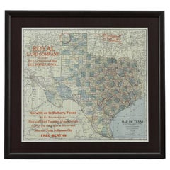
1908 "Map of Texas" by The Kenyon Company
Located in Colorado Springs, CO
Presented is an antique map of the state of Texas, printed as a pocket map in 1908 by The Kenyon
Category

Antique Early 1900s American Maps

Materials

Paper

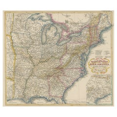
Antique Map of the Eastern United States with Inset Map of Texas
Located in Langweer, NL
. Inset map of the "southern principal part of Texas." Shows states, major cities, railroads, topography
Category

Antique Mid-19th Century Maps

Materials

Paper

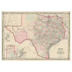
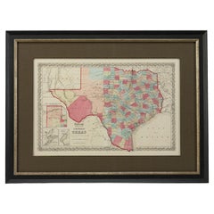
Large Antique Map of the State of Texas, 1861
Located in Langweer, NL
Antique map titled 'Johnson's New Map of the State of Texas' Large map of Texas, shows railroads
Category

Antique Mid-19th Century Maps

Materials

Paper

Large Antique Map of the State of Texas, 1861
Free Shipping
H 18.04 in W 26.58 in D 0.02 in
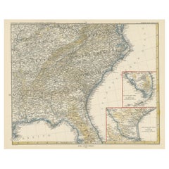
Antique Map of the Region of Georgia with Inset Maps of Florida and Texas
Located in Langweer, NL
southern part of Texas. This map was part of a set of six individual sheets with maps of the United States
Category

Antique Late 19th Century Maps

Materials

Paper

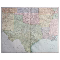
Large Original Vintage Map of Texas and Adjacent States, circa 1920
Located in St Annes, Lancashire
Great map of Texas and adjacent States Original color. Good condition Published by
Category

Vintage 1920s English Maps

Materials

Paper

1859 "Colton's New Map of the State of Texas..." by Johnson & Browning
Located in Colorado Springs, CO
Presented is "Colton's New Map of the State of Texas Compiled from De Cordova's Large Map
Category

Antique 1850s American Maps

Materials

Paper

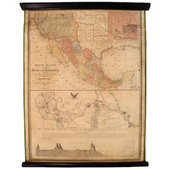
1847 Antique Map of Mexico, Texas and California by Samuel Augustus Mitchell
By Samuel Augustus Mitchell 1
Located in Colorado Springs, CO
right. The map is considered to be an adaptation of Mitchell's earlier 1846 A New Map of Texas, Oregon
Category

Antique 1840s American Maps

Materials

Paper

1864 Map of North America, Antique Hand-Colored Map, by Adolphe Hippolyte Dufour
Located in Colorado Springs, CO
Offered is a map of North America entitled Amerique du Nord from 1864. This rare, separately
Category

Antique 1860s French Maps

Materials

Paper

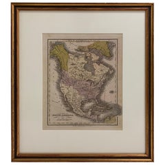
1830 Mexico and United States Framed Map
Located in Stamford, CT
Map of North America published circa 1830. Map shows United States into Canada. Mexico extending
Category

Antique 1830s American American Classical Maps

Materials

Glass, Wood, Paper

1865 "Johnson's California, Utah, Nevada, Colorado, New Mexico, Arizona" Map
Located in Colorado Springs, CO
, New Mexico, and Arizona” map. First published in 1864, this map was issued as pages 66 and 67 in the
Category

Antique Mid-19th Century Maps

Materials

Paper

Antique Map of Tennessee, Kentucky, Virginia, Alabama, Georgia and Surroundings
Located in Langweer, NL
southern part of Texas. This map was part of a set of six individual sheets with maps of the United States
Category

Antique Mid-19th Century Maps

Materials

Paper

Louisiana: A Framed 19th Century Map by O. W. Gray
By Gray and Co
Located in Alamo, CA
. It is a highly detailed map of Louisiana and adjacent portions of Mississippi to the east and Texas
Category

Antique Mid-19th Century American Other Maps

Materials

Paper

America "Amérique Septentrionale": A 19th Century French Map by Delamarche
By Maison Delamarche 1
Located in Alamo, CA
This framed mid 19th century map of North America entitled "Amérique Septentrionale" by Felix
Category

Antique Mid-19th Century American Other Maps

Materials

Paper

"The United States from the Latest Authorities" Antique Wall Map, 1835
Located in Colorado Springs, CO
This is a 1835 map of “The United States from the Latest Authorities” by Ezra Strong. A hand
Category

Antique 1830s American Maps

Materials

Paper

1847 Ornamental Map of the United States & Mexico by H. Phelps
Located in Colorado Springs, CO
map proclaims the Manifest Destiny, with the recent acquisition of Upper California and Texas at the
Category

Antique 1840s American Maps

Materials

Paper

1899 Poole Brothers Antique Railroad Map of the Illinois Central Railroad
Located in Colorado Springs, CO
lead to the creation of the Louisville, New Orleans, and Texas Railway. This map was first produced by
Category

Antique 1890s American Maps

Materials

Paper

1859 "Map of the United States of America..." by J. H. Colton
By J.H. Colton
Located in Colorado Springs, CO
across Texas appears on the map, as well as the Comanche Trail south into the Mexican State of Coahuila
Category

Antique 1850s American Maps

Materials

Paper

1863 "Lloyd's New Map of the United States, the Canadas, and New Brunswick"
Located in Colorado Springs, CO
, "Indian Territory," and Texas. The southern continuation of Florida is shown in an inset map along the
Category

Antique 1860s American Maps

Materials

Linen, Wood, Paper

Antique Map of the Eastern United States with Only the Northern Part of Florida
Located in Langweer, NL
. Inset map of the "southern principal part of Texas." Shows states, major cities, railroads, topography
Category

Antique Mid-19th Century Maps

Materials

Paper

1889 "The Pacific States and Territories"
Located in Colorado Springs, CO
Texas to the east. The map provides a fascinating look at the western states of the United States, just
Category

Antique 1880s American Maps

Materials

Paper

1889 "The Pacific States and Territories"
H 16.25 in W 14.25 in D 1 in
1879 "United States of America, Western Part" by O. J. Stuart
Located in Colorado Springs, CO
This colorful original map, titled “United States of America, Western Part,” was issued in Volume
Category

Antique 1870s American Maps

Materials

Paper

Texas, Eastern Part. USA. Century Atlas state antique vintage map
Located in Melbourne, Victoria
'The Century Atlas. Texas, Eastern Part.' Original antique map, 1903. Central fold as issued. Map
Category

Early 20th Century Victorian More Prints

Materials

Lithograph

"BLUEBONNET" #10 OF COMFORT TEXAS Volkenburg Mountain
By Dwight Holmes
Located in San Antonio, TX
, 1900. He began formal art training in Galveston high school; studied five years in Texas Christian
Category

1980s American Impressionist Landscape Paintings

Materials

Oil

Regeneration -- Grasses w/ Fire Map 4
By Suzi Davidoff
Located in New Orleans, LA
nature and the overlaying systems used to observe, map and define organic landscapes. The plants she
Category

21st Century and Contemporary Contemporary Figurative Drawings and Water...

Materials

Watercolor, Wood Panel, Charcoal, Gesso, Graphite

Regeneration -- Grasses w/ Fire Map 5
By Suzi Davidoff
Located in New Orleans, LA
nature and the overlaying systems used to observe, map and define organic landscapes. The plants she
Category

21st Century and Contemporary Contemporary Figurative Drawings and Water...

Materials

Charcoal, Gesso, Graphite, Watercolor, Wood Panel

Texas Furniture: The Cabinetmakers & Their Work, 1840-1880, First Edition
Located in valatie, NY
, and the types of woods used, maps showing the forests and resources of Texas, the locations of the
Category

Vintage 1970s American Books

Materials

Paper

Animal Skin Textile Sculpture: 'Aurora-Rhome Fun Map'
By Joshua Goode
Located in New York, NY
youth as iconic ancient artifacts. I created the fictitious Texas based Aurora – Rhoman civilization
Category

2010s Contemporary Mixed Media

Materials

Ink, Acrylic, Synthetic Paper

19th Century Embroidered Silk Panel Map Of The World
Located in Forney, TX
-crafted in Continental Europe in the 19th century, depicting map of the world, double hemisphere, having a
Category

Antique 19th Century European Victorian Decorative Art

Materials

Silk, Thread

Louisiana: A Framed 19th Century Map by O.W. Gray
Located in Alamo, CA
. It is a highly detailed map of Louisiana and adjacent portions of Mississippi to the east and Texas
Category

1870s Landscape Prints

Materials

Engraving

one of the earliest large-scale English maps of North America
By John Senex
Located in London, GB
one of the earliest large-scale English maps of North America SENEX, John. North America Corrected
Category

1710s Naturalistic More Art

Materials

Watercolor, Engraving

New France and Labrador - Graphite Drawing, Landscape, On Antiqued Map
By Don Pollack
Located in Chicago, IL
Coeur d’Alenes trail in Northern Idaho. It is a place of rugged and stark beauty barely on the old maps
Category

21st Century and Contemporary Contemporary Landscape Paintings

Materials

Canvas, Oil

Three headed Animal Skin Textile Sculpture: 'Cerberus Skin Map of the World'
By Joshua Goode
Located in New York, NY
youth as iconic ancient artifacts. I created the fictitious Texas based Aurora – Rhoman civilization
Category

2010s Contemporary Mixed Media

Materials

Ink, Acrylic, Synthetic Paper

North America: A Framed Hand-colored 19th Century German Map by Adolph Stieler
By Adolf Stieler
Located in Alamo, CA
This framed early 19th century map of North America entitled "Nord-Amerika" is plate No. LIV (No
Category

1830s Landscape Prints

Materials

Engraving

"I Drew a Map, It was Blue" Contemporary Colorful Painted Plaster Wall Sculpture
Located in Houston, TX
from the University of Houston and a BFA in painting and drawing from the University of Texas at Tyler
Category

2010s Contemporary Abstract Sculptures

Materials

Plaster, Acrylic, Panel

Standing Together: Limited Edition Portfolio by Jeanine Michna-Bales
By Jeanine Michna-Bales
Located in Dallas, TX
, Texas — including the wood-burned cover panel, archival pigment prints, embroidered map and reproduction
Category

2010s Contemporary Landscape Photography

Materials

Mixed Media, Archival Pigment

United States, 1844
Located in Houston, TX
Republic of Texas lower left. Original antique map on paper displayed on a white mat with a gold border
Category

1840s More Prints

Materials

Ink, Watercolor, Handmade Paper

United States, 1844
United States, 1844
H 24 in W 30 in D 0.1 in
Love Notes and Elegies No. 13
By Suzi Davidoff
Located in New Orleans, LA
nature and the overlaying systems used to observe, map, and define organic landscapes. Her process begins
Category

2010s Contemporary Mixed Media

Materials

Paper, Charcoal, Mixed Media, Watercolor, Graphite

Love Notes and Elegies No. 14
By Suzi Davidoff
Located in New Orleans, LA
nature and the overlaying systems used to observe, map, and define organic landscapes. Her process begins
Category

2010s Contemporary Mixed Media

Materials

Mixed Media, Watercolor, Graphite, Paper, Charcoal

Personal Memoirs of P. H. Sheridan, First Edition, Two-Volume Set, 1888
Located in Colorado Springs, CO
is highly illustrated, with 27 maps and 17 plates. The book is presented beautifully rebound in
Category

Antique 1880s American Books

Materials

Leather, Paper

The Art of Home
By Rizzoli International Publications
Located in New York, NY
interiors features a selection of homes located in areas as diverse as Austin, Texas; Boulder, Colorado; and
Category

21st Century and Contemporary Books

Materials

Paper

The Art of Home
The Art of Home
H 11.7 in W 9.3 in D 1 in
'Trinity', Chicano Artist, Museum of Contemporary Art, Los Angeles, Mexico City
Located in Santa Cruz, CA
including with “Map & Shrine” Ex Teresa Arte Actual, Mexico City (in the International Festival of
Category

1990s Figurative Paintings

Materials

Canvas, Ink, Acrylic

Roman Empire / Ara Pacis and Centaurea
By Suzi Davidoff
Located in New Orleans, LA
Charcoal, gesso, graphite and watercolor on map Davidoff is influenced by her close connection to
Category

2010s Contemporary Mixed Media

Materials

Gesso, Charcoal

Simplified World / Aplomada Falcon and Grasses
By Suzi Davidoff
Located in New Orleans, LA
Charcoal and gesso on map Davidoff is influenced by her close connection to nature and by what she
Category

2010s Contemporary Mixed Media

Materials

Gesso, Charcoal

Geochart / Paris Accord and Pitcher Plants
By Suzi Davidoff
Located in New Orleans, LA
Charcoal, gesso, graphite and watercolor on map Davidoff is influenced by her close connection to
Category

2010s Contemporary Mixed Media

Materials

Gesso, Charcoal, Watercolor, Graphite

United States with Mexico / Deep Water Corals
By Suzi Davidoff
Located in New Orleans, LA
Charcoal, gesso, graphite and watercolor on map Davidoff is influenced by her close connection to
Category

2010s Contemporary Mixed Media

Materials

Gesso, Charcoal

New Mexico Geology / Sancti-Spiritus Ipomopsis
By Suzi Davidoff
Located in New Orleans, LA
Chine colle etching on archival inkjet map Edition of 24 Framed with light maple wood frame
Category

2010s Contemporary Prints and Multiples

Materials

Etching

New Mexico Geology / Shooting Star Geranium
By Suzi Davidoff
Located in New Orleans, LA
Chine colle etching on archival inkjet map Edition of 24 Framed with light maple wood frame
Category

2010s Contemporary Prints and Multiples

Materials

Etching

New Mexico Geology / Sacramento Mountain Thistle
By Suzi Davidoff
Located in New Orleans, LA
Chine colle etching on archival inkjet map Edition of 24 Framed with light maple wood frame
Category

2010s Contemporary Prints and Multiples

Materials

Etching

New Mexico Geology / Allium
By Suzi Davidoff
Located in New Orleans, LA
Chine colle etching on archival inkjet map Edition of 24 Framed with light maple wood frame
Category

2010s Contemporary Prints and Multiples

Materials

Etching

A huge pair of 21 inches Cruchley Library Globes
By G.F. Cruchley
Located in ZWIJNDRECHT, NL
divisions in Australia, New Zealand, Californa, Texas, &c. London. Sold by Gould and Porter opticians 181
Category

Antique 1850s British Victorian Globes

Materials

Other

Many Walks on the Same Path 7
By Suzi Davidoff
Located in New Orleans, LA
nature and the overlaying systems used to observe, map, and define organic landscapes. Her process begins
Category

2010s Contemporary Mixed Media

Materials

Charcoal, Handmade Paper, Gesso

Nest Neuron IV: one-of-a-kind monoprint of abstract bird nest in blue, yellow
By Deirdre Murphy
Located in Bryn Mawr, PA
flight patterns shared commonality with immigration routes, or how light pollution maps mirror viral
Category

2010s Abstract Still-life Paintings

Materials

Ink, Archival Paper, Monoprint

Flirtation: one-of-a kind monoprint of abstract bird in nest in orange
By Deirdre Murphy
Located in Bryn Mawr, PA
flight patterns shared commonality with immigration routes, or how light pollution maps mirror viral
Category

2010s Abstract Animal Paintings

Materials

Ink, Archival Paper, Monoprint

Madera Canyon Cycle - Winter Thistles
By Suzi Davidoff
Located in New Orleans, LA
nature and the overlaying systems used to observe, map and define organic landscapes. The plants she
Category

21st Century and Contemporary Contemporary Figurative Drawings and Water...

Materials

Charcoal, Wood Panel

Madera Canyon Cycle - Grasses 1
By Suzi Davidoff
Located in New Orleans, LA
nature and the overlaying systems used to observe, map and define organic landscapes. The plants she
Category

21st Century and Contemporary Contemporary Figurative Drawings and Water...

Materials

Charcoal, Paper, Wax

Madera Canyon Cycle - Thistles 1
By Suzi Davidoff
Located in New Orleans, LA
installations that examine intricate patterns in nature and the overlaying systems used to observe, map and
Category

21st Century and Contemporary Paintings

Materials

Gesso, Charcoal, Wood Panel, Graphite, Mica

Garden Suite, May - 1, 6/2014
By Suzi Davidoff
Located in New Orleans, LA
installations that examine intricate patterns in nature and the overlaying systems used to observe, map and
Category

21st Century and Contemporary Contemporary Prints and Multiples

Materials

Monotype

Garden Suite, May - 4, 6/2014
By Suzi Davidoff
Located in New Orleans, LA
installations that examine intricate patterns in nature and the overlaying systems used to observe, map and
Category

21st Century and Contemporary Contemporary Prints and Multiples

Materials

Monotype

Pink Nest: one-of-a-kind monoprint of abstract bird nest w/ orange & white lines
By Deirdre Murphy
Located in Bryn Mawr, PA
pollution maps mirror viral molecular patterns, or aerial views of watershed systems that reveal vascular
Category

2010s Abstract Still-life Paintings

Materials

Ink, Archival Paper, Monoprint

Spin: one-of-a-kind monoprint of abstract bird nest w/ pink, orange & white line
By Deirdre Murphy
Located in Bryn Mawr, PA
pollution maps mirror viral molecular patterns, or aerial views of watershed systems that reveal vascular
Category

2010s Abstract Still-life Paintings

Materials

Ink, Archival Paper, Monoprint

  • 1
Get Updated with New Arrivals
Save "Texas Maps", and we’ll notify you when there are new listings in this category.

Texas Maps For Sale on 1stDibs

Find a variety of texas maps available on 1stDibs. Each of these unique texas maps was constructed with extraordinary care, often using paper, wood and stone. We have 25 antique and vintage texas maps in-stock, while there are 3 modern editions to choose from as well. There are all kinds of texas maps available, from those produced as long ago as the 18th Century to those made as recently as the 21st Century. Texas maps bearing neoclassical or Victorian hallmarks are very popular at 1stDibs. There have been many well-made texas maps over the years, but those made by G.F. Cruchley's, Gray and Co and J.H. Colton are often thought to be among the most beautiful.

How Much are Texas Maps?

Prices for texas maps start at $50 and top out at $240,857 with the average selling for $3,200.