Fabric Maps
1
31
to
5
21
10
31
31
31
3
2
2
1
1
3
10
18
11
5
1
3
2
5,348
88
31
31
25
13
5
5
5
3
1
1
1
Material: Fabric
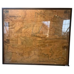
Framed Mid-19th Century Wall Map of Long Island, the Hamptons
Located in Sag Harbor, NY
A Framed museum quality find. This large wall map dates to the mid-1800s. Detailed inset maps of, Sag Harbor, East Hampton, Amagansett, Shelter Island and most villages in Long Islan...
Category
Mid-19th Century American Antique Fabric Maps
Materials
Linen, Paper
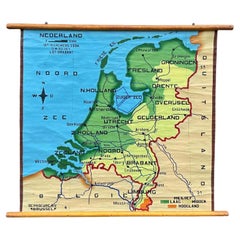
School Chart or Pull Down Map of Geography of the Netherlands, 1950s
Located in Hemiksem, VAN
A beautiful old school map of the Netherlands, painted on linen. The map shows the 3 different reliefs (low, middle, high) of the Netherlands. The beau...
Category
1950s Belgian Mid-Century Modern Vintage Fabric Maps
Materials
Linen, Paint
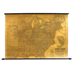
1863 "Lloyd's New Map of the United States, the Canadas, and New Brunswick"
Located in Colorado Springs, CO
Presented is “Lloyd's New Map of the United States, the Canadas and New Brunswick, From the latest Surveys, Showing Every Railroad & Station Finished to June 1863, and the Atlantic and Gulf Coasts.” A large, Civil War-era hanging map of the United States and adjacent territories, this map covers the area from the Atlantic Ocean and extends as far west as the 103 meridian, to “Dacotah,” Nebraska, Kansas, "Indian Territory," and Texas. The southern continuation of Florida is shown in an inset map along the right margin. This map was published by J. T. Lloyd, in New York, in 1863. According to the publisher’s marking at lower right, this map was originally issued in two states: "in Sheets, Colored" for 50 cents, and "Varnished nicely, with Rollers" for $1.
Throughout the map, the counties are colored and the towns and cities well labeled. A reference key in the bottom margin provides symbols for railroads, turnpikes and wagon roads, state capitals, cities and towns, and village post offices. As emphasized in the map’s title, this map is especially notable for the countless railway lines and stations depicted, with distances noted between points, listing “every railroad and finished station to June 1863.” Additionally, two shipping agents and their routes are drawn out of New York City. The map includes details of the steamship routes into New York and Philadelphia from Liverpool and on to California and Oregon via an overland Nicaraguan trek, presumably to assist gold rush emigrants.
This expansive and impressive map depicts the eastern half of the United States in the third year of the Civil War. In order not to recognize the legitimacy of the Confederate States of America, each state is shown in the same manner as the Union states. The only indication that the American Civil War was in progress when this map was published is a printed notice that Gideon Wells, Secretary of the Navy, wishes to acquire a quote on 100 copies of Lloyd’s Mississippi River map...
Category
1860s American Antique Fabric Maps
Materials
Linen, Wood, Paper
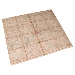
Antique Folding London Map, English, Cartography, Historic, Georgian, Dated 1783
Located in Hele, Devon, GB
This is an antique folding London map. An English, paper on linen cartographical study of the London metropolis and the surrounding area, published in the mid Georgian period, dated ...
Category
Late 18th Century British Georgian Antique Fabric Maps
Materials
Linen, Paper
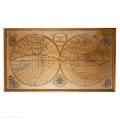
Map Silk Embroidered Western Eastern Hemisphere New Old World Asia America Afri
Located in BUNGAY, SUFFOLK
A rare, late-18th century, silk, embroidered, double hemisphere, world map, blackwork, sampler, showing the tracks of captain cook’s three voyages
- Illustrating public understanding of the world in the late-18th century and the recent discoveries of the time delineating the tracks of Captain Cook’s three voyages.
- Shows the incentive for further exploration during the 19th century as no mass is indicated within the southern polar region, the interior portions of western North America, Africa, and Australia are still relatively void of detail even though California is no longer shown as an island.
- Includes beautifully worked allegories of the four continents Asia, the Americas, Africa & Europe, a cartouche being supported by two angels and a compass
- The cream, silk ground is finely embroidered with a variety of stiches in black, silk threads emulating the black ink on maps.
-“Recent international conflicts and voyages by Captain Cook and others made the study of geography exciting at the time this map was made. Elaborate embroidered maps...
Category
18th Century British Georgian Antique Fabric Maps
Materials
Silk
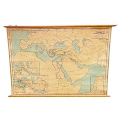
Antique Rand McNally & Company Schoolmap. Ancient Oriental Empires. Historical
Located in ROTTERDAM, ZH
This is a real unique map made by the famous Rand McNally Company. This rare schoolmap is probably made in the late 1920's. The map of all the ...
Category
1920s American American Classical Vintage Fabric Maps
Materials
Fabric, Paper
Vintage Swedish School Map of Europe, Large, Made in Sweden, 1905
Located in Los Angeles, CA
Vintage Swedish School Map of Europe - LARGE - Made in Sweden, 1905
This vintage Swedish school map is so unique and a great example of why these are so collectible.
Wooden pol...
Category
Early 1900s Swedish Antique Fabric Maps
Materials
Linen, Wood, Paper
Framed Original Land Map Survey of Tyler Park, Jersey City Railroad
Located in Lambertville, NJ
A framed and matted historical map of Tyler park jersey city New Jersey Railroad. The paper on canvas in later appropriate frame. Good condition with some creasing and age discolorat...
Category
1870s American Antique Fabric Maps
Materials
Canvas, Glass, Wood
Rare Set of 3 Map Samplers by A Charles. Italy, Spain & France
Located in Chelmsford, Essex
Set of 3 Map Samplers by A Charles. All depict countries, cities, seas and landmarks of the respective countries. The first entitled, 'SPAIN and PORTUGAL'. The second, 'MAP OF FRANCE...
Category
Early 19th Century English Antique Fabric Maps
Materials
Linen
Antique Linen Anatomical School Poster from the Cow, 1950s
Located in HEVERLEE, BE
1950s didactical anatomical school poster of the cow.
Used to explain and show the anatomical aspect of a cow to the pupils.
Printed on linen.
Cool curio item to decorate a ...
Category
1950s Belgian Vintage Fabric Maps
Materials
Linen
Large Antique 1859 Map of North America
Located in Sag Harbor, NY
This Map was made by Augustus Mitchell in 1859 It is in amazing condition for being 163 years old. This price is for the rolled up easy to ship version of this piece. I will be Frami...
Category
Mid-19th Century American Antique Fabric Maps
Materials
Canvas, Paper
Vintage Swedish Topographic School Map of European Alps, Made in Sweden 1922
Located in Los Angeles, CA
Vintage Swedish Topographic School map of European Alps, Made in Sweden 1922
This vintage Swedish school map is so unique and a great example of why these are so collectible.
W...
Category
1920s Swedish Vintage Fabric Maps
Materials
Linen, Wood, Paper
Vintage Swedish School Map of Vastergötland, Made in Sweden 1920
Located in Los Angeles, CA
Vintage Swedish School Map of Vastergötland, Made in Sweden 1920
Västergötland also known as West Gothland or the Latinized version Westrogothia in older literature, is one of the...
Category
1920s Swedish Vintage Fabric Maps
Materials
Linen, Wood, Paper
Decorative Vintage Print, Dutch Chart of Australia, 1st Edition, 1952
Located in Langweer, NL
The vintage school chart of Australia titled "Australië," created by W. Bakker & H. Rush and published in 1952:
**Title**: Australië
**Creators**: W. Bakker & H. Rush
**Publication ...
Category
Mid-20th Century European Fabric Maps
Materials
Canvas
Large Original Antique Folding Map of Manchester, England, Dated 1793
Located in St Annes, Lancashire
Superb map of Manchester and Salford
Folding map. Printed on paper laid on to the original canvas
Unframed.
Published by C. Laurent, 1793.
...
Category
1790s English Georgian Antique Fabric Maps
Materials
Canvas, Paper
Antique Railroad Map of the United States by Rand, McNally & Co, 1900
Located in Langweer, NL
Antique map titled 'Rand, McNally & Co's New Official Railroad map of the United States with portions of The Dominion of Canada, The Republic of Mexico and the West Indies'. Large railroad map of the United States, sectionalised and laid on linen. Map shows state boundaries for the United States, Mexico, the West Indies, and lower portion of Canada; major cities and towns, military posts, Native American reservations, and railroads; Oklahoma and "Indian Territory." Inset: "Map of Alaska...
Category
20th Century Fabric Maps
Materials
Linen, Paper
Antique Map of Scotland by Cary, '1811'
Located in Langweer, NL
Antique map titled 'A New Map of Scotland from the Latest Authorities':
**Title**: A New Map of Scotland from the Latest Authorities
**Publisher**: J....
Category
Early 19th Century Antique Fabric Maps
Materials
Linen, Paper
Large University Chart “Political Map of North America” by Bacon
Located in Chillerton, Isle of Wight
Large University Chart “Political Map of North America” by Bacon
W&A K Johnston’s Charts of Physical Maps By G W Bacon,
This is colourful Physical map ...
Category
Early 20th Century American Empire Fabric Maps
Materials
Linen
Large Wall Map of Europe by George Philip & Son, circa 1920
Located in Langweer, NL
Antique map titled 'Philips' New Commercial Map of Europe'. Very large wall map of Europe including the North African coast and Turkey. Decorative bord...
Category
Early 20th Century Fabric Maps
Materials
Linen, Paper
Large Topographical and Geological Map of the Teshio Oil Field, '1936'
Located in Langweer, NL
Topographical and geological map of the Teshio oil field. Shows location of oil well, oil sand, natural gas, coal, Sulphur spring, anticlinal axis, prof...
Category
20th Century Fabric Maps
Materials
Linen, Paper
Large University Chart “Africa Physical ” by Bacon
Located in Chillerton, Isle of Wight
Large University chart “Africa Physical ” by Bacon
W&A K Johnston’s charts of physical maps by G W Bacon,
This is a Physical map of Africa, it is lithograph set on Linen mounte...
Category
Early 20th Century Beaux Arts Fabric Maps
Materials
Linen
Antique Map of the Region of Wakayama, Nara and Osaka 'Japan'
Located in Langweer, NL
Geological folding map of the area with Wakayama, Nara, Osaka, Mie, and Shiga in Japan, circa 1880:
This map is a geological folding map, which means it was designed to be portable ...
Category
Late 19th Century Antique Fabric Maps
Materials
Linen, Paper
University Chart “Black Map of North America
Located in Chillerton, Isle of Wight
University Chart “Black Map of North America
W&A K Johnston’s Charts of Physical Maps By G W Bacon,
This is a Black Physical map of North A...
Category
Early 20th Century Industrial Fabric Maps
Materials
Linen
Large University Chart “Physical Map of Africa” by Bacon
Located in Chillerton, Isle of Wight
Large university chart “Physical Map of Africa” by Bacon
W&A K Johnston’s Charts of Physical Maps By G W Bacon,
This is colorful Physical map of North America, it is large lithograph set...
Category
Early 20th Century Folk Art Fabric Maps
Materials
Linen
Antique Map of the East Indies by Brouwer, 1917
Located in Langweer, NL
Antique map titled 'Geotektonische Schetskaart van het Oostelijk Gedeelte van den Oost-Indischen Archipel':
**Title**: Geotektonische Schetskaart van het Oostelijk Gedeelte van den ...
Category
Early 20th Century Fabric Maps
Materials
Canvas, Paper
Vintage Afghan Pictorial Map Rug
Located in New York, NY
A vintage Afghan Pictorial map rug from the mid-20th century.
Measures: 3' 0" x 4' 10"
Category
Mid-20th Century Afghan Folk Art Fabric Maps
Materials
Wool
Large University Chart “Political Map of North America” by Bacon
Located in Chillerton, Isle of Wight
Large University chart “Political Map of North America” by Bacon
W&A K Johnston’s Charts of Political Maps by G W Bacon,
This is colorful Physical ...
Category
Early 20th Century American Empire Fabric Maps
Materials
Linen
Antique Map of the North-West Frontier by Stanford, 1895
By E. Stanford
Located in Langweer, NL
Antique map titled 'Stanford's Sketch Map of the North West Frontier of India from Peshawar to the Pamirs'. Linen backed folding map of the North-West Frontier of India from Peshawar...
Category
Late 19th Century Antique Fabric Maps
Materials
Linen, Paper
Antique Framed Pen and Ink on Fabric Map of Cornwall from Early 19th Century
Located in Los Angeles, CA
Early 19th-century English pen-and-ink fabric map of Cornwall. With beautiful hand-drawn details and faded sepia tones, this framed piece turns history into art.
England, circa 181...
Category
Early 19th Century English Antique Fabric Maps
Materials
Fabric, Walnut
1960s Canvas Wall School Chart with Sheep by Jung-Koch-Quentell
Located in Antwerp, BE
Vintage school wall chart, pull down chart with beautiful illustrated lithograph of Sheep. It shows the animal in it's natural environment as well as some anatomical details.
This P...
Category
Mid-20th Century German Mid-Century Modern Fabric Maps
Materials
Wood, Canvas, Paper
Antique Map of Italy by Andriveau-Goujon, 1843
By Andriveau-Goujon
Located in New York, NY
Antique Map of Italy by Andriveau-Goujon, 1843. Map of Italy in two parts by Andriveau-Goujon for the Library of Prince Carini at Palazzo Carini i...
Category
1840s French Antique Fabric Maps
Materials
Linen, Paper
Recently Viewed
View AllMore Ways To Browse
Antique Sailing Maps
Antique Sailing Map
West Coat Of Arms
Bay Area Antique Furniture
Greek Asia Minor
Hemisphere World Map
Antique Maps Canada
Antique Map Canada
Canada Antique Map
Speed Map
Charing Cross
Malaysian Antique
Blaeu World Map
West Indies Map
Antique Portuguese Plates
Map Of Brazil
Map Huge
Antique Maps Of Canada
