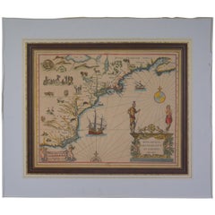
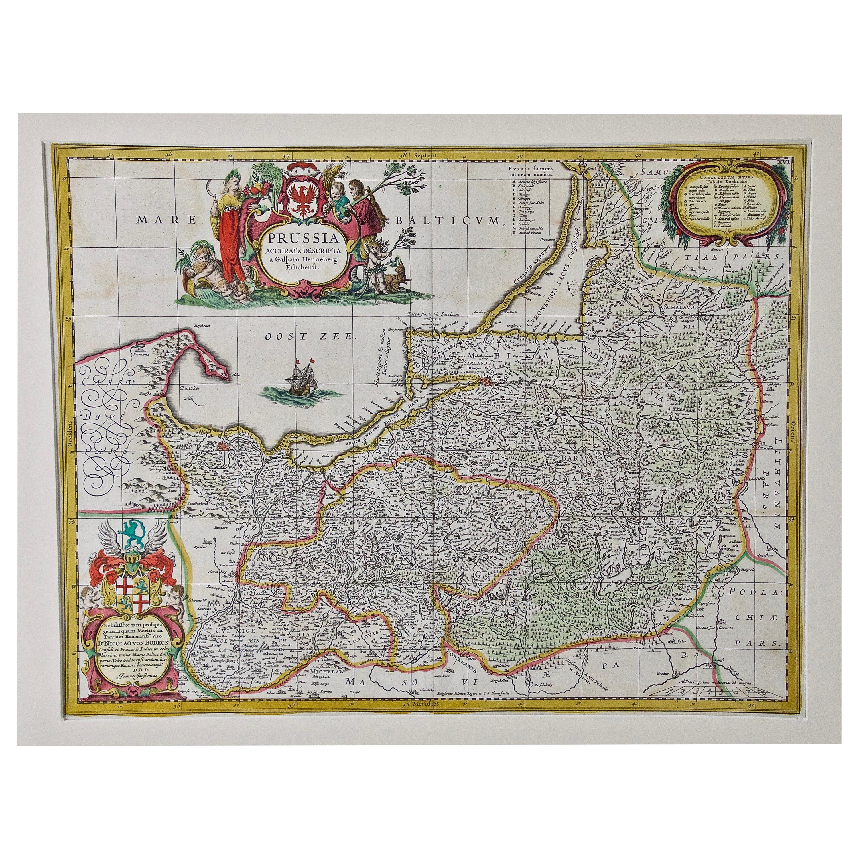
17th Century 1630 Nova Anglia Colored Map Engraving Belgium Virginia Jan Jansson
View Similar Items


Want more images or videos?
Request additional images or videos from the seller
1 of 13
17th Century 1630 Nova Anglia Colored Map Engraving Belgium Virginia Jan Jansson
About the Item
- Creator:J. Jansson (Artist)
- Dimensions:Height: 23 in (58.42 cm)Width: 26.75 in (67.95 cm)Depth: 0.125 in (3.18 mm)
- Style:American Colonial (Of the Period)
- Materials and Techniques:
- Period:
- Date of Manufacture:1630s
- Condition:Good overall- light foxing to paper as well as a small hole. see pictures.
- Seller Location:Dayton, OH
- Reference Number:Seller: 238901stDibs: LU5343219863012

About the Seller
4.9
Platinum Seller
These expertly vetted sellers are 1stDibs' most experienced sellers and are rated highest by our customers.
Established in 2010
1stDibs seller since 2020
1,113 sales on 1stDibs
More From This SellerView All
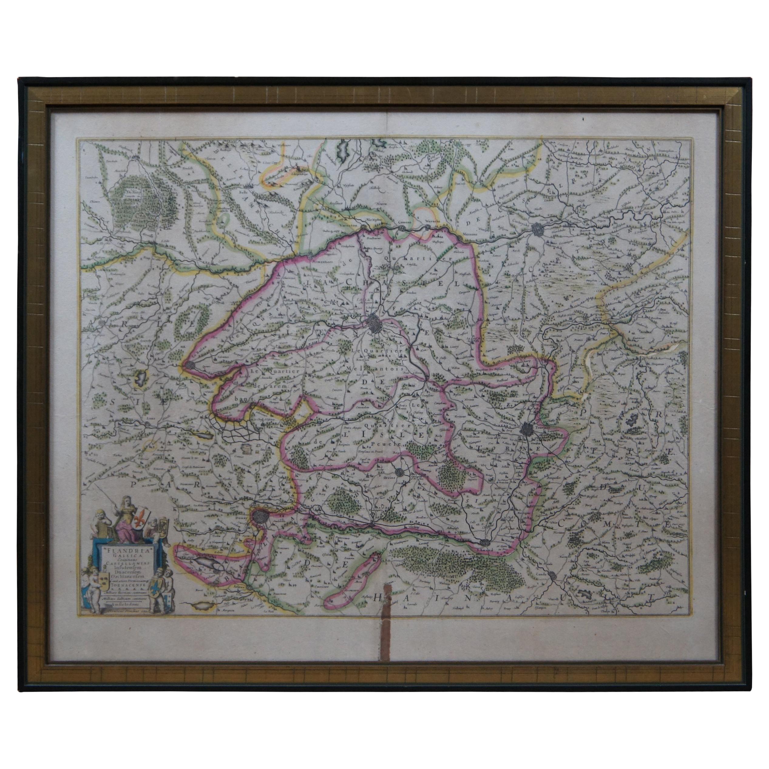
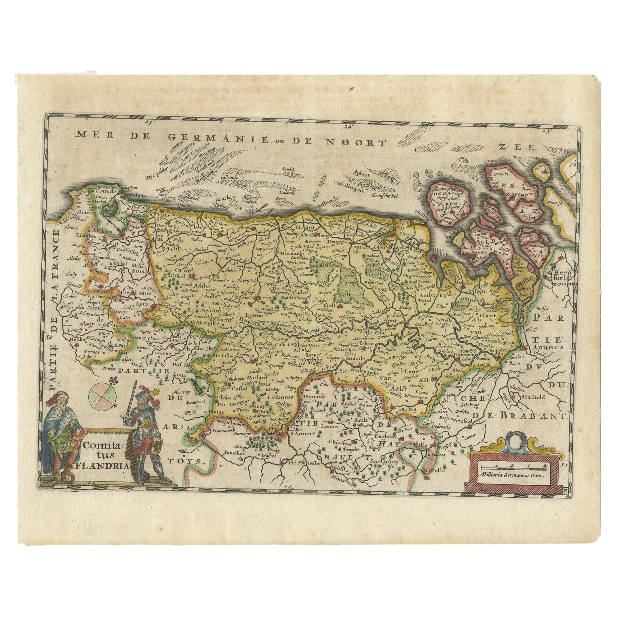
- Antique 1630 Colored Belgium Map Flandria Gallica Flanders Henricus HondiusLocated in Dayton, OH"Antique hand colored map of Flanders, Belgium, circa 1630, engraved by Henricus Hondius. “Henricus Hondius II (1597 – 16 August 1651) was a Dutch eng...Category
Antique Early 17th Century Renaissance Maps
MaterialsPaper
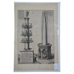
- 17th C. Column of Dilius & Obelisque Fountain Engraving Antonio Lafreri SpeculumLocated in Dayton, OH17th century (circa 1675) Roman naval column and fountain engraving. Publisher: Antonio Lafreri (French, Orgelet, Franche-Comte ca. 1512–1577 Rome) Portfolio: Speculum Romanae Magnif...Category
Antique 17th Century Neoclassical Prints
MaterialsPaper
- Antique Chicago Illinois National Map Commercial Rollup Classroom Census Map 47"Located in Dayton, OHAntique early to mid 20th century double sided hanging map titled the New Commercial and Census Map of Illinois, Edition 1073. Verso shows the National Map of Chicago and Suburbs - O...Category
Early 20th Century North American Maps
MaterialsPaper
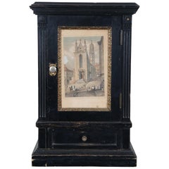
- Antique Victorian Miniature Cabinet Cupboard Rauch Engraving Maria StiegenLocated in Dayton, OHAntique black painted miniature cabinet with lower drawer, three interior shelves and door displaying an antique print by Carl Rauch titled Ansicht der Maria Stiegen Kirche in Wien (...Category
Antique 19th Century Victorian Cabinets
MaterialsHardwood, Paint, Paper
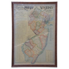
- 1903 Antique National Publishing Road Map of New Jersey Geological SurveyLocated in Dayton, OH1903 antique New Jersey road map by The National Publishing Company of Boston Massachusettes, No 384. Index for New Jersey Census 1900, Population 1...Category
Antique Early 1900s Victorian Maps
MaterialsPaper
- Vintage Oversized New York City Lower Manhattan 1840s Map PrintLocated in Dayton, OHVintage late 20th century reproduction print of New York City featuring lower Manhattan in 1840.Category
Late 20th Century Victorian Maps
MaterialsPaper


You May Also Like
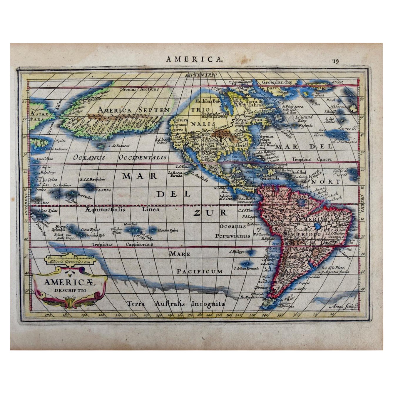
- North & South America: A 17th Century Hand-colored Map by Jansson & GoosBy Johannes JanssoniusLocated in Alamo, CAA 17th century hand-colored map of North & South America entitled "Americae Descriptio" by the cartographer Johannes Jansson, published in Jansson's Atlas Minor in Amsterdam in 1628....Category
Antique 1620s Dutch Maps
MaterialsPaper
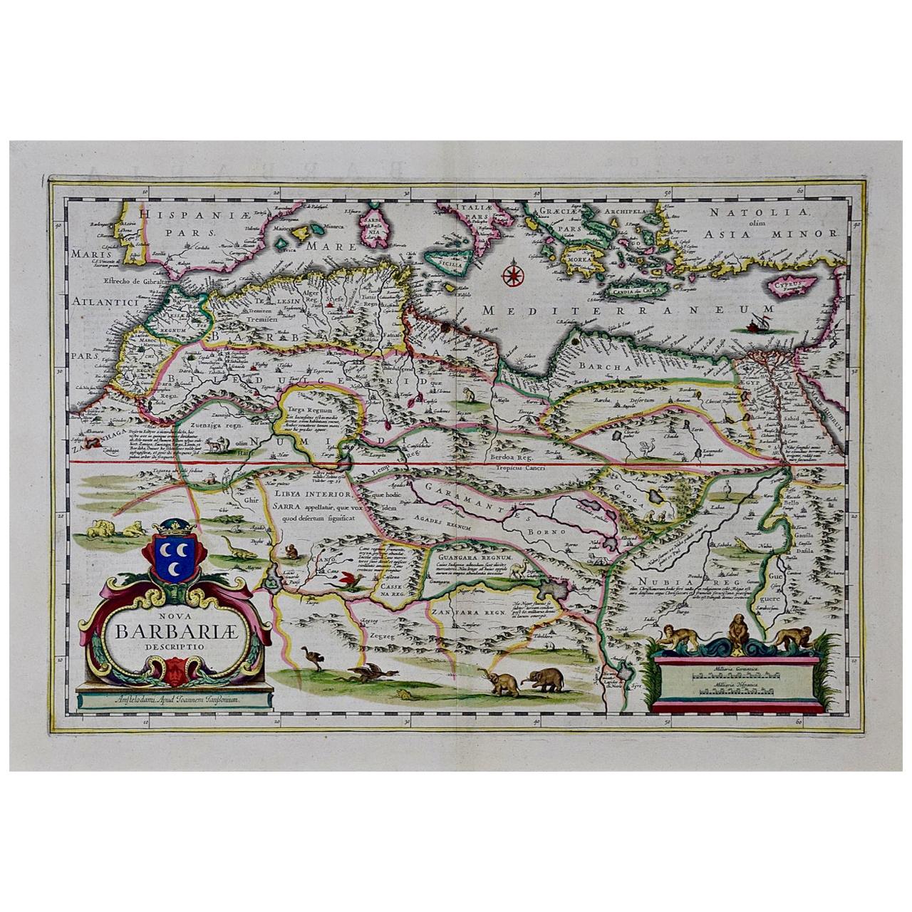
- "Nova Barbariae Descriptio", a 17th Century Hand-Colored Map of North AfricaBy Johannes JanssoniusLocated in Alamo, CAThis original attractive 17th century hand-colored map of North Africa entitled "Nova Barbariae Descriptio" by Johannes Janssonius was published in Paris in 1635. It includes the Med...Category
Antique Mid-17th Century Dutch Maps
MaterialsPaper
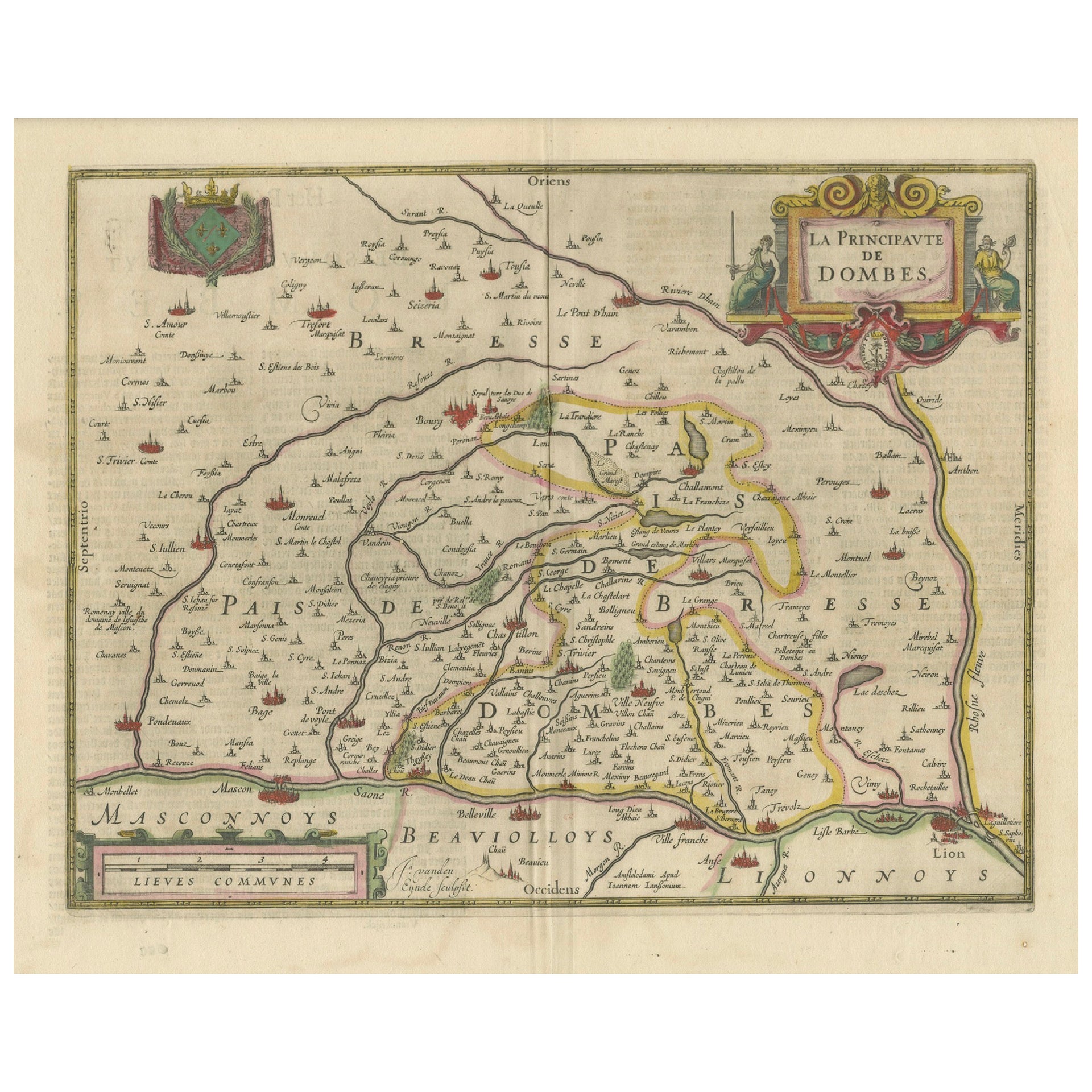
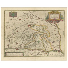
- The Principality of Dombes: A 17th-Century Cartographic Jewel by Jan JanssonLocated in Langweer, NLThe text on the map "La principaute de Dombes; J. van den Eynde sculpit.; La Principavte de Dombes" indicates that it is a map of the principality of Dombes, engraved by J. van den E...Category
Antique 1630s Maps
MaterialsPaper
- 17th Century Hand Colored Map of the Liege Region in Belgium by VisscherBy Nicolaes Visscher IILocated in Alamo, CAAn original 17th century map entitled "Leodiensis Episcopatus in omnes Subjacentes Provincias distincté divisusVisscher, Leodiensis Episcopatus" by Nicolaes Visscher II, published in Amsterdam in 1688. The map is centered on Liege, Belgium, includes the area between Antwerp, Turnhout, Roermond, Cologne, Trier and Dinant. This attractive map is presented in a cream-colored mat measuring 30" wide x 27.5" high. There is a central fold, as issued. There is minimal spotting in the upper margin and a tiny spot in the right lower margin, which are under the mat. The map is otherwise in excellent condition. The Visscher family were one of the great cartographic families of the 17th century. Begun by Claes Jansz Visscher...Category
Antique Late 17th Century Dutch Maps
MaterialsPaper
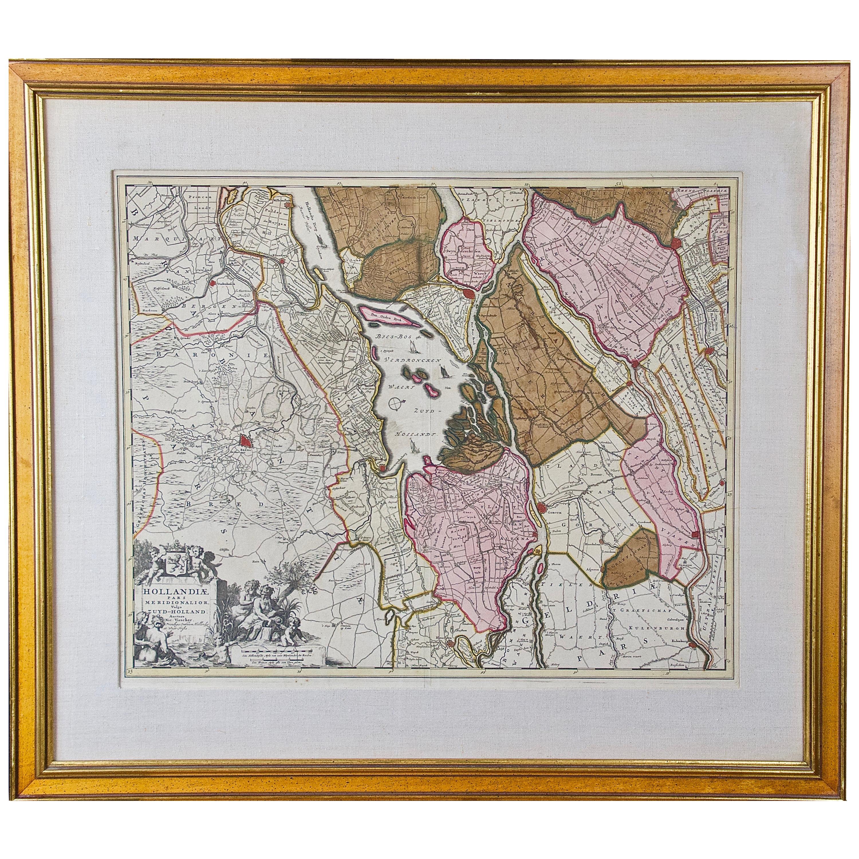
- Hand Colored 17th Century Visscher Map "Hollandiae" Southern HollandBy Nicolaes Visscher IILocated in Alamo, CAA hand colored 17th century map of the southern portions of Holland by Nicolaus (Nicolas) Visscher II entitled "Hollandiae pars Meridionalis, vulgo Zuyd-Holland", published in Amsterdam in 1678. The map shows the region between Breda, Heusden, Gornichem, Gouda, Dordrecht, and Willemstad. It includes a decorative cartouche in the lower left corner. The map is presented in an attractive maple colored wood frame with gold trim and a fabric mat. The Visscher family were one of the great cartographic families of the 17th century. Begun by Claes Jansz Visscher...Category
Antique Early 18th Century Dutch Maps
MaterialsPaper
- Northern Scotland: A 17th Century Hand-colored Map by MercatorBy Gerard MercatorLocated in Alamo, CAThis is a framed hand-colored 17th century map of Northern Scotland by Gerard Mercator entitled "Scotiae pars Septentrionalis", published in Amsterdam in 1636. It is a highly detailed map of the northern part of Scotland, with the northwest Highlands and the cities Inverness and Aberdeen, as well as the Orkney Islands and the Hebrides. There is a decorative title cartouche in the upper left corner. The map is presented in an antiqued brown wood...Category
Antique 1630s Dutch Maps
MaterialsPaper


Recently Viewed
View AllMore Ways To Browse
17th Century American Colonial
Virginia Maps
Virginia Map
Map Of Virginia
Antique Map Virginia
Antique Maps Virginia
Antique Virginia Map
Antique Virginia Maps
Virginia Antique Map
Antique Maps Of Virginia
Antique Map Of Virginia
Map New Amsterdam
Antique Maps Manhattan
Antique Manhattan Map
Antique Map Manhattan
Manhattan Antique Map
Antique Map France
Antique French Map