Antique Virginia Maps

5
to
12
83
24
70
33
31
26
18
16
13
13
13
8
7
7
6
4
3
3
2
2
2
2
2
1
1
1
1
1
1
1
1
1
1
1
2
2
1
1
1
Sort By
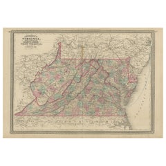
Antique Map of Virginia, Delaware, Maryland & West Virginia by Johnson, 1872
Located in Langweer, NL
Antique map titled 'Johnson's Viriginia (..). Original map of Virginia, Delaware, Maryland and West
Category

Late 19th Century Antique Virginia Maps

Materials

Paper

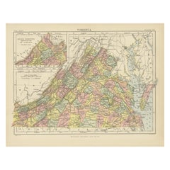
Antique Map of Virginia, with Inset Map of the South Western Continuation
Located in Langweer, NL
Antique map titled 'Virginia'. Original antique map of Virginia, United States. With inset map of
Category

Late 19th Century Antique Virginia Maps

Materials

Paper

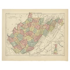
Antique Map of Virginia, with Inset Map of the Northern Part of West Viriginia
Located in Langweer, NL
Antique map titled 'West Virginia'. Original antique map of Virginia, United States. With inset map
Category

Late 19th Century Antique Virginia Maps

Materials

Paper

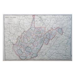
Large Original Antique Map of West Virginia, USA, C.1900
Located in St Annes, Lancashire
Fabulous map of West Virginia Original color Engraved and printed by the George F. Cram Company
Category

1890s American Antique Virginia Maps

Materials

Paper

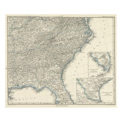
Antique Map of Tennessee, Kentucky, Virginia, Alabama, Georgia and Surroundings
Located in Langweer, NL
, Tennessee, Kentucky, Virginia and part of Florida. With inset maps of the southern part of Florida and the
Category

Mid-19th Century Antique Virginia Maps

Materials

Paper

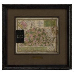
1837 Mitchell's "Tourist's Pocket Map of the State of Virginia" by J.H. Young
Located in Colorado Springs, CO
This is J. H. Young's pocket map of the Virginia, which shows county development current to 1835
Category

1830s American Antique Virginia Maps

Materials

Paper

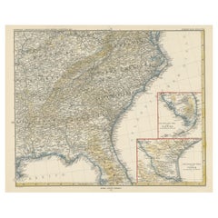
Antique Map of the Region of Georgia with Inset Maps of Florida and Texas
Located in Langweer, NL
, Tennessee, Kentucky, Virginia and part of Florida. With inset maps of the southern part of Florida and the
Category

Late 19th Century Antique Virginia Maps

Materials

Paper

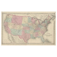
Antique Map Colton's United States of America
Located in Langweer, NL
Antique map titled 'Colton's United States of America'. Show railroads, canals, state capitals
Category

Mid-19th Century Antique Virginia Maps

Materials

Paper

Antique Map Colton's United States of America
H 17.45 in W 27.45 in D 0.02 in
Engraving of Idols of Secotam Village in Virginia 'or now North Carolina', 1721
Located in Langweer, NL
image 'Le Dieu des Vents, autre Idole des Virginiens'. The God of Wind. Both idols are key to Virginian
Category

1720s Antique Virginia Maps

Materials

Paper

1865 "Johnson's California, Utah, Nevada, Colorado, New Mexico, Arizona" Map
Located in Colorado Springs, CO
Virginia” and the “New Military Map of the United States.” Condition: Fine condition overall. Hand Colored
Category

Mid-19th Century Antique Virginia Maps

Materials

Paper

1865 "Johnson's Nebraska, Dakota, Colorado, Idaho & Kansas" Map, Johnson & Ward
Located in Colorado Springs, CO
Virginia” and the “New Military Map of the United States.”
Category

Mid-19th Century Antique Virginia Maps

Materials

Paper

1865 "Johnson's Missouri and Kansas" Map by Johnson and Ward
Located in Colorado Springs, CO
War-era maps, one of the “Vicinity of Richmond and Peninsular Campaign in Virginia” and the “New
Category

Mid-19th Century Antique Virginia Maps

Materials

Paper

New Map of North America from the Latest Discoveries, 1763
Located in Philadelphia, PA
A fine antique 18th century map of the North American seaboard. Entitled "A New Map of North
Category

Mid-18th Century English Georgian Antique Virginia Maps

Materials

Paper

1856 U.S. Coast Survey Map of Chesapeake Bay and Delaware Bay
Located in Colorado Springs, CO
Carolina. It also shows from Richmond and Petersburg, Virginia to the Atlantic Ocean. The map is highly
Category

1850s American Antique Virginia Maps

Materials

Paper

1889 "The Pacific States and Territories"
Located in Colorado Springs, CO
Presented is an uncommon 1889 map of the western United States, titled “The Pacific States and
Category

1880s American Antique Virginia Maps

Materials

Paper

1889 "The Pacific States and Territories"
H 16.25 in W 14.25 in D 1 in
Civil War Panorama of the Seat of War by John Bachmann, Antique Print circa 1864
Located in Colorado Springs, CO
theaters of War" (Stephenson & McKee Virginia in Maps p.239). This view, taken from the apparent vantage
Category

1860s American Antique Virginia Maps

Materials

Paper

Plan for the City of Washington by Andrew Ellicott, Antique Print, 19th Century
Located in Colorado Springs, CO
Territory of Columbia, ceded by the States of Virginia and Maryland to the United States of America and by
Category

Late 19th Century American Antique Virginia Maps

Materials

Paper

Virginia. USA. Century Atlas state antique vintage map
Located in Melbourne, Victoria
'The Century Atlas. Virginia' Original antique map, 1903. Central fold as issued. Map name and
Category

Early 20th Century Victorian Antique Virginia Maps

Materials

Lithograph

West Virginia. USA. Century Atlas state antique vintage map
Located in Melbourne, Victoria
'The Century Atlas. West Virginia' Original antique map, 1903. Central fold as issued. Map name
Category

Early 20th Century Victorian Antique Virginia Maps

Materials

Lithograph

American Hepplewhite Virginian Secretary Chest with Civil War Provenance
By George Hepplewhite
Located in Dallas, TX
PRESENTING a FANTASTIC and HISTORIC Early 19C American Hepplewhite Virginian Secretary Chest with
Category

Early 19th Century American American Classical Antique Virginia Maps

Materials

Brass

Important Confederate Field Map of Richmond VA 1864 with Provenance
Located in Dallas, TX
) It is the personal Map of Capt. William Alexander Obenchain who was the Head of the Virginia Corps of
Category

Mid-19th Century American American Classical Antique Virginia Maps

Materials

Canvas, Paper

Bermuda: An Early 17th Century Hand-colored Map by Henricus Hondius
By Henricus Hondius
Located in Alamo, CA
cast of The Tempest. The Bermudas were granted to the Virginia Company, which is referenced on the map
Category

Early 17th Century Old Masters Antique Virginia Maps

Materials

Engraving

Personal Memoirs of P. H. Sheridan, First Edition, Two-Volume Set, 1888
Located in Colorado Springs, CO
is highly illustrated, with 27 maps and 17 plates. The book is presented beautifully rebound in
Category

1880s American Antique Virginia Maps

Materials

Leather, Paper

McClellan's Own Story by George B. McClellan, First Edition, 1887
Located in Colorado Springs, CO
. Illustrated with steel plate engravings and maps. Rebound in quarter navy leather and cloth boards, with
Category

1880s American Antique Virginia Maps

Materials

Leather, Paper

English Pocket Globe, London, Circa 1775-1798
By Herman Moll
Located in Milano, IT
region in his 1727 map. (Encyclopaedia Britannica, ed. 1902, under "States of Central Africa"); Tartary
Category

Late 18th Century English George III Antique Virginia Maps

Materials

Shagreen, Paper

Bibliomania or Book Madness by Thomas Frognall Dibdin, 1842
Located in Dallas, TX
Bowling Green, KY and originally, Virginia. He served as a Colonel/Major on General Lee’s Staff during
Category

Mid-19th Century English Early Victorian Antique Virginia Maps

Materials

Paper

China 100 BC Han Dynasty Ancient Rare Stickman Sculpture in Earthenware Pottery
Located in Miami, FL
royal family and forbidden to ordinary people. The Chinese Han Dynasty Geography & Map The Han
Category

15th Century and Earlier Chinese Han Antique Virginia Maps

Materials

Iron

Demosthenis Selectae Orationes by Richard Mounteney 1791 7th Edition
Located in Dallas, TX
418 pages with illustrated pull out map of ancient Greece. In Latin. Previous owners label: ‘WM
Category

18th Century English Classical Greek Antique Virginia Maps

Materials

Leather, Paper

A truly delightful miniature terrestrial pocket globe
By Nathaniel Mills
Located in ZWIJNDRECHT, NL
turning overhead. In line with its counterpart, the terrestrial globe, celestial globes are mapped by a
Category

Mid-18th Century British Dutch Colonial Antique Virginia Maps

Materials

Other

General William Tecumseh Sherman Autograph
Located in Dallas, TX
attached to the Virginia Corps of Engineers and served on General Robert E. Lee’s Staff. Captain Obenchain
Category

Late 19th Century American American Classical Antique Virginia Maps

Materials

Paper

"Portrait of an Italian Fencer, " John Frederick Kensett, Hudson River School
By John Frederick Kensett
Located in New York, NY
engraver of labels, banknotes and maps and was employed part of that time by the American Bank Note Company
Category

1840s Hudson River School Antique Virginia Maps

Materials

Watercolor, Paper

Sir Francis Bacon: 18th C. Portrait of Philosopher, Scientist, Author, Statesman
By Jacobus Houbraken
Located in Alamo, CA
rolled manuscript and a compass for measuring distances on a map on the left. Francis Bacon (1561-1626
Category

1730s Antique Virginia Maps

Materials

Engraving

Ecce Homo Plate X
By Werner Drewes
Located in Fairlawn, OH
painting at Columbia and held two other positions: director of the WPA/FAP Graphic Arts Project and map
Category

1920s Bauhaus Antique Virginia Maps

Materials

Woodcut

Ecce Homo VII
By Werner Drewes
Located in Fairlawn, OH
painting at Columbia and held two other positions: director of the WPA/FAP Graphic Arts Project and map
Category

1920s Expressionist Antique Virginia Maps

Materials

Woodcut

Epic of America by Jt Adams First Edition Re-Print
Located in Dallas, TX
American with roots in Virginia and his paternal grandmother Carmen Michelena de Salias was a Venezuelan of
Category

Early 20th Century American American Classical Antique Virginia Maps

Materials

Paper

Washington D.C. Map, 1795
By John Russell
Located in Houston, TX
This map is based on the 1792 plan published by Andrew Ellicott. This is one of nine maps published
Category

1790s Great Britain (UK) Antique Virginia Maps

Washington D.C. Map, 1795
H 25 in W 30 in D 1.5 in
Rare Civil War Map of Part of South Eastern Virginia
Located in New York, NY
Rare Civil War Map published in 1862 by H. Lindenkohl & Chs. G. Krebs, shows fortifications used
Category

19th Century Realist Antique Virginia Maps

Materials

Lithograph

DeGroot's Map of Nevada Territory
By Henry DeGroot
Located in La Jolla, CA
The first printed map devoted to Nevada Territory, with the first printed guide book on Nevada
Category

1860s American American Empire Antique Virginia Maps

Materials

Paper

DeGroot's Map of Nevada Territory
H 35 in W 27 in D 1 in
Copper Topographical Map Printing Plate of Winchester, VA
Located in Cookeville, TN
This is a unique antique copper printing plate for Winchester, Virginia. It is a topographical
Category

Late 19th Century American Other Antique Virginia Maps

Materials

Copper

Copper Waterway Map Printing Plate of Winchester, VA
Located in Cookeville, TN
This is a unique antique copper printing plate for Winchester, Virginia. It is a waterway plate
Category

Late 19th Century American Other Antique Virginia Maps

Materials

Copper

Map of the American Revolution Siege of Yorktown
By Julius Bien
Located in New York, NY
Rare, original 1863 map by famous American lithographer Julius Bien entitled "A Plan of Yorktown
Category

1860s Realist Antique Virginia Maps

Materials

Lithograph

Original Map of London by John Rocque, 1741-1745
By John Roque 1
Located in Bantam, CT
A highly important map by John Rocque. An exact survey of the City of London Westminster Borough of
Category

1740s English George III Antique Virginia Maps

Fortress Monroe, Old Point Comfort and Hygeia Hotel, VA
Located in New York, NY
after the defeat of Napoleon at Waterloo in 1815. Although Virginia became part of the Confederate
Category

1860s Realist Antique Virginia Maps

Materials

Lithograph

Antique Civil War Map of Virginia, "Seat of War in Virginia Sheet 2" 1862
Located in Colorado Springs, CO
This informative map of the Seat of War in Virginia, &c., sheet 2 covers the area in northern
Category

1860s British Antique Virginia Maps

Materials

Paper

Antique Civil War Map of Virginia, "Seat of War in Virginia Sheet 3" 1862
Located in Colorado Springs, CO
This informative map of the Seat of War in Virginia, sheet 3 spans the area from Petersburg and
Category

1860s British Antique Virginia Maps

Materials

Paper

1818 Carey Atlas Correct Hand-Colored Map of Virginia
Located in Colorado Springs, CO
VIRGINIA" Published by M. Carey & Sons, Philadelphia. This original, historic Map of Virginia is found
Category

1810s North American Antique Virginia Maps

Northeastern Virginia and Vicinity of Washington Civil War Map
Located in Colorado Springs, CO
This is an attractive and highly detailed Civil War map of Northern Virginia, which shows the
Category

1890s American Antique Virginia Maps

Rare 17th Century American Map of Virginia and Florida by Jan Janssonius
By Jan Johansson
Located in Wiscasset, ME
dedicated to Italy. 1646 a fourth volume came out with "English County Maps", a year after a similar issue
Category

18th Century and Earlier Dutch Rococo Antique Virginia Maps

Antique Map of Virginia, Showing the Location of Civil War Battle Fields, 1902
Located in Colorado Springs, CO
Presented is an original map from 1902 showing the locations of battlefields across Virginia and
Category

Early 1900s American Antique Virginia Maps

Materials

Paper

1862 Pocket Map of Eastern Virginia Representing the Seat of the Civil War
Located in Colorado Springs, CO
This is an 1862 map of Eastern Virginia, compiled by Walter L. Nicholson for the U.S. Coast Survey
Category

1860s Antique Virginia Maps

Florida and Virginia: A 17th Century Hand-colored Map by Hondius after Mercator
By Gerard Mercator
Located in Alamo, CA
This hand-colored early 17th century copper-plate map entitled "Virginia et Florida" was originally
Category

Early 17th Century Dutch Antique Virginia Maps

Materials

Paper

Defenses of Washington. Extract of Military Map of N.E. Virginia, Circa 1891
Located in Colorado Springs, CO
This historical and interesting map details the various defenses poised to defend Washington from
Category

1890s Antique Virginia Maps

Map of Appomattox Court House, Antique Map from Surveys, 1867
Located in Colorado Springs, CO
. This extensively surveyed and informative map extends south to Evergreen Station and north to the Bent
Category

1860s American Antique Virginia Maps

Materials

Paper

Moll's Famous "Beaver Map"
Located in San Francisco, CA
MOLL, Herman. A New and Exact Map of the Dominions of the King of Great Britain... Containing
Category

18th Century and Earlier English Antique Virginia Maps

"Historical Civil War Map" Antique U.S. Pocket Map by Asher and Co., 1862
Located in Colorado Springs, CO
shows all the events of the war, up until August 9th, 1862, in Culpepper, Virginia. This map shows the
Category

1860s American Antique Virginia Maps

Materials

Paper

Texas Civil War Map, circa 1863
Located in Colorado Springs, CO
Richmond, Virginia. Johnson got his first taste of the map business as a salesman and book canvasser for J
Category

1860s American Antique Virginia Maps

Texas Civil War Map, circa 1863
H 20 in W 29 in D 1.5 in
1900 Plan of the City of Washington Antique Map
Located in Colorado Springs, CO
"Plan of the City of Washington in the Territory of Columbia, Ceded by the States of Virginia and
Category

Early 20th Century American Antique Virginia Maps

Materials

Paper

1865 "Johnson's Kentucky and Tennessee" Map by Johnson and Ward
Located in Colorado Springs, CO
Arkansas, Illinois, Alabama, Georgia, North Carolina, Virginia, Ohio, and Indiana. The map is beautifully
Category

Mid-19th Century Antique Virginia Maps

Materials

Paper

1862 Lloyd's New Military Map of the Border & Southern States
Located in Colorado Springs, CO
This hanging military wall map of the eastern half of United States was published by H.H. Lloyd
Category

1860s American Antique Virginia Maps

Materials

Paper

1902 "Topographical Map of the Original District of Columbia, After Arnold
Located in Colorado Springs, CO
1902 "Topographical map of the original district of Columbia and Environs: showing the
Category

Early 1900s Antique Virginia Maps

Materials

Paper

  • 1
Get Updated with New Arrivals
Save "Antique Virginia Maps", and we’ll notify you when there are new listings in this category.

Antique Virginia Maps For Sale on 1stDibs

Find a variety of antique virginia maps available on 1stDibs. Each of these unique antique virginia maps was constructed with extraordinary care, often using paper. Antique virginia maps have been made for many years, and versions that date back to the 18th Century alongside those produced as recently as the 20th Century. Antique virginia maps bearing Victorian or Rococo hallmarks are very popular at 1stDibs. There have been many well-made antique virginia maps over the years, but those made by Gerard Mercator, J. Jansson and Jan Johansson are often thought to be among the most beautiful.

How Much are Antique Virginia Maps?

The average selling price for at 1stDibs is $1,350, while they’re typically $25 on the low end and $7,500 highest priced.

Read More

Pamela Shamshiri Shares the Secrets behind Her First-Ever Book and Its Effortlessly Cool Interiors

The sought-after designer worked with the team at Hoffman Creative to produce a monograph that beautifully showcases some of Studio Shamshiri's most inspiring projects.

Moroccan Artworks and Objects Take Center Stage in an Extraordinary Villa in Tangier

Italian writer and collector Umberto Pasti opens the doors to his remarkable cave of wonders in North Africa.

Montecito Has Drawn Royalty and Celebrities, and These Homes Are Proof of Its Allure

Hollywood A-listers, ex-pat aristocrats and art collectors and style setters of all stripes appreciate the allure of the coastal California hamlet — much on our minds after recent winter floods.

Whaam! Blam! Pow! — a New Book on Pop Art Packs a Punch

Publishing house Assouline and writer Julie Belcove have teamed up to trace the history of the genre, from Roy Lichtenstein, Andy Warhol and Yayoi Kusama to Mickalene Thomas and Jeff Koons.

The Sparkling Legacy of Tiffany & Co. Explained, One Jewel at a Time

A gorgeous new book celebrates — and memorializes — the iconic jeweler’s rich heritage.

What Makes a Gem-Encrusted Chess Set Worth $4 Million?

The world’s most opulent chess set, weighing in at 513 carats, is literally fit for a king and queen.

Tauba Auerbach’s Geometric Pop-Up Book Is Mighty Rare, Thanks to a Hurricane

This sculptural art book has an epic backstory of its own.

Step inside the Storied Mansions of Palm Beach’s Most Effervescent Architect

From Spanish-style courtyards to fanciful fountains, these acclaimed structures abound in surprising and elegant details.