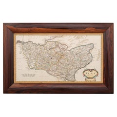
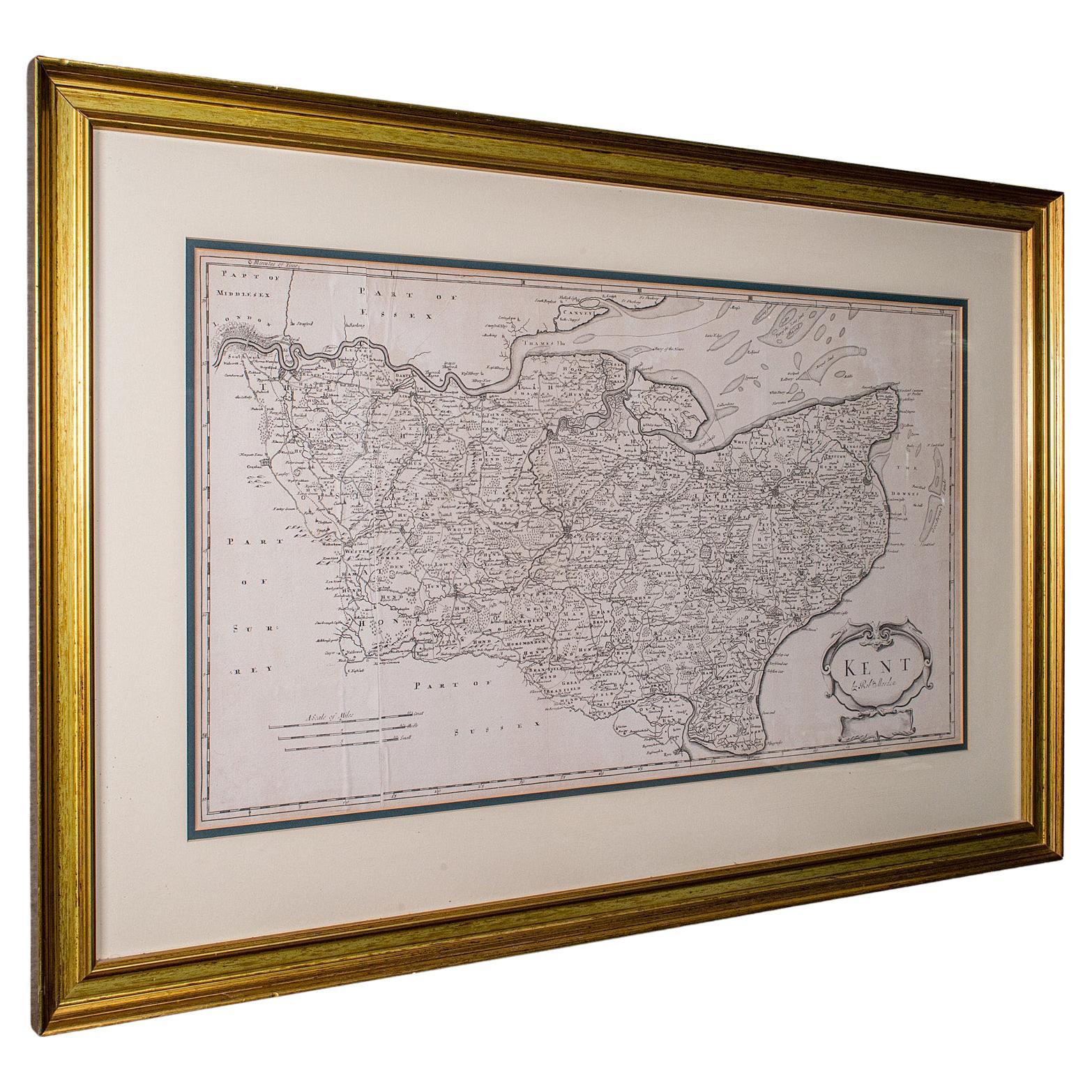
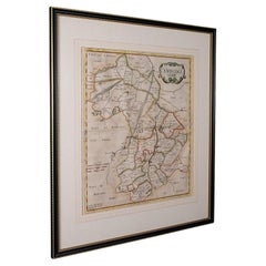
17th Century Robert Morden Map of Kent, C.1695
View Similar Items


Want more images or videos?
Request additional images or videos from the seller
1 of 19
17th Century Robert Morden Map of Kent, C.1695
About the Item
- Creator:Robert Morden (Maker)
- Dimensions:Height: 20.48 in (52 cm)Width: 31.89 in (81 cm)Depth: 0.79 in (2 cm)
- Materials and Techniques:
- Place of Origin:
- Period:
- Date of Manufacture:circa 1695
- Condition:Wear consistent with age and use. Minor fading. In Good Condition - Wear as expected with age and comes newly framed.
- Seller Location:Royal Tunbridge Wells, GB
- Reference Number:Seller: A6619a1stDibs: LU1348223946482
About the Seller
5.0
Platinum Seller
Premium sellers with a 4.7+ rating and 24-hour response times
Established in 2014
1stDibs seller since 2015
497 sales on 1stDibs
Authenticity Guarantee
In the unlikely event there’s an issue with an item’s authenticity, contact us within 1 year for a full refund. DetailsMoney-Back Guarantee
If your item is not as described, is damaged in transit, or does not arrive, contact us within 7 days for a full refund. Details24-Hour Cancellation
You have a 24-hour grace period in which to reconsider your purchase, with no questions asked.Vetted Professional Sellers
Our world-class sellers must adhere to strict standards for service and quality, maintaining the integrity of our listings.Price-Match Guarantee
If you find that a seller listed the same item for a lower price elsewhere, we’ll match it.Trusted Global Delivery
Our best-in-class carrier network provides specialized shipping options worldwide, including custom delivery.More From This Seller
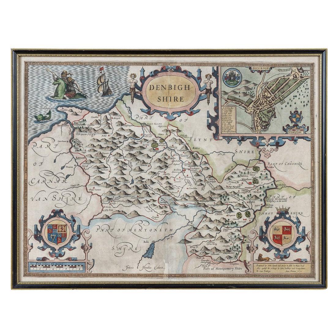
View All17th Century John Speed Map of Denbighshire, c.1610
By John Speed
Located in Royal Tunbridge Wells, Kent
Antique early 17th century British very rare and original John Speed, hand coloured map of Denbighshire, dated 1610, by John Sunbury and George Humble. John...
Category
Antique 17th Century British Maps
Materials
Wood, Paper

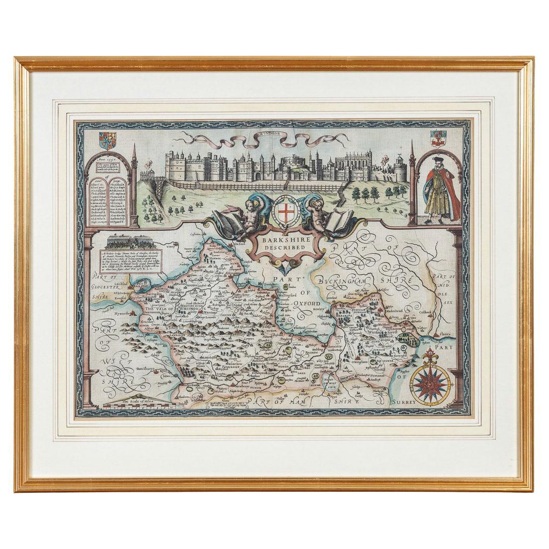
17th Century John Speed Map of the Barkshire Described, c.1616
By John Speed
Located in Royal Tunbridge Wells, Kent
Antique 17th century British very rare and original John Speed (1551-1629) map of the Barkshire Described, J. Sud and Georg Humble, publication (1616 or lat...
Category
Antique 17th Century British Maps
Materials
Paper

Antique 17th Century Limoge Signed Plaque Of A Madonna Praying
Located in Royal Tunbridge Wells, Kent
Antique 17th Century French painted porcelain wall hanging plaque portraying the Madonna in prayer against a radiant sunburst backdrop. Intricately painted with foliate patterns ador...
Category
Antique 17th Century French Other Religious Items
Materials
Porcelain

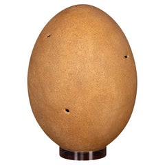
Antique Pre-17th Century Extremely Rare & Complete Elephant Bird Egg, Madagascar
Located in Royal Tunbridge Wells, Kent
An extremely rare elephant bird egg, complete albeit with only minor damage. The Elephant Bird, formally categorised as Aepyornis Maximus, is an enormous flightless bird native to Ma...
Category
Antique 15th Century and Earlier Malagasy Other Taxidermy
Materials
Eggshell
18th Century Emanuel Bowen Map of County of York, c.1740
By Emanuel Bowen
Located in Royal Tunbridge Wells, Kent
Antique 18th century British rare and original Emanuel Bowen (1694-1767) map of the County of York divided into its Ridings and subdivided into wapontakes, mounted in solid wood fram...
Category
Antique Early 18th Century British Maps
Materials
Paper

19th Century John Cary Map of North Part of West Riding of Yorkshire, C.1805
By John Cary
Located in Royal Tunbridge Wells, Kent
Antique 19th century British original John Cary sr (1755-1835) map of North part of the West Riding of Yorkshire, From the beft Authorities. Engraved J Car...
Category
Antique 19th Century British Maps
Materials
Paper

You May Also Like
Large Antique Lithography Map of Kent, English, Cartography, Robert Morden, 1700
Located in Hele, Devon, GB
This is a large antique lithography map of Kent. An English, framed atlas engraving of cartographic interest by Robert Morden, dating to the early 18th century and later.
Superb li...
Category
Antique Early 18th Century British Queen Anne Maps
Materials
Glass, Wood, Paper

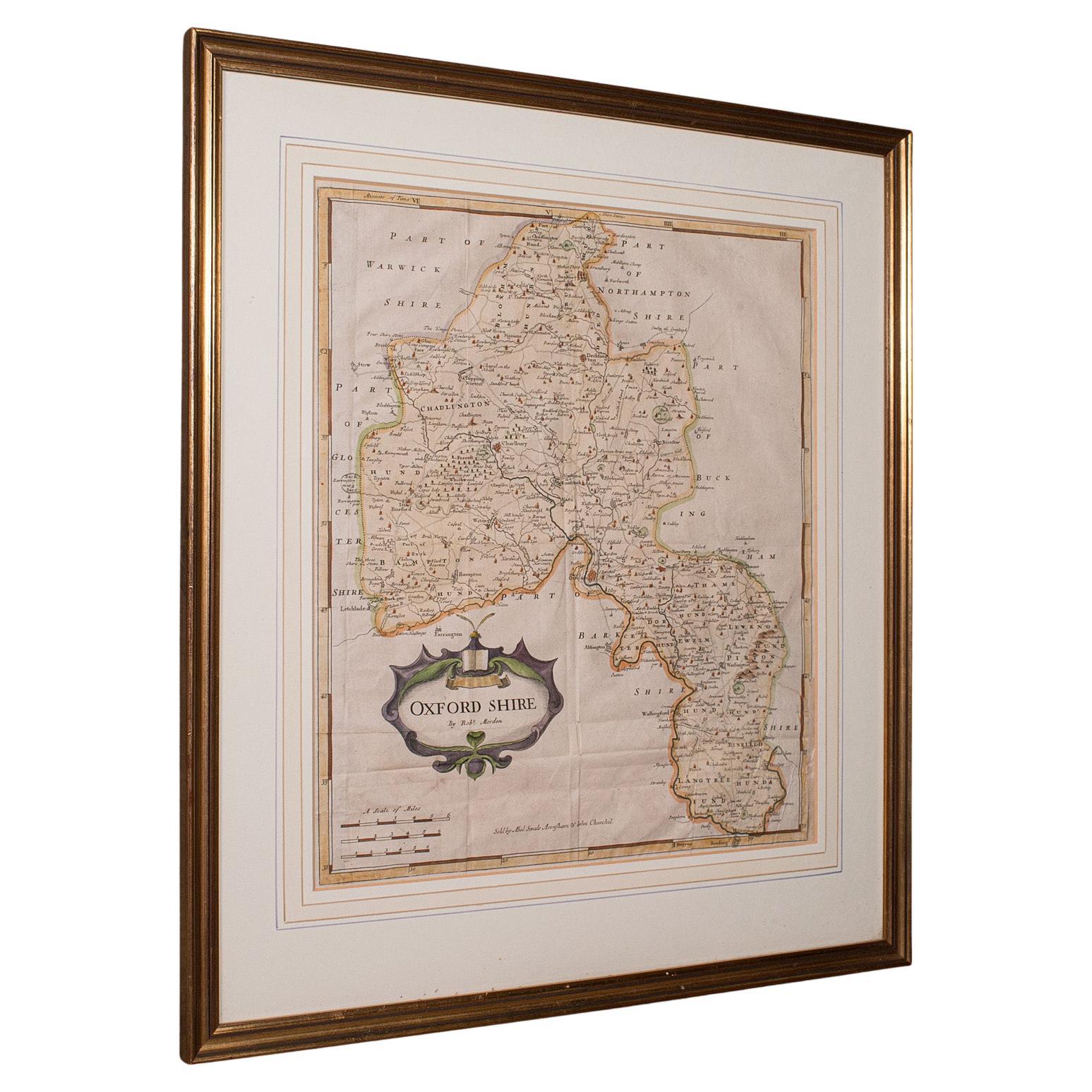
Antique Lithography Map, Oxfordshire, English, Framed Cartography, Robert Morden
Located in Hele, Devon, GB
This is an antique lithography map of Oxfordshire. An English, framed atlas engraving of cartographic interest by Robert Morden, dating to the late 17th century and later.
Superb l...
Category
Antique Late 17th Century British William and Mary Maps
Materials
Paper

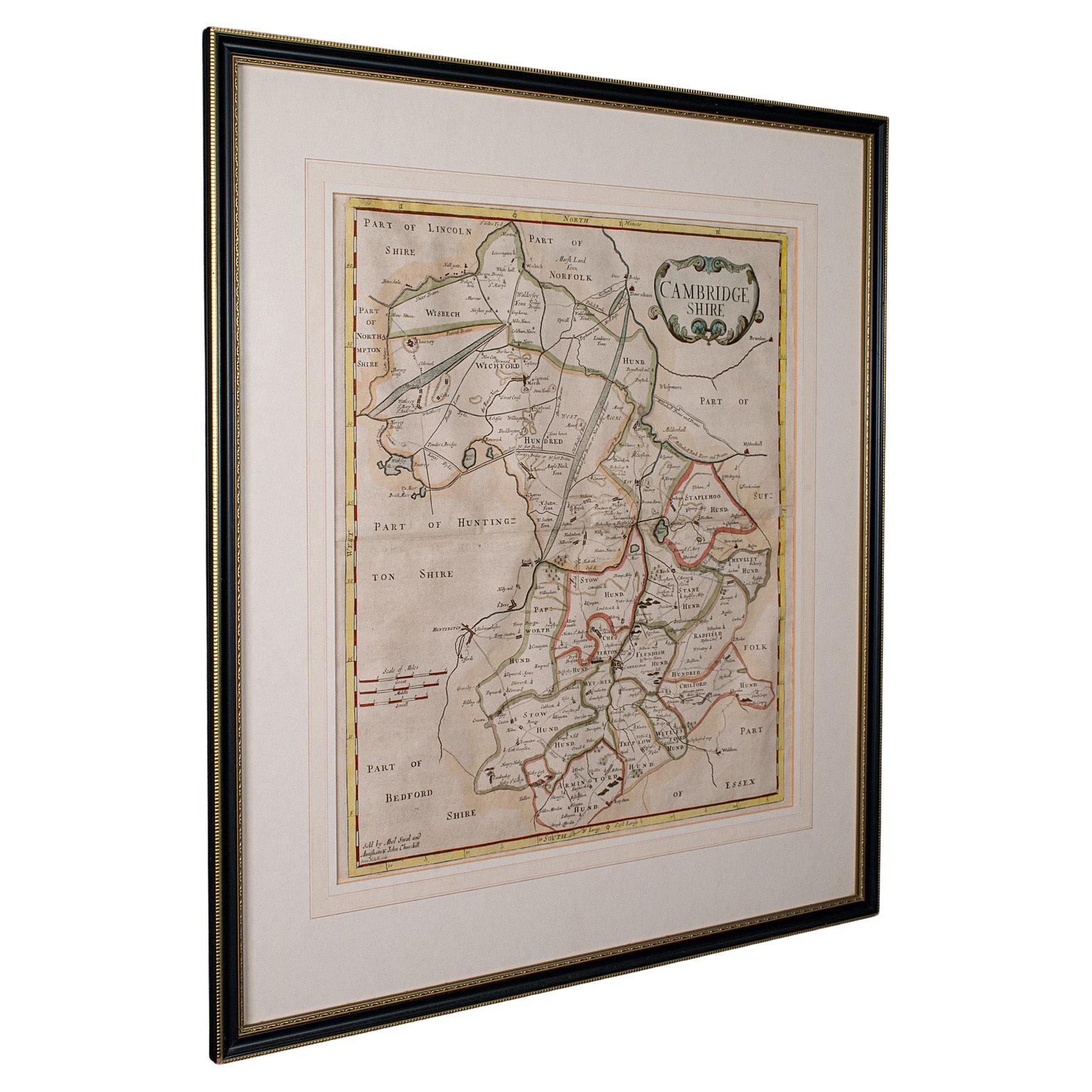
Antique County Map, Cambridgeshire, English, Framed Cartography, Robert Morden
Located in Hele, Devon, GB
This is an antique county map of Cambridgeshire. An English, framed atlas engraving of cartographic interest By Robert Morden, dating to the late 17th century and later.
Superb lit...
Category
Antique Early 18th Century British Other Maps
Materials
Glass, Wood, Paper
17th Century Nicolas Visscher Map of Southeastern Europe
Located in Hamilton, Ontario
A beautiful, highly detailed map of southeastern Europe by Nicolas Visscher. Includes regions of Northern Italy (showing the cities Bologna, Padua, and Venice), Bohemia, Austria (sho...
Category
Antique 17th Century Dutch Maps
Materials
Paper

$1,350 Sale Price
38% Off
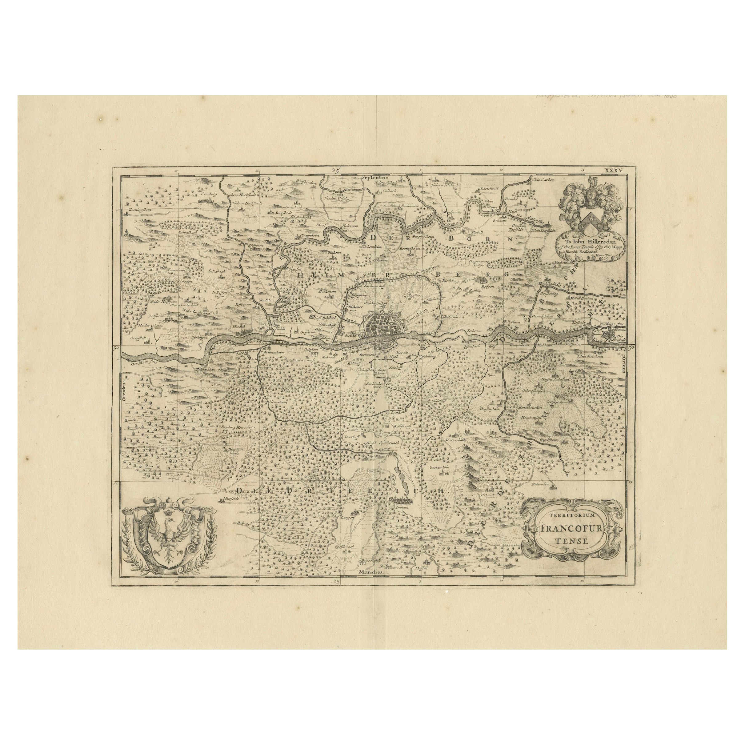
Territorium Francofurtens – Moses Pitt’s 17th-Century Map of Frankfurt
Located in Langweer, NL
Title: Territorium Francofurtens – Moses Pitt’s 17th-Century Map of Frankfurt
Description:
This rare 17th-century map, titled Territorium Francofurtens, was published by Moses ...
Category
Antique 1690s Maps
Materials
Paper
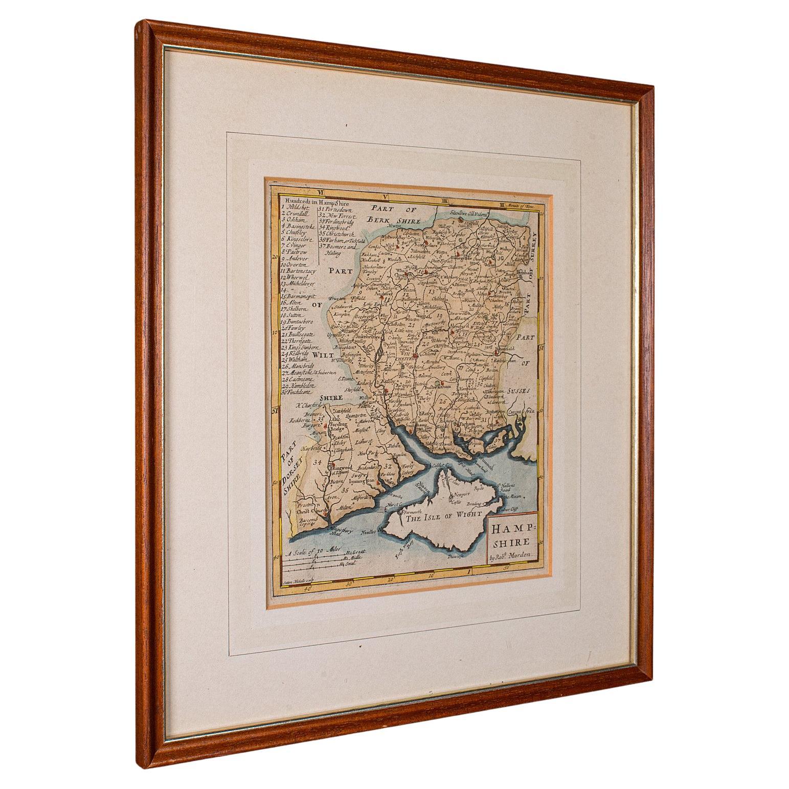
Antique County Map, Hampshire, English, Framed Cartography, Robert Morden, 1700
Located in Hele, Devon, GB
This is an antique county map of Hampshire. An English, framed atlas engraving of cartographic interest By Robert Morden, dating to the late 17th century and later.
Superb lithogra...
Category
Antique Late 17th Century British Other Maps
Materials
Glass, Wood, Paper

Recently Viewed
View AllMore Ways To Browse
Antique Map Vietnam
Antique Maps Colorado
Cuba Map
Kolkata Antique Furniture
Magellan Map
Missouri Antique Map
Naples Map
Nevada Antique Map
Raleigh Antique Furniture
Cambodia Antique Map
Caucasus Map
Ecuador Antique Map
Gambia Antique Map
Guyana Antique Map
Mariners Chart
Papua New Guinea Antique Map
Tunisia Antique Map
Ukraine Antique Map