1847 Guide Map of the U.S., from Phelps's Travellers Guide, Antique Map
View Similar Items


Want more images or videos?
Request additional images or videos from the seller
1 of 5
1847 Guide Map of the U.S., from Phelps's Travellers Guide, Antique Map
$5,800List Price
About the Item
- Dimensions:Height: 31.24 in (79.35 cm)Width: 35.5 in (90.17 cm)Depth: 4 in (10.16 cm)
- Materials and Techniques:Paper,Engraved
- Place of Origin:
- Period:
- Date of Manufacture:1847
- Condition:Wear consistent with age and use. Map is in good condition. Hand-coloring is intact and vibrant. Original fold lines visible, as issued.This map has been beautifully presented to archival standards in a custom frame.
- Seller Location:Colorado Springs, CO
- Reference Number:Seller: M0801stDibs: LU90974627263
About the Seller
4.9
Vetted Professional Seller
Every seller passes strict standards for authenticity and reliability
Established in 2010
1stDibs seller since 2011
464 sales on 1stDibs
Authenticity Guarantee
In the unlikely event there’s an issue with an item’s authenticity, contact us within 1 year for a full refund. DetailsMoney-Back Guarantee
If your item is not as described, is damaged in transit, or does not arrive, contact us within 7 days for a full refund. Details24-Hour Cancellation
You have a 24-hour grace period in which to reconsider your purchase, with no questions asked.Vetted Professional Sellers
Our world-class sellers must adhere to strict standards for service and quality, maintaining the integrity of our listings.Price-Match Guarantee
If you find that a seller listed the same item for a lower price elsewhere, we’ll match it.Trusted Global Delivery
Our best-in-class carrier network provides specialized shipping options worldwide, including custom delivery.More From This Seller
View All1847 Ornamental Map of the United States & Mexico by H. Phelps
Located in Colorado Springs, CO
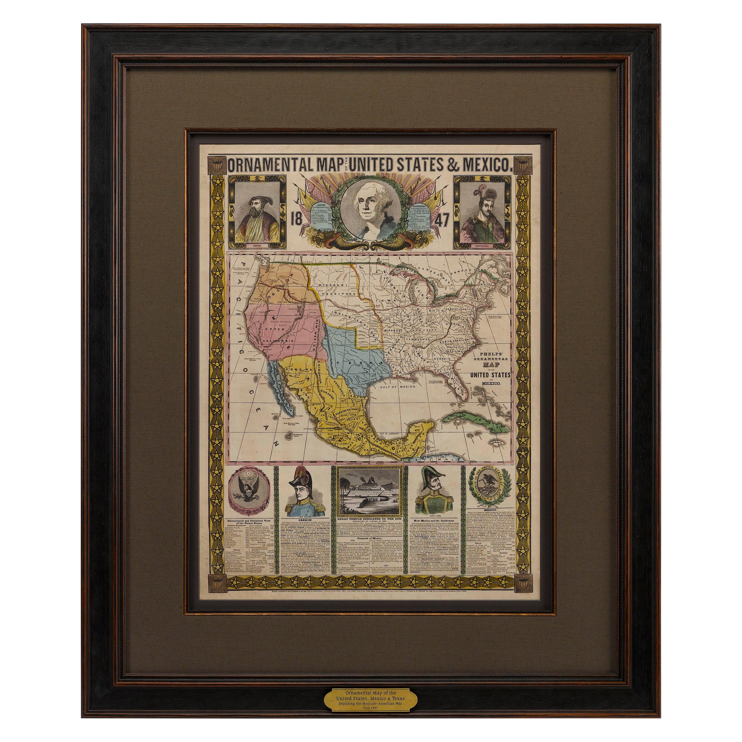
Offered is an original 1847 ornamental map of the U.S. entitled "Ornamental Map of the United States & Mexico" by Humphrey Phelps. The map was issued as an act of Congress by Phelps on Fulton Street, New York. The broadside is elaborately hand-colored.
This is a very detailed and graphic propaganda map of the United States expressing U.S. dominance of the North American continent. The hand-colored map proclaims the Manifest Destiny, with the recent acquisition of Upper California and Texas at the conclusion of the Mexican-American War. The newly acquired land is boldly colored, standing in stark contrast to the rest of the U.S. The map details a potential route for a railroad running from New York City, to Buffalo, to Chicago, then west along the Oregon Trail to Oregon City. This route anticipates the construction of the transcontinental railroad by nearly 20 years.
The map includes elaborately detailed renderings of George Washington, Hernan Cortez, and Montezuma at top to represent European expansion to the Americas. At bottom are four inset designs with text showing the following: a chronological history of the U.S. beginning from settlement to the U.S. victory in the Mexican-American war; an illustration of General Zachary Taylor with details on the Oregon Territory; an illustration of the Aztec Temple of the Sun in Tenochtitlan and a chronology of the Conquest of the Aztec Empire under Cortez; a portrait of General Antonio Lopez de Santa Anna...
Category
Antique 1840s American Maps
Materials
Paper

1812 United States Map, by Pierre Tardieu, Antique French Map Depicting the U.S.
By Pierre François Tardieu
Located in Colorado Springs, CO
1812 "United States of Nth America -- Carte des Etats-Unis De L'Amerique Septentrionale" Two-Sheet Map by Tardieu
This attractive map, published in Paris in 1812, is one of the most rare large format maps from the period. It features a view of the East Coast of the U.S. from Maryland to just below South Carolina. Additionally, Ellicott’s plan for the City of Washington D.C. is included at the top right and an illustration of Niagara Falls is shown at the bottom right with a description in both French and English. This extremely detailed map not only depicts the mountainous regions of the southeastern U.S., but also includes names of regions, rivers, and towns.
Based on the first state of Arrowsmith’s 4-sheet map of the United States, this map is completely engraved by Tardieu in Paris and showcases high quality engravings. This detailed map of the recently independent United States includes one of the largest and earliest examples of the Ellicott plan of Washington DC.
The artist, Pierre François Tardieu (PF Tardieu) was a very well-known map engraver, geographer, and illustrator. Awarded a bronze medal by King Louis-Phillipe for the accuracy and beauty of his map-making, Tardieu produced many fine works including maps of Louisiana...
Category
Antique 1810s French Maps
Materials
Paper

1847 Antique Map of Mexico, Texas and California by Samuel Augustus Mitchell
By Samuel Augustus Mitchell 1
Located in Colorado Springs, CO
Presented is the second edition of Samuel Augustus Mitchell's Map of Mexico, Including Yucatan & Upper California, an important map showing the progress of the Mexican-American War. ...
Category
Antique 1840s American Maps
Materials
Paper

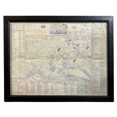
1943 "USO Map Guide to Washington"
Located in Colorado Springs, CO
This is a WWII map of Washington, DC, issued as a guide for service men and women visiting or working in the city during the war. The map was created by Allen F. Free and published a...
Category
Vintage 1940s American Mid-Century Modern Maps
Materials
Paper
"The United States from the Latest Authorities" Antique Wall Map, 1835
Located in Colorado Springs, CO
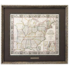
This is a 1835 map of “The United States from the Latest Authorities” by Ezra Strong. A hand-colored engraved wall map of the eastern half of the United States, this map has a large inset of the "Oregon District" and several engraved city views and two portraits.
The primary map extends to Mexico Texas and the Missouri Territory, showing the course of the Missouri River to Ft. Mandan and Old Ft. Mandan, and noting many forts along the river. The territories to the east of Missouri Territory are separately delineated as Sioux District and Huron District. The western details of the map are very good for a map of this time period, with many Native American settlements, villages, forts and other details noted.
The map is bordered with vignettes of Boston, New York, Philadelphia, Hartford, Cincinnati, and Baltimore. Each vignette notes the date settled, primary settler, and the population as of 1830. Two portraits of LaFayette and George Washington are presented in full length with related biographical information.
A large inset map at lower right shows the Oregon District, centered on the Columbia River and extending to the Rocky Mountains. This is one of the earliest commercial appearances of a separate map of Oregon...
Category
Antique 1830s American Maps
Materials
Paper

1856 U.S. Coast Survey Map of Chesapeake Bay and Delaware Bay
Located in Colorado Springs, CO
Presented is U.S. Coast Survey nautical chart or maritime map of Chesapeake Bay and Delaware Bay from 1856. The map depicts the region from Susquehanna, Maryland to the northern Outer Banks in North Carolina. It also shows from Richmond and Petersburg, Virginia to the Atlantic Ocean. The map is highly detailed with many cities and towns labeled throughout. Rivers, inlets, and bays are also labeled. Various charts illustrating more specific parts of the region are marked on the map using dotted lines. The lines form boxes, and the corresponding chart number and publication date are given. Extensive triangulation surveys were conducted the length of Chesapeake Bay and are illustrated here. Hampton Roads, Virginia is labeled, along with the James, York, and Rappahannock Rivers, which were all extensively surveyed.
The chart was published under the supervision of A. D. Bache, one of the most influential and prolific figures in the early history of the U.S. Coast Survey, for the 1856 Report of the Superintendent of the U.S. Coast Survey. Alexander Dallas Bache (1806-1867) was an American physicist, scientist, and surveyor. Bache served as the Superintendent of the U.S. Coast Survey from 1843 to 1865. Born in Philadelphia, Bache toured Europe and composed an important treatise on European Education. He also served as president of Philadelphia's Central High School and was a professor of natural history and chemistry at the University of Pennsylvania. Upon the death of Ferdinand Rudolph Hassler, Bache was appointed Superintendent of the United States Coast Survey.
The Office of the Coast Survey, founded in 1807 by President Thomas Jefferson and Secretary of Commerce Albert Gallatin...
Category
Antique 1850s American Maps
Materials
Paper

You May Also Like
Antique Map of the World by Balbi '1847'
Located in Langweer, NL
Antique map titled 'Planisphère'. Original antique map of the world. This map originates from 'Abrégé de Géographie (..)' by Adrien Balbi. Pub...
Category
Antique Mid-19th Century Maps
Materials
Paper

$238 Sale Price
20% Off
Antique Map of the British Isles by Balbi '1847'
Located in Langweer, NL
Antique map titled 'Iles Britanniques'. Original antique map of the British Isles. This map originates from 'Abrégé de Géographie (..)' by Adrien Balbi. ...
Category
Antique Mid-19th Century Maps
Materials
Paper

$142 Sale Price
20% Off
Antique Map of the United States by Balbi '1847'
Located in Langweer, NL
Antique map titled 'Etats-Unis'. Original antique map of the United States. This map originates from 'Abrégé de Géographie (..)' by Ad...
Category
Antique Mid-19th Century Maps
Materials
Paper

$190 Sale Price
20% Off
Antique Map of the City of London by Balbi '1847'
Located in Langweer, NL
Antique map titled 'London'. Original antique map of the city of London. This map originates from 'Abrégé de Géographie (..)' by Adrien Balbi. Published 1847.
Category
Antique Mid-19th Century Maps
Materials
Paper

$190 Sale Price
20% Off
Antique Map of the City of Berlin in Germany, '1847'
Located in Langweer, NL
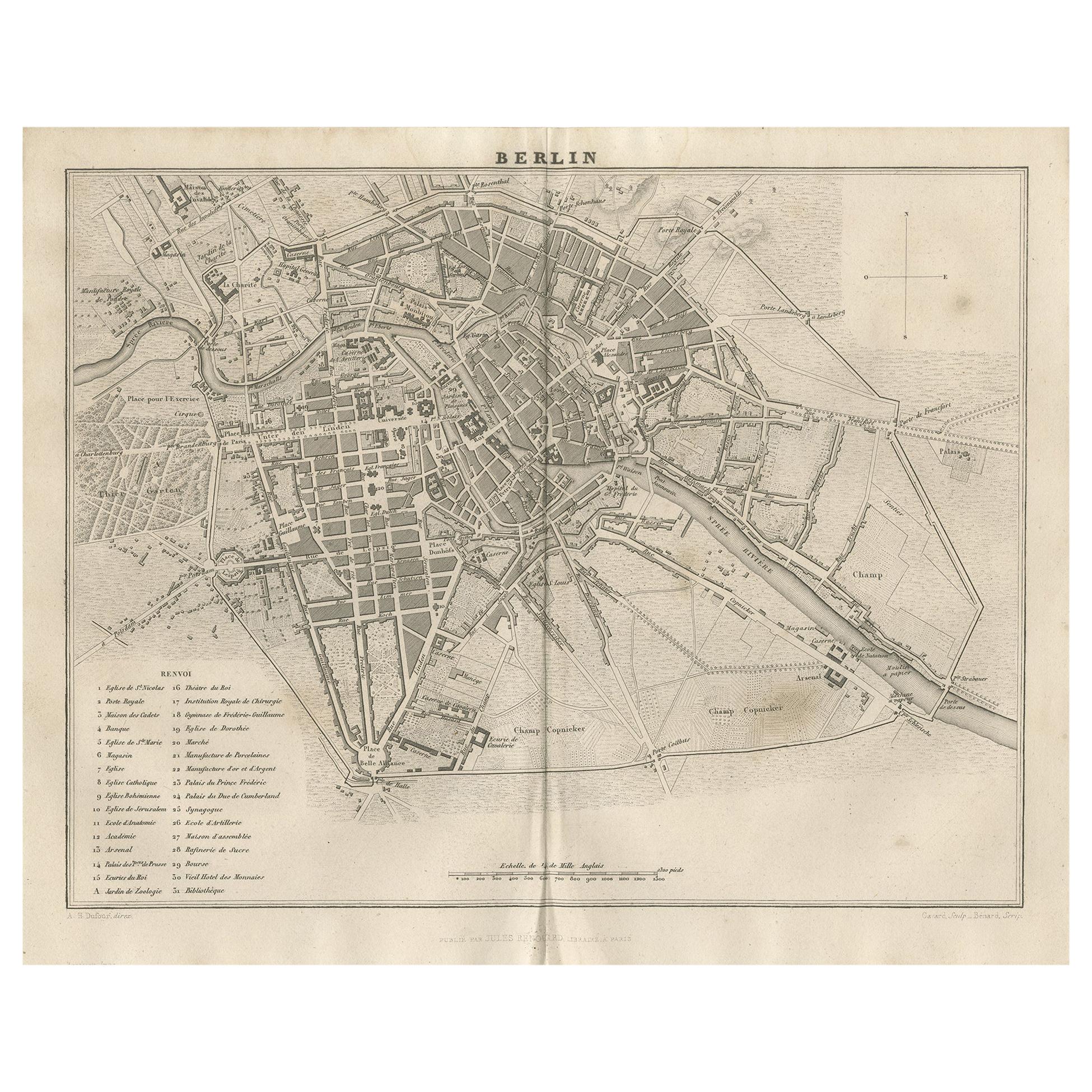
Antique map titled 'Berlin'. Original antique map of the city of Berlin, Germany. This map originates from 'Abrégé de Géographie (..)' by Adrien Balbi. Published 1847.
Category
Antique Mid-19th Century Maps
Materials
Paper

$142 Sale Price
20% Off
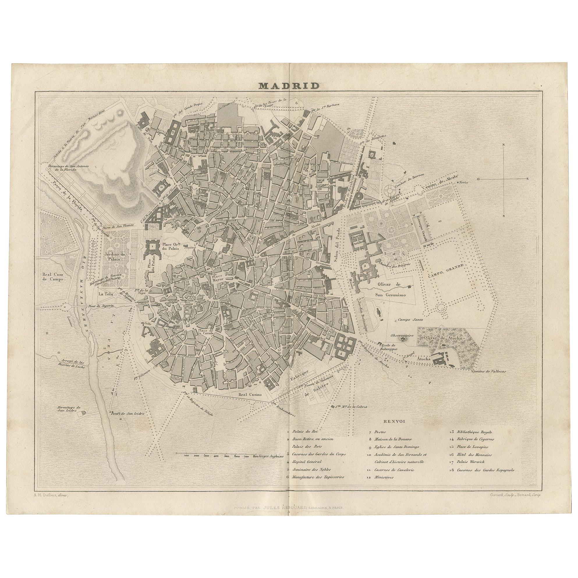
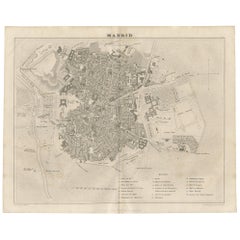
Antique Map of the City of Madrid by Balbi '1847'
Located in Langweer, NL
Antique map titled 'Madrid'. Original antique map of the city of Madrid, Spain. This map originates from 'Abrégé de Géographie (..)' by Adrien Balbi. Published 1847.
Category
Antique Mid-19th Century Maps
Materials
Paper
$142 Sale Price
20% Off
Recently Viewed
View AllMore Ways To Browse
Baltimore Antiques
Wood Minimalist Chair
Antique Imperial Furniture
Gold Modern Coffee Table
Large Side Tables
18th Century Gilded Furniture
Japanese Silver Ceramics
One Of A Kind Chair
Used Oak Dining Room Chairs
17th Century Plate
Childrens Vintage Poster
Chinese Ship
Nursery Art
Vintage Travel Poster Mid Century
Desk Key
Woven Silk Art
Carved Cabriole Table
Dark Antique Table