Items Similar to 1882 Map of Belgium and The Netherlands Highlighting Geographical Details


Want more images or videos?
Request additional images or videos from the seller
1 of 8
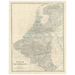
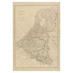
1882 Map of Belgium and The Netherlands Highlighting Geographical Details
$180.67
$225.8420% Off
£134.54
£168.1820% Off
€152
€19020% Off
CA$249.44
CA$311.8020% Off
A$276.54
A$345.6820% Off
CHF 145.33
CHF 181.6720% Off
MX$3,384.42
MX$4,230.5320% Off
NOK 1,815.07
NOK 2,268.8420% Off
SEK 1,703.63
SEK 2,129.5320% Off
DKK 1,157.28
DKK 1,446.6020% Off
About the Item
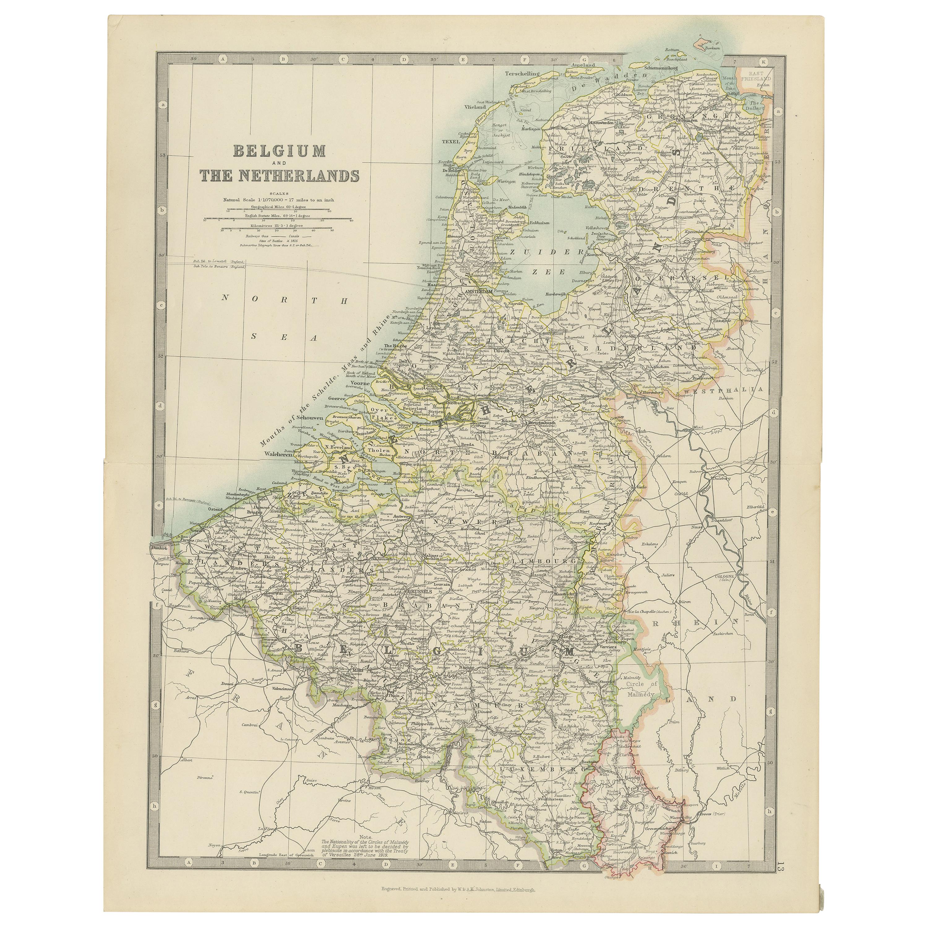
This 1882 map of Belgium and The Netherlands, published by Blackie and Son as part of the 'Comprehensive Atlas and Geography of the World,' offers a detailed representation of the two neighboring countries. It highlights their political boundaries, major cities, towns, and transportation networks, reflecting the infrastructure of the time. The map provides a clear view of key cities such as Amsterdam, Rotterdam, Brussels, and Antwerp, showcasing their roles as significant urban centers.
Topographical features, including rivers such as the Rhine, Meuse, and Scheldt, are prominently displayed, emphasizing the importance of waterways in the region's economy and transport. The map also captures the flat landscapes of The Netherlands, including the Zuiderzee (now largely reclaimed as the IJsselmeer) and the intricate network of canals. In Belgium, the rolling hills and urban density of Flanders and Wallonia are well-depicted. Subtle pastel shading is used to differentiate regions, adding a visual charm to the cartography.
Condition report: The map is in good condition with light toning and occasional spotting consistent with its age. The engraving remains sharp, and the colors are vibrant. There are no visible tears or repairs, and the margins are intact.
Framing tips: Use a classic wooden frame in walnut or dark oak to complement the map’s vintage character. A double mat with a cream or off-white inner mat and a soft green or light beige outer mat enhances the delicate pastel tones. UV-protective glass is recommended to prevent fading and preserve the map for long-term display.
- Dimensions:Height: 14.97 in (38 cm)Width: 11.03 in (28 cm)Depth: 0 in (0.02 mm)
- Materials and Techniques:
- Period:
- Date of Manufacture:1882
- Condition:Condition report: The map is in good condition with minimal edge wear. Slight toning and occasional spotting are present, consistent with its age. The engraving remains sharp, and the colors are well-preserved. Fold line in middle, as issued.
- Seller Location:Langweer, NL
- Reference Number:Seller: BG-13601-2-221stDibs: LU3054343556512
About the Seller
5.0
Recognized Seller
These prestigious sellers are industry leaders and represent the highest echelon for item quality and design.
Platinum Seller
Premium sellers with a 4.7+ rating and 24-hour response times
Established in 2009
1stDibs seller since 2017
2,609 sales on 1stDibs
Typical response time: <1 hour
- ShippingRetrieving quote...Shipping from: Langweer, Netherlands
- Return Policy
Authenticity Guarantee
In the unlikely event there’s an issue with an item’s authenticity, contact us within 1 year for a full refund. DetailsMoney-Back Guarantee
If your item is not as described, is damaged in transit, or does not arrive, contact us within 7 days for a full refund. Details24-Hour Cancellation
You have a 24-hour grace period in which to reconsider your purchase, with no questions asked.Vetted Professional Sellers
Our world-class sellers must adhere to strict standards for service and quality, maintaining the integrity of our listings.Price-Match Guarantee
If you find that a seller listed the same item for a lower price elsewhere, we’ll match it.Trusted Global Delivery
Our best-in-class carrier network provides specialized shipping options worldwide, including custom delivery.More From This Seller
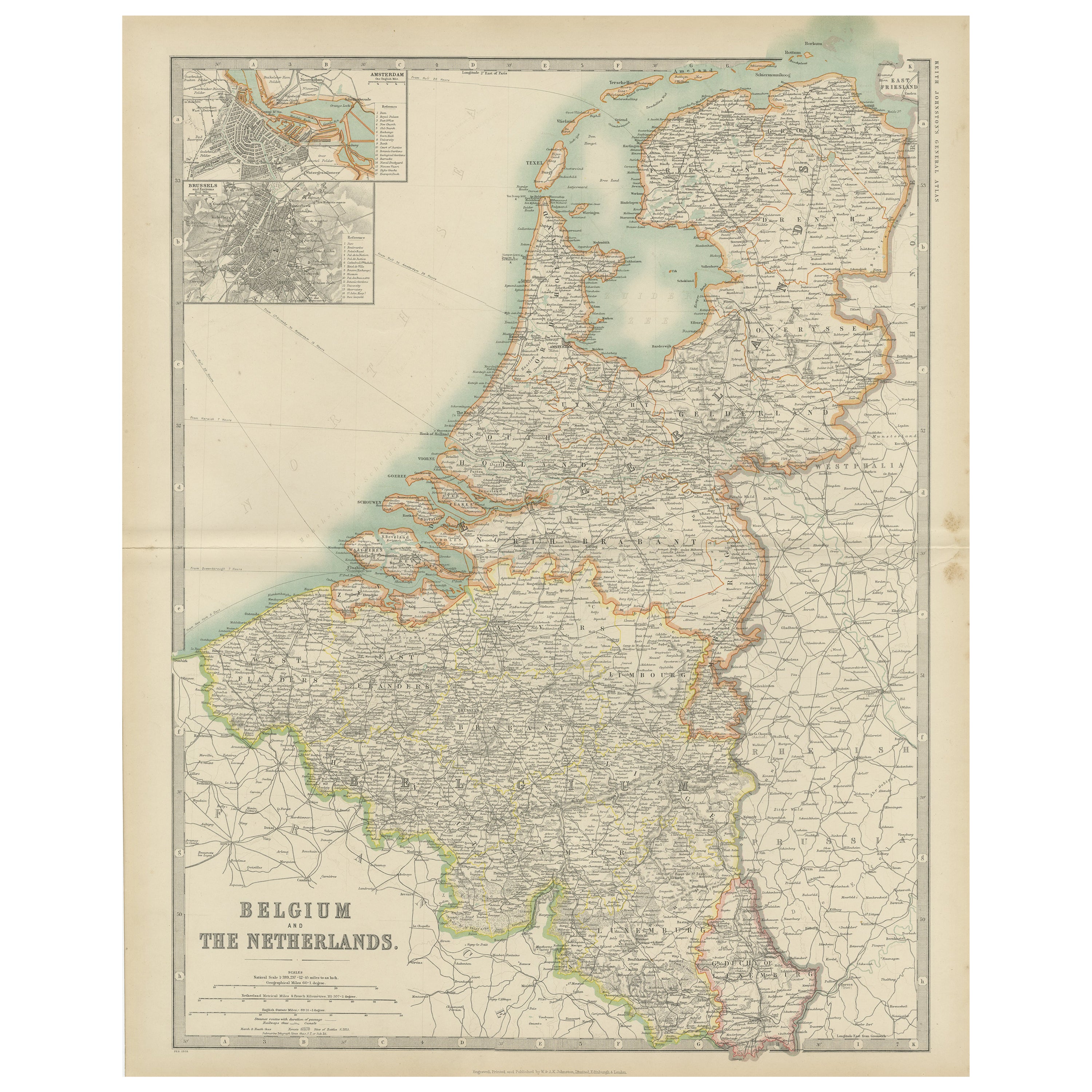
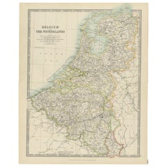
View AllAntique Map of Belgium and The Netherlands by A.K. Johnston, 1865
Located in Langweer, NL
Antique map titled 'Belgium and The Netherlands'. This map originates from the ‘Royal Atlas of Modern Geography’ by Alexander Keith Johnston. Published by William Blackwood and Sons,...
Category
Antique Mid-19th Century Maps
Materials
Paper
$261 Sale Price
20% Off
Antique Map of Belgium and the Netherlands by Johnston 'c.1920'
Located in Langweer, NL
Antique map titled 'Belgium and the Netherlands'. Original antique map of Belgium and the Netherlands. Published by W. & A.K. Johnston, circa 1920.
Category
20th Century Maps
Materials
Paper
$190 Sale Price
20% Off
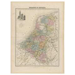
Antique Map of the Netherlands and Belgium, circa 1880
Located in Langweer, NL
Antique map titled 'Hollande et Belgique'. Old map of the Netherlands and Belgium. With decorative vignette of the Antwerp cathedral. This map o...
Category
Antique 19th Century Maps
Materials
Paper
$180 Sale Price
20% Off
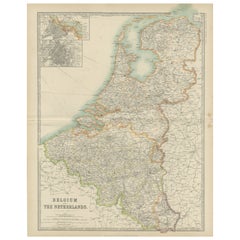
Antique Map of Belgium and the Netherlands by Johnston '1909'
Located in Langweer, NL
Antique map titled 'Belgium and The Netherlands'. Original antique map of Belgium and the Netherlands. With inset maps of Amsterdam and Brussels. This m...
Category
Early 20th Century Maps
Materials
Paper
$237 Sale Price
20% Off
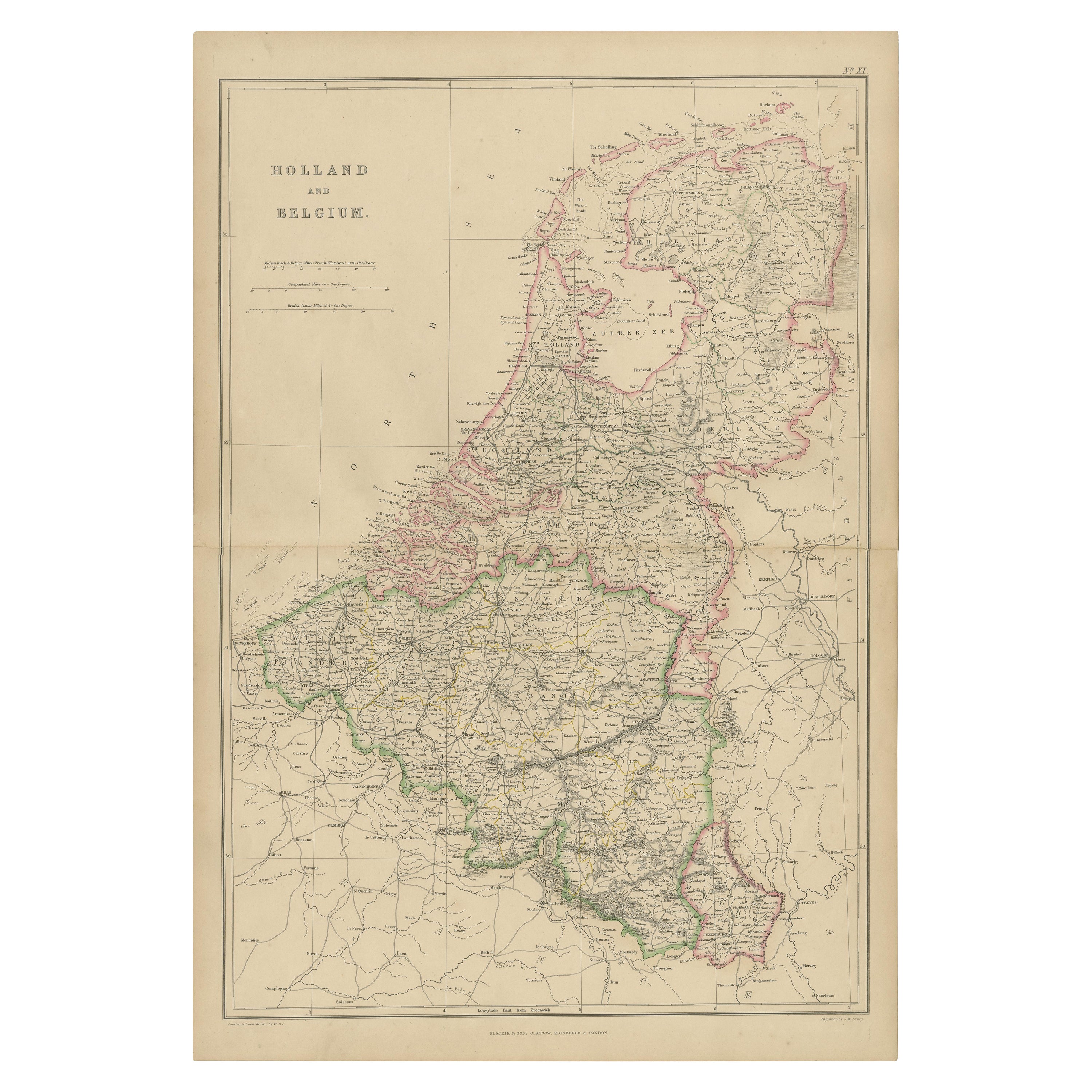
1859 Vintage Map of Holland and Belgium: Blackie's Imperial Geographic Insight
Located in Langweer, NL
The "Antique Map of Holland and Belgium" from 'The Imperial Atlas of Modern Geography', published by W. G. Blackie in 1859, is a significant hi...
Category
Antique Mid-19th Century English Maps
Materials
Paper
$237 Sale Price
20% Off
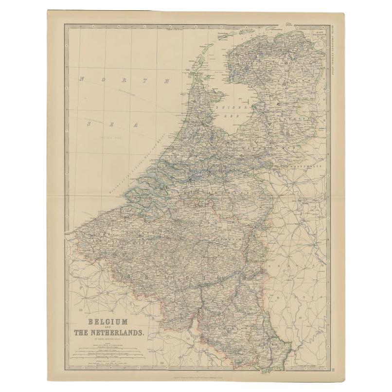
Antique Map of Belgium and the Netherlands by Johnston, 1882
By Alexander Keith Johnston
Located in Langweer, NL
Antique map titled 'Belgium and the Netherlands'. Old map of Belgium and the Netherlands. This map originates from 'The Royal Atlas of Modern Geography, Exhibiting, in a Series of En...
Category
Antique 19th Century Maps
Materials
Paper
$99 Sale Price
20% Off
You May Also Like
The Netherlands (Holland), Belgium and Luxemburg. Century Atlas antique map
Located in Melbourne, Victoria
'The Century Atlas. The Netherlands (Holland), Belgium and Luxemburg.'
Original antique map, 1903.
Inset maps of 'Amsterdam' and 'Brussels'.
Central fold as issued. Map name and num...
Category
Early 20th Century Victorian More Prints
Materials
Lithograph

Belgium and the Netherlands: A Hand-colored 17th Century Map by Visscher
By Nicolaus Visscher
Located in Alamo, CA
This is an original hand-colored 17th century map of Belgium by Nicolaus (Nicolas) Visscher II entitled "Belgium Foederatum emendate auctum et novissime editum", published in Amsterdam in 1678. The map shows the seven provinces comprising the Belgium federation or the Republic of the Seven United Netherlands or the Dutch Republic as it was also known. The republic was formed when an alliance of seven Dutch provinces in the Spanish Netherlands revolted against rule by Spain in 1579 (the Union of Utrecht) and declared their independence in 1581 (the Act of Abjuration). The seven provinces were Groningen, Frisia, Overijssel, Guelders, Utrecht, Holland and Zeeland. This was a predecessor state to the Netherlands and the first fully independent Dutch nation state. Amsterdam, Delft, Rouen, Utrecht, Brugge, Ghent, and Antwerp are all included on the map. A small inset map in the lower right depicts the course of the Maas River from Maastricht to Wessem. There is a decorative cartouche in the upper left corner and a distance scale cartouche in the lower right corner.
The map is presented in an attractive antiqued medium brown-colored wood frame with gold-colored inner and outer trim and a light tan-colored fabric mat. The frame measures 26.63" high by 30" wide by 0.75" deep. There is some darkening of the red areas in the map, presumably related to oxidation of the original iron containing pigment over time. There are also a few scattered spots. The map is otherwise in very good condition.
The Visscher family were one of the great cartographic families of the 17th century. Begun by Claes Jansz Visscher...
Category
Late 17th Century Other Art Style Landscape Prints
Materials
Engraving

1752 Vaugoundy Map of Flanders : Belgium, France, and the Netherlands, Ric.a002
Located in Norton, MA
Large Vaugoundy Map of Flanders:
Belgium, France, and the Netherlands
Colored -1752
Ric.a002
Description: This is a 1752 Didier Robert de Vaugondy map of Flanders. The map de...
Category
Antique 17th Century Unknown Maps
Materials
Paper

1643 Willem&Joan Blaeu Map NW Flanders "Flandriae Teutonicae Pars Prientalior
Located in Norton, MA
1643 Willem and Joan Blaeu map of northwest Flanders, entitled
"Flandriae Teutonicae Pars Prientalior,"
Ric0012
" Authentic" - Map of the northwest Fl...
Category
Antique 17th Century Dutch Maps
Materials
Paper

France, Northern Part. Century Atlas antique map
Located in Melbourne, Victoria
'The Century Atlas. France, Northern Part.'
Original antique map, 1903.
Inset maps of 'France in Provinces' and 'Paris and Vicinity'.
Central fold as issued. Map name and number pr...
Category
Early 20th Century Victorian More Prints
Materials
Lithograph

Antique Colored Belgium Map Flandria Gallica Flanders Henricus Hondius
Located in Dayton, OH
Antique hand colored map of Flanders, Belgium, engraved by Henricus Hondius.
Sans frame - 21.25” x 18”.
Category
Antique 19th Century Renaissance Maps
Materials
Paper

$262 Sale Price
25% Off
More Ways To Browse
Post Modern High Chairs
Vintage Vine Rug
Silver Metal Chair
Swedish Kilim
Vintage Scandanavian Chairs
Vintage Tropical Furniture
19th Century Red Glass
Antique French Console Table Tables
French 50s
Rusted Metal Art
Silver Bowl Large
Antique French Silk
Down Couch
Cobalt Blue Glass
Used Lighter Art
Blue Edge Glass
Mahogany 1950s Furniture
Solid Mahogany Table