Items Similar to 1882 Map of Brazil: Historic Borders, River Systems, and Coastal Regions


Want more images or videos?
Request additional images or videos from the seller
1 of 7
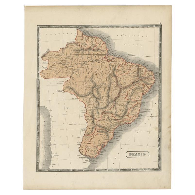
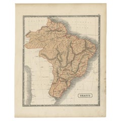
1882 Map of Brazil: Historic Borders, River Systems, and Coastal Regions
$297.62
£221.21
€250
CA$410.93
A$455.69
CHF 239.43
MX$5,567.80
NOK 2,995.63
SEK 2,811.91
DKK 1,903.62
About the Item
Title: 1882 Map of Brazil: Historic Borders, River Systems, and Coastal Regions
Description:
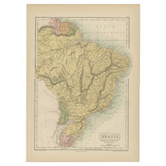
This 1882 map presents a detailed cartographic view of Brazil, the largest country in South America. It illustrates the geographical features, political divisions, and infrastructure of the nation during the late 19th century.
The map highlights Brazil’s extensive river systems, including the Amazon, São Francisco, and Paraná rivers, which were vital for transportation and commerce during this period. The coastline along the Atlantic Ocean is intricately detailed, showcasing key cities such as Rio de Janeiro, Salvador, and Recife. The political boundaries of Brazil’s provinces are marked with color outlines, providing insight into the administrative divisions of the time.
Additionally, the map includes an inset of parts of the surrounding region, offering a broader view of the geographical and political context of South America.
Condition Report:
The map is in very good condition, with a light patina typical of antique maps. The edges show minimal wear, and faint fold lines are visible but do not detract from the overall presentation. The printed details remain crisp and legible, while the coloring used to define boundaries and features is vibrant and well-preserved.
Tips on How to Frame This Map:
1. Choose a frame with a natural or dark wood finish, such as mahogany or walnut, to enhance the historical aesthetic of the map.
2. Use acid-free matting and backing to protect the map from further aging or discoloration.
3. Opt for UV-protective glass to shield the map from light exposure and preserve its vivid details.
4. Float-mounting the map can showcase its edges, emphasizing its original format, while a wide mat border provides a clean and elegant look.
5. Display the map in an area with indirect lighting to avoid glare and maintain its condition.
Recommended Matting Color:
Neutral tones like cream, beige, or light gray complement the map's aged appearance and subtle coloring. A soft green or pale blue mat can reflect Brazil’s lush forests and coastline, adding a contextual touch. Avoid bold or bright colors that might overpower the map’s intricate details.
- Dimensions:Height: 14.97 in (38 cm)Width: 22.45 in (57 cm)Depth: 0 in (0.02 mm)
- Materials and Techniques:
- Period:
- Date of Manufacture:1882
- Condition:Good condition, folding line in the middle. The outer borders are slightly discolored due to age, but not the image. This map is ideal for framing. Study the image carefully.
- Seller Location:Langweer, NL
- Reference Number:Seller: BG-13601-2-701stDibs: LU3054343552362
About the Seller
5.0
Recognized Seller
These prestigious sellers are industry leaders and represent the highest echelon for item quality and design.
Platinum Seller
Premium sellers with a 4.7+ rating and 24-hour response times
Established in 2009
1stDibs seller since 2017
2,609 sales on 1stDibs
Typical response time: <1 hour
- ShippingRetrieving quote...Shipping from: Langweer, Netherlands
- Return Policy
Authenticity Guarantee
In the unlikely event there’s an issue with an item’s authenticity, contact us within 1 year for a full refund. DetailsMoney-Back Guarantee
If your item is not as described, is damaged in transit, or does not arrive, contact us within 7 days for a full refund. Details24-Hour Cancellation
You have a 24-hour grace period in which to reconsider your purchase, with no questions asked.Vetted Professional Sellers
Our world-class sellers must adhere to strict standards for service and quality, maintaining the integrity of our listings.Price-Match Guarantee
If you find that a seller listed the same item for a lower price elsewhere, we’ll match it.Trusted Global Delivery
Our best-in-class carrier network provides specialized shipping options worldwide, including custom delivery.More From This Seller
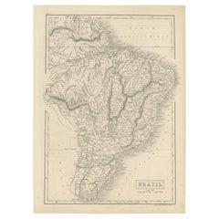
View AllAntique Map of Brazil, Including Part of Colombia, Peru and Chili, c.1880
Located in Langweer, NL
Antique map South America titled 'Brazil'. This map depicts Brazil and its surroundings including part of Colombia, Peru and Chili. Source un...
Category
Antique 19th Century Maps
Materials
Paper
$238 Sale Price
20% Off
Antique Map of Brazil with Original Outline Hand-Colouring, c.1844
Located in Langweer, NL
Antique map titled 'Brazil'. Beautiful map with outline color of Brazil, engraved by S. Hall.
Artists and Engravers: Sydney Hall (1788-1831) was one of the most recognised and prolific British map...
Category
Antique 19th Century Maps
Materials
Paper
$228 Sale Price
20% Off
Antique Map of Brazil by Levasseur '1875'
Located in Langweer, NL
Antique map titled 'Carte du Brésil'. Large map of Brazil, with small fold out. This map originates from 'Atlas de Géographie Moderne Physique et Politiq...
Category
Antique Late 19th Century French Maps
Materials
Paper
$380 Sale Price
20% Off
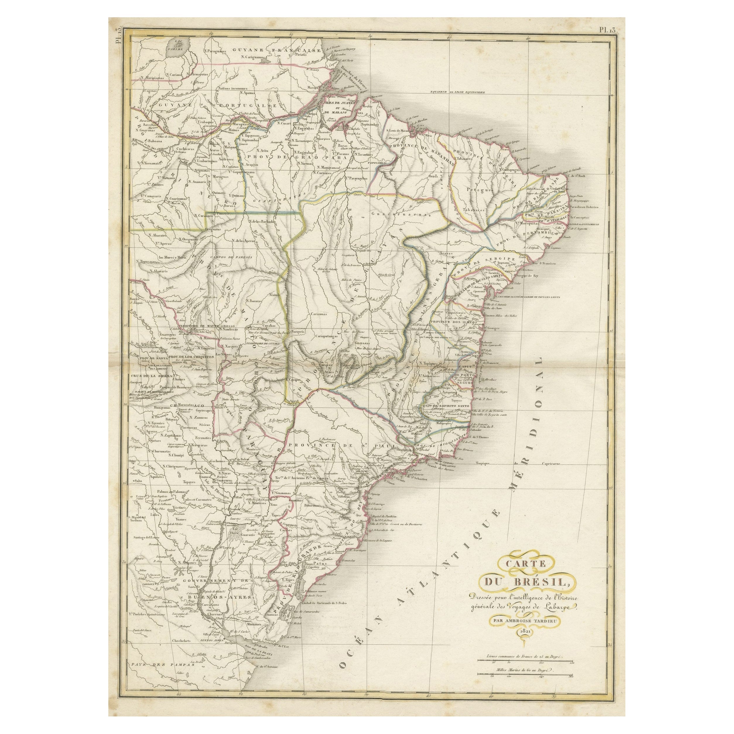
Antique Map of Brazil Extending South to the Mouth of the Rio de la Plata
Located in Langweer, NL
Antique map titled 'Carte du Brésil'. ?Beautiful map of Brazil extending south to the mouth of the Rio de la Plata and Buenos-Aires in Argentina. Published by Tardieu, 1821.
Pier...
Category
Antique Early 19th Century Maps
Materials
Paper
$228 Sale Price
20% Off
Antique Map of Brazil by Wyld, '1845'
Located in Langweer, NL
Antique map titled 'Empire of Brazil'. Original antique map of Brazil. This map originates from 'An Atlas of the World, Comprehending Separate Ma...
Category
Antique Mid-19th Century Maps
Materials
Paper

$238 Sale Price
20% Off
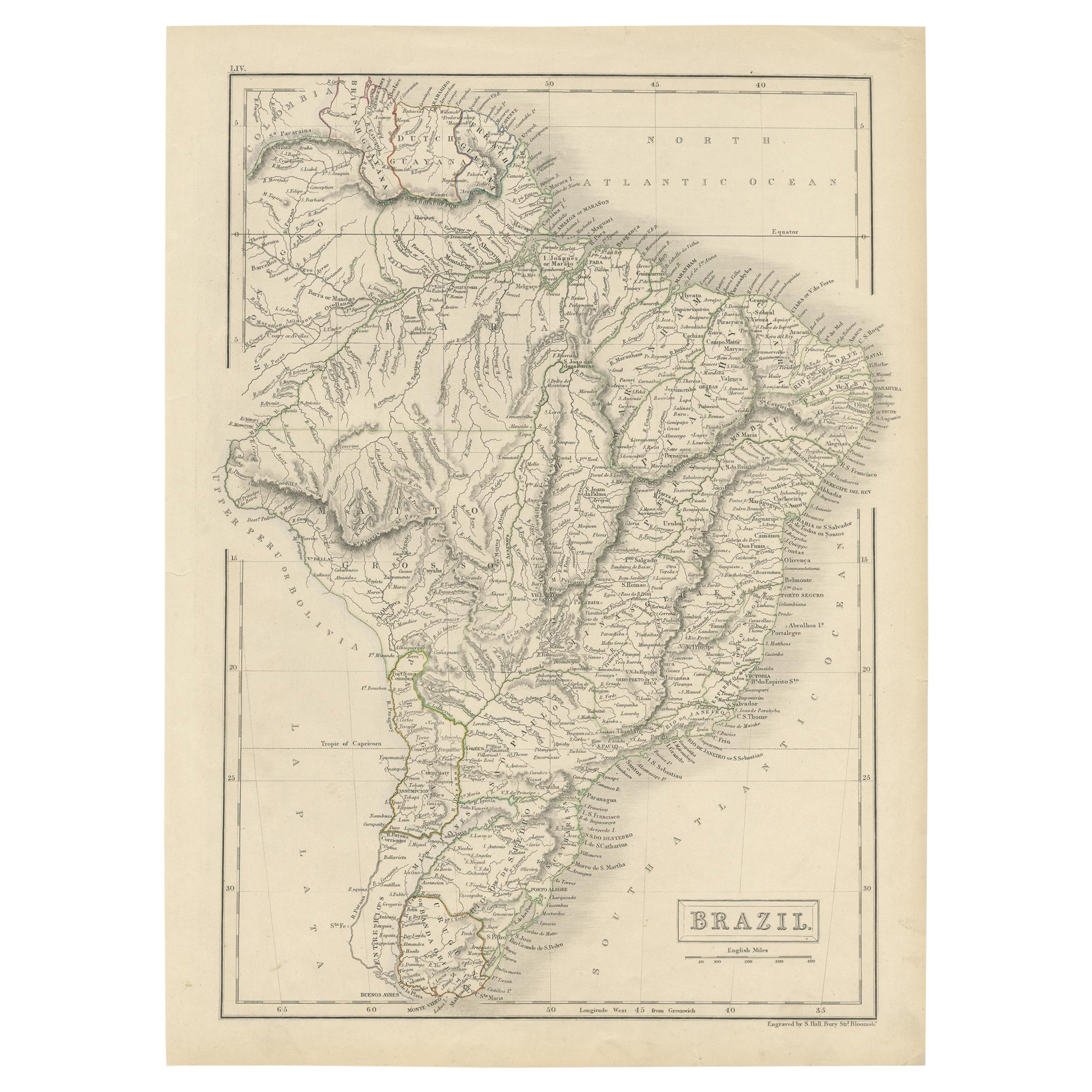
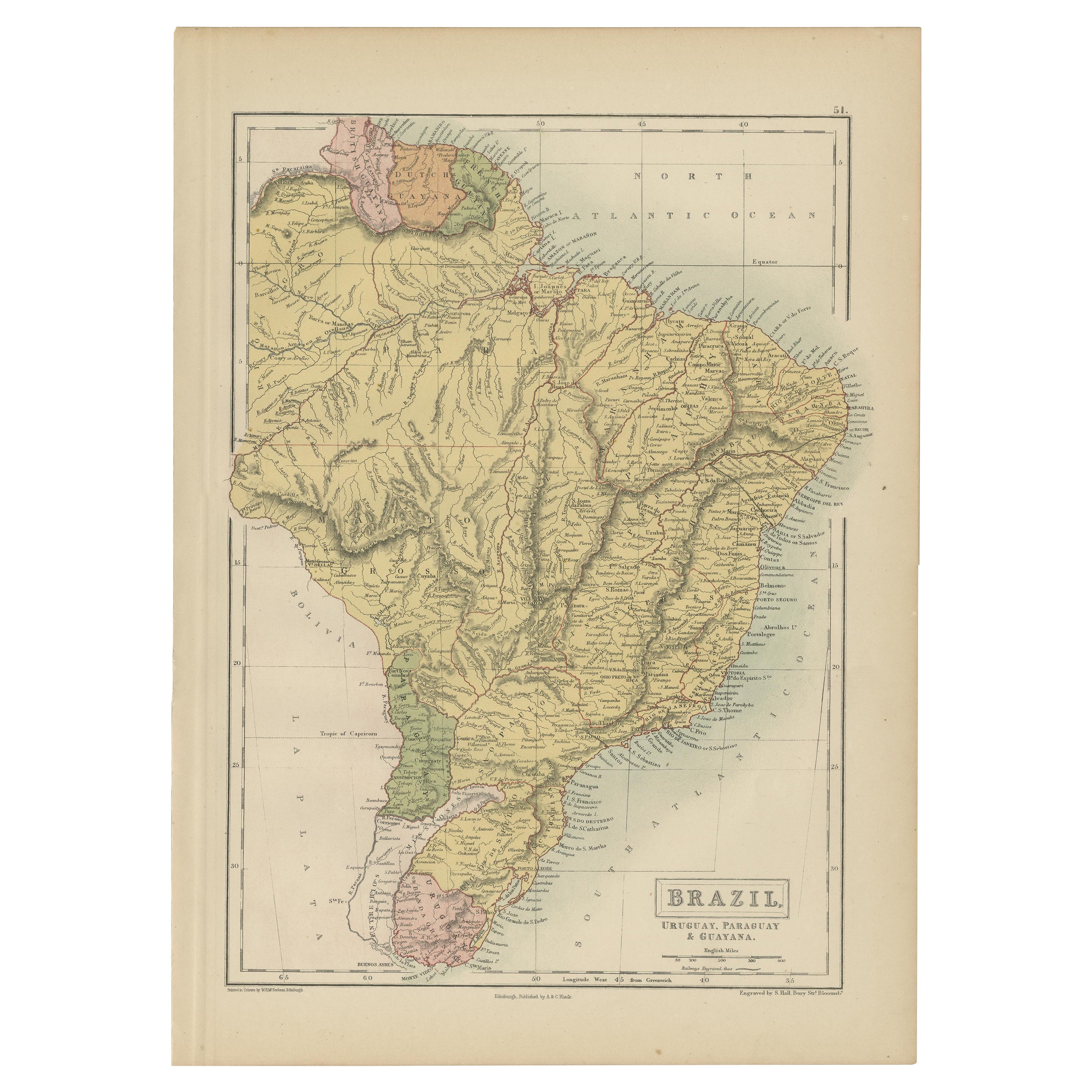
Antique Map of Brazil, Uruguay, Paraguay and Guyana by A & C. Black, 1870
Located in Langweer, NL
Antique map titled 'Brazil'. Original antique map of Brazil, Uruguay, Paraguay and Guyana. This map originates from ‘Black's General Atlas of The...
Category
Antique Late 19th Century English Maps
Materials
Paper
You May Also Like
Carte du Bresil, antique 1860s engraved map of Brazil
Located in Melbourne, Victoria
'Carte du Bresil'
Engraving with original outline colouring, circa 1860, by Alexandre Vuillemin, published in Paris.
31cm by 41cm (sheet)
21.5cm by 31.5cm (image)
Category
Late 19th Century Victorian More Prints
Materials
Lithograph

South America, Eastern Part. Century Atlas antique vintage map
Located in Melbourne, Victoria
'The Century Atlas. South America. Eastern Part'
Original antique map, 1903.
Inset map 'Rio de Janeiro and Vicinity'.
Central fold as issued. Map name and number printed on the rev...
Category
Early 20th Century Victorian More Prints
Materials
Lithograph

South America, North-West Part. Century Atlas antique vintage map
Located in Melbourne, Victoria
'The Century Atlas. South America, North-West Part'
Original antique map, 1903.
Central fold as issued. Map name and number printed on the reverse corners.
Sheet 40cm by 29.5cm.
Category
Early 20th Century Victorian More Prints
Materials
Lithograph

Original Antique Decorative Map of South America-West Coast, Fullarton, C.1870
Located in St Annes, Lancashire
Great map of Chili, Peru and part of Bolivia
Wonderful figural border
From the celebrated Royal Illustrated Atlas
Lithograph. Original color.
Published by Fullarton, Edi...
Category
Antique 1870s Scottish Maps
Materials
Paper

Antique Lithography Map, South America, English, Framed, Cartography, Victorian
Located in Hele, Devon, GB
This is an antique lithography map of South America. An English, framed atlas engraving of cartographic interest by John Rapkin , dating to the early Victorian period and later, circ...
Category
Antique Mid-19th Century British Early Victorian Maps
Materials
Wood

Antique Map of South America in Roma Frame
Located in Malibu, CA
Antique map of South America. Displayed in a new Roma frame with museum quality matting. Custom frame in platinum. No print date, but cert...
Category
Antique Late 19th Century Victorian Prints
Materials
Hardwood, Paper

More Ways To Browse
Black Crystal Glasses
Baker Furniture By
Oak Library
T Chair
Antique Italian Chairs
Antique Victorian Dining Tables
Veneer Dining Tables
Antique Brass And Copper
Antique English Country Furniture
Antique Russian Rugs
Beni Ourain Rugs
Glass Top Wood Base Coffee Tables
Inlaid Wood Frame
Large Antique Tapestry Tapestries
Large Antique Tapestry
Mid Century Modern Corner Chair
Sterling Silver Flatware Set Service For 12
1970s Brass Glass Coffee Table