Items Similar to 19th Century Lithograph Map of Lower Manhattan, New York


Want more images or videos?
Request additional images or videos from the seller
1 of 11
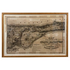
19th Century Lithograph Map of Lower Manhattan, New York
$620
$77520% Off
£468.17
£585.2120% Off
€539.51
€674.3920% Off
CA$875.08
CA$1,093.8520% Off
A$964.76
A$1,205.9520% Off
CHF 504.73
CHF 630.9120% Off
MX$11,835.81
MX$14,794.7620% Off
NOK 6,353.56
NOK 7,941.9620% Off
SEK 5,941.59
SEK 7,426.9820% Off
DKK 4,029.08
DKK 5,036.3520% Off
About the Item
1859 hand colored map of Lower Manhattan or New Amsterdam by George H. Moore.
- Dimensions:Height: 25.5 in (64.77 cm)Width: 31 in (78.74 cm)Depth: 1 in (2.54 cm)
- Style:Folk Art (Of the Period)
- Materials and Techniques:
- Place of Origin:
- Period:
- Date of Manufacture:1859
- Condition:Wear consistent with age and use. Minor losses. Minor structural damages.
- Seller Location:Haddonfield, NJ
- Reference Number:Seller: 322071stDibs: LU943418728312
About the Seller
5.0
Platinum Seller
Premium sellers with a 4.7+ rating and 24-hour response times
Established in 2010
1stDibs seller since 2012
2,031 sales on 1stDibs
Typical response time: <1 hour
- ShippingRetrieving quote...Shipping from: Haddonfield, NJ
- Return Policy
Authenticity Guarantee
In the unlikely event there’s an issue with an item’s authenticity, contact us within 1 year for a full refund. DetailsMoney-Back Guarantee
If your item is not as described, is damaged in transit, or does not arrive, contact us within 7 days for a full refund. Details24-Hour Cancellation
You have a 24-hour grace period in which to reconsider your purchase, with no questions asked.Vetted Professional Sellers
Our world-class sellers must adhere to strict standards for service and quality, maintaining the integrity of our listings.Price-Match Guarantee
If you find that a seller listed the same item for a lower price elsewhere, we’ll match it.Trusted Global Delivery
Our best-in-class carrier network provides specialized shipping options worldwide, including custom delivery.More From This Seller
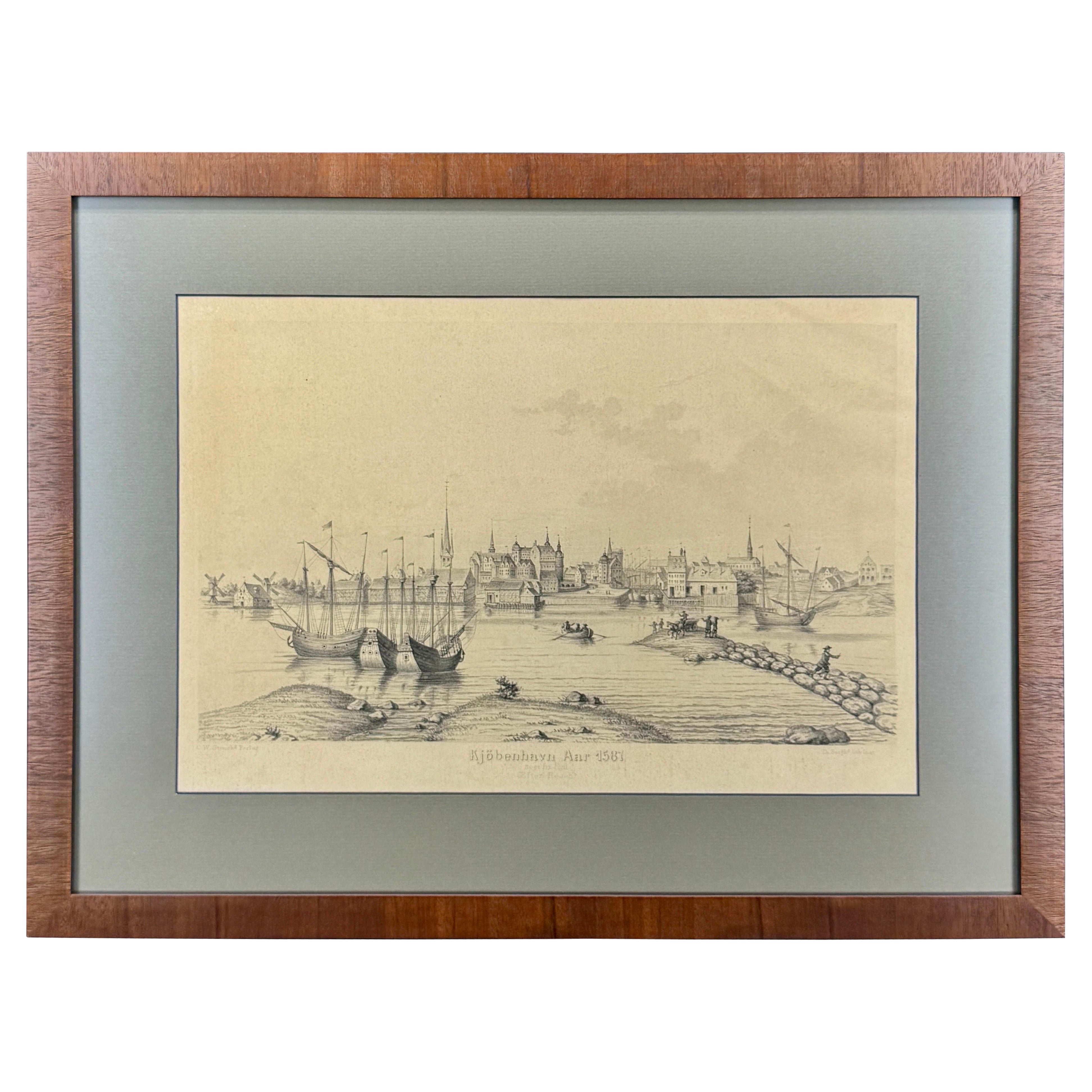
View All19th Century Reprint of 16th Century Harbor Map of Copenhagen
Located in Haddonfield, NJ
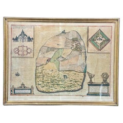
This reprint of 1587 antique map of Copenhagen, Denmark retains its original mid-century mat and has been recently reframed in classic wood frame. The muted sepia colored map is a wo...
Category
Antique 1880s Danish Baroque Maps
Materials
Wood, Paper

16th Century Antique Map of Ven Framed in Gold
Located in Haddonfield, NJ
Ven (older Swedish spelling Hven), is a Swedish island in the Öresund strait laying between Skåne, Sweden and Zealand and Denmark. The island was historically under Danish rule. Dani...
Category
Antique 16th Century Danish Baroque Maps
Materials
Wood, Paper
18th Century Map of French Pyrenees Region of France
Located in Haddonfield, NJ
An antique map titled "Principatus Benearnia, La Principaute De Bearn" created by the renowned Dutch cartographer Willem Janszoon Blaeu.
It depicts the Principality of Bearn, a histo...
Category
Antique 1880s Danish Baroque Maps
Materials
Wood, Paper

Set of Two 19th Century French Hand-Colored Regional Maps
Located in Haddonfield, NJ
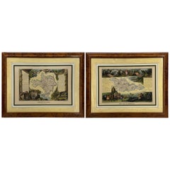
These historical regional maps depict the “Dépt de la Moselle" (Department of Moselle) and the Departement de Gard in France. Both pieces date back to the 19th Century, given their s...
Category
Antique 19th Century French Empire Drawings
Materials
Wood, Paper
Mid-Century Framed Print of View of Innsbruck from Artist Durer
Located in Haddonfield, NJ
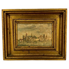
View of Innsbruck Harbor, on the river of Inn, Austria in a later print of one Durer's pieces, framed in New York City in the 1960's by Catalda Fine Arts, Inc.
Impressive artwork de...
Category
Mid-20th Century Austrian Renaissance Prints
Materials
Wood, Paper
18th C. Set of 3 Etchings of Harbor Scenes in Gilt Frames
By Pierre Mortier, Pieter Schenk the Elder
Located in Haddonfield, NJ
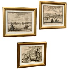
A set of three antique Dutch engravings and etchings from the 18th Century. This set has been professionally framed in newer gilt frames and feature acid-free paper to protect these...
Category
Antique 18th Century Dutch Baroque Prints
Materials
Paper, Boxwood, Paint
You May Also Like
Vintage Oversized New York City Lower Manhattan 1840s Map Print
Located in Dayton, OH
Vintage late 20th century reproduction print of New York City featuring lower Manhattan in 1840.
Category
Late 20th Century Victorian Maps
Materials
Paper

$750 Sale Price
25% Off
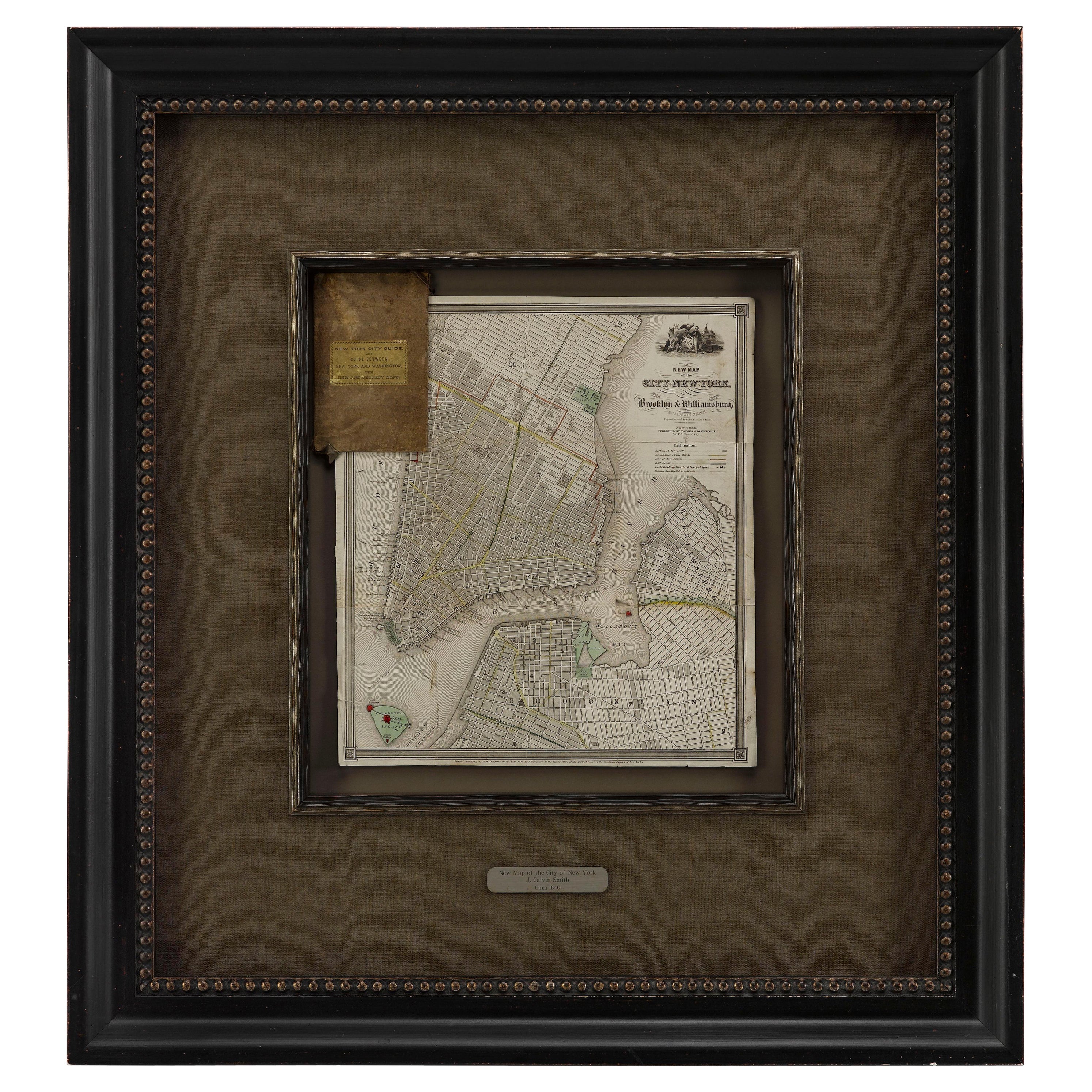
1840 "New Map of the City of New York With Part of Brooklyn & Williamsburg"
Located in Colorado Springs, CO
Presented is a hand-colored, engraved folding map titled "New Map of the City of New York With Part of Brooklyn & Williamsburg" by J. Calvin Smith. The map was issued bound in the bo...
Category
Antique 1840s American Maps
Materials
Paper

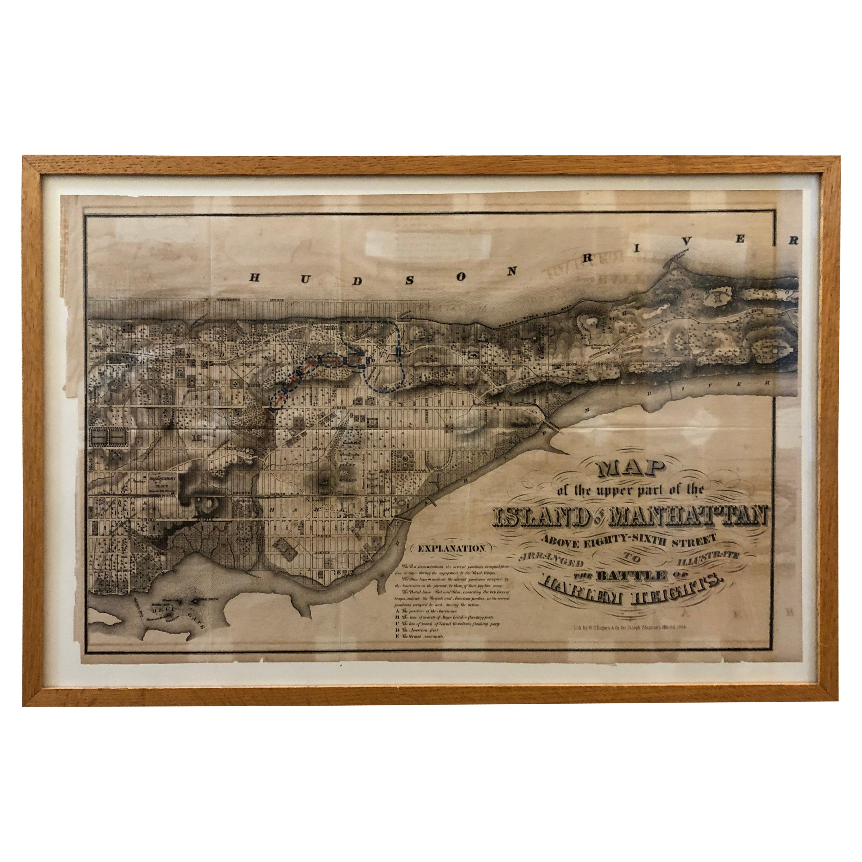
1868 Map of the Upper Part of the Island of Manhattan Above 86th Street
By Wm. Rogers Mfg. Co.
Located in San Francisco, CA
This wonderful piece of New York City history is over 150 years old. It depicts 86th street and above. It was lithographed by WC Rogers and company. It was made to show what was the Battle of Harlem during the Revolutionary war...
Category
Antique 1860s American American Colonial Maps
Materials
Paper
Rare Original Map of New Amsterdam (New York) – “Restitutio”, ca. 1674 –
Located in Dronten, NL
An exceptionally rare and original 17th-century engraving of New Amsterdam, now New York City, published by the renowned Amsterdam cartographer Carel (Carolus) Allard around 1674. Kn...
Category
Antique 17th Century Dutch Maps
Materials
Paper

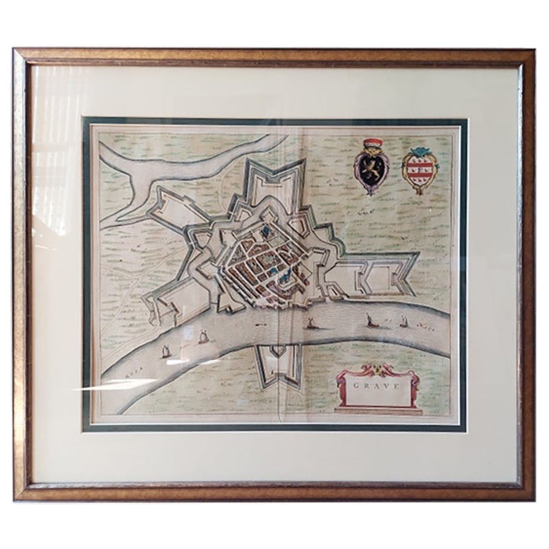
Antique Map of the City of Grave by Blaeu, 1649
Located in Langweer, NL
Antique map titled 'Grave'. Original antique map of the city of Grave, the Netherlands. Published by J. Blaeu, 1649.
Artists and Engravers: Joan Blaeu (23 September 1596 - 28 May...
Category
Antique 17th Century Maps
Materials
Paper

$669 Sale Price
20% Off
Antique Lithography Map, Isle of Thanet, Kent, English, Cartography, Victorian
Located in Hele, Devon, GB
This is an antique lithography map of The Isle of Thanet in Kent. An English, framed atlas engraving of cartographic interest, dating to the mid 19th century and later.
Superb litho...
Category
Antique Mid-19th Century British Victorian Maps
Materials
Wood

More Ways To Browse
Antique Map New York
Used Office Furniture Manhattan
Map Of Austria
Antique Maps Of Africa
Antique Map India
Antique Map Of The South Of France
Antique English Maps
Map Of Ireland
Map Of Great Britain
Miniature Maps
Ancient Maps
Iran Map
Antique Mining
Antique Maps Indonesia
Java Map
Antique Atlas Furniture
Map Railroad
China Map