Items Similar to Álava in Northern Spain: The Geography of Basque Heritage and Terrain, 1902

Want more images or videos?
Request additional images or videos from the seller
1 of 6
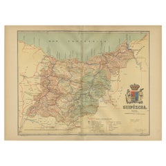
Álava in Northern Spain: The Geography of Basque Heritage and Terrain, 1902
About the Item
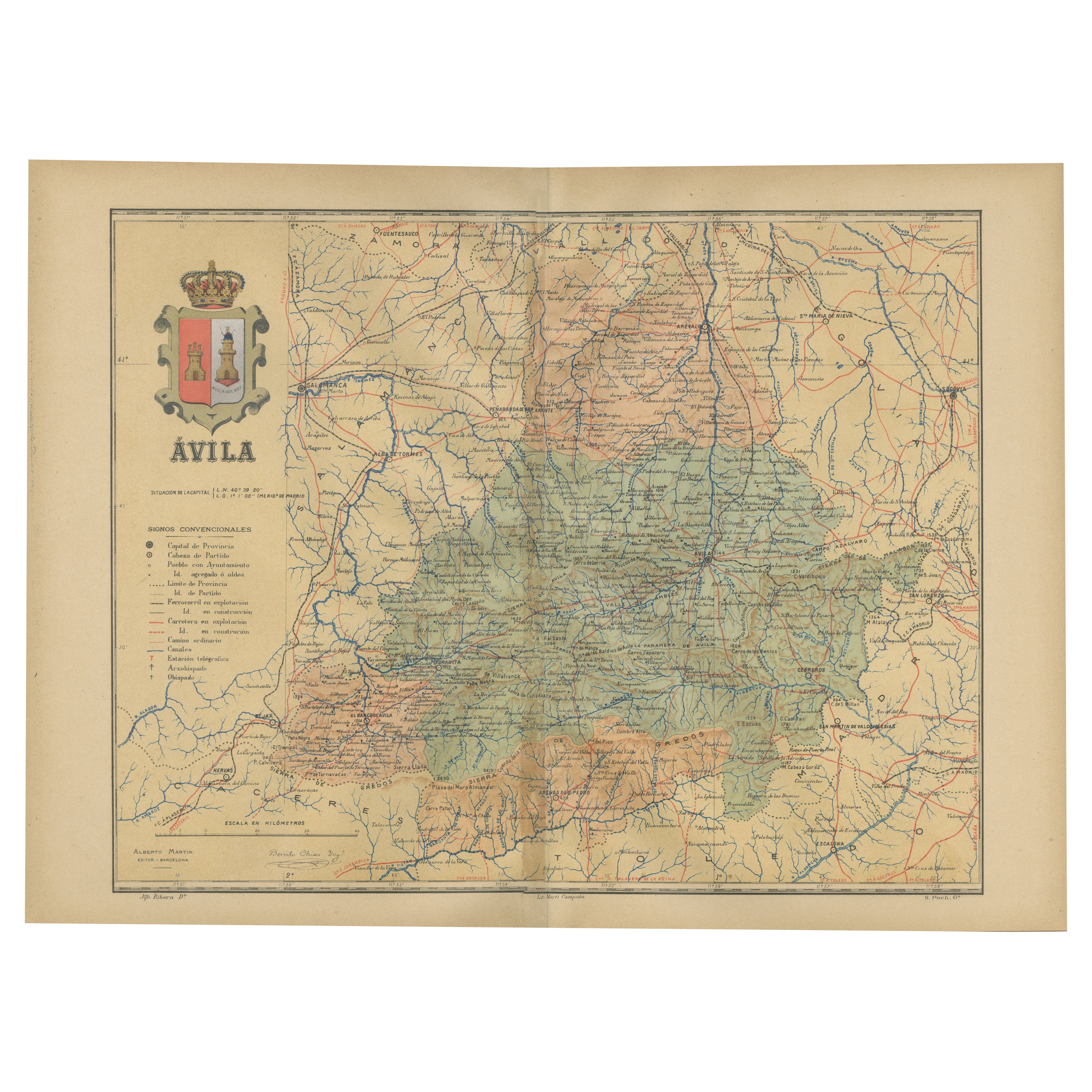
This original antique map is a historical depiction of the province of Álava (in Basque: Araba), which is one of the provinces of the Basque Country in northern Spain, as indicated by the text "Álava 1902". This particular map is part of the "Atlas Geográfico Ibero-Americano España," produced by D. Benito Chias y Carbo, a known cartographer.
The map features various elements common to geographic maps of the period:
- **Topography**: It shows the mountainous terrain of the region through contour lines and shading, indicating elevation changes.
- **Political Boundaries**: There are lines that demarcate the borders of Álava, including the enclave of Treviño (Condado de Treviño).
- **Waterways**: Rivers and streams are marked in blue, with notable water bodies being labeled.
- **Transportation Networks**: Red lines indicate roads and railways, connecting major towns and cities.
- **Urban Areas**: Towns and cities are marked with circles or dots, with larger urban centers likely represented by larger symbols.
- **Annotations**: The map includes a legend (Signos Convencionales), explaining the symbols used for roads, railways, provincial and municipal boundaries, etc.
- **Scale**: The scale of the map is provided in kilometers, located at the bottom center of the map.
- **Decorative Elements**: The coat of arms of Álava is prominently displayed at the top, adding a decorative and heraldic element to the map.
This map would have been an important tool for understanding the geographic and political landscape of Álava in the early 20th century.
The coat of arms depicted in the image has several distinctive features:
- **Crown**: At the top, there is an ornate crown with a blue cap and detailed golden embellishments, suggesting a connection to royal authority.
- **Shield**: The shield below the crown is quartered, indicating it has four sections, each with its own symbol:
- **Upper Left**: Features what appears to be a tower or castle on a red background, which is a common symbol of fortitude and defense in heraldry.
- **Upper Right**: Displays another tower or castle, similar to the one on the left.
- **Lower Left**: There is a figure that resembles a lion, a common heraldic symbol representing bravery and valor.
- **Lower Right**: Also contains a lion, mirroring the image on the left.
- **Supporters**: On either side of the shield, there are figures that seem to be supporters holding the shield. These figures are not clearly visible, but they often represent guardians of the shield and are symbolic of protection and strength.
- **Compartment**: The supporters and shield rest upon a compartment, which might depict a particular landscape or foundation related to the region.
- **Mantling**: Around the shield, there appears to be decorative mantling, which in heraldry represents the protective cloth covering worn by knights over their helmets and armor.
The vibrant highlighted gold colors, the use of traditional heraldic symbols like towers and lions, and the ornate crown all contribute to a coat of arms that is rich in symbolism and indicative of the historical and cultural significance of Álava.
- Dimensions:Height: 14.77 in (37.5 cm)Width: 20.08 in (51 cm)Depth: 0 in (0.02 mm)
- Materials and Techniques:
- Period:1900-1909
- Date of Manufacture:1902
- Condition:Good condition. Central vertical folding lines as issued. Light brown discoloring in the fold line. Aged paper with typically warm, yellowish-brown hue.
- Seller Location:Langweer, NL
- Reference Number:Seller: BG-13642-11stDibs: LU3054338022452
About the Seller
5.0
Recognized Seller
These prestigious sellers are industry leaders and represent the highest echelon for item quality and design.
Gold Seller
Premium sellers maintaining a 4.3+ rating and 24-hour response times
Established in 2009
1stDibs seller since 2017
2,467 sales on 1stDibs
Typical response time: 1 hour
- ShippingRetrieving quote...Shipping from: Langweer, Netherlands
- Return Policy
Authenticity Guarantee
In the unlikely event there’s an issue with an item’s authenticity, contact us within 1 year for a full refund. DetailsMoney-Back Guarantee
If your item is not as described, is damaged in transit, or does not arrive, contact us within 7 days for a full refund. Details24-Hour Cancellation
You have a 24-hour grace period in which to reconsider your purchase, with no questions asked.Vetted Professional Sellers
Our world-class sellers must adhere to strict standards for service and quality, maintaining the integrity of our listings.Price-Match Guarantee
If you find that a seller listed the same item for a lower price elsewhere, we’ll match it.Trusted Global Delivery
Our best-in-class carrier network provides specialized shipping options worldwide, including custom delivery.More From This Seller
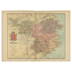
View AllGirona 1902: Geographic and Infrastructural Map of Catalonia’s Northern Province
Located in Langweer, NL
The map provided is of the province of Girona (in Catalan, Girona), located in the northeast of Spain, within the autonomous community of Catalonia, as of the year 1902. Here are the...
Category
Antique Early 1900s Maps
Materials
Paper
$367 Sale Price
20% Off
Free Shipping
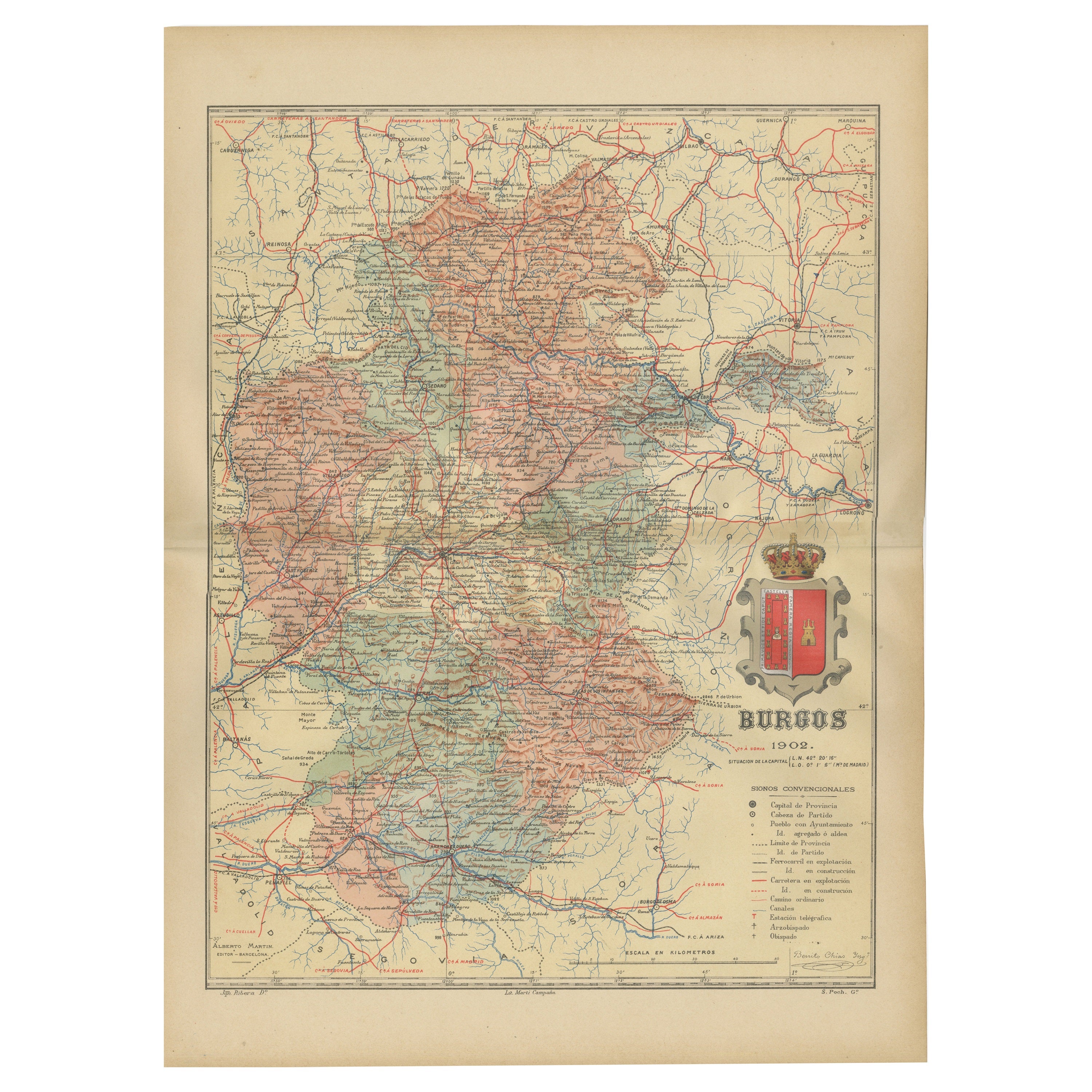
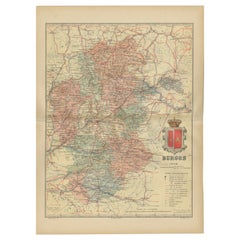
Burgos 1902: Geographic Map of Castile's Historic Heartland in Spain
Located in Langweer, NL
The map of the province of Burgos in the autonomous community of Castile and León in Spain, dated 1902. It includes the following features:
The map highlights the varied terrain wit...
Category
Antique Early 1900s Maps
Materials
Paper
$273 Sale Price
20% Off
Free Shipping
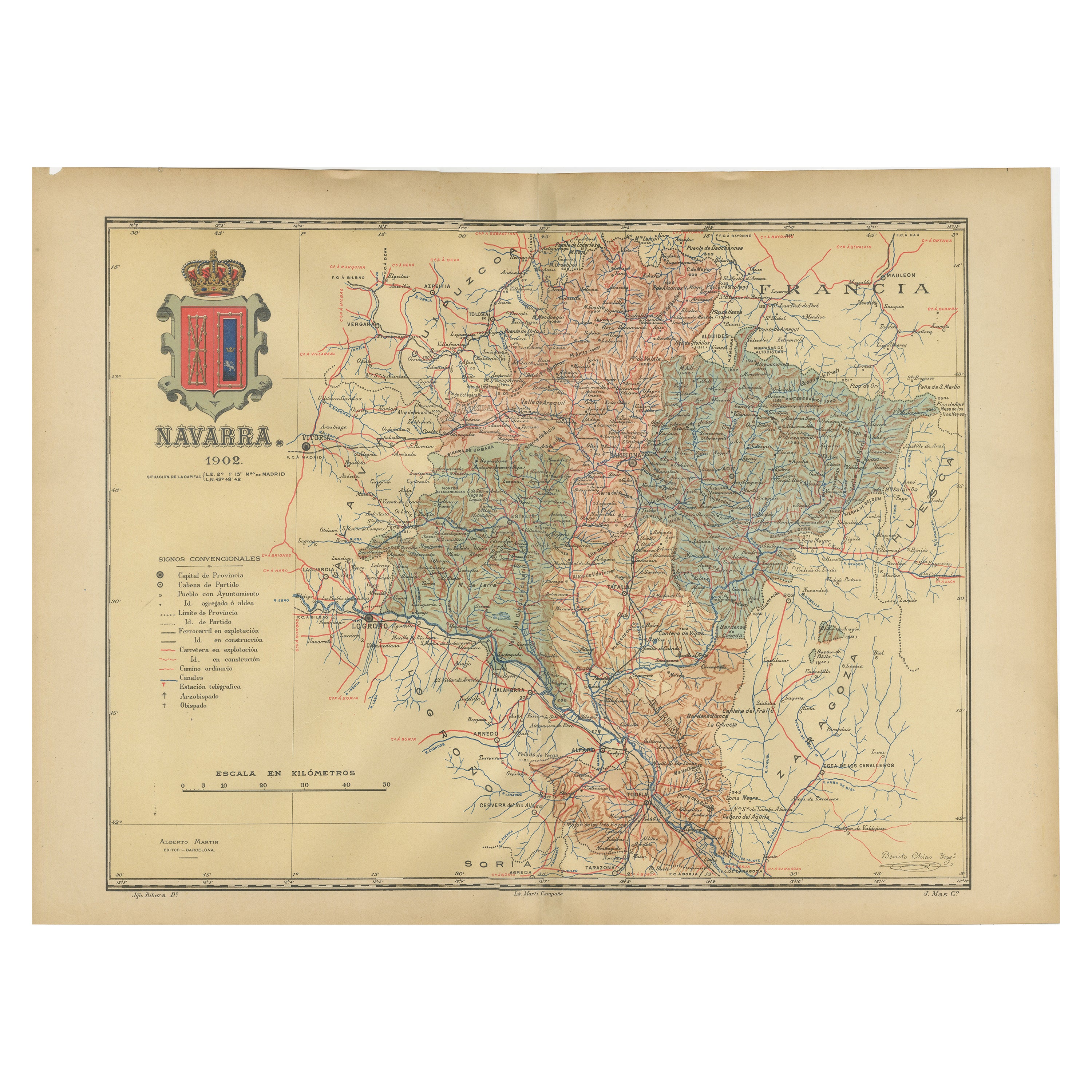
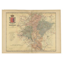
Navarra in Cartographic Detail: A 1902 Map of the Crossroads of Northern Spain
Located in Langweer, NL
The original antique map for sale shows the Spanish province of Navarra as it was in 1902. Here's a brief description and a potential title for the map:
Description:
- The map detai...
Category
Antique Early 1900s Maps
Materials
Paper
$320 Sale Price
20% Off
Free Shipping
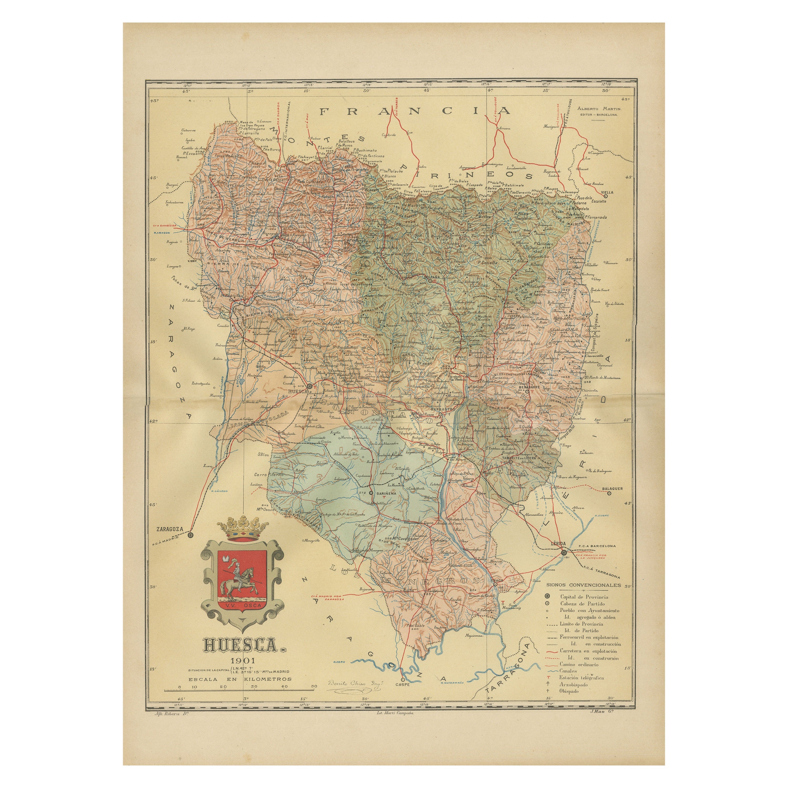
Huesca 1901: A Geographic Overview of Aragon's Northern Frontier in Spain
Located in Langweer, NL
The map provided is of the province of Huesca, located in the northeastern part of Spain, within the autonomous community of Aragon, as of the year 1901. Here are some of the key fea...
Category
Antique Early 1900s Maps
Materials
Paper

$301 Sale Price
20% Off
Free Shipping
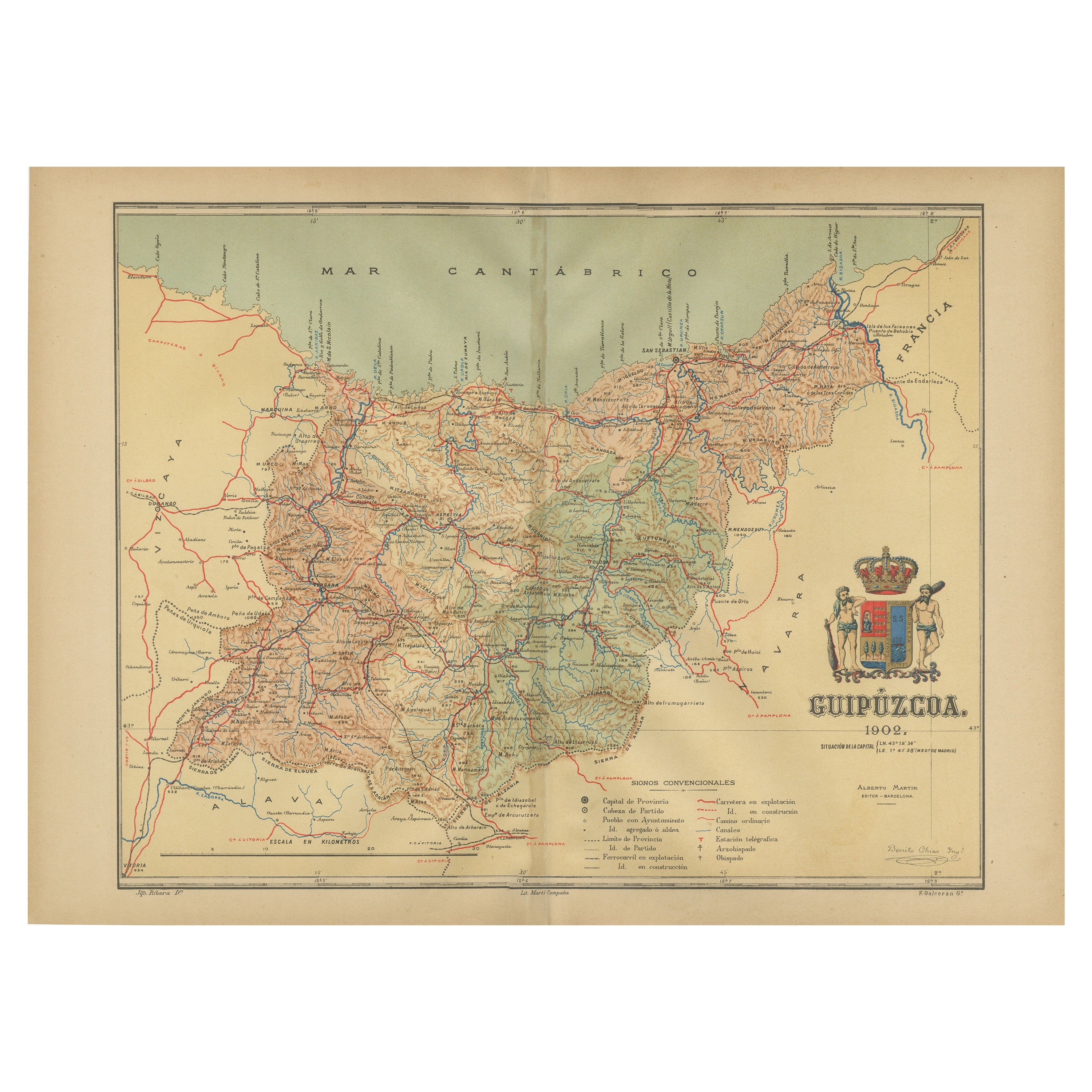
Gipuzkoa 1902: A Cartographic Snapshot of the Basque Coastline and Highlands
Located in Langweer, NL
The map showcases the province of Gipuzkoa (also known as Guipúzcoa in Spanish), which is part of the autonomous community of the Basque Country in northern Spain, as of the year 190...
Category
Antique Early 1900s Maps
Materials
Paper
$338 Sale Price
20% Off
Free Shipping
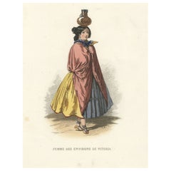
Woman from Vitoria, the Capital of the Spanish Basque Country and Alava
Located in Langweer, NL
Antique costume print titled 'Femme des Environs de Vitoria'. Old print depicting a woman from the region of Vitoria, Spain. This print originates from 'Costumes Moderne (Musée de Co...
Category
Antique 19th Century Prints
Materials
Paper
$263 Sale Price
20% Off
You May Also Like
Two volumes: Geographical Atlas of Spain (…) and General Dictionary...
Located in Madrid, ES
Two volumes: Geographical Atlas of Spain (…) and General Dictionary of all Peoples. Editors Gaspar y Roig. Spain, Madrid, 1864 and 1862.
Two volumes framed in a similar way, with l...
Category
Antique 1860s Spanish Other Books
Materials
Other

Bomber Ski Heritage Carbon Size 180 in Wood & Carbon for All Terrain Exploration
Located in Rhinebeck, NY
HERITAGE CARBON 78
These powerful, precise skis are engineered with materials that offer an unparalleled combination of high stiffness and propulsion, thanks to the liveliness of wo...
Category
2010s Italian Modern Sports Equipment and Memorabilia
Materials
Metal
1902 The Natural History of Plants
By Anton Kerner von Marilaun
Located in Bath, GB
An excellent set containing this profusely illustrated natural history of plants, translated from the German of Austrian botanist, Anton Kerner von Marilaun.
A new edition of this w...
Category
Antique Early 1900s European Books
Materials
Paper
Sotheby's The Wardington Library, Important Atlases and Geographies, Part 1 A-K
Located in valatie, NY
Sotheby's: The Wardington Library, Important Atlases and Geographies. Part One: A-K., London, 18 October 2005. 1st Ed hardcover catalog with 244 lots photographed in color and fully ...
Category
Early 2000s English Books
Materials
Paper
National Geographic Atlas of the World, Eighth Edition Hardcover Book
Located in North Hollywood, CA
National Geographic Atlas of the World, Eighth Edition
National Geographic
This is a beautiful large library or hardcover coffee table book.
Title: National Geographic Atlas of th...
Category
Early 2000s Maltese Mid-Century Modern Books
Materials
Paper
Geographical Antique Map of Principality of Monaco
By Bruno Santini
Located in Alessandria, Piemonte
ST/609 - Interesting antique color map of Monaco Principality in French language : "Carte qui contient le Principauté de Piémont, le Monferrat et la comté de...
Category
Antique Late 18th Century Italian Other Maps
Materials
Paper

Recently Viewed
View AllMore Ways To Browse
Woven Sling Chair
Wrought Iron Curule Bench
Yellow Ware Seaweed
Yoruba Textile
Yugoslavian Dining Chairs
Zeppelin Airship
10 Cab Chairs
108 Inch Dining Room Table
15 Ft Runner
1770 English Chair
17th Century Cane Chairs
17th Century Dutch Picture Frame
18th Century Oak Refectory Table
18th Century Salon Suite
1900 Bar Cart
1900s Bureau
1930s Birmingham Silver
1930s Upholstery Loveseats