Items Similar to Antique Map of French Guiana and Cayenne – Circa 1835
Want more images or videos?
Request additional images or videos from the seller
1 of 7
Antique Map of French Guiana and Cayenne – Circa 1835
$107.49
£79.65
€90
CA$148.70
A$163.87
CHF 85.79
MX$2,012.90
NOK 1,078.02
SEK 1,008.94
DKK 685.42
About the Item
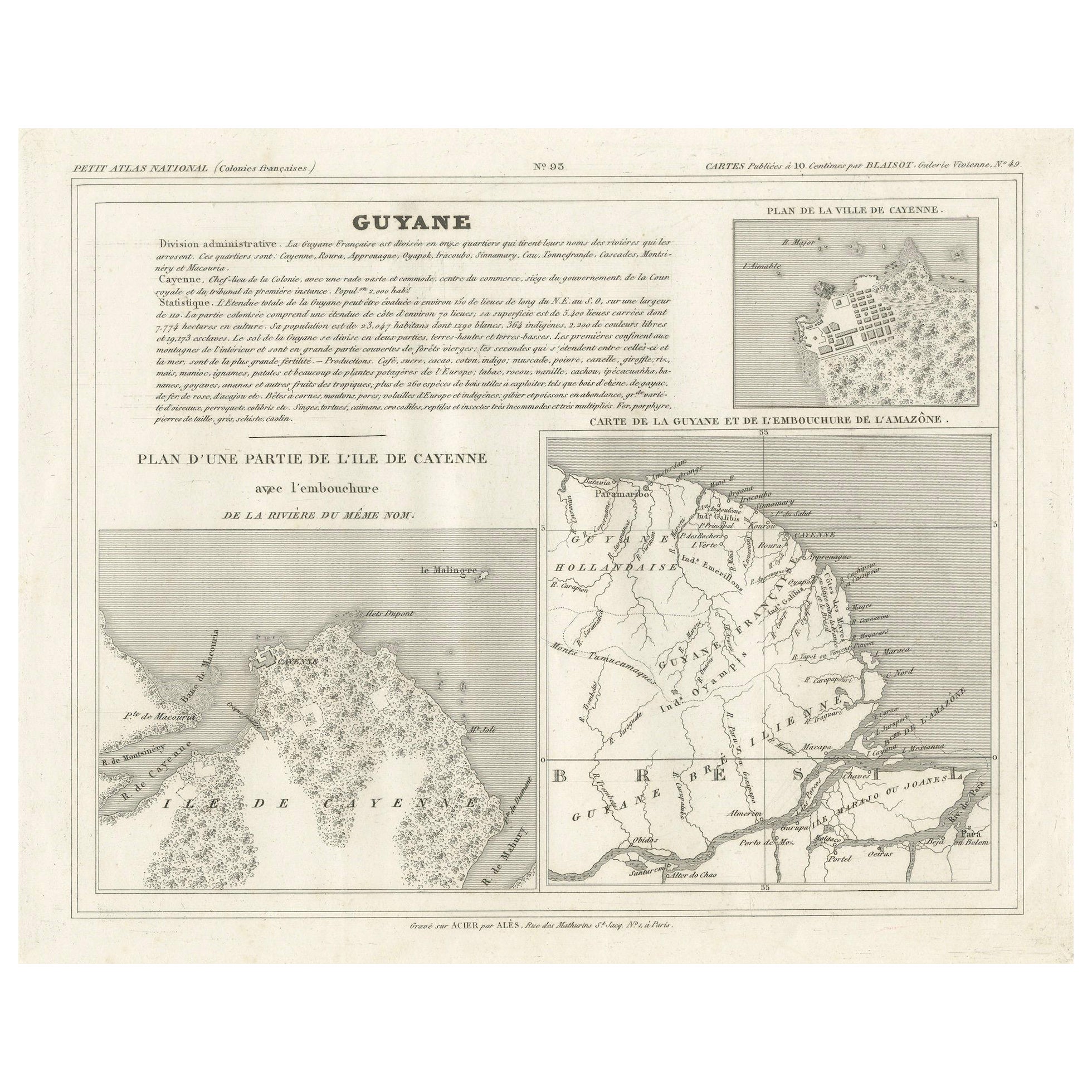
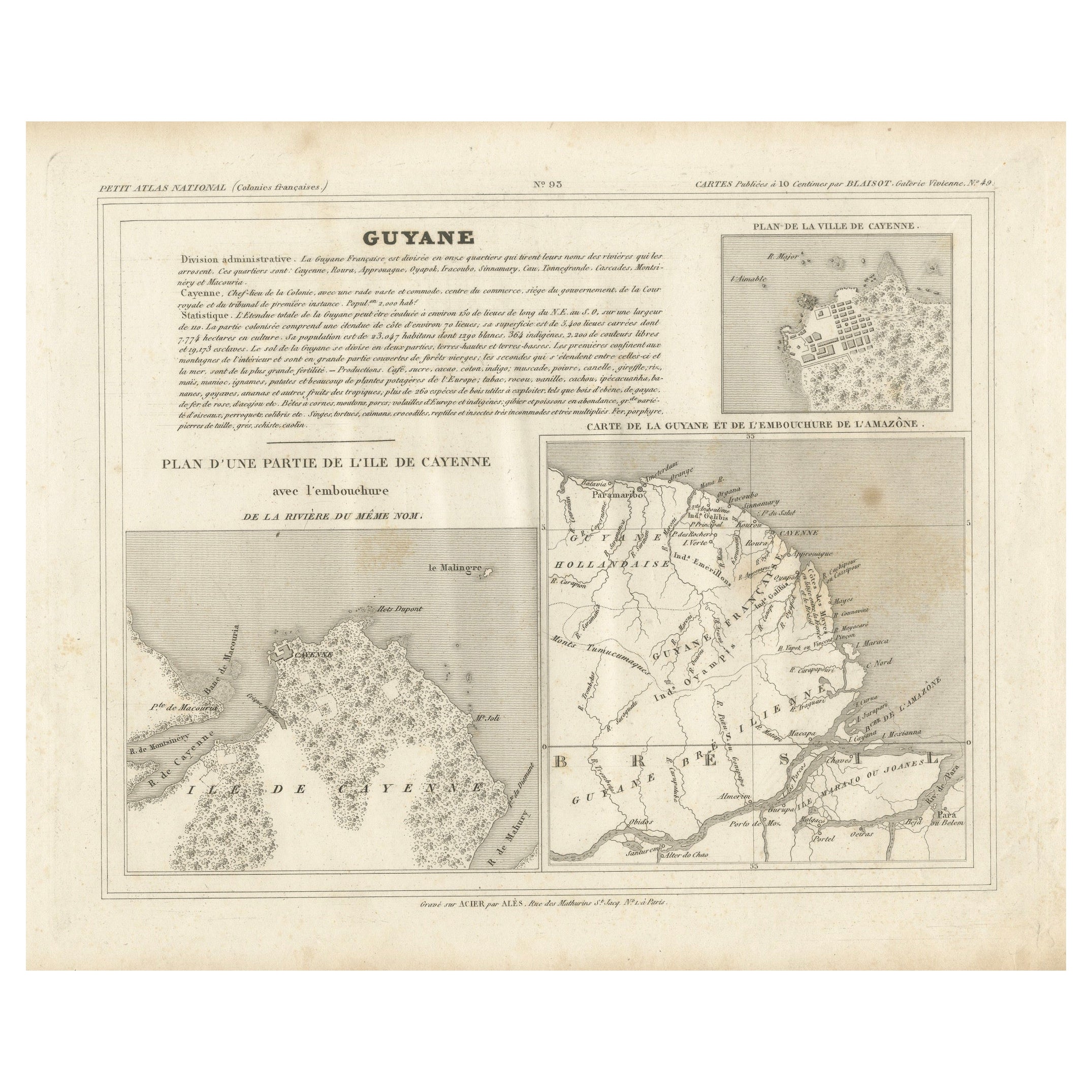
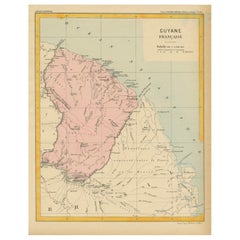
Antique Map of French Guiana and Cayenne – Circa 1835
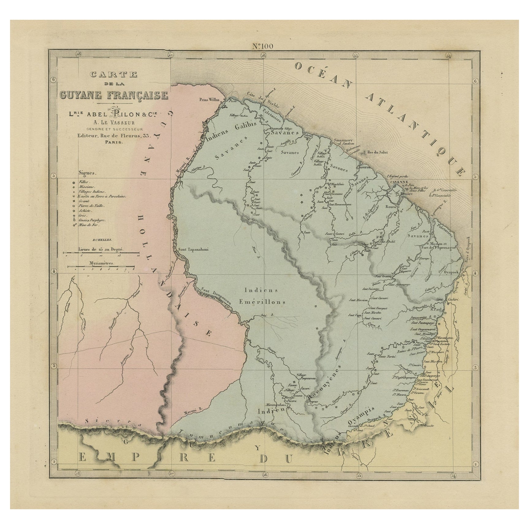
This rare 19th-century map of French Guiana, published around 1835, provides a detailed overview of the region, including the city of Cayenne and its surrounding geography. It was part of the Petit Atlas National, a collection of maps depicting French colonies. The map features three key sections:
- A general map of French Guiana, including the mouth of the Amazon River, showing territorial divisions and settlements.
- A detailed plan of the city of Cayenne, highlighting its streets and fortifications.
- A larger map of part of the Île de Cayenne, including the mouth of the Cayenne River.
The engraving was executed by Ambroise Tardieu, a prominent French cartographer, and published by Alexandre Aimé Blanchot. The map contains fine detailing and clear typography, making it an excellent representation of the colonial geography of French Guiana during the early 19th century.
Condition Report:
Paper Quality: High-quality 19th-century paper with natural toning.
Engraving: Crisp and well-preserved with fine detailing.
Margins: Wide margins with minor foxing and light age spots.
Overall Condition: Good, with no tears or significant damage, but it does have some light brown areas. Ideally this map will be handcolored.
Framing Tips:
Matting: Use a neutral acid-free mat in off-white or cream to enhance the map’s historical character.
Glass: UV-resistant glass will protect against light damage and fading.
Frame Style: A classic wooden frame in walnut or mahogany complements the antique aesthetic.
Mounting: Use archival-quality materials to preserve the paper’s condition.
This is a rare and historically significant map, reflecting France’s colonial presence in South America.
- Dimensions:Height: 9.65 in (24.5 cm)Width: 12.41 in (31.5 cm)Depth: 0.01 in (0.2 mm)
- Materials and Techniques:
- Period:
- Date of Manufacture:circa 1835
- Condition:Overall Condition: good, with no tears or significant damage, but it does have some light brown areas. Ideally this map will be handcolored.
- Seller Location:Langweer, NL
- Reference Number:Seller: BG-13039-271stDibs: LU3054343838222
About the Seller
5.0
Recognized Seller
These prestigious sellers are industry leaders and represent the highest echelon for item quality and design.
Platinum Seller
Premium sellers with a 4.7+ rating and 24-hour response times
Established in 2009
1stDibs seller since 2017
2,618 sales on 1stDibs
Typical response time: <1 hour
- ShippingRetrieving quote...Shipping from: Langweer, Netherlands
- Return Policy
Authenticity Guarantee
In the unlikely event there’s an issue with an item’s authenticity, contact us within 1 year for a full refund. DetailsMoney-Back Guarantee
If your item is not as described, is damaged in transit, or does not arrive, contact us within 7 days for a full refund. Details24-Hour Cancellation
You have a 24-hour grace period in which to reconsider your purchase, with no questions asked.Vetted Professional Sellers
Our world-class sellers must adhere to strict standards for service and quality, maintaining the integrity of our listings.Price-Match Guarantee
If you find that a seller listed the same item for a lower price elsewhere, we’ll match it.Trusted Global Delivery
Our best-in-class carrier network provides specialized shipping options worldwide, including custom delivery.More From This Seller
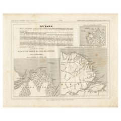
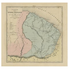
View AllMap of French Guiana, Suriname and Cayenne: Plan from Petit Atlas National, 1820
Located in Langweer, NL
This map, titled "Guyane" (French Guiana), is part of the Petit Atlas National series, focusing on French colonies. Here are the key elements of the map and its context:
Features:
-...
Category
Antique 1820s Maps
Materials
Paper

$152 Sale Price
20% Off
Map of Guyane (French Guiana) with Cayenne, circa 1826
Located in Langweer, NL
Map of Guyane (French Guiana) with Cayenne, circa 1826
This is an antique French map titled “Guyane” from *Petit Atlas National (Colonies françaises)* published by Blaisot around 18...
Category
Antique Early 19th Century French Maps
Materials
Paper
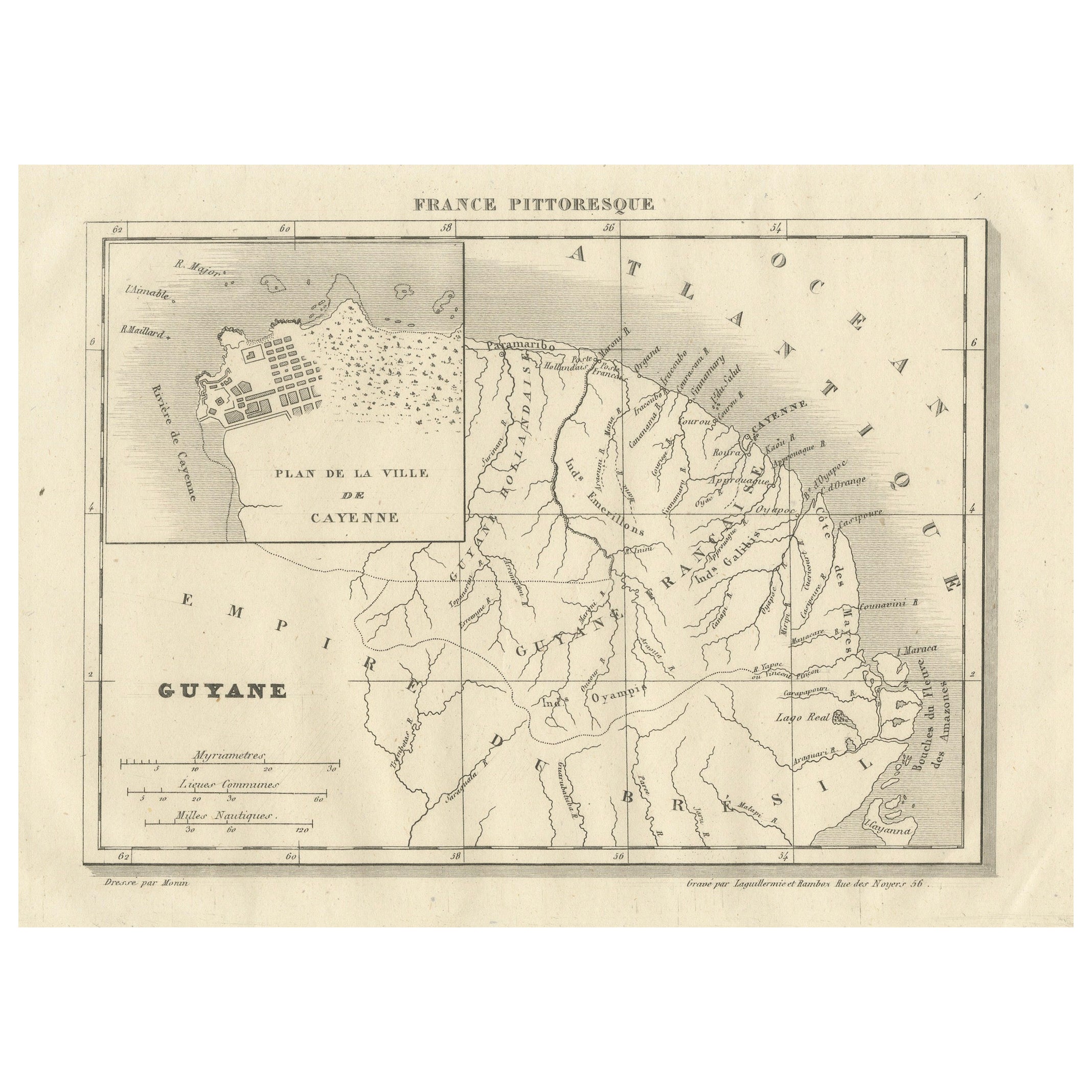
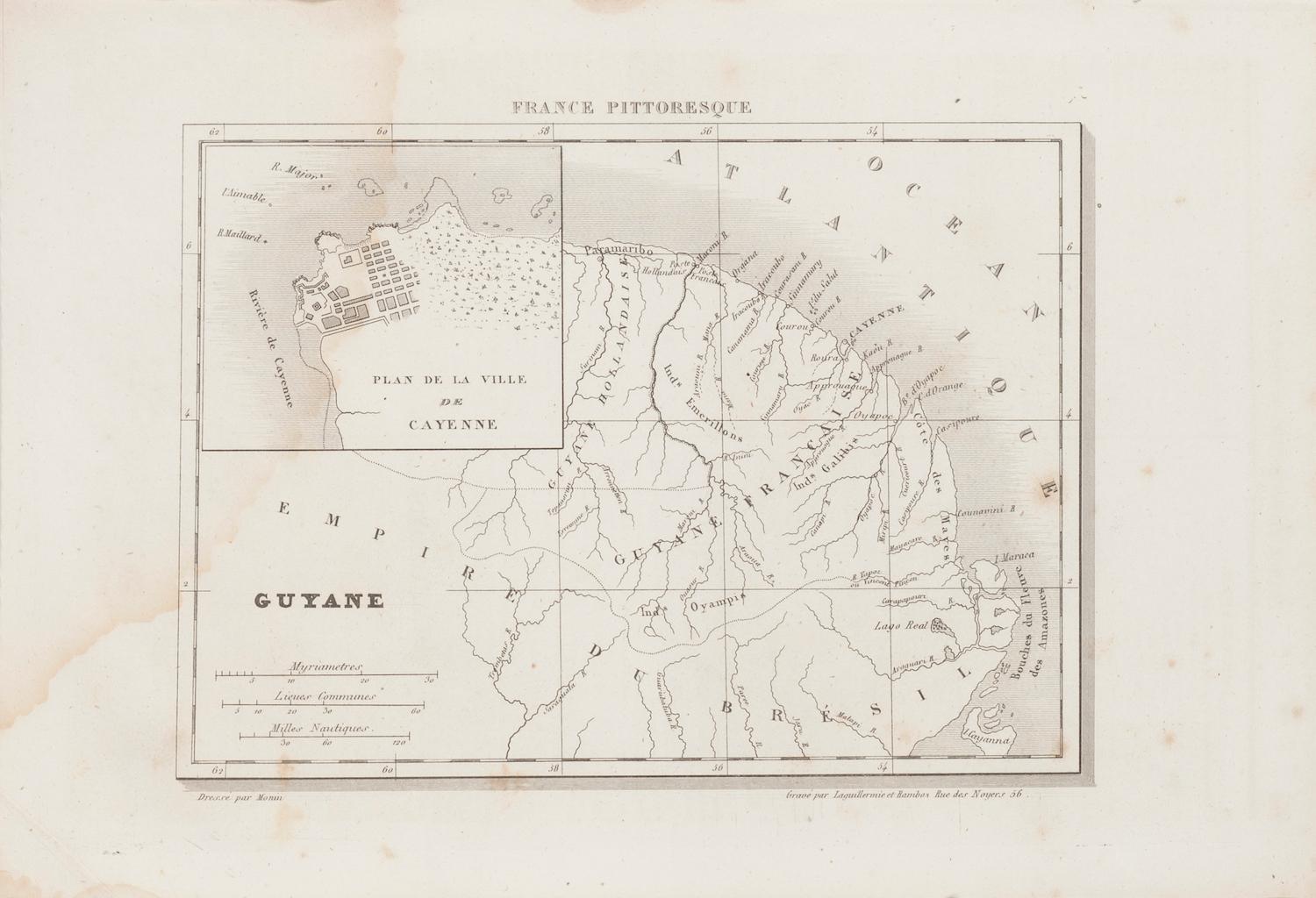
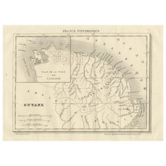
French Guiana and Cayenne: Mid-19th Century Map from France Pittoresque Series
Located in Langweer, NL
This map titled "Guyane" is part of the France Pittoresque series and provides a detailed view of French Guiana along with a plan of the city of Cayenne.
Features:
- The map showcases the broader region of French Guiana, indicating key rivers, settlements, and the coastline along the Atlantic Ocean.
- To the left, there's an inset labeled "Plan de la Ville de Cayenne", which shows the street layout, squares, and main buildings of the capital city, Cayenne. This inset provides a more detailed view of the urban area, highlighting its geometric grid layout near the coast.
- The larger map outlines geographical features such as rivers (e.g., Oyapock and Maroni), forests, and territories in the surrounding area, including the neighboring Brazilian Empire...
Category
Antique 1850s Maps
Materials
Paper
$114 Sale Price
20% Off
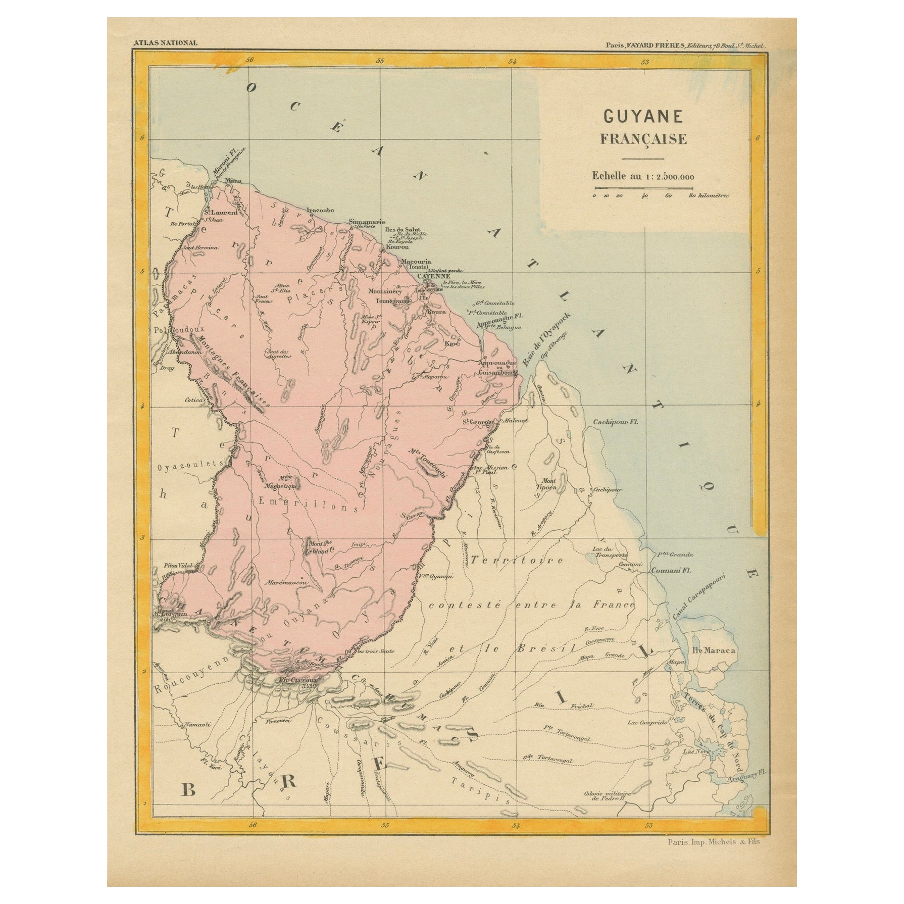
Map of French Guiana: 19th Century Atlas National Depiction of Guyane Française
Located in Langweer, NL
The map is titled "Guyane Française" (French Guiana) and is part of the Atlas National series. Here are the key details:
Features:
- The map focuses on French Guiana, a French overs...
Category
Antique 1890s Maps
Materials
Paper
$114 Sale Price
20% Off
Antique Engraved Map with Original Hand Colour of French Guiana, 1876
Located in Langweer, NL
The 1876 map of French Guiana from the "Grand Atlas Départemental de la France de L'Algérie et des colonies" by H. Fisquet, published by A. Le Vasseur in Paris, is a significant piec...
Category
Antique Late 19th Century Maps
Materials
Paper
$267 Sale Price
20% Off
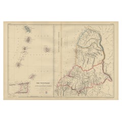
Antique Map the Windward or South Caribbean Islands and Guiana, 1859
Located in Langweer, NL
Antique map titled 'The Windward or South Caribbean Islands'. Original antique map of South Caribbean Islands. This map originates from ‘The Imperial Atlas of Modern Geography’. Published by W. G. Blackie, 1859.
The Windward Islands, also known as the Islands of Barlovento, are the southern, generally larger islands of the Lesser Antilles. Part of the West Indies, they lie south of the Leeward Islands...
Category
Antique Mid-19th Century Maps
Materials
Paper
$248 Sale Price
20% Off
You May Also Like
Ancient Map of Guyane - Original Etching - 19th Century
Located in Roma, IT
Map of Guyane is an original etching realized by an anonymous engraver of the 19th Century.
Belongs to the Series of "France Pittoresque" at the top center.
The state of preservati...
Category
19th Century Modern Figurative Prints
Materials
Etching
Map Colonies Francaises Martinique, 1845
Located in BUNGAY, SUFFOLK
Colonies Francaises, Martinique, Amerique DU SUD
Geographie et Statistique par V.Levasseur. Ing'r Geographe.
Illustre par Raymond Bonheur, peintre.
Grave par Laguihermie, Rue St...
Category
Antique 19th Century French Maps
Materials
Paper

Extremely Large Hand-Drawn Manuscript Map of Surinam, 1830, History of Slavery
Located in Amsterdam, NL
A unique large hand-drawn map of Surinam by Albrecht Helmut Hiemcke (German, 1760-1839)
?
'Colonie Surinaame', 1830
A large hand-drawn and coloured map of the colony of Suri...
Category
Antique Mid-19th Century Surinamer Maps
Materials
Paper

Large Original Antique Map of Java and Borneo, Fullarton, C.1870
Located in St Annes, Lancashire
Great map of Java and Borneo
Wonderful figurative borders
From the celebrated Royal Illustrated Atlas
Lithograph. Original color.
Published by Fullarton, Edinburgh. C.1870
Unfr...
Category
Antique 1870s Scottish Maps
Materials
Paper

Map Of Martinique - Etching - 19th Century
Located in Roma, IT
Map Of Martinique is an etching realized by an anonymous engraver of the 19th Century.
Printed within the series "France Pittoresque" at the top center.
The state of preservation o...
Category
19th Century Modern Figurative Prints
Materials
Etching

Large Original Antique Map of The West Indies by Sidney Hall, 1847
Located in St Annes, Lancashire
Great map of The West Indies
Drawn and engraved by Sidney Hall
Steel engraving
Original colour outline
Published by A & C Black. 1847
Unframed
Free shipping.
Category
Antique 1840s Scottish Maps
Materials
Paper

More Ways To Browse
Antique Russian Rugs
Beni Ourain Rugs
Glass Top Wood Base Coffee Tables
Large Antique Tapestry Tapestries
Large Antique Tapestry
Mid Century Modern Corner Chair
Sterling Silver Flatware Set Service For 12
1970s Brass Glass Coffee Table
Lane Modern Furniture
Mid Century Sofa Red
Painted Arm Chairs
Vintage Azerbaijan
Charles Rennie Mackintosh For Cassina
Painted Bar Stools
3x5 Rugs
French Iron And Glass Table
Mcm Table
Tufted Bar