Items Similar to Antique Map of Israel Filled with Biblical Scenes, Published in 1748


Want more images or videos?
Request additional images or videos from the seller
1 of 8
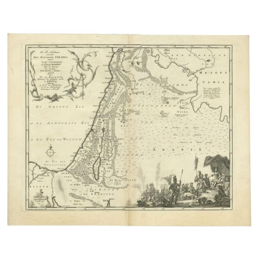
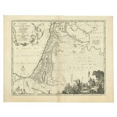
Antique Map of Israel Filled with Biblical Scenes, Published in 1748
About the Item
Antique map Holy Land titled 'Het beloofde landt Canaan doorwandelt van onsen Saligmaker Jesu Christo neffens zyne Apostelen'.
Antique map of Israel filled with biblical scenes. A compass rose orients the map with north in the top right corner. The large decorative title cartouche at bottom is flanked with the four evangelists and vignettes depicting the life of Christ, including his birth, crucifixion and a triumphant Resurrection, showing Christ bursting from the tomb and scattering Roman solders.
Artists and engravers: Engraved by J. van Jagen.
- Dimensions:Height: 14.18 in (36 cm)Width: 19.3 in (49 cm)Depth: 0 in (0.02 mm)
- Materials and Techniques:
- Period:1740-1749
- Date of Manufacture:1748
- Condition:Wear consistent with age and use. Condition: Very good, age-related toning. Dutch text on verso, please study image carefully.
- Seller Location:Langweer, NL
- Reference Number:Seller: BGI-011011stDibs: LU3054327153562
About the Seller
5.0
Recognized Seller
These prestigious sellers are industry leaders and represent the highest echelon for item quality and design.
Gold Seller
Premium sellers maintaining a 4.3+ rating and 24-hour response times
Established in 2009
1stDibs seller since 2017
2,467 sales on 1stDibs
Typical response time: 1 hour
- ShippingRetrieving quote...Shipping from: Langweer, Netherlands
- Return Policy
Authenticity Guarantee
In the unlikely event there’s an issue with an item’s authenticity, contact us within 1 year for a full refund. DetailsMoney-Back Guarantee
If your item is not as described, is damaged in transit, or does not arrive, contact us within 7 days for a full refund. Details24-Hour Cancellation
You have a 24-hour grace period in which to reconsider your purchase, with no questions asked.Vetted Professional Sellers
Our world-class sellers must adhere to strict standards for service and quality, maintaining the integrity of our listings.Price-Match Guarantee
If you find that a seller listed the same item for a lower price elsewhere, we’ll match it.Trusted Global Delivery
Our best-in-class carrier network provides specialized shipping options worldwide, including custom delivery.More From This Seller
View AllAntique Map of the Biblical Kingdom of Israel by Lindeman, c.1758
Located in Langweer, NL
Antique map titled 'De IVde Landkaart vertoonende het Koningryk Israels benevens deszelfs overheerde Landschappen (..).' Map of the biblical Kingdom of Israel under the Kings Saul, D...
Category
Antique 18th Century Maps
Materials
Paper
$231 Sale Price
20% Off
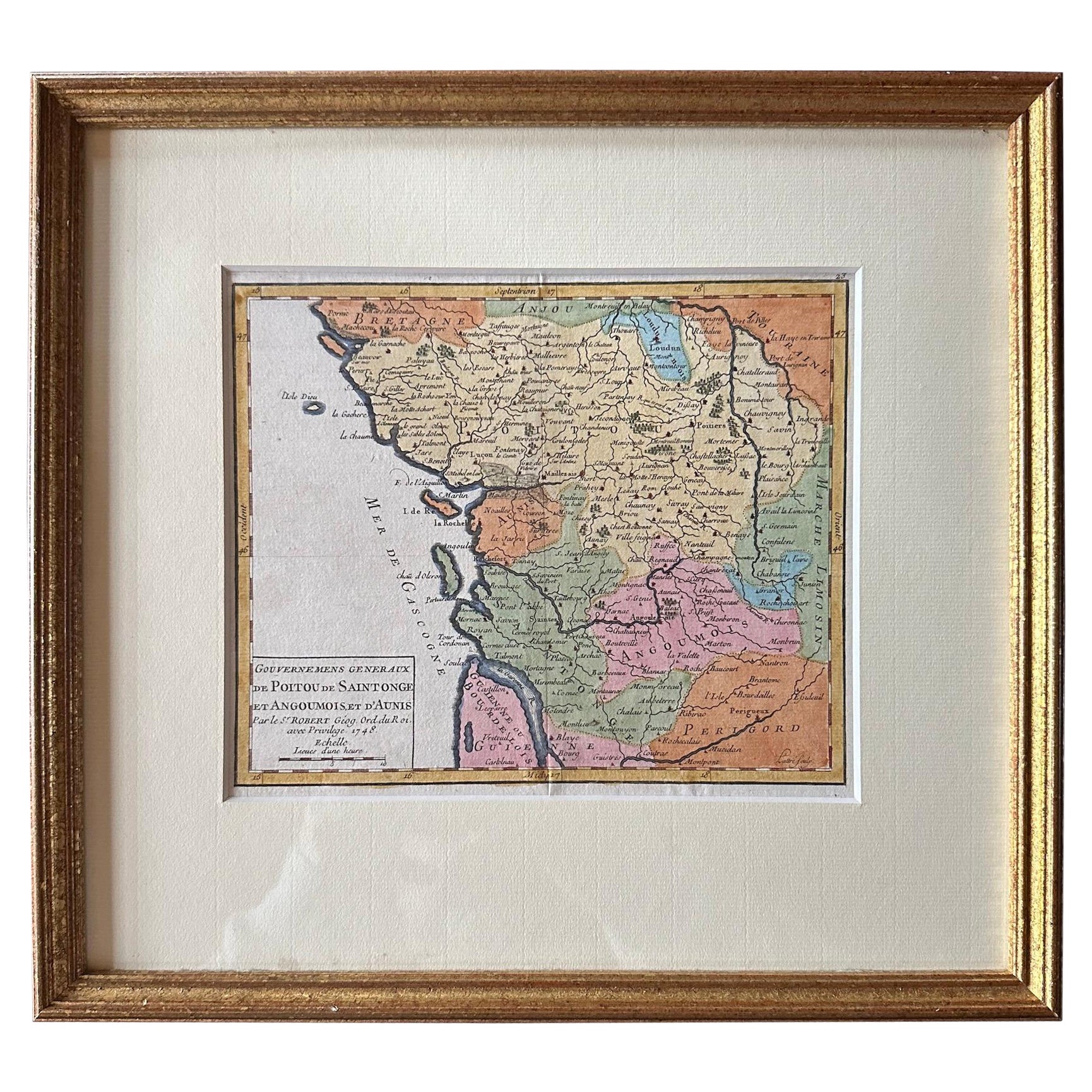
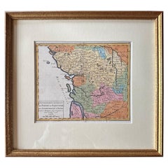
Original Antique Map of West Central France in Frame, 1748
Located in Langweer, NL
A nicely framed and hand-coloured decorative map titled "Gouvernemens Generaux De Poitou et De Saintonge" and engraved by M. Robert. This historical international map includes several specific locations, such as the Isle Dieu, Bretagne, Anjou, Touraine, Angoumois, Perigold, Saintonge, Mer de Gascogne (Bay of Biscay), Poitou, Aunis, Guienne, la Garonne Riviere (Garonne River), and Loudunois, as well as the Tour de Cordouan (Cordouan Lighthouse).
Featured towns on this map include Tonnay, Talmont, Loudun, Mortemer, Poitiers, Chalais, Riberac, Angoule, Marton, Blaye, and Monbrun.
This antique map represents the west-central region of France.
The theme of the atlas from which this map originates is the "Atlas Portatif Universel Et Militaire" by M. Robert. The source description indicates that this atlas is a portable, universal, and military collection...
Category
Antique 1740s Maps
Materials
Paper
$270 Sale Price
20% Off
Antique Map of Asia with Intricate Provincial Boundaries, Published in 1903
Located in Langweer, NL
Title: Antique Map of Asia, 1903, with Intricate Provincial Boundaries and Coastal Features
Description:
This antique map, titled "Asia," was engraved and published in 1903 by the r...
Category
Early 20th Century Maps
Materials
Paper

Original Antique Map of Southern Asia, Published in 1833
Located in Langweer, NL
Antique map titled 'Carte de l'Inde'. Detailed map extending from India in the west to Vietnam and the Malay Peninsula in the east. This map originates from 'Atlas universel de geogr...
Category
Antique Mid-19th Century Maps
Materials
Paper

$698 Sale Price
20% Off
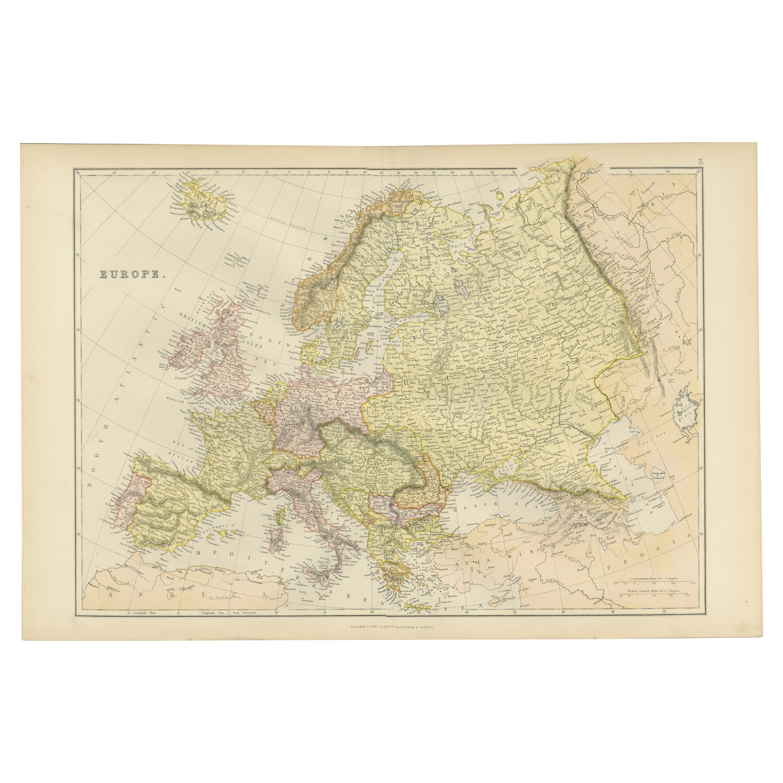
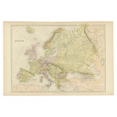
Colorful Detailed Antique Map of Europe, Published in 1882
Located in Langweer, NL
"The Antique Map of Europe from 'The Comprehensive Atlas and Geography of the World,' published in 1882 by Blackie & Son, is a testament to meticulous cartography and scholarly preci...
Category
Antique 1880s Maps
Materials
Paper
$177 Sale Price
20% Off
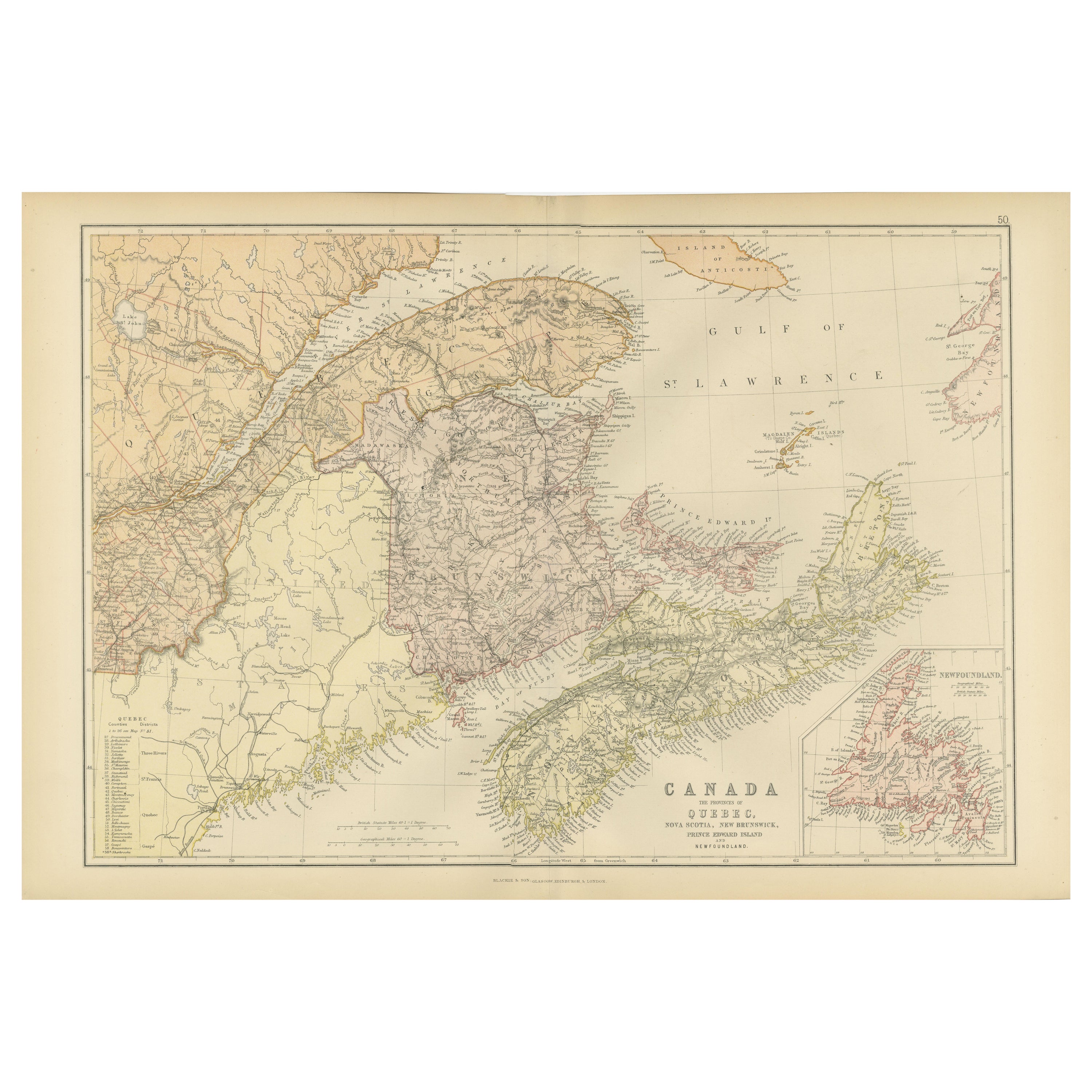
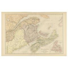
Decorative Antique Map of Eastern Canada, Published in 1882
Located in Langweer, NL
This is a historical map from the 1882 Blackie Atlas, focused on eastern Canada and the maritime provinces. The map is titled "Canada. No. 2. Provinces of Nova Scotia, New Brunswick,...
Category
Antique 1880s Maps
Materials
Paper
You May Also Like
London 1744 Published Watercolour Antique Map of East Africa by Eman Bowen
Located in West Sussex, Pulborough
We are delighted to offer for sale this New and Accurate Map of Nubia & Abissinia, together with all the Kingdoms Tributary Thereto, and bordering upon them published in 1744 by Emanuel Bowen
This is a decorative antique engraved map of East Africa...
Category
Antique 1740s English George III Maps
Materials
Paper

$1,045 Sale Price
20% Off
Large Original Vintage Map of Israel, circa 1920
Located in St Annes, Lancashire
Great map of Israel
Original color.
Good condition
Published by Alexander Gross
Unframed.
Category
Vintage 1920s English Edwardian Maps
Materials
Paper

Antique Paterson's Guide to Britain, English, Maps, Georgian, Published 1811
Located in Hele, Devon, GB
This is an antique copy of Paterson's New and Accurate guide to Direct & Principal Crossroads. An English, bound book of maps and descriptive tables, published in English by Longman,...
Category
Antique Early 19th Century British Georgian Books
Materials
Paper

1840 Map of the City of Washington Published by William M. Morrison
Located in Colorado Springs, CO
This map, printed in 1840, is a detailed representation of Washington, D.C. in the mid-19th century. The map shows block numbers, wards, and government buildings as well as details o...
Category
Antique 1840s American Federal Maps
Materials
Paper

1896 "Territory of Arizona" Map, Published by the General Land Office
Located in Colorado Springs, CO
Presented is an attractive "Territory of Arizona” map, from the “Report of the Governor of Arizona to the Secretary of the Interior." First published in 1894, this 1896 edition was r...
Category
Antique 1890s Maps
Materials
Paper
1842 Wall Map of the United States by J. H. Young, Published by S. A. Mitchell
Located in Colorado Springs, CO
Presented is an 1842 hanging “Map of the United States,” engraved by J. H. Young and published by Samuel Augustus Mitchell, Philadelphia. This is a beautiful example of the rare 1842...
Category
Antique 1840s American Maps
Materials
Paper

Recently Viewed
View AllMore Ways To Browse
Etruscan Coffee Table
European Naugahyde Chairs
European Silk Benches
European Still Life Floral Oil Painting
Expandable Coat Rack
F Grund Painting
Falcon Armchair
Farm Wagon
Fauteuil Cabriolet
Faux Bamboo Folding Chair
Federal Mahogany Sofa
Federalist Furniture
Feed Sack
Fernand Leger Oil
Fiberglass Cognac Chair
Fiberglass Pool Furniture
Fiddle And Thread Flatware
Filipino Trunk