Items Similar to Antique Map of New Guinea and New Britain by P. Carteret, circa 1773


Want more images or videos?
Request additional images or videos from the seller
1 of 6
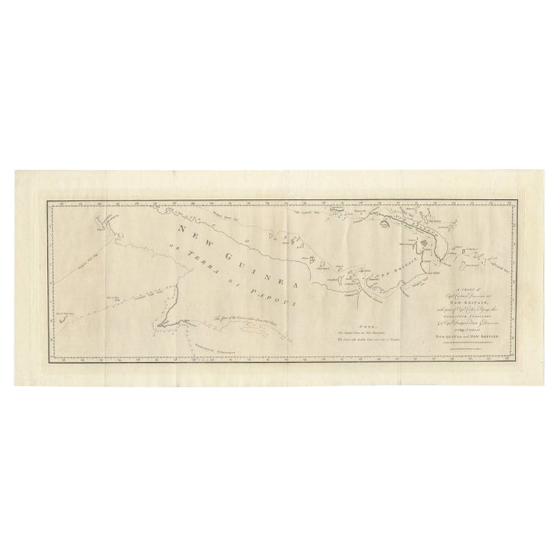
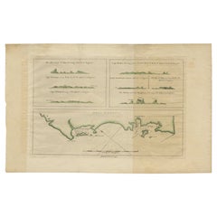
Antique Map of New Guinea and New Britain by P. Carteret, circa 1773
$523.81
$654.7620% Off
£389.33
£486.6720% Off
€440
€55020% Off
CA$723.24
CA$904.0520% Off
A$802.02
A$1,002.5320% Off
CHF 421.40
CHF 526.7520% Off
MX$9,799.32
MX$12,249.1520% Off
NOK 5,272.31
NOK 6,590.3920% Off
SEK 4,948.97
SEK 6,186.2120% Off
DKK 3,350.38
DKK 4,187.9720% Off
About the Item
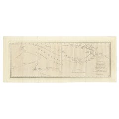
Antique Map: A Chart of Captain Carteret's Discoveries at New Britain (1769)
This rare and historically significant 18th-century map, titled *A Chart of Captn Carteret's Discoveries at New Britain,* offers a fascinating glimpse into early European explorations of the Pacific. Published in 1769, the map meticulously charts Captain Philip Carteret's 1767 voyage through New Guinea and the islands of New Britain and New Ireland, showcasing his contributions to the understanding of the Bismarck Archipelago. Adding to its significance, the map traces the paths of earlier explorer William Dampier (1699-1700) and includes Captain James Cook’s route through Endeavour Strait during his first voyage, following his groundbreaking charting of Australia's eastern coastline.
This map vividly illustrates the routes taken by these legendary navigators, including Carteret’s passage between New Britain and New Ireland, a key discovery in 18th-century Pacific navigation. Dampier’s tracks through the Bismarck Archipelago further enhance its historical depth, as they highlight one of the earliest European encounters with these remote islands. Additionally, the inclusion of Cook’s route through Endeavour Strait, after charting Australia's eastern coast and continuing to Timor, places this map within the context of one of the most important voyages in maritime history.
The map’s artistic and cartographic details are remarkable, featuring carefully engraved coastlines, navigational markings, and annotations that reflect the state of geographical knowledge in the mid-18th century. It captures the adventurous spirit of exploration and discovery, providing a tangible link to the era of great maritime expeditions.
Keywords: antique map, Captain Philip Carteret, William Dampier, Captain James Cook, New Guinea, New Britain, New Ireland, Bismarck Archipelago, 18th-century cartography, Endeavour Strait, historical exploration map, Pacific navigation, maritime history, rare maps for sale.
This map is a must-have for collectors of antique cartography, maritime history enthusiasts, and anyone interested in the Age of Discovery. Its combination of historical significance, exquisite engraving, and connection to legendary explorers like Dampier and Cook makes it an invaluable piece for any collection or display. Don't miss this opportunity to own a rare and captivating artifact of exploration history.
- Dimensions:Height: 10.63 in (27 cm)Width: 28.55 in (72.5 cm)Depth: 0.02 in (0.5 mm)
- Materials and Techniques:
- Period:
- Date of Manufacture:circa 1773
- Condition:The map is in good condition with some folding lines. Some minor soiling due to handling and age. Please study images carefully.
- Seller Location:Langweer, NL
- Reference Number:Seller: BG-008501stDibs: LU305438972001
About the Seller
5.0
Recognized Seller
These prestigious sellers are industry leaders and represent the highest echelon for item quality and design.
Platinum Seller
Premium sellers with a 4.7+ rating and 24-hour response times
Established in 2009
1stDibs seller since 2017
2,609 sales on 1stDibs
Typical response time: <1 hour
- ShippingRetrieving quote...Shipping from: Langweer, Netherlands
- Return Policy
Authenticity Guarantee
In the unlikely event there’s an issue with an item’s authenticity, contact us within 1 year for a full refund. DetailsMoney-Back Guarantee
If your item is not as described, is damaged in transit, or does not arrive, contact us within 7 days for a full refund. Details24-Hour Cancellation
You have a 24-hour grace period in which to reconsider your purchase, with no questions asked.Vetted Professional Sellers
Our world-class sellers must adhere to strict standards for service and quality, maintaining the integrity of our listings.Price-Match Guarantee
If you find that a seller listed the same item for a lower price elsewhere, we’ll match it.Trusted Global Delivery
Our best-in-class carrier network provides specialized shipping options worldwide, including custom delivery.More From This Seller
View AllLarge Antique Map of New Guinea and New Britain Showing Capt. Cooks Tract, 1773
Located in Langweer, NL
Antique map titled 'A Chart of Captain Carteret's Discoveries at New Britain, with part of Captain Cooke's Passage thro Endeavour Streights, & of Captain Dampier's tract & discoverie...
Category
Antique 18th Century Maps
Materials
Paper
$523 Sale Price
20% Off
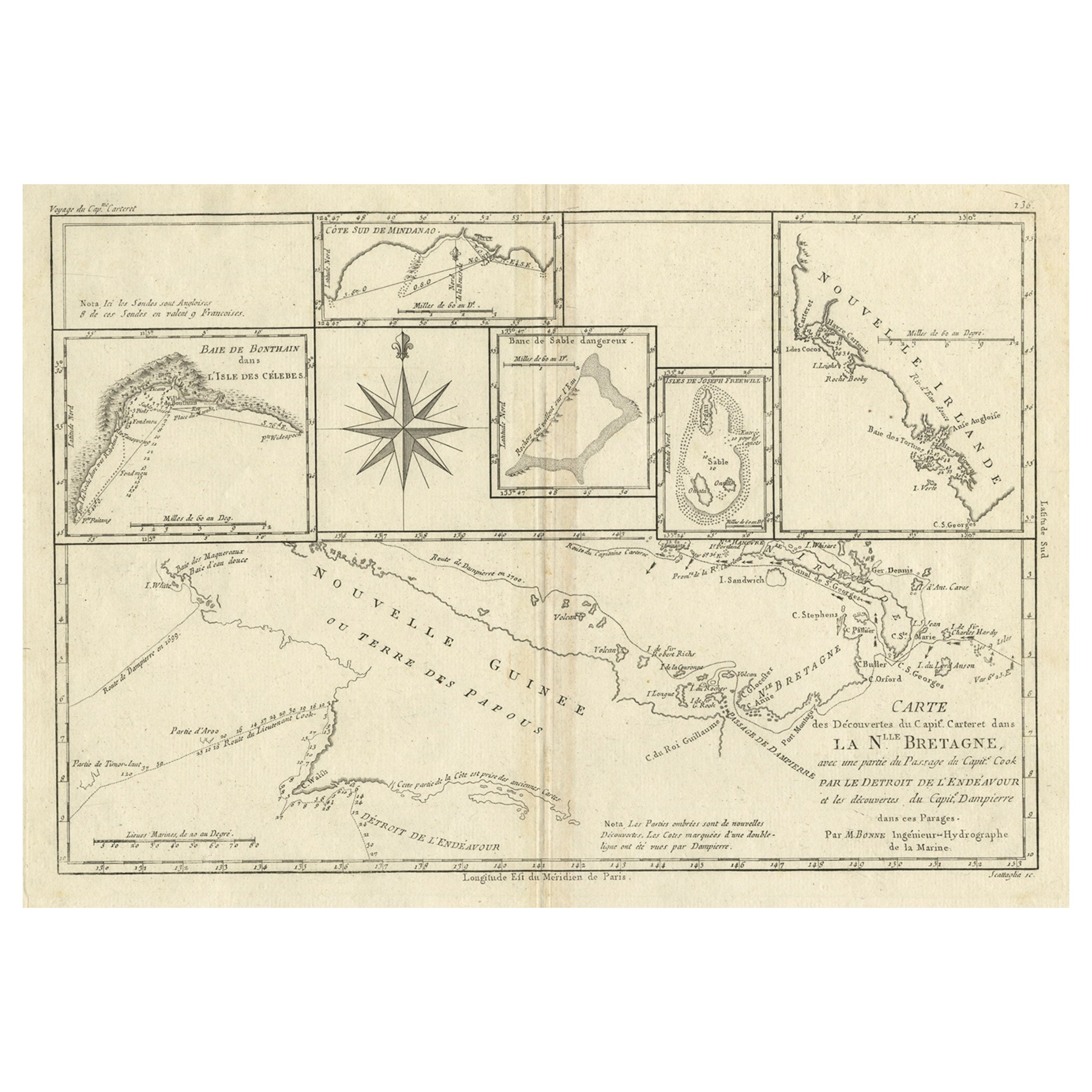
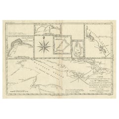
Antique Detailed Map of Papua New Guinea and the Regions to the West, ca.1780
Located in Langweer, NL
Antique map titled 'Carte des Decouvertes du Capite. Carteret dans La Nlle. Bretagne avec une parte du passage du Capite. Cook Par Le Detroit De L'Endeavor ...
Category
Antique 1780s Maps
Materials
Paper
$314 Sale Price
20% Off
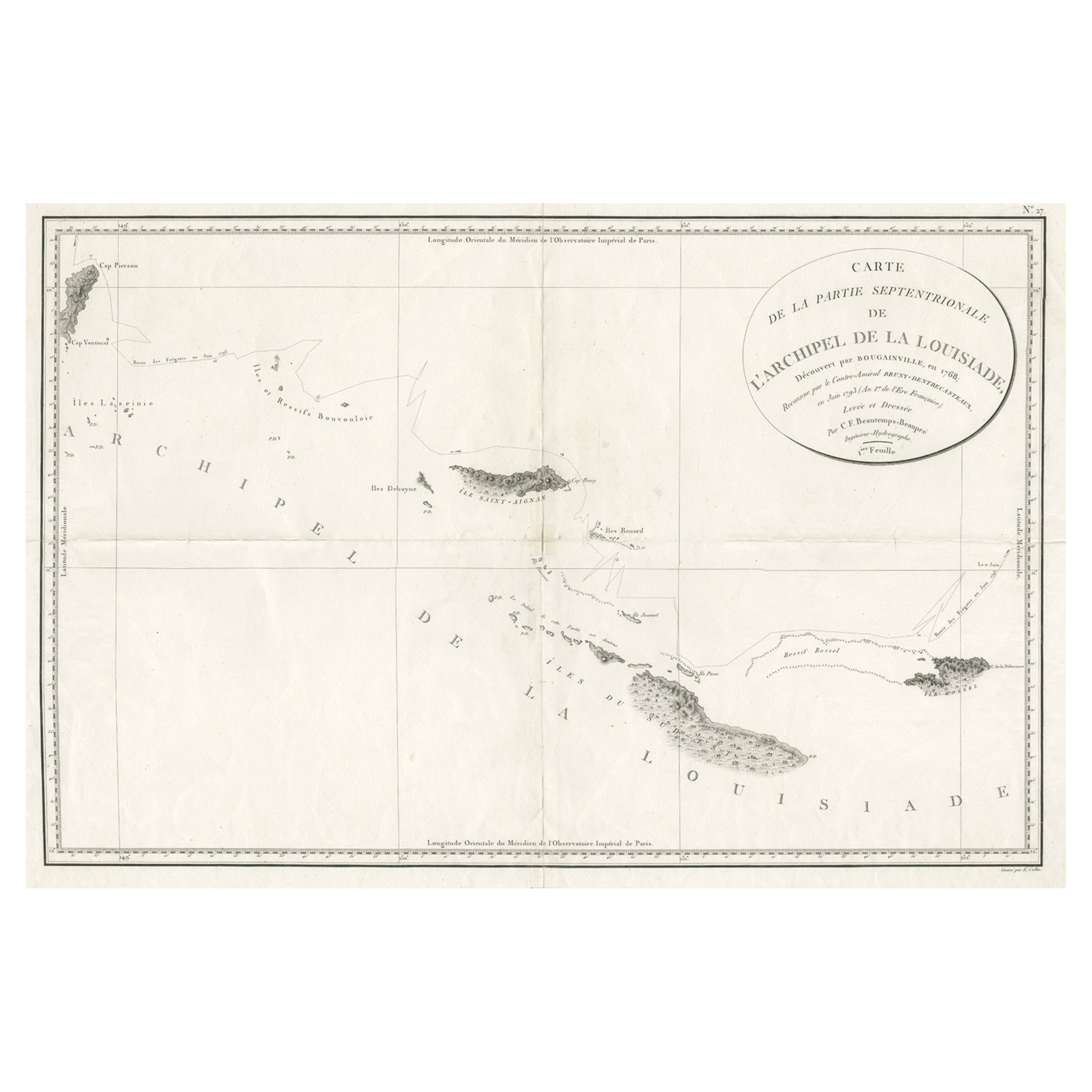
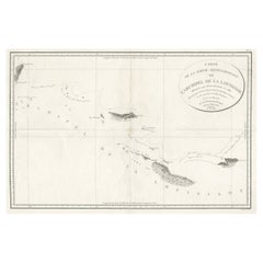
Uncommon Rare Map Showing The Louisiade Archipelago, Papua New Guinea, ca.1798
Located in Langweer, NL
Antique map titled 'Carte de la Partie Septentrionale de l'Archipel de la Louisiade'.
Uncommon map showing the area around the Louisiade Archipelago, named for Louis XV by Louis ...
Category
Antique 1790s Maps
Materials
Paper
$800 Sale Price
20% Off
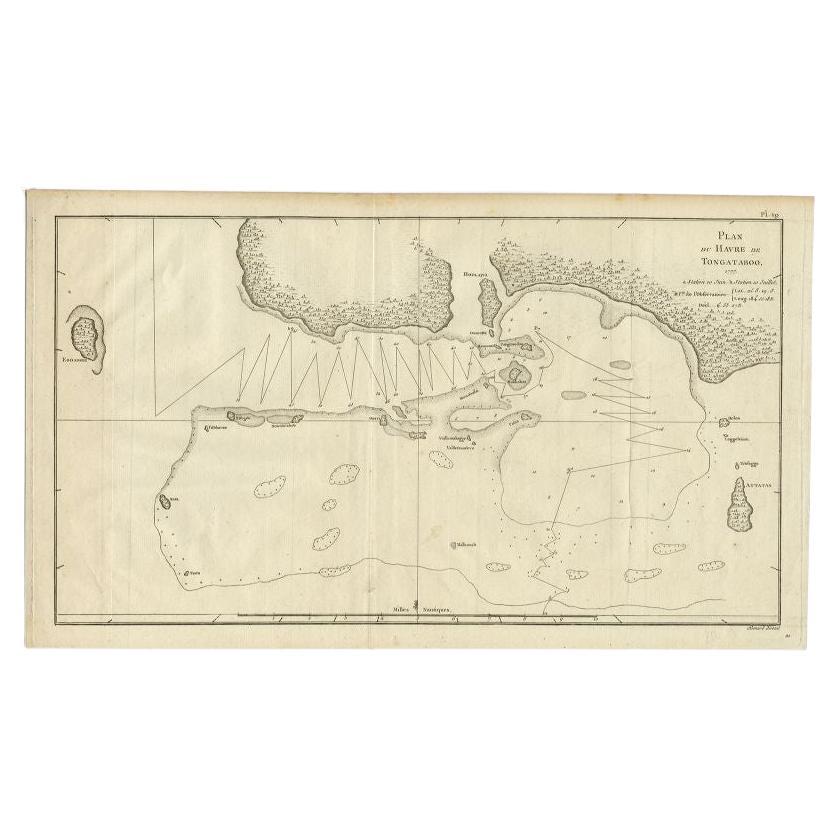
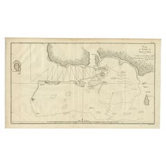
Antique Map of the Northern Coast of Tongatapu by Benard, c.1785
Located in Langweer, NL
Antique map titled 'Plan du Havre de Tongataboo'. Original antique map of Tongapatu's northern coast. This map originates from 'A New, Authentic and Complete Collection of Voyages Ro...
Category
Antique 18th Century Maps
Materials
Paper
$119 Sale Price
20% Off
Antique Map of Indonesia by C.F. Beautemps-Beaupre, circa 1807
Located in Langweer, NL
Antique map titled 'Carte de la partie du grand archipel d'Asie'. Map of Indonesia showing tracks of Recherche and Esperance in 1792-1793. This map is...
Category
Antique Early 19th Century Maps
Materials
Paper

$714 Sale Price
20% Off
Antique Map of New Ireland Island in the Bismarck Archipelago, New Guinea, 1772
Located in Langweer, NL
Antique map titled 'Nova Hibernia'. Antique map of New Ireland, an island in the Bismarck Archipelago, New Guinea. Lying just north of New Britain, from which it is separated by St. ...
Category
Antique 18th Century Maps
Materials
Paper
$209 Sale Price
20% Off
You May Also Like
Original Antique Map of South America. C.1780
Located in St Annes, Lancashire
Great map of South America
Copper-plate engraving
Published C.1780
Two small worm holes to left side of map
Unframed.
Category
Antique Early 1800s English Georgian Maps
Materials
Paper

Large Original Antique Map of The Pacific Ocean, Fullarton, C.1870
Located in St Annes, Lancashire
Great map of The Pacific Ocean
From the celebrated Royal Illustrated Atlas
Lithograph by Swanston. Original color.
Published by Fullarton,...
Category
Antique 1870s Scottish Maps
Materials
Paper

Original Antique Map of Central America / Florida, Arrowsmith, 1820
Located in St Annes, Lancashire
Great map of Central America.
Drawn under the direction of Arrowsmith.
Copper-plate engraving.
Published by Longman, Hurst, Rees, Orme and Brown, 1820
Unframed.
Category
Antique 1820s English Maps
Materials
Paper

Original Antique Map of South East Asia by Thomas Clerk, 1817
Located in St Annes, Lancashire
Great map of South East Asia
Copper-plate engraving
Drawn and engraved by Thomas Clerk, Edinburgh.
Published by Mackenzie And Dent, 1817
Unframed.
Category
Antique 1810s English Maps
Materials
Paper

Antique French Map of Asia Including China Indoneseia India, 1783
Located in Amsterdam, Noord Holland
Very nice map of Asia. 1783 Dedie au Roy.
Additional information:
Country of Manufacturing: Europe
Period: 18th century Qing (1661 - 1912)
Condition: Overall Condition B (Good Used)...
Category
Antique 18th Century European Maps
Materials
Paper

$648 Sale Price
20% Off
Ancient Map of Oceania - Original Etching - 19th century
Located in Roma, IT
This Map of Oceania is an etching realized in the 19th century.
The state of preservation of the artwork is good. At the top of the paper, the inscription “Longitudine del Meridiano...
Category
19th Century More Prints
Materials
Etching

More Ways To Browse
Gold Modern Coffee Table
Large Side Tables
Japanese Silver Ceramics
One Of A Kind Chair
Used Oak Dining Room Chairs
17th Century Plate
Childrens Vintage Poster
Chinese Ship
Vintage Travel Poster Mid Century
Desk Key
Woven Silk Art
Carved Cabriole Table
Dark Antique Table
White Wooden Table
Antique Wall Table
1960 Chair Wood Danish
Unusual Dining Table
Antique Dutch Plates